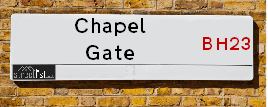
Chapel Gate is a street located in East Parley. It uses the postcode BH23 6BL. The street has a length of approximately 370 metres.
The street is located within the Bournemouth, Christchurch and Poole Council's jurisdiction. They provide various services, like refuse collection, and manage council tax collection. It's situated in the South West region of the UK.
The road has been assigned the Unique Street Reference Number of 7500535 in the National Street Gazetteer.
It is located within the county of Dorset, situated in the South West region of the UK. It's 90.92 miles South West from central London., 3.96 miles North from Bournemouth, 20.21 miles South from Salisbury and 21.64 miles South West from Southampton.
Moving to Chapel Gate?
I can help you uncover potential pitfalls and provide key questions to ask about your new property. With decades of experience as a Local Land Charges Manager, I offer confidential insights to make your move informed and stress-free.
This service is free, but you may wish to make an optional donation to support it. Please include the property name and address in your request as well as anything you wish to focus on.
Contact Me
Do you know why this road is called Chapel Gate?
What's it like to live here?
Ask the community a question.
Do you have any questions, memories to share or know any facts? We'd love to know more.
Map of Chapel Gate
| Postcodes | ||
|---|---|---|
| Icon | Postcodes for Chapel Gate | |
| Walking Distances | ||
| Distance Info | Green Circle = 10 Minutes Walk (800 metres) | |
Street Crime Data accessed from data.police.uk on 06/10/2024.
Budget Friendly Hotels near Chapel Gate
| Budget Hotel Name | Distance (miles) |
|---|---|
|
1: Name:Premier Inn Bournemouth Ferndown Address: 504 Ringwood Road Telephone: Visit Hotel Page |
2.31 |
|
2: Name:Travelodge Bournemouth Cooper Dean Address: Cooper Dean Roundabout, Castle Lane East, Bournemouth, BH7 7DP Telephone: 0871 559 1808 Visit Hotel Page |
2.58 |
|
3: Name:Travelodge Ringwood Address: A31 Eastbound, St Leonards, Ringwood, BH24 2NR Telephone: 0871 984 6237 Visit Hotel Page |
3.57 |
|
4: Name:Premier Inn Bournemouth East Cliff Address: Christchurch Road Telephone: Visit Hotel Page |
3.90 |
|
5: Name:Travelodge Bournemouth Address: 43 Christchurch Rd, Bournemouth, BH1 3PH Telephone: 0871 984 6257 Visit Hotel Page |
3.90 |
Hotel Options
Your support helps keep this site running!
If you enjoy using this website, consider buying me a coffee to help cover hosting costs.
Nearby Estate Agents
| Name | Address | Website |
|---|---|---|
| Palmer Snell | 19-21 Castle Lane West, Bournemouth, Hampshire, BH9 3LH | Visit Website |
| Simpsons Estate Agents | 85 Castle Lane West, Bournemouth, BH9 3LH | Visit Website |
| Belvoir | 122-124 Castle Lane West Bournemouth BH9 3JU | Visit Website |
| The Bungalow Centre | 1286 Wimborne Road, Bournemouth, BH10 7AJ | Visit Website |
| Heritage Sales and Lettings | 13 Malvern Road, Bournemouth, BH9 3AE |
We have found 1 postcode
Neighbourhood Policing |
| Police Force: Dorset |
 View Neighbourhood Crime and Policing View Neighbourhood Crime and Policing |
| Find a Local Neighbourhood Watch Scheme |
Location Details
| Chapel Gate | |
|---|---|

| |
| Latitude | 50.779074 |
| Longitude | -1.857563 |
| OS Easting (X): | 410041 |
| OS Northing (Y): | 97794 |
| OS Grid Reference: | SZ100978 |
Roads that have a Junction with Chapel Gate
| Street | Junction Type |
|---|---|
| Parley Lane (B3073) | roundabout |
| Chapel Lane | junction |
Sunset and Sunrise times
| Sunrise | 08:06 |
|---|---|
| Sunset | 16:08 |
Latest Weather Conditions
| Observed at Weather Station: | Bournemouth Airport 25 December 2024 at 19:00 (0.99 miles away) |
|---|---|
| Current Weather: | Mist |
| Temperature and Humidity: | 9.4°C (97.3%) |
| Wind Direction and Speed: | WSW (1 mph) |
Population Statistics
| ONS Area Code | E00103199 |
|---|---|
| ONS Area Name | Rural Employment and Retirees |
| Average Age | 50.60 |
| Area Population | 1596.00 |
| Male Population | 793.00 (50%) |
| Female Population | 803.00 (50%) |
| Benefit Claimants | 14 (1%) |
| LSOA Code: | E01020365 |
|---|---|
| LSOA Name: | Christchurch 001D |
| SOA Code: | 2a |
| SOA Name: | |
| MSOA Code: | E02004236 |
| MSOA Name: | Christchurch 001 |
Nearest Supermarkets
| Tesco West Parley Express |
|---|
| 165 New Rd, West Parley, Ferndown, BH22 8EB |
| 0345 674 6440 |
| Distance: 1.08 Miles |
| Directions to Tesco West Parley Express |
| Tesco Muscliffe Express |
|---|
| Muscliffe Neighbourhood Centre, Shillingstone Drive, Muscliffe, Bournemouth, BH9 3LR |
| 0345 026 9329 |
| Distance: 1.26 Miles |
| Directions to Tesco Muscliffe Express |
| Tesco Northbourne Express |
|---|
| 1256 Wimborne Rd, Northbourne, Bournemouth, BH10 7AG |
| 0345 026 9113 |
| Distance: 1.47 Miles |
| Directions to Tesco Northbourne Express |
| Tesco Glenmoor Rd Bournemouth Express |
|---|
| 31 Glenmoor Rd, Ferndown, BH22 8QE |
| 0345 026 9278 |
| Distance: 1.79 Miles |
| Directions to Tesco Glenmoor Rd Bournemouth Express |
Telephone Information
| Area Code |
|---|
| Area Code: 01202 - Bournemouth |
| Area Code: 01425 - Ringwood |
Local Government
| Local Council Details |
|---|
| Within the area of Bournemouth &Christchurch and Poole |
| Local Member of Parliament |
|---|
| Within the Westminster Parliamentary Constituency of Christchurch |
| The Member of Parliament is Christopher Chope |
| Details for the MP Christopher Chope on parliament.uk |
| Details for the MP Christopher Chope on theyworkforyou.com |
| In the 2024 General Election Christopher Chope won with a majority of 7,455 the result was Con hold. The total electorate was 71,060 |
| Wards, Parish Councils and County Councils |
|---|
| Ward: Commons Ward |
| Ceremonial County: Dorset |
Nearest Schools
England Secondary Schools
Parkfield School
Address: Parkfield School, Hurn, Dorset, BH23 6DF
Distance: 1.18 miles
Contact:
England Primary Schools
Parley First School
Address: Parley First School, Glenmoor Road, Ferndown, Dorset, BH22 8QE
Distance: 1.81 miles
Contact:
Nearest Hospitals
| Name | Address | Postcode | Distance | Map |
|---|
Nearest Dentists
Dentists
| Name | Address | Postcode | Distance | Map |
|---|
Nearest GP Surgeries
Doctors
JAMES FISHER MEDICAL CENTRE
Address: 4 TOLPUDDLE GARDENS, BOURNEMOUTH, DORSET, BH9 3LQ
Distance: 1.27 miles
Contact: tel: 01202 522622
GLENMOOR ROAD SURGERY
Address: 54 GLENMOOR ROAD, FERNDOWN, DORSET, BH22 8QF
Distance: 1.66 miles
Contact: :
MOORDOWN MEDICAL CENTRE
Address: 2A REDHILL CRESCENT, MOORDOWN, BOURNEMOUTH, DORSET, BH9 2XF
Distance: 1.74 miles
Contact: tel: 01202 974700
NORTHBOURNE SURGERY
Address: 1368 WIMBORNE ROAD, BOURNEMOUTH, DORSET, BH10 7AR
Distance: 1.83 miles
Contact: :
KINSON ROAD MEDICAL CENTRE
Address: 440 KINSON ROAD, KINSON, BOURNEMOUTH, DORSET, BH10 5EY
Distance: 2.08 miles
Contact: tel: 01202 574604
THE BARCELLOS FAMILY PRACTICE
Address: TRICKETTS CROSS, CORBIN AVENUE, FERNDOWN, DORSET, BH22 8AZ
Distance: 2.10 miles
Contact: tel: 01202 897989
Nearest Dispensing Chemists
Pharmacies
| Name | Address | Postcode | Telephone | Map | Distance in Km |
|---|
Nearest Opticians
Opticians
PARLEY OPTOMETRISTS
Address: 127 NEW ROAD, WEST PARLEY, FERNDOWN, DORSET, BH22 8EB
Distance: 1.08 miles
Contact: :
M&S OPTICIANS - CASTLEPOINT
Address: CASTLE POINT, CASTLE LANE WEST, BOURNEMOUTH, BH8 9UL
Distance: 1.86 miles
Contact: :
STILL & BEDFORD
Address: 922 WIMBORNE ROAD, BOURNEMOUTH, BH9 2DH
Distance: 1.88 miles
Contact: :
K C OPTICIANS (KINSON)
Address: 1553 WIMBORNE ROAD, KINSON, BOURNEMOUTH, DORSET, BH10 7AZ
Distance: 1.94 miles
Contact: tel: 01202 571601
SPECSAVERS (CASTLEPOINT)
Address: SAINSBURYS CASTLEPOINT, CASTLE LANE WEST, BOURNEMOUTH, BH8 9UW
Distance: 1.94 miles
Contact: :
4599 CASTLEPOINT
Address: ASDA STORES LTD, CASTLEPOINT SHOPPING CENTRE, CASTLE LANE WEST, BOURNEMOUTH, DORSET, BH8 9UP
Distance: 2.00 miles
Contact: :
Transport
Nearest Rail Stations
Bournemouth Station is 3.57 miles away.
Address: Bournemouth station, Holdenhurst Road, Bournemouth, Dorset, BH8 8HX
Bournemouth is situated on the Portsmouth Direct line|South Western Main Line and is managed by South Western Railway.
Bournemouth Station is staffed on a full time basis.
Pokesdown Station is 3.61 miles away.
Address: Pokesdown station, Christchurch Road, Pokesdown, Dorset, BH7 6DL
Pokesdown is situated on the Portsmouth Direct line|South Western Main Line and is managed by South Western Railway.
Pokesdown Station is staffed on a part time basis.