Ham Lane is a street located near the town of Ferndown and in the village of Hampreston and in Little Canford and in the village of Longham. The street has a length of approximately 2,892 metres.
The street is located within the Dorset Council's jurisdiction. They provide various services, like refuse collection, and manage council tax collection. It's situated in the South West region of the UK.
The road has been assigned the Unique Street Reference Numbers of 12201619, 81100039, 12206025, 12206027 and 81100460 in the National Street Gazetteer.
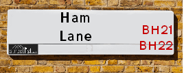
The street has the postcodes of BH22 9DW, BH22 9DR, BH22 9DP, BH21 7LT, BH21 7LS and BH21 7LR.
It is located within the county of Dorset, situated in the South West region of the UK. It's 92.82 miles South West from central London., 5.55 miles North West from Bournemouth, 19.87 miles South from Salisbury and 23.11 miles East from Dorchester.
Map of Ham Lane
| Postcodes | ||
|---|---|---|
| Icon | Postcodes for Ham Lane | |
| Walking Distances | ||
| Distance Info | Green Circle = 10 Minutes Walk (800 metres) | |
Street Crime Data accessed from data.police.uk on 06/10/2024.
Moving to Ham Lane?
I can help you uncover potential pitfalls and provide key questions to ask about your new property. With decades of experience as a Local Land Charges Manager, I offer confidential insights to make your move informed and stress-free.
This service is free, but you may wish to make an optional donation to support it. Please include the property name and address in your request as well as anything you wish to focus on.
Contact Me
Do you know why this road is called Ham Lane?
What's it like to live here?
Share a Photo of Ham Lane
Ask the community a question.
Do you have any questions, memories to share, have any photos or know any facts? We'd love to know more.
Submit Your Comment

Budget Friendly Hotels near Ham Lane
| Budget Hotel Name | Distance (miles) |
|---|---|
|
1: Name:Premier Inn Bournemouth Ferndown Address: 504 Ringwood Road Telephone: Visit Hotel Page |
2.48 |
|
2: Name:Travelodge Ringwood Address: A31 Eastbound, St Leonards, Ringwood, BH24 2NR Telephone: 0871 984 6237 Visit Hotel Page |
4.49 |
|
3: Name:Premier Inn Poole North Address: Cabot Lane Telephone: Visit Hotel Page |
4.55 |
|
4: Name:Premier Inn Bournemouth Westcliff Address: 8 Poole Road Telephone: Visit Hotel Page |
5.06 |
|
5: Name:Premier Inn Bournemouth Westbourne Address: 8 Poole Road Telephone: Visit Hotel Page |
5.06 |
Hotel Options
Your support helps keep this site running!
If you enjoy using this website, consider making a donation to help me cover hosting costs.
Nearby Estate Agents
| Name | Address | Website |
|---|---|---|
| Bliss Homes | Haviland House, 17 Cobham Road, Wimborne, BH21 7PE | Visit Website |
| Connaught Real Estates Ltd. | 12 Haviland Ferndown Industrial Park Wimborne BH21 7RG | |
| Goadsby | 503 Ringwood Road, Ferndown, BH22 9AG | Visit Website |
| Edwards | 404 Ringwood Road, Ferndown, Dorset, BH22 9AU | Visit Website |
| Winkworth | 406-408 Ringwood Road, Ferndown, BH22 9AU | Visit Website |
Neighbourhood Policing |
| Police Force: Dorset |
 View Neighbourhood Crime and Policing View Neighbourhood Crime and Policing |
| Find a Local Neighbourhood Watch Scheme |
Location Details
| Ham Lane | |
|---|---|

| |
| Latitude | 50.793079 |
| Longitude | -1.923669 |
| OS Easting (X): | 405379 |
| OS Northing (Y): | 99344 |
| OS Grid Reference: | SZ054993 |
Roads that have a Junction with Ham Lane
| Street | Junction Type |
|---|---|
| Fox Lane | junction |
| Wimborne Road West (A31) | junction |
| Fox Lane | junction |
| Old Ham Lane | junction |
| Stapehill Road | junction |
| High Mead Lane | junction |
| Glissons | junction |
| High Mead | junction |
| Ringwood Road (A348) | roundabout |
Sunset and Sunrise times
| Sunrise | 07:57 |
|---|---|
| Sunset | 16:39 |
Latest Weather Conditions
| Observed at Weather Station: | Bournemouth Airport 19 January 2025 at 00:00 (3.99 miles away) |
|---|---|
| Current Weather: | Overcast |
| Temperature and Humidity: | 2.0°C (94.3%) |
| Wind Direction and Speed: | ENE (7 mph) |
Population Statistics
| ONS Area Code | E00103413, E00103372 & E00103367 |
|---|---|
| ONS Area Name | Detached Rural Retirement, Agricultural Communities & Renting Rural Retirement |
| Average Age | 50.80 & 46.08 |
| Area Population | 1206.00 & 2502.00 |
| Male Population | 572.00 & 1230.00 (49%) |
| Female Population | 634.00 & 1272.00 (51%) |
| Benefit Claimants | 5 & 12 (0%) |
| LSOA Code: | E01020407 &E01020399 |
|---|---|
| LSOA Name: | East Dorset 009D &East Dorset 011B |
| SOA Code: | 8b &2a |
| SOA Name: | |
| MSOA Code: | E02004251 &E02004253 |
| MSOA Name: | East Dorset 009 &East Dorset 011 |
Nearest Supermarkets
| Tesco Glenmoor Rd Bournemouth Express |
|---|
| 31 Glenmoor Rd, Ferndown, BH22 8QE |
| 0345 026 9278 |
| Distance: 1.37 Miles |
| Directions to Tesco Glenmoor Rd Bournemouth Express |
| Tesco Ferndown Superstore |
|---|
| Pennys Walk, Ferndown, BH22 9TH |
| 0345 677 9270 |
| Distance: 1.48 Miles |
| Directions to Tesco Ferndown Superstore |
| Iceland Ferndown |
|---|
| 51/53 Victoria Road, Ferndown, Dorset, BH22 9HU |
| 01202893534 |
| Distance: 1.59 Miles |
| Directions to Iceland Ferndown |
| Tesco Kinson Superstore |
|---|
| 1585 Wimborne Rd, Kinson, BH10 7BB |
| 0345 610 6321 |
| Distance: 1.96 Miles |
| Directions to Tesco Kinson Superstore |
Telephone Information
| Area Code |
|---|
| Area Code: 01202 - Bournemouth |
| Area Code: 01425 - Ringwood |
Broadband Information
| Speed | Average Speed | Median Speed | Maximum Speed | Next-generation access (NGA) | Number of Connections |
|---|---|---|---|---|---|
| Greater than 2 Mbps | 5.5 | 4 | 8.9 | N | 3 |
Local Government
| Local Council Details |
|---|
| Within the area of Dorset |
| Local Member of Parliament |
|---|
| Within the Westminster Parliamentary Constituency of Christchurch |
| The Member of Parliament is Vikki Slade &Christopher Chope |
| Details for the MP Vikki Slade &Christopher Chope on parliament.uk |
| Details for the MP Vikki Slade &Christopher Chope on theyworkforyou.com |
| In the 2024 General Election Vikki Slade &Christopher Chope won with a majority of 1,352 the result was LD gain from Con &Con hold. The total electorate was 75,294 |
| Wards, Parish Councils and County Councils |
|---|
| Ward: Colehill & Wimborne Minster East &Ferndown South Ward |
| Ceremonial County: Dorset |
Nearest Schools
England Primary Schools
Parley First School
Address: Parley First School, Glenmoor Road, Ferndown, Dorset, BH22 8QE
Distance: 1.36 miles
Contact:
Ferndown First School
Address: Ferndown First School, Mountbatten Drive, Ferndown, Dorset, BH22 9FB
Distance: 1.22 miles
Contact:
Hampreston Church of England Voluntary Aided First School
Address: Hampreston Church of England Voluntary Aided First School, Hampreston Village, Wimborne, Dorset, BH21 7LX
Distance: 0.22 miles
Contact: 01202573074
Hayeswood First School
Address: Hayeswood First School, Cutlers Place, Colehill, Wimborne, Dorset, BH21 2HN
Distance: 1.43 miles
Contact: 01202882379
St Catherine's Catholic Primary School, Wimborne
Address: St Catherine's Catholic Primary School, Wimborne, Cutlers Place, Colehill, Wimborne, Dorset, BH21 2HN
Distance: 1.43 miles
Contact:
St Catherine's Catholic Primary School, Wimborne
Address: St Catherine's Catholic Primary School, Wimborne, Cutlers Place, Colehill, Wimborne, Dorset, BH21 2HN
Distance: 1.43 miles
Contact:
Hayeswood First School
Address: Hayeswood First School, Cutlers Place, Colehill, Wimborne, Dorset, BH21 2HN
Distance: 1.43 miles
Contact:
Colehill First School
Address: Colehill First School, Pilford Heath Road, Colehill, Wimborne, Dorset, BH21 2LZ
Distance: 1.64 miles
Contact: 01202882506
Colehill First School
Address: Colehill First School, Middlehill Road, Colehill, Wimborne, Dorset, BH21 2HL
Distance: 1.57 miles
Contact:
England Secondary Schools
Ferndown Upper School
Address: Ferndown Upper School, Cherry Grove, Ferndown, Dorset, BH22 9EY
Distance: 1.30 miles
Contact: 01202871243
St Michael's Church of England Middle School, Colehill
Address: St Michael's Church of England Middle School, Colehill, Colehill Lane, Colehill, Wimborne, Dorset, BH21 7AB
Distance: 2.20 miles
Contact: 01202883433
Nearest Hospitals
| Name | Address | Postcode | Distance | Map |
|---|
Nearest Dentists
Dentists
| Name | Address | Postcode | Distance | Map |
|---|
Nearest GP Surgeries
Doctors
ORCHID HOUSE SURGERY
Address: FERNDOWN MEDICAL CENTRE, ST. MARYS ROAD, FERNDOWN, DORSET, BH22 9HB
Distance: 1.41 miles
Contact: tel: 01202 897000
PENNY'S HILL PRACTICE
Address: FERNDOWN MEDICAL CENTRE, ST. MARYS ROAD, FERNDOWN, DORSET, BH22 9HB
Distance: 1.41 miles
Contact: tel: 01202 897200
THE HAMWORTHY CLUB - COVID LOCAL VACCINATION SERVICE
Address: MAGNA ROAD, WIMBORNE, BH21 3AP
Distance: 1.41 miles
Contact: :
THE HAMWORTHY CLUB - COVID LOCAL VACCINATION SERVICE 2
Address: MAGNA ROAD, WIMBORNE, BH21 3AP
Distance: 1.41 miles
Contact: :
GLENMOOR ROAD SURGERY
Address: 54 GLENMOOR ROAD, FERNDOWN, DORSET, BH22 8QF
Distance: 1.50 miles
Contact: :
THE MAGNA MEDICAL CENTRE
Address: 81 MERLEY LANE, MERLEY, WIMBORNE, DORSET, BH21 3BB
Distance: 2.02 miles
Contact: :
Nearest Dispensing Chemists
Pharmacies
| Name | Address | Postcode | Telephone | Map | Distance in Km |
|---|
Nearest Opticians
Opticians
INFINITE CLARITY LIMITED
Address: LA PORCHERIE, 427 RINGWOOD ROAD, FERNDOWN, DORSET, BH22 9AF
Distance: 1.22 miles
Contact: :
UNDERWOOD EYECARE
Address: 7 PENNYS WALK, FERNDOWN, BH22 9TH
Distance: 1.53 miles
Contact: :
HENDERSONS OPTICIANS
Address: 54 VICTORIA ROAD, FERNDOWN, DORSET, BH22 9HZ
Distance: 1.59 miles
Contact: :
STILL & BEDFORD
Address: 61 VICTORIA ROAD, FERNDOWN, BH22 9HU
Distance: 1.59 miles
Contact: :
COMPLETE COMMUNITY CARE - HEATH CLOSE
Address: 6 HEATH CLOSE, WIMBORNE, DORSET, BH21 2LP
Distance: 1.78 miles
Contact: :
PARLEY OPTOMETRISTS
Address: 127 NEW ROAD, WEST PARLEY, FERNDOWN, DORSET, BH22 8EB
Distance: 2.01 miles
Contact: :
Transport
Nearest Rail Stations
Branksome Station is 4.53 miles away.
Address: Branksome station, Poole Road, Branksome, Dorset, BH12 1DF
Branksome is situated on the Portsmouth Direct line|South Western Main Line and is managed by South Western Railway.
Branksome Station is staffed on a part time basis.
Parkstone (Dorset) Station is 4.96 miles away.
Address: Parkstone station, Station Road, Parkstone, Dorset, BH14 8UD
Parkstone (Dorset) is situated on the Portsmouth Direct line|South Western Main Line and is managed by South Western Railway.
Parkstone (Dorset) Station is staffed on a part time basis.