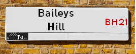
Baileys Hill in the village of Wimborne St. Giles
About Baileys Hill
Baileys Hill is a street located near the village of Wimborne St Giles. It uses the postcode BH21 5NE. The street has a length of approximately 1,866 metres.
The street is publicly maintained which means that the road is adopted and Dorset Unitary is responsible for the repair and upkeep of the highway.
Crime & Historic Map of Baileys Hill
This interactive map displays both historic mapping and street crime data. Click on a circle to view crime statistics, and use the button above to toggle the 1900s historic map.
This interactive map allows you to **zoom and pan** for a better view of the data.
- Use the + and - buttons on the map to zoom in and out.
- Scroll with your **middle mouse wheel** to zoom in and out.
- On a **mobile device**, use **pinch and zoom gestures** to navigate the map.
- Click on crime markers for more details.


| Street Crime (updated 07/02/2025) | ||
|---|---|---|
| Location Note | Central Point of Street - Not Actual Location | |
| MSOA Info | For MSOA E02004243 (Statistical Neighbourhood) | |
| Click Hint | Click on a Circle for a detailed breakdown below map. | |
| Crime Levels |
Green = Very Low Yellow = Low Orange = High Red = Very High |
|
| Postcodes | ||
| Icon | Postcodes for Baileys Hill | |
| Walking Distances | ||
| Distance Info | Green Circle = 10 Minutes Walk (800 metres) | |
Street Crime Data accessed from data.police.uk on 07/02/2025.
The street is located within the Dorset Council's jurisdiction. They provide various services, like refuse collection, and manage council tax collection. It's situated in the South West region of the UK.
The road has been assigned the Unique Street Reference Numbers of 12206141, 81100238 and 12201081 in the National Street Gazetteer.
It is located within the county of Dorset, situated in the South West region of the UK. It's 90.74 miles South West from central London., 13.43 miles North from Bournemouth, 13.73 miles South West from Salisbury and 24.27 miles North East from Dorchester.
BAILEYS HILL is within the Post Town of WIMBORNE
Moving to Baileys Hill?
I can help you uncover potential pitfalls and provide key questions to ask about your new property. With decades of experience as a Local Land Charges Manager, I offer confidential insights to make your move informed and stress-free.
This service is free, but you may wish to make an optional donation to support it. Please include the property name and address in your request as well as anything you wish to focus on.
Contact Me
Do you know why this road is called Baileys Hill?
What's it like to live here?
Share a Photo of Baileys Hill
Ask the community a question.
Do you have any questions, memories to share, have any photos or know any facts? We'd love to know more.
Submit Your Comment

Budget Friendly Hotels near Baileys Hill
| Budget Hotel Name | Distance (miles) |
|---|---|
|
1: Name:Premier Inn Bournemouth Ferndown Address: 504 Ringwood Road Telephone: Visit Hotel Page |
7.71 |
|
2: Name:Travelodge Ringwood Address: A31 Eastbound, St Leonards, Ringwood, BH24 2NR Telephone: 0871 984 6237 Visit Hotel Page |
7.78 |
|
3: Name:Premier Inn Ringwood Address: Forest Gate Business Park Telephone: Visit Hotel Page |
9.37 |
|
4: Name:Premier Inn Poole North Address: Cabot Lane Telephone: Visit Hotel Page |
11.07 |
|
5: Name:Premier Inn Poole Centre - Holes Bay Address: Holes Bay Road Telephone: Visit Hotel Page |
12.43 |
Hotel Options
Your support helps keep this site running!
If you enjoy using this website, consider making a donation to help me cover hosting costs.

EPC (Energy Performance Certificate) Information for Baileys Hill
UPRN: 200004744106
EPC Current: E
EPC Potential: B
Habitable Rooms: 5
Property Type: House
Tenure: Rented (private)
Built Form: Semi-Detached
Age Band: before 1900
Mains Gas: No
UPRN: 200004744107
EPC Current: D
EPC Potential: C
Habitable Rooms: 5
Property Type: House
Tenure: rental (private)
Built Form: Semi-Detached
Age Band: 1900-1929
Mains Gas: No
UPRN: 200004749577
EPC Current: F
EPC Potential: D
Habitable Rooms: 8
Property Type: House
Tenure: Owner-occupied
Built Form: Detached
Age Band: 1930-1949
Mains Gas: No
House Sales
| Year | High | Low | Average | Sales |
|---|---|---|---|---|
| 2014 | £595,000 | £595,000 | £595,000 | 1 |
| 2015 | £695,000 | £695,000 | £695,000 | 1 |
Contains HM Land Registry data © Crown copyright and database right 2025. This data is licensed under the Open Government Licence v3.0.
Nearby Estate Agents
| Name | Address | Website |
|---|---|---|
| Pennyfarthing | Potters Wood, Verwood, BH31 7BG | Visit Website |
| Irving & Sons | 1 Edmondsham Road, Verwood, BH31 7PA | Visit Website |
| Castleman Estate Agents | 7 Station Road Verwood BH31 7PY | Visit Website |
| Edwards | 11-13 Ringwood Road, Verwood, BH31 7AA | Visit Website |
| Goadsby | The Parade, 7 Ringwood Road, Verwood, BH31 7AA | Visit Website |
We have found 1 postcode
Neighbourhood Policing |
| Police Force: Dorset |
 View Neighbourhood Crime and Policing View Neighbourhood Crime and Policing |
| Find a Local Neighbourhood Watch Scheme |
Location Details
| Baileys Hill | |
|---|---|

| |
| Latitude | 50.904413 |
| Longitude | -1.970736 |
| OS Easting (X): | 402057 |
| OS Northing (Y): | 111721 |
| OS Grid Reference: | SU021117 |
Known Residential Addresses for Baileys Hill
- BAILEYS HOUSE, 3
Roads that have a Junction with Baileys Hill
| Street | Junction Type |
|---|---|
| Brockington Lane | junction |
| Lumber Lane | junction |
Sunset and Sunrise times
| Sunrise | 07:06 |
|---|---|
| Sunset | 17:36 |
Latest Weather Conditions
| Observed at Weather Station: | Bournemouth Airport 21 February 2025 at 05:00 (10.50 miles away) |
|---|---|
| Current Weather: | Overcast |
| Temperature and Humidity: | 11.0°C (97.9%) |
| Wind Direction and Speed: | S (13 mph) |
Population Statistics
| ONS Area Code | E00103314 |
|---|---|
| ONS Area Name | Rural White-Collar Workers |
| Average Age | 43.58 |
| Area Population | 2189.00 |
| Male Population | 1097.00 (50%) |
| Female Population | 1092.00 (50%) |
| Benefit Claimants | 7 (0%) |
| LSOA Code: | E01020389 |
|---|---|
| LSOA Name: | East Dorset 001C |
| SOA Code: | 2c |
| SOA Name: | |
| MSOA Code: | E02004243 |
| MSOA Name: | East Dorset 001 |
Nearest Supermarkets
| Tesco Verwood Express |
|---|
| 2-4 Ringwood Rd, Verwood, BH31 7AQ |
| 0345 675 7169 |
| Distance: 4.38 Miles |
| Directions to Tesco Verwood Express |
| Morrisons Verwood |
|---|
| Chiltern Drive, Verwood BH31 6UQ |
| 01202 822622. |
| Distance: 4.57 Miles |
| Directions to Morrisons Verwood |
| Tesco West Moors Express |
|---|
| 126 Station Rd, West Moors, Ferndown, BH22 0JB |
| 0345 026 9224 |
| Distance: 6.64 Miles |
| Directions to Tesco West Moors Express |
| Waitrose Wimborne |
|---|
| Rowlands Hill, Wimborne, Dorset, BH21 1AN |
| 01202 840157 |
| Distance: 7.21 Miles |
| Directions to Waitrose Wimborne |
Telephone Information
| Area Code |
|---|
| Area Code: 01725 - Rockbourne |
| Area Code: 01258 - Blandford Forum |
| Area Code: 01425 - Ringwood |
Local Government
| Local Council Details |
|---|
| Within the area of Dorset |
| Local Member of Parliament |
|---|
| Within the Westminster Parliamentary Constituency of North Dorset |
| The Member of Parliament is Simon Hoare |
| Details for the MP Simon Hoare on parliament.uk |
| Details for the MP Simon Hoare on theyworkforyou.com |
| In the 2024 General Election Simon Hoare won with a majority of 1,589 the result was Con hold. The total electorate was 72,690 |
| Wards, Parish Councils and County Councils |
|---|
| Ward: Cranborne & Alderholt Ward |
| Parish: Wimborne St. Giles Parish Council |
| Ceremonial County: Dorset |
Nearest Schools
England Primary Schools
Wimborne St Giles Church of England First School and Nursery
Address: Wimborne St Giles Church of England First School and Nursery, Wimborne St Giles, Wimborne, Dorset, BH21 5LX
Distance: 0.65 miles
Contact:
Nearest Hospitals
| Victoria Hospital |
|---|
| Address: Victoria Hospital, Victoria Road, Wimborne, BH21 1ER, |
| NHS Sector |
| Dorset Healthcare University NHS Foundation Trust |
| Telephone: 01202 856410 |
| Visit Hospital Website |
| Distance: 11.49 (miles) |
| Directions from to Victoria Hospital |
| St Leonards Community Hospital (Dorset) |
|---|
| Address: Ringwood Road, Ringwood, BH24 2RR, |
| NHS Sector |
| Dorset Healthcare University NHS Foundation Trust |
| Telephone: 01202 584200 |
| Visit Hospital Website |
| Distance: 12.57 (miles) |
| Directions from to St Leonards Community Hospital (Dorset) |
| Fordingbridge Hospital |
|---|
| Address: Bartons Road, Fordingbridge, |
| NHS Sector |
| Southern Health NHS Foundation Trust |
| Telephone: 01425 652255 |
| Visit Hospital Website |
| Distance: 12.71 (miles) |
| Directions from to Fordingbridge Hospital |
Nearest Dentists
Dentists
THE LAKES DENTAL PRACTICE
Address: UNIT 4/A, THE OLD CROSSROADS, STATION ROAD, VERWOOD, DORSET, BH31 7PU
Distance: 4.19 miles
Contact: :
FOREST LODGE DENTAL PRACTICE
Address: 18 VICARAGE ROAD, VERWOOD, DORSET, BH31 6DR
Distance: 4.39 miles
Contact: :
VERWOOD DENTAL CARE
Address: 35 RINGWOOD ROAD, VERWOOD, DORSET, BH31 7AB
Distance: 4.64 miles
Contact: :
NEWTOWN ROAD DENTAL SURGERY
Address: 131 NEWTOWN ROAD, VERWOOD, DORSET, BH31 6EH
Distance: 5.05 miles
Contact: :
212 STATION ROAD
Address: WEST MOORS, FERNDOWN, BH22 0JD
Distance: 6.43 miles
Contact: :
SMILE TEAM DENTAL CARE
Address: 212 STATION ROAD, WEST MOORS, FERNDOWN, DORSET, BH22 0JD
Distance: 6.43 miles
Contact: :
Nearest GP Surgeries
Doctors
THE CRANBORNE PRACTICE
Address: THE SURGERY, PENNYS LANE, CRANBORNE, WIMBORNE, DORSET, BH21 5QE
Distance: 2.48 miles
Contact: tel: 01725 517272
SIXPENNY HANDLEY SURGERY
Address: DEAN LANE, SIXPENNY HANDLEY, SALISBURY, WILTSHIRE, SP5 5PA
Distance: 3.76 miles
Contact: tel: 01725 552500
THE VERWOOD SURGERY
Address: 15 STATION ROAD, VERWOOD, DORSET, BH31 7PY
Distance: 4.23 miles
Contact: tel: 01202 825353
RUSHMORE HOUSE
Address: 67-71 CHURCH ROAD, THREE LEGGED CROSS, WIMBORNE, DORSET, BH21 6RQ
Distance: 5.05 miles
Contact: :
LAKE ROAD SURGERY
Address: LAKE ROAD, VERWOOD, DORSET, BH31 6EH
Distance: 5.05 miles
Contact: :
LAKE ROAD SURGERY - COVID LOCAL VACCINATION SERVICE
Address: LAKE ROAD, VERWOOD, BH31 6EH
Distance: 5.05 miles
Contact: :
Nearest Dispensing Chemists
Pharmacies
VERWOOD PHARMACY
Address: BANK COURT, 10 MANOR ROAD, VERWOOD, DORSET, BH31 6DW
Distance: 4.28 miles
Contact: tel: 01202 828499
MORRISONS PHARMACY
Address: CHILTERN DRIVE, VERWOOD, DORSET, BH31 6UU
Distance: 4.81 miles
Contact: tel: 01202 826555
VERWOOD PHARMACY
Address: LAKE ROAD SURGERY, LAKE ROAD, VERWOOD, DORSET, BH31 6EH
Distance: 5.05 miles
Contact: tel: 01202 828499
MOORS PHARMACY
Address: 175 STATION ROAD, WEST MOORS, FERNDOWN, DORSET, BH22 0HX
Distance: 6.46 miles
Contact: tel: 01202 873112
COLEHILL PHARMACY
Address: 42 MIDDLEHILL ROAD, COLEHILL, WIMBORNE, DORSET, BH21 2SE
Distance: 6.57 miles
Contact: tel: 01202 888001
THE WALFORD MILL PHARMACY
Address: MILL HOUSE, KNOBCROOK ROAD, WIMBORNE, DORSET, BH21 1NL
Distance: 6.90 miles
Contact: tel: 01202 840048
Nearest Opticians
Opticians
PEACOCK AND MURPHY OPTICIANS
Address: 27 VICARAGE ROAD, VERWOOD, DORSET, BH31 6DR
Distance: 4.39 miles
Contact: :
COMPLETE COMMUNITY CARE - HEATH CLOSE
Address: 6 HEATH CLOSE, WIMBORNE, DORSET, BH21 2LP
Distance: 6.41 miles
Contact: :
EYESTYLE CENTRE (FERNDOWN)
Address: 141-143 STATION ROAD, WEST MOORS, FERNDOWN, DORSET, BH22 0HT
Distance: 6.55 miles
Contact: :
ROVING EYE
Address: TARGETTS FARM, BOWERCHALKE, SALISBURY, WILTSHIRE, SP5 5DB
Distance: 6.73 miles
Contact: :
BOOTS OPTICIANS (WIMBORNE)
Address: 1 THE SQUARE, WIMBORNE, DORSET, BH21 1JA
Distance: 7.23 miles
Contact: :
SCRIVENS OPTICIANS (WIMBORNE)
Address: 6 THE SQUARE, WIMBORNE, BH21 1JA
Distance: 7.23 miles
Contact: :
Transport
Nearest Rail Stations
Tisbury Station is 11.79 miles away.
Address: Tisbury station, Station Road, Tisbury, Wiltshire, SP3 6JT
Tisbury is situated on the South Western Main Line and is managed by South Western Railway.
Tisbury Station is staffed on a part time basis.
Branksome Station is 12.42 miles away.
Address: Branksome station, Poole Road, Branksome, Dorset, BH12 1DF
Branksome is situated on the Portsmouth Direct line|South Western Main Line and is managed by South Western Railway.
Branksome Station is staffed on a part time basis.