Panorama Road is a street located in the town of Poole. The street has a length of approximately 1,091 metres.
The street is publicly maintained which means that the road is adopted and Bournemouth, Christchurch and Poole is responsible for the repair and upkeep of the highway.
The street is located within the Bournemouth, Christchurch and Poole Council's jurisdiction. They provide various services, like refuse collection, and manage council tax collection. It's situated in the South West region of the UK.
The road has been assigned the Unique Street Reference Numbers of 30300419, 30302985 and 30300423 in the National Street Gazetteer.
The street has the postcodes of BH13 7RS, BH13 7RG, BH13 7RF, BH13 7RE, BH13 7RD, BH13 7RB and BH13 7RA.
It is located within the county of Dorset, situated in the South West region of the UK. It's 97.74 miles South West from central London., 4.31 miles South West from Bournemouth, 21.57 miles East from Dorchester and 27.22 miles South from Salisbury.
PANORAMA ROAD is within the Post Town of POOLE
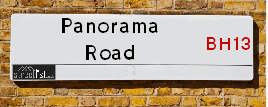
Map of Panorama Road
| Street Crime (updated 14/01/2025) | ||
|---|---|---|
| Location Note | Central Point of Street - Not Actual Location | |
| MSOA Info | For MSOA E02003211 (Statistical Neighbourhood) | |
| Click Hint | Click on a Circle for a detailed breakdown below map. | |
| Crime Levels |
Green = Very Low Yellow = Low Orange = High Red = Very High |
|
| Postcodes | ||
| Icon | Postcodes for Panorama Road | |
| Walking Distances | ||
| Distance Info | Green Circle = 10 Minutes Walk (800 metres) | |
Street Crime Data accessed from data.police.uk on 06/10/2024.
Moving to Panorama Road?
I can help you uncover potential pitfalls and provide key questions to ask about your new property. With decades of experience as a Local Land Charges Manager, I offer confidential insights to make your move informed and stress-free.
This service is free, but you may wish to make an optional donation to support it. Please include the property name and address in your request as well as anything you wish to focus on.
Contact Me
Do you know why this road is called Panorama Road?
What's it like to live here?
Share a Photo of Panorama Road
Ask the community a question.
Do you have any questions, memories to share, have any photos or know any facts? We'd love to know more.
Submit Your Comment
Find Homes to Rent in Poole

Budget Friendly Hotels near Panorama Road
| Budget Hotel Name | Distance (miles) |
|---|---|
|
1: Name:Holiday Inn Express Poole Address: Walking Fields Lane Telephone: Visit Hotel Page |
2.42 |
|
2: Name:Travelodge Poole Address: Holes Bay Rd, Poole, BH15 1LS Telephone: 0871 559 1880 Visit Hotel Page |
2.79 |
|
3: Name:Premier Inn Bournemouth Westcliff Address: 8 Poole Road Telephone: Visit Hotel Page |
3.23 |
|
4: Name:Premier Inn Bournemouth Westbourne Address: 8 Poole Road Telephone: Visit Hotel Page |
3.23 |
|
5: Name:Premier Inn Bournemouth West Cliff Address: 8 Poole Road Telephone: Visit Hotel Page |
3.23 |
Hotel Options
Your support helps keep this site running!
If you enjoy using this website, consider making a donation to help me cover hosting costs.
Flats and Apartments in Panorama Road
FLAT 1
FLAT 3
FLAT 1
FLAT 2
FLAT 3
FLAT 5
FLAT 6
FLAT 7
FLAT 8
FLAT 9
FLAT 4
FLAT 5
FLAT 1
FLAT 2
FLAT 3
FLAT 4
FLAT 5
FLAT 6
FLAT 8
FLAT 3
FLAT 1
FLAT 4
FLAT 1
FLAT 3
FLAT 1
FLAT 2
FLAT 1
FLAT 2
APARTMENT 1
APARTMENT 2
FLAT 1, 47A
FLAT 2, 47A
EPC (Energy Performance Certificate) Information for Panorama Road
UPRN: 100040823025
EPC Current: D
EPC Potential: B
Habitable Rooms: 3
Property Type: Bungalow
Tenure: rental (private)
Built Form: Detached
Age Band: 1983-1990
Mains Gas: Yes
UPRN: 10001091494
EPC Current: C
EPC Potential: B
Habitable Rooms: 5
Property Type: House
Tenure: Owner-occupied
Built Form: Semi-Detached
Age Band: 2003-2006
Mains Gas: Yes
UPRN: 100040823029
EPC Current: C
EPC Potential: C
Habitable Rooms: 5
Property Type: House
Tenure: Owner-occupied
Built Form: End-Terrace
Age Band: 1996-2002
Mains Gas: Yes
UPRN: 10001088193
EPC Current: C
EPC Potential: C
Habitable Rooms: 3
Property Type: House
Tenure: Rented (private)
Built Form: End-Terrace
Age Band: 1996-2002
Mains Gas: Yes
UPRN: 100041090589
EPC Current: C
EPC Potential: C
Habitable Rooms: 5
Property Type: Flat
Tenure: Owner-occupied
Built Form: Semi-Detached
Age Band: 2003-2006
Mains Gas: Yes
UPRN: 100040823133
EPC Current: D
EPC Potential: B
Habitable Rooms: 4
Property Type: House
Tenure: Owner-occupied
Built Form: End-Terrace
Age Band: 1991-1995
Mains Gas: Yes
UPRN: 10090376730
EPC Current: C
EPC Potential: B
Habitable Rooms: 6
Property Type: House
Tenure: Owner-occupied
Built Form: Detached
Age Band: 2012 onwards
Mains Gas: Yes
UPRN: 10001088197
EPC Current: C
EPC Potential: C
Habitable Rooms: 5
Property Type: House
Tenure: Owner-occupied
Built Form: Semi-Detached
Age Band: 1996-2002
Mains Gas: Yes
UPRN: 10001091495
EPC Current: C
EPC Potential: B
Habitable Rooms: 6
Property Type: House
Tenure: Owner-occupied
Built Form: Semi-Detached
Age Band: 2003-2006
Mains Gas: Yes
UPRN: 100040823118
EPC Current: C
EPC Potential: C
Habitable Rooms: 4
Property Type: Flat
Tenure: Owner-occupied
Built Form: Mid-Terrace
Age Band: 1996-2002
Mains Gas: Yes
UPRN: 100040823135
EPC Current: C
EPC Potential: B
Habitable Rooms: 6
Property Type: House
Tenure: Owner-occupied
Built Form: Mid-Terrace
Age Band: 1991-1995
Mains Gas: Yes
UPRN: 100041090590
EPC Current: C
EPC Potential: C
Habitable Rooms: 8
Property Type: Maisonette
Tenure: Owner-occupied
Built Form: Detached
Age Band: 1983-1990
Mains Gas: Yes
UPRN: 100040823132
EPC Current: C
EPC Potential: B
Habitable Rooms: 4
Property Type: House
Tenure: Owner-occupied
Built Form: Mid-Terrace
Age Band: 1996-2002
Mains Gas: Yes
UPRN: 10090376731
EPC Current: B
EPC Potential: B
Habitable Rooms: 5
Property Type: House
Tenure: Owner-occupied
Built Form: Semi-Detached
Age Band: 2012 onwards
Mains Gas: Yes
UPRN: 10001088198
EPC Current: C
EPC Potential: B
Habitable Rooms: 7
Property Type: House
Tenure: Rented (private)
Built Form: Semi-Detached
Age Band: 1996-2002
Mains Gas: Yes
UPRN: 100040823028
EPC Current: D
EPC Potential: B
Habitable Rooms: 4
Property Type: Bungalow
Tenure: rental (private)
Built Form: Detached
Age Band: 1983-1990
Mains Gas: Yes
UPRN: 10001091496
EPC Current: C
EPC Potential: B
Habitable Rooms: 6
Property Type: House
Tenure: Owner-occupied
Built Form: Semi-Detached
Age Band: 2003-2006
Mains Gas: Yes
UPRN: 10001088196
EPC Current: C
EPC Potential: B
Habitable Rooms: 6
Property Type: House
Tenure: Owner-occupied
Built Form: End-Terrace
Age Band: 2003-2006
Mains Gas: Yes
UPRN: 100040823131
EPC Current: D
EPC Potential: B
Habitable Rooms: 5
Property Type: House
Tenure: Owner-occupied
Built Form: End-Terrace
Age Band: 1996-2002
Mains Gas: Yes
UPRN: 100040823120
EPC Current: C
EPC Potential: C
Habitable Rooms: 4
Property Type: Flat
Tenure: Owner-occupied
Built Form: Semi-Detached
Age Band: 2003-2006
Mains Gas: Yes
UPRN: 100041056370
EPC Current: D
EPC Potential: C
Habitable Rooms: 4
Property Type: Bungalow
Tenure: Rented (private)
Built Form: Detached
Age Band: 1967-1975
Mains Gas: Yes
UPRN: 10001091498
EPC Current: C
EPC Potential: B
Habitable Rooms: 6
Property Type: House
Tenure: Owner-occupied
Built Form: Semi-Detached
Age Band: 2003-2006
Mains Gas: Yes
UPRN: 10090376734
EPC Current: B
EPC Potential: B
Habitable Rooms: 7
Property Type: House
Tenure: Owner-occupied
Built Form: Semi-Detached
Age Band: 2007-2011
Mains Gas: Yes
UPRN: 100041056371
EPC Current: D
EPC Potential: B
Habitable Rooms: 6
Property Type: House
Tenure: Owner-occupied
Built Form: Detached
Age Band: 1996-2002
Mains Gas: Yes
UPRN: 100040823145
EPC Current: C
EPC Potential: B
Habitable Rooms: 4
Property Type: Flat
Tenure: Owner-occupied
Built Form: Semi-Detached
Age Band: 1996-2002
Mains Gas: Yes
UPRN: 100040823123
EPC Current: B
EPC Potential: B
Habitable Rooms: 3
Property Type: Flat
Tenure: Owner-occupied
Built Form: Mid-Terrace
Age Band: 2003-2006
Mains Gas: Yes
UPRN: 100041231115
EPC Current: B
EPC Potential: B
Habitable Rooms: 8
Property Type: House
Tenure: Owner-occupied
Built Form: Detached
Age Band: 2007-2011
Mains Gas: Yes
UPRN: 100041090582
EPC Current: B
EPC Potential: B
Habitable Rooms: 5
Property Type: Flat
Tenure: Owner-occupied
Built Form: Mid-Terrace
Age Band: 1996-2002
Mains Gas: Yes
UPRN: 10001088369
EPC Current: C
EPC Potential: B
Habitable Rooms: 7
Property Type: House
Tenure: rental (private)
Built Form: Detached
Age Band: 1996-2002
Mains Gas: Yes
UPRN: 100040823126
EPC Current: C
EPC Potential: B
Habitable Rooms: 4
Property Type: Flat
Tenure: rental (private)
Built Form: Detached
Age Band: 1996-2002
Mains Gas: Yes
UPRN: 10001087541
EPC Current: F
EPC Potential: F
Habitable Rooms: 4
Property Type: House
Tenure: rental (private)
Built Form: Semi-Detached
Age Band: before 1900
Mains Gas: No
UPRN: 10001087542
EPC Current: F
EPC Potential: F
Habitable Rooms: 5
Property Type: House
Tenure: rental (private)
Built Form: Semi-Detached
Age Band: 1930-1949
Mains Gas: No
UPRN: 100040823128
EPC Current: C
EPC Potential: B
Habitable Rooms: 5
Property Type: Flat
Tenure: rental (private)
Built Form: Semi-Detached
Age Band: 1996-2002
Mains Gas: Yes
UPRN: 100041090581
EPC Current: C
EPC Potential: C
Habitable Rooms: 5
Property Type: Flat
Tenure: Owner-occupied
Built Form: Semi-Detached
Age Band: 1996-2002
Mains Gas: Yes
UPRN: 100040823038
EPC Current: D
EPC Potential: C
Habitable Rooms: 8
Property Type: House
Tenure: Owner-occupied
Built Form: Detached
Age Band: 1967-1975
Mains Gas: Yes
UPRN: 10001088192
EPC Current: C
EPC Potential: B
Habitable Rooms: 4
Property Type: House
Tenure: Owner-occupied
Built Form: Semi-Detached
Age Band: 2003-2006
Mains Gas: Yes
UPRN: 10001088191
EPC Current: C
EPC Potential: C
Habitable Rooms: 4
Property Type: House
Tenure: rental (private)
Built Form: Mid-Terrace
Age Band: 1996-2002
Mains Gas: Yes
UPRN: 10001088350
EPC Current: C
EPC Potential: B
Habitable Rooms: 4
Property Type: House
Tenure: rental (private)
Built Form: End-Terrace
Age Band: 2003-2006
Mains Gas: Yes
UPRN: 100040823045
EPC Current: A
EPC Potential: A
Habitable Rooms: N/A
Property Type: House
Tenure: Owner-occupied
Built Form: Detached
Age Band: 2024
Mains Gas: Unknown
UPRN: 100040823052
EPC Current: E
EPC Potential: D
Habitable Rooms: 5
Property Type: House
Tenure: rental (private)
Built Form: Detached
Age Band: 1967-1975
Mains Gas: Yes
UPRN: 100040823054
EPC Current: E
EPC Potential: B
Habitable Rooms: 5
Property Type: Bungalow
Tenure: rental (private)
Built Form: Detached
Age Band: 1950-1966
Mains Gas: Yes
UPRN: 100040823055
EPC Current: E
EPC Potential: D
Habitable Rooms: 5
Property Type: Bungalow
Tenure: rental (private)
Built Form: Detached
Age Band: 1967-1975
Mains Gas: Yes
UPRN: 100040823059
EPC Current: F
EPC Potential: D
Habitable Rooms: 4
Property Type: Flat
Tenure: rental (private)
Built Form: Detached
Age Band: 1930-1949
Mains Gas: No
UPRN: 100040823060
EPC Current: E
EPC Potential: C
Habitable Rooms: 6
Property Type: House
Tenure: Owner-occupied
Built Form: Detached
Age Band: 1930-1949
Mains Gas: Yes
UPRN: 100040823061
EPC Current: E
EPC Potential: E
Habitable Rooms: 4
Property Type: Flat
Tenure: Rented (private)
Built Form: Detached
Age Band: 1930-1949
Mains Gas: No
UPRN: 100040823062
EPC Current: F
EPC Potential: D
Habitable Rooms: 5
Property Type: Flat
Tenure: Rented (private)
Built Form: Detached
Age Band: 1950-1966
Mains Gas: No
UPRN: 100040823065
EPC Current: C
EPC Potential: B
Habitable Rooms: 6
Property Type: House
Tenure: Owner-occupied
Built Form: Detached
Age Band: 2003-2006
Mains Gas: Yes
UPRN: 100040823066
EPC Current: C
EPC Potential: B
Habitable Rooms: 6
Property Type: House
Tenure: Owner-occupied
Built Form: Detached
Age Band: 1976-1982
Mains Gas: Yes
UPRN: 100040823067
EPC Current: C
EPC Potential: B
Habitable Rooms: 6
Property Type: House
Tenure: Owner-occupied
Built Form: Detached
Age Band: 1996-2002
Mains Gas: Yes
UPRN: 100040823068
EPC Current: D
EPC Potential: C
Habitable Rooms: 6
Property Type: House
Tenure: Owner-occupied
Built Form: Detached
Age Band: 1950-1966
Mains Gas: Yes
UPRN: 100040823069
EPC Current: D
EPC Potential: B
Habitable Rooms: 3
Property Type: Bungalow
Tenure: Owner-occupied
Built Form: Detached
Age Band: 1976-1982
Mains Gas: Yes
UPRN: 100040809185
EPC Current: G
EPC Potential: F
Habitable Rooms: 1
Property Type: Bungalow
Tenure: Owner-occupied
Built Form: Detached
Age Band: 1930-1949
Mains Gas: No
UPRN: 100040823074
EPC Current: D
EPC Potential: B
Habitable Rooms: 4
Property Type: House
Tenure: Rented (private)
Built Form: Detached
Age Band: 1976-1982
Mains Gas: Yes
UPRN: 100040823076
EPC Current: D
EPC Potential: D
Habitable Rooms: 4
Property Type: Flat
Tenure: rental (private)
Built Form: Detached
Age Band: 1950-1966
Mains Gas: Yes
UPRN: 100040823075
EPC Current: E
EPC Potential: D
Habitable Rooms: 5
Property Type: Flat
Tenure: Owner-occupied
Built Form: Detached
Age Band: 1950-1966
Mains Gas: Yes
UPRN: 100040823081
EPC Current: C
EPC Potential: B
Habitable Rooms: 4
Property Type: House
Tenure: Owner-occupied
Built Form: Detached
Age Band: 1976-1982
Mains Gas: Yes
UPRN: 100040823083
EPC Current: D
EPC Potential: C
Habitable Rooms: 7
Property Type: House
Tenure: rental (private)
Built Form: Detached
Age Band: 1930-1949
Mains Gas: Yes
UPRN: 100041090708
EPC Current: C
EPC Potential: B
Habitable Rooms: 8
Property Type: House
Tenure: Owner-occupied
Built Form: Semi-Detached
Age Band: 2003-2006
Mains Gas: Yes
UPRN: 100040823088
EPC Current: E
EPC Potential: D
Habitable Rooms: 3
Property Type: Bungalow
Tenure: rental (private)
Built Form: Detached
Age Band: 1930-1949
Mains Gas: Yes
UPRN: 100040823091
EPC Current: D
EPC Potential: B
Habitable Rooms: 7
Property Type: House
Tenure: Owner-occupied
Built Form: Detached
Age Band: 1930-1949
Mains Gas: Yes
UPRN: 100040823092
EPC Current: C
EPC Potential: C
Habitable Rooms: 11
Property Type: House
Tenure: Owner-occupied
Built Form: Detached
Age Band: 2003-2006
Mains Gas: Yes
UPRN: 100040823093
EPC Current: E
EPC Potential: B
Habitable Rooms: 5
Property Type: House
Tenure: Owner-occupied
Built Form: Detached
Age Band: 1900-1929
Mains Gas: Yes
UPRN: 100040823095
EPC Current: D
EPC Potential: C
Habitable Rooms: 5
Property Type: House
Tenure: Owner-occupied
Built Form: Detached
Age Band: 1930-1949
Mains Gas: Yes
UPRN: 100040823099
EPC Current: B
EPC Potential: B
Habitable Rooms: N/A
Property Type: House
Tenure: unknown
Built Form: Detached
Age Band: U
Mains Gas: Unknown
UPRN: 100040823100
EPC Current: E
EPC Potential: C
Habitable Rooms: 11
Property Type: House
Tenure: Owner-occupied
Built Form: Detached
Age Band: 1950-1966
Mains Gas: Yes
UPRN: 100040823101
EPC Current: E
EPC Potential: C
Habitable Rooms: 12
Property Type: House
Tenure: Owner-occupied
Built Form: Detached
Age Band: 1930-1949
Mains Gas: Yes
UPRN: 100040823102
EPC Current: D
EPC Potential: C
Habitable Rooms: 8
Property Type: House
Tenure: Owner-occupied
Built Form: Detached
Age Band: 1991-1995
Mains Gas: Yes
UPRN: 100040823103
EPC Current: F
EPC Potential: D
Habitable Rooms: 9
Property Type: House
Tenure: Owner-occupied
Built Form: Detached
Age Band: 1900-1929
Mains Gas: No
UPRN: 10023692165
EPC Current: B
EPC Potential: B
Habitable Rooms: 11
Property Type: House
Tenure: Owner-occupied
Built Form: Detached
Age Band: 2007-2011
Mains Gas: Yes
UPRN: 100040823104
EPC Current: G
EPC Potential: D
Habitable Rooms: 6
Property Type: House
Tenure: Owner-occupied
Built Form: Detached
Age Band: 1950-1966
Mains Gas: No
UPRN: 100040823106
EPC Current: D
EPC Potential: B
Habitable Rooms: 7
Property Type: House
Tenure: Owner-occupied
Built Form: Detached
Age Band: 1967-1975
Mains Gas: Yes
UPRN: 100040823107
EPC Current: C
EPC Potential: C
Habitable Rooms: 9
Property Type: House
Tenure: Owner-occupied
Built Form: Detached
Age Band: 1996-2002
Mains Gas: Yes
UPRN: 100041090624
EPC Current: D
EPC Potential: D
Habitable Rooms: 9
Property Type: House
Tenure: Owner-occupied
Built Form: Detached
Age Band: 1996-2002
Mains Gas: Yes
UPRN: 10090376956
EPC Current: B
EPC Potential: B
Habitable Rooms: N/A
Property Type: House
Tenure: NO DATA!
Built Form: Semi-Detached
Age Band: U
Mains Gas: Unknown
UPRN: 10090376957
EPC Current: B
EPC Potential: B
Habitable Rooms: N/A
Property Type: House
Tenure: NO DATA!
Built Form: Semi-Detached
Age Band: U
Mains Gas: Unknown
UPRN: 10023689711
EPC Current: C
EPC Potential: C
Habitable Rooms: 16
Property Type: House
Tenure: Owner-occupied
Built Form: Detached
Age Band: 2007-2011
Mains Gas: Yes
UPRN: 100040823111
EPC Current: C
EPC Potential: B
Habitable Rooms: 5
Property Type: House
Tenure: Owner-occupied
Built Form: Detached
Age Band: 2007-2011
Mains Gas: Yes
UPRN: 100040823112
EPC Current: C
EPC Potential: C
Habitable Rooms: 13
Property Type: House
Tenure: Owner-occupied
Built Form: Detached
Age Band: 1991-1995
Mains Gas: Yes
UPRN: 10090376334
EPC Current: B
EPC Potential: B
Habitable Rooms: N/A
Property Type: House
Tenure: NO DATA!
Built Form: Detached
Age Band: U
Mains Gas: Unknown
UPRN: 100040823115
EPC Current: C
EPC Potential: C
Habitable Rooms: 7
Property Type: House
Tenure: Owner-occupied
Built Form: Detached
Age Band: 1991-1995
Mains Gas: Yes
UPRN: 10090377801
EPC Current: B
EPC Potential: B
Habitable Rooms: N/A
Property Type: Flat
Tenure: unknown
Built Form: End-Terrace
Age Band: U
Mains Gas: Unknown
UPRN: 10090377802
EPC Current: B
EPC Potential: B
Habitable Rooms: N/A
Property Type: Flat
Tenure: unknown
Built Form: End-Terrace
Age Band: U
Mains Gas: Unknown
UPRN: 100040823039
EPC Current: B
EPC Potential: B
Habitable Rooms: N/A
Property Type: House
Tenure: unknown
Built Form: NO DATA!
Age Band: U
Mains Gas: Unknown
UPRN: 10022814276
EPC Current: C
EPC Potential: C
Habitable Rooms: 6
Property Type: House
Tenure: Owner-occupied
Built Form: Semi-Detached
Age Band: 2007 onwards
Mains Gas: Yes
UPRN: 100040823139
EPC Current: D
EPC Potential: C
Habitable Rooms: 3
Property Type: Flat
Tenure: Owner-occupied
Built Form: Semi-Detached
Age Band: 1983-1990
Mains Gas: Yes
UPRN: 100040823030
EPC Current: D
EPC Potential: C
Habitable Rooms: 4
Property Type: Flat
Tenure: rental (private)
Built Form: NO DATA!
Age Band: 1976-1982
Mains Gas: Yes
UPRN: 100040823147
EPC Current: C
EPC Potential: C
Habitable Rooms: 3
Property Type: Flat
Tenure: Owner-occupied
Built Form: Semi-Detached
Age Band: 1991-1995
Mains Gas: Yes
UPRN: 10001088188
EPC Current: C
EPC Potential: C
Habitable Rooms: 5
Property Type: Flat
Tenure: Owner-occupied
Built Form: Detached
Age Band: 1996-2002
Mains Gas: Yes
UPRN: 100040823046
EPC Current: D
EPC Potential: C
Habitable Rooms: 3
Property Type: Flat
Tenure: Owner-occupied
Built Form: Detached
Age Band: 1976-1982
Mains Gas: Yes
UPRN: 100040823049
EPC Current: C
EPC Potential: C
Habitable Rooms: 7
Property Type: Flat
Tenure: Owner-occupied
Built Form: Detached
Age Band: 1976-1982
Mains Gas: Yes
UPRN: 100040823072
EPC Current: C
EPC Potential: B
Habitable Rooms: 5
Property Type: House
Tenure: rental (private)
Built Form: End-Terrace
Age Band: 1983-1990
Mains Gas: Yes
UPRN: 100040823138
EPC Current: C
EPC Potential: B
Habitable Rooms: 5
Property Type: House
Tenure: Rented (private)
Built Form: End-Terrace
Age Band: 1996-2002
Mains Gas: Yes
UPRN: 100040823031
EPC Current: C
EPC Potential: C
Habitable Rooms: 4
Property Type: Flat
Tenure: Owner-occupied
Built Form: Detached
Age Band: 1983-1990
Mains Gas: Yes
UPRN: 100040823148
EPC Current: C
EPC Potential: B
Habitable Rooms: 3
Property Type: Flat
Tenure: Owner-occupied
Built Form: Detached
Age Band: 1991-1995
Mains Gas: Yes
UPRN: 10001088189
EPC Current: C
EPC Potential: C
Habitable Rooms: 5
Property Type: Flat
Tenure: Owner-occupied
Built Form: Detached
Age Band: 1996-2002
Mains Gas: Yes
UPRN: 100040823047
EPC Current: C
EPC Potential: C
Habitable Rooms: 6
Property Type: Flat
Tenure: Owner-occupied
Built Form: Detached
Age Band: 1976-1982
Mains Gas: Yes
UPRN: 200001480320
EPC Current: C
EPC Potential: B
Habitable Rooms: 5
Property Type: House
Tenure: Owner-occupied
Built Form: Mid-Terrace
Age Band: 1991-1995
Mains Gas: Yes
UPRN: 100040823078
EPC Current: E
EPC Potential: C
Habitable Rooms: 4
Property Type: Flat
Tenure: rental (private)
Built Form: Detached
Age Band: 1950-1966
Mains Gas: Yes
UPRN: 100040823140
EPC Current: C
EPC Potential: C
Habitable Rooms: 4
Property Type: Flat
Tenure: Rented (private)
Built Form: Enclosed End-Terrace
Age Band: 1996-2002
Mains Gas: Yes
UPRN: 100040823050
EPC Current: B
EPC Potential: B
Habitable Rooms: 5
Property Type: Flat
Tenure: Rented (private)
Built Form: Detached
Age Band: 1976-1982
Mains Gas: Yes
UPRN: 100040823141
EPC Current: C
EPC Potential: C
Habitable Rooms: 4
Property Type: Flat
Tenure: Owner-occupied
Built Form: Semi-Detached
Age Band: 1996-2002
Mains Gas: Yes
UPRN: 100041090911
EPC Current: D
EPC Potential: C
Habitable Rooms: 5
Property Type: House
Tenure: Owner-occupied
Built Form: End-Terrace
Age Band: 1976-1982
Mains Gas: Yes
UPRN: 100040823149
EPC Current: C
EPC Potential: C
Habitable Rooms: 4
Property Type: Flat
Tenure: Owner-occupied
Built Form: Semi-Detached
Age Band: 1996-2002
Mains Gas: Yes
UPRN: 100040823032
EPC Current: B
EPC Potential: B
Habitable Rooms: N/A
Property Type: Flat
Tenure: unknown
Built Form: Detached
Age Band: U
Mains Gas: Unknown
UPRN: 10001088190
EPC Current: C
EPC Potential: B
Habitable Rooms: 6
Property Type: Flat
Tenure: Owner-occupied
Built Form: Detached
Age Band: U
Mains Gas: Yes
UPRN: 100040823142
EPC Current: C
EPC Potential: B
Habitable Rooms: 3
Property Type: Flat
Tenure: Owner-occupied
Built Form: Enclosed End-Terrace
Age Band: 1996-2002
Mains Gas: Yes
UPRN: 100040823136
EPC Current: C
EPC Potential: B
Habitable Rooms: 5
Property Type: House
Tenure: Owner-occupied
Built Form: End-Terrace
Age Band: 2003-2006
Mains Gas: Yes
UPRN: 10090375411
EPC Current: C
EPC Potential: C
Habitable Rooms: 4
Property Type: Flat
Tenure: Owner-occupied
Built Form: Detached
Age Band: 1996-2002
Mains Gas: Yes
UPRN: 100040823143
EPC Current: C
EPC Potential: B
Habitable Rooms: 4
Property Type: Flat
Tenure: rental (private)
Built Form: End-Terrace
Age Band: 1996-2002
Mains Gas: Yes
UPRN: 100040823137
EPC Current: C
EPC Potential: B
Habitable Rooms: 6
Property Type: House
Tenure: Owner-occupied
Built Form: Mid-Terrace
Age Band: 2003-2006
Mains Gas: Yes
UPRN: 100040823151
EPC Current: C
EPC Potential: B
Habitable Rooms: 3
Property Type: Flat
Tenure: Owner-occupied
Built Form: Mid-Terrace
Age Band: 1991-1995
Mains Gas: Yes
UPRN: 100040823144
EPC Current: C
EPC Potential: C
Habitable Rooms: 3
Property Type: Flat
Tenure: Owner-occupied
Built Form: Semi-Detached
Age Band: 1991-1995
Mains Gas: Yes
UPRN: 100040823152
EPC Current: C
EPC Potential: B
Habitable Rooms: 3
Property Type: Flat
Tenure: rental (private)
Built Form: Semi-Detached
Age Band: 1991-1995
Mains Gas: Yes
UPRN: 100040823153
EPC Current: C
EPC Potential: C
Habitable Rooms: 3
Property Type: Flat
Tenure: Owner-occupied
Built Form: Semi-Detached
Age Band: 1991-1995
Mains Gas: Yes
UPRN: 100040823146
EPC Current: C
EPC Potential: C
Habitable Rooms: 4
Property Type: Flat
Tenure: Owner-occupied
Built Form: Semi-Detached
Age Band: 1996-2002
Mains Gas: Yes
UPRN: 100040823154
EPC Current: C
EPC Potential: C
Habitable Rooms: 3
Property Type: Flat
Tenure: Owner-occupied
Built Form: Mid-Terrace
Age Band: 1991-1995
Mains Gas: Yes
UPRN: 100040823155
EPC Current: C
EPC Potential: C
Habitable Rooms: 3
Property Type: Flat
Tenure: Owner-occupied
Built Form: Semi-Detached
Age Band: 1996-2002
Mains Gas: Yes
UPRN: 100041090621
EPC Current: E
EPC Potential: C
Habitable Rooms: 5
Property Type: Flat
Tenure: rental (private)
Built Form: Detached
Age Band: 1930-1949
Mains Gas: Yes
UPRN: 10090378001
EPC Current: B
EPC Potential: B
Habitable Rooms: N/A
Property Type: House
Tenure: unknown
Built Form: NO DATA!
Age Band: U
Mains Gas: Unknown
UPRN: 10090377803
EPC Current: B
EPC Potential: B
Habitable Rooms: N/A
Property Type: Maisonette
Tenure: unknown
Built Form: End-Terrace
Age Band: U
Mains Gas: Unknown
UPRN: 100040823108
EPC Current: C
EPC Potential: B
Habitable Rooms: 2
Property Type: Bungalow
Tenure: Owner-occupied
Built Form: Detached
Age Band: 2003-2006
Mains Gas: Yes
UPRN: 10022814277
EPC Current: B
EPC Potential: B
Habitable Rooms: 9
Property Type: House
Tenure: Owner-occupied
Built Form: Semi-Detached
Age Band: 2007-2011
Mains Gas: Yes
House Sales
| Year | High | Low | Average | Sales |
|---|---|---|---|---|
| 2014 | £775,000 | £625,000 | £740,000 | 8 |
| 2015 | £700,000 | £531,000 | £2,710,875 | 8 |
| 2016 | £875,000 | £1,200,000 | £1,032,494 | 8 |
| 2017 | £1,075,000 | £962,500 | £1,018,214 | 7 |
| 2018 | £1,975,000 | £880,000 | £1,070,000 | 4 |
| 2019 | £692,500 | £850,000 | £472,313 | 4 |
| 2020 | £745,000 | £1,500,000 | £698,107 | 14 |
| 2021 | £765,000 | £550,000 | £1,176,818 | 11 |
| 2022 | £1,210,000 | £1,550,000 | £865,556 | 9 |
| 2023 | £4,700,000 | £300,000 | £6,510,000 | 5 |
| 2024 | £9,300,000 | £9,300,000 | £9,300,000 | 1 |
Contains HM Land Registry data © Crown copyright and database right 2025. This data is licensed under the Open Government Licence v3.0.
Nearby Estate Agents
| Name | Address | Website |
|---|---|---|
| Fine & Country, New Forest, Sandbanks | 16 Banks Road, Poole, BH13 7QB | Visit Website |
| Tailor Made | 16 Banks Road, Sandbanks, BH13 7QB | Visit Website |
| Fine & Country, New Forest, Sandbanks | 16 Banks Road, Poole, BH13 7QD | Visit Website |
| Mays Estate Agents | 290 Sandbanks Road Lilliput, Poole Dorset BH14 8HX | Visit Website |
| Lloyds Property Group | 264 Sandbanks Road, Parkstone, Poole, BH14 8HA | Visit Website |
Neighbourhood Policing |
| Police Force: Dorset |
 View Neighbourhood Crime and Policing View Neighbourhood Crime and Policing |
| Find a Local Neighbourhood Watch Scheme |
Location Details
| Panorama Road | |
|---|---|

| |
| Latitude | 50.686755 |
| Longitude | -1.945804 |
| OS Easting (X): | 403828 |
| OS Northing (Y): | 87521 |
| OS Grid Reference: | SZ038875 |
Known Residential Addresses for Panorama Road
- 15A
- 39
- 41
- 5
- 35
- 25
- SAFE HARBOUR, 15B
- 43
- 29
- 15C
- 55
- 51
- 49
- 55 FLAT 1
- SANDBOURNE, 67
- 28
- 44
- 42
- 62A
- 66
- 74
- 126
- 110
- 96
- 106
- 108
- 112
- 94
- 124
- 76
- 108A
- HARBOUR WATCH, 112A
- 114
- 78
- THE PENINSULA 1
- THE PENINSULA 6
- GULLS RIDGE, 63 FLAT 5
- GULLS RIDGE, 63 - 63A FLAT 8
- GULLS RIDGE, 63 - 63A FLAT 3
- THE WINNERS, 71 FLAT 9
- THE WINNERS, 71 FLAT 5
- THE WINNERS, 71 FLAT 3
- GULLS RIDGE, 63 FLAT 1
- GULLS RIDGE, 63 - 63A FLAT 4
- GULLS RIDGE, 63 - 63A FLAT 7
- THE WINNERS, 71 FLAT 2
- GULLS RIDGE, 63 - 63A FLAT 6
- WESTPOINT, 65 FLAT 2
- NORTHSHORE, 4 2
- 24 FLAT 2
- MOONDANCE, 20 PENTHOUSE
- THE LODGE, 4 1
- THE WHEELHOUSE, 10 FLAT 2
- NORTHSHORE, 4 9
- NORTHSHORE, 4 7
- NORTHSHORE, 4 4
- THE LODGE, 4 2
- MOONDANCE, 20 APARTMENT 1
- 24 FLAT 1
- NORTHSHORE, 4 1
- HARBOUR DENE, 8 FLAT 3
- THE WHEELHOUSE, 10 FLAT 1
- VELSHEDA, 8
- 22 FLAT 2
- 122
- 120
- 51A
- BLUE WATERS, 68 3
- BLUE WATERS, 68 2
- THE PENINSULA 3
- THE PENINSULA 4
- SEASCAPES, 47A 1
- REDSAILS, 59 - 61 2
- SEASCAPES, 47A 2
- REDSAILS, 59 FLAT 4
- SHOREHAVEN, 57 1
- THE MARINERS, 47 1
- NORTHSHORE, 4 16
Roads that have a Junction with Panorama Road
| Street | Junction Type |
|---|---|
| Brownsea Road | junction |
| Old Coastguard Road | junction |
| Grasmere Road | junction |
| The Horseshoe | junction |
| Banks Road (B3369) | junction |
| Ferry Way (B3369) | junction |
| Banks Road (B3369) | junction |
| Banks Road (B3369) | junction |
Sunset and Sunrise times
| Sunrise | 07:40 |
|---|---|
| Sunset | 17:01 |
Latest Weather Conditions
| Observed at Weather Station: | Bournemouth Airport 1 February 2025 at 19:00 (8.01 miles away) |
|---|---|
| Current Weather: | Overcast |
| Temperature and Humidity: | 6.3°C (83.2%) |
| Wind Direction and Speed: | SE (13 mph) |
Population Statistics
| ONS Area Code | E00077894 |
|---|---|
| ONS Area Name | Delayed Retirement |
| Average Age | 49.79 |
| Area Population | 1741.00 |
| Male Population | 908.00 (52%) |
| Female Population | 833.00 (48%) |
| Benefit Claimants | 5 (0%) |
| LSOA Code: | E01015406 |
|---|---|
| LSOA Name: | Poole 018E |
| SOA Code: | 3c |
| SOA Name: | |
| MSOA Code: | E02003211 |
| MSOA Name: | Poole 018 |
Nearest Supermarkets
| Tesco Shore Rd Express |
|---|
| Shore Rd, Poole, BH13 7PW |
| 0345 610 2871 |
| Distance: 0.89 Miles |
| Directions to Tesco Shore Rd Express |
| Tesco Lilliput Express |
|---|
| 260-262 Sandbanks Rd, Lilliput, Poole, BH14 8HA |
| 0345 026 9702 |
| Distance: 1.52 Miles |
| Directions to Tesco Lilliput Express |
| Tesco Poole Quay Express |
|---|
| D15 The Quay, Poole, BH15 1LF |
| 0345 671 9409 |
| Distance: 2.44 Miles |
| Directions to Tesco Poole Quay Express |
| Sainsburys Poole Town Local |
|---|
| Orchard Plaza, 39 High Street, Poole, England, BH15 1EG |
| 1202679115 |
| Distance: 2.57 Miles |
| Directions to Sainsburys Poole Town Local |
Telephone Information
| Area Code |
|---|
| Area Code: 01202 - Bournemouth |
| Area Code: 01929 - Wareham |
Local Government
| Local Council Details |
|---|
| Within the area of Bournemouth &Christchurch and Poole |
| Local Member of Parliament |
|---|
| Within the Westminster Parliamentary Constituency of Poole |
| The Member of Parliament is Neil Duncan-Jordan |
| Details for the MP Neil Duncan-Jordan on parliament.uk |
| Details for the MP Neil Duncan-Jordan on theyworkforyou.com |
| In the 2024 General Election Neil Duncan-Jordan won with a majority of 18 the result was Lab gain from Con. The total electorate was 72,509 |
| Wards, Parish Councils and County Councils |
|---|
| Ward: Canford Cliffs Ward |
| Parish: Unparished area |
| Ceremonial County: Dorset |
Nearest Schools
Nearest Hospitals
| St Ann's Hospital |
|---|
| Address: 69 Haven Road, Canford Cliffs, Poole, BH13 7LN, |
| NHS Sector |
| Dorset Healthcare University NHS Foundation Trust |
| Telephone: 01202 708881 |
| Visit Hospital Website |
| Distance: 1.87 (miles) |
| Directions from to St Ann's Hospital |
| Kimmeridge Court |
|---|
| Address: 69 Haven Road, Canford Cliffs, Poole, |
| NHS Sector |
| Dorset Healthcare University NHS Foundation Trust |
| Telephone: 01202 492147 |
| Visit Hospital Website |
| Distance: 1.87 (miles) |
| Directions from to Kimmeridge Court |
| Poole Hospital |
|---|
| Address: Longfleet Road, Poole, BH15 2JB, |
| NHS Sector |
| Poole Hospital NHS Foundation Trust |
| Telephone: 01202 665511 |
| Visit Hospital Website |
| Distance: 4.36 (miles) |
| Directions from to Poole Hospital |
Nearest Dentists
Dentists
DENTAL ON THE BANKS
Address: 20 HAVEN ROAD, POOLE, BH13 7LP
Distance: 1.68 miles
Contact: :
PARK COTTAGE DENTAL PRACTICE
Address: MARTELLO CORNER, 1B MARTELLO ROAD, POOLE, BH13 7DQ
Distance: 1.92 miles
Contact: :
PARK DENTAL PRACTICE
Address: 20 KINGLAND ROAD, POOLE, DORSET, BH15 1TP
Distance: 2.45 miles
Contact: :
PARKSTONE DENTAL PRACTICE
Address: 35 PENN HILL AVENUE, POOLE, DORSET, BH14 9LU
Distance: 2.52 miles
Contact: :
THE ENDODONTIC CLINIC
Address: DR J RHODES, 15 PENN HILL AVENUE, PARKSTONE, POOLE, DORSET, BH14 9LU
Distance: 2.52 miles
Contact: :
POOLE DENTAL PRACTICE
Address: 2A STATION ROAD, PARKSTONE, POOLE, DORSET, BH14 8UB
Distance: 2.53 miles
Contact: :
Nearest GP Surgeries
Doctors
THE LILLIPUT SURGERY
Address: ELMS AVENUE, POOLE, BH14 8EE
Distance: 1.76 miles
Contact: :
WESSEX ROAD SURGERY
Address: WESSEX ROAD, POOLE, BH14 8BQ
Distance: 2.51 miles
Contact: :
EVERGREEN OAK SURGERY
Address: 43 COMMERCIAL ROAD, PARKSTONE, POOLE, DORSET, BH14 0HU
Distance: 2.61 miles
Contact: tel: 01202 747496
POOLE TOWN SURGERY
Address: 36 PARKSTONE ROAD, POOLE, DORSET, BH15 2PG
Distance: 2.62 miles
Contact: tel: 01202 670111
THE NEWMAN PRACTICE (DR NEWMANS SURGERY)
Address: THE SURGERY, 36 PARKSTONE ROAD, POOLE, BH15 2PG
Distance: 2.62 miles
Contact: tel: 01202 338979
CARLISLE HOUSE SURGERY - DOLPHIN CENTRE CONSULTING ROOM
Address: BOOTS THE CHEMISTS LTD, DOLPHIN CENTRE, 190-196 HIGH STREET, POOLE, DORSET, BH15 1SX
Distance: 2.71 miles
Contact: :
Nearest Dispensing Chemists
Pharmacies
DAY LEWIS PHARMACY
Address: 28 HAVEN ROAD, CANFORD CLIFFS, POOLE, DORSET, BH13 7LP
Distance: 1.68 miles
Contact: tel: 01202 700709
DAY LEWIS PHARMACY
Address: LILLIPUT SURGERY, ELMS AVENUE, LILLIPUT, POOLE, DORSET, BH14 8EE
Distance: 1.76 miles
Contact: tel: 01202 731331
PARKSTONE PHARMACY
Address: 10 STATION ROAD, PARKSTONE, POOLE, BH14 8UB
Distance: 2.53 miles
Contact: tel: 01202 746071
ROWLANDS PHARMACY
Address: 14 PARKSTONE ROAD, POOLE, DORSET, BH15 2PG
Distance: 2.62 miles
Contact: tel: 01202 677932
BOOTS
Address: 190-196 HIGH STREET, POOLE, DORSET, BH15 1SX
Distance: 2.71 miles
Contact: tel: 01202 681377
ASDA PHARMACY
Address: WEST QUAY ROAD, POOLE, DORSET, BH15 1JQ
Distance: 2.74 miles
Contact: tel: 01202 207010
Nearest Opticians
Opticians
WHIFFEN OPTICIANS LTD
Address: 2 BOURNEMOUTH ROAD, POOLE, DORSET, BH14 0ES
Distance: 2.63 miles
Contact: :
SPECSAVERS (POOLE)
Address: 32-34 KINGLAND CRESCENT, POOLE, DORSET, BH15 1TB
Distance: 2.63 miles
Contact: :
LEIGHTONS OPTICIANS (POOLE)
Address: 157 HIGH STREET, POOLE, DORSET, BH15 1AU
Distance: 2.64 miles
Contact: :
SITE NAME VISION EXPRESS POOLE
Address: 37-38 DOLPHIN CENTRE, KINGLAND ROAD, POOLE, BH15 1ST
Distance: 2.65 miles
Contact: :
BOOTS OPTICIANS (HIGH ST, POOLE)
Address: 190-196 HIGH STREET, POOLE, DORSET, BH15 1SX
Distance: 2.71 miles
Contact: :
5840 POOLE
Address: ASDA STORES LTD, WEST QUAY ROAD, POOLE, DORSET, BH15 1JQ
Distance: 2.74 miles
Contact: :
Transport
Nearest Rail Stations
Parkstone (Dorset) Station is 2.52 miles away.
Address: Parkstone station, Station Road, Parkstone, Dorset, BH14 8UD
Parkstone (Dorset) is situated on the Portsmouth Direct line|South Western Main Line and is managed by South Western Railway.
Parkstone (Dorset) Station is staffed on a part time basis.
Poole Station is 2.79 miles away.
Address: Poole station, Serpentine Road, Poole, Dorset, BH15 2BQ
Poole is situated on the Portsmouth Direct line|South Western Main Line and is managed by South Western Railway.
Poole Station is staffed on a part time basis.