Toller Lane is a street located in the city of Bradford. The street has a length of approximately 2,292 metres.
The street is publicly maintained which means that the road is adopted and Bradford is responsible for the repair and upkeep of the highway.
The street is located within the Bradford District (B) Council's jurisdiction. They provide various services, like refuse collection, and manage council tax collection. It's situated in the Yorkshire and The Humber region of the UK.
The road has been assigned the Unique Street Reference Numbers of 7776540, 7796024, 7796060, 7796698, 7796708, 7700256, 7727410, 7796739 and 7765700 in the National Street Gazetteer.
The street has the postcodes of BD9 5NX, BD9 5NW, BD9 5NT, BD9 5NN, BD9 5JE, BD9 5JD, BD9 5JB, BD9 5DU, BD9 5DT, BD9 5DS, BD9 5DR, BD9 5BU, BD9 5BT, BD9 5BS, BD9 5BP, BD8 9HL, BD8 9DD, BD8 9DA, BD8 8QL and BD8 8QH.
It is located within the county of West Yorkshire, situated in the Yorkshire and The Humber region of the UK. It's 174.5 miles North West from central London., 10.12 miles West from Leeds, 29.44 miles North East from Manchester and 30.77 miles West from York.
TOLLER LANE is within the Post Town of BRADFORD
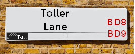
Map of Toller Lane
| Street Crime (updated 14/01/2025) | ||
|---|---|---|
| Location Note | Central Point of Street - Not Actual Location | |
| MSOA Info | For MSOAs E02002216, E02002215, E02002211 (Statistical Neighbourhood) | |
| Click Hint | Click on a Circle for a detailed breakdown below map. | |
| Crime Levels |
Green = Very Low Yellow = Low Orange = High Red = Very High |
|
| Postcodes | ||
| Icon | Postcodes for Toller Lane | |
| Walking Distances | ||
| Distance Info | Green Circle = 10 Minutes Walk (800 metres) | |
Street Crime Data accessed from data.police.uk on 06/10/2024.
Moving to Toller Lane?
I can help you uncover potential pitfalls and provide key questions to ask about your new property. With decades of experience as a Local Land Charges Manager, I offer confidential insights to make your move informed and stress-free.
This service is free, but you may wish to make an optional donation to support it. Please include the property name and address in your request as well as anything you wish to focus on.
Contact Me
Do you know why this road is called Toller Lane?
What's it like to live here?
Share a Photo of Toller Lane
Ask the community a question.
Do you have any questions, memories to share, have any photos or know any facts? We'd love to know more.
Submit Your Comment
Find Homes to Rent in Bradford

Budget Friendly Hotels near Toller Lane
| Budget Hotel Name | Distance (miles) |
|---|---|
|
1: Name:ibis budget Bradford Address: 6 Prince Court, Canal Road Telephone: Visit Hotel Page |
1.59 |
|
2: Name:Travelodge Bradford Central Address: 2 Valley Rd, Bradford, BD1 4AF Telephone: 0871 984 6171 Visit Hotel Page |
1.76 |
|
3: Name:Premier Inn Bradford Central Address: Vicar Lane Telephone: Visit Hotel Page |
2.02 |
|
4: Name:Holiday Inn Express Bradford City Centre Address: The Leisure Exchange, Vicar Lane Telephone: Visit Hotel Page |
2.09 |
|
5: Name:Travelodge Bradford Address: Mid Point, Bradford, BD3 7AY Telephone: 0871 984 6124 Visit Hotel Page |
3.51 |
Hotel Options
Your support helps keep this site running!
If you enjoy using this website, consider making a donation to help me cover hosting costs.
EPC (Energy Performance Certificate) Information for Toller Lane
UPRN: 100051228875
EPC Current: F
EPC Potential: C
Habitable Rooms: 7
Property Type: House
Tenure: Owner-occupied
Built Form: End-Terrace
Age Band: 1900-1929
Mains Gas: Yes
UPRN: 10023347841
EPC Current: E
EPC Potential: D
Habitable Rooms: 12
Property Type: House
Tenure: Owner-occupied
Built Form: Detached
Age Band: before 1900
Mains Gas: Yes
UPRN: 100051228877
EPC Current: F
EPC Potential: D
Habitable Rooms: 5
Property Type: House
Tenure: rental (private)
Built Form: End-Terrace
Age Band: 1900-1929
Mains Gas: Yes
UPRN: 100051955459
EPC Current: E
EPC Potential: D
Habitable Rooms: 5
Property Type: House
Tenure: rental (private)
Built Form: Mid-Terrace
Age Band: 1900-1929
Mains Gas: Yes
UPRN: 100051228879
EPC Current: E
EPC Potential: C
Habitable Rooms: 5
Property Type: House
Tenure: rental (private)
Built Form: Mid-Terrace
Age Band: before 1900
Mains Gas: Yes
UPRN: 100051228880
EPC Current: D
EPC Potential: C
Habitable Rooms: 7
Property Type: House
Tenure: Owner-occupied
Built Form: Mid-Terrace
Age Band: before 1900
Mains Gas: Yes
UPRN: 100051228881
EPC Current: D
EPC Potential: B
Habitable Rooms: 3
Property Type: House
Tenure: Owner-occupied
Built Form: End-Terrace
Age Band: 1900-1929
Mains Gas: Yes
UPRN: 100051228882
EPC Current: E
EPC Potential: A
Habitable Rooms: 3
Property Type: House
Tenure: Owner-occupied
Built Form: Mid-Terrace
Age Band: 1900-1929
Mains Gas: Yes
UPRN: 100051228883
EPC Current: D
EPC Potential: B
Habitable Rooms: 4
Property Type: House
Tenure: Owner-occupied
Built Form: Mid-Terrace
Age Band: 1900-1929
Mains Gas: Yes
UPRN: 100051228884
EPC Current: E
EPC Potential: C
Habitable Rooms: 9
Property Type: House
Tenure: Owner-occupied
Built Form: End-Terrace
Age Band: before 1900
Mains Gas: Yes
UPRN: 100051228907
EPC Current: E
EPC Potential: C
Habitable Rooms: 5
Property Type: Maisonette
Tenure: Owner-occupied
Built Form: End-Terrace
Age Band: 1900-1929
Mains Gas: Yes
UPRN: 100051955540
EPC Current: E
EPC Potential: C
Habitable Rooms: 3
Property Type: Flat
Tenure: Owner-occupied
Built Form: Mid-Terrace
Age Band: before 1900
Mains Gas: Yes
UPRN: 100051955981
EPC Current: E
EPC Potential: D
Habitable Rooms: 4
Property Type: Flat
Tenure: Owner-occupied
Built Form: Mid-Terrace
Age Band: 1900-1929
Mains Gas: Yes
UPRN: 100051228922
EPC Current: D
EPC Potential: C
Habitable Rooms: 4
Property Type: Flat
Tenure: Owner-occupied
Built Form: Mid-Terrace
Age Band: 1900-1929
Mains Gas: Yes
UPRN: 10070060403
EPC Current: D
EPC Potential: C
Habitable Rooms: 4
Property Type: Flat
Tenure: Owner-occupied
Built Form: Mid-Terrace
Age Band: 1900-1929
Mains Gas: Yes
UPRN: 10010585558
EPC Current: D
EPC Potential: C
Habitable Rooms: 3
Property Type: Flat
Tenure: Owner-occupied
Built Form: Mid-Terrace
Age Band: 1900-1929
Mains Gas: Yes
UPRN: 10023347884
EPC Current: E
EPC Potential: D
Habitable Rooms: 4
Property Type: Flat
Tenure: Owner-occupied
Built Form: Mid-Terrace
Age Band: before 1900
Mains Gas: Yes
House Sales
| Year | High | Low | Average | Sales |
|---|---|---|---|---|
| 2014 | £120,000 | £230,000 | £129,000 | 3 |
| 2015 | £105,000 | £190,500 | £192,000 | 4 |
| 2016 | £71,000 | £180,000 | £102,667 | 3 |
| 2017 | £32,500 | £185,000 | £118,112 | 4 |
| 2018 | £36,500 | £210,000 | £167,167 | 3 |
| 2019 | £36,000 | £270,000 | £147,563 | 8 |
| 2020 | £41,000 | £290,000 | £134,457 | 7 |
| 2021 | £82,000 | £235,000 | £180,500 | 4 |
| 2022 | £51,000 | £680,000 | £309,000 | 5 |
| 2023 | £46,000 | £95,000 | £173,600 | 5 |
| 2024 | £57,500 | £57,500 | £57,500 | 1 |
Contains HM Land Registry data © Crown copyright and database right 2025. This data is licensed under the Open Government Licence v3.0.
Nearby Estate Agents
| Name | Address | Website |
|---|---|---|
| MoveUp Property Services | 10 Duckworth Lane, Bradford,BD9 5EP | Visit Website |
| Bradford Estates | 218 Lilycroft Road, Bradford,BD9 5AL | Visit Website |
| Supreme Estates | 157 Toller Lane, Bradford,BD8 9HL | Visit Website |
| Your Choice Estate Agents | 86 Toller Lane, Bradford, BD8 9DA | Visit Website |
| Hometime Property Management | 20 Willow Street, Bradford,BD8 9NJ |
We have found 20 postcodes
Neighbourhood Policing |
| Police Force: West Yorkshire |
 View Neighbourhood Crime and Policing View Neighbourhood Crime and Policing |
| Find a Local Neighbourhood Watch Scheme |
Location Details
| Toller Lane | |
|---|---|

| |
| Latitude | 53.808523 |
| Longitude | -1.789348 |
| OS Easting (X): | 413870 |
| OS Northing (Y): | 434736 |
| OS Grid Reference: | SE139347 |
Known Residential Addresses for Toller Lane
- 160
- 411
- 544
- 554
- 546
- 550
- 437
- 155
- GIRLINGTON SERVICE STATION
- 159
- 228 CARETAKERS FLAT
- 425A
- 425
- 413
- 453
- 303
- 325
- 333
- 321
- 329
- 307
- 331
- 262
- 250
- 391
- 431
- 54
- 38
- 76
- 295
- 297
- 208
- 179
- 180
- 461
- 459
- 463
- 455
- 473
- 467
Roads that have a Junction with Toller Lane
| Street | Junction Type |
|---|---|
| Toller Drive | junction |
| Glenview Avenue | junction |
| Haworth Road | junction |
| Bingley Road (B6269) | junction |
| Toller Grove | junction |
| Duchy Drive | junction |
| Leylands Lane | junction |
| Duchy Drive | junction |
| Heaton Park Drive | junction |
| Lynton Drive | junction |
| Haslingden Drive | junction |
| Scotchman Road | junction |
| Saltburn Place | junction |
| Masham Place | junction |
| Hartman Place | junction |
| Smith Lane | junction |
| Little Lane | junction |
| Jesmond Avenue | junction |
| Mannheim Road | junction |
| Upper Woodlands Road | junction |
| Duckworth Lane | junction |
| Heidelberg Road | junction |
| Hanover Close | junction |
| Fairbank Road | junction |
| Whitby Road | junction |
| Farcliffe Road | pseudo node |
| St Chad's Road | pseudo node |
| Fairfield Road | junction |
| Abingdon Street | junction |
| Cross Road | junction |
| Ashwell Road | junction |
| Whetley Lane (A6177) | junction |
Sunset and Sunrise times
| Sunrise | 07:48 |
|---|---|
| Sunset | 16:52 |
Latest Weather Conditions
| Observed at Weather Station: | Bingley Samos 2 February 2025 at 13:00 (3.09 miles away) |
|---|---|
| Current Weather: | Sunny day |
| Temperature and Humidity: | 5.2°C (77.7%) |
| Wind Direction and Speed: | SW (11 mph) |
Population Statistics
| ONS Area Code | E00054646, E00054482, E00054514, E00054510, E00054499, E00053851, E00054506, E00054508, E00053844 & E00053841 |
|---|---|
| ONS Area Name | Pakistani Communities, Retired Independent City Dwellers, Achieving Minorities & Indian Tech Achievers |
| Average Age | 35.51, 27.56, 32.68, 30.43, 31.51, 40.19 & 33.44 |
| Area Population | 1664.00, 2275.00, 2094.00, 2235.00, 2330.00, 1990.00 & 1694.00 |
| Male Population | 808.00, 1148.00, 1068.00, 1096.00, 1185.00, 946.00 & 844.00 (50%) |
| Female Population | 856.00, 1127.00, 1026.00, 1139.00, 1145.00, 1044.00 & 850.00 (50%) |
| Benefit Claimants | 85, 116, 88, 105, 70, 37 & 58 (4%) |
| LSOA Code: | E01010840, E01010808, E01010807, E01010809, E01010804, E01010675 &E01010671 |
|---|---|
| LSOA Name: | Bradford 034D, Bradford 033D, Bradford 033C, Bradford 033E, Bradford 033A, Bradford 029D &Bradford 029B |
| SOA Code: | 7b &3b |
| SOA Name: | |
| MSOA Code: | E02002216, E02002215 &E02002211 |
| MSOA Name: | Bradford 034, Bradford 033 &Bradford 029 |
Nearest Supermarkets
| Morrisons Bradford - Victoria |
|---|
| Victoria Shopping Centre, Young Street, Bradford BD8 9BN |
| 01274 498218 |
| Distance: 0.74 Miles |
| Directions to Morrisons Bradford - Victoria |
| Iceland Manningham Food Warehouse |
|---|
| UNITS 3-4, MANNINGHAM LANE RETAIL PK, BRADFORD, BD1 3AH |
| 01274304139 |
| Distance: 0.91 Miles |
| Directions to Iceland Manningham Food Warehouse |
| Asda Bradford Cemetery Road |
|---|
| Cemetery Road, Lidget Green, Bradford, BD7 2QX |
| 01274 476230 |
| Distance: 1.01 Miles |
| Directions to Asda Bradford Cemetery Road |
| Tesco Manninghm Ln Bradford Express |
|---|
| Manningham Ln, Bradford, BD8 7HY |
| 0345 026 9840 |
| Distance: 1.2 Miles |
| Directions to Tesco Manninghm Ln Bradford Express |
Telephone Information
| Area Code |
|---|
| Area Code: 01274 - Bradford |
| Area Code: 01943 - Guiseley |
| Area Code: 01422 - Halifax |
| Area Code: 01535 - Keighley |
Broadband Information
| Speed | Average Speed | Median Speed | Maximum Speed | Next-generation access (NGA) | Number of Connections |
|---|---|---|---|---|---|
| Greater than 2 Mbps | 25.6 | 25 | >=30 | Y | 11 |
Local Government
| Local Council Details |
|---|
| Within the area of Bradford |
| Visit the Council's Website |
| City Hall, Centenary Square, Bradford &BD1 1HY |
| Telephone Number: 01274 432111 |
| Local Member of Parliament |
|---|
| Within the Westminster Parliamentary Constituency of Bradford West |
| The Member of Parliament is Naseem Shah |
| Details for the MP Naseem Shah on parliament.uk |
| Details for the MP Naseem Shah on theyworkforyou.com |
| In the 2024 General Election Naseem Shah won with a majority of 707 the result was Lab hold. The total electorate was 77,897 |
| Wards, Parish Councils and County Councils |
|---|
| Ward: Manningham, Toller &Heaton Ward |
| Parish: Unparished area |
| Ceremonial County: West Yorkshire |
Nearest Schools
England Secondary Schools
Oasis Academy Lister Park
Address: Oasis Academy Lister Park, North Avenue, Bradford, West Yorkshire, BD8 7ND
Distance: 1.06 miles
Contact: 01274362050
One In A Million Free School
Address: One In A Million Free School, Cliffe Terrace, Bradford, West Yorkshire, BD8 7DX
Distance: 1.18 miles
Contact: 01274723439
Dixons Kings Academy
Address: Dixons Kings Academy, Northside Road, Bradford, West Yorkshire, BD7 2AN
Distance: 1.21 miles
Contact: 01274089910
Bradford Girls' Grammar School
Address: Bradford Girls' Grammar School, Squire Lane, Bradford, West Yorkshire, BD9 6RB
Distance: 0.43 miles
Contact: 01274545395
Dixons Allerton Academy
Address: Dixons Allerton Academy, Rhodesway, Bradford, West Yorkshire, BD8 0DH
Distance: 1.03 miles
Contact: 01274089890
St Bede's and St Joseph's Catholic College
Address: St Bede's and St Joseph's Catholic College, Highgate, Heaton, Bradford, BD9 4BQ
Distance: 0.47 miles
Contact:
Belle Vue Girls' Academy
Address: Belle Vue Girls' Academy, Thorn Lane, Bingley Road, Bradford, West Yorkshire, BD9 6NA
Distance: 1.22 miles
Contact: 01274492341
Beckfoot Upper Heaton
Address: Beckfoot Upper Heaton, Thorn Lane, Heaton, Bradford, West Yorkshire, BD9 6AL
Distance: 1.03 miles
Contact: 01274493533
England Primary Schools
Frizinghall Primary School
Address: Frizinghall Primary School, Salisbury Road, Frizinghall, Bradford, West Yorkshire, BD9 4HP
Distance: 1.12 miles
Contact: 01274543072
Dixons Manningham Academy
Address: Dixons Manningham Academy, Wood Street, Manningham, Bradford, West Yorkshire, BD8 8HY
Distance: 1.07 miles
Contact: 01274731695
Atlas Community Primary School
Address: Atlas Community Primary School, Lincoln Close, Manningham, Atlas Community Primary School, Bradford, West Yorkshire, BD8 8DL
Distance: 0.89 miles
Contact: 01274495190
Atlas Community Primary School
Address: Atlas Community Primary School, Lincoln Close, Manningham, Bradford, West Yorkshire, BD8 8DL
Distance: 0.89 miles
Contact:
Green Lane Primary School
Address: Green Lane Primary School, Green Lane, Manningham, Bradford, West Yorkshire, BD8 8HT
Distance: 0.97 miles
Contact: 01274774644
Green Lane Primary School
Address: Green Lane Primary School, Green Lane, Bradford, West Yorkshire, BD8 8HT
Distance: 0.97 miles
Contact:
Copthorne Primary School
Address: Copthorne Primary School, All Saints' Road, Bradford, West Yorkshire, BD7 3AY
Distance: 1.72 miles
Contact: 01274501460
Copthorne Primary School
Address: Copthorne Primary School, All Saints' Road, Bradford, West Yorkshire, BD7 3AY
Distance: 1.72 miles
Contact:
Westbourne Primary School
Address: Westbourne Primary School, Skinner Lane, Manningham, Bradford, West Yorkshire, BD8 7PL
Distance: 0.63 miles
Contact: 01274483138
Westbourne Primary School
Address: Westbourne Primary School, Skinner Lane, Bradford, West Yorkshire, BD8 7PL
Distance: 0.63 miles
Contact:
Princeville Primary School
Address: Princeville Primary School, Willowfield Street, Bradford, West Yorkshire, BD7 2AH
Distance: 1.15 miles
Contact:
Iqra Primary Academy
Address: Iqra Primary Academy, Drummond Road, Bradford, West Yorkshire, BD8 8DA
Distance: 0.75 miles
Contact: 01274773350
Iqra Community Primary School
Address: Iqra Community Primary School, Drummond Road, Bradford, West Yorkshire, BD8 8DA
Distance: 0.75 miles
Contact:
Miriam Lord Community Primary School
Address: Miriam Lord Community Primary School, Bavaria Place, Manningham, Bradford, West Yorkshire, BD8 8RG
Distance: 0.64 miles
Contact:
Lidget Green Primary School
Address: Lidget Green Primary School, Birks Fold, Lidget Green, Bradford, West Yorkshire, BD7 2QN
Distance: 1.17 miles
Contact:
Whetley Academy
Address: Whetley Academy, Whetley Lane, Girlington, Bradford, West Yorkshire, BD8 9HZ
Distance: 0.53 miles
Contact: 01274422041
St Philip's CofE Primary School
Address: St Philip's CofE Primary School, Whitby Terrace, Girlington, Bradford, West Yorkshire, BD8 9JL
Distance: 0.41 miles
Contact: 01274546496
Lister Primary School
Address: Lister Primary School, Scotchman Road, Manningham, Bradford, West Yorkshire, BD9 5AT
Distance: 0.20 miles
Contact:
St Cuthbert and The First Martyrs' Catholic Primary School
Address: St Cuthbert and The First Martyrs' Catholic Primary School, Scotchman Road, Heaton, Bradford, West Yorkshire, BD9 5AT
Distance: 0.20 miles
Contact:
Girlington Primary School
Address: Girlington Primary School, Girlington Road, Bradford, West Yorkshire, BD8 9NR
Distance: 0.41 miles
Contact: 01274493543
Lilycroft Primary School
Address: Lilycroft Primary School, Lilycroft Road, Manningham, Bradford, West Yorkshire, BD9 5AD
Distance: 0.38 miles
Contact: 01274543357
Lilycroft Primary School
Address: Lilycroft Primary School, Lilycroft Road, Manningham, Bradford, West Yorkshire, BD9 5AD
Distance: 0.38 miles
Contact:
Margaret McMillan Primary School
Address: Margaret McMillan Primary School, Scotchman Road, Heaton, Margaret McMillan Primary School, Bradford, West Yorkshire, BD9 5DF
Distance: 0.13 miles
Contact: 01274495934
Margaret McMillan Primary School
Address: Margaret McMillan Primary School, Scotchman Road, Heaton, Bradford, West Yorkshire, BD9 5DF
Distance: 0.13 miles
Contact:
St William's Catholic Primary School
Address: St William's Catholic Primary School, Young Street, Bradford, West Yorkshire, BD8 9RG
Distance: 0.82 miles
Contact:
Crossley Hall Primary School
Address: Crossley Hall Primary School, Thornton Road, Bradford, West Yorkshire, BD8 0HJ
Distance: 0.90 miles
Contact:
St Matthew's Catholic Primary School
Address: St Matthew's Catholic Primary School, Saffron Drive, Allerton, Bradford, West Yorkshire, BD15 7NE
Distance: 1.43 miles
Contact:
Ley Top Primary School
Address: Ley Top Primary School, Avenel Road, Allerton, Bradford, West Yorkshire, BD15 7PQ
Distance: 1.47 miles
Contact: 01274541554
Cottingley Village Primary School
Address: Cottingley Village Primary School, Cottingley Moor Road, Cottingley, Bingley, West Yorkshire, BD16 1SY
Distance: 1.83 miles
Contact:
Heaton Primary School
Address: Heaton Primary School, Haworth Road, Bradford, West Yorkshire, BD9 6LL
Distance: 0.94 miles
Contact:
Beckfoot Allerton Primary School and Nursery
Address: Beckfoot Allerton Primary School and Nursery, Garforth Street, Allerton, Bradford, West Yorkshire, BD15 7HB
Distance: 1.38 miles
Contact: 01274541587
Allerton Primary School
Address: Allerton Primary School, Garforth Street, Allerton, Bradford, West Yorkshire, BD15 7HB
Distance: 1.38 miles
Contact:
Heaton St Barnabas' CofE Aided Primary School
Address: Heaton St Barnabas' CofE Aided Primary School, Rossefield Road, Heaton, Bradford, West Yorkshire, BD9 4DA
Distance: 0.57 miles
Contact: 01274545019
Beckfoot Heaton Primary
Address: Beckfoot Heaton Primary, Haworth Road, Bradford, West Yorkshire, BD9 6LL
Distance: 0.94 miles
Contact: 01274363070
Nearest Hospitals
| Bradford Royal Infirmary |
|---|
| Address: Duckworth Lane, Bradford, BD9 6RJ, |
| NHS Sector |
| Bradford Teaching Hospitals NHS Foundation Trust |
| Telephone: 01274 542200 |
| Visit Hospital Website |
| Distance: 0.45 (miles) |
| Directions from to Bradford Royal Infirmary |
| Westbourne Green Community Hospital |
|---|
| Address: 26 Heaton Road, Bradford, BD8 8RA, |
| Independent Sector |
| Bradford Teaching Hospitals NHS Foundation Trust |
| Telephone: 1274322093 |
| Distance: 0.87 (miles) |
| Directions from to Westbourne Green Community Hospital |
| Lynfield Mount Hospital |
|---|
| Address: Heights Lane, Bradford, BD9 6DP, |
| NHS Sector |
| Bradford District NHS Foundation Trust |
| Telephone: 01274 494194 |
| Visit Hospital Website |
| Distance: 1.06 (miles) |
| Directions from to Lynfield Mount Hospital |
Nearest Dentists
Dentists
DENTAL SURGERY
Address: 206 TOLLER LANE, BRADFORD, WEST YORKSHIRE, BD9 5BU
Distance: 0.14 miles
Contact: :
DENTAL SURGERY
Address: 65 DUCKWORTH LANE, BRADFORD, WEST YORKSHIRE, BD9 5EU
Distance: 0.22 miles
Contact: :
DENTAL SURGERY
Address: 95 OAK LANE, BRADFORD, WEST YORKSHIRE, BD9 4QU
Distance: 0.60 miles
Contact: :
J C AND A A RAYNER
Address: 21 WHETLEY LANE, BRADFORD, WEST YORKSHIRE, BD8 9EH
Distance: 0.62 miles
Contact: :
MANNINGHAM LANE DENTAL PRACTICE
Address: 259 MANNINGHAM LANE, BRADFORD, WEST YORKSHIRE, BD8 7EP
Distance: 0.99 miles
Contact: :
DENTAL SURGERY
Address: 204 BRADFORD ROAD, SHIPLEY, WEST YORKSHIRE, BD18 3AP
Distance: 1.16 miles
Contact: :
Nearest GP Surgeries
Doctors
LEYLANDS LANE MEDICAL PRACTICE
Address: 81 LEYLANDS LANE, HEATON, BRADFORD, BD9 5PZ
Distance: 0.31 miles
Contact: tel: 01274 770771
MANOR MEDICAL PRACTICE
Address: GIRLINGTON HEALTH CENTRE, 195 GIRLINGTON ROAD, BRADFORD, BD8 9PB
Distance: 0.39 miles
Contact: tel: 01274 484111
KENSINGTON PARTNERSHIP
Address: WHITEFIELD PLACE, GIRLINGTON, BRADFORD, WEST YORKSHIRE, BD8 9LB
Distance: 0.54 miles
Contact: tel: 01274 499209
DR IA GILKAR & PARTNERS
Address: KENSINGTON STREET HEALTH CENTRE, WHITEFIELD PLACE, BRADFORD, WEST YORKSHIRE, BD8 9LB
Distance: 0.54 miles
Contact: tel: 01274 496433
OAK LANE SURGERY
Address: WESTBOURNE GREEN COMMUNITY HC, 50 HEATON ROAD, BRADFORD, WEST YORKSHIRE, BD8 8RA
Distance: 0.54 miles
Contact: :
THE LISTER SURGERY
Address: 50 HEATON ROAD, BRADFORD, WEST YORKSHIRE, BD8 8RA
Distance: 0.54 miles
Contact: tel: 01274 202495
Nearest Dispensing Chemists
Pharmacies
SAHARA PHARMACY
Address: 23 DUCKWORTH LANE, BRADFORD, WEST YORKSHIRE, BD9 5ES
Distance: 0.19 miles
Contact: tel: 01274 480588
LEYLANDS LANE PHARMACY
Address: LEYLANDS MEDICAL CENTRE, 81 LEYLANDS LANE, BRADFORD, BD9 5PZ
Distance: 0.31 miles
Contact: tel: 01274 495500
GIRLINGTON PHARMACY
Address: GIRLINGTON MEDICAL CENTRE, 197 GIRLINGTON ROAD, BRADFORD, WEST YORKSHIRE, BD8 9NS
Distance: 0.40 miles
Contact: tel: 01274 773996
HEATON PHARMACY
Address: HEATON POST OFFICE, 8 HIGHGATE, HEATON, BRADFORD, WEST YORKSHIRE, BD9 4BB
Distance: 0.52 miles
Contact: tel: 01274 544226
BRADFORD PHARMACY
Address: KENSINGTON STREET HEALTH CENTRE, WHITEFIELD PLACE, BRADFORD, BD8 9LB
Distance: 0.54 miles
Contact: tel: 01274 400578
LISTER PHARMACY-WESTBOURNE GREEN
Address: WESTBOURNE GREEN CHC CTR., 50 HEATON ROAD, BRADFORD, BD8 8RA
Distance: 0.54 miles
Contact: tel: 01274 496075
Nearest Opticians
Opticians
CROSSROADS OPTICIANS
Address: 54 DUCKWORTH LANE, BRADFORD, WEST YORKSHIRE, BD9 5HB
Distance: 0.18 miles
Contact: :
EYEDEAL OPTICAL (YORKSHIRE) LTD
Address: 45 DUCKWORTH LANE, BRADFORD, WEST YORKSHIRE, BD9 5ET
Distance: 0.20 miles
Contact: :
OAKLANE OPTICIANS
Address: 68 OAK LANE, BRADFORD, WEST YORKSHIRE, BD9 4QX
Distance: 0.58 miles
Contact: :
SPECSAVERS (GIRLINGTON, BRADFORD)
Address: UNIT 12, MORRISONS SUPERMARKET, VICTORIA SHOPPING CENTRE, THORNTON ROAD, BRADFORD, WEST YORKSHIRE, BD8 9BN
Distance: 0.74 miles
Contact: :
PREMIER VISION VICTORIA
Address: INSIDE MORRISONS SUPERMARKET, VICTORIA CENTRE, THORNTON ROAD, BRADFORD, BD8 9BN
Distance: 0.74 miles
Contact: :
FINELINE EYECARE (UK) LIMITED (SSECS)
Address: 19 OAK LANE, BRADFORD, WEST YORKSHIRE, BD9 4PU
Distance: 0.84 miles
Contact: :
Transport
Nearest Rail Stations
Frizinghall Station is 1.14 miles away.
Address: Frizinghall station, Frizinghall Road, Frizinghall, West Yorkshire, BD9 4LD
Frizinghall is situated on the Wharfedale Line|Leeds to Bradford lines and is managed by Northern.
Frizinghall Station is an unstaffed station.
Bradford Forster Square Station is 1.69 miles away.
Address: Bradford Forster Square station, Forster Square, Bradford, West Yorkshire, BD1 4HY
Bradford Forster Square is situated on the Wharfedale Line|Leeds to Bradford lines and is managed by Northern.
Bradford Forster Square Station is staffed on a part time basis.