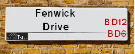
Fenwick Drive is a street located in the city of Bradford. The street has a length of approximately 1,522 metres.
The street is publicly maintained which means that the road is adopted and Bradford is responsible for the repair and upkeep of the highway.
The street is located within the Bradford District (B) Council's jurisdiction. They provide various services, like refuse collection, and manage council tax collection. It's situated in the Yorkshire and The Humber region of the UK.
The road has been assigned the Unique Street Reference Number of 7727960 in the National Street Gazetteer.
The street has the postcodes of BD6 2SB, BD6 2RZ, BD6 2QT, BD6 2PG, BD6 2NQ and BD6 2NH.
It is located within the county of West Yorkshire, situated in the Yorkshire and The Humber region of the UK. It's 171.17 miles North West from central London., 10.49 miles West from Leeds, 26.77 miles North East from Manchester and 29.02 miles North West from Sheffield.
FENWICK DRIVE is within the Post Town of BRADFORD
Map of Fenwick Drive
| Street Crime (updated 14/01/2025) | ||
|---|---|---|
| Location Note | Central Point of Street - Not Actual Location | |
| MSOA Info | For MSOA E02002241 (Statistical Neighbourhood) | |
| Click Hint | Click on a Circle for a detailed breakdown below map. | |
| Crime Levels |
Green = Very Low Yellow = Low Orange = High Red = Very High |
|
| Postcodes | ||
| Icon | Postcodes for Fenwick Drive | |
| Walking Distances | ||
| Distance Info | Green Circle = 10 Minutes Walk (800 metres) | |
Street Crime Data accessed from data.police.uk on 06/10/2024.
Moving to Fenwick Drive?
I can help you uncover potential pitfalls and provide key questions to ask about your new property. With decades of experience as a Local Land Charges Manager, I offer confidential insights to make your move informed and stress-free.
This service is free, but you may wish to make an optional donation to support it. Please include the property name and address in your request as well as anything you wish to focus on.
Contact Me
Do you know why this road is called Fenwick Drive?
What's it like to live here?
Share a Photo of Fenwick Drive
Ask the community a question.
Do you have any questions, memories to share, have any photos or know any facts? We'd love to know more.
Submit Your Comment
Find Homes to Rent in Bradford

Budget Friendly Hotels near Fenwick Drive
| Budget Hotel Name | Distance (miles) |
|---|---|
|
1: Name:Holiday Inn Express Bradford City Centre Address: The Leisure Exchange, Vicar Lane Telephone: Visit Hotel Page |
2.96 |
|
2: Name:Premier Inn Bradford South Address: Dyehouse Drive Telephone: Visit Hotel Page |
2.98 |
|
3: Name:Premier Inn Bradford Central Address: Vicar Lane Telephone: Visit Hotel Page |
3.05 |
|
4: Name:Travelodge Bradford Central Address: 2 Valley Rd, Bradford, BD1 4AF Telephone: 0871 984 6171 Visit Hotel Page |
3.26 |
|
5: Name:Days Inn Hotel Bradford - Leeds Address: Eastbound M62, Clifton, Leeds Telephone: Visit Hotel Page |
3.42 |
Hotel Options
Your support helps keep this site running!
If you enjoy using this website, consider making a donation to help me cover hosting costs.
EPC (Energy Performance Certificate) Information for Fenwick Drive
UPRN: 100051161207
EPC Current: D
EPC Potential: C
Habitable Rooms: 4
Property Type: House
Tenure: rental (social)
Built Form: Semi-Detached
Age Band: 1950-1966
Mains Gas: Yes
UPRN: 100051161209
EPC Current: D
EPC Potential: B
Habitable Rooms: 5
Property Type: House
Tenure: Owner-occupied
Built Form: Semi-Detached
Age Band: 1930-1949
Mains Gas: Yes
UPRN: 100051161214
EPC Current: D
EPC Potential: C
Habitable Rooms: 6
Property Type: House
Tenure: Owner-occupied
Built Form: Semi-Detached
Age Band: 1950-1966
Mains Gas: Yes
UPRN: 100051161215
EPC Current: D
EPC Potential: B
Habitable Rooms: 4
Property Type: House
Tenure: Rented (social)
Built Form: Semi-Detached
Age Band: 1967-1975
Mains Gas: Yes
UPRN: 100051161216
EPC Current: C
EPC Potential: B
Habitable Rooms: 4
Property Type: House
Tenure: Owner-occupied
Built Form: Semi-Detached
Age Band: 1950-1966
Mains Gas: Yes
UPRN: 100051161218
EPC Current: D
EPC Potential: B
Habitable Rooms: 3
Property Type: House
Tenure: rental (social)
Built Form: Semi-Detached
Age Band: 1950-1966
Mains Gas: Yes
UPRN: 100051161220
EPC Current: C
EPC Potential: B
Habitable Rooms: 5
Property Type: House
Tenure: Owner-occupied
Built Form: Semi-Detached
Age Band: 1930-1949
Mains Gas: Yes
UPRN: 100051161221
EPC Current: C
EPC Potential: B
Habitable Rooms: 5
Property Type: House
Tenure: Owner-occupied
Built Form: Semi-Detached
Age Band: 1950-1966
Mains Gas: Yes
UPRN: 100051161222
EPC Current: C
EPC Potential: B
Habitable Rooms: 5
Property Type: House
Tenure: Owner-occupied
Built Form: Semi-Detached
Age Band: 1950-1966
Mains Gas: Yes
UPRN: 100051161223
EPC Current: D
EPC Potential: B
Habitable Rooms: 4
Property Type: House
Tenure: Owner-occupied
Built Form: Semi-Detached
Age Band: 1930-1949
Mains Gas: Yes
UPRN: 100051161224
EPC Current: C
EPC Potential: B
Habitable Rooms: 5
Property Type: House
Tenure: Owner-occupied
Built Form: Semi-Detached
Age Band: 1930-1949
Mains Gas: Yes
UPRN: 100051161226
EPC Current: D
EPC Potential: B
Habitable Rooms: 5
Property Type: House
Tenure: Owner-occupied
Built Form: Semi-Detached
Age Band: 1950-1966
Mains Gas: Yes
UPRN: 100051161227
EPC Current: D
EPC Potential: C
Habitable Rooms: 4
Property Type: House
Tenure: Owner-occupied
Built Form: Semi-Detached
Age Band: 1950-1966
Mains Gas: Yes
UPRN: 100051161228
EPC Current: C
EPC Potential: B
Habitable Rooms: 4
Property Type: House
Tenure: Rented (private)
Built Form: Semi-Detached
Age Band: 1950-1966
Mains Gas: Yes
UPRN: 100051161229
EPC Current: E
EPC Potential: B
Habitable Rooms: 4
Property Type: House
Tenure: rental (private)
Built Form: Semi-Detached
Age Band: 1930-1949
Mains Gas: Yes
UPRN: 100051161230
EPC Current: C
EPC Potential: B
Habitable Rooms: 4
Property Type: House
Tenure: Rented (private)
Built Form: Semi-Detached
Age Band: 1950-1966
Mains Gas: Yes
UPRN: 100051161231
EPC Current: D
EPC Potential: B
Habitable Rooms: 5
Property Type: House
Tenure: Owner-occupied
Built Form: Semi-Detached
Age Band: 1930-1949
Mains Gas: Yes
UPRN: 100051161232
EPC Current: D
EPC Potential: B
Habitable Rooms: 5
Property Type: House
Tenure: Owner-occupied
Built Form: Semi-Detached
Age Band: 1950-1966
Mains Gas: Yes
UPRN: 100051161234
EPC Current: C
EPC Potential: B
Habitable Rooms: 5
Property Type: House
Tenure: Owner-occupied
Built Form: Semi-Detached
Age Band: 1950-1966
Mains Gas: Yes
UPRN: 100051161235
EPC Current: E
EPC Potential: C
Habitable Rooms: 4
Property Type: House
Tenure: Rented (private)
Built Form: Semi-Detached
Age Band: 1950-1966
Mains Gas: Yes
UPRN: 100051161237
EPC Current: D
EPC Potential: C
Habitable Rooms: 5
Property Type: House
Tenure: Owner-occupied
Built Form: Semi-Detached
Age Band: 1930-1949
Mains Gas: Yes
UPRN: 100051161239
EPC Current: D
EPC Potential: C
Habitable Rooms: 5
Property Type: House
Tenure: Owner-occupied
Built Form: Semi-Detached
Age Band: 1950-1966
Mains Gas: Yes
UPRN: 100051161241
EPC Current: C
EPC Potential: B
Habitable Rooms: 5
Property Type: House
Tenure: Owner-occupied
Built Form: Semi-Detached
Age Band: 1950-1966
Mains Gas: Yes
UPRN: 100051161243
EPC Current: D
EPC Potential: C
Habitable Rooms: 5
Property Type: House
Tenure: rental (private)
Built Form: Semi-Detached
Age Band: 1930-1949
Mains Gas: Yes
UPRN: 100051161245
EPC Current: E
EPC Potential: C
Habitable Rooms: 5
Property Type: House
Tenure: Owner-occupied
Built Form: Semi-Detached
Age Band: 1950-1966
Mains Gas: Yes
UPRN: 100051161249
EPC Current: C
EPC Potential: C
Habitable Rooms: 4
Property Type: House
Tenure: rental (private)
Built Form: Mid-Terrace
Age Band: 1967-1975
Mains Gas: Yes
UPRN: 100051161250
EPC Current: D
EPC Potential: C
Habitable Rooms: 5
Property Type: House
Tenure: Owner-occupied
Built Form: Semi-Detached
Age Band: 1950-1966
Mains Gas: Yes
UPRN: 100051161253
EPC Current: C
EPC Potential: B
Habitable Rooms: 5
Property Type: House
Tenure: Owner-occupied
Built Form: Semi-Detached
Age Band: 1967-1975
Mains Gas: Yes
UPRN: 10010581264
EPC Current: C
EPC Potential: B
Habitable Rooms: 4
Property Type: Bungalow
Tenure: Rented (social)
Built Form: End-Terrace
Age Band: 2003-2006
Mains Gas: Yes
UPRN: 100051161254
EPC Current: B
EPC Potential: B
Habitable Rooms: 4
Property Type: House
Tenure: Owner-occupied
Built Form: Mid-Terrace
Age Band: 1930-1949
Mains Gas: Yes
UPRN: 10010581265
EPC Current: C
EPC Potential: B
Habitable Rooms: 4
Property Type: Bungalow
Tenure: Rented (social)
Built Form: Mid-Terrace
Age Band: 2003-2006
Mains Gas: Yes
UPRN: 10010581266
EPC Current: C
EPC Potential: B
Habitable Rooms: 4
Property Type: Bungalow
Tenure: Rented (social)
Built Form: End-Terrace
Age Band: 2003-2006
Mains Gas: Yes
UPRN: 100051161255
EPC Current: B
EPC Potential: A
Habitable Rooms: 5
Property Type: House
Tenure: Owner-occupied
Built Form: Semi-Detached
Age Band: 1950-1966
Mains Gas: Yes
UPRN: 100051161256
EPC Current: D
EPC Potential: B
Habitable Rooms: 5
Property Type: House
Tenure: Owner-occupied
Built Form: Semi-Detached
Age Band: 1930-1949
Mains Gas: Yes
UPRN: 100051161257
EPC Current: D
EPC Potential: C
Habitable Rooms: 4
Property Type: House
Tenure: Owner-occupied
Built Form: Semi-Detached
Age Band: 1950-1966
Mains Gas: Yes
UPRN: 100051161258
EPC Current: C
EPC Potential: B
Habitable Rooms: 5
Property Type: House
Tenure: Owner-occupied
Built Form: Semi-Detached
Age Band: 1930-1949
Mains Gas: Yes
UPRN: 100051161259
EPC Current: C
EPC Potential: B
Habitable Rooms: 5
Property Type: House
Tenure: rental (private)
Built Form: Semi-Detached
Age Band: 1950-1966
Mains Gas: Yes
UPRN: 100051161260
EPC Current: D
EPC Potential: C
Habitable Rooms: 5
Property Type: House
Tenure: Rented (social)
Built Form: Semi-Detached
Age Band: 1930-1949
Mains Gas: Yes
UPRN: 100051161261
EPC Current: B
EPC Potential: A
Habitable Rooms: 5
Property Type: House
Tenure: Owner-occupied
Built Form: Semi-Detached
Age Band: 1930-1949
Mains Gas: Yes
UPRN: 100051161262
EPC Current: E
EPC Potential: C
Habitable Rooms: 5
Property Type: House
Tenure: Owner-occupied
Built Form: Semi-Detached
Age Band: 1950-1966
Mains Gas: Yes
UPRN: 100051161263
EPC Current: D
EPC Potential: B
Habitable Rooms: 5
Property Type: House
Tenure: Owner-occupied
Built Form: Semi-Detached
Age Band: 1950-1966
Mains Gas: Yes
UPRN: 100051161265
EPC Current: D
EPC Potential: B
Habitable Rooms: 5
Property Type: House
Tenure: Rented (social)
Built Form: Semi-Detached
Age Band: 1930-1949
Mains Gas: Yes
UPRN: 100051161267
EPC Current: D
EPC Potential: C
Habitable Rooms: 6
Property Type: House
Tenure: Owner-occupied
Built Form: Semi-Detached
Age Band: 1950-1966
Mains Gas: Yes
UPRN: 100051161268
EPC Current: D
EPC Potential: B
Habitable Rooms: 5
Property Type: House
Tenure: Owner-occupied
Built Form: Semi-Detached
Age Band: 1930-1949
Mains Gas: Yes
UPRN: 10090404380
EPC Current: C
EPC Potential: B
Habitable Rooms: 4
Property Type: House
Tenure: Owner-occupied
Built Form: Detached
Age Band: U
Mains Gas: Yes
UPRN: 100051161269
EPC Current: E
EPC Potential: C
Habitable Rooms: 4
Property Type: House
Tenure: Owner-occupied
Built Form: Semi-Detached
Age Band: 1950-1966
Mains Gas: Yes
UPRN: 100051161270
EPC Current: D
EPC Potential: B
Habitable Rooms: 5
Property Type: House
Tenure: Owner-occupied
Built Form: Semi-Detached
Age Band: 1950-1966
Mains Gas: Yes
UPRN: 100051161272
EPC Current: D
EPC Potential: C
Habitable Rooms: 4
Property Type: House
Tenure: Owner-occupied
Built Form: Semi-Detached
Age Band: 1950-1966
Mains Gas: Yes
UPRN: 100051161273
EPC Current: C
EPC Potential: B
Habitable Rooms: 3
Property Type: House
Tenure: Rented (social)
Built Form: Semi-Detached
Age Band: 1967-1975
Mains Gas: Yes
UPRN: 100051161274
EPC Current: C
EPC Potential: B
Habitable Rooms: 5
Property Type: House
Tenure: Owner-occupied
Built Form: Semi-Detached
Age Band: 1976-1982
Mains Gas: Yes
UPRN: 100051161277
EPC Current: C
EPC Potential: B
Habitable Rooms: 5
Property Type: House
Tenure: rental (private)
Built Form: Semi-Detached
Age Band: 1950-1966
Mains Gas: Yes
UPRN: 100051161278
EPC Current: D
EPC Potential: D
Habitable Rooms: 4
Property Type: House
Tenure: rental (private)
Built Form: Semi-Detached
Age Band: 1930-1949
Mains Gas: Yes
UPRN: 100051161280
EPC Current: D
EPC Potential: C
Habitable Rooms: 5
Property Type: House
Tenure: rental (social)
Built Form: Semi-Detached
Age Band: 1950-1966
Mains Gas: Yes
UPRN: 100051161282
EPC Current: D
EPC Potential: B
Habitable Rooms: 4
Property Type: House
Tenure: Owner-occupied
Built Form: Semi-Detached
Age Band: 1950-1966
Mains Gas: Yes
UPRN: 100051161283
EPC Current: D
EPC Potential: B
Habitable Rooms: 5
Property Type: House
Tenure: Owner-occupied
Built Form: Semi-Detached
Age Band: 1950-1966
Mains Gas: Yes
UPRN: 100051161284
EPC Current: D
EPC Potential: D
Habitable Rooms: 4
Property Type: House
Tenure: Owner-occupied
Built Form: Semi-Detached
Age Band: 1930-1949
Mains Gas: Yes
UPRN: 10010586680
EPC Current: C
EPC Potential: B
Habitable Rooms: 4
Property Type: Bungalow
Tenure: Rented (social)
Built Form: End-Terrace
Age Band: 2003-2006
Mains Gas: Yes
UPRN: 100051161285
EPC Current: D
EPC Potential: B
Habitable Rooms: 5
Property Type: House
Tenure: Owner-occupied
Built Form: Semi-Detached
Age Band: 1930-1949
Mains Gas: Yes
UPRN: 10010586681
EPC Current: C
EPC Potential: B
Habitable Rooms: 4
Property Type: Bungalow
Tenure: Rented (social)
Built Form: Mid-Terrace
Age Band: 2003-2006
Mains Gas: Yes
UPRN: 100051161286
EPC Current: D
EPC Potential: C
Habitable Rooms: 5
Property Type: House
Tenure: Rented (private)
Built Form: Semi-Detached
Age Band: 1930-1949
Mains Gas: Yes
UPRN: 10010586682
EPC Current: C
EPC Potential: B
Habitable Rooms: 4
Property Type: Bungalow
Tenure: Rented (social)
Built Form: Mid-Terrace
Age Band: 2003-2006
Mains Gas: Yes
UPRN: 10010586683
EPC Current: C
EPC Potential: B
Habitable Rooms: 4
Property Type: Bungalow
Tenure: Rented (social)
Built Form: Mid-Terrace
Age Band: 2003-2006
Mains Gas: Yes
UPRN: 10010586684
EPC Current: C
EPC Potential: B
Habitable Rooms: 4
Property Type: Bungalow
Tenure: Rented (social)
Built Form: End-Terrace
Age Band: 2003-2006
Mains Gas: Yes
UPRN: 100051161290
EPC Current: D
EPC Potential: B
Habitable Rooms: 5
Property Type: House
Tenure: Owner-occupied
Built Form: Semi-Detached
Age Band: 1930-1949
Mains Gas: Yes
UPRN: 100051161291
EPC Current: D
EPC Potential: B
Habitable Rooms: 5
Property Type: House
Tenure: Owner-occupied
Built Form: Semi-Detached
Age Band: 1950-1966
Mains Gas: Yes
UPRN: 100051161292
EPC Current: D
EPC Potential: B
Habitable Rooms: 5
Property Type: House
Tenure: rental (social)
Built Form: Semi-Detached
Age Band: 1950-1966
Mains Gas: Yes
UPRN: 100051161296
EPC Current: D
EPC Potential: D
Habitable Rooms: 4
Property Type: House
Tenure: Owner-occupied
Built Form: Semi-Detached
Age Band: 1930-1949
Mains Gas: Yes
UPRN: 100051161298
EPC Current: C
EPC Potential: B
Habitable Rooms: 3
Property Type: House
Tenure: Rented (social)
Built Form: Semi-Detached
Age Band: 1967-1975
Mains Gas: Yes
UPRN: 100051161300
EPC Current: D
EPC Potential: C
Habitable Rooms: 5
Property Type: House
Tenure: Owner-occupied
Built Form: Semi-Detached
Age Band: 1950-1966
Mains Gas: Yes
UPRN: 100051161302
EPC Current: D
EPC Potential: B
Habitable Rooms: 3
Property Type: House
Tenure: Owner-occupied
Built Form: Semi-Detached
Age Band: 1930-1949
Mains Gas: Yes
UPRN: 100051161303
EPC Current: D
EPC Potential: B
Habitable Rooms: 5
Property Type: House
Tenure: Owner-occupied
Built Form: Semi-Detached
Age Band: 1950-1966
Mains Gas: Yes
UPRN: 100051161304
EPC Current: C
EPC Potential: B
Habitable Rooms: 4
Property Type: House
Tenure: Rented (social)
Built Form: Semi-Detached
Age Band: 1930-1949
Mains Gas: Yes
UPRN: 100051161305
EPC Current: C
EPC Potential: C
Habitable Rooms: 4
Property Type: House
Tenure: Owner-occupied
Built Form: Semi-Detached
Age Band: 1950-1966
Mains Gas: Yes
UPRN: 100051161306
EPC Current: D
EPC Potential: B
Habitable Rooms: 3
Property Type: House
Tenure: Owner-occupied
Built Form: Semi-Detached
Age Band: 1950-1966
Mains Gas: Yes
UPRN: 100051161309
EPC Current: D
EPC Potential: B
Habitable Rooms: 4
Property Type: House
Tenure: Rented (private)
Built Form: Mid-Terrace
Age Band: 1930-1949
Mains Gas: Yes
UPRN: 100051161311
EPC Current: C
EPC Potential: B
Habitable Rooms: 5
Property Type: House
Tenure: Rented (private)
Built Form: Semi-Detached
Age Band: 1950-1966
Mains Gas: Yes
UPRN: 100051161312
EPC Current: C
EPC Potential: B
Habitable Rooms: 5
Property Type: House
Tenure: Rented (social)
Built Form: Semi-Detached
Age Band: 1930-1949
Mains Gas: Yes
UPRN: 100051161313
EPC Current: C
EPC Potential: B
Habitable Rooms: 4
Property Type: House
Tenure: Rented (private)
Built Form: Semi-Detached
Age Band: 1950-1966
Mains Gas: Yes
UPRN: 100051161314
EPC Current: D
EPC Potential: B
Habitable Rooms: 4
Property Type: House
Tenure: rental (social)
Built Form: Semi-Detached
Age Band: 1950-1966
Mains Gas: Yes
House Sales
| Year | High | Low | Average | Sales |
|---|---|---|---|---|
| 2014 | £76,500 | £78,000 | £77,900 | 5 |
| 2015 | £82,500 | £88,000 | £85,700 | 5 |
| 2016 | £99,950 | £107,500 | £89,730 | 5 |
| 2017 | £65,500 | £95,000 | £83,083 | 6 |
| 2018 | £100,000 | £80,000 | £90,000 | 2 |
| 2019 | £95,000 | £90,000 | £100,100 | 5 |
| 2020 | £100,000 | £102,500 | £103,300 | 4 |
| 2021 | £112,500 | £112,500 | £112,500 | 1 |
| 2022 | £137,000 | £120,000 | £125,667 | 3 |
| 2023 | £48,000 | £150,000 | £142,000 | 5 |
| 2024 | £142,000 | £142,000 | £142,000 | 1 |
Contains HM Land Registry data © Crown copyright and database right 2025. This data is licensed under the Open Government Licence v3.0.
Nearby Estate Agents
| Name | Address | Website |
|---|---|---|
| Robert Watts | 1-3 Carr House Road, Shelf, Bradford, HX3 7QY | Visit Website |
| WW Estates | 5-7 Beacon Road, Wibsey, Bradford, BD6 3HB | Visit Website |
| William H. Brown | 6 Fair Road, Wibsey, Bradford, BD6 1QN | Visit Website |
| William H. Brown - Lettings, Wibsey | 6 Fair Road, Wibsey, Bradford, BD6 1QN | Visit Website |
| Righthaus Properties | 208 High Street, Wibsey, Bradford, BD6 1QP |
Neighbourhood Policing |
| Police Force: West Yorkshire |
 View Neighbourhood Crime and Policing View Neighbourhood Crime and Policing |
| Find a Local Neighbourhood Watch Scheme |
Location Details
| Fenwick Drive | |
|---|---|

| |
| Latitude | 53.755764 |
| Longitude | -1.787840 |
| OS Easting (X): | 413986 |
| OS Northing (Y): | 428867 |
| OS Grid Reference: | SE140289 |
Known Residential Addresses for Fenwick Drive
- 75
- 3
- 18
- 14
- 22
- 16
- 10
- 20
- 28
- 21
- 35
- 31
- 17
- 23
- 26
- 33
- 51
- 83
- 107
- 103
- 105
- 150
- 132
- 152
- 162
- 79
- 101
- 120
- 72
- 66
- 61
- 68
- 67
- 63
- 74
- 158
Roads that have a Junction with Fenwick Drive
| Street | Junction Type |
|---|---|
| Halifax Road (A6036) | junction |
| Halifax Road | junction |
| Whitehaven Close | junction |
| Moresby Road | junction |
| Allerby Green | junction |
| Allerby Green | junction |
| Eaglesfield Drive | junction |
| Collinfield Rise | junction |
| Egremont Crescent | junction |
| Meadway | junction |
| Howgill Green | junction |
| Angerton Way | junction |
| Lingdale Road | junction |
| Dunnington Walk | junction |
| Eaglesfield Drive | junction |
| Alder Holt Drive | junction |
| Trenholme Avenue | junction |
| Abb Scott Lane | junction |
| Abb Scott Lane | junction |
Sunset and Sunrise times
| Sunrise | 07:50 |
|---|---|
| Sunset | 16:51 |
Latest Weather Conditions
| Observed at Weather Station: | Bingley Samos 1 February 2025 at 11:00 (4.95 miles away) |
|---|---|
| Current Weather: | Overcast |
| Temperature and Humidity: | 4.4°C (82.2%) |
| Wind Direction and Speed: | S (6 mph) |
Population Statistics
| ONS Area Code | E00054789, E00054760, E00054782 & E00054784 |
|---|---|
| ONS Area Name | Hard-Pressed Ethnic Mix & Hard-Pressed European Settlers |
| Average Age | 35.14 & 40.74 |
| Area Population | 1468.00 & 1240.00 |
| Male Population | 724.00 & 564.00 (48%) |
| Female Population | 744.00 & 676.00 (52%) |
| Benefit Claimants | 47 & 49 (4%) |
| LSOA Code: | E01010867 &E01010874 |
|---|---|
| LSOA Name: | Bradford 059G &Bradford 059H |
| SOA Code: | 5b &4c |
| SOA Name: | |
| MSOA Code: | E02002241 |
| MSOA Name: | Bradford 059 |
Nearest Supermarkets
| Tesco Bradford Buttershaw Superstore |
|---|
| Halifax Rd, Bradford, BD6 2DW |
| 0345 677 9077 |
| Distance: 0.35 Miles |
| Directions to Tesco Bradford Buttershaw Superstore |
| Tesco Low Moor Bradford Express |
|---|
| 159 Huddersfield Rd, Bradford, BD12 0TQ |
| 0345 674 6422 |
| Distance: 0.97 Miles |
| Directions to Tesco Low Moor Bradford Express |
| Asda Wyke |
|---|
| Towngate, Wyke, BD12 9JF |
| 01274 476100 |
| Distance: 1.48 Miles |
| Directions to Asda Wyke |
| Morrisons Bradford - Mayo Avenue |
|---|
| 110 Mayo Avenue, Bradford BD5 8HP |
| 01274 727676 |
| Distance: 1.59 Miles |
| Directions to Morrisons Bradford - Mayo Avenue |
Telephone Information
| Dialling Code | Telephone Exchange | Telephone Cabinet | Fibre to the Cabinet or Fibre to the Premises |
|---|---|---|---|
| 01274 | LOW MOOR - MYLOW | P36 | FTTC |
Broadband Information
| Speed | Average Speed | Median Speed | Maximum Speed | Next-generation access (NGA) | Number of Connections |
|---|---|---|---|---|---|
| Greater than 2 Mbps | 24.2 | 20 | >=30 | Y | 9 |
Local Government
| Local Council Details |
|---|
| Within the area of Bradford |
| Visit the Council's Website |
| City Hall, Centenary Square, Bradford &BD1 1HY |
| Telephone Number: 01274 432111 |
| Local Member of Parliament |
|---|
| Within the Westminster Parliamentary Constituency of Bradford South |
| The Member of Parliament is Judith Cummins |
| Details for the MP Judith Cummins on parliament.uk |
| Details for the MP Judith Cummins on theyworkforyou.com |
| In the 2024 General Election Judith Cummins won with a majority of 4,392 the result was Lab hold. The total electorate was 70,999 |
| Wards, Parish Councils and County Councils |
|---|
| Ward: Royds Ward |
| Parish: Unparished area |
| Ceremonial County: West Yorkshire |
Nearest Schools
England Primary Schools
Low Moor CofE Primary School
Address: Low Moor CofE Primary School, Park House Road, Low Moor, Bradford, West Yorkshire, BD12 0NN
Distance: 1.24 miles
Contact: 01274600797
Hill Top CofE Primary School
Address: Hill Top CofE Primary School, Common Road, Low Moor, Bradford, West Yorkshire, BD12 0TL
Distance: 0.71 miles
Contact: 01274678386
St Winefride's Catholic Primary School, A Voluntary Academy
Address: St Winefride's Catholic Primary School, A Voluntary Academy, St Paul's Avenue, Wibsey, Bradford, West Yorkshire, BD6 1SR
Distance: 0.67 miles
Contact: 01274677705
St Winefride's Catholic Primary School
Address: St Winefride's Catholic Primary School, St Paul's Avenue, Wibsey, Bradford, West Yorkshire, BD6 1SR
Distance: 0.67 miles
Contact:
Woodside Academy
Address: Woodside Academy, Fenwick Drive, Bradford, West Yorkshire, BD6 2PG
Distance: 0.23 miles
Contact: 01274414350
Woodside Academy
Address: Woodside Academy, Fenwick Drive, Bradford, West Yorkshire, BD6 2PG
Distance: 0.23 miles
Contact:
St Paul's CofE Primary School
Address: St Paul's CofE Primary School, St Paul's Avenue, Buttershaw, Bradford, West Yorkshire, BD6 1ST
Distance: 0.62 miles
Contact: 01274679183
Wibsey Primary School
Address: Wibsey Primary School, North Road, Wibsey, Bradford, West Yorkshire, BD6 1RL
Distance: 0.96 miles
Contact: 01274678016
Farfield Primary and Nursery School
Address: Farfield Primary and Nursery School, Reevy Crescent, Bradford, West Yorkshire, BD6 2BS
Distance: 0.57 miles
Contact: 01274678545
Reevy Hill Primary School
Address: Reevy Hill Primary School, Bedale Drive, Buttershaw, Bradford, West Yorkshire, BD6 3ST
Distance: 0.93 miles
Contact: 01274677549
Reevy Hill Primary School
Address: Reevy Hill Primary School, Bedale Drive, Buttershaw, Bradford, West Yorkshire, BD6 3ST
Distance: 0.93 miles
Contact:
St Michael and All Angels CofE Primary & Pre School
Address: St Michael and All Angels CofE Primary & Pre School, Meadow Close, Greenacres Estate, Shelf, Halifax, West Yorkshire, HX3 7QU
Distance: 0.82 miles
Contact: 01274676246
Home Farm Primary School
Address: Home Farm Primary School, Home Farm Close, Bradford, West Yorkshire, BD6 3NR
Distance: 1.17 miles
Contact: 01274777020
England Secondary Schools
Appleton Academy
Address: Appleton Academy, Woodside Road, Wyke, Bradford, West Yorkshire, BD12 8AL
Distance: 1.14 miles
Contact:
Buttershaw Business & Enterprise College Academy
Address: Buttershaw Business & Enterprise College Academy, Reevy Road West, Buttershaw, Bradford, West Yorkshire, BD6 3PX
Distance: 0.70 miles
Contact: 01274676285
Buttershaw Business and Enterprise College
Address: Buttershaw Business and Enterprise College, Reevy Road West, Buttershaw, Bradford, West Yorkshire, BD6 3PX
Distance: 0.70 miles
Contact:
Nearest Hospitals
| Woodside Hospital Site |
|---|
| Address: 279 Beacon Road, Wibsey, Bradford, BD6 3DQ, |
| NHS Sector |
| Woodside Hospital |
| Distance: 1.9 (miles) |
| Directions from to Woodside Hospital Site |
| Westwood Park Diagnostic Treatment Centre |
|---|
| Address: Swift Drive, Off Cooper Lane, Bradford, BD6 3NL, |
| NHS Sector |
| Bradford Teaching Hospitals NHS Foundation Trust |
| Telephone: 01274 425990 |
| Distance: 2.08 (miles) |
| Directions from to Westwood Park Diagnostic Treatment Centre |
| Cygnet Hospital Wyke |
|---|
| Address: Blankney Grange, Huddersfield Road, Wyke, Bradford, BD12 8LR, |
| Independent Sector |
| Cygnet Health Care Limited |
| Telephone: 01274 605500 |
| Visit Hospital Website |
| Distance: 3.15 (miles) |
| Directions from to Cygnet Hospital Wyke |
Nearest Dentists
Dentists
DENTAL SURGERY
Address: CARR WOOD HOUSE, CARR HOUSE ROAD, HALIFAX, WEST YORKSHIRE, HX3 7RJ
Distance: 0.74 miles
Contact: :
DENTAL SURGERY
Address: 101 ST. ENOCHS ROAD, BRADFORD, WEST YORKSHIRE, BD6 3AD
Distance: 1.10 miles
Contact: :
SUNNYBANK HOUSE (DENTAL PRACTICE)
Address: 506 HUDDERSFIELD ROAD, WYKE, BRADFORD, WEST YORKSHIRE, BD12 8AD
Distance: 1.21 miles
Contact: :
TAYLORED DENTAL CARE
Address: OSWALD HOUSE, 12 WIBSEY BANK, BRADFORD, BD6 1AN
Distance: 1.28 miles
Contact: http: HTTPS://WWW.TAYLOREDDENTALCARE.CO.UK
GREAT HORTON DENTAL PRACTICE
Address: 784 GREAT HORTON ROAD, BRADFORD, WEST YORKSHIRE, BD7 4PY
Distance: 1.53 miles
Contact: :
DENTAL SURGERY
Address: 261 SOUTHFIELD LANE, BRADFORD, WEST YORKSHIRE, BD7 3NN
Distance: 1.61 miles
Contact: :
Nearest GP Surgeries
Doctors
PARKLANDS MEDICAL PRACTICE
Address: 30 BUTTERSHAW LANE, BRADFORD, WEST YORKSHIRE, BD6 2DD
Distance: 0.46 miles
Contact: tel: 01274 678464
LOW MOOR - COVID LOCAL VACCINATION SERVICE 3
Address: 29 THE PLANTATIONS, BRADFORD, BD12 0TH
Distance: 0.74 miles
Contact: :
LOW MOOR SURGERY
Address: 29 THE PLANTATIONS, BRADFORD, WEST YORKSHIRE, BD12 0TH
Distance: 0.74 miles
Contact: tel: 01274 697600
ROYDS HEALTH LIVING CENTRE
Address: 20 RIDINGS WAY, OFF THE CRESCENT, BUTTERSHAW, BRADFORD, WEST YORKSHIRE, BD6 3UD
Distance: 0.82 miles
Contact: :
WIBSEY & QUEENSBURY MED P
Address: FAIR ROAD, BRADFORD, WEST YORKSHIRE, BD6 1TD
Distance: 0.86 miles
Contact: tel: 01274 677457
CAVALIERE V
Address: THE RIDGE MEDICAL PRACTICE, 93, SMITH AVENUE, WIBSEY, BRADFORD, WEST YORKSHIRE, BD6 1HA
Distance: 0.96 miles
Contact: tel: 01274 676224
Nearest Dispensing Chemists
Pharmacies
TESCO INSTORE PHARMACY
Address: HALIFAX ROAD, BRADFORD, WEST YORKSHIRE, BD6 2DW
Distance: 0.35 miles
Contact: tel: 01274 891847
ROWLANDS PHARMACY
Address: 28 BUTTERSHAW LANE, BRADFORD, WEST YORKSHIRE, BD6 2DD
Distance: 0.46 miles
Contact: tel: 01274 678402
SWIFT BUTTERSHAW PHARMACY
Address: 40 REEVY ROAD WEST, BUTTERSHAW, BRADFORD, WEST YORKSHIRE, BD6 3LX
Distance: 0.70 miles
Contact: tel: 01274 678100
LOWMOOR PHARMACY
Address: LOW MOOR MEDICAL CENTRE, 29 THE PLANTATIONS, WOODSIDE, BRADFORD, BD12 0TH
Distance: 0.74 miles
Contact: tel: 01274 672429
MAHMOOD LTD
Address: 214 HUDDERSFIELD ROAD, LOW MOOR, BRADFORD, WEST YORKSHIRE, BD12 0AD
Distance: 0.83 miles
Contact: tel: 01274 600785
MEDICHEM PHARMACY
Address: WIBSEY & QUEENSBURY M/C, FAIR ROAD, WIBSEY, BRADFORD, WEST YORKSHIRE, BD6 1TD
Distance: 0.86 miles
Contact: tel: 01274 674444
Nearest Opticians
Opticians
ROY FOSTER OPTICIANS
Address: 22 FAIR ROAD, BRADFORD, WEST YORKSHIRE, BD6 1QN
Distance: 0.89 miles
Contact: :
ZAHRA ASGHAR LTD T/A WYKE OPTICIANS (TOWN GATE)
Address: 55 TOWN GATE, WYKE, BRADFORD, WEST YORKSHIRE, BD12 9JD
Distance: 1.38 miles
Contact: :
PREMIER VISION OPTICIANS (MAYO AVENUE)
Address: MORRISON SUPERMARKETS, MAYO AVENUE, BRADFORD, WEST YORKSHIRE, BD5 8HP
Distance: 1.55 miles
Contact: :
EYE CLINIC OPTICIANS - GREAT HORTON RD
Address: 738 GREAT HORTON ROAD, BRADFORD, WEST YORKSHIRE, BD7 4EE
Distance: 1.57 miles
Contact: :
SPECSALES EYECARE
Address: 846 MANCHESTER ROAD, BRADFORD, WEST YORKSHIRE, BD5 8DJ
Distance: 1.70 miles
Contact: :
OPTIVU EYECARE - GREAT HORTON ROAD
Address: 469 GREAT HORTON ROAD, BRADFORD, BD7 3DL
Distance: 1.72 miles
Contact: :
Transport
Nearest Rail Stations
Low Moor Station is 1.48 miles away.
Address: Low Moor station, New Works Road, Low Moor, West Yorkshire, BD12 7BD
Low Moor is situated on the Calder Valley line and is managed by Northern.
Low Moor Station is an unstaffed station.
Bradford Interchange Station is 2.90 miles away.
Address: Bradford Interchange station, Bridge Street, Bradford, West Yorkshire, BD1 1TU
Bradford Interchange is situated on the Calder Valley line and is managed by Northern.
Bradford Interchange Station is staffed on a full time basis.