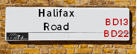
Halifax Road in Cross Roads in the village of Cullingworth
About Halifax Road
Halifax Road is a street located in the village of Cullingworth and in the village of Denholme and in the village of Hainworth and in the village of Haworth and near the village of Haworth and in the town of Keighley. The street has a length of approximately 6,165 metres.
The street is publicly maintained which means that the road is adopted and Bradford is responsible for the repair and upkeep of the highway.
Crime & Historic Map of Halifax Road
This interactive map displays both historic mapping and street crime data. Click on a circle to view crime statistics, and use the button above to toggle the 1900s historic map.
This interactive map allows you to **zoom and pan** for a better view of the data.
- Use the + and - buttons on the map to zoom in and out.
- Scroll with your **middle mouse wheel** to zoom in and out.
- On a **mobile device**, use **pinch and zoom gestures** to navigate the map.
- Click on crime markers for more details.


| Street Crime (updated 07/02/2025) | ||
|---|---|---|
| Location Note | Central Point of Street - Not Actual Location | |
| MSOA Info | For MSOAs E02002213, E02002193, E02002205 (Statistical Neighbourhood) | |
| Click Hint | Click on a Circle for a detailed breakdown below map. | |
| Crime Levels |
Green = Very Low Yellow = Low Orange = High Red = Very High |
|
| Postcodes | ||
| Icon | Postcodes for Halifax Road | |
| Walking Distances | ||
| Distance Info | Green Circle = 10 Minutes Walk (800 metres) | |
Street Crime Data accessed from data.police.uk on 07/02/2025.
The street is located within the Bradford District (B) Council's jurisdiction. They provide various services, like refuse collection, and manage council tax collection. It's situated in the Yorkshire and The Humber region of the UK.
The road has been assigned the Unique Street Reference Numbers of 7734430, 7796124, 7796429, 7796532, 7796576, 7796915, 7797241, 7721525, 7734390, 7796037, 7796319, 7700293, 7769830, 7796998, 7797167 and 7700158 in the National Street Gazetteer.
The street has the postcodes of BD22 9DH, BD22 9AA, BD21 5HW, BD21 5HL, BD21 5HH, BD21 5ET, BD21 5ES, BD21 5EP, BD21 5EH, BD21 5BB, BD13 5JG, BD13 5HD, BD13 5EG, BD13 5EF, BD13 5DE, BD13 5DD and BD21 5PP.
It is located within the county of West Yorkshire, situated in the Yorkshire and The Humber region of the UK. It's 178.22 miles North West from central London., 15.59 miles West from Leeds, 27.75 miles North East from Manchester and 35.39 miles West from York.
HALIFAX ROAD is within the Post Town of KEIGHLEY
Moving to Halifax Road?
I can help you uncover potential pitfalls and provide key questions to ask about your new property. With decades of experience as a Local Land Charges Manager, I offer confidential insights to make your move informed and stress-free.
This service is free, but you may wish to make an optional donation to support it. Please include the property name and address in your request as well as anything you wish to focus on.
Contact Me
Do you know why this road is called Halifax Road?
What's it like to live here?
Share a Photo of Halifax Road
Ask the community a question.
Do you have any questions, memories to share, have any photos or know any facts? We'd love to know more.
Submit Your Comment

Budget Friendly Hotels near Halifax Road
| Budget Hotel Name | Distance (miles) |
|---|---|
|
1: Name:Travelodge Keighley Address: Bradford Rd, Keighley, BD21 4BB Telephone: 0871 559 1824 Visit Hotel Page |
2.98 |
|
2: Name:Premier Inn Bradford North Bingley Address: 502 Bradford Road Telephone: Visit Hotel Page |
3.52 |
|
3: Name:ibis budget Bradford Address: 6 Prince Court, Canal Road Telephone: Visit Hotel Page |
7.14 |
|
4: Name:Travelodge Bradford Central Address: 2 Valley Rd, Bradford, BD1 4AF Telephone: 0871 984 6171 Visit Hotel Page |
7.30 |
|
5: Name:Travelodge Halifax Address: Dean Clough, Halifax, HX3 5AY Telephone: 0871 984 6144 Visit Hotel Page |
7.37 |
Hotel Options
Your support helps keep this site running!
If you enjoy using this website, consider making a donation to help me cover hosting costs.

EPC (Energy Performance Certificate) Information for Halifax Road
UPRN: 200004695930
EPC Current: C
EPC Potential: A
Habitable Rooms: 2
Property Type: House
Tenure: rental (private)
Built Form: Mid-Terrace
Age Band: before 1900
Mains Gas: Yes
UPRN: 200004695930
EPC Current: C
EPC Potential: A
Habitable Rooms: 2
Property Type: House
Tenure: rental (private)
Built Form: Mid-Terrace
Age Band: before 1900
Mains Gas: Yes
UPRN: 200004695930
EPC Current: C
EPC Potential: A
Habitable Rooms: 2
Property Type: House
Tenure: rental (private)
Built Form: Mid-Terrace
Age Band: before 1900
Mains Gas: Yes
UPRN: 200001588377
EPC Current: D
EPC Potential: B
Habitable Rooms: 4
Property Type: House
Tenure: Rented (private)
Built Form: Mid-Terrace
Age Band: 1900-1929
Mains Gas: Yes
UPRN: 200001588377
EPC Current: D
EPC Potential: B
Habitable Rooms: 4
Property Type: House
Tenure: Rented (private)
Built Form: Mid-Terrace
Age Band: 1900-1929
Mains Gas: Yes
UPRN: 200001588377
EPC Current: D
EPC Potential: B
Habitable Rooms: 4
Property Type: House
Tenure: Rented (private)
Built Form: Mid-Terrace
Age Band: 1900-1929
Mains Gas: Yes
UPRN: 10010574031
EPC Current: G
EPC Potential: B
Habitable Rooms: 4
Property Type: House
Tenure: Owner-occupied
Built Form: End-Terrace
Age Band: before 1900
Mains Gas: No
UPRN: 10010574031
EPC Current: G
EPC Potential: B
Habitable Rooms: 4
Property Type: House
Tenure: Owner-occupied
Built Form: End-Terrace
Age Band: before 1900
Mains Gas: No
UPRN: 10010574031
EPC Current: G
EPC Potential: B
Habitable Rooms: 4
Property Type: House
Tenure: Owner-occupied
Built Form: End-Terrace
Age Band: before 1900
Mains Gas: No
UPRN: 200001588378
EPC Current: D
EPC Potential: B
Habitable Rooms: 4
Property Type: House
Tenure: Rented (private)
Built Form: End-Terrace
Age Band: 1900-1929
Mains Gas: Yes
UPRN: 200001588378
EPC Current: D
EPC Potential: B
Habitable Rooms: 4
Property Type: House
Tenure: Rented (private)
Built Form: End-Terrace
Age Band: 1900-1929
Mains Gas: Yes
UPRN: 200001588378
EPC Current: D
EPC Potential: B
Habitable Rooms: 4
Property Type: House
Tenure: Rented (private)
Built Form: End-Terrace
Age Band: 1900-1929
Mains Gas: Yes
UPRN: 200001588379
EPC Current: D
EPC Potential: B
Habitable Rooms: 3
Property Type: House
Tenure: Rented (private)
Built Form: Semi-Detached
Age Band: before 1900
Mains Gas: Yes
UPRN: 200001588379
EPC Current: D
EPC Potential: B
Habitable Rooms: 3
Property Type: House
Tenure: Rented (private)
Built Form: Semi-Detached
Age Band: before 1900
Mains Gas: Yes
UPRN: 200001588379
EPC Current: D
EPC Potential: B
Habitable Rooms: 3
Property Type: House
Tenure: Rented (private)
Built Form: Semi-Detached
Age Band: before 1900
Mains Gas: Yes
UPRN: 100051262242
EPC Current: D
EPC Potential: C
Habitable Rooms: 5
Property Type: House
Tenure: Owner-occupied
Built Form: Detached
Age Band: 1950-1966
Mains Gas: Yes
UPRN: 100051262242
EPC Current: D
EPC Potential: C
Habitable Rooms: 5
Property Type: House
Tenure: Owner-occupied
Built Form: Detached
Age Band: 1950-1966
Mains Gas: Yes
UPRN: 100051262242
EPC Current: D
EPC Potential: C
Habitable Rooms: 5
Property Type: House
Tenure: Owner-occupied
Built Form: Detached
Age Band: 1950-1966
Mains Gas: Yes
UPRN: 100051262243
EPC Current: D
EPC Potential: B
Habitable Rooms: 6
Property Type: House
Tenure: unknown
Built Form: Semi-Detached
Age Band: 1950-1966
Mains Gas: Yes
UPRN: 100051262243
EPC Current: D
EPC Potential: B
Habitable Rooms: 6
Property Type: House
Tenure: unknown
Built Form: Semi-Detached
Age Band: 1950-1966
Mains Gas: Yes
UPRN: 100051262243
EPC Current: D
EPC Potential: B
Habitable Rooms: 6
Property Type: House
Tenure: unknown
Built Form: Semi-Detached
Age Band: 1950-1966
Mains Gas: Yes
UPRN: 100051262247
EPC Current: E
EPC Potential: B
Habitable Rooms: 5
Property Type: House
Tenure: Owner-occupied
Built Form: Semi-Detached
Age Band: 1930-1949
Mains Gas: Yes
UPRN: 100051262247
EPC Current: E
EPC Potential: B
Habitable Rooms: 5
Property Type: House
Tenure: Owner-occupied
Built Form: Semi-Detached
Age Band: 1930-1949
Mains Gas: Yes
UPRN: 100051262247
EPC Current: E
EPC Potential: B
Habitable Rooms: 5
Property Type: House
Tenure: Owner-occupied
Built Form: Semi-Detached
Age Band: 1930-1949
Mains Gas: Yes
UPRN: 100051262249
EPC Current: E
EPC Potential: B
Habitable Rooms: 5
Property Type: House
Tenure: Owner-occupied
Built Form: Semi-Detached
Age Band: 1900-1929
Mains Gas: Yes
UPRN: 100051262249
EPC Current: E
EPC Potential: B
Habitable Rooms: 5
Property Type: House
Tenure: Owner-occupied
Built Form: Semi-Detached
Age Band: 1900-1929
Mains Gas: Yes
UPRN: 100051262249
EPC Current: E
EPC Potential: B
Habitable Rooms: 5
Property Type: House
Tenure: Owner-occupied
Built Form: Semi-Detached
Age Band: 1900-1929
Mains Gas: Yes
UPRN: 100051262253
EPC Current: E
EPC Potential: C
Habitable Rooms: 5
Property Type: House
Tenure: Owner-occupied
Built Form: Semi-Detached
Age Band: 1930-1949
Mains Gas: Yes
UPRN: 100051262253
EPC Current: E
EPC Potential: C
Habitable Rooms: 5
Property Type: House
Tenure: Owner-occupied
Built Form: Semi-Detached
Age Band: 1930-1949
Mains Gas: Yes
UPRN: 100051262253
EPC Current: E
EPC Potential: C
Habitable Rooms: 5
Property Type: House
Tenure: Owner-occupied
Built Form: Semi-Detached
Age Band: 1930-1949
Mains Gas: Yes
UPRN: 100051262256
EPC Current: E
EPC Potential: B
Habitable Rooms: 4
Property Type: House
Tenure: Owner-occupied
Built Form: Semi-Detached
Age Band: 1930-1949
Mains Gas: Yes
UPRN: 100051262256
EPC Current: E
EPC Potential: B
Habitable Rooms: 4
Property Type: House
Tenure: Owner-occupied
Built Form: Semi-Detached
Age Band: 1930-1949
Mains Gas: Yes
UPRN: 100051262256
EPC Current: E
EPC Potential: B
Habitable Rooms: 4
Property Type: House
Tenure: Owner-occupied
Built Form: Semi-Detached
Age Band: 1930-1949
Mains Gas: Yes
UPRN: 100051262257
EPC Current: E
EPC Potential: B
Habitable Rooms: 5
Property Type: House
Tenure: rental (private)
Built Form: Semi-Detached
Age Band: 1930-1949
Mains Gas: Yes
UPRN: 100051262257
EPC Current: E
EPC Potential: B
Habitable Rooms: 5
Property Type: House
Tenure: rental (private)
Built Form: Semi-Detached
Age Band: 1930-1949
Mains Gas: Yes
UPRN: 100051262257
EPC Current: E
EPC Potential: B
Habitable Rooms: 5
Property Type: House
Tenure: rental (private)
Built Form: Semi-Detached
Age Band: 1930-1949
Mains Gas: Yes
UPRN: 10010574895
EPC Current: D
EPC Potential: B
Habitable Rooms: 2
Property Type: House
Tenure: rental (private)
Built Form: Semi-Detached
Age Band: before 1900
Mains Gas: Yes
UPRN: 10010574895
EPC Current: D
EPC Potential: B
Habitable Rooms: 2
Property Type: House
Tenure: rental (private)
Built Form: Semi-Detached
Age Band: before 1900
Mains Gas: Yes
UPRN: 10010574895
EPC Current: D
EPC Potential: B
Habitable Rooms: 2
Property Type: House
Tenure: rental (private)
Built Form: Semi-Detached
Age Band: before 1900
Mains Gas: Yes
House Sales
| Year | High | Low | Average | Sales |
|---|---|---|---|---|
| 2014 | £250,000 | £420,000 | £111,491 | 11 |
| 2015 | £249,950 | £357,500 | £109,121 | 12 |
| 2016 | £310,000 | £275,000 | £169,858 | 13 |
| 2017 | £56,000 | £195,000 | £98,854 | 13 |
| 2018 | £153,000 | £269,950 | £146,842 | 13 |
| 2019 | £96,000 | £180,000 | £115,700 | 10 |
| 2020 | £80,000 | £235,000 | £166,621 | 7 |
| 2021 | £282,500 | £143,000 | £117,294 | 16 |
| 2022 | £57,500 | £345,000 | £143,245 | 10 |
| 2023 | £115,000 | £215,000 | £108,997 | 17 |
| 2024 | £95,000 | £328,000 | £211,500 | 2 |
Contains HM Land Registry data © Crown copyright and database right 2025. This data is licensed under the Open Government Licence v3.0.
Nearby Estate Agents
| Name | Address | Website |
|---|---|---|
| Skipton Properties Ltd | Ebor Lane, Haworth, West Yorkshire , BD22 8HR | Visit Website |
| Open House Estate Agents | 246 Oakworth Road, Keighley, BD21 1RB | |
| Holroyds | 59 North Street, Keighley, BD21 3SL | Visit Website |
| Jigsaw Property Services | 6a Russell Street, Keighley,BD21 2JP | |
| Martin & Co | 2 North Street, Keighley, BD21 3SE | Visit Website |
We have found 17 postcodes
Neighbourhood Policing |
| Police Force: West Yorkshire |
 View Neighbourhood Crime and Policing View Neighbourhood Crime and Policing |
| Find a Local Neighbourhood Watch Scheme |
Location Details
| Halifax Road | |
|---|---|

| |
| Latitude | 53.831526 |
| Longitude | -1.919885 |
| OS Easting (X): | 405272 |
| OS Northing (Y): | 437278 |
| OS Grid Reference: | SE053373 |
Known Residential Addresses for Halifax Road
- 33
- 2
- 3
- HERMIT HOLE 132
- HERMIT HOLE 230
- THE WHINS 2
- HERMIT HOLE 238
- 436
- 253
- 325
- CROFTSIDE COURT 1
- CHAPEL HOUSE 4
- CHAPEL HOUSE 3
- MANYWELLS COURT 5
- FOUNDATION COURT, 48 FLAT 2
- FOUNDATION COURT, 48 FLAT 7
- FOUNDATION COURT, 48 FLAT 5
- FOUNDATION COURT, 48 FLAT 3
- FOUNDATION COURT, 48 FLAT 4
- FOUNDATION COURT, 48 FLAT 9
- FOUNDATION COURT, 48 FLAT 1
- GREENSIDE GARAGE
- MANYWELLS COURT 22
- WESLEY PLACE WESLEY HOUSING PROJECT
- 128 - 130
- BETA WORKS
- HERMIT HOLE 160
- HERMIT HOLE 142
- HERMIT HOLE 131
- SPRINGFIELD COTTAGES 5
- SPEEDPRINT HOUSE
- 49
- 39
- 27
- MANYWELLS COURT 7
- 64
- 103
- 90
- 81
- 408
- 406
- 353
- 347
- 335
- 327
- 37
- 4
- 32
- 26
- CROFTSIDE COURT 3
- WEAVERS COTTAGE, 22
- 12
- CROFTSIDE COURT 7
- MANYWELLS COURT 3
- MANYWELLS COURT 19
- MANYWELLS COURT 14
- MANYWELLS COURT 4
- MANYWELLS COURT 20
- MANYWELLS COURT 16
- MANYWELLS COURT 9
- MANYWELLS COURT 2
- 6
- 56
- 124
- 82
- 76
- 122
- WESLEY PLACE 72
- HERMIT HOLE 156
- HERMIT HOLE 138
- HERMIT HOLE 144
- 111
- HERMIT HOLE 137
- 107
- HERMIT HOLE 136
- HERMIT HOLE 154
- HERMIT HOLE 158
- 141
- HERMIT HOLE 231
- HERMIT HOLE 225
- 430
- 257
- 424
- 414
- 412
- 426
- 281
- 342
- 374
- 279
- 305
- 340
- 418
- 434
- 285
- 259
- 420
- SPRINGFIELD COTTAGES 4
- SPRINGFIELD COTTAGES 6
- SPRINGFIELD COTTAGES 2
Roads that have a Junction with Halifax Road
| Street | Junction Type |
|---|---|
| Oak Grove | junction |
| Wesley Place (A629) | junction |
| Elm Grove | junction |
| Ash Grove | junction |
| Birch Grove | junction |
| Hainworth Lane | junction |
| Haincliffe Road | junction |
| South Street (A629) | pseudo node |
| Manywells Brow (A629) | junction |
| Manywells Brow (B6429) | junction |
| Manywells Brow (B6429) | junction |
| Haworth Road (B6144) | junction |
| Bingley Road | junction |
| Hardgate Lane | junction |
| Bingley Road | junction |
| Haworth Road (A6033) | junction |
| Rupert Street | junction |
| Robert Street | junction |
| Sunderland Street | junction |
| Gott Street | junction |
| Vernon Street | junction |
| Worstead Road | junction |
| Myrtle Drive | junction |
| Lingfield Drive | junction |
| Hill Top Road | junction |
| Hainworth Crag Road | junction |
| Damems Lane | junction |
| Dorothy Street | junction |
| Wesley Place (A629) | pseudo node |
| Bingley Road (B6429) | junction |
| Roydwood Terrace (Back) | junction |
| Roydwood Terrace | junction |
| Church Street | junction |
| Greenside Lane | junction |
| Mill Street | junction |
| Fieldside | junction |
| New School Lane | junction |
| South Road | junction |
| Cullingworth Road (B6144) | junction |
Sunset and Sunrise times
| Sunrise | 07:15 |
|---|---|
| Sunset | 17:27 |
Latest Weather Conditions
| Observed at Weather Station: | Bingley Samos 19 February 2025 at 15:00 (2.65 miles away) |
|---|---|
| Current Weather: | Overcast |
| Temperature and Humidity: | 1.7°C (95.8%) |
| Wind Direction and Speed: | SE (6 mph) |
Population Statistics
| ONS Area Code | E00053486, E00053492, E00053489, E00053487, E00053485, E00054068, E00054064, E00054034, E00054037, E00054723 & E00054724 |
|---|---|
| ONS Area Name | White Professionals, Deprived Blue-Collar Terraces, Rural White-Collar Workers, Hard-Pressed Ethnic Mix, Deprived Neighbourhoods, Social Renting New Arrivals, Industrious Transitions & Semi-Detached Ageing |
| Average Age | 41.14, 46.40, 38.74, 41.59 & 40.83 |
| Area Population | 1796.00, 1460.00, 1865.00, 1837.00 & 1756.00 |
| Male Population | 844.00, 685.00, 916.00, 907.00 & 870.00 (48%) |
| Female Population | 952.00, 775.00, 949.00, 930.00 & 886.00 (52%) |
| Benefit Claimants | 24, 48, 18 & 26 (2%) |
| LSOA Code: | E01010590, E01010592, E01010716, E01010861 &E01010854 |
|---|---|
| LSOA Name: | Bradford 031A, Bradford 031B, Bradford 011D, Bradford 023F &Bradford 023A |
| SOA Code: | 2b, 5c, 4c, 8c &5b |
| SOA Name: | |
| MSOA Code: | E02002213, E02002193 &E02002205 |
| MSOA Name: | Bradford 031, Bradford 011 &Bradford 023 |
Nearest Supermarkets
| Morrisons Keighley |
|---|
| Worth Way, Keighley BD21 5AE |
| 01535 607554 |
| Distance: 2.33 Miles |
| Directions to Morrisons Keighley |
| Iceland Keighley |
|---|
| Gresley Road, Keighley, West Yorkshire, BD21 5JG |
| 01535691096 |
| Distance: 2.47 Miles |
| Directions to Iceland Keighley |
| Sainsburys Keighley |
|---|
| 1 Sainsburys Centre, Cavendish Street, Keighley, England, BD21 3RU |
| 01535 603117 |
| Distance: 2.65 Miles |
| Directions to Sainsburys Keighley |
| Asda Keighley |
|---|
| Bingley Street, Keighley, BD21 3ER |
| 01535 613900 |
| Distance: 2.69 Miles |
| Directions to Asda Keighley |
Telephone Information
| Area Code |
|---|
| Area Code: 01535 - Keighley |
| Area Code: 01274 - Bradford |
| Area Code: 01422 - Halifax |
Broadband Information
| Speed | Average Speed | Median Speed | Maximum Speed | Next-generation access (NGA) | Number of Connections |
|---|---|---|---|---|---|
| Greater than 2 Mbps | 19.7 | 21.7 | 23.7 | Y | 5 |
Local Government
| Local Council Details |
|---|
| Within the area of Bradford |
| Visit the Council's Website |
| City Hall, Centenary Square, Bradford &BD1 1HY |
| Telephone Number: 01274 432111 |
| Local Member of Parliament |
|---|
| Within the Westminster Parliamentary Constituency of Shipley &Keighley |
| The Member of Parliament is Anna Dixon &Robbie Moore |
| Details for the MP Anna Dixon &Robbie Moore on parliament.uk |
| Details for the MP Anna Dixon &Robbie Moore on theyworkforyou.com |
| In the 2024 General Election Anna Dixon &Robbie Moore won with a majority of 8,603 the result was Lab gain from Con &Con hold. The total electorate was 74,130 |
| Wards, Parish Councils and County Councils |
|---|
| Ward: Bingley Rural, Keighley East, Keighley West &Worth Valley Ward |
| Parish: Cullingworth & Keighley Parish Council |
| Ceremonial County: West Yorkshire |
Nearest Schools
England Primary Schools
Cullingworth Village Primary School
Address: Cullingworth Village Primary School, New School Lane, Off Halifax Road, Cullingworth, Bradford, West Yorkshire, BD13 5DA
Distance: 0.94 miles
Contact:
St Joseph's Catholic Primary School
Address: St Joseph's Catholic Primary School, Queen's Road, Ingrow, Keighley, West Yorkshire, BD21 1AR
Distance: 1.79 miles
Contact:
Lees Primary School
Address: Lees Primary School, Haworth Road, Cross Roads, Keighley, West Yorkshire, BD22 9DL
Distance: 0.67 miles
Contact:
Oxenhope CofE Primary School
Address: Oxenhope CofE Primary School, Cross Lane, Oxenhope, Keighley, West Yorkshire, BD22 9LH
Distance: 1.95 miles
Contact: 01535642271
Oxenhope CofE Primary School
Address: Oxenhope CofE Primary School, Cross Lane, Oxenhope, Keighley, West Yorkshire, BD22 9LH
Distance: 1.95 miles
Contact:
Haworth Primary School
Address: Haworth Primary School, Rawdon Road, Haworth, Keighley, West Yorkshire, BD22 8DW
Distance: 1.43 miles
Contact:
St Joseph's Catholic Primary School
Address: St Joseph's Catholic Primary School, Queen's Road, Ingrow, Keighley, West Yorkshire, BD21 1AR
Distance: 1.79 miles
Contact: 01535605880
Lees Primary School
Address: Lees Primary School, Haworth Road, Cross Roads, Keighley, West Yorkshire, BD22 9DL
Distance: 0.67 miles
Contact: 01535643320
Haworth Primary School
Address: Haworth Primary School, Rawdon Road, Haworth, Keighley, West Yorkshire, BD22 8DW
Distance: 1.43 miles
Contact: 01535642359
England Secondary Schools
Parkside School
Address: Parkside School, Parkside Terrace, Cullingworth, Bradford, West Yorkshire, BD13 5AD
Distance: 1.07 miles
Contact:
Nearest Hospitals
| Stoney Ridge Hospital |
|---|
| Address: Stoney Ridge Road, Bingley, BD16 1UL, |
| Independent Sector |
| Bradford District NHS Foundation Trust |
| Distance: 6.84 (miles) |
| Directions from to Stoney Ridge Hospital |
| Lynfield Mount Hospital |
|---|
| Address: Heights Lane, Bradford, BD9 6DP, |
| NHS Sector |
| Bradford District NHS Foundation Trust |
| Telephone: 01274 494194 |
| Visit Hospital Website |
| Distance: 7.89 (miles) |
| Directions from to Lynfield Mount Hospital |
| Airedale General Hospital |
|---|
| Address: Skipton Road, Steeton, Keighley, BD20 6TD, |
| NHS Sector |
| Airedale NHS Foundation Trust |
| Telephone: 01535 652511 |
| Visit Hospital Website |
| Distance: 7.9 (miles) |
| Directions from to Airedale General Hospital |
Nearest Dentists
Dentists
THE SMILE SPECIALIST CENTRE
Address: 9-11 STATION ROAD, HAWORTH, KEIGHLEY, BD22 8NL
Distance: 1.16 miles
Contact: :
DENTAL SURGERY
Address: 1 SPRINGWELLS, WHEATHEAD LANE, KEIGHLEY, WEST YORKSHIRE, BD22 6NL
Distance: 1.93 miles
Contact: :
KEIGHLEY HEALTH CENTRE
Address: OAKWORTH ROAD, KEIGHLEY, WEST YORKSHIRE, BD21 1SA
Distance: 2.24 miles
Contact: :
PLUM DENTAL & FACIAL CLINIC
Address: 30 DEVONSHIRE STREET, KEIGHLEY, BD21 2AU
Distance: 2.52 miles
Contact: :
OASIS DENTAL CARE LTD
Address: 32-34 DEVONSHIRE STREET, KEIGHLEY, WEST YORKSHIRE, BD21 2AU
Distance: 2.52 miles
Contact: :
OASIS DENTAL CARE
Address: 136 MAIN STREET, WILSDEN, BRADFORD, WEST YORKSHIRE, BD15 0AS
Distance: 2.53 miles
Contact: :
Nearest GP Surgeries
Doctors
BROWN GM
Address: CULLINGWORTH MEDICAL CENTRE, 12 MILL STREET, CULLINGWORTH, BRADFORD, WEST YORKSHIRE, BD13 5HA
Distance: 0.88 miles
Contact: :
HAWORTH MEDICAL PRACTICE
Address: HEATHCLIFFE MEWS, HAWORTH, KEIGHLEY, BD22 8DH
Distance: 1.43 miles
Contact: :
OAKWORTH MEDICAL PRACTICE
Address: 3 LIDGET MILL, LIDGET, OAKWORTH, KEIGHLEY, BD22 7HN
Distance: 1.50 miles
Contact: :
DENHOLME MEDICAL PRACTICE
Address: 1 BACK ANN STREET, DENHOLME, BRADFORD, BD13 4AS
Distance: 2.22 miles
Contact: :
CLARK R
Address: THE MEDICAL CENTRE, ANNE STREET, DENHOLME, BRADFORD, WEST YORKSHIRE, BD13 4AN
Distance: 2.23 miles
Contact: :
HOLYCROFT SURGERY
Address: OAKWORTH ROAD, KEIGHLEY, BD21 1SA
Distance: 2.24 miles
Contact: :
Nearest Dispensing Chemists
Pharmacies
EXEL PHARMACY
Address: 36A & B HALIFAX ROAD, CULLINGWORTH, BRADFORD, BD13 5DE
Distance: 0.93 miles
Contact: tel: 01535 275376
DAY LEWIS PHARMACY
Address: 23 MILL HEY, HAWORTH, KEIGHLEY, WEST YORKSHIRE, BD22 8NQ
Distance: 1.14 miles
Contact: tel: 01535 642248
DAY LEWIS PHARMACY
Address: 1 LIDGET MILL, OAKWORTH, KEIGHLEY, WEST YORKSHIRE, BD22 7HN
Distance: 1.50 miles
Contact: tel: 01535 643162
OLIVE PHARMACY ASHBOURNE
Address: 48 ASHBOURNE ROAD, INGROW, KEIGHLEY, BD21 1LA
Distance: 1.67 miles
Contact: tel: 01535 609608
OXENHOPE PHARMACY
Address: 36 STATION ROAD, OXENHOPE, KEIGHLEY, WEST YORKSHIRE, BD22 9JJ
Distance: 1.90 miles
Contact: tel: 01535 649308
MY PHARMACY DIRECT
Address: 33A VICTORIA ROAD, KEIGHLEY, WEST YORKSHIRE, BD21 1HD
Distance: 1.98 miles
Contact: tel: 01535 210765
Nearest Opticians
Opticians
SPECSAVERS (KEIGHLEY)
Address: 11 QUEENSWAY, AIREDALE SHOPPING CENTRE, KEIGHLEY, WEST YORKSHIRE, BD21 3PX
Distance: 2.45 miles
Contact: :
VISION EXPRESS (KEIGHLEY)
Address: 25 COLLEGE WALK, AIREDALE CENTRE, KEIGHLEY, WEST YORKSHIRE, BD21 3QA
Distance: 2.48 miles
Contact: :
BOOTS OPTICIANS (KEIGHLEY)
Address: 30 BOW STREET, KEIGHLEY, WEST YORKSHIRE, BD21 3QD
Distance: 2.51 miles
Contact: :
KNOWLE PARK OPTICIANS
Address: 42 DEVONSHIRE STREET, KEIGHLEY, WEST YORKSHIRE, BD21 2AU
Distance: 2.52 miles
Contact: :
AIREDALE OPTICIANS
Address: 50 TOWNGATE, KEIGHLEY, WEST YORKSHIRE, BD21 3QE
Distance: 2.54 miles
Contact: :
SARAH FARRAR LTD
Address: 160 MAIN STREET, WILSDEN, BRADFORD, WEST YORKSHIRE, BD15 0HX
Distance: 2.57 miles
Contact: :
Transport
Nearest Rail Stations
Keighley Station is 2.63 miles away.
Address: Keighley station, Station Bridge, Keighley, West Yorkshire, BD21 4HP
Keighley is situated on the Leeds to Morecambe line and is managed by Northern.
Keighley Station is staffed on a part time basis.
Bingley Station is 3.58 miles away.
Address: Bingley station, Wellington Street, Bingley, West Yorkshire, BD16 2NA
Bingley is situated on the Leeds to Morecambe line and is managed by Northern.
Bingley Station is staffed on a full time basis.