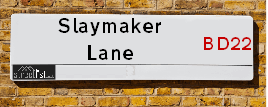
Slaymaker Lane is a street located in the village of Oakworth. It uses the postcode BD22 7EU. The street has a length of approximately 1,191 metres.
The street is located within the Bradford District (B) Council's jurisdiction. They provide various services, like refuse collection, and manage council tax collection. It's situated in the Yorkshire and The Humber region of the UK.
The road has been assigned the Unique Street Reference Number of 7769210 in the National Street Gazetteer.
It is located within the county of West Yorkshire, situated in the Yorkshire and The Humber region of the UK. It's 179.95 miles North West from central London., 17.05 miles West from Leeds, 28.35 miles North East from Manchester and 36.29 miles West from York.
Map of Slaymaker Lane
| Postcodes | ||
|---|---|---|
| Icon | Postcodes for Slaymaker Lane | |
| Walking Distances | ||
| Distance Info | Green Circle = 10 Minutes Walk (800 metres) | |
Street Crime Data accessed from data.police.uk on 06/10/2024.
Moving to Slaymaker Lane?
I can help you uncover potential pitfalls and provide key questions to ask about your new property. With decades of experience as a Local Land Charges Manager, I offer confidential insights to make your move informed and stress-free.
This service is free, but you may wish to make an optional donation to support it. Please include the property name and address in your request as well as anything you wish to focus on.
Contact Me
Do you know why this road is called Slaymaker Lane?
What's it like to live here?
Share a Photo of Slaymaker Lane
Ask the community a question.
Do you have any questions, memories to share, have any photos or know any facts? We'd love to know more.
Submit Your Comment

Budget Friendly Hotels near Slaymaker Lane
| Budget Hotel Name | Distance (miles) |
|---|---|
|
1: Name:Travelodge Keighley Address: Bradford Rd, Keighley, BD21 4BB Telephone: 0871 559 1824 Visit Hotel Page |
2.66 |
|
2: Name:Premier Inn Bradford North Bingley Address: 502 Bradford Road Telephone: Visit Hotel Page |
4.01 |
|
3: Name:ibis budget Bradford Address: 6 Prince Court, Canal Road Telephone: Visit Hotel Page |
8.74 |
|
4: Name:Travelodge Skipton Address: A65/A59 Roundabout Gargrave Rd, Skipton, BD23 1UD Telephone: 0871 984 6177 Visit Hotel Page |
8.79 |
|
5: Name:Travelodge Bradford Central Address: 2 Valley Rd, Bradford, BD1 4AF Telephone: 0871 984 6171 Visit Hotel Page |
8.94 |
Hotel Options
Your support helps keep this site running!
If you enjoy using this website, consider making a donation to help me cover hosting costs.
Nearby Estate Agents
| Name | Address | Website |
|---|---|---|
| Skipton Properties Ltd | Ebor Lane, Haworth, West Yorkshire , BD22 8HR | Visit Website |
| Open House Estate Agents | 246 Oakworth Road, Keighley, BD21 1RB | |
| Jigsaw Property Services | 6a Russell Street, Keighley,BD21 2JP | |
| Holroyds | 59 North Street, Keighley, BD21 3SL | Visit Website |
| Dacre Son & Hartley | 75 North Street, Keighley, BD21 3RZ |
We have found 1 postcode
Neighbourhood Policing |
| Police Force: West Yorkshire |
 View Neighbourhood Crime and Policing View Neighbourhood Crime and Policing |
| Find a Local Neighbourhood Watch Scheme |
Location Details
| Slaymaker Lane | |
|---|---|

| |
| Latitude | 53.850540 |
| Longitude | -1.950279 |
| OS Easting (X): | 403270 |
| OS Northing (Y): | 439391 |
| OS Grid Reference: | SE033394 |
Roads that have a Junction with Slaymaker Lane
| Street | Junction Type |
|---|---|
| Keighley Road (B6143) | junction |
| Apsley Street | junction |
| Wright Avenue | junction |
| Back Wright Avenue | junction |
| Cure Hill | junction |
Sunset and Sunrise times
| Sunrise | 07:49 |
|---|---|
| Sunset | 16:53 |
Latest Weather Conditions
| Observed at Weather Station: | Bingley Samos 2 February 2025 at 03:00 (4.42 miles away) |
|---|---|
| Current Weather: | Overcast |
| Temperature and Humidity: | 4.1°C (82.9%) |
| Wind Direction and Speed: | S (11 mph) |
Population Statistics
| ONS Area Code | E00054735 |
|---|---|
| ONS Area Name | White Suburban Communities |
| Average Age | 42.39 |
| Area Population | 1549.00 |
| Male Population | 763.00 (49%) |
| Female Population | 786.00 (51%) |
| Benefit Claimants | 8 (1%) |
| LSOA Code: | E01010860 |
|---|---|
| LSOA Name: | Bradford 014B |
| SOA Code: | 2b |
| SOA Name: | |
| MSOA Code: | E02002196 |
| MSOA Name: | Bradford 014 |
Nearest Supermarkets
| Morrisons Keighley |
|---|
| Worth Way, Keighley BD21 5AE |
| 01535 607554 |
| Distance: 2 Miles |
| Directions to Morrisons Keighley |
| Iceland Keighley |
|---|
| Gresley Road, Keighley, West Yorkshire, BD21 5JG |
| 01535691096 |
| Distance: 2.18 Miles |
| Directions to Iceland Keighley |
| Sainsburys Keighley |
|---|
| 1 Sainsburys Centre, Cavendish Street, Keighley, England, BD21 3RU |
| 01535 603117 |
| Distance: 2.25 Miles |
| Directions to Sainsburys Keighley |
| Asda Keighley |
|---|
| Bingley Street, Keighley, BD21 3ER |
| 01535 613900 |
| Distance: 2.34 Miles |
| Directions to Asda Keighley |
Telephone Information
| Area Code |
|---|
| Area Code: 01535 - Keighley |
| Area Code: 01756 - Skipton |
| Area Code: 01274 - Bradford |
Broadband Information
| Speed | Average Speed | Median Speed | Maximum Speed | Next-generation access (NGA) | Number of Connections |
|---|---|---|---|---|---|
| Less than 2 Mbps | 23.1 | 20 | >=30 | Y | 27 |
Local Government
| Local Council Details |
|---|
| Within the area of Bradford |
| Visit the Council's Website |
| City Hall, Centenary Square, Bradford &BD1 1HY |
| Telephone Number: 01274 432111 |
| Local Member of Parliament |
|---|
| Within the Westminster Parliamentary Constituency of Keighley |
| The Member of Parliament is Robbie Moore |
| Details for the MP Robbie Moore on parliament.uk |
| Details for the MP Robbie Moore on theyworkforyou.com |
| In the 2024 General Election Robbie Moore won with a majority of 1,625 the result was Con hold. The total electorate was 74,367 |
| Wards, Parish Councils and County Councils |
|---|
| Ward: Worth Valley Ward |
| Ceremonial County: West Yorkshire |
Nearest Schools
England Primary Schools
Ingrow Primary School
Address: Ingrow Primary School, Broomhill Avenue, Keighley, West Yorkshire, BD21 1BW
Distance: 1.32 miles
Contact: 01535603868
St Joseph's Catholic Primary School
Address: St Joseph's Catholic Primary School, Queen's Road, Ingrow, Keighley, West Yorkshire, BD21 1AR
Distance: 1.49 miles
Contact:
Holycroft Primary School
Address: Holycroft Primary School, Victoria Road, Keighley, West Yorkshire, BD21 1JF
Distance: 1.56 miles
Contact:
Nessfield Primary School
Address: Nessfield Primary School, Nessfield Drive, Keighley, West Yorkshire, BD22 6NP
Distance: 1.12 miles
Contact:
Laycock Primary School
Address: Laycock Primary School, Laycock Lane, Laycock, Keighley, West Yorkshire, BD22 0PP
Distance: 1.11 miles
Contact:
Oakworth Primary School
Address: Oakworth Primary School, Station Road, Oakworth, Keighley, West Yorkshire, BD22 7HX
Distance: 0.38 miles
Contact:
Haworth Primary School
Address: Haworth Primary School, Rawdon Road, Haworth, Keighley, West Yorkshire, BD22 8DW
Distance: 1.27 miles
Contact:
Worth Valley Primary School
Address: Worth Valley Primary School, Bracken Bank Crescent, Keighley, West Yorkshire, BD22 7AX
Distance: 1.05 miles
Contact: 01535604240
Worth Valley Primary School
Address: Worth Valley Primary School, Bracken Bank Crescent, Keighley, West Yorkshire, BD22 7AX
Distance: 1.05 miles
Contact:
St Joseph's Catholic Primary School
Address: St Joseph's Catholic Primary School, Queen's Road, Ingrow, Keighley, West Yorkshire, BD21 1AR
Distance: 1.49 miles
Contact: 01535605880
Holycroft Primary School
Address: Holycroft Primary School, Victoria Road, Keighley, West Yorkshire, BD21 1JF
Distance: 1.56 miles
Contact: 01535604183
Laycock Primary School
Address: Laycock Primary School, Laycock Lane, Laycock, Keighley, West Yorkshire, BD22 0PP
Distance: 1.11 miles
Contact: 01535605916
Oakworth Primary School
Address: Oakworth Primary School, Station Road, Oakworth, Keighley, West Yorkshire, BD22 7HX
Distance: 0.38 miles
Contact: 01535642309
Haworth Primary School
Address: Haworth Primary School, Rawdon Road, Haworth, Keighley, West Yorkshire, BD22 8DW
Distance: 1.27 miles
Contact: 01535642359
Oldfield Primary School
Address: Oldfield Primary School, Oldfield Lane, Oldfield, Keighley, West Yorkshire, BD22 0HZ
Distance: 2.01 miles
Contact:
England Secondary Schools
Oakbank School
Address: Oakbank School, Oakworth Road, Keighley, West Yorkshire, BD22 7DU
Distance: 1.04 miles
Contact:
Beckfoot Oakbank
Address: Beckfoot Oakbank, Oakworth Road, Keighley, West Yorkshire, BD22 7DU
Distance: 1.04 miles
Contact: 01535210111
Nearest Hospitals
| Name | Address | Postcode | Distance | Map |
|---|
Nearest Dentists
Dentists
| Name | Address | Postcode | Distance | Map |
|---|
Nearest GP Surgeries
Doctors
OAKWORTH MEDICAL PRACTICE
Address: 3 LIDGET MILL, LIDGET, OAKWORTH, KEIGHLEY, BD22 7HN
Distance: 0.33 miles
Contact: :
HAWORTH MEDICAL PRACTICE
Address: HEATHCLIFFE MEWS, HAWORTH, KEIGHLEY, BD22 8DH
Distance: 1.34 miles
Contact: :
HOLYCROFT SURGERY
Address: OAKWORTH ROAD, KEIGHLEY, BD21 1SA
Distance: 1.72 miles
Contact: :
FARFIELD GROUP PRACTICE
Address: ST. ANDREW'S SURGERIES, WEST LANE, KEIGHLEY, BD21 2LD
Distance: 1.84 miles
Contact: :
LING HOUSE MEDICAL CENTRE
Address: 49 SCOTT STREET, KEIGHLEY, WEST YORKSHIRE, BD21 2JH
Distance: 2.04 miles
Contact: tel: 01535 605747
MODALITY PARTNERSHIP (AWC)
Address: LONG LEE SURGERY, LONG LEE LANE, LONG LEE, KEIGHLEY, BD21 4TT
Distance: 2.55 miles
Contact: tel: 01535 606415
Nearest Dispensing Chemists
Pharmacies
| Name | Address | Postcode | Telephone | Map | Distance in Km |
|---|
Nearest Opticians
Opticians
KNOWLE PARK OPTICIANS
Address: 42 DEVONSHIRE STREET, KEIGHLEY, WEST YORKSHIRE, BD21 2AU
Distance: 1.97 miles
Contact: :
SPECSAVERS (KEIGHLEY)
Address: 11 QUEENSWAY, AIREDALE SHOPPING CENTRE, KEIGHLEY, WEST YORKSHIRE, BD21 3PX
Distance: 2.04 miles
Contact: :
VISION EXPRESS (KEIGHLEY)
Address: 25 COLLEGE WALK, AIREDALE CENTRE, KEIGHLEY, WEST YORKSHIRE, BD21 3QA
Distance: 2.05 miles
Contact: :
BOOTS OPTICIANS (KEIGHLEY)
Address: 30 BOW STREET, KEIGHLEY, WEST YORKSHIRE, BD21 3QD
Distance: 2.09 miles
Contact: :
AIREDALE OPTICIANS
Address: 50 TOWNGATE, KEIGHLEY, WEST YORKSHIRE, BD21 3QE
Distance: 2.11 miles
Contact: :
CLARUS OPTICIANS (KEIGHLEY)
Address: 46 CAVENDISH STREET, KEIGHLEY, WEST YORKSHIRE, BD21 3RL
Distance: 2.18 miles
Contact: :
Transport
Nearest Rail Stations
Keighley Station is 2.33 miles away.
Address: Keighley station, Station Bridge, Keighley, West Yorkshire, BD21 4HP
Keighley is situated on the Leeds to Morecambe line and is managed by Northern.
Keighley Station is staffed on a part time basis.
Steeton & Silsden Station is 3.45 miles away.
Address: Steeton & Silsden station, Station Road, Steeton, West Yorkshire, BD20 6RY
Steeton & Silsden is situated on the Leeds to Morecambe line and is managed by Northern.
Steeton & Silsden Station is an unstaffed station.