Wardle Crescent is a street located in the town of Keighley. The street has a length of approximately 324 metres.
The street is located within the Bradford District (B) Council's jurisdiction. They provide various services, like refuse collection, and manage council tax collection. It's situated in the Yorkshire and The Humber region of the UK.
The road has been assigned the Unique Street Reference Number of 7779580 in the National Street Gazetteer.
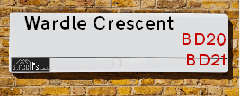
The street has the postcodes of BD21 2RS and BD21 2RR.
It is located within the county of West Yorkshire, situated in the Yorkshire and The Humber region of the UK. It's 180.77 miles North West from central London., 16.43 miles West from Leeds, 30.05 miles North East from Manchester and 35.03 miles West from York.
Map of Wardle Crescent
| Postcodes | ||
|---|---|---|
| Icon | Postcodes for Wardle Crescent | |
| Walking Distances | ||
| Distance Info | Green Circle = 10 Minutes Walk (800 metres) | |
Street Crime Data accessed from data.police.uk on 06/10/2024.
Moving to Wardle Crescent?
I can help you uncover potential pitfalls and provide key questions to ask about your new property. With decades of experience as a Local Land Charges Manager, I offer confidential insights to make your move informed and stress-free.
This service is free, but you may wish to make an optional donation to support it. Please include the property name and address in your request as well as anything you wish to focus on.
Contact Me
Do you know why this road is called Wardle Crescent?
What's it like to live here?
Share a Photo of Wardle Crescent
Ask the community a question.
Do you have any questions, memories to share, have any photos or know any facts? We'd love to know more.
Submit Your Comment

Budget Friendly Hotels near Wardle Crescent
| Budget Hotel Name | Distance (miles) |
|---|---|
|
1: Name:Travelodge Keighley Address: Bradford Rd, Keighley, BD21 4BB Telephone: 0871 559 1824 Visit Hotel Page |
1.19 |
|
2: Name:Premier Inn Bradford North Bingley Address: 502 Bradford Road Telephone: Visit Hotel Page |
2.91 |
|
3: Name:Travelodge Skipton Address: A65/A59 Roundabout Gargrave Rd, Skipton, BD23 1UD Telephone: 0871 984 6177 Visit Hotel Page |
8.09 |
|
4: Name:ibis budget Bradford Address: 6 Prince Court, Canal Road Telephone: Visit Hotel Page |
8.50 |
|
5: Name:Travelodge Bradford Central Address: 2 Valley Rd, Bradford, BD1 4AF Telephone: 0871 984 6171 Visit Hotel Page |
8.76 |
Hotel Options
Your support helps keep this site running!
If you enjoy using this website, consider making a donation to help me cover hosting costs.
Nearby Estate Agents
| Name | Address | Website |
|---|---|---|
| Jigsaw Property Services | 6a Russell Street, Keighley,BD21 2JP | |
| Open House Estate Agents | 246 Oakworth Road, Keighley, BD21 1RB | |
| Dacre Son & Hartley | 75 North Street, Keighley, BD21 3RZ | |
| Holroyds | 59 North Street, Keighley, BD21 3SL | Visit Website |
| Martin & Co | 2 North Street, Keighley, BD21 3SE | Visit Website |
Neighbourhood Policing |
| Police Force: West Yorkshire |
 View Neighbourhood Crime and Policing View Neighbourhood Crime and Policing |
| Find a Local Neighbourhood Watch Scheme |
Location Details
| Wardle Crescent | |
|---|---|

| |
| Latitude | 53.870820 |
| Longitude | -1.925716 |
| OS Easting (X): | 404883 |
| OS Northing (Y): | 441649 |
| OS Grid Reference: | SE049416 |
Roads that have a Junction with Wardle Crescent
| Street | Junction Type |
|---|---|
| Whin Knoll Avenue | junction |
| Heather Grove | junction |
Sunset and Sunrise times
| Sunrise | 07:54 |
|---|---|
| Sunset | 16:47 |
Latest Weather Conditions
| Observed at Weather Station: | Bingley Samos 30 January 2025 at 08:00 (4.82 miles away) |
|---|---|
| Current Weather: | Sunny day |
| Temperature and Humidity: | 0.4°C (84.3%) |
| Wind Direction and Speed: | W (5 mph) |
Population Statistics
| ONS Area Code | E00054125 & E00054126 |
|---|---|
| ONS Area Name | Hard-Pressed Ethnic Mix |
| Average Age | 36.34 |
| Area Population | 1571.00 |
| Male Population | 746.00 (47%) |
| Female Population | 825.00 (53%) |
| Benefit Claimants | 35 (2%) |
| LSOA Code: | E01010720 |
|---|---|
| LSOA Name: | Bradford 009B |
| SOA Code: | 4c |
| SOA Name: | |
| MSOA Code: | E02002191 |
| MSOA Name: | Bradford 009 |
Nearest Supermarkets
| Sainsburys Keighley |
|---|
| 1 Sainsburys Centre, Cavendish Street, Keighley, England, BD21 3RU |
| 01535 603117 |
| Distance: 0.87 Miles |
| Directions to Sainsburys Keighley |
| Morrisons Keighley |
|---|
| Worth Way, Keighley BD21 5AE |
| 01535 607554 |
| Distance: 0.87 Miles |
| Directions to Morrisons Keighley |
| Iceland Keighley |
|---|
| Gresley Road, Keighley, West Yorkshire, BD21 5JG |
| 01535691096 |
| Distance: 0.96 Miles |
| Directions to Iceland Keighley |
| Asda Keighley |
|---|
| Bingley Street, Keighley, BD21 3ER |
| 01535 613900 |
| Distance: 0.97 Miles |
| Directions to Asda Keighley |
Telephone Information
| Dialling Code | Telephone Exchange | Telephone Cabinet | Fibre to the Cabinet or Fibre to the Premises |
|---|---|---|---|
| 01535 | KEIGHLEY - MYKEI | P42 | FTTC |
Broadband Information
| Speed | Average Speed | Median Speed | Maximum Speed | Next-generation access (NGA) | Number of Connections |
|---|---|---|---|---|---|
| Less than 2 Mbps | 24 | 14.6 | >=30 | Y | 29 |
Local Government
| Local Council Details |
|---|
| Within the area of Bradford |
| Visit the Council's Website |
| City Hall, Centenary Square, Bradford &BD1 1HY |
| Telephone Number: 01274 432111 |
| Local Member of Parliament |
|---|
| Within the Westminster Parliamentary Constituency of Keighley |
| The Member of Parliament is Robbie Moore |
| Details for the MP Robbie Moore on parliament.uk |
| Details for the MP Robbie Moore on theyworkforyou.com |
| In the 2024 General Election Robbie Moore won with a majority of 1,625 the result was Con hold. The total electorate was 74,367 |
| Wards, Parish Councils and County Councils |
|---|
| Ward: Keighley Central Ward |
| Ceremonial County: West Yorkshire |
Nearest Schools
England Primary Schools
Riddlesden St Mary's CofE Primary School
Address: Riddlesden St Mary's CofE Primary School, Grange Road, Riddlesden, Keighley, West Yorkshire, BD20 5AB
Distance: 1.54 miles
Contact: 01535210002
Parkwood Primary School
Address: Parkwood Primary School, Parkwood Street, Keighley, West Yorkshire, BD21 4QH
Distance: 1.07 miles
Contact:
Ingrow Primary School
Address: Ingrow Primary School, Broomhill Avenue, Keighley, West Yorkshire, BD21 1BW
Distance: 1.07 miles
Contact: 01535603868
St Joseph's Catholic Primary School
Address: St Joseph's Catholic Primary School, Queen's Road, Ingrow, Keighley, West Yorkshire, BD21 1AR
Distance: 1.02 miles
Contact:
Eastwood Community School
Address: Eastwood Community School, Victoria Avenue, Keighley, West Yorkshire, BD21 3JL
Distance: 0.95 miles
Contact:
Holycroft Primary School
Address: Holycroft Primary School, Victoria Road, Keighley, West Yorkshire, BD21 1JF
Distance: 0.69 miles
Contact:
Nessfield Primary School
Address: Nessfield Primary School, Nessfield Drive, Keighley, West Yorkshire, BD22 6NP
Distance: 0.79 miles
Contact:
Victoria Primary School
Address: Victoria Primary School, Cartmel Road, Keighley, West Yorkshire, BD21 2RD
Distance: 0.32 miles
Contact:
Keighley St Andrew's CofE Primary School and Nursery
Address: Keighley St Andrew's CofE Primary School and Nursery, Lustre Street, Keighley, West Yorkshire, BD21 2ND
Distance: 0.44 miles
Contact: 01535604656
Laycock Primary School
Address: Laycock Primary School, Laycock Lane, Laycock, Keighley, West Yorkshire, BD22 0PP
Distance: 1.03 miles
Contact:
Parkwood Primary School
Address: Parkwood Primary School, Parkwood Street, Keighley, West Yorkshire, BD21 4QH
Distance: 1.07 miles
Contact: 01535603832
St Joseph's Catholic Primary School
Address: St Joseph's Catholic Primary School, Queen's Road, Ingrow, Keighley, West Yorkshire, BD21 1AR
Distance: 1.02 miles
Contact: 01535605880
St Anne's Catholic Primary School
Address: St Anne's Catholic Primary School, North Street, Keighley, West Yorkshire, BD21 3AD
Distance: 0.65 miles
Contact: 01535210600
Holycroft Primary School
Address: Holycroft Primary School, Victoria Road, Keighley, West Yorkshire, BD21 1JF
Distance: 0.69 miles
Contact: 01535604183
Victoria Primary School
Address: Victoria Primary School, Cartmel Road, Keighley, West Yorkshire, BD21 2RD
Distance: 0.32 miles
Contact: 01535210110
Merlin Top Primary Academy
Address: Merlin Top Primary Academy, Braithwaite Avenue, Keighley, West Yorkshire, BD22 6HZ
Distance: 0.28 miles
Contact: 01535210028
Our Lady of Victories Catholic School
Address: Our Lady of Victories Catholic School, Guard House Road, Keighley, West Yorkshire, BD22 6JP
Distance: 0.28 miles
Contact: 01535607149
Laycock Primary School
Address: Laycock Primary School, Laycock Lane, Laycock, Keighley, West Yorkshire, BD22 0PP
Distance: 1.03 miles
Contact: 01535605916
England Secondary Schools
Oakbank School
Address: Oakbank School, Oakworth Road, Keighley, West Yorkshire, BD22 7DU
Distance: 1.16 miles
Contact:
The Holy Family Catholic School
Address: The Holy Family Catholic School, Spring Gardens Lane, Keighley, West Yorkshire, BD20 6LH
Distance: 0.53 miles
Contact:
Carlton Keighley
Address: Carlton Keighley, Green Head Road, Utley, Keighley, West Yorkshire, BD20 6EB
Distance: 0.69 miles
Contact: 01535210333
Beckfoot Oakbank
Address: Beckfoot Oakbank, Oakworth Road, Keighley, West Yorkshire, BD22 7DU
Distance: 1.16 miles
Contact: 01535210111
Nearest Hospitals
| Name | Address | Postcode | Distance | Map |
|---|
Nearest Dentists
Dentists
| Name | Address | Postcode | Distance | Map |
|---|
Nearest GP Surgeries
Doctors
FARFIELD GROUP PRACTICE
Address: ST. ANDREW'S SURGERIES, WEST LANE, KEIGHLEY, BD21 2LD
Distance: 0.59 miles
Contact: :
LING HOUSE MEDICAL CENTRE
Address: 49 SCOTT STREET, KEIGHLEY, WEST YORKSHIRE, BD21 2JH
Distance: 0.65 miles
Contact: tel: 01535 605747
HOLYCROFT SURGERY
Address: OAKWORTH ROAD, KEIGHLEY, BD21 1SA
Distance: 0.67 miles
Contact: :
MODALITY PARTNERSHIP (AWC)
Address: LONG LEE SURGERY, LONG LEE LANE, LONG LEE, KEIGHLEY, BD21 4TT
Distance: 1.69 miles
Contact: tel: 01535 606415
DR PRESHAW AND PARTNERS
Address: 172A LONG LEE LANE, LONG LEE, KEIGHLEY, WEST YORKSHIRE, BD21 4TT
Distance: 1.69 miles
Contact: tel: 01535 609249
OAKWORTH MEDICAL PRACTICE
Address: 3 LIDGET MILL, LIDGET, OAKWORTH, KEIGHLEY, BD22 7HN
Distance: 1.91 miles
Contact: :
Nearest Dispensing Chemists
Pharmacies
| Name | Address | Postcode | Telephone | Map | Distance in Km |
|---|
Nearest Opticians
Opticians
KNOWLE PARK OPTICIANS
Address: 42 DEVONSHIRE STREET, KEIGHLEY, WEST YORKSHIRE, BD21 2AU
Distance: 0.61 miles
Contact: :
VISION EXPRESS (KEIGHLEY)
Address: 25 COLLEGE WALK, AIREDALE CENTRE, KEIGHLEY, WEST YORKSHIRE, BD21 3QA
Distance: 0.76 miles
Contact: :
AIREDALE OPTICIANS
Address: 50 TOWNGATE, KEIGHLEY, WEST YORKSHIRE, BD21 3QE
Distance: 0.78 miles
Contact: :
SPECSAVERS (KEIGHLEY)
Address: 11 QUEENSWAY, AIREDALE SHOPPING CENTRE, KEIGHLEY, WEST YORKSHIRE, BD21 3PX
Distance: 0.79 miles
Contact: :
BOOTS OPTICIANS (KEIGHLEY)
Address: 30 BOW STREET, KEIGHLEY, WEST YORKSHIRE, BD21 3QD
Distance: 0.79 miles
Contact: :
CLARUS OPTICIANS (KEIGHLEY)
Address: 46 CAVENDISH STREET, KEIGHLEY, WEST YORKSHIRE, BD21 3RL
Distance: 0.82 miles
Contact: :
Transport
Nearest Rail Stations
Keighley Station is 1.02 miles away.
Address: Keighley station, Station Bridge, Keighley, West Yorkshire, BD21 4HP
Keighley is situated on the Leeds to Morecambe line and is managed by Northern.
Keighley Station is staffed on a part time basis.
Steeton & Silsden Station is 2.17 miles away.
Address: Steeton & Silsden station, Station Road, Steeton, West Yorkshire, BD20 6RY
Steeton & Silsden is situated on the Leeds to Morecambe line and is managed by Northern.
Steeton & Silsden Station is an unstaffed station.