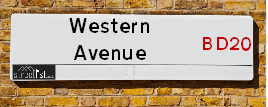
Western Avenue is a street located in the town of Keighley and near the town of Keighley. The street has a length of approximately 1,558 metres.
The street is located within the Bradford District (B) Council's jurisdiction. They provide various services, like refuse collection, and manage council tax collection. It's situated in the Yorkshire and The Humber region of the UK.
The road has been assigned the Unique Street Reference Number of 7781620 in the National Street Gazetteer.
The street has the postcodes of BD20 5QP, BD20 5DP, BD20 5DJ and BD20 5DH.
It is located within the county of West Yorkshire, situated in the Yorkshire and The Humber region of the UK. It's 181.16 miles North West from central London., 15.7 miles West from Leeds, 31.4 miles North East from Manchester and 33.78 miles West from York.
WESTERN AVENUE is within the Post Town of KEIGHLEY
Map of Western Avenue
| Street Crime (updated 14/01/2025) | ||
|---|---|---|
| Location Note | Central Point of Street - Not Actual Location | |
| MSOA Info | For MSOA E02002188 (Statistical Neighbourhood) | |
| Click Hint | Click on a Circle for a detailed breakdown below map. | |
| Crime Levels |
Green = Very Low Yellow = Low Orange = High Red = Very High |
|
| Postcodes | ||
| Icon | Postcodes for Western Avenue | |
| Walking Distances | ||
| Distance Info | Green Circle = 10 Minutes Walk (800 metres) | |
Street Crime Data accessed from data.police.uk on 06/10/2024.
Moving to Western Avenue?
I can help you uncover potential pitfalls and provide key questions to ask about your new property. With decades of experience as a Local Land Charges Manager, I offer confidential insights to make your move informed and stress-free.
This service is free, but you may wish to make an optional donation to support it. Please include the property name and address in your request as well as anything you wish to focus on.
Contact Me
Do you know why this road is called Western Avenue?
What's it like to live here?
Share a Photo of Western Avenue
Ask the community a question.
Do you have any questions, memories to share, have any photos or know any facts? We'd love to know more.
Submit Your Comment

Budget Friendly Hotels near Western Avenue
| Budget Hotel Name | Distance (miles) |
|---|---|
|
1: Name:Travelodge Keighley Address: Bradford Rd, Keighley, BD21 4BB Telephone: 0871 559 1824 Visit Hotel Page |
0.85 |
|
2: Name:Premier Inn Bradford North Bingley Address: 502 Bradford Road Telephone: Visit Hotel Page |
2.23 |
|
3: Name:Travelodge Skipton Address: A65/A59 Roundabout Gargrave Rd, Skipton, BD23 1UD Telephone: 0871 984 6177 Visit Hotel Page |
8.10 |
|
4: Name:ibis budget Bradford Address: 6 Prince Court, Canal Road Telephone: Visit Hotel Page |
8.23 |
|
5: Name:Travelodge Bradford Central Address: 2 Valley Rd, Bradford, BD1 4AF Telephone: 0871 984 6171 Visit Hotel Page |
8.53 |
Hotel Options
Your support helps keep this site running!
If you enjoy using this website, consider making a donation to help me cover hosting costs.
EPC (Energy Performance Certificate) Information for Western Avenue
UPRN: 100051276199
EPC Current: C
EPC Potential: B
Habitable Rooms: 4
Property Type: House
Tenure: Owner-occupied
Built Form: Semi-Detached
Age Band: 1950-1966
Mains Gas: Yes
UPRN: 100051276200
EPC Current: D
EPC Potential: B
Habitable Rooms: 4
Property Type: House
Tenure: Owner-occupied
Built Form: Semi-Detached
Age Band: 1930-1949
Mains Gas: Yes
UPRN: 100051276203
EPC Current: D
EPC Potential: B
Habitable Rooms: 4
Property Type: House
Tenure: Owner-occupied
Built Form: Semi-Detached
Age Band: 1950-1966
Mains Gas: Yes
UPRN: 100051276204
EPC Current: F
EPC Potential: D
Habitable Rooms: 4
Property Type: House
Tenure: Owner-occupied
Built Form: Semi-Detached
Age Band: 1950-1966
Mains Gas: Yes
UPRN: 100051276206
EPC Current: D
EPC Potential: C
Habitable Rooms: 6
Property Type: House
Tenure: Owner-occupied
Built Form: Detached
Age Band: 1930-1949
Mains Gas: Yes
UPRN: 100051276210
EPC Current: D
EPC Potential: C
Habitable Rooms: 5
Property Type: House
Tenure: Owner-occupied
Built Form: Semi-Detached
Age Band: 1930-1949
Mains Gas: Yes
UPRN: 100051276211
EPC Current: E
EPC Potential: B
Habitable Rooms: 5
Property Type: House
Tenure: Owner-occupied
Built Form: Semi-Detached
Age Band: 1967-1975
Mains Gas: Yes
UPRN: 100051276213
EPC Current: E
EPC Potential: B
Habitable Rooms: 4
Property Type: House
Tenure: unknown
Built Form: Semi-Detached
Age Band: 1950-1966
Mains Gas: Yes
UPRN: 100051276214
EPC Current: E
EPC Potential: D
Habitable Rooms: 4
Property Type: Bungalow
Tenure: Owner-occupied
Built Form: Detached
Age Band: 1930-1949
Mains Gas: Yes
UPRN: 100051276215
EPC Current: D
EPC Potential: B
Habitable Rooms: 5
Property Type: House
Tenure: Owner-occupied
Built Form: Semi-Detached
Age Band: 1950-1966
Mains Gas: Yes
UPRN: 100051276216
EPC Current: D
EPC Potential: B
Habitable Rooms: 4
Property Type: Bungalow
Tenure: Owner-occupied
Built Form: Detached
Age Band: 1930-1949
Mains Gas: Yes
UPRN: 100051276218
EPC Current: D
EPC Potential: D
Habitable Rooms: 5
Property Type: House
Tenure: Owner-occupied
Built Form: Detached
Age Band: 1930-1949
Mains Gas: Yes
UPRN: 100051276219
EPC Current: D
EPC Potential: D
Habitable Rooms: 5
Property Type: Bungalow
Tenure: Owner-occupied
Built Form: Detached
Age Band: 1930-1949
Mains Gas: Yes
UPRN: 100051276220
EPC Current: F
EPC Potential: B
Habitable Rooms: 5
Property Type: House
Tenure: Owner-occupied
Built Form: Semi-Detached
Age Band: 1930-1949
Mains Gas: Yes
UPRN: 100051276222
EPC Current: E
EPC Potential: C
Habitable Rooms: 7
Property Type: Bungalow
Tenure: Owner-occupied
Built Form: Semi-Detached
Age Band: 1950-1966
Mains Gas: Yes
UPRN: 100051276223
EPC Current: E
EPC Potential: C
Habitable Rooms: 4
Property Type: House
Tenure: Owner-occupied
Built Form: Semi-Detached
Age Band: 1950-1966
Mains Gas: Yes
UPRN: 100051276226
EPC Current: D
EPC Potential: B
Habitable Rooms: 5
Property Type: House
Tenure: Owner-occupied
Built Form: Semi-Detached
Age Band: 1950-1966
Mains Gas: Yes
UPRN: 100051276231
EPC Current: B
EPC Potential: B
Habitable Rooms: N/A
Property Type: House
Tenure: U
Built Form: Semi-Detached
Age Band: U
Mains Gas: Unknown
UPRN: 100051276233
EPC Current: F
EPC Potential: B
Habitable Rooms: 5
Property Type: House
Tenure: Owner-occupied
Built Form: Semi-Detached
Age Band: 1930-1949
Mains Gas: Yes
UPRN: 100051276234
EPC Current: D
EPC Potential: B
Habitable Rooms: 5
Property Type: House
Tenure: Owner-occupied
Built Form: End-Terrace
Age Band: 1950-1966
Mains Gas: Yes
UPRN: 100051276235
EPC Current: D
EPC Potential: B
Habitable Rooms: 5
Property Type: House
Tenure: Owner-occupied
Built Form: Semi-Detached
Age Band: 1930-1949
Mains Gas: Yes
UPRN: 100051276237
EPC Current: F
EPC Potential: D
Habitable Rooms: 5
Property Type: Bungalow
Tenure: Owner-occupied
Built Form: Semi-Detached
Age Band: 1950-1966
Mains Gas: Yes
UPRN: 100051276238
EPC Current: D
EPC Potential: B
Habitable Rooms: 4
Property Type: House
Tenure: Rented (private)
Built Form: Semi-Detached
Age Band: 1930-1949
Mains Gas: Yes
UPRN: 100051276239
EPC Current: D
EPC Potential: B
Habitable Rooms: 6
Property Type: Bungalow
Tenure: Owner-occupied
Built Form: Detached
Age Band: 1950-1966
Mains Gas: Yes
UPRN: 100051276240
EPC Current: D
EPC Potential: B
Habitable Rooms: 4
Property Type: House
Tenure: Owner-occupied
Built Form: Semi-Detached
Age Band: 1930-1949
Mains Gas: Yes
UPRN: 100051276241
EPC Current: D
EPC Potential: C
Habitable Rooms: 6
Property Type: House
Tenure: Owner-occupied
Built Form: Semi-Detached
Age Band: 1950-1966
Mains Gas: Yes
UPRN: 100051276243
EPC Current: D
EPC Potential: B
Habitable Rooms: 5
Property Type: House
Tenure: Owner-occupied
Built Form: Detached
Age Band: 1930-1949
Mains Gas: Yes
UPRN: 100051276244
EPC Current: E
EPC Potential: C
Habitable Rooms: 5
Property Type: House
Tenure: Owner-occupied
Built Form: Semi-Detached
Age Band: 1930-1949
Mains Gas: Yes
UPRN: 100051276245
EPC Current: D
EPC Potential: B
Habitable Rooms: 6
Property Type: House
Tenure: Owner-occupied
Built Form: Semi-Detached
Age Band: 1930-1949
Mains Gas: Yes
UPRN: 100051276247
EPC Current: E
EPC Potential: D
Habitable Rooms: 9
Property Type: House
Tenure: Owner-occupied
Built Form: Detached
Age Band: 1950-1966
Mains Gas: No
House Sales
| Year | High | Low | Average | Sales |
|---|---|---|---|---|
| 2014 | £135,000 | £175,000 | £141,650 | 3 |
| 2015 | £105,000 | £170,000 | £137,500 | 2 |
| 2016 | £127,000 | £160,000 | £138,375 | 4 |
| 2017 | £100,000 | £143,000 | £121,500 | 2 |
| 2018 | £185,000 | £198,500 | £155,875 | 4 |
| 2019 | £132,500 | £235,000 | £171,833 | 3 |
| 2021 | £173,000 | £279,995 | £226,498 | 2 |
| 2022 | £185,000 | £235,000 | £181,250 | 6 |
| 2023 | £230,000 | £230,000 | £230,000 | 1 |
Contains HM Land Registry data © Crown copyright and database right 2025. This data is licensed under the Open Government Licence v3.0.
Nearby Estate Agents
| Name | Address | Website |
|---|---|---|
| Quick Move Estates | 25A Bradford Road, Keighley, Riddlesden,BD21 4ET | Visit Website |
| Property Professionals | 28 Cavendish Street, Keighley, BD21 3RG | |
| Dacre Son & Hartley | 75 North Street, Keighley, BD21 3RZ | |
| Martin & Co | 2 North Street, Keighley, BD21 3SE | Visit Website |
| Your Move | 6 North Street, Keighley, BD21 3SE | Visit Website |
Neighbourhood Policing |
| Police Force: West Yorkshire |
 View Neighbourhood Crime and Policing View Neighbourhood Crime and Policing |
| Find a Local Neighbourhood Watch Scheme |
Location Details
| Western Avenue | |
|---|---|

| |
| Latitude | 53.884672 |
| Longitude | -1.898578 |
| OS Easting (X): | 406665 |
| OS Northing (Y): | 443192 |
| OS Grid Reference: | SE067432 |
Known Residential Addresses for Western Avenue
- 57
- 50
- 12
- 18
- 3
- 49
- 51
- 37
- 53
- 45
- 46
- 60
- 26
- 32
- 8
- 42
- 4
- 28
- 44
- 14
- 30
- 58
- 15
- 17
- 19
Roads that have a Junction with Western Avenue
| Street | Junction Type |
|---|---|
| Dunkirk Rise | junction |
| Banks Lane | junction |
| Elam Wood Road | junction |
Sunset and Sunrise times
| Sunrise | 08:06 |
|---|---|
| Sunset | 16:31 |
Latest Weather Conditions
| Observed at Weather Station: | Bingley Samos 22 January 2025 at 19:00 (5.27 miles away) |
|---|---|
| Current Weather: | Overcast |
| Temperature and Humidity: | 3.2°C (91.0%) |
| Wind Direction and Speed: | W (5 mph) |
Population Statistics
| ONS Area Code | E00054009, E00054013 & E00054006 |
|---|---|
| ONS Area Name | Semi-Detached Ageing, Delayed Retirement & Established Farming Communities |
| Average Age | 39.74 & 44.99 |
| Area Population | 1656.00 & 1736.00 |
| Male Population | 812.00 & 849.00 (49%) |
| Female Population | 844.00 & 887.00 (51%) |
| Benefit Claimants | 28 & 9 (1%) |
| LSOA Code: | E01010708 &E01010707 |
|---|---|
| LSOA Name: | Bradford 006C &Bradford 006B |
| SOA Code: | 8c |
| SOA Name: | |
| MSOA Code: | E02002188 |
| MSOA Name: | Bradford 006 |
Nearest Supermarkets
| Asda Keighley |
|---|
| Bingley Street, Keighley, BD21 3ER |
| 01535 613900 |
| Distance: 1.09 Miles |
| Directions to Asda Keighley |
| Sainsburys Keighley |
|---|
| 1 Sainsburys Centre, Cavendish Street, Keighley, England, BD21 3RU |
| 01535 603117 |
| Distance: 1.12 Miles |
| Directions to Sainsburys Keighley |
| Iceland Keighley |
|---|
| Gresley Road, Keighley, West Yorkshire, BD21 5JG |
| 01535691096 |
| Distance: 1.31 Miles |
| Directions to Iceland Keighley |
| Morrisons Keighley |
|---|
| Worth Way, Keighley BD21 5AE |
| 01535 607554 |
| Distance: 1.45 Miles |
| Directions to Morrisons Keighley |
Telephone Information
| Dialling Code | Telephone Exchange | Telephone Cabinet | Fibre to the Cabinet or Fibre to the Premises |
|---|---|---|---|
| 01535 | KEIGHLEY - MYKEI | P30 | FTTC |
Local Government
| Local Council Details |
|---|
| Within the area of Bradford |
| Visit the Council's Website |
| City Hall, Centenary Square, Bradford &BD1 1HY |
| Telephone Number: 01274 432111 |
| Local Member of Parliament |
|---|
| Within the Westminster Parliamentary Constituency of Keighley |
| The Member of Parliament is Robbie Moore |
| Details for the MP Robbie Moore on parliament.uk |
| Details for the MP Robbie Moore on theyworkforyou.com |
| In the 2024 General Election Robbie Moore won with a majority of 1,625 the result was Con hold. The total electorate was 74,367 |
| Wards, Parish Councils and County Councils |
|---|
| Ward: Keighley East Ward |
| Parish: Keighley Parish Council |
| Ceremonial County: West Yorkshire |
Nearest Schools
England Primary Schools
Riddlesden St Mary's CofE Primary School
Address: Riddlesden St Mary's CofE Primary School, Grange Road, Riddlesden, Keighley, West Yorkshire, BD20 5AB
Distance: 0.61 miles
Contact: 01535210002
Nearest Hospitals
| Airedale General Hospital |
|---|
| Address: Skipton Road, Steeton, Keighley, BD20 6TD, |
| NHS Sector |
| Airedale NHS Foundation Trust |
| Telephone: 01535 652511 |
| Visit Hospital Website |
| Distance: 4.45 (miles) |
| Directions from to Airedale General Hospital |
| Airedale Centre for Mental Health |
|---|
| Address: Steeton, Keighley, Bradford, |
| NHS Sector |
| Bradford District NHS Foundation Trust |
| Telephone: 1535678100 |
| Distance: 4.45 (miles) |
| Directions from to Airedale Centre for Mental Health |
| Ilkley Coronation Hospital |
|---|
| Address: Springs Lane, Ilkley, LS29 8TH, |
| Independent Sector |
| Calderdale and Huddersfield NHS Foundation Trust |
| Distance: 6.92 (miles) |
| Directions from to Ilkley Coronation Hospital |
Nearest Dentists
Dentists
SKIPTON ROAD (DENTAL SURGERY)
Address: 165-167 SKIPTON ROAD, KEIGHLEY, WEST YORKSHIRE, BD21 3BG
Distance: 1.02 miles
Contact: :
PETRIE TUCKER & PARTNERS LTD
Address: 151 SKIPTON ROAD, KEIGHLEY, WEST YORKSHIRE, BD21 3BG
Distance: 1.02 miles
Contact: :
PLUM DENTAL & FACIAL CLINIC
Address: 30 DEVONSHIRE STREET, KEIGHLEY, BD21 2AU
Distance: 1.29 miles
Contact: :
OASIS DENTAL CARE LTD
Address: 32-34 DEVONSHIRE STREET, KEIGHLEY, WEST YORKSHIRE, BD21 2AU
Distance: 1.29 miles
Contact: :
KEIGHLEY HEALTH CENTRE
Address: OAKWORTH ROAD, KEIGHLEY, WEST YORKSHIRE, BD21 1SA
Distance: 1.58 miles
Contact: :
DENTAL SURGERY
Address: 1 SPRINGWELLS, WHEATHEAD LANE, KEIGHLEY, WEST YORKSHIRE, BD22 6NL
Distance: 2.27 miles
Contact: :
Nearest GP Surgeries
Doctors
LING HOUSE MEDICAL CENTRE
Address: 49 SCOTT STREET, KEIGHLEY, WEST YORKSHIRE, BD21 2JH
Distance: 1.23 miles
Contact: tel: 01535 605747
FARFIELD GROUP PRACTICE
Address: ST. ANDREW'S SURGERIES, WEST LANE, KEIGHLEY, BD21 2LD
Distance: 1.42 miles
Contact: :
HOLYCROFT SURGERY
Address: OAKWORTH ROAD, KEIGHLEY, BD21 1SA
Distance: 1.58 miles
Contact: :
MODALITY PARTNERSHIP (AWC)
Address: LONG LEE SURGERY, LONG LEE LANE, LONG LEE, KEIGHLEY, BD21 4TT
Distance: 1.82 miles
Contact: tel: 01535 606415
DR PRESHAW AND PARTNERS
Address: 172A LONG LEE LANE, LONG LEE, KEIGHLEY, WEST YORKSHIRE, BD21 4TT
Distance: 1.82 miles
Contact: tel: 01535 609249
DR FONTANA AND PARTNERS
Address: CHAPEL ROAD, STEETON, KEIGHLEY, BD20 6NU
Distance: 2.35 miles
Contact: :
Nearest Dispensing Chemists
Pharmacies
HUSSAIN DISPENSING CHEMIST
Address: 141 NORTH STREET, KEIGHLEY, WEST YORKSHIRE, BD21 3AU
Distance: 1.05 miles
Contact: tel: 01535 602737
ASDA PHARMACY
Address: BINGLEY STREET, KEIGHLEY, WEST YORKSHIRE, BD21 3ER
Distance: 1.09 miles
Contact: tel: 01535 613910
DALTON LANE PHARMACY
Address: 2 BERRY STREET, KEIGHLEY, WEST YORKSHIRE, BD21 4HX
Distance: 1.12 miles
Contact: tel: 01535 213797
WELL
Address: 47 SCOTT STREET, KEIGHLEY, WEST YORKSHIRE, BD21 2JH
Distance: 1.23 miles
Contact: tel: 01535 609382
OLIVE LATE NIGHT PHARMACY
Address: 50 HIGHFIELD LANE, KEIGHLEY, WEST YORKSHIRE, BD21 2EH
Distance: 1.23 miles
Contact: tel: 01535 667717
BOOTS
Address: 22-28 QUEENSWAY, AIREDALE CENTRE, KEIGHLEY, WEST YORKSHIRE, BD21 3PY
Distance: 1.29 miles
Contact: tel: 01535 602600
Nearest Opticians
Opticians
CLARUS OPTICIANS (KEIGHLEY)
Address: 46 CAVENDISH STREET, KEIGHLEY, WEST YORKSHIRE, BD21 3RL
Distance: 1.18 miles
Contact: :
AIREDALE OPTICIANS
Address: 50 TOWNGATE, KEIGHLEY, WEST YORKSHIRE, BD21 3QE
Distance: 1.23 miles
Contact: :
BOOTS OPTICIANS (KEIGHLEY)
Address: 30 BOW STREET, KEIGHLEY, WEST YORKSHIRE, BD21 3QD
Distance: 1.27 miles
Contact: :
KNOWLE PARK OPTICIANS
Address: 42 DEVONSHIRE STREET, KEIGHLEY, WEST YORKSHIRE, BD21 2AU
Distance: 1.29 miles
Contact: :
VISION EXPRESS (KEIGHLEY)
Address: 25 COLLEGE WALK, AIREDALE CENTRE, KEIGHLEY, WEST YORKSHIRE, BD21 3QA
Distance: 1.30 miles
Contact: :
SPECSAVERS (KEIGHLEY)
Address: 11 QUEENSWAY, AIREDALE SHOPPING CENTRE, KEIGHLEY, WEST YORKSHIRE, BD21 3PX
Distance: 1.32 miles
Contact: :
Transport
Nearest Rail Stations
Keighley Station is 1.16 miles away.
Address: Keighley station, Station Bridge, Keighley, West Yorkshire, BD21 4HP
Keighley is situated on the Leeds to Morecambe line and is managed by Northern.
Keighley Station is staffed on a part time basis.
Steeton & Silsden Station is 2.14 miles away.
Address: Steeton & Silsden station, Station Road, Steeton, West Yorkshire, BD20 6RY
Steeton & Silsden is situated on the Leeds to Morecambe line and is managed by Northern.
Steeton & Silsden Station is an unstaffed station.