Thornton Road Bradford is a street located in the city of Bradford and in the village of Denholme and in the village of Thornton
About Thornton Road
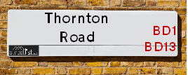
Thornton Road is a street located in the city of Bradford and in the village of Denholme and in the village of Thornton. The street has a length of approximately 9,847 metres.
Crime & Historic Map of Thornton Road
This interactive map displays both historic mapping and street crime data. Click on a circle to view crime statistics, and use the button above to toggle the 1900s historic map.
This interactive map allows you to **zoom and pan** for a better view of the data.
- Use the + and - buttons on the map to zoom in and out.
- Scroll with your **middle mouse wheel** to zoom in and out.
- On a **mobile device**, use **pinch and zoom gestures** to navigate the map.
- Click on crime markers for more details.


| Postcodes | ||
|---|---|---|
| Icon | Postcodes for Thornton Road | |
| Walking Distances | ||
| Distance Info | Green Circle = 10 Minutes Walk (800 metres) | |
Street Crime Data accessed from data.police.uk on 07/02/2025.
The street is located within the Bradford District (B) Council's jurisdiction. They provide various services, like refuse collection, and manage council tax collection. It's situated in the Yorkshire and The Humber region of the UK.
The road has been assigned the Unique Street Reference Numbers of 7775990, 7796025, 7796270, 7796466, 7796510, 7796559, 7796615, 7796711, 7796737, 7796817, 7796829, 7797005, 7797124, 7776000, 7796468, 7796571, 7796573, 7797111, 7775995, 7796012, 7709780, 7760990 and 7796009 in the National Street Gazetteer.
The street has the postcodes of BD8 9SF, BD8 9SE, BD8 9RB, BD8 9RA, BD8 9NF, BD8 9NB, BD8 9NA, BD8 9BS, BD8 9AA, BD8 8LQ, BD8 8LD, BD8 8JZ, BD8 8JU, BD8 0PB, BD8 0PA, BD8 0LE, BD8 0JN, BD8 0JG, BD8 0JE, BD8 0JD, BD8 0HJ, BD8 0HH, BD8 0EH, BD8 0EA, BD8 0BT, BD8 0BL, BD13 4HQ, BD13 4HE, BD13 4HD, BD13 3QG, BD13 3QE, BD13 3QB, BD13 3PZ, BD13 3PS, BD13 3PP, BD13 3NW, BD13 3NN, BD13 3NH, BD13 3ND, BD13 3LQ, BD13 3LP, BD13 3LN, BD13 3LA, BD13 3JX, BD13 3JN, BD13 3JD, BD13 3EE, BD13 3DG, BD13 3DE, BD13 3BE, BD13 3BD, BD13 3AS, BD13 3AJ, BD13 3AB, BD13 3AA, BD1 2NS, BD1 2LB, BD1 2JT, BD1 2JS, BD1 2JN, BD1 2JH, BD1 2JD, BD1 2EP, BD1 2EE, BD1 2DX, BD1 2DW, BD1 2DH, BD1 2DG, BD1 2BX, BD8 8LG and BD8 9BN.
It is located within the county of West Yorkshire, situated in the Yorkshire and The Humber region of the UK. It's 174.14 miles North West from central London., 11.56 miles West from Leeds, 27.69 miles North East from Manchester and 32 miles North West from Sheffield.
Moving to Thornton Road?
I can help you uncover potential pitfalls and provide key questions to ask about your new property. With decades of experience as a Local Land Charges Manager, I offer confidential insights to make your move informed and stress-free.
This service is free, but you may wish to make an optional donation to support it. Please include the property name and address in your request as well as anything you wish to focus on.
Contact Me
Do you know why this road is called Thornton Road?
What's it like to live here?
Share a Photo of Thornton Road
Ask the community a question.
Do you have any questions, memories to share, have any photos or know any facts? We'd love to know more.
Submit Your Comment

Budget Friendly Hotels near Thornton Road
| Budget Hotel Name | Distance (miles) |
|---|---|
|
1: Name:Travelodge Bradford Central Address: 2 Valley Rd, Bradford, BD1 4AF Telephone: 0871 984 6171 Visit Hotel Page |
3.05 |
|
2: Name:ibis budget Bradford Address: 6 Prince Court, Canal Road Telephone: Visit Hotel Page |
3.07 |
|
3: Name:Premier Inn Bradford Central Address: Vicar Lane Telephone: Visit Hotel Page |
3.15 |
|
4: Name:Holiday Inn Express Bradford City Centre Address: The Leisure Exchange, Vicar Lane Telephone: Visit Hotel Page |
3.17 |
|
5: Name:Travelodge Halifax Address: Dean Clough, Halifax, HX3 5AY Telephone: 0871 984 6144 Visit Hotel Page |
4.74 |
Hotel Options
Your support helps keep this site running!
If you enjoy using this website, consider making a donation to help me cover hosting costs.

Nearby Estate Agents
| Name | Address | Website |
|---|---|---|
| Whitney's | 11 Green End Clayton Bradford BD14 6BA | |
| Dinsdales Estates | 519-521 Thornton Road, Bradford, BD8 9RB | Visit Website |
| Patchett Homes | Ryefield House, 180 Highgate Road, Queensbury, Bradford, BD13 1DS | Visit Website |
| Property Ladder Nationwide | 47 Wilsden Road, Bradford,BD15 9AD | |
| Persona North | Haworth Road, Bradford, BD9 6NT |
We have found 71 postcodes
Neighbourhood Policing |
| Police Force: West Yorkshire |
 View Neighbourhood Crime and Policing View Neighbourhood Crime and Policing |
| Find a Local Neighbourhood Watch Scheme |
Location Details
| Thornton Road | |
|---|---|

| |
| Latitude | 53.793076 |
| Longitude | -1.824797 |
| OS Easting (X): | 411540 |
| OS Northing (Y): | 433011 |
| OS Grid Reference: | SE115330 |
Roads that have a Junction with Thornton Road
Sunset and Sunrise times
| Sunrise | 07:17 |
|---|---|
| Sunset | 17:24 |
Latest Weather Conditions
| Observed at Weather Station: | Bingley Samos 18 February 2025 at 02:00 (2.06 miles away) |
|---|---|
| Current Weather: | Partly cloudy (night) |
| Temperature and Humidity: | -1.6°C (79.0%) |
| Wind Direction and Speed: | SE (11 mph) |
Population Statistics
| ONS Area Code | E00176112, E00176106, E00176105, E00176115, E00054618, E00054479, E00054476, E00054466, E00054470, E00054478, E00054480, E00054477, E00054437, E00054473, E00054475, E00053498, E00054447, E00053671, E00053680, E00053679, E00053681, E00053674, E00176143, E00176102, E00054620, E00054486, E00054491, E00054495 & E00054493 |
|---|---|
| ONS Area Name | Student Communal Living, Young Families and Students, Multi-Ethnic Professional Service Workers, Asian Terraces and Flats, Industrious Transitions, Achieving Minorities, Multi-Ethnic Suburbia, Hampered Aspiration, Families in Terraces and Flats, White Professionals, Multi-Ethnic Professionals with Families, Rural White-Collar Workers, Multi-Ethnic Hardship, Private Renting Young Families & Pakistani Communities |
| Average Age | 25.52, , 31.07, 40.87, 42.29, 39.33, 38.35, 38.83, 37.00, 40.50, 27.39, 28.46, 29.07 & 30.16 |
| Area Population | 3721.00, , 1663.00, 1619.00, 1835.00, 1584.00, 1796.00, 1799.00, 1574.00, 1727.00, 2125.00, 2044.00, 1811.00 & 1809.00 |
| Male Population | 2088.00, , 850.00, 790.00, 887.00, 772.00, 892.00, 894.00, 751.00, 830.00, 1101.00, 1039.00, 908.00 & 968.00 (51%) |
| Female Population | 1633.00, , 813.00, 829.00, 948.00, 812.00, 904.00, 905.00, 823.00, 897.00, 1024.00, 1005.00, 903.00 & 841.00 (49%) |
| Benefit Claimants | 122, , 110, 33, 34, 27, 28, 23, 38, 59, 90, 129, 116 & 120 (4%) |
| LSOA Code: | E01010834, E01033691, E01010833, E01010796, E01010794, E01010798, E01010795, E01010595, E01010630, E01010628, E01010843, E01010812, E01010813 &E01010803 |
|---|---|
| LSOA Name: | Bradford 044A, Bradford 039H, Bradford 041C, Bradford 043C, Bradford 043A, Bradford 043E, Bradford 043B, Bradford 031D, Bradford 040C, Bradford 040A, Bradford 041D, Bradford 041B, Bradford 037D &Bradford 037A |
| SOA Code: | 1a, 7b, 5c, 3b, 5b &7a |
| SOA Name: | |
| MSOA Code: | E02002226, E02002221, E02002223, E02002225, E02002213, E02002222 &E02002219 |
| MSOA Name: | Bradford 044, Bradford 039, Bradford 041, Bradford 043, Bradford 031, Bradford 040 &Bradford 037 |
Nearest Supermarkets
| Tesco Leaventhorpe Esso Express |
|---|
| Thornton Rd, Thornton, Bradford, BD13 3DG |
| 0345 674 6387 |
| Distance: 0.2 Miles |
| Directions to Tesco Leaventhorpe Esso Express |
| Asda Bradford Cemetery Road |
|---|
| Cemetery Road, Lidget Green, Bradford, BD7 2QX |
| 01274 476230 |
| Distance: 1.44 Miles |
| Directions to Asda Bradford Cemetery Road |
| Morrisons Bradford - Victoria |
|---|
| Victoria Shopping Centre, Young Street, Bradford BD8 9BN |
| 01274 498218 |
| Distance: 1.54 Miles |
| Directions to Morrisons Bradford - Victoria |
| Tesco Heaton Haworth Rd Express |
|---|
| 204-206 Haworth Rd, Heaton, Bradford, BD9 6NJ |
| 0345 671 9259 |
| Distance: 1.64 Miles |
| Directions to Tesco Heaton Haworth Rd Express |
Telephone Information
| Area Code |
|---|
| Area Code: 01274 - Bradford |
| Area Code: 01422 - Halifax |
| Area Code: 01535 - Keighley |
| Area Code: 01943 - Guiseley |
Broadband Information
| Speed | Average Speed | Median Speed | Maximum Speed | Next-generation access (NGA) | Number of Connections |
|---|---|---|---|---|---|
| Greater than 2 Mbps | 17.2 | 8.4 | >=30 | Y | 12 |
Local Government
| Local Council Details |
|---|
| Within the area of Bradford |
| Visit the Council's Website |
| City Hall, Centenary Square, Bradford &BD1 1HY |
| Telephone Number: 01274 432111 |
| Local Member of Parliament |
|---|
| Within the Westminster Parliamentary Constituency of Bradford West &Shipley |
| The Member of Parliament is Naseem Shah &Anna Dixon |
| Details for the MP Naseem Shah &Anna Dixon on parliament.uk |
| Details for the MP Naseem Shah &Anna Dixon on theyworkforyou.com |
| In the 2024 General Election Naseem Shah &Anna Dixon won with a majority of 707 the result was Lab hold &Lab gain from Con. The total electorate was 77,897 |
| Wards, Parish Councils and County Councils |
|---|
| Ward: City, Thornton and Allerton, Bingley Rural, Clayton and Fairweather Green, Manningham &Toller Ward |
| Ceremonial County: West Yorkshire |
Nearest Schools
England Secondary Schools
Dixons Kings Academy
Address: Dixons Kings Academy, Northside Road, Bradford, West Yorkshire, BD7 2AN
Distance: 1.50 miles
Contact: 01274089910
Bradford Girls' Grammar School
Address: Bradford Girls' Grammar School, Squire Lane, Bradford, West Yorkshire, BD9 6RB
Distance: 1.38 miles
Contact: 01274545395
Dixons Allerton Academy
Address: Dixons Allerton Academy, Rhodesway, Bradford, West Yorkshire, BD8 0DH
Distance: 0.77 miles
Contact: 01274089890
Beckfoot Thornton
Address: Beckfoot Thornton, Leaventhorpe Lane, Thornton, Bradford, West Yorkshire, BD13 3BH
Distance: 0.17 miles
Contact: 01274881082
Thornton Grammar School
Address: Thornton Grammar School, Leaventhorpe Lane, Thornton, Bradford, West Yorkshire, BD13 3BH
Distance: 0.17 miles
Contact:
England Primary Schools
Lidget Green Primary School
Address: Lidget Green Primary School, Birks Fold, Lidget Green, Bradford, West Yorkshire, BD7 2QN
Distance: 1.23 miles
Contact:
Whetley Academy
Address: Whetley Academy, Whetley Lane, Girlington, Bradford, West Yorkshire, BD8 9HZ
Distance: 1.80 miles
Contact: 01274422041
St Philip's CofE Primary School
Address: St Philip's CofE Primary School, Whitby Terrace, Girlington, Bradford, West Yorkshire, BD8 9JL
Distance: 1.82 miles
Contact: 01274546496
Girlington Primary School
Address: Girlington Primary School, Girlington Road, Bradford, West Yorkshire, BD8 9NR
Distance: 1.66 miles
Contact: 01274493543
Lilycroft Primary School
Address: Lilycroft Primary School, Lilycroft Road, Manningham, Bradford, West Yorkshire, BD9 5AD
Distance: 2.05 miles
Contact: 01274543357
Lilycroft Primary School
Address: Lilycroft Primary School, Lilycroft Road, Manningham, Bradford, West Yorkshire, BD9 5AD
Distance: 2.05 miles
Contact:
St William's Catholic Primary School
Address: St William's Catholic Primary School, Young Street, Bradford, West Yorkshire, BD8 9RG
Distance: 1.52 miles
Contact:
Clayton St John CofE Primary School
Address: Clayton St John CofE Primary School, Bradford Road, Clayton, Bradford, West Yorkshire, BD14 6DD
Distance: 0.67 miles
Contact:
Crossley Hall Primary School
Address: Crossley Hall Primary School, Thornton Road, Bradford, West Yorkshire, BD8 0HJ
Distance: 1.07 miles
Contact:
St Matthew's Catholic Primary School
Address: St Matthew's Catholic Primary School, Saffron Drive, Allerton, Bradford, West Yorkshire, BD15 7NE
Distance: 0.49 miles
Contact:
The Academy At St. James
Address: The Academy At St. James, Chelwood Drive, Allerton, Bradford, West Yorkshire, BD15 7YD
Distance: 0.28 miles
Contact: 01274777095
St James' Church Primary School
Address: St James' Church Primary School, Chelwood Drive, Allerton, Bradford, West Yorkshire, BD15 7YD
Distance: 0.28 miles
Contact:
Ley Top Primary School
Address: Ley Top Primary School, Avenel Road, Allerton, Bradford, West Yorkshire, BD15 7PQ
Distance: 0.56 miles
Contact: 01274541554
Beckfoot Allerton Primary School and Nursery
Address: Beckfoot Allerton Primary School and Nursery, Garforth Street, Allerton, Bradford, West Yorkshire, BD15 7HB
Distance: 0.79 miles
Contact: 01274541587
Allerton Primary School
Address: Allerton Primary School, Garforth Street, Allerton, Bradford, West Yorkshire, BD15 7HB
Distance: 0.79 miles
Contact:
Thornton Primary School
Address: Thornton Primary School, Thornton Road, Thornton, Bradford, West Yorkshire, BD13 3NN
Distance: 1.26 miles
Contact: 01274833839
Thornton Primary School
Address: Thornton Primary School, Thornton Road, Thornton, Bradford, West Yorkshire, BD13 3NN
Distance: 1.26 miles
Contact:
Nearest Hospitals
| Name | Address | Postcode | Distance | Map |
|---|
Nearest Dentists
Dentists
| Name | Address | Postcode | Distance | Map |
|---|
Nearest GP Surgeries
Doctors
HOLLINS HEALTH & WELLBEING - ALLERTON
Address: ALLERTON HEALTH CENTRE, BELL DEAN ROAD, ALLERTON, BRADFORD, WEST YORKSHIRE, BD15 7WA
Distance: 0.37 miles
Contact: :
PHOENIX MEDICAL PRACTICE
Address: ALLERTON HEALTH CENTRE, BELL DEAN ROAD, ALLERTON, BRADFORD, WEST YORKSHIRE, BD15 7WA
Distance: 0.37 miles
Contact: tel: 08444 773615
DR VE WILSON
Address: LOWER GRANGE MEDICAL CENTRE, 33 BARNBY AVENUE, BRADFORD, WEST YORKSHIRE, BD8 0QN
Distance: 0.53 miles
Contact: tel: 01274 881646
THORNTON MEDICAL PRACTICE
Address: 4 CRAVEN AVENUE, THORNTON, BRADFORD, BD13 3LG
Distance: 0.94 miles
Contact: :
THORNTON & DENHOLME MEDICAL PRACTICE
Address: 4 CRAVEN AVENUE, OFF MARKET STREET, THORNTON, BRADFORD, WEST YORKSHIRE, BD13 3LG
Distance: 0.94 miles
Contact: tel: 01274 832110
HOLLYNS HEALTH & WELLBEING - CLAYTON
Address: MAYFIELD MEDICAL CENTRE, 4 GLENHOLME PARK, CLAYTON, BRADFORD, WEST YORKSHIRE, BD14 6NF
Distance: 1.05 miles
Contact: tel: 01274 880650
Nearest Dispensing Chemists
Pharmacies
| Name | Address | Postcode | Telephone | Map | Distance in Km |
|---|
Nearest Opticians
Opticians
MYVISION OPTICIANS LTD
Address: 336 ALLERTON ROAD, ALLERTON, BRADFORD, BD15 7BN
Distance: 0.88 miles
Contact: :
SPECSAVERS (GIRLINGTON, BRADFORD)
Address: UNIT 12, MORRISONS SUPERMARKET, VICTORIA SHOPPING CENTRE, THORNTON ROAD, BRADFORD, WEST YORKSHIRE, BD8 9BN
Distance: 1.53 miles
Contact: :
PREMIER VISION VICTORIA
Address: INSIDE MORRISONS SUPERMARKET, VICTORIA CENTRE, THORNTON ROAD, BRADFORD, BD8 9BN
Distance: 1.53 miles
Contact: :
K S OPTICIAN
Address: 35 BECKSIDE ROAD, LIDGET GREEN, BRADFORD, WEST YORKSHIRE, BD7 2JL
Distance: 1.54 miles
Contact: :
EYEDEAL OPTICAL (YORKSHIRE) LTD
Address: 45 DUCKWORTH LANE, BRADFORD, WEST YORKSHIRE, BD9 5ET
Distance: 1.67 miles
Contact: :
CROSSROADS OPTICIANS
Address: 54 DUCKWORTH LANE, BRADFORD, WEST YORKSHIRE, BD9 5HB
Distance: 1.68 miles
Contact: :
Transport
Nearest Rail Stations
Frizinghall Station is 2.93 miles away.
Address: Frizinghall station, Frizinghall Road, Frizinghall, West Yorkshire, BD9 4LD
Frizinghall is situated on the Wharfedale Line|Leeds to Bradford lines and is managed by Northern.
Frizinghall Station is an unstaffed station.
Bradford Forster Square Station is 2.94 miles away.
Address: Bradford Forster Square station, Forster Square, Bradford, West Yorkshire, BD1 4HY
Bradford Forster Square is situated on the Wharfedale Line|Leeds to Bradford lines and is managed by Northern.
Bradford Forster Square Station is staffed on a part time basis.