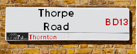
Thorpe Road is a street located in the village of Thornton. It uses the postcode BD13 3AT. The street has a length of approximately 318 metres.
The street is publicly maintained which means that the road is adopted and Bradford is responsible for the repair and upkeep of the highway.
The street is located within the Bradford District (B) Council's jurisdiction. They provide various services, like refuse collection, and manage council tax collection. It's situated in the Yorkshire and The Humber region of the UK.
The road has been assigned the Unique Street Reference Number of 7776090 in the National Street Gazetteer.
It is located within the county of West Yorkshire, situated in the Yorkshire and The Humber region of the UK. It's 174.03 miles North West from central London., 11.71 miles West from Leeds, 27.45 miles North East from Manchester and 31.89 miles North West from Sheffield.
THORPE ROAD is within the Post Town of BRADFORD
Map of Thorpe Road
| Street Crime (updated 14/01/2025) | ||
|---|---|---|
| Location Note | Central Point of Street - Not Actual Location | |
| MSOA Info | For MSOA E02002225 (Statistical Neighbourhood) | |
| Click Hint | Click on a Circle for a detailed breakdown below map. | |
| Crime Levels |
Green = Very Low Yellow = Low Orange = High Red = Very High |
|
| Postcodes | ||
| Icon | Postcodes for Thorpe Road | |
| Walking Distances | ||
| Distance Info | Green Circle = 10 Minutes Walk (800 metres) | |
Street Crime Data accessed from data.police.uk on 06/10/2024.
Moving to Thorpe Road?
I can help you uncover potential pitfalls and provide key questions to ask about your new property. With decades of experience as a Local Land Charges Manager, I offer confidential insights to make your move informed and stress-free.
This service is free, but you may wish to make an optional donation to support it. Please include the property name and address in your request as well as anything you wish to focus on.
Contact Me
Do you know why this road is called Thorpe Road?
What's it like to live here?
Share a Photo of Thorpe Road
Ask the community a question.
Do you have any questions, memories to share, have any photos or know any facts? We'd love to know more.
Submit Your Comment
Find Homes to Rent in Thornton

Budget Friendly Hotels near Thorpe Road
| Budget Hotel Name | Distance (miles) |
|---|---|
|
1: Name:Travelodge Bradford Central Address: 2 Valley Rd, Bradford, BD1 4AF Telephone: 0871 984 6171 Visit Hotel Page |
3.22 |
|
2: Name:ibis budget Bradford Address: 6 Prince Court, Canal Road Telephone: Visit Hotel Page |
3.26 |
|
3: Name:Premier Inn Bradford Central Address: Vicar Lane Telephone: Visit Hotel Page |
3.30 |
|
4: Name:Holiday Inn Express Bradford City Centre Address: The Leisure Exchange, Vicar Lane Telephone: Visit Hotel Page |
3.31 |
|
5: Name:Travelodge Halifax Address: Dean Clough, Halifax, HX3 5AY Telephone: 0871 984 6144 Visit Hotel Page |
4.50 |
Hotel Options
Your support helps keep this site running!
If you enjoy using this website, consider making a donation to help me cover hosting costs.
EPC (Energy Performance Certificate) Information for Thorpe Road
UPRN: 100051228080
EPC Current: D
EPC Potential: C
Habitable Rooms: 5
Property Type: House
Tenure: rental (private)
Built Form: Semi-Detached
Age Band: 1930-1949
Mains Gas: Yes
UPRN: 100051228082
EPC Current: D
EPC Potential: C
Habitable Rooms: 5
Property Type: House
Tenure: rental (private)
Built Form: Semi-Detached
Age Band: 1930-1949
Mains Gas: Yes
UPRN: 100051228083
EPC Current: E
EPC Potential: B
Habitable Rooms: 3
Property Type: Bungalow
Tenure: Owner-occupied
Built Form: Detached
Age Band: 1967-1975
Mains Gas: Yes
UPRN: 100051228084
EPC Current: D
EPC Potential: B
Habitable Rooms: 5
Property Type: House
Tenure: Owner-occupied
Built Form: Semi-Detached
Age Band: 1930-1949
Mains Gas: Yes
UPRN: 100051228085
EPC Current: D
EPC Potential: C
Habitable Rooms: 4
Property Type: Bungalow
Tenure: Owner-occupied
Built Form: Detached
Age Band: 1950-1966
Mains Gas: Yes
UPRN: 100051228087
EPC Current: D
EPC Potential: B
Habitable Rooms: 4
Property Type: Bungalow
Tenure: Owner-occupied
Built Form: Detached
Age Band: 1967-1975
Mains Gas: Yes
UPRN: 100051228089
EPC Current: D
EPC Potential: B
Habitable Rooms: 5
Property Type: Bungalow
Tenure: Owner-occupied
Built Form: Detached
Age Band: 1967-1975
Mains Gas: Yes
UPRN: 100051228090
EPC Current: D
EPC Potential: B
Habitable Rooms: 4
Property Type: Bungalow
Tenure: Owner-occupied
Built Form: Semi-Detached
Age Band: 1976-1982
Mains Gas: Yes
UPRN: 100051228092
EPC Current: D
EPC Potential: C
Habitable Rooms: 3
Property Type: Bungalow
Tenure: Owner-occupied
Built Form: Detached
Age Band: 1976-1982
Mains Gas: Yes
UPRN: 100051228094
EPC Current: D
EPC Potential: B
Habitable Rooms: 4
Property Type: Bungalow
Tenure: Owner-occupied
Built Form: Semi-Detached
Age Band: 1950-1966
Mains Gas: Yes
UPRN: 100051228095
EPC Current: D
EPC Potential: B
Habitable Rooms: 3
Property Type: Bungalow
Tenure: Owner-occupied
Built Form: Semi-Detached
Age Band: 1967-1975
Mains Gas: Yes
UPRN: 100051228097
EPC Current: D
EPC Potential: B
Habitable Rooms: 3
Property Type: Bungalow
Tenure: Owner-occupied
Built Form: Semi-Detached
Age Band: 1967-1975
Mains Gas: Yes
UPRN: 100051228099
EPC Current: E
EPC Potential: B
Habitable Rooms: 3
Property Type: Bungalow
Tenure: Owner-occupied
Built Form: Semi-Detached
Age Band: 1976-1982
Mains Gas: Yes
UPRN: 100051228102
EPC Current: D
EPC Potential: B
Habitable Rooms: 4
Property Type: Bungalow
Tenure: Owner-occupied
Built Form: Detached
Age Band: 1967-1975
Mains Gas: Yes
UPRN: 100051228103
EPC Current: D
EPC Potential: B
Habitable Rooms: 5
Property Type: Bungalow
Tenure: Owner-occupied
Built Form: Detached
Age Band: 1950-1966
Mains Gas: Yes
UPRN: 100051228105
EPC Current: D
EPC Potential: B
Habitable Rooms: 4
Property Type: Bungalow
Tenure: Owner-occupied
Built Form: Detached
Age Band: 1976-1982
Mains Gas: Yes
UPRN: 100051228106
EPC Current: D
EPC Potential: B
Habitable Rooms: 4
Property Type: Bungalow
Tenure: Rented (private)
Built Form: Detached
Age Band: 1967-1975
Mains Gas: Yes
UPRN: 100051228107
EPC Current: F
EPC Potential: F
Habitable Rooms: 4
Property Type: Bungalow
Tenure: Owner-occupied
Built Form: Detached
Age Band: 1950-1966
Mains Gas: No
UPRN: 100051228111
EPC Current: D
EPC Potential: B
Habitable Rooms: 6
Property Type: Bungalow
Tenure: Owner-occupied
Built Form: Detached
Age Band: 1976-1982
Mains Gas: Yes
UPRN: 100051228112
EPC Current: D
EPC Potential: B
Habitable Rooms: 2
Property Type: Bungalow
Tenure: Owner-occupied
Built Form: Semi-Detached
Age Band: 1976-1982
Mains Gas: Yes
UPRN: 100051228113
EPC Current: F
EPC Potential: C
Habitable Rooms: 5
Property Type: Bungalow
Tenure: Owner-occupied
Built Form: Detached
Age Band: 1950-1966
Mains Gas: No
UPRN: 100051228115
EPC Current: F
EPC Potential: B
Habitable Rooms: 4
Property Type: Bungalow
Tenure: Owner-occupied
Built Form: Detached
Age Band: 1967-1975
Mains Gas: Yes
UPRN: 100051228118
EPC Current: D
EPC Potential: B
Habitable Rooms: 4
Property Type: Bungalow
Tenure: Owner-occupied
Built Form: Detached
Age Band: 1950-1966
Mains Gas: Yes
UPRN: 100051228119
EPC Current: F
EPC Potential: A
Habitable Rooms: 2
Property Type: Bungalow
Tenure: Owner-occupied
Built Form: Semi-Detached
Age Band: 1976-1982
Mains Gas: Yes
UPRN: 100051228120
EPC Current: D
EPC Potential: B
Habitable Rooms: 2
Property Type: Bungalow
Tenure: Owner-occupied
Built Form: Mid-Terrace
Age Band: 1967-1975
Mains Gas: Yes
UPRN: 100051228121
EPC Current: D
EPC Potential: B
Habitable Rooms: 5
Property Type: Bungalow
Tenure: Owner-occupied
Built Form: Semi-Detached
Age Band: 1967-1975
Mains Gas: Yes
House Sales
| Year | High | Low | Average | Sales |
|---|---|---|---|---|
| 2014 | £85,000 | £250,000 | £100,200 | 5 |
| 2015 | £149,950 | £195,000 | £138,325 | 6 |
| 2016 | £93,000 | £120,000 | £117,000 | 3 |
| 2017 | £100,000 | £100,000 | £100,000 | 1 |
| 2018 | £110,000 | £110,000 | £110,000 | 1 |
| 2019 | £128,000 | £183,000 | £155,500 | 2 |
| 2020 | £129,000 | £129,000 | £129,000 | 1 |
| 2021 | £162,500 | £96,000 | £129,250 | 2 |
| 2022 | £215,000 | £215,000 | £215,000 | 1 |
| 2023 | £180,000 | £210,000 | £195,000 | 2 |
| 2024 | £226,000 | £226,000 | £226,000 | 1 |
Contains HM Land Registry data © Crown copyright and database right 2025. This data is licensed under the Open Government Licence v3.0.
Nearby Estate Agents
| Name | Address | Website |
|---|---|---|
| Whitney's | 11 Green End Clayton Bradford BD14 6BA | |
| Patchett Homes | Ryefield House, 180 Highgate Road, Queensbury, Bradford, BD13 1DS | Visit Website |
| Sugdens | 44 High Street, Queensbury, Bradford, BD13 2PA | Visit Website |
| Property Ladder Nationwide | 47 Wilsden Road, Bradford,BD15 9AD | |
| Dinsdales Estates | 519-521 Thornton Road, Bradford, BD8 9RB | Visit Website |
We have found 1 postcode
Neighbourhood Policing |
| Police Force: West Yorkshire |
 View Neighbourhood Crime and Policing View Neighbourhood Crime and Policing |
| Find a Local Neighbourhood Watch Scheme |
Location Details
| Thorpe Road | |
|---|---|

| |
| Latitude | 53.790199 |
| Longitude | -1.828288 |
| OS Easting (X): | 411311 |
| OS Northing (Y): | 432691 |
| OS Grid Reference: | SE113327 |
Known Residential Addresses for Thorpe Road
- 33
- 1
- 34
- 4
- 24
- 5
- 28
- 45
- 3
- 10
- 9
- 8
- 35
- 16
- 20
- 15
- 11A
- 6
- 39
- 18
- 51
- 49
Roads that have a Junction with Thorpe Road
| Street | Junction Type |
|---|---|
| Old Road | junction |
| Thorpe Grove | junction |
| Thorpe Avenue | junction |
Sunset and Sunrise times
| Sunrise | 07:50 |
|---|---|
| Sunset | 16:51 |
Latest Weather Conditions
| Observed at Weather Station: | Bingley Samos 1 February 2025 at 16:00 (2.08 miles away) |
|---|---|
| Current Weather: | Overcast |
| Temperature and Humidity: | 4.6°C (80.7%) |
| Wind Direction and Speed: | S (8 mph) |
Population Statistics
| ONS Area Code | E00054448 |
|---|---|
| ONS Area Name | Detached Retirement Living |
| Average Age | 42.29 |
| Area Population | 1835.00 |
| Male Population | 887.00 (48%) |
| Female Population | 948.00 (52%) |
| Benefit Claimants | 34 (2%) |
| LSOA Code: | E01010794 |
|---|---|
| LSOA Name: | Bradford 043A |
| SOA Code: | 3b |
| SOA Name: | |
| MSOA Code: | E02002225 |
| MSOA Name: | Bradford 043 |
Nearest Supermarkets
| Tesco Leaventhorpe Esso Express |
|---|
| Thornton Rd, Thornton, Bradford, BD13 3DG |
| 0345 674 6387 |
| Distance: 0.12 Miles |
| Directions to Tesco Leaventhorpe Esso Express |
| Asda Bradford Cemetery Road |
|---|
| Cemetery Road, Lidget Green, Bradford, BD7 2QX |
| 01274 476230 |
| Distance: 1.6 Miles |
| Directions to Asda Bradford Cemetery Road |
| Tesco Queensbury Superstore |
|---|
| 3 Brighouse Rd, Queensbury, BD13 1QD |
| 0345 026 9667 |
| Distance: 1.61 Miles |
| Directions to Tesco Queensbury Superstore |
| Morrisons Bradford - Victoria |
|---|
| Victoria Shopping Centre, Young Street, Bradford BD8 9BN |
| 01274 498218 |
| Distance: 1.73 Miles |
| Directions to Morrisons Bradford - Victoria |
Telephone Information
| Area Code |
|---|
| Area Code: 01274 - Bradford |
| Area Code: 01422 - Halifax |
| Area Code: 01535 - Keighley |
| Area Code: 01943 - Guiseley |
Broadband Information
| Speed | Average Speed | Median Speed | Maximum Speed | Next-generation access (NGA) | Number of Connections |
|---|---|---|---|---|---|
| Less than 2 Mbps | 18.8 | 20 | >=30 | Y | 21 |
Local Government
| Local Council Details |
|---|
| Within the area of Bradford |
| Visit the Council's Website |
| City Hall, Centenary Square, Bradford &BD1 1HY |
| Telephone Number: 01274 432111 |
| Local Member of Parliament |
|---|
| Within the Westminster Parliamentary Constituency of Bradford West |
| The Member of Parliament is Naseem Shah |
| Details for the MP Naseem Shah on parliament.uk |
| Details for the MP Naseem Shah on theyworkforyou.com |
| In the 2024 General Election Naseem Shah won with a majority of 707 the result was Lab hold. The total electorate was 77,897 |
| Wards, Parish Councils and County Councils |
|---|
| Ward: Thornton and Allerton Ward |
| Parish: Unparished area |
| Ceremonial County: West Yorkshire |
Nearest Schools
England Primary Schools
St William's Catholic Primary School
Address: St William's Catholic Primary School, Young Street, Bradford, West Yorkshire, BD8 9RG
Distance: 1.70 miles
Contact:
Clayton St John CofE Primary School
Address: Clayton St John CofE Primary School, Bradford Road, Clayton, Bradford, West Yorkshire, BD14 6DD
Distance: 0.61 miles
Contact:
Crossley Hall Primary School
Address: Crossley Hall Primary School, Thornton Road, Bradford, West Yorkshire, BD8 0HJ
Distance: 1.27 miles
Contact:
St Matthew's Catholic Primary School
Address: St Matthew's Catholic Primary School, Saffron Drive, Allerton, Bradford, West Yorkshire, BD15 7NE
Distance: 0.73 miles
Contact:
The Academy At St. James
Address: The Academy At St. James, Chelwood Drive, Allerton, Bradford, West Yorkshire, BD15 7YD
Distance: 0.47 miles
Contact: 01274777095
St James' Church Primary School
Address: St James' Church Primary School, Chelwood Drive, Allerton, Bradford, West Yorkshire, BD15 7YD
Distance: 0.47 miles
Contact:
Ley Top Primary School
Address: Ley Top Primary School, Avenel Road, Allerton, Bradford, West Yorkshire, BD15 7PQ
Distance: 0.78 miles
Contact: 01274541554
Beckfoot Allerton Primary School and Nursery
Address: Beckfoot Allerton Primary School and Nursery, Garforth Street, Allerton, Bradford, West Yorkshire, BD15 7HB
Distance: 1.01 miles
Contact: 01274541587
Allerton Primary School
Address: Allerton Primary School, Garforth Street, Allerton, Bradford, West Yorkshire, BD15 7HB
Distance: 1.01 miles
Contact:
Thornton Primary School
Address: Thornton Primary School, Thornton Road, Thornton, Bradford, West Yorkshire, BD13 3NN
Distance: 1.11 miles
Contact: 01274833839
Thornton Primary School
Address: Thornton Primary School, Thornton Road, Thornton, Bradford, West Yorkshire, BD13 3NN
Distance: 1.11 miles
Contact:
England Secondary Schools
Bradford Girls' Grammar School
Address: Bradford Girls' Grammar School, Squire Lane, Bradford, West Yorkshire, BD9 6RB
Distance: 1.61 miles
Contact: 01274545395
Dixons Allerton Academy
Address: Dixons Allerton Academy, Rhodesway, Bradford, West Yorkshire, BD8 0DH
Distance: 1.00 miles
Contact: 01274089890
Beckfoot Thornton
Address: Beckfoot Thornton, Leaventhorpe Lane, Thornton, Bradford, West Yorkshire, BD13 3BH
Distance: 0.28 miles
Contact: 01274881082
Thornton Grammar School
Address: Thornton Grammar School, Leaventhorpe Lane, Thornton, Bradford, West Yorkshire, BD13 3BH
Distance: 0.28 miles
Contact:
Nearest Hospitals
| Westwood Park Diagnostic Treatment Centre |
|---|
| Address: Swift Drive, Off Cooper Lane, Bradford, BD6 3NL, |
| NHS Sector |
| Bradford Teaching Hospitals NHS Foundation Trust |
| Telephone: 01274 425990 |
| Distance: 2.64 (miles) |
| Directions from to Westwood Park Diagnostic Treatment Centre |
| Lynfield Mount Hospital |
|---|
| Address: Heights Lane, Bradford, BD9 6DP, |
| NHS Sector |
| Bradford District NHS Foundation Trust |
| Telephone: 01274 494194 |
| Visit Hospital Website |
| Distance: 2.64 (miles) |
| Directions from to Lynfield Mount Hospital |
| Woodside Hospital Site |
|---|
| Address: 279 Beacon Road, Wibsey, Bradford, BD6 3DQ, |
| NHS Sector |
| Woodside Hospital |
| Distance: 2.78 (miles) |
| Directions from to Woodside Hospital Site |
Nearest Dentists
Dentists
DENTAL SURGERY
Address: 1 CAMBRIDGE STREET, CLAYTON, BRADFORD, WEST YORKSHIRE, BD14 6RH
Distance: 0.58 miles
Contact: :
DENTAL SURGERY
Address: 90A MARKET STREET, THORNTON, BRADFORD, WEST YORKSHIRE, BD13 3EY
Distance: 0.86 miles
Contact: :
ALLERTON DENTAL PRACTICE
Address: 254-256 ALLERTON ROAD, ALLERTON, BRADFORD, WEST YORKSHIRE, BD15 7RA
Distance: 1.00 miles
Contact: :
DENTAL SURGERY
Address: 12 BECKSIDE ROAD, BRADFORD, WEST YORKSHIRE, BD7 2LS
Distance: 1.63 miles
Contact: :
DENTAL SURGERY
Address: 78 HIGH STREET, QUEENSBURY, BRADFORD, WEST YORKSHIRE, BD13 2PA
Distance: 1.66 miles
Contact: :
GREAT HORTON DENTAL PRACTICE
Address: 784 GREAT HORTON ROAD, BRADFORD, WEST YORKSHIRE, BD7 4PY
Distance: 1.77 miles
Contact: :
Nearest GP Surgeries
Doctors
HOLLINS HEALTH & WELLBEING - ALLERTON
Address: ALLERTON HEALTH CENTRE, BELL DEAN ROAD, ALLERTON, BRADFORD, WEST YORKSHIRE, BD15 7WA
Distance: 0.57 miles
Contact: :
PHOENIX MEDICAL PRACTICE
Address: ALLERTON HEALTH CENTRE, BELL DEAN ROAD, ALLERTON, BRADFORD, WEST YORKSHIRE, BD15 7WA
Distance: 0.57 miles
Contact: tel: 08444 773615
DR VE WILSON
Address: LOWER GRANGE MEDICAL CENTRE, 33 BARNBY AVENUE, BRADFORD, WEST YORKSHIRE, BD8 0QN
Distance: 0.75 miles
Contact: tel: 01274 881646
THORNTON MEDICAL PRACTICE
Address: 4 CRAVEN AVENUE, THORNTON, BRADFORD, BD13 3LG
Distance: 0.78 miles
Contact: :
THORNTON & DENHOLME MEDICAL PRACTICE
Address: 4 CRAVEN AVENUE, OFF MARKET STREET, THORNTON, BRADFORD, WEST YORKSHIRE, BD13 3LG
Distance: 0.78 miles
Contact: tel: 01274 832110
HOLLYNS HEALTH & WELLBEING - CLAYTON
Address: MAYFIELD MEDICAL CENTRE, 4 GLENHOLME PARK, CLAYTON, BRADFORD, WEST YORKSHIRE, BD14 6NF
Distance: 0.95 miles
Contact: tel: 01274 880650
Nearest Dispensing Chemists
Pharmacies
ALLERTON PHARMACY
Address: BELL DEAN ROAD, ALLERTON, BRADFORD, BD15 7WA
Distance: 0.57 miles
Contact: tel: 01274 880589
STATION ROAD PHARMACY
Address: 26 STATION ROAD, CLAYTON, BRADFORD, BD14 6AN
Distance: 0.65 miles
Contact: tel: 01274 880132
RAJ'S CHEMIST
Address: 7 THE SQUARE, BRADFORD, WEST YORKSHIRE, BD8 0QB
Distance: 0.72 miles
Contact: tel: 01274 884751
BOOTS
Address: THORNTON MEDICAL CENTRE, 2 CRAVEN AVENUE, THORNTON, BRADFORD, WEST YORKSHIRE, BD13 3LF
Distance: 0.78 miles
Contact: tel: 01274 832216
COHENS CHEMIST
Address: 4 GLENHOLME PARK, CLAYTON, BRADFORD, WEST YORKSHIRE, BD14 6NF
Distance: 0.95 miles
Contact: tel: 01274 889802
PRECINCT PHARMACY
Address: ALLERTON SHOPPING CENTRE, 350 ALLERTON ROAD, ALLERTON, BRADFORD, BD15 7BN
Distance: 1.10 miles
Contact: tel: 01274 491247
Nearest Opticians
Opticians
MYVISION OPTICIANS LTD
Address: 336 ALLERTON ROAD, ALLERTON, BRADFORD, BD15 7BN
Distance: 1.10 miles
Contact: :
K S OPTICIAN
Address: 35 BECKSIDE ROAD, LIDGET GREEN, BRADFORD, WEST YORKSHIRE, BD7 2JL
Distance: 1.64 miles
Contact: :
VICTORIA GORE OPTOMETRIST
Address: 72-74 HIGH STREET, QUEENSBURY, BRADFORD, WEST YORKSHIRE, BD13 2PA
Distance: 1.66 miles
Contact: :
SPECSAVERS (GIRLINGTON, BRADFORD)
Address: UNIT 12, MORRISONS SUPERMARKET, VICTORIA SHOPPING CENTRE, THORNTON ROAD, BRADFORD, WEST YORKSHIRE, BD8 9BN
Distance: 1.72 miles
Contact: :
PREMIER VISION VICTORIA
Address: INSIDE MORRISONS SUPERMARKET, VICTORIA CENTRE, THORNTON ROAD, BRADFORD, BD8 9BN
Distance: 1.72 miles
Contact: :
EYE CLINIC OPTICIANS - GREAT HORTON RD
Address: 738 GREAT HORTON ROAD, BRADFORD, WEST YORKSHIRE, BD7 4EE
Distance: 1.78 miles
Contact: :
Transport
Nearest Rail Stations
Bradford Forster Square Station is 3.11 miles away.
Address: Bradford Forster Square station, Forster Square, Bradford, West Yorkshire, BD1 4HY
Bradford Forster Square is situated on the Wharfedale Line|Leeds to Bradford lines and is managed by Northern.
Bradford Forster Square Station is staffed on a part time basis.
Frizinghall Station is 3.17 miles away.
Address: Frizinghall station, Frizinghall Road, Frizinghall, West Yorkshire, BD9 4LD
Frizinghall is situated on the Wharfedale Line|Leeds to Bradford lines and is managed by Northern.
Frizinghall Station is an unstaffed station.