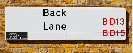
Back Lane is a street located in the city of Bradford and near the city of Bradford. The street has a length of approximately 737 metres.
The street is publicly maintained which means that the road is adopted and Bradford is responsible for the repair and upkeep of the highway.
The street is located within the Bradford District (B) Council's jurisdiction. They provide various services, like refuse collection, and manage council tax collection. It's situated in the Yorkshire and The Humber region of the UK.
The road has been assigned the Unique Street Reference Numbers of 7705560, 7796895 and 7796933 in the National Street Gazetteer.
The street has the postcodes of BD13 1HL, BD13 1HH, BD13 1HB, BD13 1EZ and BD13 1EY.
It is located within the county of West Yorkshire, situated in the Yorkshire and The Humber region of the UK. It's 172.85 miles North West from central London., 11.57 miles West from Leeds, 26.72 miles North East from Manchester and 30.73 miles North West from Sheffield.
BACK LANE is within the Post Town of BRADFORD
Map of Back Lane
| Street Crime (updated 14/01/2025) | ||
|---|---|---|
| Location Note | Central Point of Street - Not Actual Location | |
| MSOA Info | For MSOAs E02002231, E02002240 (Statistical Neighbourhood) | |
| Click Hint | Click on a Circle for a detailed breakdown below map. | |
| Crime Levels |
Green = Very Low Yellow = Low Orange = High Red = Very High |
|
| Postcodes | ||
| Icon | Postcodes for Back Lane | |
| Walking Distances | ||
| Distance Info | Green Circle = 10 Minutes Walk (800 metres) | |
Street Crime Data accessed from data.police.uk on 06/10/2024.
Moving to Back Lane?
I can help you uncover potential pitfalls and provide key questions to ask about your new property. With decades of experience as a Local Land Charges Manager, I offer confidential insights to make your move informed and stress-free.
This service is free, but you may wish to make an optional donation to support it. Please include the property name and address in your request as well as anything you wish to focus on.
Contact Me
Do you know why this road is called Back Lane?
What's it like to live here?
Share a Photo of Back Lane
Ask the community a question.
Do you have any questions, memories to share, have any photos or know any facts? We'd love to know more.
Submit Your Comment
Find Homes to Rent in Bradford

Budget Friendly Hotels near Back Lane
| Budget Hotel Name | Distance (miles) |
|---|---|
|
1: Name:Holiday Inn Express Bradford City Centre Address: The Leisure Exchange, Vicar Lane Telephone: Visit Hotel Page |
3.28 |
|
2: Name:Premier Inn Bradford Central Address: Vicar Lane Telephone: Visit Hotel Page |
3.32 |
|
3: Name:Travelodge Bradford Central Address: 2 Valley Rd, Bradford, BD1 4AF Telephone: 0871 984 6171 Visit Hotel Page |
3.36 |
|
4: Name:ibis budget Bradford Address: 6 Prince Court, Canal Road Telephone: Visit Hotel Page |
3.53 |
|
5: Name:Travelodge Halifax Address: Dean Clough, Halifax, HX3 5AY Telephone: 0871 984 6144 Visit Hotel Page |
3.57 |
Hotel Options
Your support helps keep this site running!
If you enjoy using this website, consider making a donation to help me cover hosting costs.
EPC (Energy Performance Certificate) Information for Back Lane
UPRN: 200004693232
EPC Current: E
EPC Potential: B
Habitable Rooms: 2
Property Type: House
Tenure: Owner-occupied
Built Form: Mid-Terrace
Age Band: before 1900
Mains Gas: Yes
UPRN: 200004693251
EPC Current: D
EPC Potential: D
Habitable Rooms: 2
Property Type: House
Tenure: rental (private)
Built Form: Mid-Terrace
Age Band: before 1900
Mains Gas: Yes
UPRN: 200004693262
EPC Current: D
EPC Potential: B
Habitable Rooms: 3
Property Type: House
Tenure: Owner-occupied
Built Form: Semi-Detached
Age Band: before 1900
Mains Gas: Yes
UPRN: 200004693284
EPC Current: D
EPC Potential: B
Habitable Rooms: 2
Property Type: House
Tenure: Owner-occupied
Built Form: Mid-Terrace
Age Band: before 1900
Mains Gas: Yes
UPRN: 200004693290
EPC Current: D
EPC Potential: B
Habitable Rooms: 3
Property Type: House
Tenure: Rented (private)
Built Form: End-Terrace
Age Band: before 1900
Mains Gas: Yes
UPRN: 200004693224
EPC Current: D
EPC Potential: B
Habitable Rooms: 4
Property Type: House
Tenure: Owner-occupied
Built Form: Mid-Terrace
Age Band: before 1900
Mains Gas: Yes
UPRN: 200004693225
EPC Current: F
EPC Potential: B
Habitable Rooms: 2
Property Type: House
Tenure: Owner-occupied
Built Form: End-Terrace
Age Band: before 1900
Mains Gas: Yes
UPRN: 200004693226
EPC Current: D
EPC Potential: B
Habitable Rooms: 4
Property Type: House
Tenure: Owner-occupied
Built Form: Mid-Terrace
Age Band: before 1900
Mains Gas: Yes
UPRN: 200004693228
EPC Current: F
EPC Potential: D
Habitable Rooms: 4
Property Type: House
Tenure: Owner-occupied
Built Form: Mid-Terrace
Age Band: before 1900
Mains Gas: Yes
UPRN: 200004693230
EPC Current: D
EPC Potential: B
Habitable Rooms: 4
Property Type: House
Tenure: Owner-occupied
Built Form: Mid-Terrace
Age Band: before 1900
Mains Gas: Yes
UPRN: 200004693231
EPC Current: D
EPC Potential: B
Habitable Rooms: 4
Property Type: Bungalow
Tenure: Owner-occupied
Built Form: Semi-Detached
Age Band: 1950-1966
Mains Gas: Yes
UPRN: 200004693234
EPC Current: D
EPC Potential: B
Habitable Rooms: 3
Property Type: Bungalow
Tenure: Owner-occupied
Built Form: Semi-Detached
Age Band: 1930-1949
Mains Gas: Yes
UPRN: 200004693235
EPC Current: E
EPC Potential: C
Habitable Rooms: 3
Property Type: House
Tenure: Owner-occupied
Built Form: Mid-Terrace
Age Band: before 1900
Mains Gas: Yes
UPRN: 200004693236
EPC Current: D
EPC Potential: D
Habitable Rooms: 4
Property Type: Bungalow
Tenure: Owner-occupied
Built Form: Semi-Detached
Age Band: 1950-1966
Mains Gas: Yes
UPRN: 200004693237
EPC Current: D
EPC Potential: D
Habitable Rooms: 3
Property Type: House
Tenure: Owner-occupied
Built Form: Mid-Terrace
Age Band: before 1900
Mains Gas: Yes
UPRN: 200004693239
EPC Current: C
EPC Potential: A
Habitable Rooms: 3
Property Type: House
Tenure: Rented (social)
Built Form: Mid-Terrace
Age Band: 1900-1929
Mains Gas: Yes
UPRN: 200004693240
EPC Current: D
EPC Potential: B
Habitable Rooms: 4
Property Type: Bungalow
Tenure: Owner-occupied
Built Form: Semi-Detached
Age Band: 1950-1966
Mains Gas: Yes
UPRN: 200004693241
EPC Current: E
EPC Potential: B
Habitable Rooms: 3
Property Type: House
Tenure: Owner-occupied
Built Form: Mid-Terrace
Age Band: before 1900
Mains Gas: Yes
UPRN: 200004693243
EPC Current: D
EPC Potential: D
Habitable Rooms: 3
Property Type: House
Tenure: rental (private)
Built Form: End-Terrace
Age Band: 1900-1929
Mains Gas: Yes
UPRN: 200004693244
EPC Current: D
EPC Potential: B
Habitable Rooms: 3
Property Type: House
Tenure: Rented (private)
Built Form: End-Terrace
Age Band: 1900-1929
Mains Gas: Yes
UPRN: 200004693245
EPC Current: D
EPC Potential: C
Habitable Rooms: 3
Property Type: House
Tenure: rental (private)
Built Form: Mid-Terrace
Age Band: before 1900
Mains Gas: Yes
UPRN: 200004693249
EPC Current: D
EPC Potential: C
Habitable Rooms: 4
Property Type: House
Tenure: Owner-occupied
Built Form: Semi-Detached
Age Band: 1950-1966
Mains Gas: Yes
UPRN: 200004693253
EPC Current: E
EPC Potential: C
Habitable Rooms: 3
Property Type: House
Tenure: Owner-occupied
Built Form: Semi-Detached
Age Band: before 1900
Mains Gas: Yes
UPRN: 200004693255
EPC Current: E
EPC Potential: B
Habitable Rooms: 3
Property Type: House
Tenure: rental (private)
Built Form: Semi-Detached
Age Band: 1900-1929
Mains Gas: Yes
UPRN: 200004693256
EPC Current: D
EPC Potential: B
Habitable Rooms: 5
Property Type: House
Tenure: Owner-occupied
Built Form: Semi-Detached
Age Band: 1976-1982
Mains Gas: Yes
UPRN: 200004693259
EPC Current: D
EPC Potential: B
Habitable Rooms: 3
Property Type: Bungalow
Tenure: Owner-occupied
Built Form: Semi-Detached
Age Band: 1950-1966
Mains Gas: Yes
UPRN: 200004693261
EPC Current: D
EPC Potential: B
Habitable Rooms: 3
Property Type: Bungalow
Tenure: Owner-occupied
Built Form: Semi-Detached
Age Band: 1950-1966
Mains Gas: Yes
UPRN: 200004693263
EPC Current: D
EPC Potential: B
Habitable Rooms: 5
Property Type: House
Tenure: Owner-occupied
Built Form: Semi-Detached
Age Band: 1950-1966
Mains Gas: Yes
UPRN: 200004693264
EPC Current: C
EPC Potential: B
Habitable Rooms: 3
Property Type: Bungalow
Tenure: Owner-occupied
Built Form: Semi-Detached
Age Band: 1950-1966
Mains Gas: Yes
UPRN: 200004693268
EPC Current: C
EPC Potential: C
Habitable Rooms: 3
Property Type: Bungalow
Tenure: Owner-occupied
Built Form: Semi-Detached
Age Band: 1950-1966
Mains Gas: Yes
UPRN: 200004693270
EPC Current: D
EPC Potential: B
Habitable Rooms: 3
Property Type: House
Tenure: Rented (private)
Built Form: End-Terrace
Age Band: before 1900
Mains Gas: Yes
UPRN: 200004693271
EPC Current: D
EPC Potential: B
Habitable Rooms: 4
Property Type: House
Tenure: Owner-occupied
Built Form: Semi-Detached
Age Band: 1950-1966
Mains Gas: Yes
UPRN: 200004693272
EPC Current: D
EPC Potential: B
Habitable Rooms: 3
Property Type: House
Tenure: Owner-occupied
Built Form: Mid-Terrace
Age Band: before 1900
Mains Gas: Yes
UPRN: 200004693274
EPC Current: C
EPC Potential: B
Habitable Rooms: 5
Property Type: House
Tenure: Owner-occupied
Built Form: Semi-Detached
Age Band: 1950-1966
Mains Gas: Yes
UPRN: 200004693275
EPC Current: E
EPC Potential: D
Habitable Rooms: 8
Property Type: House
Tenure: Owner-occupied
Built Form: Semi-Detached
Age Band: before 1900
Mains Gas: Yes
UPRN: 200004693276
EPC Current: D
EPC Potential: B
Habitable Rooms: 5
Property Type: House
Tenure: Owner-occupied
Built Form: Semi-Detached
Age Band: 1950-1966
Mains Gas: Yes
UPRN: 200004693277
EPC Current: E
EPC Potential: C
Habitable Rooms: 4
Property Type: Bungalow
Tenure: Owner-occupied
Built Form: Semi-Detached
Age Band: 1950-1966
Mains Gas: Yes
UPRN: 200004693279
EPC Current: D
EPC Potential: B
Habitable Rooms: 6
Property Type: Bungalow
Tenure: Rented (private)
Built Form: Semi-Detached
Age Band: 1950-1966
Mains Gas: Yes
UPRN: 200004693282
EPC Current: D
EPC Potential: C
Habitable Rooms: 5
Property Type: House
Tenure: Owner-occupied
Built Form: Detached
Age Band: 1967-1975
Mains Gas: Yes
UPRN: 200004693285
EPC Current: D
EPC Potential: B
Habitable Rooms: 3
Property Type: Bungalow
Tenure: Owner-occupied
Built Form: Semi-Detached
Age Band: 1967-1975
Mains Gas: Yes
UPRN: 200004693288
EPC Current: D
EPC Potential: A
Habitable Rooms: 3
Property Type: Bungalow
Tenure: Owner-occupied
Built Form: Semi-Detached
Age Band: 1930-1949
Mains Gas: Yes
UPRN: 200004693292
EPC Current: D
EPC Potential: B
Habitable Rooms: 2
Property Type: House
Tenure: Owner-occupied
Built Form: Semi-Detached
Age Band: 1900-1929
Mains Gas: Yes
UPRN: 200004693294
EPC Current: D
EPC Potential: B
Habitable Rooms: 4
Property Type: House
Tenure: Owner-occupied
Built Form: Semi-Detached
Age Band: 1950-1966
Mains Gas: Yes
UPRN: 200004693223
EPC Current: E
EPC Potential: D
Habitable Rooms: 6
Property Type: Bungalow
Tenure: Owner-occupied
Built Form: Detached
Age Band: 1930-1949
Mains Gas: Yes
House Sales
| Year | High | Low | Average | Sales |
|---|---|---|---|---|
| 2014 | £43,000 | £235,000 | £106,000 | 4 |
| 2016 | £137,000 | £167,000 | £144,000 | 3 |
| 2017 | £60,000 | £60,000 | £60,000 | 1 |
| 2018 | £83,000 | £169,950 | £114,200 | 4 |
| 2019 | £107,000 | £97,000 | £132,333 | 3 |
| 2020 | £55,500 | £129,950 | £107,658 | 6 |
| 2021 | £165,000 | £137,000 | £149,667 | 3 |
| 2022 | £125,000 | £230,000 | £178,000 | 4 |
| 2023 | £146,000 | £175,000 | £148,250 | 6 |
Contains HM Land Registry data © Crown copyright and database right 2025. This data is licensed under the Open Government Licence v3.0.
Nearby Estate Agents
| Name | Address | Website |
|---|---|---|
| Patchett Homes | Ryefield House, 180 Highgate Road, Queensbury, Bradford, BD13 1DS | Visit Website |
| Whitney's | 11 Green End Clayton Bradford BD14 6BA | |
| Sugdens | 44 High Street, Queensbury, Bradford, BD13 2PA | Visit Website |
| Bronte Estate Agents | 11 High Street, Queensbury, BD13 2PE | Visit Website |
| Robert Watts | 1-3 Carr House Road, Shelf, Bradford, HX3 7QY | Visit Website |
Neighbourhood Policing |
| Police Force: West Yorkshire |
 View Neighbourhood Crime and Policing View Neighbourhood Crime and Policing |
| Find a Local Neighbourhood Watch Scheme |
Location Details
| Back Lane | |
|---|---|

| |
| Latitude | 53.773232 |
| Longitude | -1.821679 |
| OS Easting (X): | 411751 |
| OS Northing (Y): | 430804 |
| OS Grid Reference: | SE118308 |
Known Residential Addresses for Back Lane
- 68
- 117
- 38
- 58
- 19
- 61
- 63
- 49
- 15
- 27
- 51
- 43
- 57
- 71
- 77
- 47
- 60
- 14
- 12
- 22
- 18
- 16
- 24
- 41
- 7
Roads that have a Junction with Back Lane
| Street | Junction Type |
|---|---|
| Sheep Hill Lane | junction |
| Round Hill Close | junction |
| Lytham Drive | junction |
| Coombe Hill | junction |
| Mcmahon Drive | junction |
| Julian Drive | junction |
| Highgate Road (A647) | junction |
Sunset and Sunrise times
| Sunrise | 07:45 |
|---|---|
| Sunset | 16:57 |
Latest Weather Conditions
| Observed at Weather Station: | Bingley Samos 4 February 2025 at 03:00 (3.15 miles away) |
|---|---|
| Current Weather: | Overcast |
| Temperature and Humidity: | 7.1°C (85.1%) |
| Wind Direction and Speed: | S (7 mph) |
Population Statistics
| ONS Area Code | E00054247, E00054235 & E00054249 |
|---|---|
| ONS Area Name | Multi-Ethnic Professionals with Families, White Suburban Communities & White Professionals |
| Average Age | & 39.30 |
| Male Population | & 859.00 (50%) |
| Female Population | & 874.00 (50%) |
| Benefit Claimants | & 53 (3%) |
| LSOA Code: | E01033696 &E01010752 |
|---|---|
| LSOA Name: | Bradford 049I &Bradford 058A |
| SOA Code: | 3b &3a |
| SOA Name: | |
| MSOA Code: | E02002231 &E02002240 |
| MSOA Name: | Bradford 049 &Bradford 058 |
Nearest Supermarkets
| Tesco Queensbury Superstore |
|---|
| 3 Brighouse Rd, Queensbury, BD13 1QD |
| 0345 026 9667 |
| Distance: 0.87 Miles |
| Directions to Tesco Queensbury Superstore |
| Tesco Leaventhorpe Esso Express |
|---|
| Thornton Rd, Thornton, Bradford, BD13 3DG |
| 0345 674 6387 |
| Distance: 1.32 Miles |
| Directions to Tesco Leaventhorpe Esso Express |
| Tesco Bradford Extra |
|---|
| Great Horton Rd, Bradford, BD7 4EY |
| 0345 026 9541 |
| Distance: 1.46 Miles |
| Directions to Tesco Bradford Extra |
| Tesco Bradford Buttershaw Superstore |
|---|
| Halifax Rd, Bradford, BD6 2DW |
| 0345 677 9077 |
| Distance: 1.48 Miles |
| Directions to Tesco Bradford Buttershaw Superstore |
Telephone Information
| Area Code |
|---|
| Area Code: 01274 - Bradford |
| Area Code: 01422 - Halifax |
| Area Code: 01535 - Keighley |
| Area Code: 01943 - Guiseley |
Local Government
| Local Council Details |
|---|
| Within the area of Bradford |
| Visit the Council's Website |
| City Hall, Centenary Square, Bradford &BD1 1HY |
| Telephone Number: 01274 432111 |
| Local Member of Parliament |
|---|
| Within the Westminster Parliamentary Constituency of Bradford South |
| The Member of Parliament is Judith Cummins |
| Details for the MP Judith Cummins on parliament.uk |
| Details for the MP Judith Cummins on theyworkforyou.com |
| In the 2024 General Election Judith Cummins won with a majority of 4,392 the result was Lab hold. The total electorate was 70,999 |
| Wards, Parish Councils and County Councils |
|---|
| Ward: Queensbury Ward |
| Parish: Unparished area |
| Ceremonial County: West Yorkshire |
Nearest Schools
England Primary Schools
Wibsey Primary School
Address: Wibsey Primary School, North Road, Wibsey, Bradford, West Yorkshire, BD6 1RL
Distance: 1.88 miles
Contact: 01274678016
Southmere Primary Academy
Address: Southmere Primary Academy, Ewart Street, Bradford, West Yorkshire, BD7 3NR
Distance: 1.60 miles
Contact:
St Oswald's Church of England Primary Academy
Address: St Oswald's Church of England Primary Academy, Cross Lane, Great Horton, Bradford, West Yorkshire, BD7 3JT
Distance: 1.73 miles
Contact: 01274573396
Brackenhill Primary School
Address: Brackenhill Primary School, Dracup Road, Great Horton, Bradford, West Yorkshire, BD7 4HA
Distance: 1.37 miles
Contact: 01274578286
Farfield Primary and Nursery School
Address: Farfield Primary and Nursery School, Reevy Crescent, Bradford, West Yorkshire, BD6 2BS
Distance: 1.27 miles
Contact: 01274678545
Clayton Village Primary School
Address: Clayton Village Primary School, John Street, Clayton, Bradford, West Yorkshire, BD14 6AD
Distance: 0.64 miles
Contact:
Reevy Hill Primary School
Address: Reevy Hill Primary School, Bedale Drive, Buttershaw, Bradford, West Yorkshire, BD6 3ST
Distance: 1.09 miles
Contact: 01274677549
Reevy Hill Primary School
Address: Reevy Hill Primary School, Bedale Drive, Buttershaw, Bradford, West Yorkshire, BD6 3ST
Distance: 1.09 miles
Contact:
St Anthony's Catholic Primary School
Address: St Anthony's Catholic Primary School, Bradford Road, Clayton, Bradford, West Yorkshire, BD14 6HW
Distance: 1.00 miles
Contact:
Hollingwood Primary School
Address: Hollingwood Primary School, Hollingwood Lane, Bradford, West Yorkshire, BD7 4BE
Distance: 0.87 miles
Contact: 01274575353
Hollingwood Primary School
Address: Hollingwood Primary School, Hollingwood Lane, Bradford, West Yorkshire, BD7 4BE
Distance: 0.87 miles
Contact:
St John the Evangelist Catholic Primary School
Address: St John the Evangelist Catholic Primary School, Beacon Road, Bradford, West Yorkshire, BD6 3DQ
Distance: 0.87 miles
Contact: 01274679030
St John the Evangelist Catholic Primary School
Address: St John the Evangelist Catholic Primary School, Beacon Road, Bradford, West Yorkshire, BD6 3DQ
Distance: 0.87 miles
Contact:
Home Farm Primary School
Address: Home Farm Primary School, Home Farm Close, Bradford, West Yorkshire, BD6 3NR
Distance: 0.66 miles
Contact: 01274777020
Clayton St John CofE Primary School
Address: Clayton St John CofE Primary School, Bradford Road, Clayton, Bradford, West Yorkshire, BD14 6DD
Distance: 0.82 miles
Contact:
Stocks Lane Primary School
Address: Stocks Lane Primary School, Stocks Lane, Clayton Heights, Queensbury, Bradford, West Yorkshire, BD13 2RH
Distance: 0.20 miles
Contact: 01274880569
Russell Hall Primary School
Address: Russell Hall Primary School, West End, Queensbury, Bradford, West Yorkshire, BD13 2AW
Distance: 1.23 miles
Contact: 01274882116
Foxhill Primary School
Address: Foxhill Primary School, Brighouse and Denholme Road, Queensbury, Bradford, West Yorkshire, BD13 1LN
Distance: 1.37 miles
Contact: 01274882426
England Secondary Schools
Buttershaw Business & Enterprise College Academy
Address: Buttershaw Business & Enterprise College Academy, Reevy Road West, Buttershaw, Bradford, West Yorkshire, BD6 3PX
Distance: 1.26 miles
Contact: 01274676285
Buttershaw Business and Enterprise College
Address: Buttershaw Business and Enterprise College, Reevy Road West, Buttershaw, Bradford, West Yorkshire, BD6 3PX
Distance: 1.26 miles
Contact:
Queensbury Academy
Address: Queensbury Academy, Deanstones Lane, Queensbury, Bradford, West Yorkshire, BD13 2AS
Distance: 1.25 miles
Contact:
Queensbury School
Address: Queensbury School, Deanstones Lane, Queensbury, Bradford, West Yorkshire, BD13 2AS
Distance: 1.25 miles
Contact:
Nearest Hospitals
| Westwood Park Diagnostic Treatment Centre |
|---|
| Address: Swift Drive, Off Cooper Lane, Bradford, BD6 3NL, |
| NHS Sector |
| Bradford Teaching Hospitals NHS Foundation Trust |
| Telephone: 01274 425990 |
| Distance: 0.88 (miles) |
| Directions from to Westwood Park Diagnostic Treatment Centre |
| Woodside Hospital Site |
|---|
| Address: 279 Beacon Road, Wibsey, Bradford, BD6 3DQ, |
| NHS Sector |
| Woodside Hospital |
| Distance: 1.35 (miles) |
| Directions from to Woodside Hospital Site |
| Bradford Royal Infirmary |
|---|
| Address: Duckworth Lane, Bradford, BD9 6RJ, |
| NHS Sector |
| Bradford Teaching Hospitals NHS Foundation Trust |
| Telephone: 01274 542200 |
| Visit Hospital Website |
| Distance: 4.05 (miles) |
| Directions from to Bradford Royal Infirmary |
Nearest Dentists
Dentists
DENTAL SURGERY
Address: 1 CAMBRIDGE STREET, CLAYTON, BRADFORD, WEST YORKSHIRE, BD14 6RH
Distance: 0.64 miles
Contact: :
DENTAL SURGERY
Address: 78 HIGH STREET, QUEENSBURY, BRADFORD, WEST YORKSHIRE, BD13 2PA
Distance: 1.02 miles
Contact: :
DENTAL SURGERY
Address: CARR WOOD HOUSE, CARR HOUSE ROAD, HALIFAX, WEST YORKSHIRE, HX3 7RJ
Distance: 1.28 miles
Contact: :
GREAT HORTON DENTAL PRACTICE
Address: 784 GREAT HORTON ROAD, BRADFORD, WEST YORKSHIRE, BD7 4PY
Distance: 1.32 miles
Contact: :
DENTAL SURGERY
Address: 11A WEST END, QUEENSBURY, BRADFORD, WEST YORKSHIRE, BD13 2BD
Distance: 1.35 miles
Contact: :
DENTAL SURGERY
Address: 261 SOUTHFIELD LANE, BRADFORD, WEST YORKSHIRE, BD7 3NN
Distance: 1.63 miles
Contact: :
Nearest GP Surgeries
Doctors
HOLLYNS HEALTH & WELLBEING - CLAYTON
Address: MAYFIELD MEDICAL CENTRE, 4 GLENHOLME PARK, CLAYTON, BRADFORD, WEST YORKSHIRE, BD14 6NF
Distance: 0.50 miles
Contact: tel: 01274 880650
HORTON BANK PRACTICE
Address: 1220 GREAT HORTON ROAD, BRADFORD, WEST YORKSHIRE, BD7 4PL
Distance: 0.65 miles
Contact: tel: 01274 410666
HORTON BANK SITE
Address: 1220 GREAT HORTON ROAD, BRADFORD, BD7 4PL
Distance: 0.65 miles
Contact: :
ROYDS HEALTH LIVING CENTRE
Address: 20 RIDINGS WAY, OFF THE CRESCENT, BUTTERSHAW, BRADFORD, WEST YORKSHIRE, BD6 3UD
Distance: 1.09 miles
Contact: :
THE WILLOWS MEDICAL PRACTICE
Address: 8 OSBOURNE DRIVE, QUEENSBURY, BRADFORD, BD13 2GD
Distance: 1.18 miles
Contact: tel: 01274 888350
SHELF HEALTH CENTRE (CARITAS GROUP)
Address: SHELF MOOR ROAD, HALIFAX, WEST YORKSHIRE, HX3 7PQ
Distance: 1.24 miles
Contact: :
Nearest Dispensing Chemists
Pharmacies
COHENS CHEMIST
Address: 4 GLENHOLME PARK, CLAYTON, BRADFORD, WEST YORKSHIRE, BD14 6NF
Distance: 0.50 miles
Contact: tel: 01274 889802
BOOTS
Address: HORTON BANK PRACTICE, 1220A GREAT HORTON ROAD, BRADFORD, WEST YORKSHIRE, BD7 4PL
Distance: 0.65 miles
Contact: tel: 01274 571822
STATION ROAD PHARMACY
Address: 26 STATION ROAD, CLAYTON, BRADFORD, BD14 6AN
Distance: 0.65 miles
Contact: tel: 01274 880132
TESCO INSTORE PHARMACY
Address: 3 BRIGHOUSE ROAD, QUEENSBURY, BRADFORD, WEST YORKSHIRE, BD13 1QA
Distance: 0.96 miles
Contact: tel: 01274 901449
COHENS PHARMACIES
Address: 66-68 HIGH STREET, QUEENSBURY, BRADFORD, BD13 2PA
Distance: 1.02 miles
Contact: :
SWIFT BUTTERSHAW PHARMACY
Address: 40 REEVY ROAD WEST, BUTTERSHAW, BRADFORD, WEST YORKSHIRE, BD6 3LX
Distance: 1.16 miles
Contact: tel: 01274 678100
Nearest Opticians
Opticians
VICTORIA GORE OPTOMETRIST
Address: 72-74 HIGH STREET, QUEENSBURY, BRADFORD, WEST YORKSHIRE, BD13 2PA
Distance: 1.02 miles
Contact: :
EYE CLINIC OPTICIANS - GREAT HORTON RD
Address: 738 GREAT HORTON ROAD, BRADFORD, WEST YORKSHIRE, BD7 4EE
Distance: 1.37 miles
Contact: :
OPTIVU EYECARE - GREAT HORTON ROAD
Address: 469 GREAT HORTON ROAD, BRADFORD, BD7 3DL
Distance: 1.59 miles
Contact: :
K S OPTICIAN
Address: 35 BECKSIDE ROAD, LIDGET GREEN, BRADFORD, WEST YORKSHIRE, BD7 2JL
Distance: 1.66 miles
Contact: :
ROY FOSTER OPTICIANS
Address: 22 FAIR ROAD, BRADFORD, WEST YORKSHIRE, BD6 1QN
Distance: 1.91 miles
Contact: :
SPECSAVERS (GIRLINGTON, BRADFORD)
Address: UNIT 12, MORRISONS SUPERMARKET, VICTORIA SHOPPING CENTRE, THORNTON ROAD, BRADFORD, WEST YORKSHIRE, BD8 9BN
Distance: 2.18 miles
Contact: :
Transport
Nearest Rail Stations
Bradford Interchange Station is 3.19 miles away.
Address: Bradford Interchange station, Bridge Street, Bradford, West Yorkshire, BD1 1TU
Bradford Interchange is situated on the Calder Valley line and is managed by Northern.
Bradford Interchange Station is staffed on a full time basis.
Low Moor Station is 3.24 miles away.
Address: Low Moor station, New Works Road, Low Moor, West Yorkshire, BD12 7BD
Low Moor is situated on the Calder Valley line and is managed by Northern.
Low Moor Station is an unstaffed station.