Whalley Road is a street located in the village of Billington and in the town of Blackburn and in the village of Langho and near the village of Langho. The street has a length of approximately 7,999 metres.
The street is publicly maintained which means that the road is adopted and Lancashire is responsible for the repair and upkeep of the highway.
The street is located within the Ribble Valley District (B) and Blackburn with Darwen (B) Council's jurisdiction. They provide various services, like refuse collection, and manage council tax collection. It's situated in the North West region of the UK.
The road has been assigned the Unique Street Reference Numbers of 31800432, 31800002, 31801111, 31802225, 31800516, 2903794 and 2914072 in the National Street Gazetteer.
The street has the postcodes of BB7 9PD, BB7 9NZ, BB7 9NW, BB7 9NT, BB7 9NF, BB7 9NA, BB7 9LS, BB7 9LG, BB7 9HY, BB6 8ES, BB6 8EQ, BB6 8EJ, BB6 8EF, BB6 8DD, BB6 8BY, BB6 8AB, BB6 8AA, BB1 9PJ, BB1 9NE, BB1 9ND, BB1 9NB, BB1 9LQ, BB1 9LN, BB1 9LL, BB1 9LJ, BB1 9LH, BB1 9LF and BB1 9JT.
It is located within the county of Lancashire, situated in the North West region of the UK. It's 185.51 miles North West from central London., 22.47 miles North from Manchester, 23.73 miles South East from Lancaster and 35.26 miles North East from Liverpool.
WHALLEY ROAD is within the Post Town of BLACKBURN
Map of Whalley Road
| Street Crime (updated 14/01/2025) | ||
|---|---|---|
| Location Note | Central Point of Street - Not Actual Location | |
| MSOA Info | For MSOAs E02005277, E02005276 (Statistical Neighbourhood) | |
| Click Hint | Click on a Circle for a detailed breakdown below map. | |
| Crime Levels |
Green = Very Low Yellow = Low Orange = High Red = Very High |
|
| Postcodes | ||
| Icon | Postcodes for Whalley Road | |
| Walking Distances | ||
| Distance Info | Green Circle = 10 Minutes Walk (800 metres) | |
Street Crime Data accessed from data.police.uk on 06/10/2024.
Moving to Whalley Road?
I can help you uncover potential pitfalls and provide key questions to ask about your new property. With decades of experience as a Local Land Charges Manager, I offer confidential insights to make your move informed and stress-free.
This service is free, but you may wish to make an optional donation to support it. Please include the property name and address in your request as well as anything you wish to focus on.
Contact Me
Do you know why this road is called Whalley Road?
What's it like to live here?
Share a Photo of Whalley Road
Ask the community a question.
Do you have any questions, memories to share, have any photos or know any facts? We'd love to know more.
Submit Your Comment
Find Homes to Rent in Accrington

Budget Friendly Hotels near Whalley Road
| Budget Hotel Name | Distance (miles) |
|---|---|
|
1: Name:Premier Inn Blackburn South M65 J4 Address: Off Eccleshill Road Telephone: Visit Hotel Page |
5.33 |
|
2: Name:Travelodge Blackburn M65 Address: Darwen Motorway Service Area, Commercial Rd, M65 Motorway, Blackburn with Darwen, Darwen, BB3 0AT Telephone: 0871 984 6122 Visit Hotel Page |
5.74 |
|
3: Name:Travelodge Burnley Address: Barracks Rd, Burnley, BB11 4SB Telephone: 0871 984 6125 Visit Hotel Page |
6.38 |
|
4: Name:Holiday Inn Express Burnley M65 Jct 10 Address: 55 Pendle Way Telephone: Visit Hotel Page |
6.56 |
|
5: Name:Premier Inn Burnley Address: Queen Victoria Road Telephone: Visit Hotel Page |
7.52 |
Hotel Options
Your support helps keep this site running!
If you enjoy using this website, consider making a donation to help me cover hosting costs.
EPC (Energy Performance Certificate) Information for Whalley Road
UPRN: 100010579900
EPC Current: D
EPC Potential: B
Habitable Rooms: 5
Property Type: House
Tenure: Rented (private)
Built Form: End-Terrace
Age Band: 1900-1929
Mains Gas: Yes
UPRN: 100010579900
EPC Current: D
EPC Potential: B
Habitable Rooms: 5
Property Type: House
Tenure: Rented (private)
Built Form: End-Terrace
Age Band: 1900-1929
Mains Gas: Yes
UPRN: 100010579900
EPC Current: D
EPC Potential: B
Habitable Rooms: 5
Property Type: House
Tenure: Rented (private)
Built Form: End-Terrace
Age Band: 1900-1929
Mains Gas: Yes
UPRN: 100010579900
EPC Current: D
EPC Potential: B
Habitable Rooms: 5
Property Type: House
Tenure: Rented (private)
Built Form: End-Terrace
Age Band: 1900-1929
Mains Gas: Yes
UPRN: 100010581909
EPC Current: C
EPC Potential: C
Habitable Rooms: 7
Property Type: House
Tenure: Owner-occupied
Built Form: Semi-Detached
Age Band: 1967-1975
Mains Gas: Yes
UPRN: 100010581909
EPC Current: C
EPC Potential: C
Habitable Rooms: 7
Property Type: House
Tenure: Owner-occupied
Built Form: Semi-Detached
Age Band: 1967-1975
Mains Gas: Yes
UPRN: 100010581909
EPC Current: C
EPC Potential: C
Habitable Rooms: 7
Property Type: House
Tenure: Owner-occupied
Built Form: Semi-Detached
Age Band: 1967-1975
Mains Gas: Yes
UPRN: 100010581909
EPC Current: C
EPC Potential: C
Habitable Rooms: 7
Property Type: House
Tenure: Owner-occupied
Built Form: Semi-Detached
Age Band: 1967-1975
Mains Gas: Yes
UPRN: 10022971875
EPC Current: D
EPC Potential: D
Habitable Rooms: 5
Property Type: Flat
Tenure: Rented (private)
Built Form: Mid-Terrace
Age Band: 1900-1929
Mains Gas: Yes
UPRN: 10022971875
EPC Current: D
EPC Potential: D
Habitable Rooms: 5
Property Type: Flat
Tenure: Rented (private)
Built Form: Mid-Terrace
Age Band: 1900-1929
Mains Gas: Yes
UPRN: 10022971875
EPC Current: D
EPC Potential: D
Habitable Rooms: 5
Property Type: Flat
Tenure: Rented (private)
Built Form: Mid-Terrace
Age Band: 1900-1929
Mains Gas: Yes
UPRN: 10022971875
EPC Current: D
EPC Potential: D
Habitable Rooms: 5
Property Type: Flat
Tenure: Rented (private)
Built Form: Mid-Terrace
Age Band: 1900-1929
Mains Gas: Yes
UPRN: 100010581151
EPC Current: D
EPC Potential: C
Habitable Rooms: 5
Property Type: House
Tenure: Owner-occupied
Built Form: Mid-Terrace
Age Band: 1900-1929
Mains Gas: Yes
UPRN: 100010581151
EPC Current: D
EPC Potential: C
Habitable Rooms: 5
Property Type: House
Tenure: Owner-occupied
Built Form: Mid-Terrace
Age Band: 1900-1929
Mains Gas: Yes
UPRN: 100010581151
EPC Current: D
EPC Potential: C
Habitable Rooms: 5
Property Type: House
Tenure: Owner-occupied
Built Form: Mid-Terrace
Age Band: 1900-1929
Mains Gas: Yes
UPRN: 100010581151
EPC Current: D
EPC Potential: C
Habitable Rooms: 5
Property Type: House
Tenure: Owner-occupied
Built Form: Mid-Terrace
Age Band: 1900-1929
Mains Gas: Yes
UPRN: 100010581912
EPC Current: C
EPC Potential: B
Habitable Rooms: 4
Property Type: Bungalow
Tenure: Owner-occupied
Built Form: Semi-Detached
Age Band: 1950-1966
Mains Gas: Yes
UPRN: 100010581912
EPC Current: C
EPC Potential: B
Habitable Rooms: 4
Property Type: Bungalow
Tenure: Owner-occupied
Built Form: Semi-Detached
Age Band: 1950-1966
Mains Gas: Yes
UPRN: 100010581912
EPC Current: C
EPC Potential: B
Habitable Rooms: 4
Property Type: Bungalow
Tenure: Owner-occupied
Built Form: Semi-Detached
Age Band: 1950-1966
Mains Gas: Yes
UPRN: 100010581912
EPC Current: C
EPC Potential: B
Habitable Rooms: 4
Property Type: Bungalow
Tenure: Owner-occupied
Built Form: Semi-Detached
Age Band: 1950-1966
Mains Gas: Yes
UPRN: 100010581915
EPC Current: D
EPC Potential: C
Habitable Rooms: 3
Property Type: Bungalow
Tenure: Owner-occupied
Built Form: Semi-Detached
Age Band: 1930-1949
Mains Gas: Yes
UPRN: 100010581915
EPC Current: D
EPC Potential: C
Habitable Rooms: 3
Property Type: Bungalow
Tenure: Owner-occupied
Built Form: Semi-Detached
Age Band: 1930-1949
Mains Gas: Yes
UPRN: 100010581915
EPC Current: D
EPC Potential: C
Habitable Rooms: 3
Property Type: Bungalow
Tenure: Owner-occupied
Built Form: Semi-Detached
Age Band: 1930-1949
Mains Gas: Yes
UPRN: 100010581915
EPC Current: D
EPC Potential: C
Habitable Rooms: 3
Property Type: Bungalow
Tenure: Owner-occupied
Built Form: Semi-Detached
Age Band: 1930-1949
Mains Gas: Yes
UPRN: 100010581916
EPC Current: F
EPC Potential: E
Habitable Rooms: 4
Property Type: Bungalow
Tenure: Owner-occupied
Built Form: Semi-Detached
Age Band: 1930-1949
Mains Gas: Yes
UPRN: 100010581916
EPC Current: F
EPC Potential: E
Habitable Rooms: 4
Property Type: Bungalow
Tenure: Owner-occupied
Built Form: Semi-Detached
Age Band: 1930-1949
Mains Gas: Yes
UPRN: 100010581916
EPC Current: F
EPC Potential: E
Habitable Rooms: 4
Property Type: Bungalow
Tenure: Owner-occupied
Built Form: Semi-Detached
Age Band: 1930-1949
Mains Gas: Yes
UPRN: 100010581916
EPC Current: F
EPC Potential: E
Habitable Rooms: 4
Property Type: Bungalow
Tenure: Owner-occupied
Built Form: Semi-Detached
Age Band: 1930-1949
Mains Gas: Yes
UPRN: 100010581917
EPC Current: D
EPC Potential: B
Habitable Rooms: 3
Property Type: Bungalow
Tenure: Owner-occupied
Built Form: Semi-Detached
Age Band: 1930-1949
Mains Gas: Yes
UPRN: 100010581917
EPC Current: D
EPC Potential: B
Habitable Rooms: 3
Property Type: Bungalow
Tenure: Owner-occupied
Built Form: Semi-Detached
Age Band: 1930-1949
Mains Gas: Yes
UPRN: 100010581917
EPC Current: D
EPC Potential: B
Habitable Rooms: 3
Property Type: Bungalow
Tenure: Owner-occupied
Built Form: Semi-Detached
Age Band: 1930-1949
Mains Gas: Yes
UPRN: 100010581917
EPC Current: D
EPC Potential: B
Habitable Rooms: 3
Property Type: Bungalow
Tenure: Owner-occupied
Built Form: Semi-Detached
Age Band: 1930-1949
Mains Gas: Yes
UPRN: 100010581918
EPC Current: C
EPC Potential: B
Habitable Rooms: 7
Property Type: Bungalow
Tenure: Owner-occupied
Built Form: Semi-Detached
Age Band: 1930-1949
Mains Gas: Yes
UPRN: 100010581918
EPC Current: C
EPC Potential: B
Habitable Rooms: 7
Property Type: Bungalow
Tenure: Owner-occupied
Built Form: Semi-Detached
Age Band: 1930-1949
Mains Gas: Yes
UPRN: 100010581918
EPC Current: C
EPC Potential: B
Habitable Rooms: 7
Property Type: Bungalow
Tenure: Owner-occupied
Built Form: Semi-Detached
Age Band: 1930-1949
Mains Gas: Yes
UPRN: 100010581918
EPC Current: C
EPC Potential: B
Habitable Rooms: 7
Property Type: Bungalow
Tenure: Owner-occupied
Built Form: Semi-Detached
Age Band: 1930-1949
Mains Gas: Yes
UPRN: 100010581919
EPC Current: F
EPC Potential: B
Habitable Rooms: 3
Property Type: Bungalow
Tenure: Owner-occupied
Built Form: Detached
Age Band: 1950-1966
Mains Gas: No
UPRN: 100010581919
EPC Current: F
EPC Potential: B
Habitable Rooms: 3
Property Type: Bungalow
Tenure: Owner-occupied
Built Form: Detached
Age Band: 1950-1966
Mains Gas: No
UPRN: 100010581919
EPC Current: F
EPC Potential: B
Habitable Rooms: 3
Property Type: Bungalow
Tenure: Owner-occupied
Built Form: Detached
Age Band: 1950-1966
Mains Gas: No
UPRN: 100010581919
EPC Current: F
EPC Potential: B
Habitable Rooms: 3
Property Type: Bungalow
Tenure: Owner-occupied
Built Form: Detached
Age Band: 1950-1966
Mains Gas: No
UPRN: 100010581921
EPC Current: E
EPC Potential: C
Habitable Rooms: 6
Property Type: House
Tenure: rental (private)
Built Form: Semi-Detached
Age Band: 1930-1949
Mains Gas: Yes
UPRN: 100010581921
EPC Current: E
EPC Potential: C
Habitable Rooms: 6
Property Type: House
Tenure: rental (private)
Built Form: Semi-Detached
Age Band: 1930-1949
Mains Gas: Yes
UPRN: 100010581921
EPC Current: E
EPC Potential: C
Habitable Rooms: 6
Property Type: House
Tenure: rental (private)
Built Form: Semi-Detached
Age Band: 1930-1949
Mains Gas: Yes
UPRN: 100010581921
EPC Current: E
EPC Potential: C
Habitable Rooms: 6
Property Type: House
Tenure: rental (private)
Built Form: Semi-Detached
Age Band: 1930-1949
Mains Gas: Yes
UPRN: 100010581924
EPC Current: D
EPC Potential: B
Habitable Rooms: 3
Property Type: Bungalow
Tenure: Owner-occupied
Built Form: Detached
Age Band: 1930-1949
Mains Gas: Yes
UPRN: 100010581924
EPC Current: D
EPC Potential: B
Habitable Rooms: 3
Property Type: Bungalow
Tenure: Owner-occupied
Built Form: Detached
Age Band: 1930-1949
Mains Gas: Yes
UPRN: 100010581924
EPC Current: D
EPC Potential: B
Habitable Rooms: 3
Property Type: Bungalow
Tenure: Owner-occupied
Built Form: Detached
Age Band: 1930-1949
Mains Gas: Yes
UPRN: 100010581924
EPC Current: D
EPC Potential: B
Habitable Rooms: 3
Property Type: Bungalow
Tenure: Owner-occupied
Built Form: Detached
Age Band: 1930-1949
Mains Gas: Yes
UPRN: 100010581925
EPC Current: F
EPC Potential: C
Habitable Rooms: 4
Property Type: Bungalow
Tenure: Owner-occupied
Built Form: Semi-Detached
Age Band: 1930-1949
Mains Gas: Yes
UPRN: 100010581925
EPC Current: F
EPC Potential: C
Habitable Rooms: 4
Property Type: Bungalow
Tenure: Owner-occupied
Built Form: Semi-Detached
Age Band: 1930-1949
Mains Gas: Yes
UPRN: 100010581925
EPC Current: F
EPC Potential: C
Habitable Rooms: 4
Property Type: Bungalow
Tenure: Owner-occupied
Built Form: Semi-Detached
Age Band: 1930-1949
Mains Gas: Yes
UPRN: 100010581925
EPC Current: F
EPC Potential: C
Habitable Rooms: 4
Property Type: Bungalow
Tenure: Owner-occupied
Built Form: Semi-Detached
Age Band: 1930-1949
Mains Gas: Yes
UPRN: 100010581926
EPC Current: D
EPC Potential: C
Habitable Rooms: 5
Property Type: Bungalow
Tenure: Owner-occupied
Built Form: Semi-Detached
Age Band: 1950-1966
Mains Gas: Yes
UPRN: 100010581926
EPC Current: D
EPC Potential: C
Habitable Rooms: 5
Property Type: Bungalow
Tenure: Owner-occupied
Built Form: Semi-Detached
Age Band: 1950-1966
Mains Gas: Yes
UPRN: 100010581926
EPC Current: D
EPC Potential: C
Habitable Rooms: 5
Property Type: Bungalow
Tenure: Owner-occupied
Built Form: Semi-Detached
Age Band: 1950-1966
Mains Gas: Yes
UPRN: 100010581926
EPC Current: D
EPC Potential: C
Habitable Rooms: 5
Property Type: Bungalow
Tenure: Owner-occupied
Built Form: Semi-Detached
Age Band: 1950-1966
Mains Gas: Yes
UPRN: 100010581928
EPC Current: D
EPC Potential: B
Habitable Rooms: 4
Property Type: Bungalow
Tenure: Owner-occupied
Built Form: Semi-Detached
Age Band: 1930-1949
Mains Gas: Yes
UPRN: 100010581928
EPC Current: D
EPC Potential: B
Habitable Rooms: 4
Property Type: Bungalow
Tenure: Owner-occupied
Built Form: Semi-Detached
Age Band: 1930-1949
Mains Gas: Yes
UPRN: 100010581928
EPC Current: D
EPC Potential: B
Habitable Rooms: 4
Property Type: Bungalow
Tenure: Owner-occupied
Built Form: Semi-Detached
Age Band: 1930-1949
Mains Gas: Yes
UPRN: 100010581928
EPC Current: D
EPC Potential: B
Habitable Rooms: 4
Property Type: Bungalow
Tenure: Owner-occupied
Built Form: Semi-Detached
Age Band: 1930-1949
Mains Gas: Yes
UPRN: 100010581929
EPC Current: D
EPC Potential: B
Habitable Rooms: 5
Property Type: Bungalow
Tenure: rental (private)
Built Form: Detached
Age Band: 1930-1949
Mains Gas: Yes
UPRN: 100010581929
EPC Current: D
EPC Potential: B
Habitable Rooms: 5
Property Type: Bungalow
Tenure: rental (private)
Built Form: Detached
Age Band: 1930-1949
Mains Gas: Yes
UPRN: 100010581929
EPC Current: D
EPC Potential: B
Habitable Rooms: 5
Property Type: Bungalow
Tenure: rental (private)
Built Form: Detached
Age Band: 1930-1949
Mains Gas: Yes
UPRN: 100010581929
EPC Current: D
EPC Potential: B
Habitable Rooms: 5
Property Type: Bungalow
Tenure: rental (private)
Built Form: Detached
Age Band: 1930-1949
Mains Gas: Yes
UPRN: 100012406388
EPC Current: E
EPC Potential: C
Habitable Rooms: 6
Property Type: House
Tenure: Owner-occupied
Built Form: Semi-Detached
Age Band: 1930-1949
Mains Gas: Yes
UPRN: 100012406388
EPC Current: E
EPC Potential: C
Habitable Rooms: 6
Property Type: House
Tenure: Owner-occupied
Built Form: Semi-Detached
Age Band: 1930-1949
Mains Gas: Yes
UPRN: 100012406388
EPC Current: E
EPC Potential: C
Habitable Rooms: 6
Property Type: House
Tenure: Owner-occupied
Built Form: Semi-Detached
Age Band: 1930-1949
Mains Gas: Yes
UPRN: 100012406388
EPC Current: E
EPC Potential: C
Habitable Rooms: 6
Property Type: House
Tenure: Owner-occupied
Built Form: Semi-Detached
Age Band: 1930-1949
Mains Gas: Yes
UPRN: 100010581930
EPC Current: C
EPC Potential: B
Habitable Rooms: 4
Property Type: Bungalow
Tenure: Owner-occupied
Built Form: Semi-Detached
Age Band: 1900-1929
Mains Gas: Yes
UPRN: 100010581930
EPC Current: C
EPC Potential: B
Habitable Rooms: 4
Property Type: Bungalow
Tenure: Owner-occupied
Built Form: Semi-Detached
Age Band: 1900-1929
Mains Gas: Yes
UPRN: 100010581930
EPC Current: C
EPC Potential: B
Habitable Rooms: 4
Property Type: Bungalow
Tenure: Owner-occupied
Built Form: Semi-Detached
Age Band: 1900-1929
Mains Gas: Yes
UPRN: 100010581930
EPC Current: C
EPC Potential: B
Habitable Rooms: 4
Property Type: Bungalow
Tenure: Owner-occupied
Built Form: Semi-Detached
Age Band: 1900-1929
Mains Gas: Yes
UPRN: 100012406389
EPC Current: E
EPC Potential: B
Habitable Rooms: 4
Property Type: House
Tenure: Owner-occupied
Built Form: Semi-Detached
Age Band: 1930-1949
Mains Gas: Yes
UPRN: 100012406389
EPC Current: E
EPC Potential: B
Habitable Rooms: 4
Property Type: House
Tenure: Owner-occupied
Built Form: Semi-Detached
Age Band: 1930-1949
Mains Gas: Yes
UPRN: 100012406389
EPC Current: E
EPC Potential: B
Habitable Rooms: 4
Property Type: House
Tenure: Owner-occupied
Built Form: Semi-Detached
Age Band: 1930-1949
Mains Gas: Yes
UPRN: 100012406389
EPC Current: E
EPC Potential: B
Habitable Rooms: 4
Property Type: House
Tenure: Owner-occupied
Built Form: Semi-Detached
Age Band: 1930-1949
Mains Gas: Yes
UPRN: 100010581931
EPC Current: D
EPC Potential: C
Habitable Rooms: 4
Property Type: Bungalow
Tenure: unknown
Built Form: Semi-Detached
Age Band: U
Mains Gas: Yes
UPRN: 100010581931
EPC Current: D
EPC Potential: C
Habitable Rooms: 4
Property Type: Bungalow
Tenure: unknown
Built Form: Semi-Detached
Age Band: U
Mains Gas: Yes
UPRN: 100010581931
EPC Current: D
EPC Potential: C
Habitable Rooms: 4
Property Type: Bungalow
Tenure: unknown
Built Form: Semi-Detached
Age Band: U
Mains Gas: Yes
UPRN: 100010581931
EPC Current: D
EPC Potential: C
Habitable Rooms: 4
Property Type: Bungalow
Tenure: unknown
Built Form: Semi-Detached
Age Band: U
Mains Gas: Yes
UPRN: 100012406390
EPC Current: D
EPC Potential: B
Habitable Rooms: 5
Property Type: House
Tenure: Owner-occupied
Built Form: Semi-Detached
Age Band: 1930-1949
Mains Gas: Yes
UPRN: 100012406390
EPC Current: D
EPC Potential: B
Habitable Rooms: 5
Property Type: House
Tenure: Owner-occupied
Built Form: Semi-Detached
Age Band: 1930-1949
Mains Gas: Yes
UPRN: 100012406390
EPC Current: D
EPC Potential: B
Habitable Rooms: 5
Property Type: House
Tenure: Owner-occupied
Built Form: Semi-Detached
Age Band: 1930-1949
Mains Gas: Yes
UPRN: 100012406390
EPC Current: D
EPC Potential: B
Habitable Rooms: 5
Property Type: House
Tenure: Owner-occupied
Built Form: Semi-Detached
Age Band: 1930-1949
Mains Gas: Yes
UPRN: 100010581932
EPC Current: E
EPC Potential: B
Habitable Rooms: 4
Property Type: Bungalow
Tenure: Owner-occupied
Built Form: Semi-Detached
Age Band: 1930-1949
Mains Gas: Yes
UPRN: 100010581932
EPC Current: E
EPC Potential: B
Habitable Rooms: 4
Property Type: Bungalow
Tenure: Owner-occupied
Built Form: Semi-Detached
Age Band: 1930-1949
Mains Gas: Yes
UPRN: 100010581932
EPC Current: E
EPC Potential: B
Habitable Rooms: 4
Property Type: Bungalow
Tenure: Owner-occupied
Built Form: Semi-Detached
Age Band: 1930-1949
Mains Gas: Yes
UPRN: 100010581932
EPC Current: E
EPC Potential: B
Habitable Rooms: 4
Property Type: Bungalow
Tenure: Owner-occupied
Built Form: Semi-Detached
Age Band: 1930-1949
Mains Gas: Yes
UPRN: 100010581933
EPC Current: D
EPC Potential: C
Habitable Rooms: 4
Property Type: Bungalow
Tenure: Owner-occupied
Built Form: Semi-Detached
Age Band: 1930-1949
Mains Gas: Yes
UPRN: 100010581933
EPC Current: D
EPC Potential: C
Habitable Rooms: 4
Property Type: Bungalow
Tenure: Owner-occupied
Built Form: Semi-Detached
Age Band: 1930-1949
Mains Gas: Yes
UPRN: 100010581933
EPC Current: D
EPC Potential: C
Habitable Rooms: 4
Property Type: Bungalow
Tenure: Owner-occupied
Built Form: Semi-Detached
Age Band: 1930-1949
Mains Gas: Yes
UPRN: 100010581933
EPC Current: D
EPC Potential: C
Habitable Rooms: 4
Property Type: Bungalow
Tenure: Owner-occupied
Built Form: Semi-Detached
Age Band: 1930-1949
Mains Gas: Yes
UPRN: 100012406392
EPC Current: D
EPC Potential: C
Habitable Rooms: 4
Property Type: House
Tenure: Owner-occupied
Built Form: Semi-Detached
Age Band: 1930-1949
Mains Gas: Yes
UPRN: 100012406392
EPC Current: D
EPC Potential: C
Habitable Rooms: 4
Property Type: House
Tenure: Owner-occupied
Built Form: Semi-Detached
Age Band: 1930-1949
Mains Gas: Yes
UPRN: 100012406392
EPC Current: D
EPC Potential: C
Habitable Rooms: 4
Property Type: House
Tenure: Owner-occupied
Built Form: Semi-Detached
Age Band: 1930-1949
Mains Gas: Yes
UPRN: 100012406392
EPC Current: D
EPC Potential: C
Habitable Rooms: 4
Property Type: House
Tenure: Owner-occupied
Built Form: Semi-Detached
Age Band: 1930-1949
Mains Gas: Yes
UPRN: 100010581934
EPC Current: D
EPC Potential: C
Habitable Rooms: 3
Property Type: House
Tenure: Owner-occupied
Built Form: Detached
Age Band: 1950-1966
Mains Gas: Yes
UPRN: 100010581934
EPC Current: D
EPC Potential: C
Habitable Rooms: 3
Property Type: House
Tenure: Owner-occupied
Built Form: Detached
Age Band: 1950-1966
Mains Gas: Yes
UPRN: 100010581934
EPC Current: D
EPC Potential: C
Habitable Rooms: 3
Property Type: House
Tenure: Owner-occupied
Built Form: Detached
Age Band: 1950-1966
Mains Gas: Yes
UPRN: 100010581934
EPC Current: D
EPC Potential: C
Habitable Rooms: 3
Property Type: House
Tenure: Owner-occupied
Built Form: Detached
Age Band: 1950-1966
Mains Gas: Yes
UPRN: 100012406394
EPC Current: E
EPC Potential: B
Habitable Rooms: 4
Property Type: House
Tenure: Owner-occupied
Built Form: Semi-Detached
Age Band: 1930-1949
Mains Gas: Yes
UPRN: 100012406394
EPC Current: E
EPC Potential: B
Habitable Rooms: 4
Property Type: House
Tenure: Owner-occupied
Built Form: Semi-Detached
Age Band: 1930-1949
Mains Gas: Yes
UPRN: 100012406394
EPC Current: E
EPC Potential: B
Habitable Rooms: 4
Property Type: House
Tenure: Owner-occupied
Built Form: Semi-Detached
Age Band: 1930-1949
Mains Gas: Yes
UPRN: 100012406394
EPC Current: E
EPC Potential: B
Habitable Rooms: 4
Property Type: House
Tenure: Owner-occupied
Built Form: Semi-Detached
Age Band: 1930-1949
Mains Gas: Yes
UPRN: 100010581936
EPC Current: D
EPC Potential: C
Habitable Rooms: 5
Property Type: House
Tenure: Owner-occupied
Built Form: Semi-Detached
Age Band: 1930-1949
Mains Gas: Yes
UPRN: 100010581936
EPC Current: D
EPC Potential: C
Habitable Rooms: 5
Property Type: House
Tenure: Owner-occupied
Built Form: Semi-Detached
Age Band: 1930-1949
Mains Gas: Yes
UPRN: 100010581936
EPC Current: D
EPC Potential: C
Habitable Rooms: 5
Property Type: House
Tenure: Owner-occupied
Built Form: Semi-Detached
Age Band: 1930-1949
Mains Gas: Yes
UPRN: 100010581936
EPC Current: D
EPC Potential: C
Habitable Rooms: 5
Property Type: House
Tenure: Owner-occupied
Built Form: Semi-Detached
Age Band: 1930-1949
Mains Gas: Yes
UPRN: 100012406396
EPC Current: E
EPC Potential: C
Habitable Rooms: 7
Property Type: House
Tenure: Owner-occupied
Built Form: Detached
Age Band: 1950-1966
Mains Gas: Yes
UPRN: 100012406396
EPC Current: E
EPC Potential: C
Habitable Rooms: 7
Property Type: House
Tenure: Owner-occupied
Built Form: Detached
Age Band: 1950-1966
Mains Gas: Yes
UPRN: 100012406396
EPC Current: E
EPC Potential: C
Habitable Rooms: 7
Property Type: House
Tenure: Owner-occupied
Built Form: Detached
Age Band: 1950-1966
Mains Gas: Yes
UPRN: 100012406396
EPC Current: E
EPC Potential: C
Habitable Rooms: 7
Property Type: House
Tenure: Owner-occupied
Built Form: Detached
Age Band: 1950-1966
Mains Gas: Yes
UPRN: 100010581938
EPC Current: F
EPC Potential: C
Habitable Rooms: 5
Property Type: Bungalow
Tenure: Owner-occupied
Built Form: Detached
Age Band: 1930-1949
Mains Gas: Yes
UPRN: 100010581938
EPC Current: F
EPC Potential: C
Habitable Rooms: 5
Property Type: Bungalow
Tenure: Owner-occupied
Built Form: Detached
Age Band: 1930-1949
Mains Gas: Yes
UPRN: 100010581938
EPC Current: F
EPC Potential: C
Habitable Rooms: 5
Property Type: Bungalow
Tenure: Owner-occupied
Built Form: Detached
Age Band: 1930-1949
Mains Gas: Yes
UPRN: 100010581938
EPC Current: F
EPC Potential: C
Habitable Rooms: 5
Property Type: Bungalow
Tenure: Owner-occupied
Built Form: Detached
Age Band: 1930-1949
Mains Gas: Yes
UPRN: 100012406397
EPC Current: F
EPC Potential: D
Habitable Rooms: 7
Property Type: House
Tenure: Owner-occupied
Built Form: Detached
Age Band: 1900-1929
Mains Gas: Yes
UPRN: 100012406397
EPC Current: F
EPC Potential: D
Habitable Rooms: 7
Property Type: House
Tenure: Owner-occupied
Built Form: Detached
Age Band: 1900-1929
Mains Gas: Yes
UPRN: 100012406397
EPC Current: F
EPC Potential: D
Habitable Rooms: 7
Property Type: House
Tenure: Owner-occupied
Built Form: Detached
Age Band: 1900-1929
Mains Gas: Yes
UPRN: 100012406397
EPC Current: F
EPC Potential: D
Habitable Rooms: 7
Property Type: House
Tenure: Owner-occupied
Built Form: Detached
Age Band: 1900-1929
Mains Gas: Yes
UPRN: 100010581940
EPC Current: D
EPC Potential: B
Habitable Rooms: 5
Property Type: Bungalow
Tenure: Owner-occupied
Built Form: Detached
Age Band: 1950-1966
Mains Gas: Yes
UPRN: 100010581940
EPC Current: D
EPC Potential: B
Habitable Rooms: 5
Property Type: Bungalow
Tenure: Owner-occupied
Built Form: Detached
Age Band: 1950-1966
Mains Gas: Yes
UPRN: 100010581940
EPC Current: D
EPC Potential: B
Habitable Rooms: 5
Property Type: Bungalow
Tenure: Owner-occupied
Built Form: Detached
Age Band: 1950-1966
Mains Gas: Yes
UPRN: 100010581940
EPC Current: D
EPC Potential: B
Habitable Rooms: 5
Property Type: Bungalow
Tenure: Owner-occupied
Built Form: Detached
Age Band: 1950-1966
Mains Gas: Yes
UPRN: 100010581939
EPC Current: C
EPC Potential: B
Habitable Rooms: 8
Property Type: Bungalow
Tenure: Owner-occupied
Built Form: Detached
Age Band: 1976-1982
Mains Gas: Yes
UPRN: 100010581939
EPC Current: C
EPC Potential: B
Habitable Rooms: 8
Property Type: Bungalow
Tenure: Owner-occupied
Built Form: Detached
Age Band: 1976-1982
Mains Gas: Yes
UPRN: 100010581939
EPC Current: C
EPC Potential: B
Habitable Rooms: 8
Property Type: Bungalow
Tenure: Owner-occupied
Built Form: Detached
Age Band: 1976-1982
Mains Gas: Yes
UPRN: 100010581939
EPC Current: C
EPC Potential: B
Habitable Rooms: 8
Property Type: Bungalow
Tenure: Owner-occupied
Built Form: Detached
Age Band: 1976-1982
Mains Gas: Yes
UPRN: 100012406398
EPC Current: D
EPC Potential: C
Habitable Rooms: 6
Property Type: House
Tenure: Owner-occupied
Built Form: Detached
Age Band: 1930-1949
Mains Gas: Yes
UPRN: 100012406398
EPC Current: D
EPC Potential: C
Habitable Rooms: 6
Property Type: House
Tenure: Owner-occupied
Built Form: Detached
Age Band: 1930-1949
Mains Gas: Yes
UPRN: 100012406398
EPC Current: D
EPC Potential: C
Habitable Rooms: 6
Property Type: House
Tenure: Owner-occupied
Built Form: Detached
Age Band: 1930-1949
Mains Gas: Yes
UPRN: 100012406398
EPC Current: D
EPC Potential: C
Habitable Rooms: 6
Property Type: House
Tenure: Owner-occupied
Built Form: Detached
Age Band: 1930-1949
Mains Gas: Yes
UPRN: 100012406400
EPC Current: D
EPC Potential: C
Habitable Rooms: 4
Property Type: Bungalow
Tenure: Owner-occupied
Built Form: Detached
Age Band: 1950-1966
Mains Gas: Yes
UPRN: 100012406400
EPC Current: D
EPC Potential: C
Habitable Rooms: 4
Property Type: Bungalow
Tenure: Owner-occupied
Built Form: Detached
Age Band: 1950-1966
Mains Gas: Yes
UPRN: 100012406400
EPC Current: D
EPC Potential: C
Habitable Rooms: 4
Property Type: Bungalow
Tenure: Owner-occupied
Built Form: Detached
Age Band: 1950-1966
Mains Gas: Yes
UPRN: 100012406400
EPC Current: D
EPC Potential: C
Habitable Rooms: 4
Property Type: Bungalow
Tenure: Owner-occupied
Built Form: Detached
Age Band: 1950-1966
Mains Gas: Yes
UPRN: 100010581943
EPC Current: D
EPC Potential: C
Habitable Rooms: 5
Property Type: Bungalow
Tenure: Owner-occupied
Built Form: Semi-Detached
Age Band: 1996-2002
Mains Gas: Yes
UPRN: 100010581943
EPC Current: D
EPC Potential: C
Habitable Rooms: 5
Property Type: Bungalow
Tenure: Owner-occupied
Built Form: Semi-Detached
Age Band: 1996-2002
Mains Gas: Yes
UPRN: 100010581943
EPC Current: D
EPC Potential: C
Habitable Rooms: 5
Property Type: Bungalow
Tenure: Owner-occupied
Built Form: Semi-Detached
Age Band: 1996-2002
Mains Gas: Yes
UPRN: 100010581943
EPC Current: D
EPC Potential: C
Habitable Rooms: 5
Property Type: Bungalow
Tenure: Owner-occupied
Built Form: Semi-Detached
Age Band: 1996-2002
Mains Gas: Yes
UPRN: 100010581944
EPC Current: E
EPC Potential: B
Habitable Rooms: 3
Property Type: Bungalow
Tenure: Owner-occupied
Built Form: Semi-Detached
Age Band: 1930-1949
Mains Gas: Yes
UPRN: 100010581944
EPC Current: E
EPC Potential: B
Habitable Rooms: 3
Property Type: Bungalow
Tenure: Owner-occupied
Built Form: Semi-Detached
Age Band: 1930-1949
Mains Gas: Yes
UPRN: 100010581944
EPC Current: E
EPC Potential: B
Habitable Rooms: 3
Property Type: Bungalow
Tenure: Owner-occupied
Built Form: Semi-Detached
Age Band: 1930-1949
Mains Gas: Yes
UPRN: 100010581944
EPC Current: E
EPC Potential: B
Habitable Rooms: 3
Property Type: Bungalow
Tenure: Owner-occupied
Built Form: Semi-Detached
Age Band: 1930-1949
Mains Gas: Yes
UPRN: 100012406401
EPC Current: D
EPC Potential: B
Habitable Rooms: 4
Property Type: Bungalow
Tenure: Owner-occupied
Built Form: Semi-Detached
Age Band: 1930-1949
Mains Gas: Yes
UPRN: 100012406401
EPC Current: D
EPC Potential: B
Habitable Rooms: 4
Property Type: Bungalow
Tenure: Owner-occupied
Built Form: Semi-Detached
Age Band: 1930-1949
Mains Gas: Yes
UPRN: 100012406401
EPC Current: D
EPC Potential: B
Habitable Rooms: 4
Property Type: Bungalow
Tenure: Owner-occupied
Built Form: Semi-Detached
Age Band: 1930-1949
Mains Gas: Yes
UPRN: 100012406401
EPC Current: D
EPC Potential: B
Habitable Rooms: 4
Property Type: Bungalow
Tenure: Owner-occupied
Built Form: Semi-Detached
Age Band: 1930-1949
Mains Gas: Yes
UPRN: 100010581945
EPC Current: D
EPC Potential: B
Habitable Rooms: 4
Property Type: Bungalow
Tenure: Owner-occupied
Built Form: Semi-Detached
Age Band: 1930-1949
Mains Gas: Yes
UPRN: 100010581945
EPC Current: D
EPC Potential: B
Habitable Rooms: 4
Property Type: Bungalow
Tenure: Owner-occupied
Built Form: Semi-Detached
Age Band: 1930-1949
Mains Gas: Yes
UPRN: 100010581945
EPC Current: D
EPC Potential: B
Habitable Rooms: 4
Property Type: Bungalow
Tenure: Owner-occupied
Built Form: Semi-Detached
Age Band: 1930-1949
Mains Gas: Yes
UPRN: 100010581945
EPC Current: D
EPC Potential: B
Habitable Rooms: 4
Property Type: Bungalow
Tenure: Owner-occupied
Built Form: Semi-Detached
Age Band: 1930-1949
Mains Gas: Yes
UPRN: 100012406402
EPC Current: D
EPC Potential: B
Habitable Rooms: 3
Property Type: Bungalow
Tenure: Owner-occupied
Built Form: Detached
Age Band: 1950-1966
Mains Gas: Yes
UPRN: 100012406402
EPC Current: D
EPC Potential: B
Habitable Rooms: 3
Property Type: Bungalow
Tenure: Owner-occupied
Built Form: Detached
Age Band: 1950-1966
Mains Gas: Yes
UPRN: 100012406402
EPC Current: D
EPC Potential: B
Habitable Rooms: 3
Property Type: Bungalow
Tenure: Owner-occupied
Built Form: Detached
Age Band: 1950-1966
Mains Gas: Yes
UPRN: 100012406402
EPC Current: D
EPC Potential: B
Habitable Rooms: 3
Property Type: Bungalow
Tenure: Owner-occupied
Built Form: Detached
Age Band: 1950-1966
Mains Gas: Yes
UPRN: 100010581946
EPC Current: D
EPC Potential: B
Habitable Rooms: 4
Property Type: Bungalow
Tenure: rental (private)
Built Form: Semi-Detached
Age Band: 1930-1949
Mains Gas: Yes
UPRN: 100010581946
EPC Current: D
EPC Potential: B
Habitable Rooms: 4
Property Type: Bungalow
Tenure: rental (private)
Built Form: Semi-Detached
Age Band: 1930-1949
Mains Gas: Yes
UPRN: 100010581946
EPC Current: D
EPC Potential: B
Habitable Rooms: 4
Property Type: Bungalow
Tenure: rental (private)
Built Form: Semi-Detached
Age Band: 1930-1949
Mains Gas: Yes
UPRN: 100010581946
EPC Current: D
EPC Potential: B
Habitable Rooms: 4
Property Type: Bungalow
Tenure: rental (private)
Built Form: Semi-Detached
Age Band: 1930-1949
Mains Gas: Yes
UPRN: 100012406403
EPC Current: D
EPC Potential: B
Habitable Rooms: 4
Property Type: Bungalow
Tenure: Owner-occupied
Built Form: Detached
Age Band: 1930-1949
Mains Gas: Yes
UPRN: 100012406403
EPC Current: D
EPC Potential: B
Habitable Rooms: 4
Property Type: Bungalow
Tenure: Owner-occupied
Built Form: Detached
Age Band: 1930-1949
Mains Gas: Yes
UPRN: 100012406403
EPC Current: D
EPC Potential: B
Habitable Rooms: 4
Property Type: Bungalow
Tenure: Owner-occupied
Built Form: Detached
Age Band: 1930-1949
Mains Gas: Yes
UPRN: 100012406403
EPC Current: D
EPC Potential: B
Habitable Rooms: 4
Property Type: Bungalow
Tenure: Owner-occupied
Built Form: Detached
Age Band: 1930-1949
Mains Gas: Yes
UPRN: 100010581947
EPC Current: D
EPC Potential: B
Habitable Rooms: 3
Property Type: Bungalow
Tenure: unknown
Built Form: Semi-Detached
Age Band: 1900-1929
Mains Gas: Yes
UPRN: 100010581947
EPC Current: D
EPC Potential: B
Habitable Rooms: 3
Property Type: Bungalow
Tenure: unknown
Built Form: Semi-Detached
Age Band: 1900-1929
Mains Gas: Yes
UPRN: 100010581947
EPC Current: D
EPC Potential: B
Habitable Rooms: 3
Property Type: Bungalow
Tenure: unknown
Built Form: Semi-Detached
Age Band: 1900-1929
Mains Gas: Yes
UPRN: 100010581947
EPC Current: D
EPC Potential: B
Habitable Rooms: 3
Property Type: Bungalow
Tenure: unknown
Built Form: Semi-Detached
Age Band: 1900-1929
Mains Gas: Yes
UPRN: 100012406404
EPC Current: E
EPC Potential: C
Habitable Rooms: 4
Property Type: House
Tenure: Owner-occupied
Built Form: Detached
Age Band: 1967-1975
Mains Gas: Yes
UPRN: 100012406404
EPC Current: E
EPC Potential: C
Habitable Rooms: 4
Property Type: House
Tenure: Owner-occupied
Built Form: Detached
Age Band: 1967-1975
Mains Gas: Yes
UPRN: 100012406404
EPC Current: E
EPC Potential: C
Habitable Rooms: 4
Property Type: House
Tenure: Owner-occupied
Built Form: Detached
Age Band: 1967-1975
Mains Gas: Yes
UPRN: 100012406404
EPC Current: E
EPC Potential: C
Habitable Rooms: 4
Property Type: House
Tenure: Owner-occupied
Built Form: Detached
Age Band: 1967-1975
Mains Gas: Yes
UPRN: 100010581949
EPC Current: D
EPC Potential: B
Habitable Rooms: 3
Property Type: Bungalow
Tenure: Owner-occupied
Built Form: Semi-Detached
Age Band: 1967-1975
Mains Gas: Yes
UPRN: 100010581949
EPC Current: D
EPC Potential: B
Habitable Rooms: 3
Property Type: Bungalow
Tenure: Owner-occupied
Built Form: Semi-Detached
Age Band: 1967-1975
Mains Gas: Yes
UPRN: 100010581949
EPC Current: D
EPC Potential: B
Habitable Rooms: 3
Property Type: Bungalow
Tenure: Owner-occupied
Built Form: Semi-Detached
Age Band: 1967-1975
Mains Gas: Yes
UPRN: 100010581949
EPC Current: D
EPC Potential: B
Habitable Rooms: 3
Property Type: Bungalow
Tenure: Owner-occupied
Built Form: Semi-Detached
Age Band: 1967-1975
Mains Gas: Yes
UPRN: 100010581950
EPC Current: D
EPC Potential: B
Habitable Rooms: 5
Property Type: Bungalow
Tenure: Owner-occupied
Built Form: Semi-Detached
Age Band: 1930-1949
Mains Gas: Yes
UPRN: 100010581950
EPC Current: D
EPC Potential: B
Habitable Rooms: 5
Property Type: Bungalow
Tenure: Owner-occupied
Built Form: Semi-Detached
Age Band: 1930-1949
Mains Gas: Yes
UPRN: 100010581950
EPC Current: D
EPC Potential: B
Habitable Rooms: 5
Property Type: Bungalow
Tenure: Owner-occupied
Built Form: Semi-Detached
Age Band: 1930-1949
Mains Gas: Yes
UPRN: 100010581950
EPC Current: D
EPC Potential: B
Habitable Rooms: 5
Property Type: Bungalow
Tenure: Owner-occupied
Built Form: Semi-Detached
Age Band: 1930-1949
Mains Gas: Yes
UPRN: 100010581951
EPC Current: F
EPC Potential: D
Habitable Rooms: 4
Property Type: Bungalow
Tenure: Owner-occupied
Built Form: Detached
Age Band: 1900-1929
Mains Gas: Yes
UPRN: 100010581951
EPC Current: F
EPC Potential: D
Habitable Rooms: 4
Property Type: Bungalow
Tenure: Owner-occupied
Built Form: Detached
Age Band: 1900-1929
Mains Gas: Yes
UPRN: 100010581951
EPC Current: F
EPC Potential: D
Habitable Rooms: 4
Property Type: Bungalow
Tenure: Owner-occupied
Built Form: Detached
Age Band: 1900-1929
Mains Gas: Yes
UPRN: 100010581951
EPC Current: F
EPC Potential: D
Habitable Rooms: 4
Property Type: Bungalow
Tenure: Owner-occupied
Built Form: Detached
Age Band: 1900-1929
Mains Gas: Yes
UPRN: 100010581952
EPC Current: D
EPC Potential: B
Habitable Rooms: 5
Property Type: Bungalow
Tenure: Owner-occupied
Built Form: Detached
Age Band: 1950-1966
Mains Gas: Yes
UPRN: 100010581952
EPC Current: D
EPC Potential: B
Habitable Rooms: 5
Property Type: Bungalow
Tenure: Owner-occupied
Built Form: Detached
Age Band: 1950-1966
Mains Gas: Yes
UPRN: 100010581952
EPC Current: D
EPC Potential: B
Habitable Rooms: 5
Property Type: Bungalow
Tenure: Owner-occupied
Built Form: Detached
Age Band: 1950-1966
Mains Gas: Yes
UPRN: 100010581952
EPC Current: D
EPC Potential: B
Habitable Rooms: 5
Property Type: Bungalow
Tenure: Owner-occupied
Built Form: Detached
Age Band: 1950-1966
Mains Gas: Yes
UPRN: 100010581953
EPC Current: E
EPC Potential: C
Habitable Rooms: 4
Property Type: Bungalow
Tenure: Owner-occupied
Built Form: Detached
Age Band: 1900-1929
Mains Gas: Yes
UPRN: 100010581953
EPC Current: E
EPC Potential: C
Habitable Rooms: 4
Property Type: Bungalow
Tenure: Owner-occupied
Built Form: Detached
Age Band: 1900-1929
Mains Gas: Yes
UPRN: 100010581953
EPC Current: E
EPC Potential: C
Habitable Rooms: 4
Property Type: Bungalow
Tenure: Owner-occupied
Built Form: Detached
Age Band: 1900-1929
Mains Gas: Yes
UPRN: 100010581953
EPC Current: E
EPC Potential: C
Habitable Rooms: 4
Property Type: Bungalow
Tenure: Owner-occupied
Built Form: Detached
Age Band: 1900-1929
Mains Gas: Yes
UPRN: 100010581954
EPC Current: D
EPC Potential: C
Habitable Rooms: 8
Property Type: Bungalow
Tenure: Owner-occupied
Built Form: Detached
Age Band: 1930-1949
Mains Gas: Yes
UPRN: 100010581954
EPC Current: D
EPC Potential: C
Habitable Rooms: 8
Property Type: Bungalow
Tenure: Owner-occupied
Built Form: Detached
Age Band: 1930-1949
Mains Gas: Yes
UPRN: 100010581954
EPC Current: D
EPC Potential: C
Habitable Rooms: 8
Property Type: Bungalow
Tenure: Owner-occupied
Built Form: Detached
Age Band: 1930-1949
Mains Gas: Yes
UPRN: 100010581954
EPC Current: D
EPC Potential: C
Habitable Rooms: 8
Property Type: Bungalow
Tenure: Owner-occupied
Built Form: Detached
Age Band: 1930-1949
Mains Gas: Yes
UPRN: 100012406406
EPC Current: D
EPC Potential: C
Habitable Rooms: 6
Property Type: House
Tenure: Owner-occupied
Built Form: Detached
Age Band: 1967-1975
Mains Gas: Yes
UPRN: 100012406406
EPC Current: D
EPC Potential: C
Habitable Rooms: 6
Property Type: House
Tenure: Owner-occupied
Built Form: Detached
Age Band: 1967-1975
Mains Gas: Yes
UPRN: 100012406406
EPC Current: D
EPC Potential: C
Habitable Rooms: 6
Property Type: House
Tenure: Owner-occupied
Built Form: Detached
Age Band: 1967-1975
Mains Gas: Yes
UPRN: 100012406406
EPC Current: D
EPC Potential: C
Habitable Rooms: 6
Property Type: House
Tenure: Owner-occupied
Built Form: Detached
Age Band: 1967-1975
Mains Gas: Yes
UPRN: 100010581955
EPC Current: D
EPC Potential: B
Habitable Rooms: 3
Property Type: House
Tenure: Owner-occupied
Built Form: Mid-Terrace
Age Band: 1900-1929
Mains Gas: Yes
UPRN: 100010581955
EPC Current: D
EPC Potential: B
Habitable Rooms: 3
Property Type: House
Tenure: Owner-occupied
Built Form: Mid-Terrace
Age Band: 1900-1929
Mains Gas: Yes
UPRN: 100010581955
EPC Current: D
EPC Potential: B
Habitable Rooms: 3
Property Type: House
Tenure: Owner-occupied
Built Form: Mid-Terrace
Age Band: 1900-1929
Mains Gas: Yes
UPRN: 100010581955
EPC Current: D
EPC Potential: B
Habitable Rooms: 3
Property Type: House
Tenure: Owner-occupied
Built Form: Mid-Terrace
Age Band: 1900-1929
Mains Gas: Yes
UPRN: 100010581957
EPC Current: E
EPC Potential: C
Habitable Rooms: 5
Property Type: House
Tenure: Owner-occupied
Built Form: End-Terrace
Age Band: 1900-1929
Mains Gas: Yes
UPRN: 100010581957
EPC Current: E
EPC Potential: C
Habitable Rooms: 5
Property Type: House
Tenure: Owner-occupied
Built Form: End-Terrace
Age Band: 1900-1929
Mains Gas: Yes
UPRN: 100010581957
EPC Current: E
EPC Potential: C
Habitable Rooms: 5
Property Type: House
Tenure: Owner-occupied
Built Form: End-Terrace
Age Band: 1900-1929
Mains Gas: Yes
UPRN: 100010581957
EPC Current: E
EPC Potential: C
Habitable Rooms: 5
Property Type: House
Tenure: Owner-occupied
Built Form: End-Terrace
Age Band: 1900-1929
Mains Gas: Yes
UPRN: 100010581963
EPC Current: D
EPC Potential: C
Habitable Rooms: 4
Property Type: House
Tenure: Owner-occupied
Built Form: Mid-Terrace
Age Band: before 1900
Mains Gas: Yes
UPRN: 100010581963
EPC Current: D
EPC Potential: C
Habitable Rooms: 4
Property Type: House
Tenure: Owner-occupied
Built Form: Mid-Terrace
Age Band: before 1900
Mains Gas: Yes
UPRN: 100010581963
EPC Current: D
EPC Potential: C
Habitable Rooms: 4
Property Type: House
Tenure: Owner-occupied
Built Form: Mid-Terrace
Age Band: before 1900
Mains Gas: Yes
UPRN: 100010581963
EPC Current: D
EPC Potential: C
Habitable Rooms: 4
Property Type: House
Tenure: Owner-occupied
Built Form: Mid-Terrace
Age Band: before 1900
Mains Gas: Yes
UPRN: 100010581965
EPC Current: D
EPC Potential: B
Habitable Rooms: 4
Property Type: House
Tenure: Owner-occupied
Built Form: Mid-Terrace
Age Band: before 1900
Mains Gas: Yes
UPRN: 100010581965
EPC Current: D
EPC Potential: B
Habitable Rooms: 4
Property Type: House
Tenure: Owner-occupied
Built Form: Mid-Terrace
Age Band: before 1900
Mains Gas: Yes
UPRN: 100010581965
EPC Current: D
EPC Potential: B
Habitable Rooms: 4
Property Type: House
Tenure: Owner-occupied
Built Form: Mid-Terrace
Age Band: before 1900
Mains Gas: Yes
UPRN: 100010581965
EPC Current: D
EPC Potential: B
Habitable Rooms: 4
Property Type: House
Tenure: Owner-occupied
Built Form: Mid-Terrace
Age Band: before 1900
Mains Gas: Yes
UPRN: 100010581967
EPC Current: D
EPC Potential: C
Habitable Rooms: 4
Property Type: House
Tenure: Owner-occupied
Built Form: Mid-Terrace
Age Band: before 1900
Mains Gas: Yes
UPRN: 100010581967
EPC Current: D
EPC Potential: C
Habitable Rooms: 4
Property Type: House
Tenure: Owner-occupied
Built Form: Mid-Terrace
Age Band: before 1900
Mains Gas: Yes
UPRN: 100010581967
EPC Current: D
EPC Potential: C
Habitable Rooms: 4
Property Type: House
Tenure: Owner-occupied
Built Form: Mid-Terrace
Age Band: before 1900
Mains Gas: Yes
UPRN: 100010581967
EPC Current: D
EPC Potential: C
Habitable Rooms: 4
Property Type: House
Tenure: Owner-occupied
Built Form: Mid-Terrace
Age Band: before 1900
Mains Gas: Yes
UPRN: 100010581968
EPC Current: D
EPC Potential: D
Habitable Rooms: 5
Property Type: House
Tenure: Owner-occupied
Built Form: Mid-Terrace
Age Band: 1900-1929
Mains Gas: Yes
UPRN: 100010581968
EPC Current: D
EPC Potential: D
Habitable Rooms: 5
Property Type: House
Tenure: Owner-occupied
Built Form: Mid-Terrace
Age Band: 1900-1929
Mains Gas: Yes
UPRN: 100010581968
EPC Current: D
EPC Potential: D
Habitable Rooms: 5
Property Type: House
Tenure: Owner-occupied
Built Form: Mid-Terrace
Age Band: 1900-1929
Mains Gas: Yes
UPRN: 100010581968
EPC Current: D
EPC Potential: D
Habitable Rooms: 5
Property Type: House
Tenure: Owner-occupied
Built Form: Mid-Terrace
Age Band: 1900-1929
Mains Gas: Yes
UPRN: 100010581969
EPC Current: D
EPC Potential: B
Habitable Rooms: 4
Property Type: House
Tenure: Owner-occupied
Built Form: Mid-Terrace
Age Band: 1930-1949
Mains Gas: Yes
UPRN: 100010581969
EPC Current: D
EPC Potential: B
Habitable Rooms: 4
Property Type: House
Tenure: Owner-occupied
Built Form: Mid-Terrace
Age Band: 1930-1949
Mains Gas: Yes
UPRN: 100010581969
EPC Current: D
EPC Potential: B
Habitable Rooms: 4
Property Type: House
Tenure: Owner-occupied
Built Form: Mid-Terrace
Age Band: 1930-1949
Mains Gas: Yes
UPRN: 100010581969
EPC Current: D
EPC Potential: B
Habitable Rooms: 4
Property Type: House
Tenure: Owner-occupied
Built Form: Mid-Terrace
Age Band: 1930-1949
Mains Gas: Yes
UPRN: 10022977145
EPC Current: B
EPC Potential: A
Habitable Rooms: N/A
Property Type: House
Tenure: unknown
Built Form: Semi-Detached
Age Band: U
Mains Gas: Unknown
UPRN: 10022977145
EPC Current: B
EPC Potential: A
Habitable Rooms: N/A
Property Type: House
Tenure: unknown
Built Form: Semi-Detached
Age Band: U
Mains Gas: Unknown
UPRN: 10022977145
EPC Current: B
EPC Potential: A
Habitable Rooms: N/A
Property Type: House
Tenure: unknown
Built Form: Semi-Detached
Age Band: U
Mains Gas: Unknown
UPRN: 10022977145
EPC Current: B
EPC Potential: A
Habitable Rooms: N/A
Property Type: House
Tenure: unknown
Built Form: Semi-Detached
Age Band: U
Mains Gas: Unknown
UPRN: 100010581972
EPC Current: C
EPC Potential: B
Habitable Rooms: 6
Property Type: House
Tenure: Owner-occupied
Built Form: Semi-Detached
Age Band: 1950-1966
Mains Gas: Yes
UPRN: 100010581972
EPC Current: C
EPC Potential: B
Habitable Rooms: 6
Property Type: House
Tenure: Owner-occupied
Built Form: Semi-Detached
Age Band: 1950-1966
Mains Gas: Yes
UPRN: 100010581972
EPC Current: C
EPC Potential: B
Habitable Rooms: 6
Property Type: House
Tenure: Owner-occupied
Built Form: Semi-Detached
Age Band: 1950-1966
Mains Gas: Yes
UPRN: 100010581972
EPC Current: C
EPC Potential: B
Habitable Rooms: 6
Property Type: House
Tenure: Owner-occupied
Built Form: Semi-Detached
Age Band: 1950-1966
Mains Gas: Yes
UPRN: 100010581973
EPC Current: C
EPC Potential: B
Habitable Rooms: 7
Property Type: Bungalow
Tenure: Owner-occupied
Built Form: Detached
Age Band: 1967-1975
Mains Gas: Yes
UPRN: 100010581973
EPC Current: C
EPC Potential: B
Habitable Rooms: 7
Property Type: Bungalow
Tenure: Owner-occupied
Built Form: Detached
Age Band: 1967-1975
Mains Gas: Yes
UPRN: 100010581973
EPC Current: C
EPC Potential: B
Habitable Rooms: 7
Property Type: Bungalow
Tenure: Owner-occupied
Built Form: Detached
Age Band: 1967-1975
Mains Gas: Yes
UPRN: 100010581973
EPC Current: C
EPC Potential: B
Habitable Rooms: 7
Property Type: Bungalow
Tenure: Owner-occupied
Built Form: Detached
Age Band: 1967-1975
Mains Gas: Yes
UPRN: 100010581974
EPC Current: D
EPC Potential: C
Habitable Rooms: 5
Property Type: House
Tenure: Owner-occupied
Built Form: Semi-Detached
Age Band: 1950-1966
Mains Gas: Yes
UPRN: 100010581974
EPC Current: D
EPC Potential: C
Habitable Rooms: 5
Property Type: House
Tenure: Owner-occupied
Built Form: Semi-Detached
Age Band: 1950-1966
Mains Gas: Yes
UPRN: 100010581974
EPC Current: D
EPC Potential: C
Habitable Rooms: 5
Property Type: House
Tenure: Owner-occupied
Built Form: Semi-Detached
Age Band: 1950-1966
Mains Gas: Yes
UPRN: 100010581974
EPC Current: D
EPC Potential: C
Habitable Rooms: 5
Property Type: House
Tenure: Owner-occupied
Built Form: Semi-Detached
Age Band: 1950-1966
Mains Gas: Yes
UPRN: 100010581975
EPC Current: D
EPC Potential: C
Habitable Rooms: 5
Property Type: House
Tenure: Owner-occupied
Built Form: Semi-Detached
Age Band: 1950-1966
Mains Gas: Yes
UPRN: 100010581975
EPC Current: D
EPC Potential: C
Habitable Rooms: 5
Property Type: House
Tenure: Owner-occupied
Built Form: Semi-Detached
Age Band: 1950-1966
Mains Gas: Yes
UPRN: 100010581975
EPC Current: D
EPC Potential: C
Habitable Rooms: 5
Property Type: House
Tenure: Owner-occupied
Built Form: Semi-Detached
Age Band: 1950-1966
Mains Gas: Yes
UPRN: 100010581975
EPC Current: D
EPC Potential: C
Habitable Rooms: 5
Property Type: House
Tenure: Owner-occupied
Built Form: Semi-Detached
Age Band: 1950-1966
Mains Gas: Yes
UPRN: 100010581976
EPC Current: D
EPC Potential: B
Habitable Rooms: 5
Property Type: Bungalow
Tenure: Owner-occupied
Built Form: Detached
Age Band: 1967-1975
Mains Gas: Yes
UPRN: 100010581976
EPC Current: D
EPC Potential: B
Habitable Rooms: 5
Property Type: Bungalow
Tenure: Owner-occupied
Built Form: Detached
Age Band: 1967-1975
Mains Gas: Yes
UPRN: 100010581976
EPC Current: D
EPC Potential: B
Habitable Rooms: 5
Property Type: Bungalow
Tenure: Owner-occupied
Built Form: Detached
Age Band: 1967-1975
Mains Gas: Yes
UPRN: 100010581976
EPC Current: D
EPC Potential: B
Habitable Rooms: 5
Property Type: Bungalow
Tenure: Owner-occupied
Built Form: Detached
Age Band: 1967-1975
Mains Gas: Yes
UPRN: 100010581977
EPC Current: D
EPC Potential: B
Habitable Rooms: 5
Property Type: House
Tenure: Owner-occupied
Built Form: Semi-Detached
Age Band: 1950-1966
Mains Gas: Yes
UPRN: 100010581977
EPC Current: D
EPC Potential: B
Habitable Rooms: 5
Property Type: House
Tenure: Owner-occupied
Built Form: Semi-Detached
Age Band: 1950-1966
Mains Gas: Yes
UPRN: 100010581977
EPC Current: D
EPC Potential: B
Habitable Rooms: 5
Property Type: House
Tenure: Owner-occupied
Built Form: Semi-Detached
Age Band: 1950-1966
Mains Gas: Yes
UPRN: 100010581977
EPC Current: D
EPC Potential: B
Habitable Rooms: 5
Property Type: House
Tenure: Owner-occupied
Built Form: Semi-Detached
Age Band: 1950-1966
Mains Gas: Yes
UPRN: 100010581981
EPC Current: D
EPC Potential: C
Habitable Rooms: 5
Property Type: House
Tenure: Owner-occupied
Built Form: Semi-Detached
Age Band: 1950-1966
Mains Gas: Yes
UPRN: 100010581981
EPC Current: D
EPC Potential: C
Habitable Rooms: 5
Property Type: House
Tenure: Owner-occupied
Built Form: Semi-Detached
Age Band: 1950-1966
Mains Gas: Yes
UPRN: 100010581981
EPC Current: D
EPC Potential: C
Habitable Rooms: 5
Property Type: House
Tenure: Owner-occupied
Built Form: Semi-Detached
Age Band: 1950-1966
Mains Gas: Yes
UPRN: 100010581981
EPC Current: D
EPC Potential: C
Habitable Rooms: 5
Property Type: House
Tenure: Owner-occupied
Built Form: Semi-Detached
Age Band: 1950-1966
Mains Gas: Yes
UPRN: 100010581985
EPC Current: D
EPC Potential: C
Habitable Rooms: 4
Property Type: Bungalow
Tenure: Owner-occupied
Built Form: Detached
Age Band: 1967-1975
Mains Gas: Yes
UPRN: 100010581985
EPC Current: D
EPC Potential: C
Habitable Rooms: 4
Property Type: Bungalow
Tenure: Owner-occupied
Built Form: Detached
Age Band: 1967-1975
Mains Gas: Yes
UPRN: 100010581985
EPC Current: D
EPC Potential: C
Habitable Rooms: 4
Property Type: Bungalow
Tenure: Owner-occupied
Built Form: Detached
Age Band: 1967-1975
Mains Gas: Yes
UPRN: 100010581985
EPC Current: D
EPC Potential: C
Habitable Rooms: 4
Property Type: Bungalow
Tenure: Owner-occupied
Built Form: Detached
Age Band: 1967-1975
Mains Gas: Yes
UPRN: 100010581986
EPC Current: E
EPC Potential: C
Habitable Rooms: 5
Property Type: Bungalow
Tenure: Owner-occupied
Built Form: Detached
Age Band: 1967-1975
Mains Gas: Yes
UPRN: 100010581986
EPC Current: E
EPC Potential: C
Habitable Rooms: 5
Property Type: Bungalow
Tenure: Owner-occupied
Built Form: Detached
Age Band: 1967-1975
Mains Gas: Yes
UPRN: 100010581986
EPC Current: E
EPC Potential: C
Habitable Rooms: 5
Property Type: Bungalow
Tenure: Owner-occupied
Built Form: Detached
Age Band: 1967-1975
Mains Gas: Yes
UPRN: 100010581986
EPC Current: E
EPC Potential: C
Habitable Rooms: 5
Property Type: Bungalow
Tenure: Owner-occupied
Built Form: Detached
Age Band: 1967-1975
Mains Gas: Yes
UPRN: 100010581987
EPC Current: D
EPC Potential: C
Habitable Rooms: 6
Property Type: House
Tenure: Owner-occupied
Built Form: Semi-Detached
Age Band: 1930-1949
Mains Gas: Yes
UPRN: 100010581987
EPC Current: D
EPC Potential: C
Habitable Rooms: 6
Property Type: House
Tenure: Owner-occupied
Built Form: Semi-Detached
Age Band: 1930-1949
Mains Gas: Yes
UPRN: 100010581987
EPC Current: D
EPC Potential: C
Habitable Rooms: 6
Property Type: House
Tenure: Owner-occupied
Built Form: Semi-Detached
Age Band: 1930-1949
Mains Gas: Yes
UPRN: 100010581987
EPC Current: D
EPC Potential: C
Habitable Rooms: 6
Property Type: House
Tenure: Owner-occupied
Built Form: Semi-Detached
Age Band: 1930-1949
Mains Gas: Yes
UPRN: 100010581989
EPC Current: D
EPC Potential: B
Habitable Rooms: 5
Property Type: House
Tenure: Owner-occupied
Built Form: Semi-Detached
Age Band: 1930-1949
Mains Gas: Yes
UPRN: 100010581989
EPC Current: D
EPC Potential: B
Habitable Rooms: 5
Property Type: House
Tenure: Owner-occupied
Built Form: Semi-Detached
Age Band: 1930-1949
Mains Gas: Yes
UPRN: 100010581989
EPC Current: D
EPC Potential: B
Habitable Rooms: 5
Property Type: House
Tenure: Owner-occupied
Built Form: Semi-Detached
Age Band: 1930-1949
Mains Gas: Yes
UPRN: 100010581989
EPC Current: D
EPC Potential: B
Habitable Rooms: 5
Property Type: House
Tenure: Owner-occupied
Built Form: Semi-Detached
Age Band: 1930-1949
Mains Gas: Yes
UPRN: 100010581996
EPC Current: D
EPC Potential: C
Habitable Rooms: 3
Property Type: Bungalow
Tenure: Owner-occupied
Built Form: Semi-Detached
Age Band: 1967-1975
Mains Gas: Yes
UPRN: 100010581996
EPC Current: D
EPC Potential: C
Habitable Rooms: 3
Property Type: Bungalow
Tenure: Owner-occupied
Built Form: Semi-Detached
Age Band: 1967-1975
Mains Gas: Yes
UPRN: 100010581996
EPC Current: D
EPC Potential: C
Habitable Rooms: 3
Property Type: Bungalow
Tenure: Owner-occupied
Built Form: Semi-Detached
Age Band: 1967-1975
Mains Gas: Yes
UPRN: 100010581996
EPC Current: D
EPC Potential: C
Habitable Rooms: 3
Property Type: Bungalow
Tenure: Owner-occupied
Built Form: Semi-Detached
Age Band: 1967-1975
Mains Gas: Yes
UPRN: 100010582005
EPC Current: D
EPC Potential: C
Habitable Rooms: 5
Property Type: House
Tenure: Owner-occupied
Built Form: Semi-Detached
Age Band: 1950-1966
Mains Gas: Yes
UPRN: 100010582005
EPC Current: D
EPC Potential: C
Habitable Rooms: 5
Property Type: House
Tenure: Owner-occupied
Built Form: Semi-Detached
Age Band: 1950-1966
Mains Gas: Yes
UPRN: 100010582005
EPC Current: D
EPC Potential: C
Habitable Rooms: 5
Property Type: House
Tenure: Owner-occupied
Built Form: Semi-Detached
Age Band: 1950-1966
Mains Gas: Yes
UPRN: 100010582005
EPC Current: D
EPC Potential: C
Habitable Rooms: 5
Property Type: House
Tenure: Owner-occupied
Built Form: Semi-Detached
Age Band: 1950-1966
Mains Gas: Yes
UPRN: 100010582007
EPC Current: E
EPC Potential: D
Habitable Rooms: 4
Property Type: Bungalow
Tenure: Owner-occupied
Built Form: Detached
Age Band: 1900-1929
Mains Gas: Yes
UPRN: 100010582007
EPC Current: E
EPC Potential: D
Habitable Rooms: 4
Property Type: Bungalow
Tenure: Owner-occupied
Built Form: Detached
Age Band: 1900-1929
Mains Gas: Yes
UPRN: 100010582007
EPC Current: E
EPC Potential: D
Habitable Rooms: 4
Property Type: Bungalow
Tenure: Owner-occupied
Built Form: Detached
Age Band: 1900-1929
Mains Gas: Yes
UPRN: 100010582007
EPC Current: E
EPC Potential: D
Habitable Rooms: 4
Property Type: Bungalow
Tenure: Owner-occupied
Built Form: Detached
Age Band: 1900-1929
Mains Gas: Yes
UPRN: 100010582008
EPC Current: D
EPC Potential: C
Habitable Rooms: 4
Property Type: Bungalow
Tenure: Owner-occupied
Built Form: Detached
Age Band: 1930-1949
Mains Gas: Yes
UPRN: 100010582008
EPC Current: D
EPC Potential: C
Habitable Rooms: 4
Property Type: Bungalow
Tenure: Owner-occupied
Built Form: Detached
Age Band: 1930-1949
Mains Gas: Yes
UPRN: 100010582008
EPC Current: D
EPC Potential: C
Habitable Rooms: 4
Property Type: Bungalow
Tenure: Owner-occupied
Built Form: Detached
Age Band: 1930-1949
Mains Gas: Yes
UPRN: 100010582008
EPC Current: D
EPC Potential: C
Habitable Rooms: 4
Property Type: Bungalow
Tenure: Owner-occupied
Built Form: Detached
Age Band: 1930-1949
Mains Gas: Yes
UPRN: 100010582009
EPC Current: E
EPC Potential: C
Habitable Rooms: 9
Property Type: House
Tenure: Owner-occupied
Built Form: Detached
Age Band: 1900-1929
Mains Gas: Yes
UPRN: 100010582009
EPC Current: E
EPC Potential: C
Habitable Rooms: 9
Property Type: House
Tenure: Owner-occupied
Built Form: Detached
Age Band: 1900-1929
Mains Gas: Yes
UPRN: 100010582009
EPC Current: E
EPC Potential: C
Habitable Rooms: 9
Property Type: House
Tenure: Owner-occupied
Built Form: Detached
Age Band: 1900-1929
Mains Gas: Yes
UPRN: 100010582009
EPC Current: E
EPC Potential: C
Habitable Rooms: 9
Property Type: House
Tenure: Owner-occupied
Built Form: Detached
Age Band: 1900-1929
Mains Gas: Yes
UPRN: 100010582010
EPC Current: E
EPC Potential: E
Habitable Rooms: 8
Property Type: House
Tenure: unknown
Built Form: Detached
Age Band: U
Mains Gas: Yes
UPRN: 100010582010
EPC Current: E
EPC Potential: E
Habitable Rooms: 8
Property Type: House
Tenure: unknown
Built Form: Detached
Age Band: U
Mains Gas: Yes
UPRN: 100010582010
EPC Current: E
EPC Potential: E
Habitable Rooms: 8
Property Type: House
Tenure: unknown
Built Form: Detached
Age Band: U
Mains Gas: Yes
UPRN: 100010582010
EPC Current: E
EPC Potential: E
Habitable Rooms: 8
Property Type: House
Tenure: unknown
Built Form: Detached
Age Band: U
Mains Gas: Yes
UPRN: 100012406405
EPC Current: D
EPC Potential: B
Habitable Rooms: 3
Property Type: Bungalow
Tenure: rental (private)
Built Form: Detached
Age Band: 1983-1990
Mains Gas: Yes
UPRN: 100012406405
EPC Current: D
EPC Potential: B
Habitable Rooms: 3
Property Type: Bungalow
Tenure: rental (private)
Built Form: Detached
Age Band: 1983-1990
Mains Gas: Yes
UPRN: 100012406405
EPC Current: D
EPC Potential: B
Habitable Rooms: 3
Property Type: Bungalow
Tenure: rental (private)
Built Form: Detached
Age Band: 1983-1990
Mains Gas: Yes
UPRN: 100012406405
EPC Current: D
EPC Potential: B
Habitable Rooms: 3
Property Type: Bungalow
Tenure: rental (private)
Built Form: Detached
Age Band: 1983-1990
Mains Gas: Yes
UPRN: 100010581971
EPC Current: D
EPC Potential: B
Habitable Rooms: 5
Property Type: House
Tenure: Owner-occupied
Built Form: Semi-Detached
Age Band: 1967-1975
Mains Gas: Yes
UPRN: 100010581971
EPC Current: D
EPC Potential: B
Habitable Rooms: 5
Property Type: House
Tenure: Owner-occupied
Built Form: Semi-Detached
Age Band: 1967-1975
Mains Gas: Yes
UPRN: 100010581971
EPC Current: D
EPC Potential: B
Habitable Rooms: 5
Property Type: House
Tenure: Owner-occupied
Built Form: Semi-Detached
Age Band: 1967-1975
Mains Gas: Yes
UPRN: 100010581971
EPC Current: D
EPC Potential: B
Habitable Rooms: 5
Property Type: House
Tenure: Owner-occupied
Built Form: Semi-Detached
Age Band: 1967-1975
Mains Gas: Yes
UPRN: 100012406409
EPC Current: D
EPC Potential: C
Habitable Rooms: 3
Property Type: Bungalow
Tenure: Owner-occupied
Built Form: Detached
Age Band: 1976-1982
Mains Gas: Yes
UPRN: 100012406409
EPC Current: D
EPC Potential: C
Habitable Rooms: 3
Property Type: Bungalow
Tenure: Owner-occupied
Built Form: Detached
Age Band: 1976-1982
Mains Gas: Yes
UPRN: 100012406409
EPC Current: D
EPC Potential: C
Habitable Rooms: 3
Property Type: Bungalow
Tenure: Owner-occupied
Built Form: Detached
Age Band: 1976-1982
Mains Gas: Yes
UPRN: 100012406409
EPC Current: D
EPC Potential: C
Habitable Rooms: 3
Property Type: Bungalow
Tenure: Owner-occupied
Built Form: Detached
Age Band: 1976-1982
Mains Gas: Yes
UPRN: 10022973837
EPC Current: E
EPC Potential: C
Habitable Rooms: 10
Property Type: House
Tenure: Owner-occupied
Built Form: Detached
Age Band: before 1900
Mains Gas: Yes
UPRN: 10022973837
EPC Current: E
EPC Potential: C
Habitable Rooms: 10
Property Type: House
Tenure: Owner-occupied
Built Form: Detached
Age Band: before 1900
Mains Gas: Yes
UPRN: 10022973837
EPC Current: E
EPC Potential: C
Habitable Rooms: 10
Property Type: House
Tenure: Owner-occupied
Built Form: Detached
Age Band: before 1900
Mains Gas: Yes
UPRN: 10022973837
EPC Current: E
EPC Potential: C
Habitable Rooms: 10
Property Type: House
Tenure: Owner-occupied
Built Form: Detached
Age Band: before 1900
Mains Gas: Yes
UPRN: 200001633582
EPC Current: F
EPC Potential: F
Habitable Rooms: 5
Property Type: House
Tenure: rental (private)
Built Form: Semi-Detached
Age Band: before 1900
Mains Gas: No
UPRN: 200001633582
EPC Current: F
EPC Potential: F
Habitable Rooms: 5
Property Type: House
Tenure: rental (private)
Built Form: Semi-Detached
Age Band: before 1900
Mains Gas: No
UPRN: 200001633582
EPC Current: F
EPC Potential: F
Habitable Rooms: 5
Property Type: House
Tenure: rental (private)
Built Form: Semi-Detached
Age Band: before 1900
Mains Gas: No
UPRN: 200001633582
EPC Current: F
EPC Potential: F
Habitable Rooms: 5
Property Type: House
Tenure: rental (private)
Built Form: Semi-Detached
Age Band: before 1900
Mains Gas: No
House Sales
| Year | High | Low | Average | Sales |
|---|---|---|---|---|
| 2014 | £210,000 | £158,000 | £212,874 | 8 |
| 2015 | £78,000 | £170,000 | £178,195 | 10 |
| 2016 | £250,000 | £257,000 | £224,438 | 16 |
| 2017 | £240,000 | £495,000 | £213,450 | 22 |
| 2018 | £65,000 | £495,000 | £203,000 | 4 |
| 2019 | £189,000 | £345,000 | £297,398 | 17 |
| 2020 | £190,000 | £570,000 | £283,923 | 11 |
| 2021 | £230,000 | £740,000 | £295,412 | 30 |
| 2022 | £293,000 | £520,100 | £326,011 | 9 |
| 2023 | £265,000 | £310,000 | £284,057 | 13 |
| 2024 | £399,950 | £399,950 | £399,950 | 1 |
Contains HM Land Registry data © Crown copyright and database right 2025. This data is licensed under the Open Government Licence v3.0.
Nearby Estate Agents
| Name | Address | Website |
|---|---|---|
| Athertons | 53 King Street, Whalley, BB7 9SP | Visit Website |
| Athertons, Whalley - Commercial | 53 King Street, Whalley, BB7 9SP | Visit Website |
| Fine & Country | 39 King Street, Whalley, BB7 9SP | Visit Website |
| Mortimers Chartered Surveyors | 39 King Street, Whalley, BB7 9SP | Visit Website |
| Mortimers Chartered Surveyors | 45 Queen Street, Great Harwood, BB6 7QP | Visit Website |
We have found 28 postcodes
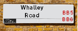
Neighbourhood Policing |
| Police Force: Lancashire |
 View Neighbourhood Crime and Policing View Neighbourhood Crime and Policing |
| Find a Local Neighbourhood Watch Scheme |
Location Details
| Whalley Road | |
|---|---|

| |
| Latitude | 53.787653 |
| Longitude | -2.416792 |
| OS Easting (X): | 372543 |
| OS Northing (Y): | 432474 |
| OS Grid Reference: | SD725325 |
Known Residential Addresses for Whalley Road
- THE COACH HOUSE
- LITTLE ACRES, 26A
- 28
- 26
- TAVISTOCK, 26B
- PYETHORN FARMHOUSE
- 112
- 106
- 124
- 92
- 160
- 73
- MEADOWSIDE BARN
- 33
- 131
- 129
- HOLLY BANK, 8
- ALVERA
- 128
- 63
- 75
- 59
- 65C
- 71
- 52
- 32
- 62
- 62A
- 60
- 82
- 84
- 11
- GLENBURN
- 1
- 2
- GROSVENOR LODGE, 82 FLAT 2
- GROSVENOR LODGE, 82 FLAT 6
- GROSVENOR LODGE, 82 FLAT 1
- 130
- 9
- MYTTON FOLD FARM HOTEL
- 16
- 30
- HIGHER ELKER FARM
- ELKER CROFT
- WARWICK HOUSE
- 3
- 80
- 76
- 65
- 120
- 100
- 134
- 98
- ACKTON VILLA, 29
- 35
- 27A
- 51
- 27B
- 41
- 24
- ROCK MOUNT, 22
- 168
- 154
- 150
- 128A
- 136
- 67
- 36
- 34
- 40
- 56
- 44
- 18
- 50
- 48
- 74
- 70
- 68
- 55
- 47
- HILLCREST
- MEADOWVILLE
- THE CROFT
- 46
- 38
- 20
- 14
- 96
- 116
- 122
- 69
- 67A
- 43
- 45
- 6
- 7
- 5
Roads that have a Junction with Whalley Road
| Street | Junction Type |
|---|---|
| Hollies Road | junction |
| Anderson Road | junction |
| Sunnyside Avenue | junction |
| Durham Road | junction |
| Durham Drive | junction |
| Somerset Avenue | junction |
| Hollowhead Lane | junction |
| Ribchester Road (B6245) | junction |
| Wilpshire Banks | junction |
| Station Close | junction |
| Showley Brook Close | junction |
| Whalley New Road (A666) | pseudo node |
| Northcote Road | junction |
| Whinney Lane | junction |
| Olive Bank | junction |
| Moorland Road | junction |
| St Mary's Drive | junction |
| York Lane | junction |
| Whitehalgh Lane | junction |
| Portland Road | junction |
| Springdale Road | junction |
| Rogersfield | junction |
| Longsight Road (A59) | roundabout |
| Longsight Road (A59) | roundabout |
| Longworth Road | junction |
| Moor Lane | junction |
| Whalley Old Road | junction |
| Nab Rise | junction |
| Dale View | junction |
| Calder Avenue | junction |
| Rocklea Gardens | junction |
| Calder Avenue | junction |
| Neddy Lane | junction |
| The Meadows | junction |
| Weavers Croft | junction |
| Billington Gardens | junction |
| Meadow Close | junction |
| Elker Lane | junction |
| Longsight Road | junction |
Sunset and Sunrise times
| Sunrise | 07:56 |
|---|---|
| Sunset | 16:49 |
Latest Weather Conditions
| Observed at Weather Station: | Stonyhurst 30 January 2025 at 08:00 (4.77 miles away) |
|---|---|
| Current Weather: | Clear night |
| Temperature and Humidity: | 2.1°C (88.5%) |
| Wind Direction and Speed: | (0 mph) |
Population Statistics
| ONS Area Code | E00128675, E00128668, E00128671, E00128672, E00128670, E00128676, E00128576, E00128577, E00128571, E00128506, E00128503, E00128504, E00128511, E00128510 & E00128509 |
|---|---|
| ONS Area Name | White Suburban Communities, Rural White-Collar Workers, Detached Retirement Living, Comfortable Suburbia, Self-Sufficient Retirement, Semi-Detached Ageing, Established Farming Communities, Rural Life, Ageing Industrious Workers, Deprived Blue-Collar Terraces & Industrious Transitions |
| Average Age | 43.88, 44.48, 44.79, 46.97, 38.81 & 41.34 |
| Area Population | 1090.00, 1492.00, 1212.00, 1049.00, 2094.00 & 1060.00 |
| Male Population | 516.00, 769.00, 591.00, 524.00, 1038.00 & 518.00 (49%) |
| Female Population | 574.00, 723.00, 621.00, 525.00, 1056.00 & 542.00 (51%) |
| Benefit Claimants | 6, 7, 4, 3, 11 & 5 (0%) |
| LSOA Code: | E01025353, E01025352, E01025333, E01025332, E01025319 &E01025318 |
|---|---|
| LSOA Name: | Ribble Valley 008G, Ribble Valley 008F, Ribble Valley 007C, Ribble Valley 008C, Ribble Valley 007B &Ribble Valley 007A |
| SOA Code: | 8b, 2b &5b |
| SOA Name: | |
| MSOA Code: | E02005277 &E02005276 |
| MSOA Name: | Ribble Valley 008 &Ribble Valley 007 |
Nearest Supermarkets
| Morrisons Great Harwood |
|---|
| Queen Street, Great Harwood, Blackburn BB6 7AL |
| 01254 886274 |
| Distance: 0.56 Miles |
| Directions to Morrisons Great Harwood |
| Tesco Great Harwood Superstore |
|---|
| Queen St, Great Harwood, BB6 7AT |
| 0345 671 9430 |
| Distance: 0.7 Miles |
| Directions to Tesco Great Harwood Superstore |
| Iceland Hyndburn Food Warehouse |
|---|
| UNIT 6B THE PEEL CENTRE, HYNDBURN, , BB1 3HT |
| 01254699554 |
| Distance: 2.31 Miles |
| Directions to Iceland Hyndburn Food Warehouse |
| Tesco Blackburn Roe Lee Express |
|---|
| 3 Roe Lee Retail Centre, Whalley New Rd, Blackburn, BB1 9AX |
| 0345 675 7088 |
| Distance: 2.8 Miles |
| Directions to Tesco Blackburn Roe Lee Express |
Telephone Information
| Area Code |
|---|
| Area Code: 01254 - Blackburn |
| Area Code: 01200 - Clitheroe |
| Area Code: 01282 - Burnley |
Local Government
| Local Council Details |
|---|
| Within the area of Ribble Valley |
| Visit the Council's Website |
| Council Offices, Church Walk, Clitheroe, Lancashire &BB7 2RA |
| Send email |
| Telephone Number: 01200 425111 |
| Local Member of Parliament |
|---|
| Within the Westminster Parliamentary Constituency of Ribble Valley |
| The Member of Parliament is Maya Ellis &Jonathan Hinder |
| Details for the MP Maya Ellis &Jonathan Hinder on parliament.uk |
| Details for the MP Maya Ellis &Jonathan Hinder on theyworkforyou.com |
| In the 2024 General Election Maya Ellis &Jonathan Hinder won with a majority of 856 the result was Lab gain from Con. The total electorate was 80,484 |
| Wards, Parish Councils and County Councils |
|---|
| Ward: Wilpshire & Ramsgreave, Billington & Langho, Brockhall & Dinckley &Whalley & Painter Wood Ward |
| Parish: Wilpshire & Billington and Langho Parish Council |
| Ceremonial County: Lancashire |
Nearest Schools
England Primary Schools
St Hubert's Roman Catholic Primary School, Great Harwood
Address: St Hubert's Roman Catholic Primary School, Great Harwood, Hallfield Road, Great Harwood, Blackburn, Lancashire, BB6 7SN
Distance: 0.86 miles
Contact: 01254885778
Great Harwood St Bartholomew's Parish Church of England Voluntary Aided Primary School
Address: Great Harwood St Bartholomew's Parish Church of England Voluntary Aided Primary School, Ash Street, Great Harwood, Blackburn, Lancashire, BB6 7QA
Distance: 0.41 miles
Contact: 01254884534
St Wulstan's Catholic Primary School, Great Harwood
Address: St Wulstan's Catholic Primary School, Great Harwood, Rushton Street, Great Harwood, Lancashire, BB6 7JQ
Distance: 0.34 miles
Contact: 01254884533
Great Harwood Primary School
Address: Great Harwood Primary School, Rushton Street, Great Harwood, Blackburn, Lancashire, BB6 7JQ
Distance: 0.34 miles
Contact: 01254880810
Great Harwood St John's Church of England Primary School
Address: Great Harwood St John's Church of England Primary School, St John's Street, Great Harwood, Blackburn, Lancashire, BB6 7ES
Distance: 0.58 miles
Contact: 01254885926
St Charles' RC School
Address: St Charles' RC School, Knowles Street, Rishton, Blackburn, Lancashire, BB1 4HT
Distance: 1.45 miles
Contact: 01254886110
Rishton St Peter and St Paul's Church of England Primary School
Address: Rishton St Peter and St Paul's Church of England Primary School, Arundel Street, Rishton, Blackburn, Lancashire, BB1 4DT
Distance: 1.23 miles
Contact: 01254884522
England Secondary Schools
The Hyndburn Academy
Address: The Hyndburn Academy, Stourton Street, Rishton, Blackburn, Lancashire, BB1 4ED
Distance: 1.16 miles
Contact: 01254885378
Norden High School & Sports College
Address: Norden High School & Sports College, Stourton Street, Rishton, Blackburn, Lancashire, BB1 4ED
Distance: 1.16 miles
Contact:
Nearest Hospitals
| Accrington Victoria Hospital |
|---|
| Address: Accrington Victoria Community Hospital, Haywood Road, Accrington, BB5 6AS, |
| NHS Sector |
| East Lancashire Hospitals NHS Trust |
| Telephone: 01254 359003 |
| Visit Hospital Website |
| Distance: 4.52 (miles) |
| Directions from to Accrington Victoria Hospital |
| Royal Blackburn Hospital |
|---|
| Address: Haslingden Road, Haslingden Road, Blackburn, BB2 3HH, |
| NHS Sector |
| East Lancashire Hospitals NHS Trust |
| Telephone: 01254 263555 |
| Visit Hospital Website |
| Distance: 6.53 (miles) |
| Directions from to Royal Blackburn Hospital |
| BMI The Beardwood Hospital |
|---|
| Address: Preston New Road, Blackburn, BB2 7AE, |
| Independent Sector |
| BMI Healthcare |
| Telephone: 01254 507607 |
| Visit Hospital Website |
| Distance: 7.29 (miles) |
| Directions from to BMI The Beardwood Hospital |
Nearest Dentists
Dentists
DENTAL SURGERY
Address: 18 GLEBE STREET, GREAT HARWOOD, BLACKBURN, LANCASHIRE, BB6 7AA
Distance: 0.49 miles
Contact: :
DENTAL SURGERY
Address: 70 QUEEN STREET, GREAT HARWOOD, BLACKBURN, LANCASHIRE, BB6 7AL
Distance: 0.56 miles
Contact: :
DENTAL SURGERY
Address: 28 HIGH STREET, RISHTON, BLACKBURN, LANCASHIRE, BB1 4LA
Distance: 1.33 miles
Contact: :
DENTAL SURGERY
Address: 57 PICKUP STREET, CLAYTON LE MOORS, ACCRINGTON, LANCASHIRE, BB5 5NS
Distance: 1.53 miles
Contact: :
THE MACFARLANE DENTAL PRACTICE
Address: 33A KING STREET, WHALLEY, CLITHEROE, LANCASHIRE, BB7 9SP
Distance: 2.36 miles
Contact: :
ELLISON AND GRIFFITHS
Address: 83 KING STREET, WHALLEY, CLITHEROE, LANCASHIRE, BB7 9SW
Distance: 2.42 miles
Contact: :
Nearest GP Surgeries
Doctors
GREAT HARWOOD HEALTH CENTRE
Address: WATER STREET, GREAT HARWOOD, BLACKBURN, LANCASHIRE, BB6 7QR
Distance: 0.54 miles
Contact: :
THE WEAVERS PRACTICE (GREAT HARWOOD HEALTH CENTRE)
Address: GREAT HARWOOD HEALTH CENTRE, WATER STREET, GREAT HARWOOD, BLACKBURN, LANCASHIRE, BB6 7QR
Distance: 0.54 miles
Contact: :
GREAT HARWOOD MEDICAL GROUP
Address: GREAT HARWOOD HEALTH CENTRE, WATER STREET, GREAT HARWOOD, BLACKBURN, LANCASHIRE, BB6 7QR
Distance: 0.54 miles
Contact: tel: 01254 617570
GREAT HARWOOD SURGERY
Address: 32 HIGH STREET, RISHTON, BLACKBURN, BB1 4LA
Distance: 1.33 miles
Contact: tel: 01254 617590
THE WEAVERS PRACTICE
Address: HIGH STREET, RISHTON, BLACKBURN, BB1 4LA
Distance: 1.33 miles
Contact: tel: 01254 884217
GREAT HARWOOD SURGERY
Address: 32 HIGH STREET, RISHTON, BLACKBURN, BB1 4LA
Distance: 1.33 miles
Contact: :
Nearest Dispensing Chemists
Pharmacies
E B HOLDEN PHARMACY
Address: 9-11 QUEEN STREET, GREAT HARWOOD, BLACKBURN, LANCASHIRE, BB6 7QL
Distance: 0.40 miles
Contact: tel: 01254 886178
MY PHARMACY
Address: HESKETH HOUSE, 1 HESKETH STREET, GREAT HARWOOD, BLACKBURN, BB6 7DW
Distance: 0.44 miles
Contact: tel: 01254 882800
BOOTS
Address: 50 QUEEN STREET, GREAT HARWOOD, BLACKBURN, LANCASHIRE, BB6 7QQ
Distance: 0.45 miles
Contact: tel: 01254 884330
TESCO INSTORE PHARMACY
Address: QUEEN STREET, GREAT HARWOOD, BLACKBURN, LANCASHIRE, BB6 7AL
Distance: 0.56 miles
Contact: tel: 01707 297706
RISHTON PHARMACY
Address: 42 HIGH STREET, RISHTON, BLACKBURN, LANCASHIRE, BB1 4LA
Distance: 1.33 miles
Contact: tel: 01254 883831
COHENS CHEMIST
Address: 53-55 HIGH STREET, RISHTON, BLACKBURN, LANCASHIRE, BB1 4LD
Distance: 1.36 miles
Contact: tel: 01254 884044
Nearest Opticians
Opticians
PAUL NUTTALL OPTOMETRISTS (GREAT HARWOOD)
Address: 49 BLACKBURN ROAD, GREAT HARWOOD, BLACKBURN, LANCASHIRE, BB6 7DF
Distance: 0.39 miles
Contact: :
EYES OF HARWOOD
Address: 76 QUEEN STREET, GREAT HARWOOD, BLACKBURN, LANCASHIRE, BB6 7AL
Distance: 0.56 miles
Contact: :
UNIVISION EYE CENTRE
Address: 41 HIGH STREET, RISHTON, BLACKBURN, BB1 4JZ
Distance: 1.35 miles
Contact: :
OPTICAL DIRECT CLM LTD
Address: LONGTON HOUSE, BURNLEY ROAD, CLAYTON LE MOORS, ACCRINGTON, LANCASHIRE, BB5 5TW
Distance: 1.86 miles
Contact: :
SPECTACLE FACTORY SHOP LTD
Address: 45 KING STREET, WHALLEY, CLITHEROE, LANCASHIRE, BB7 9SP
Distance: 2.36 miles
Contact: :
IDEAL EYECARE
Address: 775 WHALLEY NEW ROAD, BLACKBURN, LANCASHIRE, BB1 9BE
Distance: 2.57 miles
Contact: :
Transport
Nearest Rail Stations
Rishton Station is 1.67 miles away.
Address: Rishton station, Station Road, Rishton, Lancashire, BB1 4EY
Rishton is situated on the East Lancashire line and is managed by Northern.
Rishton Station is an unstaffed station.
Langho Station is 1.75 miles away.
Address: Langho station, off Whalley New Road, Langho, Lancashire, BB6 8EZ
Langho is situated on the Ribble Valley line and is managed by Northern.
Langho Station is an unstaffed station.