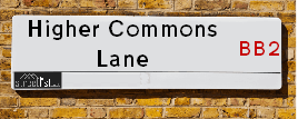
Higher Commons Lane is a street located in the village of Mellor Brook and in the village of Osbaldeston. The street has a length of approximately 1,062 metres.
The street is located within the Ribble Valley District (B) Council's jurisdiction. They provide various services, like refuse collection, and manage council tax collection. It's situated in the North West region of the UK.
The road has been assigned the Unique Street Reference Number of 31800876 in the National Street Gazetteer.
The street has the postcodes of BB2 7PS, BB2 7LS and BB2 7LR.
It is located within the county of Lancashire, situated in the North West region of the UK. It's 187.92 miles North West from central London., 21.18 miles South East from Lancaster, 24.17 miles North West from Manchester and 31.59 miles North East from Liverpool.
Map of Higher Commons Lane
| Postcodes | ||
|---|---|---|
| Icon | Postcodes for Higher Commons Lane | |
| Walking Distances | ||
| Distance Info | Green Circle = 10 Minutes Walk (800 metres) | |
Street Crime Data accessed from data.police.uk on 06/10/2024.
Moving to Higher Commons Lane?
I can help you uncover potential pitfalls and provide key questions to ask about your new property. With decades of experience as a Local Land Charges Manager, I offer confidential insights to make your move informed and stress-free.
This service is free, but you may wish to make an optional donation to support it. Please include the property name and address in your request as well as anything you wish to focus on.
Contact Me
Do you know why this road is called Higher Commons Lane?
What's it like to live here?
Share a Photo of Higher Commons Lane
Ask the community a question.
Do you have any questions, memories to share, have any photos or know any facts? We'd love to know more.
Submit Your Comment
Budget Friendly Hotels near Higher Commons Lane
| Budget Hotel Name | Distance (miles) |
|---|---|
|
1: Name:Premier Inn Preston East Address: Bluebell Way Telephone: Visit Hotel Page |
4.73 |
|
2: Name:Premier Inn Blackburn South M65 J4 Address: Off Eccleshill Road Telephone: Visit Hotel Page |
5.16 |
|
3: Name:Travelodge Blackburn M65 Address: Darwen Motorway Service Area, Commercial Rd, M65 Motorway, Blackburn with Darwen, Darwen, BB3 0AT Telephone: 0871 984 6122 Visit Hotel Page |
5.38 |
|
4: Name:Travelodge Preston Central Address: Preston Farmers Office, New Hall Ln, Preston, PR1 5NX Telephone: 0871 984 6150 Visit Hotel Page |
5.90 |
|
5: Name:Holiday Inn Express Preston South Address: Reedfield Place, Walton Summit Telephone: Visit Hotel Page |
6.18 |
Hotel Options
Your support helps keep this site running!
If you enjoy using this website, consider making a donation to help me cover hosting costs.
Nearby Estate Agents
| Name | Address | Website |
|---|---|---|
| Stones Young Estate and Letting Agents | The Old Post Office 740 Whalley New Road Blackburn BB1 9BA | |
| Pads Abroad Ltd. | Kennard 18 east park road Blackburn Lancashire BB1 8BB | Visit Website |
| Lock and Key Estate Agent | 7 Hope Street, Blackburn,BB2 1DY | Visit Website |
| Mayets Sales & Lettings | 82 London Road, Blackburn,BB1 7LR | Visit Website |
| Hilarys Estate Agents | 1 Strawberry Bank, Blackburn,BB2 6AA | Visit Website |
Neighbourhood Policing |
| Police Force: Lancashire |
 View Neighbourhood Crime and Policing View Neighbourhood Crime and Policing |
| Find a Local Neighbourhood Watch Scheme |
Location Details
| Higher Commons Lane | |
|---|---|

| |
| Latitude | 53.779894 |
| Longitude | -2.544057 |
| OS Easting (X): | 364153 |
| OS Northing (Y): | 431668 |
| OS Grid Reference: | SD642317 |
Roads that have a Junction with Higher Commons Lane
| Street | Junction Type |
|---|---|
| Osbaldeston Lane | junction |
| Commons Lane | junction |
| Whalley Road | junction |
Sunset and Sunrise times
| Sunrise | 08:24 |
|---|---|
| Sunset | 16:07 |
Latest Weather Conditions
| Observed at Weather Station: | Stonyhurst 5 January 2025 at 04:00 (5.77 miles away) |
|---|---|
| Current Weather: | Clear night |
| Temperature and Humidity: | 0.5°C (95.7%) |
| Wind Direction and Speed: | (0 mph) |
Population Statistics
| ONS Area Code | E00128589, E00128531 & E00128588 |
|---|---|
| ONS Area Name | Agricultural Communities & Rural White-Collar Workers |
| Average Age | 46.29 & 46.75 |
| Area Population | 1121.00 & 1132.00 |
| Male Population | 540.00 & 557.00 (49%) |
| Female Population | 581.00 & 575.00 (51%) |
| Benefit Claimants | 3 & 4 (0%) |
| LSOA Code: | E01025336 &E01025323 |
|---|---|
| LSOA Name: | Ribble Valley 008D &Ribble Valley 008A |
| SOA Code: | 2b |
| SOA Name: | |
| MSOA Code: | E02005277 |
| MSOA Name: | Ribble Valley 008 |
Nearest Supermarkets
| Tesco Blackburn Roe Lee Express |
|---|
| 3 Roe Lee Retail Centre, Whalley New Rd, Blackburn, BB1 9AX |
| 0345 675 7088 |
| Distance: 2.79 Miles |
| Directions to Tesco Blackburn Roe Lee Express |
| Tesco Blackburn Bank Top Express |
|---|
| 71-73 Bank Top, Blackburn, BB2 1TN |
| 0345 026 9899 |
| Distance: 3.2 Miles |
| Directions to Tesco Blackburn Bank Top Express |
| Sainsburys Blackburn Preston Old Road Local |
|---|
| 395 Preston Old Road, Blackburn, England, BB2 5LW |
| 01254 209433 |
| Distance: 3.43 Miles |
| Directions to Sainsburys Blackburn Preston Old Road Local |
| Morrisons Blackburn |
|---|
| Railway Road, Blackburn BB1 5BE |
| 01254 682321 |
| Distance: 3.45 Miles |
| Directions to Morrisons Blackburn |
Telephone Information
| Area Code |
|---|
| Area Code: 01254 - Blackburn |
| Area Code: 01772 - Preston |
| Area Code: 01200 - Clitheroe |
Broadband Information
| Speed | Average Speed | Median Speed | Maximum Speed | Next-generation access (NGA) | Number of Connections |
|---|---|---|---|---|---|
| Less than 2 Mbps | 2.9 | 2.9 | 4.3 | N | 3 |
Local Government
| Local Council Details |
|---|
| Within the area of Ribble Valley |
| Visit the Council's Website |
| Council Offices, Church Walk, Clitheroe, Lancashire &BB7 2RA |
| Send email |
| Telephone Number: 01200 425111 |
| Local Member of Parliament |
|---|
| Within the Westminster Parliamentary Constituency of Ribble Valley |
| The Member of Parliament is Maya Ellis |
| Details for the MP Maya Ellis on parliament.uk |
| Details for the MP Maya Ellis on theyworkforyou.com |
| In the 2024 General Election Maya Ellis won with a majority of 856 the result was Lab gain from Con. The total electorate was 80,484 |
| Wards, Parish Councils and County Councils |
|---|
| Ward: Mellor Ward |
| Ceremonial County: Lancashire |
Nearest Schools
England Primary Schools
Salesbury Church of England Primary School
Address: Salesbury Church of England Primary School, Lovely Hall Lane, Salesbury, Blackburn, Lancashire, BB1 9EQ
Distance: 2.38 miles
Contact: 01254244580
Lammack Primary School
Address: Lammack Primary School, Lammack Road, Blackburn, Lancashire, BB1 8LH
Distance: 2.13 miles
Contact: 01254698584
Mellor St Mary Church of England Primary School
Address: Mellor St Mary Church of England Primary School, Brundhurst Fold, Mellor, Blackburn, Lancashire, BB2 7JT
Distance: 0.66 miles
Contact: 01254812581
St Mary's Roman Catholic Primary School, Osbaldeston
Address: St Mary's Roman Catholic Primary School, Osbaldeston, Longsight Road, Osbaldeston, Blackburn, Lancashire, BB2 7HX
Distance: 0.30 miles
Contact: 01254812543
Balderstone St Leonard's Church of England Voluntary Aided Primary School
Address: Balderstone St Leonard's Church of England Voluntary Aided Primary School, Commons Lane, Balderstone, Blackburn, Lancashire, BB2 7LL
Distance: 0.91 miles
Contact: 01254769150
Nearest Hospitals
| Name | Address | Postcode | Distance | Map |
|---|
Nearest Dentists
Dentists
| Name | Address | Postcode | Distance | Map |
|---|
Nearest GP Surgeries
Doctors
MELLOR SURGERY
Address: MELLOR SURGERY, ST MARY'S GARDENS, MELLOR, BLACKBURN, LANCASHIRE, BB2 7JW
Distance: 0.84 miles
Contact: tel: 01254 812810
LIMEFIELD SURGERY
Address: 293-295 PRESTON NEW ROAD, BLACKBURN, LANCASHIRE, BB2 6PL
Distance: 2.64 miles
Contact: tel: 01254 915740
BROWNHILL SURGERY
Address: 788-790 WHALLEY NEW ROAD, BLACKBURN, LANCASHIRE, BB1 9BA
Distance: 2.66 miles
Contact: tel: 01254 247477
BLAKEWATER HEALTHCARE
Address: 367 WHALLEY NEW ROAD, BLACKBURN, BB1 9SR
Distance: 3.04 miles
Contact: tel: 01254 360158
REDLAM SURGERY
Address: 62-64 REDLAM, BLACKBURN, LANCASHIRE, BB2 1UW
Distance: 3.06 miles
Contact: tel: 01254 260051
FAMILY PRACTICE
Address: BARBARA CASTLE WAY HC, SIMMONS STREET, BLACKBURN, LANCASHIRE, BB2 1AX
Distance: 3.10 miles
Contact: tel: 01254 617301
Nearest Dispensing Chemists
Pharmacies
| Name | Address | Postcode | Telephone | Map | Distance in Km |
|---|
Nearest Opticians
Opticians
OPTICAL CARE LTD
Address: 41 YEW TREE DRIVE, BLACKBURN, LANCASHIRE, BB2 7DW
Distance: 2.02 miles
Contact: :
EYE HD OPTICS LTD T/A BUBBLE EYECARE - HOME VISITING OPTICIAN
Address: LITTLE ACRE, BILLINGE END ROAD, BLACKBURN, BB2 6QB
Distance: 2.15 miles
Contact: :
HAROON AHMED LIMITED
Address: 11 MERLIN ROAD, BLACKBURN, BB2 7BA
Distance: 2.29 miles
Contact: :
NEW BANK OPTICAL
Address: 26 NEW BANK ROAD, BLACKBURN, LANCASHIRE, BB2 6JW
Distance: 2.56 miles
Contact: :
KASBIL DOMICILIARY CARE
Address: 52 KNOWSLEY ROAD WEST, CLAYTON LE DALE, BLACKBURN, BB1 9PW
Distance: 2.60 miles
Contact: :
ON SIGHT CARE
Address: 24 BUNCER LANE, BLACKBURN, BB2 6SN
Distance: 2.64 miles
Contact: :
Transport
Nearest Rail Stations
Ramsgreave & Wilpshire Station is 2.67 miles away.
Address: Ramsgreave & Wilpshire station, Ramsgreave Road, Wilpshire, Lancashire, BB1 9BP
Ramsgreave & Wilpshire is situated on the Ribble Valley line and is managed by Northern.
Ramsgreave & Wilpshire Station is an unstaffed station.
Pleasington Station is 3.38 miles away.
Address: Pleasington station, Victoria Road, Pleasington, Lancashire, BB2 5JQ
Pleasington is situated on the East Lancashire line and is managed by Northern.
Pleasington Station is an unstaffed station.