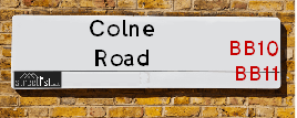
Colne Road is a street located in the town of Brierfield and in the town of Burnley. The street has a length of approximately 2,953 metres.
The street is located within the Burnley District (B) and Pendle District (B) Council's jurisdiction. They provide various services, like refuse collection, and manage council tax collection. It's situated in the North West region of the UK.
The road has been assigned the Unique Street Reference Numbers of 5000019, 5001614 and 29803440 in the National Street Gazetteer.
The street has the postcodes of BB11 2AA, BB11 1PS, BB10 2LG, BB10 2LF, BB10 2LD, BB10 2LB, BB10 1TW, BB10 1TP, BB10 1LW, BB10 1LQ, BB10 1LP, BB10 1LN, BB10 1LL, BB10 1LJ, BB10 1LG, BB10 1LF, BB10 1LD, BB10 1LA, BB10 1EZ, BB10 1EW, BB10 1EL, BB10 1EJ, BB10 1EF, BB10 1ED, BB10 1EA, BB10 1DZ, BB10 1DY, BB10 1DU, BB10 1DT, BB10 3AT, BB10 2LW, BB10 1HH and BB10 1EH.
It is located within the county of Lancashire, situated in the North West region of the UK. It's 182.63 miles North West from central London., 22.45 miles North from Manchester, 28.38 miles West from Leeds and 28.4 miles South East from Lancaster.
COLNE ROAD is within the Post Town of BURNLEY
Map of Colne Road
| Street Crime (updated 14/01/2025) | ||
|---|---|---|
| Location Note | Central Point of Street - Not Actual Location | |
| MSOA Info | For MSOAs E02005178, E02005182, E02005177, E02005176, E02005252 (Statistical Neighbourhood) | |
| Click Hint | Click on a Circle for a detailed breakdown below map. | |
| Crime Levels |
Green = Very Low Yellow = Low Orange = High Red = Very High |
|
| Postcodes | ||
| Icon | Postcodes for Colne Road | |
| Walking Distances | ||
| Distance Info | Green Circle = 10 Minutes Walk (800 metres) | |
Street Crime Data accessed from data.police.uk on 06/10/2024.
Moving to Colne Road?
I can help you uncover potential pitfalls and provide key questions to ask about your new property. With decades of experience as a Local Land Charges Manager, I offer confidential insights to make your move informed and stress-free.
This service is free, but you may wish to make an optional donation to support it. Please include the property name and address in your request as well as anything you wish to focus on.
Contact Me
Do you know why this road is called Colne Road?
What's it like to live here?
Share a Photo of Colne Road
Ask the community a question.
Do you have any questions, memories to share, have any photos or know any facts? We'd love to know more.
Submit Your Comment
Find Homes to Rent in Burnley

Budget Friendly Hotels near Colne Road
| Budget Hotel Name | Distance (miles) |
|---|---|
|
1: Name:Premier Inn Burnley Address: Queen Victoria Road Telephone: Visit Hotel Page |
0.56 |
|
2: Name:Holiday Inn Express Burnley M65 Jct 10 Address: 55 Pendle Way Telephone: Visit Hotel Page |
1.08 |
|
3: Name:Travelodge Burnley Address: Barracks Rd, Burnley, BB11 4SB Telephone: 0871 984 6125 Visit Hotel Page |
1.42 |
|
4: Name:Premier Inn Blackburn South M65 J4 Address: Off Eccleshill Road Telephone: Visit Hotel Page |
11.36 |
|
5: Name:Travelodge Blackburn M65 Address: Darwen Motorway Service Area, Commercial Rd, M65 Motorway, Blackburn with Darwen, Darwen, BB3 0AT Telephone: 0871 984 6122 Visit Hotel Page |
11.70 |
Hotel Options
Your support helps keep this site running!
If you enjoy using this website, consider making a donation to help me cover hosting costs.
House Sales
| Year | High | Low | Average | Sales |
|---|---|---|---|---|
| 2014 | £100,000 | £135,000 | £51,147 | 17 |
| 2015 | £95,000 | £135,000 | £83,333 | 6 |
| 2016 | £100,000 | £65,000 | £68,031 | 8 |
| 2017 | £140,000 | £85,000 | £79,535 | 14 |
| 2018 | £80,000 | £168,000 | £251,600 | 5 |
| 2019 | £90,000 | £87,500 | £102,550 | 10 |
| 2020 | £111,000 | £145,000 | £159,167 | 12 |
| 2021 | £77,500 | £110,000 | £89,008 | 12 |
| 2022 | £100,000 | £775,000 | £102,733 | 15 |
| 2023 | £135,000 | £180,000 | £119,788 | 13 |
Contains HM Land Registry data © Crown copyright and database right 2025. This data is licensed under the Open Government Licence v3.0.
Nearby Estate Agents
| Name | Address | Website |
|---|---|---|
| Rehman Property Consultancy | 20 - 22 Briercliffe Road, Burnley,BB10 1XB | |
| Brunlea Estate Agents | 189 Briercliffe Road, Burnley,BB10 1UR | |
| Lancashire Property Management | North Bridge House, Elm Street, Burnley,BB10 1PD | Visit Website |
| Local Lettings | Northbridge House, Office C56, Elm Street, Burnley,BB10 1PD | |
| Bridgfords | 1A Manchester Road, Burnley, Lancashire, BB11 1HQ | Visit Website |
We have found 33 postcodes
Neighbourhood Policing |
| Police Force: Lancashire |
 View Neighbourhood Crime and Policing View Neighbourhood Crime and Policing |
| Find a Local Neighbourhood Watch Scheme |
Location Details
| Colne Road | |
|---|---|

| |
| Latitude | 53.803956 |
| Longitude | -2.236018 |
| OS Easting (X): | 384458 |
| OS Northing (Y): | 434233 |
| OS Grid Reference: | SD845342 |
Known Residential Addresses for Colne Road
- 500
- 94
- OSBORNE GROVE, 367 APARTMENT 10
- OSBORNE GROVE, 367 APARTMENT 9
- OSBORNE GROVE, 367 APARTMENT 12
- OSBORNE GROVE, 367 APARTMENT 2
- OSBORNE GROVE, 367 APARTMENT 6
- OSBORNE GROVE, 367 APARTMENT 5
- 128
- 148 - 150
- 146
- 142
- 144
- 222
- 180
- 212
- 194 - 198
- 214
- 234A
- 258
- 280
- 312 - 314
- 260
- 191
- 316
- 434
- 422
- 123
- 124C
- 84 - 86
- REEDLEY HALL
- BANK HALL WORKS
- 16
- 72
- 343
- 462
- 458
- 363
- 501
- 357
- 361
- 514
- 512
- 511
- 152
- 200
- 304
- 292
- 290C
- 306 - 308
- 244
- 294
- 380
- 384
- 338
- 388
- 378
- 368
- 249
- 231
- 235
- 245
- 247
- 225
- 261
- 259
- 253
- 287
- 277
- 309
- 303
- 412
- 402
- 438
- 430
- 398
- 410
- 418
- 396
- 404
- 408
- 426
- 4
- 2
- 1
- 3
- 27
- 35
- 50
- 42
- 543
- 549
- 557
- 547
Roads that have a Junction with Colne Road
| Street | Junction Type |
|---|---|
| Barden Street (A682) | junction |
| Holbeck Avenue | junction |
| Hurtley Street | junction |
| Briercliffe Road (A682) | junction |
| Extwistle Street | junction |
| Hebrew Road | junction |
| Birley Place | junction |
| Allen Street | junction |
| Hallwell Street | junction |
| Thursby Square | junction |
| Hebrew Road | junction |
| Plantation Street | junction |
| Active Way (A679) | junction |
| Garsdale Avenue | junction |
| Robinson Lane | junction |
| Swaledale Avenue | junction |
| Roundwood Avenue | junction |
| Clarkson Close | junction |
| Reedley Drive | junction |
| Redman Road | junction |
| Holden Road | junction |
| Reedley Grove | junction |
| Windermere Avenue | junction |
| Fifth Avenue | junction |
| Queen's Road | junction |
| Keswick Road | junction |
| Peart Street | junction |
| Shuttleworth Street | junction |
| Ruskin Street | junction |
| Hind Street | junction |
| Rosebery Street | junction |
| Disraeli Street | junction |
| Pratt Street | junction |
| Murray Street | junction |
| Bright Street | junction |
| Newman Street | junction |
| Rylands Street | junction |
| Ford Street | junction |
| Heap Street | junction |
| Barden Street (A682) | junction |
Sunset and Sunrise times
| Sunrise | 07:47 |
|---|---|
| Sunset | 16:58 |
Latest Weather Conditions
| Observed at Weather Station: | Stonyhurst 4 February 2025 at 16:00 (9.94 miles away) |
|---|---|
| Current Weather: | Clear night |
| Temperature and Humidity: | 8.2°C (85.4%) |
| Wind Direction and Speed: | (0 mph) |
Population Statistics
| ONS Area Code | E00126266, E00126170, E00126356, E00126371, E00126372, E00126365, E00126370, E00126355, E00126363, E00126358, E00126261, E00126273, E00126260, E00126353, E00127971, E00127975, E00126173 & E00126174 |
|---|---|
| ONS Area Name | Pakistani Communities, Families in Terraces and Flats, Social Renting New Arrivals, Multi-Ethnic Suburbia, Communal Retirement & Retired City Hardship |
| Average Age | 32.71, 41.31, 33.64, 35.97, 46.31, 30.51, 42.91 & 39.09 |
| Area Population | 1367.00, 1522.00, 1377.00, 1562.00, 1426.00, 1574.00, 1617.00 & 1122.00 |
| Male Population | 702.00, 724.00, 727.00, 783.00, 690.00, 849.00, 757.00 & 557.00 (50%) |
| Female Population | 665.00, 798.00, 650.00, 779.00, 736.00, 725.00, 860.00 & 565.00 (50%) |
| Benefit Claimants | 53, 44, 58, 50, 19, 81, 24 & 11 (3%) |
| LSOA Code: | E01024876, E01024857, E01024895, E01024898, E01024897, E01024877, E01024891 &E01025213 |
|---|---|
| LSOA Name: | Burnley 003C, Burnley 007B, Burnley 003F, Burnley 002D, Burnley 002C, Burnley 003D, Burnley 001D &Pendle 013D |
| SOA Code: | 7b, 4b, 7a, 3d, 3b &5c |
| SOA Name: | |
| MSOA Code: | E02005178, E02005182, E02005177, E02005176 &E02005252 |
| MSOA Name: | Burnley 003, Burnley 007, Burnley 002, Burnley 001 &Pendle 013 |
Nearest Supermarkets
| Iceland Burnley Briercliffe |
|---|
| Unit B Briercliffe Ctr, Briercliffe Road, Burnley Lancashire, BB10 1WB |
| 01282416360 |
| Distance: 0.24 Miles |
| Directions to Iceland Burnley Briercliffe |
| Tesco Reedley Esso Express |
|---|
| Casterton Ave, Reedley, Burnley, BB10 2PA |
| 0345 026 9252 |
| Distance: 0.57 Miles |
| Directions to Tesco Reedley Esso Express |
| Asda Burnley |
|---|
| Princess Way, Burnley, BB12 0EQ |
| 01282 450033 |
| Distance: 0.69 Miles |
| Directions to Asda Burnley |
| Sainsburys Burnley |
|---|
| Active Way, Burnley, England, BB11 1BS |
| 01282 832033 |
| Distance: 0.72 Miles |
| Directions to Sainsburys Burnley |
Telephone Information
| Area Code |
|---|
| Area Code: 01282 - Burnley |
| Area Code: 01200 - Clitheroe |
Local Government
| Local Council Details |
|---|
| Within the area of Burnley &Pendle |
| Visit the Council's Website |
| Visit the Council's Website |
| Town Hall, Burnley, Lancashire, BB11 9SA, Market Street, Nelson, Lancashire &BB9 7LG |
| Send email |
| Telephone Number: 01282 425011 &01282 661 661 |
| Local Member of Parliament |
|---|
| Within the Westminster Parliamentary Constituency of Burnley &Pendle |
| The Member of Parliament is Oliver Ryan |
| Details for the MP Oliver Ryan on parliament.uk |
| Details for the MP Oliver Ryan on theyworkforyou.com |
| In the 2024 General Election Oliver Ryan won with a majority of 3,420 the result was Lab gain from Con. The total electorate was 74,954 |
| Wards, Parish Councils and County Councils |
|---|
| Ward: Daneshouse with Stoneyholme, Bank Hall, Queensgate, Lanehead &Brierfield West & Reedley Ward |
| Parish: Reedley Hallows Parish Council |
| Ceremonial County: Lancashire |
Nearest Schools
England Primary Schools
Briercliffe Primary School
Address: Briercliffe Primary School, Delamere Road, Briercliffe, Burnley, Lancashire, BB10 2JU
Distance: 1.55 miles
Contact: 01282459421
St James' Lanehead Church of England Primary School
Address: St James' Lanehead Church of England Primary School, Briercliffe Road, Burnley, Lancashire, BB10 2NH
Distance: 0.86 miles
Contact: 01282426833
Heasandford Primary School
Address: Heasandford Primary School, Williams Road, Burnley, Lancashire, BB10 3DA
Distance: 0.27 miles
Contact: 01282422009
Nelson St Paul's Church of England Primary School
Address: Nelson St Paul's Church of England Primary School, Hibson Road, Nelson, Lancashire, BB9 0PY
Distance: 1.79 miles
Contact: 01282617035
St John the Baptist Roman Catholic Primary School
Address: St John the Baptist Roman Catholic Primary School, Thames Avenue, Burnley, Lancashire, BB10 2PZ
Distance: 0.66 miles
Contact:
Burnley Casterton Primary School
Address: Burnley Casterton Primary School, Thames Avenue, Burnley, Lancashire, BB10 2PZ
Distance: 0.66 miles
Contact:
Burnley St Stephen's Church of England Voluntary Aided Primary School
Address: Burnley St Stephen's Church of England Voluntary Aided Primary School, Woodgrove Road, Burnley, Lancashire, BB11 3EJ
Distance: 1.58 miles
Contact: 01282427848
Burnley Stoneyholme Community Primary School
Address: Burnley Stoneyholme Community Primary School, Oswald Street, Burnley, Lancashire, BB12 0BN
Distance: 0.53 miles
Contact: 01282437190
St Mary's Roman Catholic Primary School, Burnley
Address: St Mary's Roman Catholic Primary School, Burnley, Holcombe Drive, Burnley, Lancashire, BB10 4BH
Distance: 0.90 miles
Contact: 01282427546
Burnley Springfield Community Primary School
Address: Burnley Springfield Community Primary School, Oxford Road, Burnley, Lancashire, BB11 3HP
Distance: 1.40 miles
Contact: 01282437277
Reedley Primary School
Address: Reedley Primary School, Reedley Road, Reedley, Burnley, Lancashire, BB10 2NE
Distance: 1.14 miles
Contact: 01282693688
Barden Primary School
Address: Barden Primary School, Burnley Campus, Barden Lane, Burnley, Lancashire, BB10 1JD
Distance: 0.19 miles
Contact: 01282226777
Burnley St Peter's Church of England Primary School
Address: Burnley St Peter's Church of England Primary School, Church Street, Burnley, Lancashire, BB11 2DL
Distance: 0.89 miles
Contact: 01282426873
Holy Trinity Roman Catholic Primary School, Brierfield
Address: Holy Trinity Roman Catholic Primary School, Brierfield, Halifax Road, Brierfield, Nelson, Lancashire, BB9 5BL
Distance: 1.45 miles
Contact: 01282613709
Pendle Primary Academy
Address: Pendle Primary Academy, Walter Street, Brierfield, Nelson, Lancashire, BB9 5AW
Distance: 1.29 miles
Contact: 01282615927
Burnley Holy Trinity Church of England Primary School
Address: Burnley Holy Trinity Church of England Primary School, Raglan Road, Burnley, Lancashire, BB11 4LB
Distance: 1.52 miles
Contact: 01282434368
England Secondary Schools
Sir John Thursby Community College
Address: Sir John Thursby Community College, Eastern Avenue, Burnley, Lancashire, BB10 2AT
Distance: 0.65 miles
Contact: 01282682313
Marsden Heights Community College
Address: Marsden Heights Community College, Edge End Lane, Nelson, Lancashire, BB9 0PR
Distance: 1.65 miles
Contact:
Unity College
Address: Unity College, Townley Holmes, Burnley, Lancashire, BB11 3DF
Distance: 1.59 miles
Contact: 01282683010
Blessed Trinity RC College
Address: Blessed Trinity RC College, Ormerod Road, Burnley, Lancashire, BB10 3AA
Distance: 0.70 miles
Contact:
England Higher Schools
Thomas Whitham Sixth Form
Address: Thomas Whitham Sixth Form, Burnley Campus, Burnley, Lancashire, BB10 1JD
Distance: 0.19 miles
Contact:
Burnley College
Address: Burnley College, Princess Way, Burnley, Lancashire, BB12 0AN
Distance: 0.85 miles
Contact: 01282733373
Nearest Hospitals
| Burnley General Hospital |
|---|
| Address: Burnley General Hospital, Casterton Avenue, Burnley, |
| NHS Sector |
| East Lancashire Hospitals NHS Trust |
| Telephone: 01282 425071 |
| Visit Hospital Website |
| Distance: 0.9 (miles) |
| Directions from to Burnley General Hospital |
| Pendle Community Hospital |
|---|
| Address: Leeds Road, Leeds Rd, Nelson, BB9 9SZ, |
| NHS Sector |
| East Lancashire Hospitals NHS Trust |
| Telephone: 01282 425071 |
| Visit Hospital Website |
| Distance: 3.94 (miles) |
| Directions from to Pendle Community Hospital |
| Accrington Victoria Hospital |
|---|
| Address: Accrington Victoria Community Hospital, Haywood Road, Accrington, BB5 6AS, |
| NHS Sector |
| East Lancashire Hospitals NHS Trust |
| Telephone: 01254 359003 |
| Visit Hospital Website |
| Distance: 9.91 (miles) |
| Directions from to Accrington Victoria Hospital |
Nearest Dentists
Dentists
BRIERCLIFFE ROAD DENTAL PRACTICE
Address: 84 BRIERCLIFFE ROAD, BURNLEY, LANCASHIRE, BB10 1UX
Distance: 0.22 miles
Contact: :
QUEENSGATE DENTAL PRACTICE
Address: 303 COLNE ROAD, BURNLEY, LANCASHIRE, BB10 1EJ
Distance: 0.34 miles
Contact: :
DENTAL SURGERY
Address: 2 COLNE ROAD, BURNLEY, LANCASHIRE, BB10 1LA
Distance: 0.52 miles
Contact: :
BURNLEY GENERAL HOSPITAL
Address: CASTERTON AVENUE, BURNLEY, BB10 2PQ
Distance: 0.56 miles
Contact: :
DENTAL CARE CENTRE
Address: 17 ORMEROD ROAD, BURNLEY, LANCASHIRE, BB11 2RU
Distance: 0.74 miles
Contact: :
DENTAL SURGERY
Address: 58 BANK PARADE, BURNLEY, LANCASHIRE, BB11 1TS
Distance: 0.85 miles
Contact: :
Nearest GP Surgeries
Doctors
COLNE ROAD SURGERY
Address: 34-36 COLNE ROAD, BURNLEY, LANCASHIRE, BB10 1LS
Distance: 0.19 miles
Contact: tel: 01282 731490
DANESHOUSE BRANCH
Address: OLD HALL STREET, BURNLEY, BB10 1LZ
Distance: 0.24 miles
Contact: :
THURSBY SURGERY
Address: 2 BROWHEAD ROAD, BURNLEY, LANCASHIRE, BB10 3BF
Distance: 0.29 miles
Contact: tel: 01282 644330
PARKSIDE SURGERY
Address: PRESTIGE PARK, COLNE ROAD, BURNLEY, LANCASHIRE, BB11 1PS
Distance: 0.65 miles
Contact: tel: 01282 731444
ST PETER'S CENTRE - COVID LOCAL VACCINATION SERVICE
Address: GROUND FLOOR, CHURCH STREET, BURNLEY, BB11 2DL
Distance: 0.89 miles
Contact: :
BURNLEY GROUP PRACTICE
Address: ST PETERS CENTRE, 3RD FLOOR CHURCH STREET, BURNLEY, LANCASHIRE, BB11 2DL
Distance: 0.89 miles
Contact: tel: 01282 644222
Nearest Dispensing Chemists
Pharmacies
WELL
Address: PIT TOP, 4 BROWHEAD ROAD, BURNLEY, LANCASHIRE, BB10 3BF
Distance: 0.29 miles
Contact: tel: 01282 424695
PEAK PLUS PHARMACY
Address: 36 ABEL STREET, BURNLEY, BB10 1QR
Distance: 0.30 miles
Contact: tel: 01282 423722
COLNE ROAD PHARMACY
Address: 60 COLNE ROAD, BURNLEY, LANCASHIRE, BB10 1LG
Distance: 0.39 miles
Contact: tel: 01282 423526
BURNLEY LATE NIGHT PHARMACY
Address: 36B COLNE ROAD, BURNLEY, LANCASHIRE, BB10 1LG
Distance: 0.39 miles
Contact: tel: 01282 421421
BRIERCLIFFE PHARMACY
Address: 198 BRIERCLIFFE ROAD, BURNLEY, BB10 2NZ
Distance: 0.69 miles
Contact: tel: 01282 453568
ASDA PHARMACY
Address: ASDA STORES LTD, PRINCESS WAY, BURNLEY, LANCASHIRE, BB12 0EQ
Distance: 0.77 miles
Contact: tel: 01282 838177
Nearest Opticians
Opticians
THE EYESITE LTD (BRIERFIELD)
Address: UNIT D, BRIERCLIFFE SHOPPING CENTRE, BRIERCLIFFE ROAD, BURNLEY, LANCASHIRE, BB10 1WB
Distance: 0.24 miles
Contact: :
4194 BURNLEY
Address: PRINCESS WAY, BURNLEY, BB12 0EQ
Distance: 0.77 miles
Contact: :
BOOTS OPTICIANS (ST JAMES STREET BURNLEY)
Address: 51 ST. JAMES'S STREET, BURNLEY, LANCASHIRE, BB11 1QL
Distance: 1.03 miles
Contact: :
SPECSAVERS (BURNLEY)
Address: UNIT 41, 25 THE MALL, CHARTER WALK SHOPPING CENTRE, BURNLEY, LANCASHIRE, BB11 1BA
Distance: 1.03 miles
Contact: :
J BROWN LTD
Address: 58 ST. JAMES'S STREET, BURNLEY, BB11 1NH
Distance: 1.07 miles
Contact: :
STEPHEN C BYE OPTICIANS
Address: 30 MANCHESTER ROAD, BURNLEY, LANCASHIRE, BB11 1HH
Distance: 1.11 miles
Contact: :
Transport
Nearest Rail Stations
Burnley Central Station is 0.81 miles away.
Address: Burnley Central station, Railway Street, Burnley, Lancashire, BB11 1DA
Burnley Central is situated on the East Lancashire line and is managed by Northern.
Burnley Central Station is staffed on a part time basis.
Burnley Barracks Station is 1.26 miles away.
Address: Burnley Barracks station, Junction Street, Burnley Barracks, Lancashire, BB12 0HG
Burnley Barracks is situated on the East Lancashire line|Calder Valley line and is managed by Northern.
Burnley Barracks Station is an unstaffed station.