Robinson Lane Brierfield is a street located in the town of Brierfield and near the town of Brierfield
About Robinson Lane
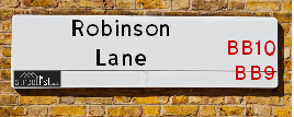
Robinson Lane is a street located in the town of Brierfield and near the town of Brierfield. The street has a length of approximately 748 metres.
Crime & Historic Map of Robinson Lane
This interactive map displays both historic mapping and street crime data. Click on a circle to view crime statistics, and use the button above to toggle the 1900s historic map.
This interactive map allows you to **zoom and pan** for a better view of the data.
- Use the + and - buttons on the map to zoom in and out.
- Scroll with your **middle mouse wheel** to zoom in and out.
- On a **mobile device**, use **pinch and zoom gestures** to navigate the map.
- Click on crime markers for more details.


| Postcodes | ||
|---|---|---|
| Icon | Postcodes for Robinson Lane | |
| Walking Distances | ||
| Distance Info | Green Circle = 10 Minutes Walk (800 metres) | |
Street Crime Data accessed from data.police.uk on 07/02/2025.
The street is located within the Pendle District (B) Council's jurisdiction. They provide various services, like refuse collection, and manage council tax collection. It's situated in the North West region of the UK.
The road has been assigned the Unique Street Reference Number of 29800049 in the National Street Gazetteer.
The street has the postcodes of BB9 5QS and BB9 5QR.
It is located within the county of Lancashire, situated in the North West region of the UK. It's 183.68 miles North West from central London., 23.53 miles North from Manchester, 27.58 miles South East from Lancaster and 28.63 miles West from Leeds.
Moving to Robinson Lane?
I can help you uncover potential pitfalls and provide key questions to ask about your new property. With decades of experience as a Local Land Charges Manager, I offer confidential insights to make your move informed and stress-free.
This service is free, but you may wish to make an optional donation to support it. Please include the property name and address in your request as well as anything you wish to focus on.
Contact Me
Do you know why this road is called Robinson Lane?
What's it like to live here?
Share a Photo of Robinson Lane
Ask the community a question.
Do you have any questions, memories to share, have any photos or know any facts? We'd love to know more.
Submit Your Comment

Budget Friendly Hotels near Robinson Lane
| Budget Hotel Name | Distance (miles) |
|---|---|
|
1: Name:Premier Inn Burnley Address: Queen Victoria Road Telephone: Visit Hotel Page |
1.67 |
|
2: Name:Holiday Inn Express Burnley M65 Jct 10 Address: 55 Pendle Way Telephone: Visit Hotel Page |
1.87 |
|
3: Name:Travelodge Burnley Address: Barracks Rd, Burnley, BB11 4SB Telephone: 0871 984 6125 Visit Hotel Page |
2.22 |
|
4: Name:Premier Inn Blackburn South M65 J4 Address: Off Eccleshill Road Telephone: Visit Hotel Page |
11.77 |
|
5: Name:Travelodge Blackburn M65 Address: Darwen Motorway Service Area, Commercial Rd, M65 Motorway, Blackburn with Darwen, Darwen, BB3 0AT Telephone: 0871 984 6122 Visit Hotel Page |
12.14 |
Hotel Options
Your support helps keep this site running!
If you enjoy using this website, consider making a donation to help me cover hosting costs.

Nearby Estate Agents
| Name | Address | Website |
|---|---|---|
| Whitefield Estate Agents | 76-78 Colne Road, Brierfield, Nelson,BB9 5NN | Visit Website |
| Brunlea Estate Agents | 189 Briercliffe Road, Burnley,BB10 1UR | |
| Rehman Property Consultancy | 20 - 22 Briercliffe Road, Burnley,BB10 1XB | |
| Lancashire Property Management | North Bridge House, Elm Street, Burnley,BB10 1PD | Visit Website |
| Local Lettings | Northbridge House, Office C56, Elm Street, Burnley,BB10 1PD |
Neighbourhood Policing |
| Police Force: Lancashire |
 View Neighbourhood Crime and Policing View Neighbourhood Crime and Policing |
| Find a Local Neighbourhood Watch Scheme |
Location Details
| Robinson Lane | |
|---|---|

| |
| Latitude | 53.819635 |
| Longitude | -2.241571 |
| OS Easting (X): | 384098 |
| OS Northing (Y): | 435979 |
| OS Grid Reference: | SD841360 |
Roads that have a Junction with Robinson Lane
| Street | Junction Type |
|---|---|
| Reedley Road | junction |
Sunset and Sunrise times
| Sunrise | 07:16 |
|---|---|
| Sunset | 17:28 |
Latest Weather Conditions
| Observed at Weather Station: | Stonyhurst 19 February 2025 at 08:00 (9.43 miles away) |
|---|---|
| Current Weather: | Clear night |
| Temperature and Humidity: | 1.4°C (77.5%) |
| Wind Direction and Speed: | (0 mph) |
Population Statistics
| ONS Area Code | E00127972 & E00127975 |
|---|---|
| ONS Area Name | Rural White-Collar Workers & Multi-Ethnic Suburbia |
| Average Age | 39.09 |
| Area Population | 1122.00 |
| Male Population | 557.00 (50%) |
| Female Population | 565.00 (50%) |
| Benefit Claimants | 11 (1%) |
| LSOA Code: | E01025213 |
|---|---|
| LSOA Name: | Pendle 013D |
| SOA Code: | 3b |
| SOA Name: | |
| MSOA Code: | E02005252 |
| MSOA Name: | Pendle 013 |
Nearest Supermarkets
| Tesco Reedley Esso Express |
|---|
| Casterton Ave, Reedley, Burnley, BB10 2PA |
| 0345 026 9252 |
| Distance: 0.92 Miles |
| Directions to Tesco Reedley Esso Express |
| Iceland Burnley Briercliffe |
|---|
| Unit B Briercliffe Ctr, Briercliffe Road, Burnley Lancashire, BB10 1WB |
| 01282416360 |
| Distance: 1.1 Miles |
| Directions to Iceland Burnley Briercliffe |
| Morrisons Nelson |
|---|
| Pendle Street, Nelson BB9 7UZ |
| 01282 449196 |
| Distance: 1.65 Miles |
| Directions to Morrisons Nelson |
| Asda Burnley |
|---|
| Princess Way, Burnley, BB12 0EQ |
| 01282 450033 |
| Distance: 1.68 Miles |
| Directions to Asda Burnley |
Telephone Information
| Area Code |
|---|
| Area Code: 01282 - Burnley |
| Area Code: 01200 - Clitheroe |
Broadband Information
| Speed | Average Speed | Median Speed | Maximum Speed | Next-generation access (NGA) | Number of Connections |
|---|---|---|---|---|---|
| Less than 2 Mbps | 2.3 | 2 | 4.4 | N | 6 |
Local Government
| Local Council Details |
|---|
| Within the area of Pendle |
| Visit the Council's Website |
| Market Street, Nelson, Lancashire &BB9 7LG |
| Send email |
| Telephone Number: 01282 661 661 |
| Local Member of Parliament |
|---|
| Within the Westminster Parliamentary Constituency of Pendle |
| The Member of Parliament is Oliver Ryan |
| Details for the MP Oliver Ryan on parliament.uk |
| Details for the MP Oliver Ryan on theyworkforyou.com |
| In the 2024 General Election Oliver Ryan won with a majority of 3,420 the result was Lab gain from Con. The total electorate was 74,954 |
| Wards, Parish Councils and County Councils |
|---|
| Ward: Brierfield West & Reedley Ward |
| Ceremonial County: Lancashire |
Nearest Schools
England Secondary Schools
Sir John Thursby Community College
Address: Sir John Thursby Community College, Eastern Avenue, Burnley, Lancashire, BB10 2AT
Distance: 1.44 miles
Contact: 01282682313
Marsden Heights Community College
Address: Marsden Heights Community College, Edge End Lane, Nelson, Lancashire, BB9 0PR
Distance: 0.92 miles
Contact:
England Primary Schools
St James' Lanehead Church of England Primary School
Address: St James' Lanehead Church of England Primary School, Briercliffe Road, Burnley, Lancashire, BB10 2NH
Distance: 1.21 miles
Contact: 01282426833
Marsden Community Primary School
Address: Marsden Community Primary School, Percy Street, Nelson, Lancashire, BB9 0BE
Distance: 1.38 miles
Contact: 01282612769
Heasandford Primary School
Address: Heasandford Primary School, Williams Road, Burnley, Lancashire, BB10 3DA
Distance: 1.30 miles
Contact: 01282422009
Nelson St Philip's Church of England Primary School
Address: Nelson St Philip's Church of England Primary School, Leeds Road, Nelson, Lancashire, BB9 9TQ
Distance: 1.78 miles
Contact: 01282614463
Nelson St Paul's Church of England Primary School
Address: Nelson St Paul's Church of England Primary School, Hibson Road, Nelson, Lancashire, BB9 0PY
Distance: 1.11 miles
Contact: 01282617035
St John the Baptist Roman Catholic Primary School
Address: St John the Baptist Roman Catholic Primary School, Thames Avenue, Burnley, Lancashire, BB10 2PZ
Distance: 0.80 miles
Contact:
Burnley Casterton Primary School
Address: Burnley Casterton Primary School, Thames Avenue, Burnley, Lancashire, BB10 2PZ
Distance: 0.80 miles
Contact:
St John Southworth Roman Catholic Primary School, Nelson
Address: St John Southworth Roman Catholic Primary School, Nelson, Lomeshaye Road, Nelson, Lancashire, BB9 0DQ
Distance: 1.29 miles
Contact:
Reedley Primary School
Address: Reedley Primary School, Reedley Road, Reedley, Burnley, Lancashire, BB10 2NE
Distance: 0.56 miles
Contact: 01282693688
Whitefield Infant School and Nursery
Address: Whitefield Infant School and Nursery, Every Street, Nelson, Lancashire, BB9 7HF
Distance: 1.44 miles
Contact: 01282612807
Barden Primary School
Address: Barden Primary School, Burnley Campus, Barden Lane, Burnley, Lancashire, BB10 1JD
Distance: 0.93 miles
Contact: 01282226777
Holy Trinity Roman Catholic Primary School, Brierfield
Address: Holy Trinity Roman Catholic Primary School, Brierfield, Halifax Road, Brierfield, Nelson, Lancashire, BB9 5BL
Distance: 0.75 miles
Contact: 01282613709
Lomeshaye Junior School
Address: Lomeshaye Junior School, Norfolk Street, Nelson, Lancashire, BB9 7SY
Distance: 1.47 miles
Contact: 01282612063
Pendle Primary Academy
Address: Pendle Primary Academy, Walter Street, Brierfield, Nelson, Lancashire, BB9 5AW
Distance: 0.41 miles
Contact: 01282615927
Wheatley Lane Methodist Voluntary Aided Primary School
Address: Wheatley Lane Methodist Voluntary Aided Primary School, Fence, Burnley, Lancashire, BB12 9ED
Distance: 1.27 miles
Contact: 01282617214
England Higher Schools
Thomas Whitham Sixth Form
Address: Thomas Whitham Sixth Form, Burnley Campus, Burnley, Lancashire, BB10 1JD
Distance: 0.93 miles
Contact:
Nearest Hospitals
| Name | Address | Postcode | Distance | Map |
|---|
Nearest Dentists
Dentists
| Name | Address | Postcode | Distance | Map |
|---|
Nearest GP Surgeries
Doctors
PWE PENDLE VALLEY (BRIERFIELD HC)
Address: ARTHUR STREET, BRIERFIELD, NELSON, LANCASHIRE, BB9 5SN
Distance: 0.48 miles
Contact: :
PENDLE VIEW MEDICAL CTRE
Address: PENDLE VALLEY MEDICAL CTR, 47 ARTHUR ST, BRIERFIELD, NELSON, BB9 5RZ
Distance: 0.58 miles
Contact: tel: 01282 614599
COLNE ROAD SURGERY
Address: 34-36 COLNE ROAD, BURNLEY, LANCASHIRE, BB10 1LS
Distance: 1.29 miles
Contact: tel: 01282 731490
DANESHOUSE BRANCH
Address: OLD HALL STREET, BURNLEY, BB10 1LZ
Distance: 1.31 miles
Contact: :
BRIERCLIFFE SURGERY
Address: BRIERCLIFFE PRIMARY CARE CENTRE, BRIERCLIFFE ROAD, BURNLEY, LANCASHIRE, BB10 2EZ
Distance: 1.33 miles
Contact: tel: 01282 648051
THURSBY SURGERY
Address: 2 BROWHEAD ROAD, BURNLEY, LANCASHIRE, BB10 3BF
Distance: 1.37 miles
Contact: tel: 01282 644330
Nearest Dispensing Chemists
Pharmacies
| Name | Address | Postcode | Telephone | Map | Distance in Km |
|---|
Nearest Opticians
Opticians
S W ALLEN OPTICAL LTD
Address: 1 RAILWAY STREET, BRIERFIELD, NELSON, LANCASHIRE, BB9 5PJ
Distance: 0.38 miles
Contact: :
THE EYESITE LTD (BRIERFIELD)
Address: UNIT D, BRIERCLIFFE SHOPPING CENTRE, BRIERCLIFFE ROAD, BURNLEY, LANCASHIRE, BB10 1WB
Distance: 1.10 miles
Contact: :
BROWN OPTOMETRISTS
Address: 35 RAILWAY STREET, NELSON, LANCASHIRE, BB9 9SG
Distance: 1.57 miles
Contact: :
EYE CARE OPTICAL
Address: 14 MANCHESTER ROAD, NELSON, BB9 7EG
Distance: 1.58 miles
Contact: :
SPECSAVERS (NELSON)
Address: 8 MARSDEN MALL, PENDLE RISE SHOPPING CENTRE, NELSON, LANCASHIRE, BB9 9SL
Distance: 1.61 miles
Contact: :
SPECTACLE FACTORY SHOP (NELSON)
Address: 51 SCOTLAND ROAD, NELSON, LANCASHIRE, BB9 7UY
Distance: 1.72 miles
Contact: :
Transport
Nearest Rail Stations
Brierfield Station is 0.39 miles away.
Address: Brierfield station, Railway Street, Brierfield, Lancashire, BB9 5PU
Brierfield is situated on the East Lancashire line and is managed by Northern.
Brierfield Station is an unstaffed station.
Nelson Station is 1.55 miles away.
Address: Nelson station, Hibson Road, Nelson, Lancashire, BB9 9SF
Nelson is situated on the East Lancashire line and is managed by Northern.
Nelson Station is staffed on a part time basis.