Mead Avenue is a street located in the town of Yeovil. It uses the postcode BA22 8RT. The street has a length of approximately 806 metres.
The street is located within the South Somerset District Council's jurisdiction. They provide various services, like refuse collection, and manage council tax collection. It's situated in the South West region of the UK.
The road has been assigned the Unique Street Reference Number of 36610530 in the National Street Gazetteer.
It is located within the county of Somerset, situated in the South West region of the UK. It's 117.67 miles West from central London., 1.9 miles West from Yeovil, 19.23 miles North West from Dorchester and 19.26 miles East from Taunton.
Map of Mead Avenue
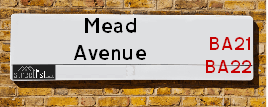
| Postcodes | ||
|---|---|---|
| Icon | Postcodes for Mead Avenue | |
| Walking Distances | ||
| Distance Info | Green Circle = 10 Minutes Walk (800 metres) | |
Street Crime Data accessed from data.police.uk on 06/10/2024.
Moving to Mead Avenue?
I can help you uncover potential pitfalls and provide key questions to ask about your new property. With decades of experience as a Local Land Charges Manager, I offer confidential insights to make your move informed and stress-free.
This service is free, but you may wish to make an optional donation to support it. Please include the property name and address in your request as well as anything you wish to focus on.
Contact Me
Do you know why this road is called Mead Avenue?
What's it like to live here?
Share a Photo of Mead Avenue
Ask the community a question.
Do you have any questions, memories to share, have any photos or know any facts? We'd love to know more.
Submit Your Comment

Budget Friendly Hotels near Mead Avenue
| Budget Hotel Name | Distance (miles) |
|---|---|
|
1: Name:Premier Inn Yeovil Airfield Address: 1 Alvington Lane Telephone: Visit Hotel Page |
0.39 |
|
2: Name:Premier Inn Yeovil Town Centre Address: Key Market House Telephone: Visit Hotel Page |
2.12 |
|
3: Name:Travelodge Yeovil Podimore Address: Podimore Services, A303 Roundabout, Nr. Yeovil, BA22 8JG Telephone: 0871 984 6059 Visit Hotel Page |
5.27 |
|
4: Name:Travelodge Ilminster Address: A303, Horton Cross, Ilminster, TA19 9PT Telephone: 0871 984 6229 Visit Hotel Page |
11.56 |
|
5: Name:Travelodge Wincanton Address: Lawrence Hill, Wincanton, BA9 8AB Telephone: 0871 984 6511 Visit Hotel Page |
13.08 |
Hotel Options
Your support helps keep this site running!
If you enjoy using this website, consider making a donation to help me cover hosting costs.
Nearby Estate Agents
| Name | Address | Website |
|---|---|---|
| Humberts Yeovil | Motivo House Bluebell Road Yeovil Somerset BA20 2FG | Visit Website |
| Chants Estate Agents | Yeovil Innovation Centre Office 55 Barracks Close Copse Road Yeovil Somerset BA22 8RN | Visit Website |
| LiveWest - Agusta Park | Grebe Road, Lufton,BA22 8FY | Visit Website |
| Towers Wills | The White House 114 Hendford Hill, Yeovil, BA20 2RF | Visit Website |
| YeoLets | Unit A Park 5, Park Road, Yeovil, BA20 1AP | Visit Website |
We have found 1 postcode
Neighbourhood Policing |
| Police Force: Avon And Somerset |
 View Neighbourhood Crime and Policing View Neighbourhood Crime and Policing |
| Find a Local Neighbourhood Watch Scheme |
Location Details
| Mead Avenue | |
|---|---|

| |
| Latitude | 50.947314 |
| Longitude | -2.673129 |
| OS Easting (X): | 352718 |
| OS Northing (Y): | 116707 |
| OS Grid Reference: | ST527167 |
Roads that have a Junction with Mead Avenue
| Street | Junction Type |
|---|---|
| Lufton Way | junction |
| Edward Close | junction |
| Memorial Road | junction |
| Termare Close | junction |
| Lufton Way | junction |
Sunset and Sunrise times
| Sunrise | 08:00 |
|---|---|
| Sunset | 16:43 |
Latest Weather Conditions
| Observed at Weather Station: | Yeovilton 20 January 2025 at 21:00 (4.30 miles away) |
|---|---|
| Current Weather: | Cloudy |
| Temperature and Humidity: | 5.6°C (93.7%) |
| Wind Direction and Speed: | SSE (2 mph) |
Population Statistics
| ONS Area Code | E00148538 |
|---|---|
| ONS Area Name | Ageing Rural Flat Tenants |
| Average Age | 43.35 |
| Area Population | 1518.00 |
| Male Population | 709.00 (47%) |
| Female Population | 809.00 (53%) |
| Benefit Claimants | 9 (1%) |
| LSOA Code: | E01029162 |
|---|---|
| LSOA Name: | South Somerset 013B |
| SOA Code: | 5a |
| SOA Name: | |
| MSOA Code: | E02006087 |
| MSOA Name: | South Somerset 013 |
Nearest Supermarkets
| Asda Yeovil |
|---|
| Preston Road, Yeovil, BA20 2HB |
| 01935 709500 |
| Distance: 0.36 Miles |
| Directions to Asda Yeovil |
| Tesco Yeovil Abbey Manor Express |
|---|
| The Forum, Abbey Manor Park, Yeovil, BA21 3TL |
| 0345 026 9096 |
| Distance: 0.43 Miles |
| Directions to Tesco Yeovil Abbey Manor Express |
| Tesco Ilchester Rd Express |
|---|
| 147 Ilchester Rd, Yeovil, BA21 3BL |
| 0345 610 2883 |
| Distance: 1.28 Miles |
| Directions to Tesco Ilchester Rd Express |
| Morrisons Yeovil |
|---|
| Lysander Road, Yeovil BA20 2AU |
| 01935 412119 |
| Distance: 1.47 Miles |
| Directions to Morrisons Yeovil |
Telephone Information
| Area Code |
|---|
| Area Code: 01935 - Yeovil |
Broadband Information
| Speed | Average Speed | Median Speed | Maximum Speed | Next-generation access (NGA) | Number of Connections |
|---|---|---|---|---|---|
| Less than 2 Mbps | 4.8 | 5.1 | 8 | Y | 12 |
Local Government
| Local Council Details |
|---|
| Within the area of South Somerset |
| Visit the Council's Website |
| Council Offices, Brympton Way, Yeovil, Somerset &BA20 2HT |
| Telephone Number: 01935 462 462 |
| Local Member of Parliament |
|---|
| Within the Westminster Parliamentary Constituency of Yeovil |
| The Member of Parliament is Adam Dance |
| Details for the MP Adam Dance on parliament.uk |
| Details for the MP Adam Dance on theyworkforyou.com |
| In the 2024 General Election Adam Dance won with a majority of 12,268 the result was LD gain from Con. The total electorate was 79,918 |
| Wards, Parish Councils and County Councils |
|---|
| Ward: Brympton Ward |
| Ceremonial County: Somerset |
Nearest Schools
England Primary Schools
Oaklands Primary School
Address: Oaklands Primary School, Preston Grove, Yeovil, Somerset, BA20 2DU
Distance: 1.20 miles
Contact: 01935425447
Holy Trinity Church of England Primary School
Address: Holy Trinity Church of England Primary School, Lime Tree Avenue, Yeovil, Somerset, BA20 2PW
Distance: 1.37 miles
Contact:
Preston CofE Primary School
Address: Preston CofE Primary School, The Toose, Abbey Manor Park, Yeovil, Somerset, BA21 3SN
Distance: 0.31 miles
Contact: 01935474538
Preston CofE VC Primary School
Address: Preston CofE VC Primary School, The Toose, Abbey Manor Park, Yeovil, Somerset, BA21 3SN
Distance: 0.31 miles
Contact:
Kingfisher Primary School
Address: Kingfisher Primary School, Kingfisher Drive, Houndstone, Yeovil, BA22 8FJ
Distance: 0.46 miles
Contact: 01935472730
England Secondary Schools
Preston School Academy
Address: Preston School Academy, Monks Dale, Yeovil, Somerset, BA21 3JD
Distance: 0.72 miles
Contact: 01935471131
Westfield Academy
Address: Westfield Academy, Stiby Road, Yeovil, Somerset, BA21 3EP
Distance: 0.97 miles
Contact: 01935423747
Nearest Hospitals
| Name | Address | Postcode | Distance | Map |
|---|
Nearest Dentists
Dentists
| Name | Address | Postcode | Distance | Map |
|---|
Nearest GP Surgeries
Doctors
ABBEY MANOR SURGERY - COVID LOCAL VACCINATION SERVICE 2
Address: THE FORUM, YEOVIL, SOMERSET, BA21 3TL
Distance: 0.41 miles
Contact: :
ABBEY MANOR MEDICAL PRACTICE
Address: THE FORUM, YEOVIL, SOMERSET, BA21 3TL
Distance: 0.41 miles
Contact: :
PRESTON GROVE MEDICAL CENTRE, YEOVIL
Address: PRESTON GROVE, YEOVIL, SOMERSET, BA20 2BQ
Distance: 1.31 miles
Contact: tel: 01935 474353
RYALLS PARK MEDICAL CENTRE, YEOVIL
Address: MARSH LANE, YEOVIL, SOMERSET, BA21 3BA
Distance: 1.44 miles
Contact: tel: 01935 434000
DIAMOND HEALTH GROUP
Address: 74 HENDFORD, YEOVIL, SOMERSET, BA20 1UJ
Distance: 1.67 miles
Contact: tel: 01935 470200
PENN HILL SURGERY, YEOVIL
Address: ST. NICHOLAS CLOSE, YEOVIL, SOMERSET, BA20 1SB
Distance: 1.84 miles
Contact: tel: 01935 470800
Nearest Dispensing Chemists
Pharmacies
| Name | Address | Postcode | Telephone | Map | Distance in Km |
|---|
Nearest Opticians
Opticians
YOEVIL EXTRA
Address: QUEENSWAY PLACE, HUISH, YEOVIL, SOMERSET, BA20 1DL
Distance: 1.60 miles
Contact: :
VISION EXPRESS (QUEENSWAY)
Address: QUEENSWAY PLACE, YEOVIL, SOMERSET, BA20 1DL
Distance: 1.60 miles
Contact: :
ROBERT FRITH OPTOMETRISTS LTD (YEOVIL)
Address: 26-28 PRINCES STREET, YEOVIL, BA20 1EQ
Distance: 1.76 miles
Contact: :
BOOTS OPTICIANS (YEOVIL)
Address: 39-41 MIDDLE STREET, YEOVIL, SOMERSET, BA20 1LG
Distance: 1.94 miles
Contact: :
VISION EXPRESS (YEOVIL)
Address: 44-46 MIDDLE STREET, YEOVIL, SOMERSET, BA20 1LX
Distance: 1.97 miles
Contact: :
SPECSAVERS (YEOVIL)
Address: 50-52 MIDDLE STREET, YEOVIL, SOMERSET, BA20 1LX
Distance: 1.97 miles
Contact: :
Transport
Nearest Rail Stations
Yeovil Pen Mill Station is 2.61 miles away.
Address: Yeovil Pen Mill station, Sherborne Road, Yeovil, Somerset, BA21 5DD
Yeovil Pen Mill is situated on the Heart of Wessex Line and is managed by Great Western Railway.
Yeovil Pen Mill Station is staffed on a part time basis.
Yeovil Junction Station is 3.04 miles away.
Address: Yeovil Junction station, off Newton Road, Stoford, Somerset, BA22 9UU
Yeovil Junction is situated on the South Western Main Line and is managed by South Western Railway.
Yeovil Junction Station is staffed on a part time basis.