Porchestall Drove Glastonbury is a street located in the town of Glastonbury
About Porchestall Drove
Porchestall Drove is a street located in the town of Glastonbury. The street has a length of approximately 1,172 metres.
The street is located within the Mendip District Council's jurisdiction. They provide various services, like refuse collection, and manage council tax collection. It's situated in the South West region of the UK.
The road has been assigned the Unique Street Reference Number of 25000172 in the National Street Gazetteer.
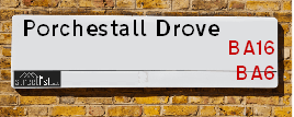
The street has the postcodes of BA6 9NW, BA6 9LX and BA6 9LR.
It is located within the county of Somerset, situated in the South West region of the UK. It's 116.42 miles West from central London., 14.88 miles North from Yeovil, 18.29 miles North East from Taunton and 22.15 miles South from Bristol.

Do you know why this road is called Porchestall Drove?
What's it like to live here?
Ask the community a question.
Do you have any questions, memories to share or know any facts? We'd love to know more.
Map of Porchestall Drove
| Postcodes | ||
|---|---|---|
| Icon | Postcodes for Porchestall Drove | |
| Walking Distances | ||
| Distance Info | Green Circle = 10 Minutes Walk (800 metres) | |
Street Crime Data accessed from data.police.uk on 06/10/2024.
Budget Friendly Hotels near Porchestall Drove
| Budget Hotel Name | Distance (miles) |
|---|---|
|
1: Name:Premier Inn Glastonbury Address: Morland Road Telephone: Visit Hotel Page |
0.38 |
|
2: Name:Travelodge Glastonbury Address: A39 Wirral Park Rd, Glastonbury, BA6 9XE Telephone: 0871 984 6339 Visit Hotel Page |
0.40 |
|
3: Name:Premier Inn Wells Somerset Address: Rowdens Road Telephone: Visit Hotel Page |
5.43 |
|
4: Name:Travelodge Yeovil Podimore Address: Podimore Services, A303 Roundabout, Nr. Yeovil, BA22 8JG Telephone: 0871 984 6059 Visit Hotel Page |
9.11 |
|
5: Name:Premier Inn Bridgwater North A38 Address: Express Park Telephone: Visit Hotel Page |
11.05 |
Your support helps keep this site running!
If you enjoy using this website, consider buying me a coffee to help cover hosting costs.
Nearby Estate Agents
| Name | Address | Website |
|---|---|---|
| Tor Estates | 20 High Street, Glastonbury, BA6 9DU | Visit Website |
| holland & odam | 30 High Street, Glastonbury, BA6 9DX | Visit Website |
| Cooper & Tanner | 41 High Street, Glastonbury, BA6 9DS | |
| Heritage Estates | 80 High Street, Glastonbury,,BA6 9DZ | Visit Website |
| Cooper & Tanner | 58A High Street, Street, BA16 0EQ |
Neighbourhood Policing |
| Police Force: Avon And Somerset |
 View Neighbourhood Crime and Policing View Neighbourhood Crime and Policing |
| Find a Local Neighbourhood Watch Scheme |
Location Details
| Porchestall Drove | |
|---|---|

| |
| Latitude | 51.145771 |
| Longitude | -2.736745 |
| OS Easting (X): | 348470 |
| OS Northing (Y): | 138817 |
| OS Grid Reference: | ST485388 |
Roads that have a Junction with Porchestall Drove
| Street | Junction Type |
|---|---|
| Benedict Street | junction |
| Thomas Way | junction |
| Middle Drove | junction |
| Back River Drove | junction |
Sunset and Sunrise times
| Sunrise | 07:30 |
|---|---|
| Sunset | 16:21 |
Latest Weather Conditions
| Observed at Weather Station: | Yeovilton 17 November 2024 at 05:00 (10.53 miles away) |
|---|---|
| Current Weather: | Overcast |
| Temperature and Humidity: | 6.7°C (93.9%) |
| Wind Direction and Speed: | W (6 mph) |
Population Statistics
| ONS Area Code | E00147919 |
|---|---|
| ONS Area Name | Communal Retirement |
| Average Age | 42.21 |
| Area Population | 1498.00 |
| Male Population | 715.00 (48%) |
| Female Population | 783.00 (52%) |
| Benefit Claimants | 15 (1%) |
| LSOA Code: | E01029047 |
|---|---|
| LSOA Name: | Mendip 012A |
| SOA Code: | 5a |
| SOA Name: | |
| MSOA Code: | E02006058 |
| MSOA Name: | Mendip 012 |
Nearest Supermarkets
| Tesco Glastonbury Superstore |
|---|
| Wirral Park Rd, Glastonbury, BA6 9XE |
| 0345 671 9553 |
| Distance: 0.32 Miles |
| Directions to Tesco Glastonbury Superstore |
| Morrisons Glastonbury |
|---|
| Street Road, Glastonbury BA6 9ED |
| 01458 831087 |
| Distance: 0.73 Miles |
| Directions to Morrisons Glastonbury |
| Sainsburys Street |
|---|
| Gravenchon Way, Street, England, BA16 0HS |
| 01458 446252 |
| Distance: 1.51 Miles |
| Directions to Sainsburys Street |
| Iceland Street Food Warehouse |
|---|
| UNIT 3, STREET RETAIL PK., GRAVENCHON WAY, STREET, SOMERSET, BA16 0HS |
| 01458446283 |
| Distance: 1.58 Miles |
| Directions to Iceland Street Food Warehouse |
Telephone Information
| Area Code |
|---|
| Area Code: 01458 - Glastonbury |
| Area Code: 01749 - Shepton Mallet |
Local Government
| Local Council Details |
|---|
| Within the area of Mendip |
| Visit the Council's Website |
| Council Offices, Cannards Grave Road, Shepton Mallet, Somerset &BA4 5BT |
| Send email |
| Telephone Number: 03333 043333 |
| Local Member of Parliament |
|---|
| Within the Westminster Parliamentary Constituency of Wells |
| The Member of Parliament is Sarah Dyke |
| Details for the MP Sarah Dyke on parliament.uk |
| Details for the MP Sarah Dyke on theyworkforyou.com |
| In the 2024 General Election Sarah Dyke won with a majority of 6,611 the result was LD gain from Con. The total electorate was 72,982 |
| Wards, Parish Councils and County Councils |
|---|
| Ward: Glastonbury St Benedict's Ward |
| Ceremonial County: Somerset |
Nearest Schools
England Secondary Schools
St Dunstan's School
Address: St Dunstan's School, Wells Road, Glastonbury, Somerset, BA6 9BY
Distance: 1.07 miles
Contact: 01458832943
England Primary Schools
St John's Church of England Voluntary Controlled Infants School
Address: St John's Church of England Voluntary Controlled Infants School, High Street, Glastonbury, Somerset, BA6 9DR
Distance: 0.93 miles
Contact: 01458832085
St Benedict's Church of England Voluntary Aided Junior School
Address: St Benedict's Church of England Voluntary Aided Junior School, Benedict Street, Glastonbury, Somerset, BA6 9EX
Distance: 0.76 miles
Contact: 01458831811
England Higher Schools
Strode College
Address: Strode College, Church Road, Street, Somerset, BA16 0AB
Distance: 1.06 miles
Contact: 01458844402
Nearest Hospitals
| Name | Address | Postcode | Distance | Map |
|---|
Nearest Dentists
Dentists
| Name | Address | Postcode | Distance | Map |
|---|
Nearest GP Surgeries
Doctors
GLASTONBURY SURGERY
Address: FEVERSHAM LANE, GLASTONBURY, SOMERSET, BA6 9LP
Distance: 0.67 miles
Contact: tel: 01458 833666
GLASTONBURY HEALTH CENTRE - COVID LOCAL VACCINATION SERVICE
Address: GLASTONBURY HEALTH CENTRE, 1 WELLS ROAD, GLASTONBURY, BA6 9DD
Distance: 1.05 miles
Contact: :
GLASTONBURY HEALTH CENTRE
Address: GLASTONBURY HEALTH & DENTAL CLINIC, 1 WELLS ROAD, GLASTONBURY, SOMERSET, BA6 9DD
Distance: 1.05 miles
Contact: tel: 01458 834100
VINE SURGERY PARTNERSHIP
Address: VINE SURGERY, HINDHAYES LANE, STREET, SOMERSET, BA16 0ET
Distance: 1.35 miles
Contact: tel: 01458 841122
MILLFIELD SENIOR SCHOOL
Address: BUTLEIGH ROAD, STREET, SOMERSET, BA16 0YD
Distance: 1.62 miles
Contact: :
MILLFIELD PREP SCHOOL
Address: EDGARLEY HALL, GLASTONBURY, SOMERSET, BA6 8LD
Distance: 2.11 miles
Contact: :
Nearest Dispensing Chemists
Pharmacies
| Name | Address | Postcode | Telephone | Map | Distance in Km |
|---|
Nearest Opticians
Opticians
Transport
Nearest Rail Stations
Castle Cary Station is 9.81 miles away.
Address: Castle Cary station, Station Wharf, Castle Cary, Somerset, BA7 7PE
Castle Cary is situated on the Reading to Taunton Line|Heart of Wessex Line and is managed by Great Western Railway.
Castle Cary Station is staffed on a part time basis.
Bridgwater Station is 11.06 miles away.
Address: Bridgwater station, St Johns Street, Bridgwater, Somerset, TA6 5HB
Bridgwater is situated on the Bristol to Exeter Line and is managed by Great Western Railway.
Bridgwater Station is staffed on a part time basis.