Blackberry Lane is a street located in Conkwell. It uses the postcode BA2 7FE. The street has a length of approximately 1,839 metres.
The street is located within the Wiltshire Council's jurisdiction. They provide various services, like refuse collection, and manage council tax collection. It's situated in the South West region of the UK.
The road has been assigned the Unique Street Reference Numbers of 44200584, 43802939 and 44200583 in the National Street Gazetteer.
It is located within the county of Wiltshire, situated in the South West region of the UK. It's 95.29 miles West from central London., 4.73 miles North West from Trowbridge, 14.34 miles South East from Bristol and 26.47 miles South West from Swindon.
Map of Blackberry Lane
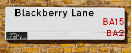
| Postcodes | ||
|---|---|---|
| Icon | Postcodes for Blackberry Lane | |
| Walking Distances | ||
| Distance Info | Green Circle = 10 Minutes Walk (800 metres) | |
Street Crime Data accessed from data.police.uk on 06/10/2024.
Moving to Blackberry Lane?
I can help you uncover potential pitfalls and provide key questions to ask about your new property. With decades of experience as a Local Land Charges Manager, I offer confidential insights to make your move informed and stress-free.
This service is free, but you may wish to make an optional donation to support it. Please include the property name and address in your request as well as anything you wish to focus on.
Contact Me
Do you know why this road is called Blackberry Lane?
What's it like to live here?
Share a Photo of Blackberry Lane
Ask the community a question.
Do you have any questions, memories to share, have any photos or know any facts? We'd love to know more.
Submit Your Comment

Budget Friendly Hotels near Blackberry Lane
| Budget Hotel Name | Distance (miles) |
|---|---|
|
1: Name:Travelodge Bath Waterside Address: Widcombe Basin, Rossiter Rd, Bath, BA2 4JP Telephone: 0871 984 6407 Visit Hotel Page |
2.71 |
|
2: Name:Travelodge Bath City Centre Bath Spa Address: 6-10 Westgate Buildings, Bath, BA1 1EB Telephone: 0871 984 6523 Visit Hotel Page |
3.15 |
|
3: Name:Premier Inn Bath City Centre Address: 4 James Street West Telephone: Visit Hotel Page |
3.25 |
|
4: Name:Travelodge Bath Central Address: 1, York Buildings, George St, Bath, BA1 2EB Telephone: 0871 984 6219 Visit Hotel Page |
3.28 |
|
5: Name:Holiday Inn Express Bath Address: Lower Bristol Road, Brougham Hayes, North East Somerset Telephone: Visit Hotel Page |
3.57 |
Hotel Options
Your support helps keep this site running!
If you enjoy using this website, consider making a donation to help me cover hosting costs.
Nearby Estate Agents
| Name | Address | Website |
|---|---|---|
| Aquarius Homes | 1a Avenue Place, Combe Down, Bath, BA2 5EE | Visit Website |
| Edwards Estates | Castle Farm Midford Road Midford Bath Banes BA2 7BU | Visit Website |
| TYNINGS | Isabella House The Avenue Combe Down Bath BA2 5EH | Visit Website |
| Jeremy Jenkins | 27 Market Street, Bradford-On-Avon, BA15 1LL | Visit Website |
| Geoffrey M Saxty | Georgian House, 14 St. Margarets Street, Bradford-On-Avon,BA15 1DA | Visit Website |
We have found 1 postcode
Neighbourhood Policing |
| Police Force: Wiltshire |
 View Neighbourhood Crime and Policing View Neighbourhood Crime and Policing |
| Find a Local Neighbourhood Watch Scheme |
Location Details
| Blackberry Lane | |
|---|---|

| |
| Latitude | 51.355440 |
| Longitude | -2.301532 |
| OS Easting (X): | 379005 |
| OS Northing (Y): | 161917 |
| OS Grid Reference: | ST790619 |
Roads that have a Junction with Blackberry Lane
| Street | Junction Type |
|---|
Sunset and Sunrise times
| Sunrise | 07:48 |
|---|---|
| Sunset | 16:55 |
Latest Weather Conditions
| Observed at Weather Station: | Lyneham 29 January 2025 at 19:00 (16.78 miles away) |
|---|---|
| Current Weather: | Overcast |
| Temperature and Humidity: | 4.4°C (91.2%) |
| Wind Direction and Speed: | (0 mph) |
Population Statistics
| ONS Area Code | E00163530 |
|---|---|
| ONS Area Name | Detached Rural Retirement |
| Average Age | 46.48 |
| Area Population | 1813.00 |
| Male Population | 869.00 (48%) |
| Female Population | 944.00 (52%) |
| Benefit Claimants | 11 (1%) |
| LSOA Code: | E01032059 |
|---|---|
| LSOA Name: | Wiltshire 023B |
| SOA Code: | 2b |
| SOA Name: | |
| MSOA Code: | E02006681 |
| MSOA Name: | Wiltshire 023 |
Nearest Supermarkets
| Sainsburys Bradford On Avon |
|---|
| Elm Cross Shopping Centre, Rowden Lane, Bradford-On-Avon, England, BA15 2AZ |
| 01225 864682 |
| Distance: 2.5 Miles |
| Directions to Sainsburys Bradford On Avon |
| Tesco Bathwick Hill Express |
|---|
| Bathwick Hill, Bath, BA2 4EN |
| 0345 675 7185 |
| Distance: 2.78 Miles |
| Directions to Tesco Bathwick Hill Express |
| Tesco Combe Down Esso Express |
|---|
| 100 Midford Rd, Combe Down, Bath, BA2 5RU |
| 0345 026 9043 |
| Distance: 2.88 Miles |
| Directions to Tesco Combe Down Esso Express |
| Sainsburys Bath Southgate Local |
|---|
| 2-4 Dorchester Street, Bath, England, BA1 1SS |
| 1225443799 |
| Distance: 2.93 Miles |
| Directions to Sainsburys Bath Southgate Local |
Telephone Information
| Area Code |
|---|
| Area Code: 01225 - Bath |
| Area Code: 01373 - Frome |
Local Government
| Local Council Details |
|---|
| Within the area of Wiltshire |
| Visit the Council's Website |
| County Hall, Bythesea Road, Trowbridge, Wiltshire &BA14 8JN |
| Send email |
| Telephone Number: 0300 456 0100 |
| Local Member of Parliament |
|---|
| Within the Westminster Parliamentary Constituency of Chippenham |
| The Member of Parliament is Brian Mathew |
| Details for the MP Brian Mathew on parliament.uk |
| Details for the MP Brian Mathew on theyworkforyou.com |
| In the 2024 General Election Brian Mathew won with a majority of 2,401 the result was LD gain from Con. The total electorate was 73,482 |
| Wards, Parish Councils and County Councils |
|---|
| Ward: Winsley & Westwood Ward |
| Ceremonial County: Wiltshire |
Nearest Schools
England Primary Schools
Winsley Church of England Voluntary Controlled Primary School
Address: Winsley Church of England Voluntary Controlled Primary School, Tyning Road, Winsley, Bradford-on-Avon, Wiltshire, BA15 2JN
Distance: 0.88 miles
Contact:
Nearest Hospitals
| Name | Address | Postcode | Distance | Map |
|---|
Nearest Dentists
Dentists
| Name | Address | Postcode | Distance | Map |
|---|
Nearest GP Surgeries
Doctors
WINSLEY / TYNING ROAD BRANCH SURGERY
Address: 73A TYNING ROAD, WINSLEY, BRADFORD-ON-AVON, WILTSHIRE, BA15 2JW
Distance: 0.79 miles
Contact: :
DR BROOKS, BECKINGTON/FRESHFORD
Address: FRESHFORD SURGERY, YOUNGHUSBAND HOUSE, FRESHFORD, BATH, AVON, BA2 7TT
Distance: 1.09 miles
Contact: :
COMBE DOWN SURGERY
Address: COMBE DOWN HOUSE, THE AVENUE, COMBE DOWN, BATH, AVON, BA2 5EG
Distance: 1.94 miles
Contact: tel: 01225 832226
UNIVERSITY MEDICAL CENTRE
Address: QUARRY HOUSE, NORTH ROAD, BATH, AVON, BA2 7AY
Distance: 1.99 miles
Contact: tel: 01225 789100
BRADFORD-ON-AVON AND MELKSHAM HEALTH
Address: STATION APPROACH, BRADFORD-ON-AVON, WILTSHIRE, BA15 1DQ
Distance: 2.20 miles
Contact: tel: 01225 866611
ST MARGARET'S SURGERY
Address: 29 BRIDGE STREET, BRADFORD-ON-AVON, WILTSHIRE, BA15 1BY
Distance: 2.30 miles
Contact: :
Nearest Dispensing Chemists
Pharmacies
| Name | Address | Postcode | Telephone | Map | Distance in Km |
|---|
Nearest Opticians
Opticians
NIXON AND SHAW OPTICIANS
Address: 4 CHURCH STREET, BRADFORD-ON-AVON, WILTSHIRE, BA15 1LN
Distance: 2.18 miles
Contact: :
CARTER AND HARDING BRADFORD ON AVON
Address: 9 THE SHAMBLES, BRADFORD-ON-AVON, WILTSHIRE, BA15 1JS
Distance: 2.26 miles
Contact: :
BOOTS OPTICIANS (BATH)
Address: MSU 1 THE SOUTHGATE CENTRE, BATH, AVON, BA1 1AT
Distance: 2.93 miles
Contact: :
KATHRYN ANTHONY OPTICIANS
Address: 16 PIERREPONT STREET, BATH, AVON, BA1 1LA
Distance: 2.96 miles
Contact: :
M&S OPTICIANS - BATH
Address: 16-18 STALL STREET, BATH, BA1 1QB
Distance: 3.01 miles
Contact: :
VISION EXPRESS (BATH)
Address: 53 SOUTHGATE, BATH, AVON, BA1 1TG
Distance: 3.01 miles
Contact: :
Transport
Nearest Rail Stations
Freshford Station is 0.93 miles away.
Address: Freshford station, Station Road, Freshford, Bath and North East Somerset, BA2 7WQ
Freshford is situated on the Heart of Wessex Line|Wessex Main Line and is managed by Great Western Railway.
Freshford Station is an unstaffed station.
Avoncliff Station is 1.40 miles away.
Address: Avoncliff station, un-named lane off Belcombe Road, Avoncliff, Wiltshire, BA15 2HD
Avoncliff is situated on the Heart of Wessex Line|Wessex Main Line and is managed by Great Western Railway.
Avoncliff Station is an unstaffed station.