Bratton Road is a street located in the village of West Ashton and near the village of West Ashton. The street has a length of approximately 4,471 metres.
The street is located within the Wiltshire Council's jurisdiction. They provide various services, like refuse collection, and manage council tax collection. It's situated in the South West region of the UK.
The road has been assigned the Unique Street Reference Numbers of 43801215, 44200744 and 43801357 in the National Street Gazetteer.
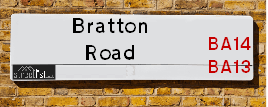
The street has the postcodes of BA14 6BD, BA14 6AZ, BA14 6AY and BA14 6AX.
It is located within the county of Wiltshire, situated in the South West region of the UK. It's 89.64 miles West from central London., 3.12 miles South East from Trowbridge, 21.87 miles North West from Salisbury and 22.13 miles South East from Bristol.
Map of Bratton Road
| Postcodes | ||
|---|---|---|
| Icon | Postcodes for Bratton Road | |
| Walking Distances | ||
| Distance Info | Green Circle = 10 Minutes Walk (800 metres) | |
Street Crime Data accessed from data.police.uk on 06/10/2024.
Moving to Bratton Road?
I can help you uncover potential pitfalls and provide key questions to ask about your new property. With decades of experience as a Local Land Charges Manager, I offer confidential insights to make your move informed and stress-free.
This service is free, but you may wish to make an optional donation to support it. Please include the property name and address in your request as well as anything you wish to focus on.
Contact Me
Do you know why this road is called Bratton Road?
What's it like to live here?
Share a Photo of Bratton Road
Ask the community a question.
Do you have any questions, memories to share, have any photos or know any facts? We'd love to know more.
Submit Your Comment

Budget Friendly Hotels near Bratton Road
| Budget Hotel Name | Distance (miles) |
|---|---|
|
1: Name:Premier Inn Trowbridge Address: St Stephens Place Telephone: Visit Hotel Page |
2.99 |
|
2: Name:Travelodge Melksham Address: Commerce Way, Melksham, SN12 6AD Telephone: 0871 984 8484 Visit Hotel Page |
4.53 |
|
3: Name:Travelodge Warminster Address: A36/A350 Bypass, Service Area, Bath Rd, Warminster, BA12 7RU Telephone: 0871 984 6058 Visit Hotel Page |
5.37 |
|
4: Name:Travelodge Beckington Address: Trowbridge Road, Frome, BA11 6SF Telephone: 0871 984 6220 Visit Hotel Page |
5.82 |
|
5: Name:Premier Inn Frome Address: Commerce Park Telephone: Visit Hotel Page |
6.71 |
Hotel Options
Your support helps keep this site running!
If you enjoy using this website, consider making a donation to help me cover hosting costs.
Nearby Estate Agents
| Name | Address | Website |
|---|---|---|
| Daykin Estates | Unit 4 Commerce Close, Westbury, BA13 4FZ | Visit Website |
| Sandoes | Smallbrook House, Edward Street, Westbury, BA13 3BQ | Visit Website |
| The Frome Letting Centre LTD | 24 Warminster Road Westbury BA13 3PE | Visit Website |
| Allen & Harris | 15a Warminster Road, Westbury, Wiltshire, BA13 3PD | |
| Paxtons | 15 Hackett Place, Hilperton, Trowbridge, BA14 7GW | Visit Website |
Neighbourhood Policing |
| Police Force: Wiltshire |
 View Neighbourhood Crime and Policing View Neighbourhood Crime and Policing |
| Find a Local Neighbourhood Watch Scheme |
Location Details
| Bratton Road | |
|---|---|

| |
| Latitude | 51.289996 |
| Longitude | -2.153975 |
| OS Easting (X): | 389264 |
| OS Northing (Y): | 154607 |
| OS Grid Reference: | ST893546 |
Roads that have a Junction with Bratton Road
| Street | Junction Type |
|---|---|
| West Ashton Road | junction |
| Orchard Close | junction |
| Shepherds Drove | junction |
| East Town Road | junction |
Sunset and Sunrise times
| Sunrise | 07:42 |
|---|---|
| Sunset | 17:02 |
Latest Weather Conditions
| Observed at Weather Station: | Lyneham 2 February 2025 at 17:00 (16.29 miles away) |
|---|---|
| Current Weather: | Clear night |
| Temperature and Humidity: | 5.5°C (59.7%) |
| Wind Direction and Speed: | (0 mph) |
Population Statistics
| ONS Area Code | E00166340 & E00166417 |
|---|---|
| ONS Area Name | Rural White-Collar Workers & Ageing in Suburbia |
| Average Age | 45.35 |
| Area Population | 2569.00 |
| Male Population | 1212.00 (47%) |
| Female Population | 1357.00 (53%) |
| Benefit Claimants | 10 (0%) |
| LSOA Code: | E01032084 |
|---|---|
| LSOA Name: | Wiltshire 037C |
| SOA Code: | 2b |
| SOA Name: | |
| MSOA Code: | E02006689 |
| MSOA Name: | Wiltshire 037 |
Nearest Supermarkets
| Tesco Westbury Fore St Express |
|---|
| Fore St, Westbury, Wiltshire, BA13 3AY |
| 0345 674 6451 |
| Distance: 2.15 Miles |
| Directions to Tesco Westbury Fore St Express |
| Morrisons Westbury |
|---|
| 42 Edward Street, Westbury BA13 3BL |
| 01373 865950 |
| Distance: 2.44 Miles |
| Directions to Morrisons Westbury |
| Tesco Trowbridge Extra |
|---|
| County Way, Trowbridge, BA14 7AQ |
| 0345 677 9685 |
| Distance: 2.8 Miles |
| Directions to Tesco Trowbridge Extra |
| Tesco Trowbridge Eastbourne Rd Express |
|---|
| 54 Eastbourne Rd, Trowbridge, BA14 7HW |
| 0345 026 9125 |
| Distance: 3.04 Miles |
| Directions to Tesco Trowbridge Eastbourne Rd Express |
Telephone Information
| Dialling Code | Telephone Exchange | Telephone Cabinet | Fibre to the Cabinet or Fibre to the Premises |
|---|---|---|---|
| 01225 | TROWBRIDGE - SSTRO | P11 | FTTC |
Local Government
| Local Council Details |
|---|
| Within the area of Wiltshire |
| Visit the Council's Website |
| County Hall, Bythesea Road, Trowbridge, Wiltshire &BA14 8JN |
| Send email |
| Telephone Number: 0300 456 0100 |
| Local Member of Parliament |
|---|
| Within the Westminster Parliamentary Constituency of South West Wiltshire |
| The Member of Parliament is Andrew Murrison |
| Details for the MP Andrew Murrison on parliament.uk |
| Details for the MP Andrew Murrison on theyworkforyou.com |
| In the 2024 General Election Andrew Murrison won with a majority of 3,243 the result was Con hold. The total electorate was 73,071 |
| Wards, Parish Councils and County Councils |
|---|
| Ward: Southwick Ward |
| Ceremonial County: Wiltshire |
Nearest Schools
England Primary Schools
Castle Mead School
Address: Castle Mead School, Mascroft Road, Hilperton, Trowbridge, Wiltshire, BA14 6GD
Distance: 2.28 miles
Contact: 01225768641
West Ashton Church of England Primary School
Address: West Ashton Church of England Primary School, 29 Bratton Road, West Ashton, Trowbridge, Wiltshire, BA14 6AZ
Distance: 1.07 miles
Contact: 01225754354
West Ashton Church of England Voluntary Aided Primary School
Address: West Ashton Church of England Voluntary Aided Primary School, Bratton Road, West Ashton, Trowbridge, Wiltshire, BA14 6AZ
Distance: 1.07 miles
Contact:
Nearest Hospitals
| Name | Address | Postcode | Distance | Map |
|---|
Nearest Dentists
Dentists
| Name | Address | Postcode | Distance | Map |
|---|
Nearest GP Surgeries
Doctors
BRATTON SURGERY
Address: THE TYNNINGS, BRATTON, WESTBURY, WILTSHIRE, BA13 4RR
Distance: 1.90 miles
Contact: tel: 01380 830249
LOVEMEAD GROUP PRACTICE
Address: ROUNDSTONE SURGERY, POLEBARN CIRCUS, TROWBRIDGE, WILTSHIRE, BA14 7EH
Distance: 2.89 miles
Contact: tel: 01225 759850
TROWBRIDGE HEALTH CENTRE
Address: TROWBRIDGE HEALTH CENTRE, PROSPECT PLACE, TROWBRIDGE, WILTSHIRE, BA14 8QA
Distance: 3.34 miles
Contact: tel: 01225 435757
THE WHITE HORSE HEALTH CENTRE - COVID LOCAL VACCINATION SERVICE 2
Address: MANE WAY, WESTBURY, BA13 3FQ
Distance: 3.35 miles
Contact: :
WESTBURY GROUP PRACTICE
Address: WHITE HORSE HEALTH CENTRE, MANE WAY, LEIGH PARK, WESTBURY, WILTSHIRE, BA13 3FQ
Distance: 3.35 miles
Contact: tel: 01373 828330
BRADFORD ROAD MEDICAL CTR
Address: 60 BRADFORD ROAD, TROWBRIDGE, WILTSHIRE, BA14 9AR
Distance: 3.45 miles
Contact: :
Nearest Dispensing Chemists
Pharmacies
| Name | Address | Postcode | Telephone | Map | Distance in Km |
|---|
Nearest Opticians
Opticians
HAINE AND SMITH OPTICIANS (WESTBURY)
Address: 19 HIGH STREET, WESTBURY, WILTSHIRE, BA13 3BN
Distance: 2.41 miles
Contact: :
TROWBRIDGE EXTRA
Address: COUNTY WAY, TROWBRIDGE, WILTSHIRE, BA14 7AQ
Distance: 2.80 miles
Contact: :
R D WHITE OPTICIANS
Address: 38 ROUNDSTONE STREET, TROWBRIDGE, WILTSHIRE, BA14 8DE
Distance: 3.09 miles
Contact: :
BOOTS OPTICIANS (TROWBRIDGE)
Address: 28-29 FORE STREET, TROWBRIDGE, WILTSHIRE, BA14 8EW
Distance: 3.13 miles
Contact: :
HAINE AND SMITH OPTICIANS (TROWBRIDGE)
Address: 5A THE SHIRES, TROWBRIDGE, WILTSHIRE, BA14 8AT
Distance: 3.17 miles
Contact: :
SPECSAVERS (TROWBRIDGE)
Address: 23 THE SHIRES, TROWBRIDGE, WILTSHIRE, BA14 8AT
Distance: 3.17 miles
Contact: :
Transport
Nearest Rail Stations
Westbury Station is 2.52 miles away.
Address: Westbury station, Station Approach, Westbury, Wiltshire, BA13 4HP
Westbury is situated on the Reading to Taunton Line|Heart of Wessex Line|Wessex Main Line and is managed by Great Western Railway.
Westbury Station is staffed on a full time basis.
Trowbridge Station is 3.32 miles away.
Address: Trowbridge station, Stallard Street, Trowbridge, Wiltshire, BA14 8HW
Trowbridge is situated on the Heart of Wessex Line|Wessex Main Line and is managed by Great Western Railway.
Trowbridge Station is staffed on a part time basis.