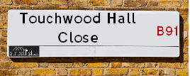
About Touchwood Hall Close
Touchwood Hall Close is a street located in the town of Solihull. It uses the postcode B91 2UE. The street has a length of approximately 278 metres.
The street is located within the Solihull District (B) Council's jurisdiction. They provide various services, like refuse collection, and manage council tax collection. It's situated in the West Midlands region of the UK.
The road has been assigned the Unique Street Reference Number of 35002348 in the National Street Gazetteer.
It is located within the county of West Midlands, situated in the West Midlands region of the UK. It's 95.4 miles North West from central London., 6.75 miles South East from Birmingham, 11.41 miles West from Coventry and 24.27 miles North East from Worcester.

Do you know why this road is called Touchwood Hall Close?
What's it like to live here?
Ask the community a question.
Do you have any questions, memories to share or know any facts? We'd love to know more.
Map of Touchwood Hall Close
| Postcodes | ||
|---|---|---|
| Icon | Postcodes for Touchwood Hall Close | |
| Walking Distances | ||
| Distance Info | Green Circle = 10 Minutes Walk (800 metres) | |
Nearby Estate Agents
| Name | Address | Website |
|---|---|---|
| Dixons | 70 Poplar Road, Solihull, West Midlands, B91 3AB | |
| Dixons Lettings | 70 Poplar Road, Solihull, B91 3AB | Visit Website |
| Burchell Edwards | Doubleday House, 29 High Street, Solihull, B91 3SN | Visit Website |
We have found 1 postcode
Neighbourhood Policing |
| Police Force: West Midlands |
 View Neighbourhood Crime and Policing View Neighbourhood Crime and Policing |
| Find a Local Neighbourhood Watch Scheme |
Location Details
| Touchwood Hall Close | |
|---|---|

| |
| Latitude | 52.416562 |
| Longitude | -1.778669 |
| OS Easting (X): | 415051 |
| OS Northing (Y): | 279905 |
| OS Grid Reference: | SP151799 |
Roads that have a Junction with Touchwood Hall Close
| Street | Junction Type |
|---|---|
| Lode Lane (B425) | junction |
Sunset and Sunrise times
| Sunrise | 06:50 |
|---|---|
| Sunset | 19:09 |
Latest Weather Conditions
| Observed at Weather Station: | Coleshill 20 September 2024 at 21:00 (5.79 miles away) |
|---|---|
| Current Weather: | Mist |
| Temperature and Humidity: | 15.3°C (89.5%) |
| Wind Direction and Speed: | NNE (8 mph) |
Population Statistics
| ONS Area Code | E00051710 |
|---|---|
| ONS Area Name | Communal Retirement |
| Average Age | 52.85 |
| Area Population | 1604.00 |
| Male Population | 703.00 (44%) |
| Female Population | 901.00 (56%) |
| Benefit Claimants | 9 (1%) |
| LSOA Code: | E01010226 |
|---|---|
| LSOA Name: | Solihull 016B |
| SOA Code: | 3c |
| SOA Name: | |
| MSOA Code: | E02002096 |
| MSOA Name: | Solihull 016 |
Nearest Supermarkets
| Sainsburys Solihull |
|---|
| 11 Poplar Way, Solihull, England, B91 3BX |
| 0121 704 2402 |
| Distance: 0.17 Miles |
| Directions to Sainsburys Solihull |
| Tesco Solihull High Street Express |
|---|
| 1-3 High Street, Solihull, B91 3SJ |
| 0345 610 6779 |
| Distance: 0.18 Miles |
| Directions to Tesco Solihull High Street Express |
| Waitrose Solihull |
|---|
| 29 Homer Road, Solihull, West Midlands, B91 3QG |
| 0121 704 0455 |
| Distance: 0.3 Miles |
| Directions to Waitrose Solihull |
| Morrisons Solihull |
|---|
| George Road, Solihull B91 3BQ |
| 0121 7090680 |
| Distance: 0.32 Miles |
| Directions to Morrisons Solihull |
Telephone Information
| Dialling Code | Telephone Exchange | Telephone Cabinet | Fibre to the Cabinet or Fibre to the Premises |
|---|---|---|---|
| 0121 | SOLIHULL - CMSOL | P49 | FTTC |
Broadband Information
| Speed | Average Speed | Median Speed | Maximum Speed | Next-generation access (NGA) | Number of Connections |
|---|---|---|---|---|---|
| Less than 2 Mbps | 23.1 | 20 | >=30 | Y | 41 |
Local Government
| Local Council Details |
|---|
| Within the area of Solihull |
| Visit the Council's Website |
| PO Box 18, Council House, Solihull, West Midlands &B91 3QS |
| Send email |
| Telephone Number: 0121 704 6000 |
| Local Member of Parliament |
|---|
| Within the Westminster Parliamentary Constituency of Solihull |
| The Member of Parliament is Saqib Bhatti |
| Details for the MP Saqib Bhatti on parliament.uk |
| Details for the MP Saqib Bhatti on theyworkforyou.com |
| In the 2024 General Election Saqib Bhatti won with a majority of 4,584 the result was Con hold. The total electorate was 73,659 |
| Wards, Parish Councils and County Councils |
|---|
| Ward: Silhill Ward |
| Ceremonial County: West Midlands |
Nearest Schools
England Primary Schools
Coppice Junior School
Address: Coppice Junior School, Coppice Road, Solihull, West Midlands, B92 9JY
Distance: 1.13 miles
Contact:
Damson Wood Nursery and Infant School
Address: Damson Wood Nursery and Infant School, Stockwell Rise, Solihull, West Midlands, B92 9LX
Distance: 1.11 miles
Contact: 01217058652
Damson Wood Nursery and Infant School
Address: Damson Wood Nursery and Infant School, Stockwell Rise, Solihull, West Midlands, B92 9LX
Distance: 1.11 miles
Contact:
Yew Tree Primary School
Address: Yew Tree Primary School, Wherretts Well Lane, Solihull, West Midlands, B91 2SD
Distance: 0.77 miles
Contact:
St Alphege Church of England Junior School
Address: St Alphege Church of England Junior School, Widney Manor Road, Solihull, West Midlands, B91 3JG
Distance: 0.78 miles
Contact: 01217042714
St Alphege Church of England Infant and Nursery School
Address: St Alphege Church of England Infant and Nursery School, New Road, Solihull, West Midlands, B91 3DW
Distance: 0.42 miles
Contact: 01217050443
Greswold Primary School
Address: Greswold Primary School, Buryfield Road, Solihull, West Midlands, B91 2AZ
Distance: 0.50 miles
Contact: 01217054738
Ulverley School
Address: Ulverley School, Rodney Road, Solihull, West Midlands, B92 8RZ
Distance: 1.38 miles
Contact:
St Andrew's Catholic Primary School
Address: St Andrew's Catholic Primary School, Windrush Close, Solihull, West Midlands, B92 8QL
Distance: 1.89 miles
Contact:
St Augustine's Catholic Primary School
Address: St Augustine's Catholic Primary School, Whitefields Road, Solihull, West Midlands, B91 3NZ
Distance: 0.88 miles
Contact:
Oak Cottage Primary School
Address: Oak Cottage Primary School, Greswolde Road, Solihull, West Midlands, B91 1DY
Distance: 1.21 miles
Contact: 01217049123
Sharmans Cross Junior School
Address: Sharmans Cross Junior School, Sharmans Cross Road, Solihull, West Midlands, B91 1PH
Distance: 1.18 miles
Contact: 01217052379
Widney Junior School
Address: Widney Junior School, Clifton Crescent, Solihull, West Midlands, B91 3LQ
Distance: 1.48 miles
Contact: 01217058516
Blossomfield Infant and Nursery School
Address: Blossomfield Infant and Nursery School, Eastcote Close, Shirley, Solihull, West Midlands, B90 3QX
Distance: 1.60 miles
Contact: 01217445522
Langley Primary School
Address: Langley Primary School, St Bernard's Road, Olton, Solihull, West Midlands, B92 7DJ
Distance: 1.53 miles
Contact:
Cranmore Infant School
Address: Cranmore Infant School, Northland Road, Shirley, Solihull, West Midlands, B90 4SA
Distance: 1.54 miles
Contact: 01217053443
Our Lady of Compassion Catholic Primary School
Address: Our Lady of Compassion Catholic Primary School, Kineton Green Road, Solihull, West Midlands, B92 7EG
Distance: 1.74 miles
Contact:
Streetsbrook Infant and Early Years Academy
Address: Streetsbrook Infant and Early Years Academy, Ralph Road, Shirley, Solihull, West Midlands, B90 3LB
Distance: 1.63 miles
Contact: 01217445245
Streetsbrook Infant and Nursery School
Address: Streetsbrook Infant and Nursery School, Ralph Road, Shirley, Solihull, West Midlands, B90 3LB
Distance: 1.63 miles
Contact:
England Higher Schools
Solihull Sixth Form College
Address: Solihull Sixth Form College, Widney Manor Road, Solihull, West Midlands, B91 3WR
Distance: 0.78 miles
Contact: 01217042581
Solihull College & University Centre
Address: Solihull College & University Centre, Blossomfield Campus, Blossomfield Road, Solihull, West Midlands, B91 1SB
Distance: 0.75 miles
Contact: 01216787000
England Secondary Schools
Lode Heath School
Address: Lode Heath School, Lode Lane, Solihull, West Midlands, B91 2HW
Distance: 0.62 miles
Contact: 01217041421
St Peter's Catholic School
Address: St Peter's Catholic School, Whitefields Road, Solihull, West Midlands, B91 3NZ
Distance: 0.88 miles
Contact:
Tudor Grange Academy, Solihull
Address: Tudor Grange Academy, Solihull, Dingle Lane, Solihull, West Midlands, B91 3PD
Distance: 1.05 miles
Contact: 01217055100
Alderbrook School
Address: Alderbrook School, Blossomfield Road, Solihull, West Midlands, B91 1SN
Distance: 1.06 miles
Contact: 01217042146
Langley School
Address: Langley School, Kineton Green Road, Olton, Solihull, West Midlands, B92 7ER
Distance: 1.63 miles
Contact: 01217069771
Nearest Hospitals
| Name | Address | Postcode | Distance | Map |
|---|
Nearest Dentists
Dentists
| Name | Address | Postcode | Distance | Map |
|---|
Nearest GP Surgeries
Doctors
SOLIHULL HEALTHCARE PARTNERSHIP
Address: GROVE SURGERY, 3 GROVE ROAD, SOLIHULL, WEST MIDLANDS, B91 2AG
Distance: 0.26 miles
Contact: tel: 0121 7051105
YEW TREE MEDICAL CENTRE
Address: 100 YEW TREE LANE, SOLIHULL, WEST MIDLANDS, B91 2RA
Distance: 0.65 miles
Contact: :
BLOSSOMFIELD SURGERY
Address: 308 BLOSSOMFIELD ROAD, SOLIHULL, B91 1TF
Distance: 1.52 miles
Contact: :
MONKSPATH SURGERY - COVID LOCAL VACCINATION SERVICE 2
Address: FARMHOUSE WAY, SHIRLEY, SOLIHULL, B90 4EH
Distance: 1.76 miles
Contact: :
MONKSPATH SURGERY
Address: FARMHOUSE WAY, SHIRLEY, SOLIHULL, B90 4EH
Distance: 1.76 miles
Contact: :
NORTHBROOK HEALTH CENTRE
Address: 93 NORTHBROOK ROAD, SHIRLEY, SOLIHULL, WEST MIDLANDS, B90 3LX
Distance: 1.81 miles
Contact: tel: 0121 7465000
Nearest Dispensing Chemists
Pharmacies
| Name | Address | Postcode | Telephone | Map | Distance in Km |
|---|
Nearest Opticians
Opticians
Transport
Nearest Rail Stations
Solihull Station is 0.44 miles away.
Address: Solihull station, Station Approach, Solihull, West Midlands, B91 1LE
Solihull is situated on the Chiltern Main Line and is managed by Chiltern Railway.
Solihull Station is an unstaffed station.
Widney Manor Station is 1.44 miles away.
Address: Widney Manor station, Widney Manor Road, Solihull, West Midlands, B91 3JW
Widney Manor is situated on the Chiltern Main Line.
Widney Manor Station is staffed on a part time basis.