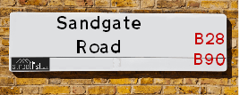
Sandgate Road is a street located in the city of Birmingham. The street has a length of approximately 616 metres.
The street is publicly maintained which means that the road is adopted and Solihull is responsible for the repair and upkeep of the highway.
The street is located within the Birmingham District (B) and Solihull District (B) Council's jurisdiction. They provide various services, like refuse collection, and manage council tax collection. It's situated in the West Midlands region of the UK.
The road has been assigned the Unique Street Reference Number of 2705548 and 35006572 in the National Street Gazetteer.
The street has the postcodes of B28 0UW, B28 0UN, B28 0UL and B28 0UJ.
It is located within the county of West Midlands, situated in the West Midlands region of the UK. It's 97.23 miles North West from central London., 5.16 miles South East from Birmingham, 13.82 miles West from Coventry and 22.44 miles North East from Worcester.
SANDGATE ROAD is within the Post Town of
Map of Sandgate Road
| Street Crime (updated 14/01/2025) | ||
|---|---|---|
| Location Note | Central Point of Street - Not Actual Location | |
| MSOA Info | For MSOA E02006807 (Statistical Neighbourhood) | |
| Click Hint | Click on a Circle for a detailed breakdown below map. | |
| Crime Levels |
Green = Very Low Yellow = Low Orange = High Red = Very High |
|
| Postcodes | ||
| Icon | Postcodes for Sandgate Road | |
| Walking Distances | ||
| Distance Info | Green Circle = 10 Minutes Walk (800 metres) | |
Street Crime Data accessed from data.police.uk on 06/10/2024.
Moving to Sandgate Road?
I can help you uncover potential pitfalls and provide key questions to ask about your new property. With decades of experience as a Local Land Charges Manager, I offer confidential insights to make your move informed and stress-free.
This service is free, but you may wish to make an optional donation to support it. Please include the property name and address in your request as well as anything you wish to focus on.
Contact Me
Do you know why this road is called Sandgate Road?
What's it like to live here?
Share a Photo of Sandgate Road
Ask the community a question.
Do you have any questions, memories to share, have any photos or know any facts? We'd love to know more.
Submit Your Comment
Find Homes to Rent in Birmingham

Find Homes to Rent in Shirley
Budget Friendly Hotels near Sandgate Road
| Budget Hotel Name | Distance (miles) |
|---|---|
|
1: Name:Premier Inn Birmingham South Hall Green Address: Stratford Road Telephone: Visit Hotel Page |
0.44 |
|
2: Name:Travelodge Birmingham Maypole Address: Maypole Lane, Birmingham, B14 5JF Telephone: 0871 559 1896 Visit Hotel Page |
2.26 |
|
3: Name:Premier Inn Solihull Town Centre Address: Station Road Telephone: Visit Hotel Page |
2.27 |
|
4: Name:Premier Inn Solihull South M42 Address: Stratford Road Telephone: Visit Hotel Page |
2.61 |
|
5: Name:Holiday Inn Express Birmingham�South A45 Address: 1270 Coventry Road, Yardley Telephone: Visit Hotel Page |
3.25 |
Hotel Options
Your support helps keep this site running!
If you enjoy using this website, consider making a donation to help me cover hosting costs.
House Sales
| Year | High | Low | Average | Sales |
|---|---|---|---|---|
| 2014 | £142,100 | £203,000 | £191,605 | 10 |
| 2015 | £271,000 | £230,000 | £220,667 | 3 |
| 2016 | £186,000 | £177,450 | £194,992 | 6 |
| 2017 | £243,000 | £242,250 | £242,625 | 2 |
| 2018 | £275,000 | £246,000 | £260,500 | 2 |
| 2019 | £235,000 | £234,950 | £241,590 | 5 |
| 2020 | £265,000 | £283,000 | £256,500 | 7 |
| 2021 | £268,000 | £325,000 | £251,071 | 7 |
| 2022 | £415,000 | £64,500 | £289,124 | 5 |
| 2023 | £325,000 | £325,000 | £325,000 | 1 |
| 2024 | £437,500 | £260,000 | £317,500 | 3 |
Contains HM Land Registry data © Crown copyright and database right 2025. This data is licensed under the Open Government Licence v3.0.
Nearby Estate Agents
| Name | Address | Website |
|---|---|---|
| Partridge Homes | 120a Haslucks Green Road, Shirley, Solihull, B90 2EH | Visit Website |
| Clive Tanner Wyatts | Highfield House 1562-1564 Stratford Road Hall Green Solihull B28 9HA | Visit Website |
| Red Brick Sales & Lettings - Solihull, Solihull | 63 Haslucks Green Road, Shirley, Solihull, B90 2ED | |
| Black & Golds Estate Agents | 117 Stratford Road Shirley Solihull B90 3ND | Visit Website |
| Northwood | 115 Stratford Road Shirley B90 3ND | Visit Website |
Neighbourhood Policing |
| Police Force: West Midlands |
 View Neighbourhood Crime and Policing View Neighbourhood Crime and Policing |
| Find a Local Neighbourhood Watch Scheme |
Location Details
| Sandgate Road | |
|---|---|

| |
| Latitude | 52.416226 |
| Longitude | -1.835872 |
| OS Easting (X): | 411161 |
| OS Northing (Y): | 279857 |
| OS Grid Reference: | SP112799 |
Known Residential Addresses for Sandgate Road
- 119
- 109
- 121
- 107
- 87
- 99
- 153
- 147
- 75
- 116
- 104
- 94
- 126
- 54
- 102
- 50
- 108
- 110
- 92
- 88
- 114
- 76
- 9
- 39
- 12
- 67
- 5
- 37
- 49
- 19
- 11
- 7
- 36
- 93
- 139
- 141
- 149
- 72
- 62
- 74
- 53
- 32
Roads that have a Junction with Sandgate Road
| Street | Junction Type |
|---|---|
| Sandy Hill Road | junction |
| Blythsford Road | junction |
| Blythsford Road | junction |
Sunset and Sunrise times
| Sunrise | 08:04 |
|---|---|
| Sunset | 16:30 |
Latest Weather Conditions
| Observed at Weather Station: | Coleshill 18 January 2025 at 02:00 (7.59 miles away) |
|---|---|
| Current Weather: | Overcast |
| Temperature and Humidity: | 3.0°C (87.1%) |
| Wind Direction and Speed: | SSW (2 mph) |
Population Statistics
| ONS Area Code | E00045831, E00045833 & E00045829 |
|---|---|
| ONS Area Name | Multi-Ethnic Suburbia & Achieving Minorities |
| Average Age | 38.19 |
| Area Population | 1661.00 |
| Male Population | 827.00 (50%) |
| Female Population | 834.00 (50%) |
| Benefit Claimants | 20 (1%) |
| LSOA Code: | E01009041 |
|---|---|
| LSOA Name: | Birmingham 132C |
| SOA Code: | 3b |
| SOA Name: | |
| MSOA Code: | E02006807 |
| MSOA Name: | Birmingham 132 |
Nearest Supermarkets
| Tesco Hall Green Superstore |
|---|
| 21-35 Stratford Rd, Shirley, Solihull, B90 3LU |
| 0345 677 9325 |
| Distance: 0.3 Miles |
| Directions to Tesco Hall Green Superstore |
| Asda Shirley |
|---|
| Parkgate, Stratford Road, Shirley, Solihull, B90 3GG |
| 0121 296 3731 |
| Distance: 0.36 Miles |
| Directions to Asda Shirley |
| Iceland Shirley (b-ham) |
|---|
| 267/271 Stratford Road, Shirley, Birmingham, B90 3AL |
| 01217331255 |
| Distance: 0.55 Miles |
| Directions to Iceland Shirley (b-ham) |
| Tesco Robin Hood Express |
|---|
| 200 Robin Hood Ln, Birmingham, B28 0LG |
| 0345 671 9362 |
| Distance: 0.76 Miles |
| Directions to Tesco Robin Hood Express |
Telephone Information
| Dialling Code | Telephone Exchange | Telephone Cabinet | Fibre to the Cabinet or Fibre to the Premises |
|---|---|---|---|
| 0121 | SHIRLEY; WEST MIDLANDS - CMSHI | P29 | FTTC |
Broadband Information
| Speed | Average Speed | Median Speed | Maximum Speed | Next-generation access (NGA) | Number of Connections |
|---|---|---|---|---|---|
| Greater than 2 Mbps | >=30 | 25 | >=30 | Y | 8 |
Local Government
| Local Council Details |
|---|
| Within the area of Birmingham |
| Visit the Council's Website |
| Council House, Victoria Square, Birmingham &B1 1BB |
| Send email |
| Telephone Number: 0121 303 1111 |
| Local Member of Parliament |
|---|
| Within the Westminster Parliamentary Constituency of Birmingham &Hall Green |
| The Member of Parliament is Tahir Ali |
| Details for the MP Tahir Ali on parliament.uk |
| Details for the MP Tahir Ali on theyworkforyou.com |
| In the 2024 General Election Tahir Ali won with a majority of 5,656 the result was Lab hold. The total electorate was 76,936 |
| Wards, Parish Councils and County Councils |
|---|
| Ward: Hall Green South Ward |
| Parish: Unparished area |
| Ceremonial County: West Midlands |
Nearest Schools
England Primary Schools
Lakey Lane Junior and Infant School
Address: Lakey Lane Junior and Infant School, Lakey Lane, Hall Green, Birmingham, West Midlands, B28 8RY
Distance: 1.05 miles
Contact: 01214641990
St Ambrose Barlow Catholic Primary School
Address: St Ambrose Barlow Catholic Primary School, 841 Shirley Road, Hall Green, Birmingham, West Midlands, B28 9JJ
Distance: 0.54 miles
Contact: 01214642791
Chilcote Primary School
Address: Chilcote Primary School, Chilcote Close, Birmingham, West Midlands, B28 0PB
Distance: 0.39 miles
Contact: 01217445678
Hall Green Junior School
Address: Hall Green Junior School, Stratford Road, Hall Green, Birmingham, West Midlands, B28 9AJ
Distance: 1.10 miles
Contact: 01214643840
Hall Green Infant School
Address: Hall Green Infant School, Petersfield Road, Hall Green, Birmingham, West Midlands, B28 0AR
Distance: 1.17 miles
Contact: 01214643082
Our Lady of Lourdes Catholic Primary School
Address: Our Lady of Lourdes Catholic Primary School, Trittiford Road, Yardley Wood, Birmingham, West Midlands, B13 0EU
Distance: 1.09 miles
Contact: 01214442684
Yardley Wood Community Primary School
Address: Yardley Wood Community Primary School, School Road, Yardley Wood, Birmingham, West Midlands, B14 4ER
Distance: 1.12 miles
Contact: 01216752456
Sharmans Cross Junior School
Address: Sharmans Cross Junior School, Sharmans Cross Road, Solihull, West Midlands, B91 1PH
Distance: 1.25 miles
Contact: 01217052379
Widney Junior School
Address: Widney Junior School, Clifton Crescent, Solihull, West Midlands, B91 3LQ
Distance: 1.80 miles
Contact: 01217058516
Blossomfield Infant and Nursery School
Address: Blossomfield Infant and Nursery School, Eastcote Close, Shirley, Solihull, West Midlands, B90 3QX
Distance: 0.92 miles
Contact: 01217445522
Langley Primary School
Address: Langley Primary School, St Bernard's Road, Olton, Solihull, West Midlands, B92 7DJ
Distance: 1.16 miles
Contact:
Cranmore Infant School
Address: Cranmore Infant School, Northland Road, Shirley, Solihull, West Midlands, B90 4SA
Distance: 1.63 miles
Contact: 01217053443
Our Lady of Compassion Catholic Primary School
Address: Our Lady of Compassion Catholic Primary School, Kineton Green Road, Solihull, West Midlands, B92 7EG
Distance: 1.43 miles
Contact:
Streetsbrook Infant and Early Years Academy
Address: Streetsbrook Infant and Early Years Academy, Ralph Road, Shirley, Solihull, West Midlands, B90 3LB
Distance: 0.79 miles
Contact: 01217445245
Streetsbrook Infant and Nursery School
Address: Streetsbrook Infant and Nursery School, Ralph Road, Shirley, Solihull, West Midlands, B90 3LB
Distance: 0.79 miles
Contact:
Our Lady of the Wayside Catholic Primary School
Address: Our Lady of the Wayside Catholic Primary School, Stratford Road, Shirley, Solihull, West Midlands, B90 4AY
Distance: 1.39 miles
Contact:
Shirley Heath Junior School
Address: Shirley Heath Junior School, Coombe Road, Shirley, Solihull, West Midlands, B90 3DS
Distance: 1.09 miles
Contact: 01217441339
Woodlands Infant School
Address: Woodlands Infant School, Woodlands Lane, Shirley, Solihull, West Midlands, B90 2PX
Distance: 1.24 miles
Contact: 01217442840
Robin Hood Academy
Address: Robin Hood Academy, Pitmaston Road, Hall Green, Birmingham, West Midlands, B28 9PP
Distance: 0.67 miles
Contact: 01214642187
Tudor Grange Primary Academy, St James
Address: Tudor Grange Primary Academy, St James, Halifax Road, Shirley, Solihull, B90 2BT
Distance: 0.65 miles
Contact: 01217447897
Haslucks Green School
Address: Haslucks Green School, Haslucks Green Road, Shirley, Solihull, West Midlands, B90 2EJ
Distance: 0.29 miles
Contact: 01217442088
Burman Infant School
Address: Burman Infant School, Velsheda Road, Shirley, Solihull, West Midlands, B90 2JW
Distance: 0.66 miles
Contact: 01217441843
Mill Lodge Primary School
Address: Mill Lodge Primary School, Aqueduct Road, Shirley, Solihull, West Midlands, B90 1BT
Distance: 0.97 miles
Contact: 01214303010
Billesley Primary School
Address: Billesley Primary School, Trittiford Road, Billesley, Birmingham, West Midlands, B13 0ES
Distance: 1.53 miles
Contact: 01216752800
Peterbrook Primary School
Address: Peterbrook Primary School, High Street, Solihull Lodge, Shirley, Solihull, West Midlands, B90 1HR
Distance: 1.16 miles
Contact: 01214302545
England Secondary Schools
Langley School
Address: Langley School, Kineton Green Road, Olton, Solihull, West Midlands, B92 7ER
Distance: 1.32 miles
Contact: 01217069771
Light Hall School
Address: Light Hall School, Hathaway Road, Shirley, Solihull, West Midlands, B90 2PZ
Distance: 1.18 miles
Contact: 01217443835
Hall Green School
Address: Hall Green School, Southam Road, Hall Green, Birmingham, West Midlands, B28 0AA
Distance: 1.39 miles
Contact: 01216288787
Nearest Hospitals
| Hertford House |
|---|
| Address: 29 Old Warwick Road, Olton, Solihull, B92 7JQ, |
| NHS Sector |
| Birmingham and Solihull Mental Health NHS Foundation Trust |
| Telephone: 0121 678 4860 |
| Visit Hospital Website |
| Distance: 3.1 (miles) |
| Directions from to Hertford House |
| Solihull Hospital |
|---|
| Address: Lode Lane, Solihull, B91 2JL, |
| Independent Sector |
| University Hospitals Birmingham NHS Foundation Trust |
| Telephone: 1214242000 |
| Visit Hospital Website |
| Distance: 4.17 (miles) |
| Directions from to Solihull Hospital |
| Zinnia Centre |
|---|
| Address: 100 Showell Green Lane, Birmingham, B11 4HL, |
| NHS Sector |
| Birmingham and Solihull Mental Health NHS Foundation Trust |
| Telephone: 0121 301 5300 |
| Visit Hospital Website |
| Distance: 4.22 (miles) |
| Directions from to Zinnia Centre |
Nearest Dentists
Dentists
DENTAL SURGERY
Address: 37 STRATFORD ROAD, SHIRLEY, SOLIHULL, WEST MIDLANDS, B90 3LU
Distance: 0.27 miles
Contact: :
ROBIN HOOD DENTAL PRACTICE
Address: 1491 STRATFORD ROAD, HALL GREEN, BIRMINGHAM, WEST MIDLANDS, B28 9HT
Distance: 0.49 miles
Contact: :
STRATFORD ROAD (DENTAL SURGERY)
Address: 276 STRATFORD ROAD, SHIRLEY, SOLIHULL, B90 3AD
Distance: 0.64 miles
Contact: :
DENTAL SURGERY
Address: 1381 STRATFORD ROAD, HALL GREEN, BIRMINGHAM, WEST MIDLANDS, B28 9HS
Distance: 0.66 miles
Contact: :
SHIRLEY DENTAL CARE
Address: 383 STRATFORD ROAD, SHIRLEY, SOLIHULL, WEST MIDLANDS, B90 3BW
Distance: 0.87 miles
Contact: :
SHERWOOD DENTAL PRACTICE
Address: 633 SHIRLEY ROAD, HALL GREEN, BIRMINGHAM, WEST MIDLANDS, B28 9JU
Distance: 0.98 miles
Contact: :
Nearest GP Surgeries
Doctors
BALDWINS LANE SURGERY
Address: 265 BALDWINS LANE, HALL GREEN, BIRMINGHAM, WEST MIDLANDS, B28 0RF
Distance: 0.45 miles
Contact: tel: 0121 7441290
NORTHBROOK HEALTH CENTRE
Address: 93 NORTHBROOK ROAD, SHIRLEY, SOLIHULL, WEST MIDLANDS, B90 3LX
Distance: 0.66 miles
Contact: tel: 0121 7465000
THE JACEY PRACTICE
Address: 93 NORTHBROOK ROAD, SHIRLEY, SOLIHULL, B90 3LX
Distance: 0.66 miles
Contact: :
HASLUCKS GREEN MEDICAL CENTRE
Address: 287 HASLUCKS GREEN ROAD, SHIRLEY, SOLIHULL, B90 2LW
Distance: 0.67 miles
Contact: :
PARK SURGERY
Address: 278 STRATFORD ROAD, SHIRLEY, SOLIHULL, WEST MIDLANDS, B90 3AF
Distance: 0.68 miles
Contact: :
SHIRLEY MEDICAL CENTRE
Address: UNION ROAD, SHIRLEY, SOLIHULL, WEST MIDLANDS, B90 3DT
Distance: 0.97 miles
Contact: tel: 0121 7441029
Nearest Dispensing Chemists
Pharmacies
TESCO INSTORE PHARMACY
Address: TESCO STORES LTD, 21-35 STRATFORD ROAD, SHIRLEY, SOLIHULL, WEST MIDLANDS, B90 3LU
Distance: 0.27 miles
Contact: tel: 0121 6091347
HASLUCKS GREEN PHARMACY
Address: 130 HASLUCKS GREEN ROAD, SHIRLEY, SOLIHULL, WEST MIDLANDS, B90 2EH
Distance: 0.35 miles
Contact: tel: 01217 441471
ROBIN HOOD PHARMACY
Address: 1518 STRATFORD ROAD, HALL GREEN, BIRMINGHAM, WEST MIDLANDS, B28 9ET
Distance: 0.38 miles
Contact: tel: 0121 5723727
NEWBOROUGH PHARMACY
Address: 284 BALDWINS LANE, HALL GREEN, BIRMINGHAM, WEST MIDLANDS, B28 0XB
Distance: 0.38 miles
Contact: tel: 0121 7441023
BUZZ DOCTOR PHARMACY
Address: 229 STRATFORD ROAD, SHIRLEY, SOLIHULL, B90 3AH
Distance: 0.49 miles
Contact: tel: 01217 441141
BOOTS
Address: 239 STRATFORD ROAD, SHIRLEY, SOLIHULL, WEST MIDLANDS, B90 3AH
Distance: 0.49 miles
Contact: tel: 0121 7440495
Nearest Opticians
Opticians
DIRECT SPECS LTD (STRATFORD ROAD)
Address: 111 STRATFORD ROAD, SHIRLEY, SOLIHULL, WEST MIDLANDS, B90 3ND
Distance: 0.31 miles
Contact: :
HESSA OPTICIANS (HALL GREEN)
Address: 1537 STRATFORD ROAD, HALL GREEN, BIRMINGHAM, WEST MIDLANDS, B28 9JA
Distance: 0.34 miles
Contact: :
5880 SHIRLEY
Address: ASDA STORES LTD, PARKGATE, STRATFORD ROAD, SHIRLEY, SOLIHULL, WEST MIDLANDS, B90 3GG
Distance: 0.37 miles
Contact: :
OPTICAL EYE LUSIONS
Address: 1514 STRATFORD ROAD, HALL GREEN, BIRMINGHAM, WEST MIDLANDS, B28 9ET
Distance: 0.38 miles
Contact: :
THE EYE COLLECTIVE (HALL GREEN) LTD
Address: 278 BALDWINS LANE, BIRMINGHAM, B28 0XB
Distance: 0.38 miles
Contact: :
BOOTS OPTICIANS (SHIRLEY)
Address: 199 STRATFORD ROAD, SHIRLEY, SOLIHULL, WEST MIDLANDS, B90 3AU
Distance: 0.43 miles
Contact: :
Transport
Nearest Rail Stations
Yardley Wood Station is 0.86 miles away.
Address: Yardley Wood station, Highfield Road, Yardley Wood, West Midlands, B28 0BY
Yardley Wood is situated on the North Warwickshire (Shakespeare Line) Line.
Yardley Wood Station is staffed on a part time basis.
Shirley Station is 0.97 miles away.
Address: Shirley station, Haslucks Green Road, Shirley, West Midlands, B90 2NE
Shirley is situated on the North Warwickshire (Shakespeare Line) Line.
Shirley Station is staffed on a part time basis.