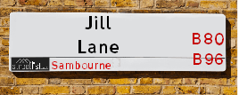
Jill Lane Astwood Bank is a street located near the village of Astwood Bank and in the village of Sambourne
About Jill Lane
Jill Lane is a street located near the village of Astwood Bank and in the village of Sambourne. The street has a length of approximately 1,886 metres.
The street is located within the Stratford-on-Avon District Council's jurisdiction. They provide various services, like refuse collection, and manage council tax collection. It's situated in the West Midlands region of the UK.
The road has been assigned the Unique Street Reference Number of 38301090 in the National Street Gazetteer.
The street has the postcodes of B96 6ER, B96 6EW and B96 6ES.
It is located within the county of Warwickshire, situated in the West Midlands region of the UK. It's 93.87 miles North West from central London., 13.56 miles East from Worcester, 14.89 miles South from Birmingham and 20.1 miles South West from Coventry.

Do you know why this road is called Jill Lane?
What's it like to live here?
Ask the community a question.
Do you have any questions, memories to share or know any facts? We'd love to know more.
Map of Jill Lane
| Postcodes | ||
|---|---|---|
| Icon | Postcodes for Jill Lane | |
| Walking Distances | ||
| Distance Info | Green Circle = 10 Minutes Walk (800 metres) | |
Street Crime Data accessed from data.police.uk on 06/10/2024.
Budget Friendly Hotels near Jill Lane
| Budget Hotel Name | Distance (miles) |
|---|---|
|
1: Name:Holiday Inn Express Birmingham Redditch Address: 2 Hewell Road Telephone: Visit Hotel Page |
3.18 |
|
2: Name:Premier Inn Redditch North A441 Address: Bordesley Lane Telephone: Visit Hotel Page |
3.64 |
|
3: Name:Premier Inn Redditch West A448 Address: Birchfield Road Telephone: Visit Hotel Page |
3.71 |
|
4: Name:Travelodge Stratford Alcester Address: Oversley Mill, A435 Rdabt SN, Alcester, B49 6PQ Telephone: 0871 984 6107 Visit Hotel Page |
4.60 |
|
5: Name:Travelodge Bromsgrove Address: 2 Finstall Rd, Bromsgrove, B60 2DZ Telephone: 0871 984 8484 Visit Hotel Page |
6.67 |
Your support helps keep this site running!
If you enjoy using this website, consider buying me a coffee to help cover hosting costs.
Nearby Estate Agents
| Name | Address | Website |
|---|---|---|
| Jeremy McGinn & Co | 1196a Evesham Road, Astwood Bank, Redditch, B96 6AA | Visit Website |
| Securelets at Jeremy & Co | 1196a Evesham Road, Astwood Bank, B96 6AA | Visit Website |
| King Homes | The Grange 37 Alcester Road, Studley, B80 7LL | Visit Website |
| Arden Estates | 373 Evesham Road, Redditch, B97 5JA | Visit Website |
| Lamberts Sales and Lettings | 11 Alcester Street, Redditch, B98 8AE |
Neighbourhood Policing |
| Police Force: Warwickshire |
 View Neighbourhood Crime and Policing View Neighbourhood Crime and Policing |
| Find a Local Neighbourhood Watch Scheme |
Location Details
| Jill Lane | |
|---|---|

| |
| Latitude | 52.264253 |
| Longitude | -1.922213 |
| OS Easting (X): | 405308 |
| OS Northing (Y): | 262945 |
| OS Grid Reference: | SP053629 |
Roads that have a Junction with Jill Lane
| Street | Junction Type |
|---|---|
| Sambourne Lane (B4092) | junction |
| Oak Tree Lane | junction |
| The Slough (A448) | junction |
| The Slough (A448) | junction |
Sunset and Sunrise times
| Sunrise | 07:39 |
|---|---|
| Sunset | 16:08 |
Latest Weather Conditions
| Observed at Weather Station: | Pershore 21 November 2024 at 23:00 (9.46 miles away) |
|---|---|
| Current Weather: | Clear night |
| Temperature and Humidity: | 0.4°C (84.4%) |
| Wind Direction and Speed: | SW (7 mph) |
Population Statistics
| ONS Area Code | E00159135 & E00159134 |
|---|---|
| ONS Area Name | Rural White-Collar Workers & Renting Rural Retirement |
| Average Age | 45.55 |
| Area Population | 1858.00 |
| Male Population | 930.00 (50%) |
| Female Population | 928.00 (50%) |
| Benefit Claimants | 17 (1%) |
| LSOA Code: | E01031213 |
|---|---|
| LSOA Name: | Stratford-on-Avon 001A |
| SOA Code: | 2b |
| SOA Name: | |
| MSOA Code: | E02006504 |
| MSOA Name: | Stratford-on-Avon 001 |
Nearest Supermarkets
| Tesco Studley Express |
|---|
| 33-35 Alcester Rd, Studley, B80 7LL |
| 0345 026 9065 |
| Distance: 1.32 Miles |
| Directions to Tesco Studley Express |
| Tesco Redditch Extra |
|---|
| Coldfield Dr, Oakenshaw, Redditch, B98 7RU |
| 0345 677 9569 |
| Distance: 1.77 Miles |
| Directions to Tesco Redditch Extra |
| Tesco Lodge Park Express |
|---|
| 7-9 Shakespeare Ave, Lodge Park, Redditch, B98 7LB |
| 0345 026 9070 |
| Distance: 2.42 Miles |
| Directions to Tesco Lodge Park Express |
| Asda Redditch |
|---|
| Jinnah Road, Redditch, B98 7ER |
| 01527 509341 |
| Distance: 2.6 Miles |
| Directions to Asda Redditch |
Telephone Information
| Area Code |
|---|
| Area Code: 01527 - Redditch |
| Area Code: 01564 - Lapworth |
Local Government
| Local Council Details |
|---|
| Within the area of Stratford-on-Avon |
| Visit the Council's Website |
| Elizabeth House, Church Street, Stratford upon Avon, Warwickshire &CV37 6HX |
| Send email |
| Telephone Number: 01789 267 575 |
| Local Member of Parliament |
|---|
| Within the Westminster Parliamentary Constituency of Stratford-on-Avon |
| The Member of Parliament is Manuela Perteghella |
| Details for the MP Manuela Perteghella on parliament.uk |
| Details for the MP Manuela Perteghella on theyworkforyou.com |
| In the 2024 General Election Manuela Perteghella won with a majority of 7,122 the result was LD gain from Con. The total electorate was 75,714 |
| Wards, Parish Councils and County Councils |
|---|
| Ward: Studley with Sambourne &Studley with Mappleborough Green Ward |
| Ceremonial County: Warwickshire |
Nearest Schools
England Primary Schools
Studley St Mary's CofE Academy
Address: Studley St Mary's CofE Academy, New Road, Studley, Warwickshire, B80 7ND
Distance: 1.22 miles
Contact: 01527852153
Studley Community Infants' School
Address: Studley Community Infants' School, High Street, Studley, Warwickshire, B80 7HJ
Distance: 1.24 miles
Contact:
St Mary's Catholic Primary School, Studley
Address: St Mary's Catholic Primary School, Studley, Pool Road, Studley, Warwickshire, B80 7QU
Distance: 1.13 miles
Contact:
Woodrow First School
Address: Woodrow First School, Longdon Close, Woodrow South, Redditch, Worcestershire, B98 7UZ
Distance: 1.45 miles
Contact: 01527527619
Astwood Bank Primary School
Address: Astwood Bank Primary School, Church Road, Astwood Bank, Redditch, Worcestershire, B96 6EH
Distance: 0.67 miles
Contact: 01527959084
Astwood Bank First School
Address: Astwood Bank First School, Church Road, Astwood Bank, Redditch, Worcestershire, B96 6EH
Distance: 0.67 miles
Contact:
Crabbs Cross Academy
Address: Crabbs Cross Academy, Evesham Road, Crabbs Cross, Redditch, Worcestershire, B97 5JH
Distance: 1.43 miles
Contact: 01527543624
England Secondary Schools
Studley High School
Address: Studley High School, Crooks Lane, Studley, Warwickshire, B80 7QX
Distance: 1.04 miles
Contact: 01527852478
Ridgeway Secondary School
Address: Ridgeway Secondary School, Evesham Road, Astwood Bank, Redditch, Worcestershire, B96 6BD
Distance: 0.96 miles
Contact:
St Augustine's Catholic High School
Address: St Augustine's Catholic High School, Stonepits Lane, Hunt End, Redditch, Worcestershire, B97 5LX
Distance: 1.16 miles
Contact: 01527550400
Nearest Hospitals
| Name | Address | Postcode | Distance | Map |
|---|
Nearest Dentists
Dentists
| Name | Address | Postcode | Distance | Map |
|---|
Nearest GP Surgeries
Doctors
THE RIDGEWAY SURGERY
Address: 6-8 FECKENHAM ROAD, ASTWOOD BANK, REDDITCH, WORCESTERSHIRE, B96 6DS
Distance: 0.76 miles
Contact: tel: 01527 892418
POOL MEDICAL CENTRE
Address: POOL ROAD, STUDLEY, WARWICKSHIRE, B80 7QU
Distance: 1.13 miles
Contact: tel: 01527 853671
CRABBS CROSS MEDICAL CENTRE
Address: THE MEDICAL CENTRE, 39 KENILWORTH CLOSE, CRABBS CROSS, REDDITCH, WORCESTERSHIRE, B97 5JX
Distance: 1.49 miles
Contact: tel: 01527 402149
CRABBS CROSS SURGERY
Address: 1 KENILWORTH CLOSE, CRABBS CROSS, REDDITCH, B97 5JX
Distance: 1.49 miles
Contact: tel: 01527 544610
THE BRIDGE SURGERY
Address: 8 EVESHAM ROAD, REDDITCH, WORCESTERSHIRE, B97 4LA
Distance: 2.27 miles
Contact: tel: 01527 555600
FECKENHAM SURGERY
Address: 26 HIGH STREET, FECKENHAM, REDDITCH, WORCESTERSHIRE, B96 6HS
Distance: 2.91 miles
Contact: :
Nearest Dispensing Chemists
Pharmacies
| Name | Address | Postcode | Telephone | Map | Distance in Km |
|---|
Nearest Opticians
Opticians
Transport
Nearest Rail Stations
Redditch Station is 3.07 miles away.
Address: Redditch station, Bromsgrove Road, Redditch, Worcestershire, B97 4RB
Redditch is situated on the Bristol to Brimingham Line.
Redditch Station is staffed on a part time basis.
Wootton Wawen Station is 5.82 miles away.
Address: Wootton Wawen station, Wawensmere Road, Wootton Wawen, Warwickshire, B95 6BJ
Wootton Wawen is situated on the North Warwickshire (Shakespeare Line) Line.
Wootton Wawen Station is an unstaffed station.