Wishaw Lane is a street located in the city of Birmingham. It uses the postcode B76 9AR. The street has a length of approximately 1,631 metres.
The street is located within the Birmingham District (B) Council's jurisdiction. They provide various services, like refuse collection, and manage council tax collection. It's situated in the West Midlands region of the UK.
The road has been assigned the Unique Street Reference Number of 2707640 in the National Street Gazetteer.
It is located within the county of West Midlands, situated in the West Midlands region of the UK. It's 100.65 miles North West from central London., 7.12 miles North East from Birmingham, 14.01 miles North West from Coventry and 27.41 miles West from Leicester.
Map of Wishaw Lane
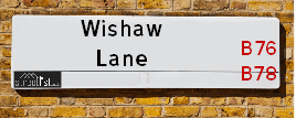
| Postcodes | ||
|---|---|---|
| Icon | Postcodes for Wishaw Lane | |
| Walking Distances | ||
| Distance Info | Green Circle = 10 Minutes Walk (800 metres) | |
Street Crime Data accessed from data.police.uk on 06/10/2024.
Moving to Wishaw Lane?
I can help you uncover potential pitfalls and provide key questions to ask about your new property. With decades of experience as a Local Land Charges Manager, I offer confidential insights to make your move informed and stress-free.
This service is free, but you may wish to make an optional donation to support it. Please include the property name and address in your request as well as anything you wish to focus on.
Contact Me
Do you know why this road is called Wishaw Lane?
What's it like to live here?
Share a Photo of Wishaw Lane
Ask the community a question.
Do you have any questions, memories to share, have any photos or know any facts? We'd love to know more.
Submit Your Comment
Budget Friendly Hotels near Wishaw Lane
| Budget Hotel Name | Distance (miles) |
|---|---|
|
1: Name:Holiday Inn Express Birmingham - Castle Bromwich Address: 1200 Chester Rd, Castle Bromwich Telephone: Visit Hotel Page |
2.45 |
|
2: Name:Travelodge Birmingham Castle Bromwich Address: Chester Rd, Birmingham, B36 0AG Telephone: 0871 559 1813 Visit Hotel Page |
2.53 |
|
3: Name:Travelodge Birmingham Fort Dunlop Address: Fort Dunlop, Fort Pkwy, Birmingham, B24 9FD Telephone: 0871 984 6312 Visit Hotel Page |
2.77 |
|
4: Name:Premier Inn Birmingham North Sutton Coldfield Address: Whitehouse Common Road Telephone: Visit Hotel Page |
2.93 |
|
5: Name:Travelodge Birmingham Sutton Coldfield Address: Boldmere Rd, Sutton Coldfield, B73 5UP Telephone: 0871 984 6108 Visit Hotel Page |
3.31 |
Hotel Options
Your support helps keep this site running!
If you enjoy using this website, consider making a donation to help me cover hosting costs.
Nearby Estate Agents
| Name | Address | Website |
|---|---|---|
| Green & Company | 34 Walmley Road, Walmley Sutton Coldfield, B76 1QN | Visit Website |
| Paul Carr | 32 Walmley Road, Walmley, Sutton Coldfield, B76 1QN | |
| Acres | 49 Walmley Road, Walmley, Sutton Coldfield, West Midlands, B76 1NP | Visit Website |
| Lovell, Coming Soon - The Point | Farnborough Rd, Castle Vale, Birmingham, B35 7LN | Visit Website |
| Chambers Property | Albion Terrace, Water Orton, Birmingham, B46 1ST | Visit Website |
We have found 1 postcode
Neighbourhood Policing |
| Police Force: West Midlands |
 View Neighbourhood Crime and Policing View Neighbourhood Crime and Policing |
| Find a Local Neighbourhood Watch Scheme |
Location Details
| Wishaw Lane | |
|---|---|

| |
| Latitude | 52.538358 |
| Longitude | -1.762901 |
| OS Easting (X): | 416079 |
| OS Northing (Y): | 293455 |
| OS Grid Reference: | SP161935 |
Roads that have a Junction with Wishaw Lane
| Street | Junction Type |
|---|---|
| Bull's Lane | junction |
| Hurst Green Road | pseudo node |
Sunset and Sunrise times
| Sunrise | 08:15 |
|---|---|
| Sunset | 16:08 |
Latest Weather Conditions
| Observed at Weather Station: | Coleshill 3 January 2025 at 15:00 (5.09 miles away) |
|---|---|
| Current Weather: | Overcast |
| Temperature and Humidity: | 4.6°C (72.2%) |
| Wind Direction and Speed: | WSW (7 mph) |
Population Statistics
| ONS Area Code | E00047847 |
|---|---|
| ONS Area Name | Hard-Pressed Ethnic Mix |
| Average Age | 43.37 |
| Area Population | 1445.00 |
| Male Population | 705.00 (49%) |
| Female Population | 740.00 (51%) |
| Benefit Claimants | 26 (2%) |
| LSOA Code: | E01009441 |
|---|---|
| LSOA Name: | Birmingham 021B |
| SOA Code: | 5c |
| SOA Name: | |
| MSOA Code: | E02001847 |
| MSOA Name: | Birmingham 021 |
Nearest Supermarkets
| Asda Minworth |
|---|
| Walmley Ash Road, Sutton Coldfield, B76 1XL |
| 0121 313 7100 |
| Distance: 0.87 Miles |
| Directions to Asda Minworth |
| Tesco Water Orton Express |
|---|
| 8 Station Buildings, Birmingham Rd, Birmingham, B46 1SR |
| 0345 026 9273 |
| Distance: 1.65 Miles |
| Directions to Tesco Water Orton Express |
| Sainsburys Castle Vale |
|---|
| Castle Vale Retail Park, Chester Road, Castle Vale, Birmingham, England, B35 6HB |
| 0121 776 7425 |
| Distance: 2.01 Miles |
| Directions to Sainsburys Castle Vale |
| Tesco Castle Bromwich Green Ln Express |
|---|
| 136-140 Green Ln, Castle Bromwich, Birmingham, B36 0BX |
| 0345 026 9107 |
| Distance: 2.19 Miles |
| Directions to Tesco Castle Bromwich Green Ln Express |
Telephone Information
| Area Code |
|---|
| Area Code: 01675 - Coleshill |
| Area Code: 0121 - Birmingham |
| Area Code: 01827 - Tamworth |
| Area Code: 01676 - Meriden |
Broadband Information
| Speed | Average Speed | Median Speed | Maximum Speed | Next-generation access (NGA) | Number of Connections |
|---|---|---|---|---|---|
| Greater than 2 Mbps | 4.2 | 4.2 | 5.1 | N | 6 |
Local Government
| Local Council Details |
|---|
| Within the area of Birmingham |
| Visit the Council's Website |
| Council House, Victoria Square, Birmingham &B1 1BB |
| Send email |
| Telephone Number: 0121 303 1111 |
| Local Member of Parliament |
|---|
| Within the Westminster Parliamentary Constituency of Sutton Coldfield |
| The Member of Parliament is Andrew Mitchell |
| Details for the MP Andrew Mitchell on parliament.uk |
| Details for the MP Andrew Mitchell on theyworkforyou.com |
| In the 2024 General Election Andrew Mitchell won with a majority of 2,543 the result was Con hold. The total electorate was 74,080 |
| Wards, Parish Councils and County Councils |
|---|
| Ward: Sutton Walmley & Minworth Ward |
| Ceremonial County: West Midlands |
Nearest Schools
England Secondary Schools
Greenwood Academy
Address: Greenwood Academy, Farnborough Road, Castle Vale, Birmingham, West Midlands, B35 7NL
Distance: 1.52 miles
Contact: 01214646101
England Primary Schools
St Gerard's RC Junior and Infant School
Address: St Gerard's RC Junior and Infant School, Yatesbury Avenue, Castle Vale, Birmingham, West Midlands, B35 6LB
Distance: 1.49 miles
Contact: 01214642613
The Deanery Church of England Primary School
Address: The Deanery Church of England Primary School, Fox Hollies Road, Walmley, Sutton Coldfield, West Midlands, B76 2RD
Distance: 1.38 miles
Contact: 01213516441
Walmley Infant School
Address: Walmley Infant School, Walmley Ash Road, Walmley, Sutton Coldfield, West Midlands, B76 1JB
Distance: 1.19 miles
Contact: 01213511355
Walmley Junior School
Address: Walmley Junior School, Walmley Ash Road, Sutton Coldfield, West Midlands, B76 1JB
Distance: 1.19 miles
Contact: 01213511346
Topcliffe Primary School
Address: Topcliffe Primary School, Hawkinge Drive, Castle Vale, Birmingham, West Midlands, B35 6BS
Distance: 1.78 miles
Contact:
Penns Primary School
Address: Penns Primary School, Berwood Road, Sutton Coldfield, West Midlands, B72 1BS
Distance: 2.22 miles
Contact: 01214648014
Pegasus Primary School
Address: Pegasus Primary School, Turnhouse Road, Castle Vale, Birmingham, West Midlands, B35 6PR
Distance: 1.44 miles
Contact: 01214644293
Topcliffe Primary School
Address: Topcliffe Primary School, Hawkinge Drive, Castle Vale, Birmingham, West Midlands, B35 6BS
Distance: 1.78 miles
Contact: 01216756296
Nearest Hospitals
| Name | Address | Postcode | Distance | Map |
|---|
Nearest Dentists
Dentists
| Name | Address | Postcode | Distance | Map |
|---|
Nearest GP Surgeries
Doctors
ASHFIELD SURGERY
Address: 8 WALMLEY ROAD, SUTTON COLDFIELD, B76 1QN
Distance: 1.56 miles
Contact: tel: 0121 3513238
SATIS HOUSE
Address: 10 BIRMINGHAM ROAD, WATER ORTON, BIRMINGHAM, WEST MIDLANDS, B46 1TH
Distance: 1.58 miles
Contact: tel: 0121 7767572
EDEN COURT MEDICAL PRACTICE
Address: 200 TANGMERE DRIVE, CASTLE VALE, BIRMINGHAM, WEST MIDLANDS, B35 6EE
Distance: 1.92 miles
Contact: tel: 0121 7488200
SHAH ZAMAN SURGERY - COVID LOCAL VACCINATION SERVICE
Address: SHAH ZAMAN SURGERY, CASTLE VALE PRIMARY CARE CENTRE, 70 TANGMERE DRIVE, CASTLE VALE, BIRMINGHAM, B35 7QX
Distance: 1.99 miles
Contact: :
SHAH ZAMAN SURGERY
Address: 70 TANGMERE DRIVE, BIRMINGHAM, B35 7QX
Distance: 1.99 miles
Contact: tel: 0121 4651500
PARKFIELD MEDICAL CENTRE
Address: 10 PARKFIELD DRIVE, CASTLE BROMWICH, BIRMINGHAM, WEST MIDLANDS, B36 9EJ
Distance: 2.08 miles
Contact: tel: 0121 7495757
Nearest Dispensing Chemists
Pharmacies
| Name | Address | Postcode | Telephone | Map | Distance in Km |
|---|
Nearest Opticians
Opticians
4977 MINWORTH
Address: ASDA STORES LTD, WALMLEY ASH ROAD, MINWORTH, SUTTON COLDFIELD, WEST MIDLANDS, B76 1XL
Distance: 0.81 miles
Contact: :
COMPLETE COMMUNITY CARE OPTICIANS (SUTTON)
Address: OAK HOUSE, 9 NEW LEASOW, SUTTON COLDFIELD, WEST MIDLANDS, B76 1YL
Distance: 1.07 miles
Contact: :
CHARLES MORRIS OPTICIANS
Address: 28 WALMLEY ROAD, SUTTON COLDFIELD, WEST MIDLANDS, B76 1QN
Distance: 1.56 miles
Contact: :
CASTLE VALE SPECSAVERS LIMITED
Address: CASTLE VALE SHOPPING CENTRE, CASTLE VALE RETAIL PARK, CHESTER ROAD, BIRMINGHAM, B35 6HB
Distance: 2.05 miles
Contact: :
EYE CENTRE OPTICIAN (REDDICAP HEATH)
Address: 53C REDDICAP HEATH ROAD, SUTTON COLDFIELD, WEST MIDLANDS, B75 7DX
Distance: 2.21 miles
Contact: :
ELLIS OPTICIANS
Address: 350 BRADFORD ROAD, BIRMINGHAM, WEST MIDLANDS, B36 9AD
Distance: 2.56 miles
Contact: :
Transport
Nearest Rail Stations
Water Orton Station is 1.60 miles away.
Address: Water Orton station, Marsh Lane, Water Orton, Warwickshire, B46 1NE
Water Orton is situated on the Birmingham to Peterborough Line|Birmingham to Nottingham Line.
Water Orton Station is an unstaffed station.
Coleshill Parkway Station is 2.75 miles away.
Address: Coleshill Parkway station, Station Road, Coleshill, Warwickshire, B46 1JZ
Coleshill Parkway is situated on the Birmingham to Peterborough Line.
Coleshill Parkway Station is staffed on a part time basis.