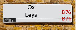
Ox Leys Road is a street located near the city of Birmingham and in Grove End. The street has a length of approximately 2,404 metres.
The street is publicly maintained which means that the road is adopted and Birmingham is responsible for the repair and upkeep of the highway.
The street is located within the Birmingham District (B) Council's jurisdiction. They provide various services, like refuse collection, and manage council tax collection. It's situated in the West Midlands region of the UK.
The road has been assigned the Unique Street Reference Number of 2709437 and 2707105 in the National Street Gazetteer.
The street has the postcodes of B76 9PG, B76 9PA and B75 7HP.
It is located within the county of West Midlands, situated in the West Midlands region of the UK. It's 101.72 miles North West from central London., 7.64 miles North East from Birmingham, 15.05 miles North West from Coventry and 27.45 miles West from Leicester.
OX LEYS ROAD is within the Post Town of SUTTON COLDFIELD
Moving to Ox Leys Road?
I can help you uncover potential pitfalls and provide key questions to ask about your new property. With decades of experience as a Local Land Charges Manager, I offer confidential insights to make your move informed and stress-free.
This service is free, but you may wish to make an optional donation to support it. Please include the property name and address in your request as well as anything you wish to focus on.
Contact Me
Do you know why this road is called Ox Leys Road?
What's it like to live here?
Ask the community a question.
Do you have any questions, memories to share or know any facts? We'd love to know more.
Map of Ox Leys Road
| Street Crime (updated 02/11/2024) | ||
|---|---|---|
| Location Note | Central Point of Street - Not Actual Location | |
| MSOA Info | For MSOA E02001838 (Statistical Neighbourhood) | |
| Click Hint | Click on a Circle for a detailed breakdown below map. | |
| Crime Levels |
Green = Very Low Yellow = Low Orange = High Red = Very High |
|
| Postcodes | ||
| Icon | Postcodes for Ox Leys Road | |
| Walking Distances | ||
| Distance Info | Green Circle = 10 Minutes Walk (800 metres) | |
Street Crime Data accessed from data.police.uk on 06/10/2024.
Budget Friendly Hotels near Ox Leys Road
| Budget Hotel Name | Distance (miles) |
|---|---|
|
1: Name:Premier Inn Birmingham North Sutton Coldfield Address: Whitehouse Common Road Telephone: Visit Hotel Page |
1.81 |
|
2: Name:Travelodge Birmingham Sutton Coldfield Address: Boldmere Rd, Sutton Coldfield, B73 5UP Telephone: 0871 984 6108 Visit Hotel Page |
2.97 |
|
3: Name:Holiday Inn Express Birmingham - Castle Bromwich Address: 1200 Chester Rd, Castle Bromwich Telephone: Visit Hotel Page |
3.36 |
|
4: Name:Travelodge Birmingham Fort Dunlop Address: Fort Dunlop, Fort Pkwy, Birmingham, B24 9FD Telephone: 0871 984 6312 Visit Hotel Page |
3.54 |
|
5: Name:Travelodge Birmingham Castle Bromwich Address: Chester Rd, Birmingham, B36 0AG Telephone: 0871 559 1813 Visit Hotel Page |
3.68 |
Hotel Options
Your support helps keep this site running!
If you enjoy using this website, consider buying me a coffee to help cover hosting costs.
EPC (Energy Performance Certificate) Information for Ox Leys Road
UPRN: 10091555057
EPC Current: C
EPC Potential: C
Habitable Rooms: 5
Property Type: House
Tenure: Owner-occupied
Built Form: Detached
Age Band: 1900-1929
Mains Gas: No
UPRN: 100071313138
EPC Current: E
EPC Potential: C
Habitable Rooms: 8
Property Type: House
Tenure: Owner-occupied
Built Form: Detached
Age Band: before 1900
Mains Gas: No
UPRN: 100071313139
EPC Current: E
EPC Potential: C
Habitable Rooms: 8
Property Type: House
Tenure: Owner-occupied
Built Form: Detached
Age Band: before 1900
Mains Gas: No
UPRN: 100071313140
EPC Current: E
EPC Potential: C
Habitable Rooms: 6
Property Type: House
Tenure: Owner-occupied
Built Form: Detached
Age Band: 1967-1975
Mains Gas: No
House Sales
| Year | High | Low | Average | Sales |
|---|---|---|---|---|
| 2014 | £377,500 | £367,500 | £372,500 | 2 |
| 2015 | £353,000 | £348,000 | £350,500 | 2 |
| 2016 | £700,000 | £700,000 | £700,000 | 1 |
| 2017 | £625,000 | £625,000 | £625,000 | 1 |
| 2020 | £435,000 | £800,000 | £617,500 | 2 |
| 2021 | £419,000 | £24,555,000 | £17,775,667 | 3 |
Contains HM Land Registry data © Crown copyright and database right 2024. This data is licensed under the Open Government Licence v3.0.
Nearby Estate Agents
| Name | Address | Website |
|---|---|---|
| Green & Company | 34 Walmley Road, Walmley Sutton Coldfield, B76 1QN | Visit Website |
| Paul Carr | 32 Walmley Road, Walmley, Sutton Coldfield, B76 1QN | |
| Acres | 49 Walmley Road, Walmley, Sutton Coldfield, West Midlands, B76 1NP | Visit Website |
| Steve Morris & Son | 1 Coleshill Street, Sutton Coldfield,B72 1SD | Visit Website |
| Aston Knowles | 8 High Street, Sutton Coldfield, B72 1XA | Visit Website |
Neighbourhood Policing |
| Police Force: West Midlands |
 View Neighbourhood Crime and Policing View Neighbourhood Crime and Policing |
| Find a Local Neighbourhood Watch Scheme |
Location Details
| Ox Leys Road | |
|---|---|

| |
| Latitude | 52.555734 |
| Longitude | -1.770414 |
| OS Easting (X): | 415563 |
| OS Northing (Y): | 295386 |
| OS Grid Reference: | SP156954 |
Known Residential Addresses for Ox Leys Road
- THE COTTAGE
- LANGLEY PARK HOUSE
- THIMBLE END FARM
- OLD LANGLEY HALL 4
- OLD LANGLEY HALL 12
- OLD LANGLEY HALL 3
- OLD LANGLEY HALL 11
Roads that have a Junction with Ox Leys Road
| Street | Junction Type |
|---|---|
| Holly Lane | junction |
| Bull's Lane | junction |
| Fox Hollies Road | junction |
| Grove Lane | junction |
| Grove Lane | junction |
Sunset and Sunrise times
| Sunrise | 08:14 |
|---|---|
| Sunset | 15:57 |
Latest Weather Conditions
| Observed at Weather Station: | Coleshill 22 December 2024 at 22:00 (6.25 miles away) |
|---|---|
| Current Weather: | Clear night |
| Temperature and Humidity: | 5.8°C (67.5%) |
| Wind Direction and Speed: | WNW (17 mph) |
Population Statistics
| ONS Area Code | E00047803 |
|---|---|
| ONS Area Name | Delayed Retirement |
| Average Age | 43.98 |
| Area Population | 1635.00 |
| Male Population | 807.00 (49%) |
| Female Population | 828.00 (51%) |
| Benefit Claimants | 8 (0%) |
| LSOA Code: | E01009450 |
|---|---|
| LSOA Name: | Birmingham 012E |
| SOA Code: | 8c |
| SOA Name: | |
| MSOA Code: | E02001838 |
| MSOA Name: | Birmingham 012 |
Nearest Supermarkets
| Asda Minworth |
|---|
| Walmley Ash Road, Sutton Coldfield, B76 1XL |
| 0121 313 7100 |
| Distance: 1.69 Miles |
| Directions to Asda Minworth |
| Tesco Coldfield Esso Express |
|---|
| Whitehouse Common Rd, Sutton Coldfield, B75 6HD |
| 0345 026 9423 |
| Distance: 1.71 Miles |
| Directions to Tesco Coldfield Esso Express |
| Little Waitrose Sutton Coldfield |
|---|
| 83 The Parade, Sutton Coldfield, West Midlands, B72 1PL |
| 01213 553866 |
| Distance: 2.29 Miles |
| Directions to Little Waitrose Sutton Coldfield |
| Iceland Sutton Cfield |
|---|
| Maney Corner, Birmingham Road, Sutton Coldfield, B72 1QL |
| 01213557665 |
| Distance: 2.34 Miles |
| Directions to Iceland Sutton Cfield |
Telephone Information
| Area Code |
|---|
| Area Code: 01675 - Coleshill |
| Area Code: 01827 - Tamworth |
| Area Code: 0121 - Birmingham |
| Area Code: 01922 - Walsall |
Broadband Information
| Speed | Average Speed | Median Speed | Maximum Speed | Next-generation access (NGA) | Number of Connections |
|---|---|---|---|---|---|
| Less than 2 Mbps | 3.4 | 2.9 | 7 | N | 4 |
Local Government
| Local Council Details |
|---|
| Within the area of Birmingham |
| Visit the Council's Website |
| Council House, Victoria Square, Birmingham &B1 1BB |
| Send email |
| Telephone Number: 0121 303 1111 |
| Local Member of Parliament |
|---|
| Within the Westminster Parliamentary Constituency of Sutton Coldfield |
| The Member of Parliament is Andrew Mitchell |
| Details for the MP Andrew Mitchell on parliament.uk |
| Details for the MP Andrew Mitchell on theyworkforyou.com |
| In the 2024 General Election Andrew Mitchell won with a majority of 2,543 the result was Con hold. The total electorate was 74,080 |
| Wards, Parish Councils and County Councils |
|---|
| Ward: Sutton Walmley & Minworth Ward |
| Parish: Unparished area |
| Ceremonial County: West Midlands |
Nearest Schools
England Primary Schools
New Hall Primary School
Address: New Hall Primary School, Langley Hall Drive, New Hall Primary School, Sutton Coldfield, West Midlands, B75 7NQ
Distance: 0.84 miles
Contact: 01214645170
Holy Cross Catholic Primary School
Address: Holy Cross Catholic Primary School, Laburnum Drive, Walmley, Sutton Coldfield, West Midlands, B76 2SP
Distance: 0.92 miles
Contact: 01216752158
England Secondary Schools
John Willmott School
Address: John Willmott School, Reddicap Heath Road, Sutton Coldfield, West Midlands, B75 7DY
Distance: 1.11 miles
Contact: 01213781946
John Willmott School
Address: John Willmott School, Reddicap Heath Road, Sutton Coldfield, West Midlands, B75 7DY
Distance: 1.11 miles
Contact:
Nearest Hospitals
| Good Hope Hospital |
|---|
| Address: Rectory Road, Sutton Coldfield, B75 7RR, |
| Independent Sector |
| University Hospitals Birmingham NHS Foundation Trust |
| Telephone: 0121 424 2000 |
| Visit Hospital Website |
| Distance: 3.09 (miles) |
| Directions from to Good Hope Hospital |
| Ardenleigh |
|---|
| Address: 385 Kingsbury Road, Erdington, Birmingham, B24 9SA, |
| NHS Sector |
| Birmingham and Solihull Mental Health NHS Foundation Trust |
| Telephone: 0121 301 4411 |
| Visit Hospital Website |
| Distance: 6.08 (miles) |
| Directions from to Ardenleigh |
| Endeavour Court |
|---|
| Address: 210 Reservoir Road, Erdington, Birmingham, B23 6DJ, |
| NHS Sector |
| Birmingham and Solihull Mental Health NHS Foundation Trust |
| Telephone: 0121 301 7350 |
| Visit Hospital Website |
| Distance: 6.86 (miles) |
| Directions from to Endeavour Court |
Nearest Dentists
Dentists
DENTAL SURGERY
Address: 462 WALMLEY ROAD, SUTTON COLDFIELD, WEST MIDLANDS, B76 1PA
Distance: 1.39 miles
Contact: :
DENTAL SURGERY
Address: 321 WYLDE GREEN ROAD, SUTTON COLDFIELD, WEST MIDLANDS, B76 1RF
Distance: 1.60 miles
Contact: :
WALMLEY DENTAL SURGERY
Address: 1-2 WALMLEY CHAMBERS, 3 WALMLEY CLOSE, SUTTON COLDFIELD, WEST MIDLANDS, B76 1NQ
Distance: 1.67 miles
Contact: :
SUTTON AESTHETIC DENTISTRY
Address: 4 SOUTH PARADE, SUTTON COLDFIELD, WEST MIDLANDS, B72 1QY
Distance: 2.14 miles
Contact: :
COLESHILL STREET (DENTAL SURGERY)
Address: 29 COLESHILL STREET, SUTTON COLDFIELD, WEST MIDLANDS, B72 1SD
Distance: 2.22 miles
Contact: :
SHARMA
Address: 7 COLESHILL STREET, SUTTON COLDFIELD, WEST MIDLANDS, B72 1SD
Distance: 2.22 miles
Contact: :
Nearest GP Surgeries
Doctors
FALCON MEDICAL CENTRE
Address: 93 CARHAMPTON ROAD, SUTTON COLDFIELD, WEST MIDLANDS, B75 7PG
Distance: 1.06 miles
Contact: :
ASHFIELD SURGERY
Address: 8 WALMLEY ROAD, SUTTON COLDFIELD, B76 1QN
Distance: 1.62 miles
Contact: tel: 0121 3513238
SUTTON COLDFIELD GROUP PRACTICE
Address: 233 TAMWORTH ROAD, SUTTON COLDFIELD, WEST MIDLANDS, B75 6DX
Distance: 2.13 miles
Contact: tel: 01213 233235
DR MARTIN SC
Address: ASHFURLONG MEDICAL CENTRE, 233 TAMWORTH ROAD, SUTTON COLDFIELD, WEST MIDLANDS, B75 6DX
Distance: 2.13 miles
Contact: tel: 01213542032
THE MANOR PRACTICE
Address: 61 HOLLAND ROAD, SUTTON COLDFIELD, WEST MIDLANDS, B72 1RL
Distance: 2.24 miles
Contact: tel: 0121 3542032
VESEY PRACTICE
Address: JAMES PRESTON HEALTH CENTRE, 61 HOLLAND ROAD, SUTTON COLDFIELD, WEST MIDLANDS, B72 1RL
Distance: 2.24 miles
Contact: :
Nearest Dispensing Chemists
Pharmacies
PEAK PHARMACY
Address: 7 CHURCHILL PARADE, SUTTON COLDFIELD, WEST MIDLANDS, B75 7LD
Distance: 0.97 miles
Contact: tel: 01213 780444
WALMLEY PHARMACY
Address: 5 WALMLEY CLOSE, SUTTON COLDFIELD, B76 1NQ
Distance: 1.67 miles
Contact: tel: 0121 3132725
SUTTON PHARMACY
Address: 9 WALMLEY CLOSE, SUTTON COLDFIELD, B76 1NQ
Distance: 1.67 miles
Contact: tel: 01213 511212
ASDA PHARMACY
Address: ASH FARM, WALMLEY ASH ROAD, MINWORTH, SUTTON COLDFIELD, WEST MIDLANDS, B76 1AD
Distance: 1.71 miles
Contact: tel: 0121 3514808
ASHFURLONG PHARMACY
Address: LLOYDS PHARMACY, 233 TAMWORTH ROAD, SUTTON COLDFIELD, WEST MIDLANDS, B75 6DX
Distance: 2.13 miles
Contact: tel: 0121 3234300
VESEY PHARMACY
Address: 2 COLES LANE, SUTTON COLDFIELD, B72 1NE
Distance: 2.20 miles
Contact: tel: 0121 3541184
Nearest Opticians
Opticians
EYE CENTRE OPTICIAN (REDDICAP HEATH)
Address: 53C REDDICAP HEATH ROAD, SUTTON COLDFIELD, WEST MIDLANDS, B75 7DX
Distance: 1.31 miles
Contact: :
COMPLETE COMMUNITY CARE OPTICIANS (SUTTON)
Address: OAK HOUSE, 9 NEW LEASOW, SUTTON COLDFIELD, WEST MIDLANDS, B76 1YL
Distance: 1.43 miles
Contact: :
CHARLES MORRIS OPTICIANS
Address: 28 WALMLEY ROAD, SUTTON COLDFIELD, WEST MIDLANDS, B76 1QN
Distance: 1.62 miles
Contact: :
4977 MINWORTH
Address: ASDA STORES LTD, WALMLEY ASH ROAD, MINWORTH, SUTTON COLDFIELD, WEST MIDLANDS, B76 1XL
Distance: 1.64 miles
Contact: :
OPHTHALMIC DIAGNOSTIC SERVICES LTD
Address: 1 COLESHILL STREET, SUTTON COLDFIELD, WEST MIDLANDS, B72 1SD
Distance: 2.22 miles
Contact: :
NEIL BERRY OPTICIAN (SUTTON COLDFIELD)
Address: 6 HOLLAND STREET, SUTTON COLDFIELD, WEST MIDLANDS, B72 1RR
Distance: 2.24 miles
Contact: :
Transport
Nearest Rail Stations
Sutton Coldfield Station is 2.37 miles away.
Address: Sutton Coldfield station, Railway Road, Sutton Coldfield, West Midlands, B73 6AY
Sutton Coldfield is situated on the Bristol to Brimingham Line.
Sutton Coldfield Station is staffed on a part time basis.
Wylde Green Station is 2.66 miles away.
Address: Wylde Green station, Station Road, Wylde Green, West Midlands, B73 5LA
Wylde Green is situated on the Bristol to Brimingham Line.
Wylde Green Station is staffed on a part time basis.