Fox Hollies Road is a street located near the city of Birmingham and in the town of Royal Sutton Coldfield. The street has a length of approximately 2,301 metres.
The street is located within the Birmingham District (B) Council's jurisdiction. They provide various services, like refuse collection, and manage council tax collection. It's situated in the West Midlands region of the UK.
The road has been assigned the Unique Street Reference Number of 2707873 in the National Street Gazetteer.
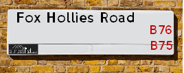
The street has the postcodes of B76 2RN, B76 2RL, B76 2RJ, B76 2RD, B76 2RU and B76 2RT.
It is located within the county of West Midlands, situated in the West Midlands region of the UK. It's 101.85 miles North West from central London., 6.66 miles North East from Birmingham, 15.25 miles North West from Coventry and 28.34 miles West from Leicester.
Map of Fox Hollies Road
| Postcodes | ||
|---|---|---|
| Icon | Postcodes for Fox Hollies Road | |
| Walking Distances | ||
| Distance Info | Green Circle = 10 Minutes Walk (800 metres) | |
Street Crime Data accessed from data.police.uk on 06/10/2024.
Moving to Fox Hollies Road?
I can help you uncover potential pitfalls and provide key questions to ask about your new property. With decades of experience as a Local Land Charges Manager, I offer confidential insights to make your move informed and stress-free.
This service is free, but you may wish to make an optional donation to support it. Please include the property name and address in your request as well as anything you wish to focus on.
Contact Me
Do you know why this road is called Fox Hollies Road?
What's it like to live here?
Share a Photo of Fox Hollies Road
Ask the community a question.
Do you have any questions, memories to share, have any photos or know any facts? We'd love to know more.
Submit Your Comment

Budget Friendly Hotels near Fox Hollies Road
| Budget Hotel Name | Distance (miles) |
|---|---|
|
1: Name:Premier Inn Birmingham North Sutton Coldfield Address: Whitehouse Common Road Telephone: Visit Hotel Page |
1.90 |
|
2: Name:Travelodge Birmingham Sutton Coldfield Address: Boldmere Rd, Sutton Coldfield, B73 5UP Telephone: 0871 984 6108 Visit Hotel Page |
2.15 |
|
3: Name:Holiday Inn Express Birmingham - Castle Bromwich Address: 1200 Chester Rd, Castle Bromwich Telephone: Visit Hotel Page |
2.59 |
|
4: Name:Travelodge Birmingham Fort Dunlop Address: Fort Dunlop, Fort Pkwy, Birmingham, B24 9FD Telephone: 0871 984 6312 Visit Hotel Page |
2.67 |
|
5: Name:Travelodge Birmingham Castle Bromwich Address: Chester Rd, Birmingham, B36 0AG Telephone: 0871 559 1813 Visit Hotel Page |
3.13 |
Hotel Options
Your support helps keep this site running!
If you enjoy using this website, consider making a donation to help me cover hosting costs.
Nearby Estate Agents
| Name | Address | Website |
|---|---|---|
| Green & Company | 34 Walmley Road, Walmley Sutton Coldfield, B76 1QN | Visit Website |
| Paul Carr | 32 Walmley Road, Walmley, Sutton Coldfield, B76 1QN | |
| Acres | 49 Walmley Road, Walmley, Sutton Coldfield, West Midlands, B76 1NP | Visit Website |
| Acres | 28 Beeches Walk, Sutton Coldfield, B73 6HN | Visit Website |
| Hunters | 32a Beeches Walk, Sutton Coldfield, B73 6HN | Visit Website |
Neighbourhood Policing |
| Police Force: West Midlands |
 View Neighbourhood Crime and Policing View Neighbourhood Crime and Policing |
| Find a Local Neighbourhood Watch Scheme |
Location Details
| Fox Hollies Road | |
|---|---|

| |
| Latitude | 52.547054 |
| Longitude | -1.789023 |
| OS Easting (X): | 414305 |
| OS Northing (Y): | 294417 |
| OS Grid Reference: | SP143944 |
Roads that have a Junction with Fox Hollies Road
| Street | Junction Type |
|---|---|
| Walmley Road (B4148) | junction |
| Warrington Close | junction |
| Foxes Meadow | junction |
| Harvington Way | junction |
| Monkspath | junction |
| Signal Hayes Road | junction |
| Ox Leys Road | junction |
Sunset and Sunrise times
| Sunrise | 08:12 |
|---|---|
| Sunset | 16:16 |
Latest Weather Conditions
| Observed at Weather Station: | Coleshill 9 January 2025 at 00:00 (6.26 miles away) |
|---|---|
| Current Weather: | Overcast |
| Temperature and Humidity: | -1.3°C (90.8%) |
| Wind Direction and Speed: | N (0 mph) |
Population Statistics
| ONS Area Code | E00047829, E00047825, E00047826 & E00047803 |
|---|---|
| ONS Area Name | Ageing in Suburbia, Self-Sufficient Retirement, Indian Tech Achievers & Delayed Retirement |
| Average Age | 44.02, 44.66 & 43.98 |
| Area Population | 1441.00, 1785.00 & 1635.00 |
| Male Population | 729.00, 851.00 & 807.00 (49%) |
| Female Population | 712.00, 934.00 & 828.00 (51%) |
| Benefit Claimants | 3, 11 & 8 (0%) |
| LSOA Code: | E01009436, E01009437 &E01009450 |
|---|---|
| LSOA Name: | Birmingham 012B, Birmingham 006C &Birmingham 012E |
| SOA Code: | 8a, 3b &8c |
| SOA Name: | |
| MSOA Code: | E02001838 &E02001832 |
| MSOA Name: | Birmingham 012 &Birmingham 006 |
Nearest Supermarkets
| Asda Minworth |
|---|
| Walmley Ash Road, Sutton Coldfield, B76 1XL |
| 0121 313 7100 |
| Distance: 1.08 Miles |
| Directions to Asda Minworth |
| Iceland Sutton Cfield |
|---|
| Maney Corner, Birmingham Road, Sutton Coldfield, B72 1QL |
| 01213557665 |
| Distance: 1.7 Miles |
| Directions to Iceland Sutton Cfield |
| Tesco Birmingham Rd Sutton Express |
|---|
| 3 Maney Corner, Birmingham Rd, Sutton Coldfield, B72 1QL |
| 0345 675 7047 |
| Distance: 1.72 Miles |
| Directions to Tesco Birmingham Rd Sutton Express |
| Tesco Coldfield Esso Express |
|---|
| Whitehouse Common Rd, Sutton Coldfield, B75 6HD |
| 0345 026 9423 |
| Distance: 1.76 Miles |
| Directions to Tesco Coldfield Esso Express |
Telephone Information
| Area Code |
|---|
| Area Code: 01675 - Coleshill |
| Area Code: 0121 - Birmingham |
| Area Code: 01827 - Tamworth |
| Area Code: 01922 - Walsall |
Broadband Information
| Speed | Average Speed | Median Speed | Maximum Speed | Next-generation access (NGA) | Number of Connections |
|---|---|---|---|---|---|
| Greater than 2 Mbps | 21.6 | 17.6 | >=30 | Y | 16 |
Local Government
| Local Council Details |
|---|
| Within the area of Birmingham |
| Visit the Council's Website |
| Council House, Victoria Square, Birmingham &B1 1BB |
| Send email |
| Telephone Number: 0121 303 1111 |
| Local Member of Parliament |
|---|
| Within the Westminster Parliamentary Constituency of Sutton Coldfield |
| The Member of Parliament is Andrew Mitchell |
| Details for the MP Andrew Mitchell on parliament.uk |
| Details for the MP Andrew Mitchell on theyworkforyou.com |
| In the 2024 General Election Andrew Mitchell won with a majority of 2,543 the result was Con hold. The total electorate was 74,080 |
| Wards, Parish Councils and County Councils |
|---|
| Ward: Sutton Walmley & Minworth Ward |
| Ceremonial County: West Midlands |
Nearest Schools
England Secondary Schools
Fairfax
Address: Fairfax, Fairfax Road, Sutton Coldfield, West Midlands, B75 7JT
Distance: 1.06 miles
Contact: 01213781288
Plantsbrook School
Address: Plantsbrook School, Upper Holland Road, Sutton Coldfield, West Midlands, B72 1RB
Distance: 1.48 miles
Contact: 01213627310
John Willmott School
Address: John Willmott School, Reddicap Heath Road, Sutton Coldfield, West Midlands, B75 7DY
Distance: 0.97 miles
Contact: 01213781946
John Willmott School
Address: John Willmott School, Reddicap Heath Road, Sutton Coldfield, West Midlands, B75 7DY
Distance: 0.97 miles
Contact:
Bishop Walsh Catholic School
Address: Bishop Walsh Catholic School, Wylde Green Road, Sutton Coldfield, West Midlands, B76 1QT
Distance: 0.94 miles
Contact: 01213513215
England Primary Schools
The Deanery Church of England Primary School
Address: The Deanery Church of England Primary School, Fox Hollies Road, Walmley, Sutton Coldfield, West Midlands, B76 2RD
Distance: 0.35 miles
Contact: 01213516441
Walmley Infant School
Address: Walmley Infant School, Walmley Ash Road, Walmley, Sutton Coldfield, West Midlands, B76 1JB
Distance: 0.80 miles
Contact: 01213511355
Walmley Junior School
Address: Walmley Junior School, Walmley Ash Road, Sutton Coldfield, West Midlands, B76 1JB
Distance: 0.80 miles
Contact: 01213511346
Penns Primary School
Address: Penns Primary School, Berwood Road, Sutton Coldfield, West Midlands, B72 1BS
Distance: 1.43 miles
Contact: 01214648014
New Hall Primary School
Address: New Hall Primary School, Langley Hall Drive, New Hall Primary School, Sutton Coldfield, West Midlands, B75 7NQ
Distance: 1.33 miles
Contact: 01214645170
Minworth Junior and Infant School
Address: Minworth Junior and Infant School, Water Orton Lane, Minworth, SUTTON COLDFIELD, West Midlands, B76 9BU
Distance: 1.54 miles
Contact: 01213511345
Holy Cross Catholic Primary School
Address: Holy Cross Catholic Primary School, Laburnum Drive, Walmley, Sutton Coldfield, West Midlands, B76 2SP
Distance: 0.67 miles
Contact: 01216752158
Whitehouse Common Primary School
Address: Whitehouse Common Primary School, Cotysmore Road, Sutton Coldfield, West Midlands, B75 6BL
Distance: 1.86 miles
Contact: 01214641918
Hollyfield Primary School
Address: Hollyfield Primary School, Hollyfield Road, Sutton Coldfield, West Midlands, B75 7SG
Distance: 1.18 miles
Contact: 01213780672
Town Junior School
Address: Town Junior School, Ebrook Road, Sutton Coldfield, West Midlands, B72 1NX
Distance: 1.42 miles
Contact: 01214648738
Nearest Hospitals
| Name | Address | Postcode | Distance | Map |
|---|
Nearest Dentists
Dentists
| Name | Address | Postcode | Distance | Map |
|---|
Nearest GP Surgeries
Doctors
ASHFIELD SURGERY
Address: 8 WALMLEY ROAD, SUTTON COLDFIELD, B76 1QN
Distance: 0.63 miles
Contact: tel: 0121 3513238
FALCON MEDICAL CENTRE
Address: 93 CARHAMPTON ROAD, SUTTON COLDFIELD, WEST MIDLANDS, B75 7PG
Distance: 1.22 miles
Contact: :
THE MANOR PRACTICE
Address: 61 HOLLAND ROAD, SUTTON COLDFIELD, WEST MIDLANDS, B72 1RL
Distance: 1.64 miles
Contact: tel: 0121 3542032
VESEY PRACTICE
Address: JAMES PRESTON HEALTH CENTRE, 61 HOLLAND ROAD, SUTTON COLDFIELD, WEST MIDLANDS, B72 1RL
Distance: 1.64 miles
Contact: :
THE HAWTHORNS SURGERY - COVID LOCAL VACCINATION SERVICE
Address: THE HAWTHORNS SURGERY, 331 BIRMINGHAM ROAD, SUTTON COLDFIELD, B72 1DL
Distance: 1.66 miles
Contact: :
THE HAWTHORNS SURGERY
Address: 331 BIRMINGHAM ROAD, SUTTON COLDFIELD, B72 1DL
Distance: 1.66 miles
Contact: tel: 0121 3732211
Nearest Dispensing Chemists
Pharmacies
| Name | Address | Postcode | Telephone | Map | Distance in Km |
|---|
Nearest Opticians
Opticians
COMPLETE COMMUNITY CARE OPTICIANS (SUTTON)
Address: OAK HOUSE, 9 NEW LEASOW, SUTTON COLDFIELD, WEST MIDLANDS, B76 1YL
Distance: 0.61 miles
Contact: :
CHARLES MORRIS OPTICIANS
Address: 28 WALMLEY ROAD, SUTTON COLDFIELD, WEST MIDLANDS, B76 1QN
Distance: 0.63 miles
Contact: :
EYE CENTRE OPTICIAN (REDDICAP HEATH)
Address: 53C REDDICAP HEATH ROAD, SUTTON COLDFIELD, WEST MIDLANDS, B75 7DX
Distance: 1.06 miles
Contact: :
4977 MINWORTH
Address: ASDA STORES LTD, WALMLEY ASH ROAD, MINWORTH, SUTTON COLDFIELD, WEST MIDLANDS, B76 1XL
Distance: 1.07 miles
Contact: :
NEIL BERRY OPTICIAN (SUTTON COLDFIELD)
Address: 6 HOLLAND STREET, SUTTON COLDFIELD, WEST MIDLANDS, B72 1RR
Distance: 1.68 miles
Contact: :
LAD & TURNER OPTICIANS
Address: 8 THE LANES SHOPPING CENTRE, BIRMINGHAM ROAD, SUTTON COLDFIELD, WEST MIDLANDS, B72 1YG
Distance: 1.75 miles
Contact: :
Transport
Nearest Rail Stations
Wylde Green Station is 1.80 miles away.
Address: Wylde Green station, Station Road, Wylde Green, West Midlands, B73 5LA
Wylde Green is situated on the Bristol to Brimingham Line.
Wylde Green Station is staffed on a part time basis.
Sutton Coldfield Station is 1.95 miles away.
Address: Sutton Coldfield station, Railway Road, Sutton Coldfield, West Midlands, B73 6AY
Sutton Coldfield is situated on the Bristol to Brimingham Line.
Sutton Coldfield Station is staffed on a part time basis.