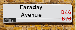
Faraday Avenue is a street located in the town of Coleshill. It uses the postcode B46 1PW. The street has a length of approximately 2,576 metres.
The street is located within the North Warwickshire District (B) Council's jurisdiction. They provide various services, like refuse collection, and manage council tax collection. It's situated in the West Midlands region of the UK.
The road has been assigned the Unique Street Reference Number of 28401045 and 28400604 in the National Street Gazetteer.
It is located within the county of Warwickshire, situated in the West Midlands region of the UK. It's 98.44 miles North West from central London., 8.73 miles East from Birmingham, 11.75 miles North West from Coventry and 25.46 miles West from Leicester.
Map of Faraday Avenue
| Postcodes | ||
|---|---|---|
| Icon | Postcodes for Faraday Avenue | |
| Walking Distances | ||
| Distance Info | Green Circle = 10 Minutes Walk (800 metres) | |
Street Crime Data accessed from data.police.uk on 06/10/2024.
Moving to Faraday Avenue?
I can help you uncover potential pitfalls and provide key questions to ask about your new property. With decades of experience as a Local Land Charges Manager, I offer confidential insights to make your move informed and stress-free.
This service is free, but you may wish to make an optional donation to support it. Please include the property name and address in your request as well as anything you wish to focus on.
Contact Me
Do you know why this road is called Faraday Avenue?
What's it like to live here?
Share a Photo of Faraday Avenue
Ask the community a question.
Do you have any questions, memories to share, have any photos or know any facts? We'd love to know more.
Submit Your Comment
Budget Friendly Hotels near Faraday Avenue
| Budget Hotel Name | Distance (miles) |
|---|---|
|
1: Name:Travelodge Birmingham Castle Bromwich Address: Chester Rd, Birmingham, B36 0AG Telephone: 0871 559 1813 Visit Hotel Page |
3.23 |
|
2: Name:Holiday Inn Express Birmingham - Castle Bromwich Address: 1200 Chester Rd, Castle Bromwich Telephone: Visit Hotel Page |
3.90 |
|
3: Name:Holiday Inn Express Birmingham NEC Address: Bickenhill Parkway Telephone: Visit Hotel Page |
4.32 |
|
4: Name:Travelodge Birmingham Fort Dunlop Address: Fort Dunlop, Fort Pkwy, Birmingham, B24 9FD Telephone: 0871 984 6312 Visit Hotel Page |
4.40 |
|
5: Name:Premier Inn Birmingham NEC/Airport Address: Bickenhill Parkway Telephone: Visit Hotel Page |
4.56 |
Hotel Options
Your support helps keep this site running!
If you enjoy using this website, consider making a donation to help me cover hosting costs.
Nearby Estate Agents
| Name | Address | Website |
|---|---|---|
| Chambers Property | Albion Terrace, Water Orton, Birmingham, B46 1ST | Visit Website |
| First Choice Property Centre | Wynn House, 60 High Street, Coleshill,B46 1AZ | Visit Website |
| Waters & Co. | 81 High Street, Coleshill, Birmingham, B46 3AG | Visit Website |
| Bairstow Eves | 94 High Street, Coleshill, Birmingham, West Midlands, B46 3BL | Visit Website |
| Green Grey - Selling property, Coleshill | 140 High Street, Coleshill, B46 3BJ |
We have found 1 postcode
Neighbourhood Policing |
| Police Force: Warwickshire |
 View Neighbourhood Crime and Policing View Neighbourhood Crime and Policing |
| Find a Local Neighbourhood Watch Scheme |
Location Details
| Faraday Avenue | |
|---|---|

| |
| Latitude | 52.526034 |
| Longitude | -1.708849 |
| OS Easting (X): | 419750 |
| OS Northing (Y): | 292098 |
| OS Grid Reference: | SP198921 |
Roads that have a Junction with Faraday Avenue
| Street | Junction Type |
|---|---|
| Lichfield Road (A446) | roundabout |
| Lichfield Road (A446) | roundabout |
| Hams Lane | junction |
| Edison Road | roundabout |
| Canton Lane | roundabout |
Sunset and Sunrise times
| Sunrise | 08:15 |
|---|---|
| Sunset | 16:04 |
Latest Weather Conditions
| Observed at Weather Station: | Coleshill 31 December 2024 at 22:00 (3.29 miles away) |
|---|---|
| Current Weather: | Overcast |
| Temperature and Humidity: | 10.8°C (78.8%) |
| Wind Direction and Speed: | S (19 mph) |
Population Statistics
| ONS Area Code | E00168279 |
|---|---|
| ONS Area Name | Rural White-Collar Workers |
| Average Age | 46.63 |
| Area Population | 1617.00 |
| Male Population | 815.00 (50%) |
| Female Population | 802.00 (50%) |
| Benefit Claimants | 15 (1%) |
| LSOA Code: | E01031024 |
|---|---|
| LSOA Name: | North Warwickshire 004B |
| SOA Code: | 2b |
| SOA Name: | |
| MSOA Code: | E02006471 |
| MSOA Name: | North Warwickshire 004 |
Nearest Supermarkets
| Tesco Water Orton Express |
|---|
| 8 Station Buildings, Birmingham Rd, Birmingham, B46 1SR |
| 0345 026 9273 |
| Distance: 1.49 Miles |
| Directions to Tesco Water Orton Express |
| Morrisons Coleshill |
|---|
| Park Road, Coleshill B46 1AS |
| 01675 462256 |
| Distance: 1.86 Miles |
| Directions to Morrisons Coleshill |
| Tesco Castle Bromwich Green Ln Express |
|---|
| 136-140 Green Ln, Castle Bromwich, Birmingham, B36 0BX |
| 0345 026 9107 |
| Distance: 2.53 Miles |
| Directions to Tesco Castle Bromwich Green Ln Express |
| Morrisons Birmingham - Castle Bromwich |
|---|
| 264 Chester Road, Castle Bromwich, Birmingham B34 7HR |
| 0121 776 7878 |
| Distance: 2.96 Miles |
| Directions to Morrisons Birmingham - Castle Bromwich |
Telephone Information
| Area Code |
|---|
| Area Code: 01675 - Coleshill |
| Area Code: 01676 - Meriden |
| Area Code: 01827 - Tamworth |
| Area Code: 0121 - Birmingham |
Local Government
| Local Council Details |
|---|
| Within the area of North Warwickshire |
| Visit the Council's Website |
| South Street, Atherstone, Warwickshire &CV9 1DE |
| Send email |
| Telephone Number: 01827 715 341 |
| Local Member of Parliament |
|---|
| Within the Westminster Parliamentary Constituency of North Warwickshire |
| The Member of Parliament is Rachel Taylor |
| Details for the MP Rachel Taylor on parliament.uk |
| Details for the MP Rachel Taylor on theyworkforyou.com |
| In the 2024 General Election Rachel Taylor won with a majority of 2,198 the result was Lab gain from Con. The total electorate was 69,752 |
| Wards, Parish Councils and County Councils |
|---|
| Ward: Curdworth Ward |
| Ceremonial County: Warwickshire |
Nearest Schools
England Primary Schools
Curdworth Primary School
Address: Curdworth Primary School, Farthing Lane, Curdworth, Sutton Coldfield, West Midlands, B76 9HF
Distance: 1.17 miles
Contact:
Water Orton Primary School
Address: Water Orton Primary School, Plank Lane, Water Orton, Birmingham, Warwickshire, B46 1SG
Distance: 1.56 miles
Contact: 01217472851
Nearest Hospitals
| Name | Address | Postcode | Distance | Map |
|---|
Nearest Dentists
Dentists
| Name | Address | Postcode | Distance | Map |
|---|
Nearest GP Surgeries
Doctors
SATIS HOUSE
Address: 10 BIRMINGHAM ROAD, WATER ORTON, BIRMINGHAM, WEST MIDLANDS, B46 1TH
Distance: 1.73 miles
Contact: tel: 0121 7767572
HAZELWOOD PRACTICE - COVID LOCAL VACCINATION SERVICE
Address: 27 PARKFIELD ROAD, COLESHILL, BIRMINGHAM, B46 3LD
Distance: 2.01 miles
Contact: :
HAZELWOOD GROUP PRACTICE
Address: 27 PARKFIELD ROAD, COLESHILL, BIRMINGHAM, WEST MIDLANDS, B46 3LD
Distance: 2.01 miles
Contact: tel: 01675 463165
GREEN LANE SURGERY
Address: SMITHS WOOD MEDICAL CTR, BURTONS WAY, SMITHS WOOD, BIRMINGHAM, WEST MIDLANDS, B36 0SZ
Distance: 2.27 miles
Contact: tel: 0121 7495115
ARRAN MEDICAL CENTRE
Address: BURTONS WAY, BIRMINGHAM, WEST MIDLANDS, B36 0SZ
Distance: 2.27 miles
Contact: tel: 0121 7704043
THE CASTLE PRACTICE
Address: 2 HAWTHORNE ROAD, CASTLE BROMWICH, BIRMINGHAM, WEST MIDLANDS, B36 0HH
Distance: 2.67 miles
Contact: tel: 0121 7472422
Nearest Dispensing Chemists
Pharmacies
| Name | Address | Postcode | Telephone | Map | Distance in Km |
|---|
Nearest Opticians
Opticians
SCRIVENS OPTICIANS (COLESHILL)
Address: 91 HIGH STREET, COLESHILL, BIRMINGHAM, WEST MIDLANDS, B46 3AG
Distance: 1.81 miles
Contact: :
COVENTRY 2 DOMICILIARY SPECSAVERS LIMITED
Address: 165 MERIDEN DRIVE, BIRMINGHAM, B37 6BT
Distance: 2.70 miles
Contact: :
I M HADFIELD OPTOMETRISTS - KINGSHURST
Address: 20 THE PARADE, KINGSHURST, BIRMINGHAM, WEST MIDLANDS, B37 6BA
Distance: 2.83 miles
Contact: :
COOK OPTICIANS
Address: 6 HURST LANE, CASTLE BROMWICH, BIRMINGHAM, WEST MIDLANDS, B34 7HR
Distance: 2.96 miles
Contact: :
4977 MINWORTH
Address: ASDA STORES LTD, WALMLEY ASH ROAD, MINWORTH, SUTTON COLDFIELD, WEST MIDLANDS, B76 1XL
Distance: 3.01 miles
Contact: :
ELLIS OPTICIANS
Address: 350 BRADFORD ROAD, BIRMINGHAM, WEST MIDLANDS, B36 9AD
Distance: 3.18 miles
Contact: :
Transport
Nearest Rail Stations
Coleshill Parkway Station is 0.66 miles away.
Address: Coleshill Parkway station, Station Road, Coleshill, Warwickshire, B46 1JZ
Coleshill Parkway is situated on the Birmingham to Peterborough Line.
Coleshill Parkway Station is staffed on a part time basis.
Water Orton Station is 1.53 miles away.
Address: Water Orton station, Marsh Lane, Water Orton, Warwickshire, B46 1NE
Water Orton is situated on the Birmingham to Peterborough Line|Birmingham to Nottingham Line.
Water Orton Station is an unstaffed station.