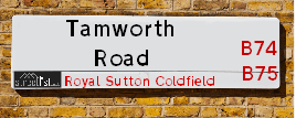
Tamworth Road is a street located in the village of Bassetts Pole and in the town of Royal Sutton Coldfield and near the town of Royal Sutton Coldfield. The street has a length of approximately 4,365 metres.
The street is located within the Lichfield District and North Warwickshire District (B) Council's jurisdiction. They provide various services, like refuse collection, and manage council tax collection. It's situated in the West Midlands region of the UK.
The road has been assigned the Unique Street Reference Numbers of 23400654, 28400422 and 28401344 in the National Street Gazetteer.
The street has the postcodes of B75 6EB, B75 6DZ, B75 6DY, B75 6DX, B75 6DL, B75 6DJ, B75 6DH, B75 6DG, B75 5RX, B75 6LG, B75 6JP and B75 6JL.
It is located within the county of Warwickshire, situated in the West Midlands region of the UK. It's 103.29 miles North West from central London., 8.15 miles North East from Birmingham, 16.6 miles North West from Coventry and 27.38 miles South West from Derby.
TAMWORTH ROAD is within the Post Town of SUTTON COLDFIELD
Map of Tamworth Road
| Street Crime (updated 14/01/2025) | ||
|---|---|---|
| Location Note | Central Point of Street - Not Actual Location | |
| MSOA Info | For MSOAs E02006471, E02001830, E02001832, E02001829, E02001838 (Statistical Neighbourhood) | |
| Click Hint | Click on a Circle for a detailed breakdown below map. | |
| Crime Levels |
Green = Very Low Yellow = Low Orange = High Red = Very High |
|
| Postcodes | ||
| Icon | Postcodes for Tamworth Road | |
| Walking Distances | ||
| Distance Info | Green Circle = 10 Minutes Walk (800 metres) | |
Street Crime Data accessed from data.police.uk on 06/10/2024.
Moving to Tamworth Road?
I can help you uncover potential pitfalls and provide key questions to ask about your new property. With decades of experience as a Local Land Charges Manager, I offer confidential insights to make your move informed and stress-free.
This service is free, but you may wish to make an optional donation to support it. Please include the property name and address in your request as well as anything you wish to focus on.
Contact Me
Do you know why this road is called Tamworth Road?
What's it like to live here?
Share a Photo of Tamworth Road
Ask the community a question.
Do you have any questions, memories to share, have any photos or know any facts? We'd love to know more.
Submit Your Comment

Budget Friendly Hotels near Tamworth Road
| Budget Hotel Name | Distance (miles) |
|---|---|
|
1: Name:Premier Inn Birmingham North Sutton Coldfield Address: Whitehouse Common Road Telephone: Visit Hotel Page |
0.54 |
|
2: Name:Travelodge Birmingham Sutton Coldfield Address: Boldmere Rd, Sutton Coldfield, B73 5UP Telephone: 0871 984 6108 Visit Hotel Page |
2.84 |
|
3: Name:Travelodge Birmingham Streetly Address: Chester Rd, Sutton Coldfield, B73 6SP Telephone: 0871 559 1805 Visit Hotel Page |
3.80 |
|
4: Name:Holiday Inn Express Birmingham - Castle Bromwich Address: 1200 Chester Rd, Castle Bromwich Telephone: Visit Hotel Page |
4.56 |
|
5: Name:Travelodge Birmingham Fort Dunlop Address: Fort Dunlop, Fort Pkwy, Birmingham, B24 9FD Telephone: 0871 984 6312 Visit Hotel Page |
4.58 |
Hotel Options
Your support helps keep this site running!
If you enjoy using this website, consider making a donation to help me cover hosting costs.
EPC (Energy Performance Certificate) Information for Tamworth Road
UPRN: 10001177483
EPC Current: E
EPC Potential: D
Habitable Rooms: 8
Property Type: Bungalow
Tenure: Owner-occupied
Built Form: Detached
Age Band: 1950-1966
Mains Gas: Yes
UPRN: 10001177483
EPC Current: E
EPC Potential: D
Habitable Rooms: 8
Property Type: Bungalow
Tenure: Owner-occupied
Built Form: Detached
Age Band: 1950-1966
Mains Gas: Yes
UPRN: 10001177483
EPC Current: E
EPC Potential: D
Habitable Rooms: 8
Property Type: Bungalow
Tenure: Owner-occupied
Built Form: Detached
Age Band: 1950-1966
Mains Gas: Yes
UPRN: 10001177535
EPC Current: C
EPC Potential: B
Habitable Rooms: 4
Property Type: Bungalow
Tenure: Owner-occupied
Built Form: Detached
Age Band: 1950-1966
Mains Gas: Yes
UPRN: 10001177535
EPC Current: C
EPC Potential: B
Habitable Rooms: 4
Property Type: Bungalow
Tenure: Owner-occupied
Built Form: Detached
Age Band: 1950-1966
Mains Gas: Yes
UPRN: 10001177535
EPC Current: C
EPC Potential: B
Habitable Rooms: 4
Property Type: Bungalow
Tenure: Owner-occupied
Built Form: Detached
Age Band: 1950-1966
Mains Gas: Yes
UPRN: 10001177485
EPC Current: D
EPC Potential: C
Habitable Rooms: 9
Property Type: Bungalow
Tenure: Owner-occupied
Built Form: Detached
Age Band: 1930-1949
Mains Gas: Yes
UPRN: 10001177485
EPC Current: D
EPC Potential: C
Habitable Rooms: 9
Property Type: Bungalow
Tenure: Owner-occupied
Built Form: Detached
Age Band: 1930-1949
Mains Gas: Yes
UPRN: 10001177485
EPC Current: D
EPC Potential: C
Habitable Rooms: 9
Property Type: Bungalow
Tenure: Owner-occupied
Built Form: Detached
Age Band: 1930-1949
Mains Gas: Yes
UPRN: 10001177488
EPC Current: D
EPC Potential: C
Habitable Rooms: 6
Property Type: Bungalow
Tenure: rental (private)
Built Form: Detached
Age Band: 1950-1966
Mains Gas: Yes
UPRN: 10001177488
EPC Current: D
EPC Potential: C
Habitable Rooms: 6
Property Type: Bungalow
Tenure: rental (private)
Built Form: Detached
Age Band: 1950-1966
Mains Gas: Yes
UPRN: 10001177488
EPC Current: D
EPC Potential: C
Habitable Rooms: 6
Property Type: Bungalow
Tenure: rental (private)
Built Form: Detached
Age Band: 1950-1966
Mains Gas: Yes
UPRN: 10001177490
EPC Current: E
EPC Potential: D
Habitable Rooms: 7
Property Type: Bungalow
Tenure: Owner-occupied
Built Form: Detached
Age Band: 1950-1966
Mains Gas: Yes
UPRN: 10001177490
EPC Current: E
EPC Potential: D
Habitable Rooms: 7
Property Type: Bungalow
Tenure: Owner-occupied
Built Form: Detached
Age Band: 1950-1966
Mains Gas: Yes
UPRN: 10001177490
EPC Current: E
EPC Potential: D
Habitable Rooms: 7
Property Type: Bungalow
Tenure: Owner-occupied
Built Form: Detached
Age Band: 1950-1966
Mains Gas: Yes
UPRN: 10001177495
EPC Current: D
EPC Potential: C
Habitable Rooms: 5
Property Type: Bungalow
Tenure: Owner-occupied
Built Form: Detached
Age Band: 1983-1990
Mains Gas: Yes
UPRN: 10001177495
EPC Current: D
EPC Potential: C
Habitable Rooms: 5
Property Type: Bungalow
Tenure: Owner-occupied
Built Form: Detached
Age Band: 1983-1990
Mains Gas: Yes
UPRN: 10001177495
EPC Current: D
EPC Potential: C
Habitable Rooms: 5
Property Type: Bungalow
Tenure: Owner-occupied
Built Form: Detached
Age Band: 1983-1990
Mains Gas: Yes
UPRN: 10001177491
EPC Current: C
EPC Potential: C
Habitable Rooms: 6
Property Type: Bungalow
Tenure: Owner-occupied
Built Form: Detached
Age Band: 1930-1949
Mains Gas: Yes
UPRN: 10001177491
EPC Current: C
EPC Potential: C
Habitable Rooms: 6
Property Type: Bungalow
Tenure: Owner-occupied
Built Form: Detached
Age Band: 1930-1949
Mains Gas: Yes
UPRN: 10001177491
EPC Current: C
EPC Potential: C
Habitable Rooms: 6
Property Type: Bungalow
Tenure: Owner-occupied
Built Form: Detached
Age Band: 1930-1949
Mains Gas: Yes
UPRN: 10001177494
EPC Current: E
EPC Potential: D
Habitable Rooms: 5
Property Type: Bungalow
Tenure: Owner-occupied
Built Form: Detached
Age Band: 1950-1966
Mains Gas: Yes
UPRN: 10001177494
EPC Current: E
EPC Potential: D
Habitable Rooms: 5
Property Type: Bungalow
Tenure: Owner-occupied
Built Form: Detached
Age Band: 1950-1966
Mains Gas: Yes
UPRN: 10001177494
EPC Current: E
EPC Potential: D
Habitable Rooms: 5
Property Type: Bungalow
Tenure: Owner-occupied
Built Form: Detached
Age Band: 1950-1966
Mains Gas: Yes
House Sales
| Year | High | Low | Average | Sales |
|---|---|---|---|---|
| 2014 | £385,000 | £420,000 | £394,556 | 9 |
| 2015 | £201,500 | £300,000 | £481,122 | 12 |
| 2016 | £394,000 | £650,000 | £377,500 | 14 |
| 2017 | £430,000 | £545,000 | £422,786 | 7 |
| 2018 | £425,000 | £337,500 | £427,500 | 6 |
| 2019 | £490,000 | £450,000 | £449,100 | 5 |
| 2020 | £499,950 | £688,000 | £556,742 | 6 |
| 2021 | £510,000 | £315,000 | £591,329 | 12 |
| 2022 | £625,000 | £1,100,000 | £540,600 | 5 |
| 2023 | £545,000 | £412,000 | £566,750 | 4 |
Contains HM Land Registry data © Crown copyright and database right 2025. This data is licensed under the Open Government Licence v3.0.
Nearby Estate Agents
| Name | Address | Website |
|---|---|---|
| Preferential Properties Ltd | 224 Lichfield Road, Sutton Coldfield, West Midlands, B74 2UB | Visit Website |
| Green & Company | 1 Carlton House 18 Mere Green Road, Four Oaks Sutton Coldfield, B75 5BS | Visit Website |
| Bill Tandy & Co | 5 Mere Green Road, Four Oaks, Sutton Coldfield, B75 5BL | Visit Website |
| Century 21 | 1 Mere Green Road, Four Oaks, Sutton Coldfield, B75 5BL | Visit Website |
| Harveys Estate Agents | 3B Mere Green Road, Sutton Coldfield, B75 5BL | Visit Website |
We have found 12 postcodes
Neighbourhood Policing |
| Police Force: Warwickshire &West Midlands |
| Find a Local Neighbourhood Watch Scheme |
Location Details
| Tamworth Road | |
|---|---|

| |
| Latitude | 52.575784 |
| Longitude | -1.790039 |
| OS Easting (X): | 414226 |
| OS Northing (Y): | 297612 |
| OS Grid Reference: | SP142976 |
Known Residential Addresses for Tamworth Road
- CLYRO
- ANKERDINE
- OAKWOOD
- GLENHURST
- 16
- 26
- 8
- 22
- 12
- 14
- 96
- 118
- 86
- 102
- 82
- 108
- 142
- 166
- 154
- 184
- 174
- 176A
- 172
- 180
- 215A
- 231
- 221
- 229
- 199
- 219
- 213
- 209
- 181
- 165
- 177
- 169
- 155
- 151
- 111
- 15A
- 1A
- SOVEREIGN HOUSE, 150 APARTMENT 1
- TRINITY HOUSE, 152 APARTMENT 4
- SOVEREIGN HOUSE, 150 APARTMENT 2
- SOVEREIGN HOUSE, 150 APARTMENT 4
- SOVEREIGN HOUSE, 150 APARTMENT 7
- SOVEREIGN HOUSE, 150 APARTMENT 5
- 176
- 32
- 36
- 34
- 78
- 56
- 72
- 54
- 76
- 103
- 125
- 83
- 71
- 93
- 91
- 123
- 95
- 85
- 89
- 131
- 81
- 5
- 25
- 23
- 119
- 107
Roads that have a Junction with Tamworth Road
| Street | Junction Type |
|---|---|
| Lichfield Road (A5127) | junction |
| Bromwich Drive | junction |
| Knights Wood Close | junction |
| St Andrews Road | junction |
| St Andrews Road | junction |
| Bedford Road | junction |
| Whitehouse Common Road (B4148) | junction |
| Fox Hill Road | junction |
| Hill Lane | pseudo node |
| Hill Lane | junction |
Sunset and Sunrise times
| Sunrise | 08:00 |
|---|---|
| Sunset | 16:36 |
Latest Weather Conditions
| Observed at Weather Station: | Coleshill 22 January 2025 at 08:00 (7.86 miles away) |
|---|---|
| Current Weather: | Mist |
| Temperature and Humidity: | 1.6°C (98.5%) |
| Wind Direction and Speed: | S (2 mph) |
Population Statistics
| ONS Area Code | E00158152, E00047747, E00047746, E00047858, E00047748, E00047693 & E00047803 |
|---|---|
| ONS Area Name | Indian Tech Achievers, Delayed Retirement, Ageing in Suburbia, Detached Retirement Living & Rural White-Collar Workers |
| Average Age | 46.12, 46.59, 47.47, 46.73, 35.84 & 43.98 |
| Area Population | 1578.00, 1631.00, 1644.00, 1538.00, 2669.00 & 1635.00 |
| Male Population | 801.00, 786.00, 792.00, 759.00, 1293.00 & 807.00 (49%) |
| Female Population | 777.00, 845.00, 852.00, 779.00, 1376.00 & 828.00 (51%) |
| Benefit Claimants | 11, 9, 6, 4, 14 & 8 (0%) |
| LSOA Code: | E01031023, E01009430, E01009428, E01009444, E01009416 &E01009450 |
|---|---|
| LSOA Name: | North Warwickshire 004A, Birmingham 004E, Birmingham 004D, Birmingham 006D, Birmingham 003A &Birmingham 012E |
| SOA Code: | 2b, 8a &8c |
| SOA Name: | |
| MSOA Code: | E02006471, E02001830, E02001832, E02001829 &E02001838 |
| MSOA Name: | North Warwickshire 004, Birmingham 004, Birmingham 006, Birmingham 003 &Birmingham 012 |
Nearest Supermarkets
| Tesco Coldfield Esso Express |
|---|
| Whitehouse Common Rd, Sutton Coldfield, B75 6HD |
| 0345 026 9423 |
| Distance: 0.61 Miles |
| Directions to Tesco Coldfield Esso Express |
| Sainsburys Mere Green |
|---|
| 30 Mere Green Road, Sutton Coldfield, England, B75 5BT |
| 0121 323 3213 |
| Distance: 1.68 Miles |
| Directions to Sainsburys Mere Green |
| Little Waitrose Sutton Coldfield |
|---|
| 83 The Parade, Sutton Coldfield, West Midlands, B72 1PL |
| 01213 553866 |
| Distance: 1.74 Miles |
| Directions to Little Waitrose Sutton Coldfield |
| Waitrose Four Oaks |
|---|
| 7 Highgate Centre, Belwell Lane, Sutton Coldfield, West Midlands, B74 4AB |
| 0121 3086006 |
| Distance: 1.92 Miles |
| Directions to Waitrose Four Oaks |
Telephone Information
| Dialling Code | Telephone Exchange | Telephone Cabinet | Fibre to the Cabinet or Fibre to the Premises |
|---|---|---|---|
| 0121 | SUTTON COLDFIELD - CMSUT | P42 | FTTC |
Broadband Information
| Speed | Average Speed | Median Speed | Maximum Speed | Next-generation access (NGA) | Number of Connections |
|---|---|---|---|---|---|
| Less than 2 Mbps | >=30 | 15 | >=30 | Y | 20 |
Local Government
| Local Council Details |
|---|
| Within the area of North Warwickshire &Birmingham |
| Visit the Council's Website |
| Visit the Council's Website |
| South Street, Atherstone, Warwickshire, CV9 1DE, Council House, Victoria Square, Birmingham &B1 1BB |
| Send email |
| Telephone Number: 01827 715 341 &0121 303 1111 |
| Local Member of Parliament |
|---|
| Within the Westminster Parliamentary Constituency of North Warwickshire &Sutton Coldfield |
| The Member of Parliament is Rachel Taylor &Andrew Mitchell |
| Details for the MP Rachel Taylor &Andrew Mitchell on parliament.uk |
| Details for the MP Rachel Taylor &Andrew Mitchell on theyworkforyou.com |
| In the 2024 General Election Rachel Taylor &Andrew Mitchell won with a majority of 2,198 the result was Lab gain from Con &Con hold. The total electorate was 69,752 |
| Wards, Parish Councils and County Councils |
|---|
| Ward: Curdworth, Sutton Trinity, Sutton Roughley &Sutton Walmley & Minworth Ward |
| Parish: Middleton Parish Council |
| Ceremonial County: Warwickshire |
Nearest Schools
England Secondary Schools
Fairfax
Address: Fairfax, Fairfax Road, Sutton Coldfield, West Midlands, B75 7JT
Distance: 1.04 miles
Contact: 01213781288
John Willmott School
Address: John Willmott School, Reddicap Heath Road, Sutton Coldfield, West Midlands, B75 7DY
Distance: 1.08 miles
Contact: 01213781946
John Willmott School
Address: John Willmott School, Reddicap Heath Road, Sutton Coldfield, West Midlands, B75 7DY
Distance: 1.08 miles
Contact:
Bishop Vesey's Grammar School
Address: Bishop Vesey's Grammar School, Lichfield Road, Sutton Coldfield, West Midlands, B74 2NH
Distance: 1.42 miles
Contact: 01212505400
England Primary Schools
New Hall Primary School
Address: New Hall Primary School, Langley Hall Drive, New Hall Primary School, Sutton Coldfield, West Midlands, B75 7NQ
Distance: 0.78 miles
Contact: 01214645170
Whitehouse Common Primary School
Address: Whitehouse Common Primary School, Cotysmore Road, Sutton Coldfield, West Midlands, B75 6BL
Distance: 0.90 miles
Contact: 01214641918
Hollyfield Primary School
Address: Hollyfield Primary School, Hollyfield Road, Sutton Coldfield, West Midlands, B75 7SG
Distance: 1.10 miles
Contact: 01213780672
Moor Hall Primary School
Address: Moor Hall Primary School, Rowallan Road, Sutton Coldfield, West Midlands, B75 6RE
Distance: 1.23 miles
Contact: 01216753966
Nearest Hospitals
| Good Hope Hospital |
|---|
| Address: Rectory Road, Sutton Coldfield, B75 7RR, |
| Independent Sector |
| University Hospitals Birmingham NHS Foundation Trust |
| Telephone: 0121 424 2000 |
| Visit Hospital Website |
| Distance: 1.75 (miles) |
| Directions from to Good Hope Hospital |
| Spire Little Aston Hospital |
|---|
| Address: Little Aston Hall Drive, Little Aston, Sutton Coldfield, |
| Independent Sector |
| Spire Healthcare |
| Telephone: 0121 353 2444 |
| Visit Hospital Website |
| Distance: 6.35 (miles) |
| Directions from to Spire Little Aston Hospital |
| Sir Robert Peel Community Hospital |
|---|
| Address: Plantation Lane, Mile Oak, Tamworth, B78 3NG, |
| Independent Sector |
| University Hospital of Derby and Burton NHS Foundation Trust |
| Distance: 6.69 (miles) |
| Directions from to Sir Robert Peel Community Hospital |
Nearest Dentists
Dentists
DENTAL SURGERY
Address: 462 WALMLEY ROAD, SUTTON COLDFIELD, WEST MIDLANDS, B76 1PA
Distance: 1.26 miles
Contact: :
SMILE SOLUTIONS
Address: 140 MERE GREEN ROAD, SUTTON COLDFIELD, B75 5DB
Distance: 1.51 miles
Contact: http: HTTP://WWW.SMILESOLUTIONS.ORG.UK
COLESHILL STREET (DENTAL SURGERY)
Address: 29 COLESHILL STREET, SUTTON COLDFIELD, WEST MIDLANDS, B72 1SD
Distance: 1.52 miles
Contact: :
SHARMA
Address: 7 COLESHILL STREET, SUTTON COLDFIELD, WEST MIDLANDS, B72 1SD
Distance: 1.52 miles
Contact: :
DENTAL SURGERY
Address: 27 COLESHILL STREET, SUTTON COLDFIELD, WEST MIDLANDS, B72 1SD
Distance: 1.52 miles
Contact: :
OASIS DENTAL CARE LIMITED
Address: 8 MILL STREET, SUTTON COLDFIELD, WEST MIDLANDS, B72 1TJ
Distance: 1.58 miles
Contact: :
Nearest GP Surgeries
Doctors
SUTTON COLDFIELD GROUP PRACTICE
Address: 233 TAMWORTH ROAD, SUTTON COLDFIELD, WEST MIDLANDS, B75 6DX
Distance: 0.71 miles
Contact: tel: 01213 233235
DR MARTIN SC
Address: ASHFURLONG MEDICAL CENTRE, 233 TAMWORTH ROAD, SUTTON COLDFIELD, WEST MIDLANDS, B75 6DX
Distance: 0.71 miles
Contact: tel: 01213542032
FALCON MEDICAL CENTRE
Address: 93 CARHAMPTON ROAD, SUTTON COLDFIELD, WEST MIDLANDS, B75 7PG
Distance: 0.77 miles
Contact: :
SCGP LEY HILL SURGERY - COVID LOCAL VACCINATION SERVICE
Address: 228 LICHFIELD ROAD, SUTTON COLDFIELD, B74 2UE
Distance: 1.67 miles
Contact: :
LEY HILL SURGERY
Address: 228 LICHFIELD ROAD, SUTTON COLDFIELD, WEST MIDLANDS, B74 2UE
Distance: 1.67 miles
Contact: :
FOUR OAKS MEDICAL CENTRE
Address: CARLTON HOUSE, 18 MERE GREEN ROAD, SUTTON COLDFIELD, WEST MIDLANDS, B75 5BS
Distance: 1.78 miles
Contact: :
Nearest Dispensing Chemists
Pharmacies
ASHFURLONG PHARMACY
Address: LLOYDS PHARMACY, 233 TAMWORTH ROAD, SUTTON COLDFIELD, WEST MIDLANDS, B75 6DX
Distance: 0.71 miles
Contact: tel: 0121 3234300
PEAK PHARMACY
Address: 7 CHURCHILL PARADE, SUTTON COLDFIELD, WEST MIDLANDS, B75 7LD
Distance: 0.87 miles
Contact: tel: 01213 780444
LLOYDSPHARMACY
Address: LEY HILL SURGERY, 228 LICHFIELD ROAD, SUTTON COLDFIELD, B74 2UE
Distance: 1.67 miles
Contact: tel: 01213 080050
BOOTS
Address: 44-46 GRACECHURCH SHOPPING CENTRE, THE PARADE, SUTTON COLDFIELD, WEST MIDLANDS, B72 1PD
Distance: 1.72 miles
Contact: tel: 01213 541729
BOOTS
Address: 16 MERE GREEN ROAD, SUTTON COLDFIELD, WEST MIDLANDS, B75 5BP
Distance: 1.82 miles
Contact: tel: 01213 080947
VESEY PHARMACY
Address: 2 COLES LANE, SUTTON COLDFIELD, B72 1NE
Distance: 1.87 miles
Contact: tel: 0121 3541184
Nearest Opticians
Opticians
EYE CENTRE OPTICIAN (REDDICAP HEATH)
Address: 53C REDDICAP HEATH ROAD, SUTTON COLDFIELD, WEST MIDLANDS, B75 7DX
Distance: 1.13 miles
Contact: :
ODSUK LTD
Address: 18 DOWER ROAD, SUTTON COLDFIELD, WEST MIDLANDS, B75 6UA
Distance: 1.46 miles
Contact: :
OPHTHALMIC DIAGNOSTIC SERVICES LTD
Address: 1 COLESHILL STREET, SUTTON COLDFIELD, WEST MIDLANDS, B72 1SD
Distance: 1.52 miles
Contact: :
SPECSAVERS (SUTTON COLDFIELD)
Address: UNIT 4, RED ROSE CENTRE, 57B LOWER PARADE, SUTTON COLDFIELD, WEST MIDLANDS, B72 1XX
Distance: 1.66 miles
Contact: :
ANDREW MARTIN OPTOMETRIST (LICHFIELD)
Address: 244 LICHFIELD ROAD, SUTTON COLDFIELD, WEST MIDLANDS, B74 2UD
Distance: 1.70 miles
Contact: :
M.D. BAILEY OPTICIANS
Address: 244 LICHFIELD ROAD, SUTTON COLDFIELD, WEST MIDLANDS, B74 2UD
Distance: 1.70 miles
Contact: :
Transport
Nearest Rail Stations
Four Oaks Station is 1.62 miles away.
Address: Four Oaks station, Lichfield Road, Sutton Coldfield, West Midlands, B74 2TD
Four Oaks is situated on the Bristol to Brimingham Line.
Four Oaks Station is staffed on a part time basis.
Sutton Coldfield Station is 1.64 miles away.
Address: Sutton Coldfield station, Railway Road, Sutton Coldfield, West Midlands, B73 6AY
Sutton Coldfield is situated on the Bristol to Brimingham Line.
Sutton Coldfield Station is staffed on a part time basis.