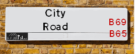
City Road is a street located in the town of Rowley Regis. The street has a length of approximately 1,299 metres.
The street is located within the Sandwell District (B) Council's jurisdiction. They provide various services, like refuse collection, and manage council tax collection. It's situated in the West Midlands region of the UK.
The road has been assigned the Unique Street Reference Number of 33611080 and 33680042 in the National Street Gazetteer.
The street has the postcodes of B69 1RB, B69 1QZ, B69 1QY, B69 1QT, B69 1QS, B69 1QR and B69 1QP.
It is located within the county of West Midlands, situated in the West Midlands region of the UK. It's 107.88 miles North West from central London., 6.29 miles West from Birmingham, 22.76 miles North from Worcester and 23.58 miles West from Coventry.
Map of City Road
| Postcodes | ||
|---|---|---|
| Icon | Postcodes for City Road | |
| Walking Distances | ||
| Distance Info | Green Circle = 10 Minutes Walk (800 metres) | |
Street Crime Data accessed from data.police.uk on 06/10/2024.
Moving to City Road?
I can help you uncover potential pitfalls and provide key questions to ask about your new property. With decades of experience as a Local Land Charges Manager, I offer confidential insights to make your move informed and stress-free.
This service is free, but you may wish to make an optional donation to support it. Please include the property name and address in your request as well as anything you wish to focus on.
Contact Me
Do you know why this road is called City Road?
What's it like to live here?
Share a Photo of City Road
Ask the community a question.
Do you have any questions, memories to share, have any photos or know any facts? We'd love to know more.
Submit Your Comment

Budget Friendly Hotels near City Road
| Budget Hotel Name | Distance (miles) |
|---|---|
|
1: Name:Premier Inn Birmingham Oldbury M5 Jct2 Address: Wolverhampton Road Telephone: Visit Hotel Page |
0.54 |
|
2: Name:Travelodge Birmingham Oldbury Address: Wolverhampton Rd, Oldbury, B69 2BH Telephone: 0871 984 6095 Visit Hotel Page |
0.66 |
|
3: Name:Holiday Inn Express Birmingham Oldbury M5, Jct.2 Address: Birchley Park, Oldbury Telephone: Visit Hotel Page |
1.17 |
|
4: Name:Premier Inn Dudley Town Centre Address: Castlegate Business Park Telephone: Visit Hotel Page |
1.34 |
|
5: Name:Travelodge Dudley Town Centre Address: Discovery Way, Dudley, DY1 4SQ Telephone: 0871 984 6517 Visit Hotel Page |
1.61 |
Hotel Options
Your support helps keep this site running!
If you enjoy using this website, consider making a donation to help me cover hosting costs.
Nearby Estate Agents
| Name | Address | Website |
|---|---|---|
| Hamilton James Lettings & Sales | 2 Midpoint, Burnt Tree, Tipton, Birmingham,DY4 7UF | Visit Website |
| Tom Giles & Co | 11 Church Street, Oldbury, B69 3AD | Visit Website |
| Paul Jackson | 19 Birmingham Street, Oldbury,B69 4DT | Visit Website |
| Innovate Estate Agents | 18 Birmingham Street, Oldbury, B69 4DS | Visit Website |
| Black Country Homes | 58 Birmingham Street, Oldbury,B69 4DZ | Visit Website |
Neighbourhood Policing |
| Police Force: West Midlands |
 View Neighbourhood Crime and Policing View Neighbourhood Crime and Policing |
| Find a Local Neighbourhood Watch Scheme |
Location Details
| City Road | |
|---|---|

| |
| Latitude | 52.503879 |
| Longitude | -2.044799 |
| OS Easting (X): | 396959 |
| OS Northing (Y): | 289595 |
| OS Grid Reference: | SO970896 |
Roads that have a Junction with City Road
| Street | Junction Type |
|---|---|
| Grace Road | junction |
| East Avenue | junction |
| West Avenue | junction |
| Hawfield Road | junction |
| Tower Road | junction |
| Darbys Hill Road | junction |
| Oakham Road | junction |
| New Birmingham Road (A4123) | junction |
| New Birmingham Road | junction |
| Leslie Rise | junction |
| Park Road | junction |
| Poplar Avenue | junction |
| Poplar Rise | junction |
Sunset and Sunrise times
| Sunrise | 08:06 |
|---|---|
| Sunset | 16:31 |
Latest Weather Conditions
| Observed at Weather Station: | Coleshill 18 January 2025 at 03:00 (15.06 miles away) |
|---|---|
| Current Weather: | Mist |
| Temperature and Humidity: | 2.3°C (87.7%) |
| Wind Direction and Speed: | S (6 mph) |
Population Statistics
| ONS Area Code | E00050961, E00050969, E00050966, E00050976 & E00050980 |
|---|---|
| ONS Area Name | Hard-Pressed Ethnic Mix & Industrious Transitions |
| Average Age | 34.99, 36.05 & 39.66 |
| Area Population | 1599.00, 2303.00 & 1531.00 |
| Male Population | 751.00, 1172.00 & 725.00 (49%) |
| Female Population | 848.00, 1131.00 & 806.00 (51%) |
| Benefit Claimants | 47, 39 & 54 (3%) |
| LSOA Code: | E01010084, E01010082 &E01010077 |
|---|---|
| LSOA Name: | Sandwell 022G, Sandwell 022E &Sandwell 022A |
| SOA Code: | 4c &3b |
| SOA Name: | |
| MSOA Code: | E02002064 |
| MSOA Name: | Sandwell 022 |
Nearest Supermarkets
| Iceland Oldbury Food Warehouse |
|---|
| UNIT 9, OLDBURY GREEN RETAIL PARK, OLDBURY, WEST MIDLANDS, B69 3DD |
| 01215446391 |
| Distance: 1 Miles |
| Directions to Iceland Oldbury Food Warehouse |
| Sainsburys Oldbury |
|---|
| Freeth Street, Oldbury, England, B69 3DB |
| 0121 6237070 |
| Distance: 1.13 Miles |
| Directions to Sainsburys Oldbury |
| Tesco Dudley Extra |
|---|
| Town Gate Retail Park, Birmingham Rd, Dudley, DY1 4RP |
| 0345 266 6573 |
| Distance: 1.17 Miles |
| Directions to Tesco Dudley Extra |
| Asda Oldbury |
|---|
| Wolverhampton Road, Oldbury, B69 4PU |
| 0121 569 7300 |
| Distance: 1.44 Miles |
| Directions to Asda Oldbury |
Telephone Information
| Area Code |
|---|
| Area Code: 01384 - Dudley |
| Area Code: 01922 - Walsall |
| Area Code: 01902 - Wolverhampton |
| Area Code: 0121 - Birmingham |
Broadband Information
| Speed | Average Speed | Median Speed | Maximum Speed | Next-generation access (NGA) | Number of Connections |
|---|---|---|---|---|---|
| Less than 2 Mbps | 14.6 | 4.5 | >=30 | Y | 28 |
Local Government
| Local Council Details |
|---|
| Within the area of Sandwell |
| Visit the Council's Website |
| Sandwell Council House, PO Box 2374, Oldbury, West Midlands &B69 3DE |
| Send email |
| Telephone Number: 0845 358 2200 |
| Local Member of Parliament |
|---|
| Within the Westminster Parliamentary Constituency of West Bromwich West |
| The Member of Parliament is Sarah Coombes |
| Details for the MP Sarah Coombes on parliament.uk |
| Details for the MP Sarah Coombes on theyworkforyou.com |
| In the 2024 General Election Sarah Coombes won with a majority of 9,554 the result was Lab gain from Con. The total electorate was 74,025 |
| Wards, Parish Councils and County Councils |
|---|
| Ward: Tividale Ward |
| Ceremonial County: West Midlands |
Nearest Schools
England Primary Schools
St Francis Xavier Catholic Primary School
Address: St Francis Xavier Catholic Primary School, McKean Road, Oldbury, West Midlands, B69 4BA
Distance: 1.37 miles
Contact:
Grace Mary Primary School
Address: Grace Mary Primary School, Hawfield Road, Tividale, Oldbury, West Midlands, B69 1LD
Distance: 0.23 miles
Contact: 01384255910
Tividale Hall Primary School
Address: Tividale Hall Primary School, Regent Road, Tividale, Oldbury, West Midlands, B69 1TR
Distance: 0.62 miles
Contact: 01384254865
Burnt Tree Primary School
Address: Burnt Tree Primary School, Hill Road, Tividale, Oldbury, West Midlands, B69 2LN
Distance: 0.80 miles
Contact: 01215572967
Sacred Heart Primary School
Address: Sacred Heart Primary School, Sedgley Road East, Tipton, West Midlands, DY4 8UH
Distance: 1.32 miles
Contact: 01215571511
Beechwood Church of England Primary School
Address: Beechwood Church of England Primary School, Beechwood Road, Dudley, West Midlands, DY2 7QA
Distance: 1.17 miles
Contact: 01384470127
The CofE School of St Edmund and St John
Address: The CofE School of St Edmund and St John, Beechwood Road, Dudley, West Midlands, DY2 7QA
Distance: 1.17 miles
Contact:
St Joseph's Catholic Primary School
Address: St Joseph's Catholic Primary School, Hillcrest Road, Dudley, West Midlands, DY2 7PW
Distance: 1.25 miles
Contact: 01384889424
Tipton Green Junior School
Address: Tipton Green Junior School, Manor Road, Tipton, West Midlands, DY4 8PR
Distance: 1.72 miles
Contact:
Silvertrees Academy
Address: Silvertrees Academy, Silvertrees Road, Tipton, West Midlands, DY4 8NH
Distance: 1.84 miles
Contact: 01215571923
Kates Hill Community Primary School
Address: Kates Hill Community Primary School, Peel Street, Dudley, West Midlands, DY2 7HP
Distance: 1.15 miles
Contact:
Langley Primary School
Address: Langley Primary School, Titford Road, Oldbury, West Midlands, B69 4QB
Distance: 1.49 miles
Contact: 01215521744
St Francis Xavier Catholic Primary School
Address: St Francis Xavier Catholic Primary School, McKean Road, Oldbury, West Midlands, B69 4BA
Distance: 1.37 miles
Contact: 01212745975
Christ Church CofE Primary School
Address: Christ Church CofE Primary School, Albert Street, Oldbury, West Midlands, B69 4DE
Distance: 1.29 miles
Contact: 01215523625
Rounds Green Primary School
Address: Rounds Green Primary School, Brades Road, Oldbury, West Midlands, B69 2DP
Distance: 0.76 miles
Contact:
St James CofE Primary School
Address: St James CofE Primary School, Wolverley Crescent, Oldbury, West Midlands, B69 1BG
Distance: 0.96 miles
Contact: 01215525491
Causeway Green Primary School
Address: Causeway Green Primary School, Penncricket Lane, Oldbury, West Midlands, B68 8LX
Distance: 1.83 miles
Contact: 01215592068
Rowley Hall Primary School
Address: Rowley Hall Primary School, Windsor Road, Sandwell, Rowley Regis, West Midlands, B65 9HU
Distance: 1.04 miles
Contact: 01215591400
Blackheath Primary School
Address: Blackheath Primary School, Blackheath Primary School Britannia Road, Rowley Regis, West Midlands, B65 9NF
Distance: 1.70 miles
Contact: 01215591033
Oakham Primary School
Address: Oakham Primary School, Darbys Hill Road, Tividale, Oldbury, West Midlands, B69 1SG
Distance: 0.26 miles
Contact: 01384254368
Springfield Primary School
Address: Springfield Primary School, Dudley Road, Rowley Regis, West Midlands, B65 8JY
Distance: 1.10 miles
Contact: 01215591333
Tividale Community Primary School
Address: Tividale Community Primary School, Dudley Road West, Tividale, Oldbury, West Midlands, B69 2HT
Distance: 0.69 miles
Contact: 01215571765
Kates Hill Primary School
Address: Kates Hill Primary School, Peel Street, Dudley, West Midlands, DY2 7HP
Distance: 1.15 miles
Contact: 01384900670
Sledmere Primary School
Address: Sledmere Primary School, The School Drive, Off Buffery Road, Dudley, West Midlands, DY2 8EH
Distance: 1.40 miles
Contact:
England Higher Schools
Dudley College of Technology
Address: Dudley College of Technology, The Broadway, Dudley, West Midlands, DY1 4AS
Distance: 1.74 miles
Contact: 01384363000
England Secondary Schools
Oldbury Academy
Address: Oldbury Academy, Pound Road, Oldbury, West Midlands, B68 8NE
Distance: 2.18 miles
Contact: 01215333750
St Michael's Church of England High School
Address: St Michael's Church of England High School, Curral Road, Rowley Regis, West Midlands, B65 9AN
Distance: 1.42 miles
Contact: 01215616881
Ormiston Sandwell Community Academy
Address: Ormiston Sandwell Community Academy, Lower City Road, Oldbury, West Midlands, B69 2HE
Distance: 0.47 miles
Contact: 01215525501
Nearest Hospitals
| Name | Address | Postcode | Distance | Map |
|---|
Nearest Dentists
Dentists
| Name | Address | Postcode | Distance | Map |
|---|
Nearest GP Surgeries
Doctors
OAKHAM SURGERY
Address: 213 REGENT ROAD, TIVIDALE, OLDBURY, WEST MIDLANDS, B69 1RZ
Distance: 0.57 miles
Contact: :
PORTWAY FAMILY PRACTICE
Address: PORTWAY LIFESTYLE CENTRE, NEWBURY LANE, OLDBURY, WEST MIDLANDS, B69 1HE
Distance: 0.75 miles
Contact: tel: 0121 6123424
PORTWAY LIFESTYLE CENTRE - COVID LOCAL VACCINATION SERVICE 2
Address: PORTWAY LIFESTYLE CENTRE, NEWBURY LANE, OLDBURY, B69 1HE
Distance: 0.75 miles
Contact: :
WHITEHEATH MEDICAL CENTRE
Address: BADSEY ROAD, OLDBURY, WEST MIDLANDS, B69 1EJ
Distance: 0.85 miles
Contact: :
WHITEHEATH MEDICAL CENTRE - COVID LOCAL VACCINATION SERVICE 2
Address: BADSEY ROAD, OLDBURY, B69 1EJ
Distance: 0.85 miles
Contact: :
WALFORD STREET, TIVIDALE
Address: 19 WALFORD STREET, TIVIDALE, OLDBURY, WEST MIDLANDS, B69 2LD
Distance: 0.90 miles
Contact: tel: 0121 5571328
Nearest Dispensing Chemists
Pharmacies
| Name | Address | Postcode | Telephone | Map | Distance in Km |
|---|
Nearest Opticians
Opticians
ON CALL OPTICIANS
Address: 61 TRAFALGAR ROAD, TIVIDALE, OLDBURY, WEST MIDLANDS, B69 1RE
Distance: 0.29 miles
Contact: :
ON CALL EYECARE LTD
Address: 61 TRAFALGAR ROAD, TIVIDALE, OLDBURY, B69 1RE
Distance: 0.29 miles
Contact: :
PORTWAY OPTICIANS
Address: 51A NEW BIRMINGHAM ROAD, TIVIDALE, OLDBURY, WEST MIDLANDS, B69 2JQ
Distance: 0.34 miles
Contact: :
DUDLEY EXTRA
Address: TESCO STORES LTD, TOWN GATE RETAIL PARK, BIRMINGHAM ROAD, DUDLEY, WEST MIDLANDS, DY1 4RP
Distance: 1.15 miles
Contact: :
SCRIVENS OPTICIANS (OLDBURY)
Address: 9 BIRMINGHAM STREET, OLDBURY, WEST MIDLANDS, B69 4DT
Distance: 1.23 miles
Contact: :
THE RIGHT VISION OPHTHALMIC OPTICIANS
Address: 34 BIRMINGHAM STREET, OLDBURY, WEST MIDLANDS, B69 4DS
Distance: 1.26 miles
Contact: :
Transport
Nearest Rail Stations
Sandwell & Dudley Station is 1.43 miles away.
Address: Sandwell & Dudley station, Bromford Road, West Bromwich, West Midlands, B70 7JD
Sandwell & Dudley is situated on the Rugby�Birmingham�Stafford line|West Coast Main Line.
Sandwell & Dudley Station is staffed on a full time basis.
Dudley Port Station is 1.45 miles away.
Address: Dudley Port station, Station Drive, off Dudley Port, Dudley, DY4 8UB
Dudley Port is situated on the Rugby�Birmingham�Stafford line|West Coast Main Line.
Dudley Port Station is staffed on a part time basis.