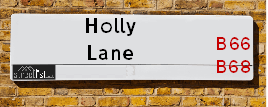
Holly Lane is a street located in the town of Smethwick. The street has a length of approximately 1,551 metres.
The street is located within the Sandwell District (B) Council's jurisdiction. They provide various services, like refuse collection, and manage council tax collection. It's situated in the West Midlands region of the UK.
The road has been assigned the Unique Street Reference Number of 33625220 in the National Street Gazetteer.
The street has the postcodes of B67 7LD, B67 7LB, B67 7LA, B67 7JZ, B67 7JY, B67 7JQ, B67 7JG, B67 7JE, B67 7JD, B66 1QW, B66 1QQ, B66 1QN and B66 1QL.
It is located within the county of West Midlands, situated in the West Midlands region of the UK. It's 105.67 miles North West from central London., 3.76 miles West from Birmingham, 21.05 miles West from Coventry and 23.29 miles North East from Worcester.
Map of Holly Lane
| Postcodes | ||
|---|---|---|
| Icon | Postcodes for Holly Lane | |
| Walking Distances | ||
| Distance Info | Green Circle = 10 Minutes Walk (800 metres) | |
Street Crime Data accessed from data.police.uk on 06/10/2024.
Moving to Holly Lane?
I can help you uncover potential pitfalls and provide key questions to ask about your new property. With decades of experience as a Local Land Charges Manager, I offer confidential insights to make your move informed and stress-free.
This service is free, but you may wish to make an optional donation to support it. Please include the property name and address in your request as well as anything you wish to focus on.
Contact Me
Do you know why this road is called Holly Lane?
What's it like to live here?
Share a Photo of Holly Lane
Ask the community a question.
Do you have any questions, memories to share, have any photos or know any facts? We'd love to know more.
Submit Your Comment

Budget Friendly Hotels near Holly Lane
| Budget Hotel Name | Distance (miles) |
|---|---|
|
1: Name:Premier Inn West Bromwich Central Address: 144 High Street Telephone: Visit Hotel Page |
1.23 |
|
2: Name:Holiday Inn Express Birmingham Oldbury M5, Jct.2 Address: Birchley Park, Oldbury Telephone: Visit Hotel Page |
1.56 |
|
3: Name:Premier Inn West Bromwich Town Centre New Square Address: Congregation Way Telephone: Visit Hotel Page |
1.68 |
|
4: Name:Travelodge West Bromwich Address: 3 Providence Place, West Bromwich, B70 8SZ Telephone: 0871 559 1898 Visit Hotel Page |
1.85 |
|
5: Name:Travelodge Birmingham Oldbury Address: Wolverhampton Rd, Oldbury, B69 2BH Telephone: 0871 984 6095 Visit Hotel Page |
1.91 |
Hotel Options
Your support helps keep this site running!
If you enjoy using this website, consider making a donation to help me cover hosting costs.
Nearby Estate Agents
| Name | Address | Website |
|---|---|---|
| Urban City Group | 104 High Street, Sandwell, Smethwick, B66 1AA | |
| Imperial Lettings | 126 Dog Kennel Lane, Oldbury, B68 9NA | Visit Website |
| Regional Homes | 274 High Street, Smethwick,B66 3NL | Visit Website |
| Connells | 70-76 Birmingham Street, Oldbury, B69 4EB | Visit Website |
| Connells Lettings | 70/76 Birmingham Street, Oldbury, B69 4EB | Visit Website |
We have found 13 postcodes
Neighbourhood Policing |
| Police Force: West Midlands |
 View Neighbourhood Crime and Policing View Neighbourhood Crime and Policing |
| Find a Local Neighbourhood Watch Scheme |
Location Details
| Holly Lane | |
|---|---|

| |
| Latitude | 52.497466 |
| Longitude | -1.985316 |
| OS Easting (X): | 400996 |
| OS Northing (Y): | 288880 |
| OS Grid Reference: | SP010889 |
Roads that have a Junction with Holly Lane
| Street | Junction Type |
|---|---|
| Michael Road | junction |
| West Park Road | junction |
| Marion Road | junction |
| Hugh Road | junction |
| Victoria Road | junction |
| Oldbury Road (A457) | junction |
| Draycott Road | junction |
| Ramila Close | junction |
| St Paul's Road (B4169) | junction |
| Forster Street | junction |
| Devonshire Road | junction |
Sunset and Sunrise times
| Sunrise | 08:05 |
|---|---|
| Sunset | 16:31 |
Latest Weather Conditions
| Observed at Weather Station: | Coleshill 18 January 2025 at 03:00 (12.53 miles away) |
|---|---|
| Current Weather: | Mist |
| Temperature and Humidity: | 2.3°C (87.7%) |
| Wind Direction and Speed: | S (6 mph) |
Population Statistics
| ONS Area Code | E00050834, E00050835, E00050840 & E00050816 |
|---|---|
| ONS Area Name | Asian Terraces and Flats, Pakistani Communities & Achieving Minorities |
| Average Age | 33.57 & 38.12 |
| Area Population | 1872.00 & 1232.00 |
| Male Population | 920.00 & 567.00 (48%) |
| Female Population | 952.00 & 665.00 (52%) |
| Benefit Claimants | 49 & 33 (3%) |
| LSOA Code: | E01010047 &E01010051 |
|---|---|
| LSOA Name: | Sandwell 023B &Sandwell 031D |
| SOA Code: | 7b |
| SOA Name: | |
| MSOA Code: | E02002065 &E02002073 |
| MSOA Name: | Sandwell 023 &Sandwell 031 |
Nearest Supermarkets
| Asda Cape Hill |
|---|
| Off Windmill Lane - Smethwick, Birmingham, B66 3EN |
| 0121 555 1520 |
| Distance: 1.19 Miles |
| Directions to Asda Cape Hill |
| Iceland Smethwick |
|---|
| Unit3 Windmill Shpng Prk, Smethwick, Birmingham, B66 3PR |
| 01215652477 |
| Distance: 1.21 Miles |
| Directions to Iceland Smethwick |
| Tesco Birmingham Bristnall Express |
|---|
| Bristnall Hall Rd, Oldbury, Birmingham, B68 9TX |
| 0345 674 6406 |
| Distance: 1.22 Miles |
| Directions to Tesco Birmingham Bristnall Express |
| Iceland West Bromwich |
|---|
| 21/21a Kings Square, Sandwell Centre, West Bromwich, B70 7NN |
| 01215257475 |
| Distance: 1.43 Miles |
| Directions to Iceland West Bromwich |
Telephone Information
| Area Code |
|---|
| Area Code: 0121 - Birmingham |
| Area Code: 01384 - Dudley |
| Area Code: 01922 - Walsall |
| Area Code: 01902 - Wolverhampton |
Broadband Information
| Speed | Average Speed | Median Speed | Maximum Speed | Next-generation access (NGA) | Number of Connections |
|---|---|---|---|---|---|
| Less than 2 Mbps | 16.3 | 6.3 | >=30 | Y | 13 |
Local Government
| Local Council Details |
|---|
| Within the area of Sandwell |
| Visit the Council's Website |
| Sandwell Council House, PO Box 2374, Oldbury, West Midlands &B69 3DE |
| Send email |
| Telephone Number: 0845 358 2200 |
| Local Member of Parliament |
|---|
| Within the Westminster Parliamentary Constituency of Warley |
| The Member of Parliament is Gurinder Josan |
| Details for the MP Gurinder Josan on parliament.uk |
| Details for the MP Gurinder Josan on theyworkforyou.com |
| In the 2024 General Election Gurinder Josan won with a majority of 11,188 the result was Lab hold. The total electorate was 72,863 |
| Wards, Parish Councils and County Councils |
|---|
| Ward: St Pauls &Smethwick Ward |
| Ceremonial County: West Midlands |
Nearest Schools
England Secondary Schools
Handsworth Grammar School
Address: Handsworth Grammar School, Grove Lane, Handsworth, Birmingham, West Midlands, B21 9ET
Distance: 2.24 miles
Contact:
Shireland Collegiate Academy
Address: Shireland Collegiate Academy, Waterloo Road, Smethwick, West Midlands, B66 4ND
Distance: 1.34 miles
Contact: 01215588086
George Dixon Academy
Address: George Dixon Academy, Portland Road, Edgbaston, Birmingham, West Midlands, B16 9GD
Distance: 1.86 miles
Contact: 01215666565
Lordswood Boys' School
Address: Lordswood Boys' School, Hagley Road, Birmingham, West Midlands, B17 8BJ
Distance: 1.90 miles
Contact:
Holly Lodge High School College of Science
Address: Holly Lodge High School College of Science, Holly Lane, Smethwick, West Midlands, B67 7JG
Distance: 0.08 miles
Contact: 01215580691
King Edward VI Handsworth Grammar School for Boys
Address: King Edward VI Handsworth Grammar School for Boys, Grove Lane, Handsworth, Birmingham, West Midlands, B21 9ET
Distance: 2.24 miles
Contact: 01215542794
Holyhead School
Address: Holyhead School, Milestone Lane, Handsworth, Birmingham, West Midlands, B21 0HN
Distance: 1.67 miles
Contact: 01215231960
Sandwell Academy
Address: Sandwell Academy, Halfords Lane, West Bromwich, West Midlands, B71 4LG
Distance: 1.06 miles
Contact: 01215251700
Shireland Biomedical Utc
Address: Shireland Biomedical Utc, 350 High Street, West Bromwich, West Midlands, B70 8DJ
Distance: 1.71 miles
Contact: 01218281123
Bristnall Hall Academy
Address: Bristnall Hall Academy, Bristnall Hall Lane, Oldbury, West Midlands, B68 9PA
Distance: 1.01 miles
Contact: 01215525425
Q3 Academy Langley
Address: Q3 Academy Langley, Moat Road, Oldbury, West Midlands, B68 8ED
Distance: 1.12 miles
Contact: 01215167070
Oldbury Academy
Address: Oldbury Academy, Pound Road, Oldbury, West Midlands, B68 8NE
Distance: 1.53 miles
Contact: 01215333750
England Primary Schools
St Augustine's Catholic Primary School
Address: St Augustine's Catholic Primary School, Avenue Road, Handsworth, Birmingham, West Midlands, B21 8ED
Distance: 2.08 miles
Contact: 01215545069
Barford Primary School
Address: Barford Primary School, Barford Road, Ladywood, Birmingham, West Midlands, B16 0EF
Distance: 2.32 miles
Contact: 01214643765
City Road Primary School
Address: City Road Primary School, Cavendish Road, Rotton Park, Birmingham, West Midlands, B16 0HL
Distance: 1.96 miles
Contact:
Summerfield Primary School
Address: Summerfield Primary School, Cuthbert Road, Winson Green, Birmingham, West Midlands, B18 4AH
Distance: 1.97 miles
Contact: 01216752355
Shireland Hall Primary Academy
Address: Shireland Hall Primary Academy, Montague Road, Smethwick, West Midlands, B66 4PW
Distance: 1.55 miles
Contact: 01215586331
Cape Primary School
Address: Cape Primary School, Cape Hill, Smethwick, West Midlands, B66 4SH
Distance: 1.51 miles
Contact: 01215581667
St James Church of England Primary School, Handsworth
Address: St James Church of England Primary School, Handsworth, Sandwell Road, Birmingham, West Midlands, B21 8NH
Distance: 1.69 miles
Contact: 01215235861
Victoria Park Primary
Address: Victoria Park Primary, Ballot Street, Smethwick, West Midlands, B66 3HH
Distance: 1.13 miles
Contact: 01215588701
Victoria Park Primary
Address: Victoria Park Primary, Ballot Street, Smethwick, West Midlands, B66 3HH
Distance: 1.13 miles
Contact:
St Matthew's CofE Primary School
Address: St Matthew's CofE Primary School, Windmill Lane, Smethwick, West Midlands, B66 3LX
Distance: 1.26 miles
Contact: 01215581651
George Dixon Primary School
Address: George Dixon Primary School, City Road, Edgbaston, Birmingham, West Midlands, B17 8LE
Distance: 1.85 miles
Contact: 01216752775
Crocketts Community Primary School
Address: Crocketts Community Primary School, Coopers Lane, Smethwick, West Midlands, B67 7DW
Distance: 0.73 miles
Contact: 01215581659
Bearwood Primary School
Address: Bearwood Primary School, Bearwood Road, Smethwick, West Midlands, B66 4HB
Distance: 1.53 miles
Contact: 01214344499
St Gregory's Catholic Primary School
Address: St Gregory's Catholic Primary School, Park Road, Bearwood, Smethwick, West Midlands, B67 5HX
Distance: 1.48 miles
Contact: 01214294609
Annie Lennard Primary School
Address: Annie Lennard Primary School, The Oval, Smethwick, West Midlands, B67 6LE
Distance: 1.08 miles
Contact: 01214294284
Devonshire Junior Academy
Address: Devonshire Junior Academy, Auckland Road, Smethwick, West Midlands, B67 7AT
Distance: 0.39 miles
Contact: 01215581654
Devonshire Infant School
Address: Devonshire Infant School, Auckland Road, Smethwick, West Midlands, B67 7AT
Distance: 0.39 miles
Contact:
Abbey Junior School
Address: Abbey Junior School, Barclay Road, Smethwick, West Midlands, B67 5LT
Distance: 1.47 miles
Contact: 01214292700
Abbey Infant School
Address: Abbey Infant School, Maurice Road, Smethwick, West Midlands, B67 5LR
Distance: 1.41 miles
Contact: 01214291689
Lightwoods Primary School
Address: Lightwoods Primary School, Castle Road East, Oldbury, West Midlands, B68 9BG
Distance: 2.00 miles
Contact:
Wattville Primary School
Address: Wattville Primary School, Wattville Road, Handsworth, Birmingham, West Midlands, B21 0DP
Distance: 1.32 miles
Contact: 01215542768
St Philip's Catholic Primary School
Address: St Philip's Catholic Primary School, Messenger Road, Smethwick, West Midlands, B66 3DU
Distance: 1.15 miles
Contact: 01215581643
Galton Valley Primary School
Address: Galton Valley Primary School, Brasshouse Lane, Smethwick, West Midlands, B66 1BA
Distance: 0.70 miles
Contact: 01215581690
George Betts Primary Academy
Address: George Betts Primary Academy, West End Avenue, Smethwick, West Midlands, B66 1RE
Distance: 0.42 miles
Contact: 01215580472
Lyng Primary School
Address: Lyng Primary School, Horton Street, West Bromwich, West Midlands, B70 7SQ
Distance: 1.15 miles
Contact: 01215531480
Holy Trinity CofE Primary School
Address: Holy Trinity CofE Primary School, Trinity Road South, West Bromwich, West Midlands, B70 6NF
Distance: 0.89 miles
Contact: 01215531573
Lodge Primary School
Address: Lodge Primary School, Oak Lane, West Bromwich, West Midlands, B70 8PN
Distance: 1.59 miles
Contact: 01215532389
All Saints CofE Primary School
Address: All Saints CofE Primary School, Wilford Road, West Bromwich, West Midlands, B71 1QN
Distance: 2.32 miles
Contact: 01215670033
St Francis Xavier Catholic Primary School
Address: St Francis Xavier Catholic Primary School, McKean Road, Oldbury, West Midlands, B69 4BA
Distance: 1.24 miles
Contact:
Uplands Manor Primary School and Nursery
Address: Uplands Manor Primary School and Nursery, Addenbrooke Road, Smethwick, West Midlands, B67 6HT
Distance: 1.01 miles
Contact: 01215581602
King George V Primary School
Address: King George V Primary School, Beeches Road, West Bromwich, West Midlands, B70 6JA
Distance: 1.49 miles
Contact: 01215530060
Moat Farm Infant School
Address: Moat Farm Infant School, Brookfields Road, Oldbury, West Midlands, B68 9QR
Distance: 1.03 miles
Contact: 01215521885
Moat Farm Junior School
Address: Moat Farm Junior School, Brookfields Road, Moat Farm Junior School, Oldbury, West Midlands, B68 9QR
Distance: 1.03 miles
Contact:
St Hubert's Catholic Primary School
Address: St Hubert's Catholic Primary School, Wolverhampton Road, Oldbury, West Midlands, B68 0LP
Distance: 1.87 miles
Contact:
Rood End Primary School
Address: Rood End Primary School, Rood End Road, Oldbury, West Midlands, B68 8SQ
Distance: 0.63 miles
Contact: 01215521866
Warley Infant School
Address: Warley Infant School, Bleakhouse Road, Oldbury, West Midlands, B68 9DS
Distance: 1.64 miles
Contact:
Bleakhouse Primary School
Address: Bleakhouse Primary School, Bleakhouse Road, Oldbury, West Midlands, B68 9DS
Distance: 1.64 miles
Contact: 01214222841
Brandhall Primary School
Address: Brandhall Primary School, Brennand Road, Oldbury, West Midlands, B68 0SH
Distance: 1.95 miles
Contact: 01214225336
Langley Primary School
Address: Langley Primary School, Titford Road, Oldbury, West Midlands, B69 4QB
Distance: 1.32 miles
Contact: 01215521744
St Francis Xavier Catholic Primary School
Address: St Francis Xavier Catholic Primary School, McKean Road, Oldbury, West Midlands, B69 4BA
Distance: 1.24 miles
Contact: 01212745975
Christ Church CofE Primary School
Address: Christ Church CofE Primary School, Albert Street, Oldbury, West Midlands, B69 4DE
Distance: 1.29 miles
Contact: 01215523625
Rounds Green Primary School
Address: Rounds Green Primary School, Brades Road, Oldbury, West Midlands, B69 2DP
Distance: 1.78 miles
Contact:
Causeway Green Primary School
Address: Causeway Green Primary School, Penncricket Lane, Oldbury, West Midlands, B68 8LX
Distance: 1.79 miles
Contact: 01215592068
England Higher Schools
Sandwell College
Address: Sandwell College, 1 Spon Lane, West Bromwich, West Midlands, B70 6AW
Distance: 1.25 miles
Contact: 01216675000
Nearest Hospitals
| Name | Address | Postcode | Distance | Map |
|---|
Nearest Dentists
Dentists
| Name | Address | Postcode | Distance | Map |
|---|
Nearest GP Surgeries
Doctors
LODGE ROAD SURGERY
Address: LODGE ROAD, WARLEY, SMETHWICK, WEST MIDLANDS, B67 7LU
Distance: 0.17 miles
Contact: tel: 0121 5580499
ST PAUL'S MEDICAL PRACTICE
Address: 222 ST. PAULS ROAD, SMETHWICK, WEST MIDLANDS, B66 1HB
Distance: 0.27 miles
Contact: tel: 0121 5580431
WARLEY ROAD SURGERY
Address: 118 WARLEY ROAD, WARLEY, OLDBURY, WEST MIDLANDS, B68 9SZ
Distance: 0.61 miles
Contact: tel: 0121 5445681
ROOD END MEDICAL PRACTICE
Address: 182-184 VICARAGE ROAD, OLDBURY, WEST MIDLANDS, B68 8JB
Distance: 0.65 miles
Contact: tel: 0121 5448666
DOG KENNEL LANE SURGERY
Address: 64 DOG KENNEL LANE, WARLEY, OLDBURY, WEST MIDLANDS, B68 9LZ
Distance: 0.69 miles
Contact: tel: 0121 5521713
BRASSHOUSE COMMUNITY CENTRE - COVID LOCAL VACCINATION SERVICE 2
Address: BRASSHOUSE LANE, SMETHWICK, B66 1BA
Distance: 0.70 miles
Contact: :
Nearest Dispensing Chemists
Pharmacies
| Name | Address | Postcode | Telephone | Map | Distance in Km |
|---|
Nearest Opticians
Opticians
EYE SEE 20/20
Address: 28 HIGH STREET, SMETHWICK, WEST MIDLANDS, B66 1DT
Distance: 0.43 miles
Contact: :
CLEARHUB LIMITED T/A EYES AND VISION
Address: 70 HIGH STREET, SMETHWICK, B66 1DS
Distance: 0.46 miles
Contact: :
MASTERS OPTICIANS
Address: 182 - 184 VICARAGE ROAD, OLDBURY, WEST MIDLANDS, B68 8JB
Distance: 0.65 miles
Contact: :
HAWTHORNS EYE CARE
Address: 93 LEWISHAM ROAD, SMETHWICK, WEST MIDLANDS, B66 2DD
Distance: 0.81 miles
Contact: :
VINEY'S OPTICIANS LTD
Address: 277-279 HIGH STREET, SMETHWICK, WEST MIDLANDS, B66 3NJ
Distance: 0.84 miles
Contact: :
EURO EYE CARE (UK) LTD (SMETHWICK)
Address: 279 HIGH STREET, SMETHWICK, WEST MIDLANDS, B66 3NJ
Distance: 0.84 miles
Contact: :
Transport
Nearest Rail Stations
Smethwick Galton Bridge Station is 0.36 miles away.
Address: Smethwick Galton Bridge station, Oldbury Road, Smethwick, West Midlands, B66 1HU
Smethwick Galton Bridge is situated on the Birmingham to Worcester via Kidderminster line|Rugby�Birmingham�Stafford line|West Coast Main Line.
Smethwick Galton Bridge Station is staffed on a part time basis.
Smethwick Rolfe Street Station is 0.62 miles away.
Address: Smethwick Rolfe Street station, Rolfe Street, Smethwick, West Midlands, B66 2AF
Smethwick Rolfe Street is situated on the Rugby�Birmingham�Stafford line|West Coast Main Line.
Smethwick Rolfe Street Station is staffed on a part time basis.