Abbey Road Oldbury is a street located in the town of Oldbury and in the town of Smethwick
About Abbey Road
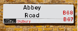
Abbey Road is a street located in the town of Oldbury and in the town of Smethwick. The street has a length of approximately 1,248 metres.
The street is located within the Sandwell District (B) Council's jurisdiction. They provide various services, like refuse collection, and manage council tax collection. It's situated in the West Midlands region of the UK.
The road has been assigned the Unique Street Reference Number of 33600100 in the National Street Gazetteer.
The street has the postcodes of B67 5RD, B67 5RA, B67 5NW, B67 5NQ, B67 5NN, B67 5NG, B67 5NA, B67 5LX, B67 5LW, B67 5LU, B67 5LT, B67 5LS, B67 5LQ, B67 5LP, B67 5LN, B67 5LJ, B67 5LH and B67 5LG.
It is located within the county of West Midlands, situated in the West Midlands region of the UK. It's 104.65 miles North West from central London., 3.46 miles West from Birmingham, 20.57 miles West from Coventry and 22 miles North East from Worcester.
Abbey
Religious (Aramaic)
Road names containing the word "Abbey" are common in the UK, with 705 occurrences, highlighting the significant role religious communities have played in shaping national identity. By the Middle Ages, there was a flourishing of monastic communities, including the Benedictines, Dominicans, and Franciscans. These orders established great abbeys to house their members and practice their religious lives.
Far from leading a cloistered existence, abbeys served as seats of learning, providing alms and medical aid to the communities around them. However, the wealth and power these abbeys amassed eventually drew the envy of English King Henry VIII. He dissolved the monasteries, stripping them of their assets and leaving many of these magnificent buildings in ruins.
The word "Abbey" is derived from the Aramaic "Abba," meaning "Father." In Latin, the male head of an abbey was called "Abbas," and the female head, "Abbatissa." The term for the buildings and community overseen by an abbot or abbess was "Abbatia." After the Norman Conquest, the French form "Abbé" evolved into the English "Abbey" we use today.
In modern times, there has been a resurgence of abbeys. Notable examples include Saint Michael's Abbey in Farnborough and Douai Abbey near Newbury, continuing the legacy of these historic religious communities.

Do you know why this road is called Abbey Road?
What's it like to live here?
Ask the community a question.
Do you have any questions, memories to share or know any facts? We'd love to know more.
Map of Abbey Road
| Postcodes | ||
|---|---|---|
| Icon | Postcodes for Abbey Road | |
| Walking Distances | ||
| Distance Info | Green Circle = 10 Minutes Walk (800 metres) | |
Street Crime Data accessed from data.police.uk on 06/10/2024.
Budget Friendly Hotels near Abbey Road
| Budget Hotel Name | Distance (miles) |
|---|---|
|
1: Name:Premier Inn Birmingham Central Hagley Road Address: 176 - 184 Hagley Road Telephone: Visit Hotel Page |
1.82 |
|
2: Name:Holiday Inn Express Birmingham Oldbury M5, Jct.2 Address: Birchley Park, Oldbury Telephone: Visit Hotel Page |
2.06 |
|
3: Name:Travelodge Birmingham Oldbury Address: Wolverhampton Rd, Oldbury, B69 2BH Telephone: 0871 984 6095 Visit Hotel Page |
2.59 |
|
4: Name:Travelodge Birmingham Central Broadway Plaza Address: 220 Ladywood Middleway, Birmingham, B16 8LP Telephone: 0871 984 6325 Visit Hotel Page |
2.60 |
|
5: Name:Premier Inn West Bromwich Central Address: 144 High Street Telephone: Visit Hotel Page |
2.72 |
Your support helps keep this site running!
If you enjoy using this website, consider buying me a coffee to help cover hosting costs.
Nearby Estate Agents
| Name | Address | Website |
|---|---|---|
| Liberty Estate Agents | 12 Abbey Road Smethwick B67 5RD | |
| Royal Estates | 464 Bearwood Road, Birmingham, B66 4HA | Visit Website |
| Gordon Brooks | 592a Bearwood Road, Smethwick,B66 4BW | Visit Website |
| Paul Estates | 625 Bearwood Road, Edgbaston, Smethwick, B66 4BL | Visit Website |
| Connells Lettings | 122 Poplar Road, Edgbaston, Smethwick, B66 4AP | Visit Website |
We have found 18 postcodes
Neighbourhood Policing |
| Police Force: West Midlands |
 View Neighbourhood Crime and Policing View Neighbourhood Crime and Policing |
| Find a Local Neighbourhood Watch Scheme |
Location Details
| Abbey Road | |
|---|---|

| |
| Latitude | 52.475991 |
| Longitude | -1.983153 |
| OS Easting (X): | 401144 |
| OS Northing (Y): | 286492 |
| OS Grid Reference: | SP011865 |
Roads that have a Junction with Abbey Road
| Street | Junction Type |
|---|---|
| Thimblemill Road (B4182) | junction |
| Katherine Road | junction |
| Pargeter Road | junction |
| Rathbone Road | junction |
| Maurice Road | junction |
| Barclay Road | junction |
| Alexander Road | junction |
| Woodbourne Road | junction |
| Leicester Close | junction |
| Pitcairn Road | junction |
| Hurst Road | junction |
| Harborne Road | junction |
| Pottery Road | junction |
Sunset and Sunrise times
| Sunrise | 07:32 |
|---|---|
| Sunset | 16:13 |
Latest Weather Conditions
| Observed at Weather Station: | Coleshill 17 November 2024 at 21:00 (12.38 miles away) |
|---|---|
| Current Weather: | Partly cloudy (night) |
| Temperature and Humidity: | 5.5°C (95.9%) |
| Wind Direction and Speed: | W (5 mph) |
Population Statistics
| ONS Area Code | E00050201, E00050200, E00050198, E00050204, E00050208 & E00050206 |
|---|---|
| ONS Area Name | Social Renting New Arrivals, Multi-Ethnic Professionals with Families, Private Renting Young Families & Inner City Ethnic Mix |
| Average Age | 36.95, 39.28 & 42.24 |
| Area Population | 1413.00, 1267.00 & 1446.00 |
| Male Population | 657.00, 596.00 & 700.00 (47%) |
| Female Population | 756.00, 671.00 & 746.00 (53%) |
| Benefit Claimants | 27, 30 & 22 (2%) |
| LSOA Code: | E01009926, E01009922 &E01009923 |
|---|---|
| LSOA Name: | Sandwell 034E, Sandwell 034B &Sandwell 036A |
| SOA Code: | 3d, 7a &3b |
| SOA Name: | |
| MSOA Code: | E02002076 &E02002078 |
| MSOA Name: | Sandwell 034 &Sandwell 036 |
Nearest Supermarkets
| Iceland Bearwood |
|---|
| 548/552 Bearwood Road, Smethwick, Warley West Midlands, B66 4BT |
| 01214203345 |
| Distance: 0.57 Miles |
| Directions to Iceland Bearwood |
| Tesco Birmingham Bristnall Express |
|---|
| Bristnall Hall Rd, Oldbury, Birmingham, B68 9TX |
| 0345 674 6406 |
| Distance: 0.76 Miles |
| Directions to Tesco Birmingham Bristnall Express |
| Tesco Edgbaston Hagley Rd Express |
|---|
| Hagley Rd, Birmingham, B17 8DJ |
| 0345 675 7057 |
| Distance: 1.12 Miles |
| Directions to Tesco Edgbaston Hagley Rd Express |
| Iceland Smethwick |
|---|
| Unit3 Windmill Shpng Prk, Smethwick, Birmingham, B66 3PR |
| 01215652477 |
| Distance: 1.25 Miles |
| Directions to Iceland Smethwick |
Telephone Information
| Area Code |
|---|
| Area Code: 0121 - Birmingham |
| Area Code: 01384 - Dudley |
| Area Code: 01922 - Walsall |
Broadband Information
| Speed | Average Speed | Median Speed | Maximum Speed | Next-generation access (NGA) | Number of Connections |
|---|---|---|---|---|---|
| Greater than 2 Mbps | 17.8 | 19 | 21 | N | 12 |
Local Government
| Local Council Details |
|---|
| Within the area of Sandwell |
| Visit the Council's Website |
| Sandwell Council House, PO Box 2374, Oldbury, West Midlands &B69 3DE |
| Send email |
| Telephone Number: 0845 358 2200 |
| Local Member of Parliament |
|---|
| Within the Westminster Parliamentary Constituency of Warley |
| The Member of Parliament is Gurinder Josan |
| Details for the MP Gurinder Josan on parliament.uk |
| Details for the MP Gurinder Josan on theyworkforyou.com |
| In the 2024 General Election Gurinder Josan won with a majority of 11,188 the result was Lab hold. The total electorate was 72,863 |
| Wards, Parish Councils and County Councils |
|---|
| Ward: Abbey Ward |
| Ceremonial County: West Midlands |
Nearest Schools
England Primary Schools
Chad Vale Primary School
Address: Chad Vale Primary School, Nursery Road, Edgbaston, Birmingham, West Midlands, B15 3JU
Distance: 1.85 miles
Contact: 01214647329
City Road Primary School
Address: City Road Primary School, Cavendish Road, Rotton Park, Birmingham, West Midlands, B16 0HL
Distance: 1.75 miles
Contact:
Summerfield Primary School
Address: Summerfield Primary School, Cuthbert Road, Winson Green, Birmingham, West Midlands, B18 4AH
Distance: 1.97 miles
Contact: 01216752355
Shireland Hall Primary Academy
Address: Shireland Hall Primary Academy, Montague Road, Smethwick, West Midlands, B66 4PW
Distance: 1.36 miles
Contact: 01215586331
Harborne Primary School
Address: Harborne Primary School, Station Road, Harborne, Birmingham, West Midlands, B17 9LU
Distance: 1.74 miles
Contact: 01214642705
St Mary's Catholic Primary School
Address: St Mary's Catholic Primary School, Vivian Road, Harborne, Birmingham, West Midlands, B17 0DN
Distance: 1.82 miles
Contact: 01214642141
Cape Primary School
Address: Cape Primary School, Cape Hill, Smethwick, West Midlands, B66 4SH
Distance: 1.48 miles
Contact: 01215581667
Victoria Park Primary
Address: Victoria Park Primary, Ballot Street, Smethwick, West Midlands, B66 3HH
Distance: 1.41 miles
Contact: 01215588701
Victoria Park Primary
Address: Victoria Park Primary, Ballot Street, Smethwick, West Midlands, B66 3HH
Distance: 1.41 miles
Contact:
St Matthew's CofE Primary School
Address: St Matthew's CofE Primary School, Windmill Lane, Smethwick, West Midlands, B66 3LX
Distance: 1.50 miles
Contact: 01215581651
George Dixon Primary School
Address: George Dixon Primary School, City Road, Edgbaston, Birmingham, West Midlands, B17 8LE
Distance: 1.12 miles
Contact: 01216752775
Crocketts Community Primary School
Address: Crocketts Community Primary School, Coopers Lane, Smethwick, West Midlands, B67 7DW
Distance: 1.21 miles
Contact: 01215581659
Bearwood Primary School
Address: Bearwood Primary School, Bearwood Road, Smethwick, West Midlands, B66 4HB
Distance: 0.55 miles
Contact: 01214344499
St Gregory's Catholic Primary School
Address: St Gregory's Catholic Primary School, Park Road, Bearwood, Smethwick, West Midlands, B67 5HX
Distance: 0.26 miles
Contact: 01214294609
Annie Lennard Primary School
Address: Annie Lennard Primary School, The Oval, Smethwick, West Midlands, B67 6LE
Distance: 0.42 miles
Contact: 01214294284
Devonshire Junior Academy
Address: Devonshire Junior Academy, Auckland Road, Smethwick, West Midlands, B67 7AT
Distance: 1.20 miles
Contact: 01215581654
Devonshire Infant School
Address: Devonshire Infant School, Auckland Road, Smethwick, West Midlands, B67 7AT
Distance: 1.20 miles
Contact:
World's End Infant and Nursery School
Address: World's End Infant and Nursery School, Worlds End Lane, Quinton, Birmingham, West Midlands, B32 2SA
Distance: 1.45 miles
Contact: 01214220453
World's End Junior School
Address: World's End Junior School, Worlds End Lane, Quinton, Birmingham, West Midlands, B32 2SA
Distance: 1.45 miles
Contact: 01214645913
Abbey Junior School
Address: Abbey Junior School, Barclay Road, Smethwick, West Midlands, B67 5LT
Distance: 0.12 miles
Contact: 01214292700
Abbey Infant School
Address: Abbey Infant School, Maurice Road, Smethwick, West Midlands, B67 5LR
Distance: 0.14 miles
Contact: 01214291689
Our Lady of Fatima Catholic Primary School
Address: Our Lady of Fatima Catholic Primary School, Winchfield Drive, Harborne, Birmingham, West Midlands, B17 8TR
Distance: 0.69 miles
Contact:
Lightwoods Primary School
Address: Lightwoods Primary School, Castle Road East, Oldbury, West Midlands, B68 9BG
Distance: 0.56 miles
Contact:
St Philip's Catholic Primary School
Address: St Philip's Catholic Primary School, Messenger Road, Smethwick, West Midlands, B66 3DU
Distance: 1.68 miles
Contact: 01215581643
Galton Valley Primary School
Address: Galton Valley Primary School, Brasshouse Lane, Smethwick, West Midlands, B66 1BA
Distance: 1.78 miles
Contact: 01215581690
George Betts Primary Academy
Address: George Betts Primary Academy, West End Avenue, Smethwick, West Midlands, B66 1RE
Distance: 1.81 miles
Contact: 01215580472
Uplands Manor Primary School and Nursery
Address: Uplands Manor Primary School and Nursery, Addenbrooke Road, Smethwick, West Midlands, B67 6HT
Distance: 0.58 miles
Contact: 01215581602
Our Lady of Fatima Catholic Primary School
Address: Our Lady of Fatima Catholic Primary School, Winchfield Drive, Harborne, Birmingham, West Midlands, B17 8TR
Distance: 0.69 miles
Contact: 01214292900
Woodhouse Primary Academy
Address: Woodhouse Primary Academy, Woodhouse Road, Quinton, Birmingham, West Midlands, B32 2DL
Distance: 1.17 miles
Contact: 01214641769
Moat Farm Infant School
Address: Moat Farm Infant School, Brookfields Road, Oldbury, West Midlands, B68 9QR
Distance: 0.86 miles
Contact: 01215521885
Moat Farm Junior School
Address: Moat Farm Junior School, Brookfields Road, Moat Farm Junior School, Oldbury, West Midlands, B68 9QR
Distance: 0.86 miles
Contact:
St Hubert's Catholic Primary School
Address: St Hubert's Catholic Primary School, Wolverhampton Road, Oldbury, West Midlands, B68 0LP
Distance: 0.64 miles
Contact:
Rood End Primary School
Address: Rood End Primary School, Rood End Road, Oldbury, West Midlands, B68 8SQ
Distance: 1.53 miles
Contact: 01215521866
Warley Infant School
Address: Warley Infant School, Bleakhouse Road, Oldbury, West Midlands, B68 9DS
Distance: 0.64 miles
Contact:
Bleakhouse Primary School
Address: Bleakhouse Primary School, Bleakhouse Road, Oldbury, West Midlands, B68 9DS
Distance: 0.64 miles
Contact: 01214222841
Brandhall Primary School
Address: Brandhall Primary School, Brennand Road, Oldbury, West Midlands, B68 0SH
Distance: 0.99 miles
Contact: 01214225336
Langley Primary School
Address: Langley Primary School, Titford Road, Oldbury, West Midlands, B69 4QB
Distance: 1.74 miles
Contact: 01215521744
Perryfields Primary School
Address: Perryfields Primary School, Apsley Road, Oldbury, West Midlands, B68 0QY
Distance: 1.29 miles
Contact: 01214222848
Quinton Church Primary School
Address: Quinton Church Primary School, Hagley Road West, Quinton, Birmingham, West Midlands, B32 1AJ
Distance: 1.50 miles
Contact: 01216754422
Quinton Church Primary School
Address: Quinton Church Primary School, Hagley Road West, Quinton, Birmingham, West Midlands, B32 1AJ
Distance: 1.50 miles
Contact:
Causeway Green Primary School
Address: Causeway Green Primary School, Penncricket Lane, Oldbury, West Midlands, B68 8LX
Distance: 1.60 miles
Contact: 01215592068
England Secondary Schools
St Paul's School for Girls
Address: St Paul's School for Girls, Vernon Road, Edgbaston, Birmingham, West Midlands, B16 9SL
Distance: 1.77 miles
Contact: 01214540895
Shireland Collegiate Academy
Address: Shireland Collegiate Academy, Waterloo Road, Smethwick, West Midlands, B66 4ND
Distance: 0.95 miles
Contact: 01215588086
George Dixon Academy
Address: George Dixon Academy, Portland Road, Edgbaston, Birmingham, West Midlands, B16 9GD
Distance: 1.19 miles
Contact: 01215666565
Lordswood Girls' School and The Sixth Form Centre, Harborne A Specialist Media Arts College
Address: Lordswood Girls' School and The Sixth Form Centre, Harborne A Specialist Media Arts College, Knightlow Road, Harborne, Birmingham, West Midlands, B17 8QB
Distance: 0.98 miles
Contact:
Lordswood Boys' School
Address: Lordswood Boys' School, Hagley Road, Birmingham, West Midlands, B17 8BJ
Distance: 0.74 miles
Contact:
Holly Lodge High School College of Science
Address: Holly Lodge High School College of Science, Holly Lane, Smethwick, West Midlands, B67 7JG
Distance: 1.54 miles
Contact: 01215580691
King Edward VI Lordswood School for Girls
Address: King Edward VI Lordswood School for Girls, Knightlow Road, Harborne, Birmingham, West Midlands, B17 8QB
Distance: 0.98 miles
Contact: 01214292838
Bristnall Hall Academy
Address: Bristnall Hall Academy, Bristnall Hall Lane, Oldbury, West Midlands, B68 9PA
Distance: 0.63 miles
Contact: 01215525425
Q3 Academy Langley
Address: Q3 Academy Langley, Moat Road, Oldbury, West Midlands, B68 8ED
Distance: 1.05 miles
Contact: 01215167070
Perryfields High School Specialist Maths and Computing College
Address: Perryfields High School Specialist Maths and Computing College, Oldacre Road, Oldbury, West Midlands, B68 0RG
Distance: 1.29 miles
Contact:
Oldbury Academy
Address: Oldbury Academy, Pound Road, Oldbury, West Midlands, B68 8NE
Distance: 1.15 miles
Contact: 01215333750
Leasowes High School
Address: Leasowes High School, Kent Road, Halesowen, West Midlands, B62 8PJ
Distance: 2.13 miles
Contact: 01384686606
Leasowes High School
Address: Leasowes High School, Kent Road, Halesowen, West Midlands, B62 8PJ
Distance: 2.13 miles
Contact:
Nearest Hospitals
| Name | Address | Postcode | Distance | Map |
|---|
Nearest Dentists
Dentists
| Name | Address | Postcode | Distance | Map |
|---|
Nearest GP Surgeries
Doctors
NORMAN ROAD SURGERY
Address: 110 NORMAN ROAD, SMETHWICK, WEST MIDLANDS, B67 5PU
Distance: 0.23 miles
Contact: tel: 01214291373
BEARWOOD MEDICAL CENTRE
Address: 176 MILCOTE ROAD, WARLEY, SMETHWICK, WEST MIDLANDS, B67 5BP
Distance: 0.41 miles
Contact: tel: 0121 4291572
HILL TOP MEDICAL CENTRE
Address: 15 HILL TOP ROAD, WARLEY, OLDBURY, WEST MIDLANDS, B68 9DU
Distance: 0.66 miles
Contact: tel: 0121 4222146
BEARWOOD ROAD SURGERY
Address: 348 BEARWOOD ROAD, WARLEY, SMETHWICK, WEST MIDLANDS, B66 4ES
Distance: 0.72 miles
Contact: tel: 0121 4291345
HOLLY BUSH
Address: THE HOLLY BUSH MEDICAL CENTRE, 435 HAGLEY ROAD WEST, QUINTON, BIRMINGHAM, WEST MIDLANDS, B32 2AD
Distance: 0.82 miles
Contact: tel: 01214231205
THE DOVECOTE SURGERY
Address: 464 HAGLEY ROAD WEST, OLDBURY, B68 0DJ
Distance: 0.96 miles
Contact: :
Nearest Dispensing Chemists
Pharmacies
| Name | Address | Postcode | Telephone | Map | Distance in Km |
|---|
Nearest Opticians
Opticians
Transport
Nearest Rail Stations
Smethwick Rolfe Street Station is 1.50 miles away.
Address: Smethwick Rolfe Street station, Rolfe Street, Smethwick, West Midlands, B66 2AF
Smethwick Rolfe Street is situated on the Rugby�Birmingham�Stafford line|West Coast Main Line.
Smethwick Rolfe Street Station is staffed on a part time basis.
Langley Green Station is 1.54 miles away.
Address: Langley Green station, Western Road, Langley Green, West Midlands, B69 4LZ
Langley Green is situated on the Birmingham to Worcester via Kidderminster line.
Langley Green Station is staffed on a part time basis.