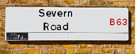
Severn Road in the town of HALESOWEN
About Severn Road
Severn Road is a street located in the town of Halesowen. The street has a length of approximately 659 metres.
The street is publicly maintained which means that the road is adopted and Dudley is responsible for the repair and upkeep of the highway.
Crime & Historic Map of Severn Road
This interactive map displays both historic mapping and street crime data. Click on a circle to view crime statistics, and use the button above to toggle the 1900s historic map.
This interactive map allows you to **zoom and pan** for a better view of the data.
- Use the + and - buttons on the map to zoom in and out.
- Scroll with your **middle mouse wheel** to zoom in and out.
- On a **mobile device**, use **pinch and zoom gestures** to navigate the map.
- Click on crime markers for more details.


| Street Crime (updated 07/02/2025) | ||
|---|---|---|
| Location Note | Central Point of Street - Not Actual Location | |
| MSOA Info | For MSOA E02002032 (Statistical Neighbourhood) | |
| Click Hint | Click on a Circle for a detailed breakdown below map. | |
| Crime Levels |
Green = Very Low Yellow = Low Orange = High Red = Very High |
|
| Postcodes | ||
| Icon | Postcodes for Severn Road | |
| Walking Distances | ||
| Distance Info | Green Circle = 10 Minutes Walk (800 metres) | |
Street Crime Data accessed from data.police.uk on 07/02/2025.
The street is located within the Dudley District (B) Council's jurisdiction. They provide various services, like refuse collection, and manage council tax collection. It's situated in the West Midlands region of the UK.
The road has been assigned the Unique Street Reference Number of 11403836 in the National Street Gazetteer.
The street has the postcodes of B63 2NL, B63 2LS, B63 2LR and B63 2LP.
It is located within the county of West Midlands, situated in the West Midlands region of the UK. It's 107.38 miles North West from central London., 8.14 miles West from Birmingham, 19.06 miles North from Worcester and 24.79 miles West from Coventry.
SEVERN ROAD is within the Post Town of HALESOWEN
Moving to Severn Road?
I can help you uncover potential pitfalls and provide key questions to ask about your new property. With decades of experience as a Local Land Charges Manager, I offer confidential insights to make your move informed and stress-free.
This service is free, but you may wish to make an optional donation to support it. Please include the property name and address in your request as well as anything you wish to focus on.
Contact Me
Do you know why this road is called Severn Road?
What's it like to live here?
Share a Photo of Severn Road
Ask the community a question.
Do you have any questions, memories to share, have any photos or know any facts? We'd love to know more.
Submit Your Comment
Find Homes to Rent in Halesowen

Budget Friendly Hotels near Severn Road
| Budget Hotel Name | Distance (miles) |
|---|---|
|
1: Name:Travelodge Birmingham Halesowen Address: Whitehall Rd, Birmingham, B63 3HY Telephone: 0871 984 6488 Visit Hotel Page |
1.86 |
|
2: Name:Premier Inn Hagley Address: Birmingham Road Telephone: Visit Hotel Page |
1.88 |
|
3: Name:Premier Inn Stourbridge Town Centre Address: Birmingham Street Telephone: Visit Hotel Page |
2.12 |
|
4: Name:Travelodge Birmingham Dudley Address: Dudley Rd, Brierley Hill, Birmingham, DY5 1LE Telephone: 0871 984 6063 Visit Hotel Page |
2.56 |
|
5: Name:Travelodge Birmingham Frankley M5 Southbound Address: Moto Service Area, Illey Ln, M5 Motorway, Frankley, Birmingham, B32 4AR Telephone: 0871 984 6067 Visit Hotel Page |
3.62 |
Hotel Options
Your support helps keep this site running!
If you enjoy using this website, consider making a donation to help me cover hosting costs.

Flats and Apartments in Severn Road
FLAT 7
FLAT 8
FLAT 10
FLAT 11
FLAT 12
FLAT 15
FLAT 16
FLAT 17
FLAT 18
FLAT 19
FLAT 20
FLAT 31
FLAT 32
FLAT 35
FLAT 41
FLAT 42
FLAT 43
FLAT 45
FLAT 46
FLAT 55
FLAT 57
FLAT 60
FLAT 61
FLAT 62
FLAT 63
EPC (Energy Performance Certificate) Information for Severn Road
UPRN: 90037643
EPC Current: D
EPC Potential: D
Habitable Rooms: 4
Property Type: House
Tenure: Owner-occupied
Built Form: End-Terrace
Age Band: 1950-1966
Mains Gas: Yes
UPRN: 90116662
EPC Current: D
EPC Potential: C
Habitable Rooms: 2
Property Type: Flat
Tenure: Rented (social)
Built Form: Semi-Detached
Age Band: 1967-1975
Mains Gas: Yes
UPRN: 90116655
EPC Current: C
EPC Potential: C
Habitable Rooms: 4
Property Type: Flat
Tenure: Rented (social)
Built Form: Semi-Detached
Age Band: 1967-1975
Mains Gas: Yes
UPRN: 90037644
EPC Current: D
EPC Potential: B
Habitable Rooms: 5
Property Type: House
Tenure: rental (social)
Built Form: Mid-Terrace
Age Band: 1967-1975
Mains Gas: Yes
UPRN: 90116663
EPC Current: C
EPC Potential: C
Habitable Rooms: 2
Property Type: Flat
Tenure: Rented (social)
Built Form: Semi-Detached
Age Band: 1967-1975
Mains Gas: Yes
UPRN: 90116656
EPC Current: D
EPC Potential: C
Habitable Rooms: 4
Property Type: Maisonette
Tenure: Rented (social)
Built Form: Semi-Detached
Age Band: 1967-1975
Mains Gas: Yes
UPRN: 90037645
EPC Current: B
EPC Potential: A
Habitable Rooms: 5
Property Type: House
Tenure: Owner-occupied
Built Form: Mid-Terrace
Age Band: 1950-1966
Mains Gas: Yes
UPRN: 90116664
EPC Current: C
EPC Potential: C
Habitable Rooms: 2
Property Type: Flat
Tenure: Rented (social)
Built Form: Semi-Detached
Age Band: 1967-1975
Mains Gas: Yes
UPRN: 90037646
EPC Current: D
EPC Potential: C
Habitable Rooms: 3
Property Type: House
Tenure: Rented (social)
Built Form: Mid-Terrace
Age Band: 1967-1975
Mains Gas: Yes
UPRN: 90116665
EPC Current: D
EPC Potential: C
Habitable Rooms: 1
Property Type: Flat
Tenure: Rented (social)
Built Form: Mid-Terrace
Age Band: 1967-1975
Mains Gas: Yes
UPRN: 90116658
EPC Current: D
EPC Potential: D
Habitable Rooms: 4
Property Type: Maisonette
Tenure: Rented (social)
Built Form: Semi-Detached
Age Band: 1967-1975
Mains Gas: Yes
UPRN: 90037647
EPC Current: B
EPC Potential: B
Habitable Rooms: 5
Property Type: House
Tenure: Owner-occupied
Built Form: End-Terrace
Age Band: 1950-1966
Mains Gas: Yes
UPRN: 90116666
EPC Current: D
EPC Potential: C
Habitable Rooms: 1
Property Type: Flat
Tenure: Rented (social)
Built Form: Mid-Terrace
Age Band: 1967-1975
Mains Gas: Yes
UPRN: 90037648
EPC Current: B
EPC Potential: B
Habitable Rooms: 5
Property Type: House
Tenure: Owner-occupied
Built Form: End-Terrace
Age Band: 1950-1966
Mains Gas: Yes
UPRN: 90116667
EPC Current: C
EPC Potential: C
Habitable Rooms: 2
Property Type: Flat
Tenure: Rented (social)
Built Form: Semi-Detached
Age Band: 1967-1975
Mains Gas: Yes
UPRN: 90116660
EPC Current: D
EPC Potential: D
Habitable Rooms: 4
Property Type: Maisonette
Tenure: Rented (social)
Built Form: Semi-Detached
Age Band: 1967-1975
Mains Gas: Yes
UPRN: 90037649
EPC Current: C
EPC Potential: B
Habitable Rooms: 5
Property Type: House
Tenure: Owner-occupied
Built Form: End-Terrace
Age Band: 1950-1966
Mains Gas: Yes
UPRN: 90116661
EPC Current: D
EPC Potential: D
Habitable Rooms: 3
Property Type: Flat
Tenure: Rented (social)
Built Form: Semi-Detached
Age Band: 1967-1975
Mains Gas: Yes
UPRN: 90037650
EPC Current: C
EPC Potential: B
Habitable Rooms: 4
Property Type: House
Tenure: Owner-occupied
Built Form: End-Terrace
Age Band: 1930-1949
Mains Gas: Yes
UPRN: 90116670
EPC Current: C
EPC Potential: B
Habitable Rooms: 3
Property Type: Flat
Tenure: Rented (social)
Built Form: Mid-Terrace
Age Band: 1967-1975
Mains Gas: Yes
UPRN: 90037653
EPC Current: D
EPC Potential: C
Habitable Rooms: 4
Property Type: House
Tenure: Owner-occupied
Built Form: Mid-Terrace
Age Band: 1967-1975
Mains Gas: Yes
UPRN: 90037654
EPC Current: B
EPC Potential: A
Habitable Rooms: 5
Property Type: House
Tenure: Owner-occupied
Built Form: Mid-Terrace
Age Band: 1950-1966
Mains Gas: Yes
UPRN: 90116674
EPC Current: C
EPC Potential: C
Habitable Rooms: 3
Property Type: Flat
Tenure: Rented (social)
Built Form: Semi-Detached
Age Band: 1967-1975
Mains Gas: Yes
UPRN: 90037656
EPC Current: D
EPC Potential: C
Habitable Rooms: 4
Property Type: House
Tenure: Owner-occupied
Built Form: Mid-Terrace
Age Band: 1950-1966
Mains Gas: Yes
UPRN: 90116675
EPC Current: C
EPC Potential: C
Habitable Rooms: 2
Property Type: Flat
Tenure: Rented (social)
Built Form: Semi-Detached
Age Band: 1967-1975
Mains Gas: Yes
UPRN: 90037657
EPC Current: C
EPC Potential: B
Habitable Rooms: 4
Property Type: House
Tenure: Owner-occupied
Built Form: Mid-Terrace
Age Band: 1950-1966
Mains Gas: Yes
UPRN: 90037658
EPC Current: C
EPC Potential: B
Habitable Rooms: 4
Property Type: House
Tenure: Owner-occupied
Built Form: Mid-Terrace
Age Band: 1967-1975
Mains Gas: Yes
UPRN: 90037659
EPC Current: C
EPC Potential: C
Habitable Rooms: 4
Property Type: House
Tenure: rental (private)
Built Form: Mid-Terrace
Age Band: 1950-1966
Mains Gas: Yes
UPRN: 90037660
EPC Current: D
EPC Potential: C
Habitable Rooms: 3
Property Type: House
Tenure: Rented (social)
Built Form: Mid-Terrace
Age Band: 1967-1975
Mains Gas: Yes
UPRN: 90116649
EPC Current: D
EPC Potential: C
Habitable Rooms: 2
Property Type: Maisonette
Tenure: Rented (social)
Built Form: Semi-Detached
Age Band: 1967-1975
Mains Gas: Yes
UPRN: 90116682
EPC Current: C
EPC Potential: C
Habitable Rooms: 2
Property Type: Flat
Tenure: Rented (social)
Built Form: Semi-Detached
Age Band: 1967-1975
Mains Gas: Yes
UPRN: 90116652
EPC Current: D
EPC Potential: D
Habitable Rooms: 2
Property Type: Flat
Tenure: rental (social)
Built Form: Detached
Age Band: 1967-1975
Mains Gas: Yes
UPRN: 90116683
EPC Current: C
EPC Potential: C
Habitable Rooms: 1
Property Type: Flat
Tenure: Rented (social)
Built Form: End-Terrace
Age Band: 1967-1975
Mains Gas: Yes
UPRN: 90116653
EPC Current: D
EPC Potential: C
Habitable Rooms: 3
Property Type: Maisonette
Tenure: Rented (social)
Built Form: Semi-Detached
Age Band: 1950-1966
Mains Gas: Yes
UPRN: 90116684
EPC Current: C
EPC Potential: C
Habitable Rooms: 2
Property Type: Flat
Tenure: Rented (social)
Built Form: End-Terrace
Age Band: 1967-1975
Mains Gas: Yes
UPRN: 90116654
EPC Current: C
EPC Potential: C
Habitable Rooms: 2
Property Type: Flat
Tenure: Rented (social)
Built Form: Semi-Detached
Age Band: 1967-1975
Mains Gas: Yes
UPRN: 90116685
EPC Current: C
EPC Potential: C
Habitable Rooms: 2
Property Type: Flat
Tenure: Rented (social)
Built Form: End-Terrace
Age Band: 1967-1975
Mains Gas: Yes
UPRN: 90037662
EPC Current: D
EPC Potential: C
Habitable Rooms: 3
Property Type: House
Tenure: Rented (social)
Built Form: Mid-Terrace
Age Band: 1967-1975
Mains Gas: Yes
UPRN: 90116687
EPC Current: C
EPC Potential: C
Habitable Rooms: 3
Property Type: Flat
Tenure: Rented (social)
Built Form: Semi-Detached
Age Band: 1967-1975
Mains Gas: Yes
UPRN: 90037663
EPC Current: D
EPC Potential: C
Habitable Rooms: 4
Property Type: House
Tenure: Rented (social)
Built Form: Mid-Terrace
Age Band: 1967-1975
Mains Gas: Yes
UPRN: 90116688
EPC Current: C
EPC Potential: C
Habitable Rooms: 1
Property Type: Flat
Tenure: Rented (social)
Built Form: Semi-Detached
Age Band: 1950-1966
Mains Gas: Yes
UPRN: 90116689
EPC Current: C
EPC Potential: C
Habitable Rooms: 2
Property Type: Flat
Tenure: Rented (social)
Built Form: End-Terrace
Age Band: 1967-1975
Mains Gas: Yes
UPRN: 90037665
EPC Current: D
EPC Potential: C
Habitable Rooms: 3
Property Type: House
Tenure: Rented (social)
Built Form: Mid-Terrace
Age Band: 1967-1975
Mains Gas: Yes
UPRN: 90116690
EPC Current: C
EPC Potential: C
Habitable Rooms: 2
Property Type: Flat
Tenure: Rented (social)
Built Form: Semi-Detached
Age Band: 1967-1975
Mains Gas: Yes
UPRN: 90037666
EPC Current: D
EPC Potential: B
Habitable Rooms: 4
Property Type: House
Tenure: Owner-occupied
Built Form: Mid-Terrace
Age Band: 1967-1975
Mains Gas: Yes
UPRN: 90116691
EPC Current: C
EPC Potential: C
Habitable Rooms: 1
Property Type: Flat
Tenure: Rented (social)
Built Form: End-Terrace
Age Band: 1967-1975
Mains Gas: Yes
UPRN: 90037667
EPC Current: D
EPC Potential: C
Habitable Rooms: 3
Property Type: House
Tenure: Rented (social)
Built Form: Mid-Terrace
Age Band: 1967-1975
Mains Gas: Yes
UPRN: 90037668
EPC Current: D
EPC Potential: C
Habitable Rooms: 3
Property Type: House
Tenure: Rented (social)
Built Form: Mid-Terrace
Age Band: 1967-1975
Mains Gas: Yes
UPRN: 90037669
EPC Current: D
EPC Potential: C
Habitable Rooms: 3
Property Type: House
Tenure: Rented (social)
Built Form: Mid-Terrace
Age Band: 1967-1975
Mains Gas: Yes
UPRN: 90116694
EPC Current: C
EPC Potential: C
Habitable Rooms: 1
Property Type: Flat
Tenure: Rented (social)
Built Form: Semi-Detached
Age Band: 1967-1975
Mains Gas: Yes
UPRN: 90037670
EPC Current: E
EPC Potential: C
Habitable Rooms: 5
Property Type: House
Tenure: Rented (social)
Built Form: End-Terrace
Age Band: 1967-1975
Mains Gas: Yes
UPRN: 90116695
EPC Current: C
EPC Potential: C
Habitable Rooms: 2
Property Type: Flat
Tenure: Rented (social)
Built Form: End-Terrace
Age Band: 1967-1975
Mains Gas: Yes
UPRN: 90159802
EPC Current: D
EPC Potential: B
Habitable Rooms: 6
Property Type: House
Tenure: rental (social)
Built Form: Detached
Age Band: 1996-2002
Mains Gas: Yes
UPRN: 90155417
EPC Current: D
EPC Potential: C
Habitable Rooms: 7
Property Type: House
Tenure: rental (social)
Built Form: Detached
Age Band: 1996-2002
Mains Gas: Yes
UPRN: 90159279
EPC Current: D
EPC Potential: B
Habitable Rooms: 3
Property Type: House
Tenure: rental (social)
Built Form: Semi-Detached
Age Band: 1996-2002
Mains Gas: Yes
UPRN: 90116698
EPC Current: D
EPC Potential: C
Habitable Rooms: 3
Property Type: Flat
Tenure: Rented (social)
Built Form: End-Terrace
Age Band: 1967-1975
Mains Gas: Yes
UPRN: 90155418
EPC Current: D
EPC Potential: B
Habitable Rooms: 3
Property Type: House
Tenure: rental (social)
Built Form: Semi-Detached
Age Band: 1996-2002
Mains Gas: Yes
UPRN: 90116699
EPC Current: C
EPC Potential: C
Habitable Rooms: 2
Property Type: Flat
Tenure: Rented (social)
Built Form: Semi-Detached
Age Band: 1967-1975
Mains Gas: Yes
UPRN: 90159278
EPC Current: D
EPC Potential: B
Habitable Rooms: 5
Property Type: House
Tenure: rental (social)
Built Form: Semi-Detached
Age Band: 1996-2002
Mains Gas: Yes
UPRN: 90116700
EPC Current: C
EPC Potential: C
Habitable Rooms: 3
Property Type: Flat
Tenure: Rented (social)
Built Form: Semi-Detached
Age Band: 1967-1975
Mains Gas: Yes
UPRN: 90155419
EPC Current: D
EPC Potential: B
Habitable Rooms: 5
Property Type: House
Tenure: rental (social)
Built Form: Semi-Detached
Age Band: 1996-2002
Mains Gas: Yes
UPRN: 90116701
EPC Current: C
EPC Potential: C
Habitable Rooms: 2
Property Type: Flat
Tenure: Rented (social)
Built Form: Mid-Terrace
Age Band: 1967-1975
Mains Gas: Yes
UPRN: 90159277
EPC Current: D
EPC Potential: B
Habitable Rooms: 5
Property Type: House
Tenure: rental (social)
Built Form: End-Terrace
Age Band: 1996-2002
Mains Gas: Yes
UPRN: 90155420
EPC Current: D
EPC Potential: C
Habitable Rooms: 5
Property Type: House
Tenure: rental (social)
Built Form: End-Terrace
Age Band: 1996-2002
Mains Gas: Yes
UPRN: 90159140
EPC Current: D
EPC Potential: B
Habitable Rooms: 4
Property Type: House
Tenure: Rented (social)
Built Form: Mid-Terrace
Age Band: 1991-1995
Mains Gas: Yes
UPRN: 90155421
EPC Current: D
EPC Potential: B
Habitable Rooms: 5
Property Type: House
Tenure: rental (social)
Built Form: Mid-Terrace
Age Band: 1996-2002
Mains Gas: Yes
UPRN: 90116705
EPC Current: C
EPC Potential: C
Habitable Rooms: 3
Property Type: Flat
Tenure: Rented (social)
Built Form: Semi-Detached
Age Band: 1967-1975
Mains Gas: Yes
UPRN: 90158685
EPC Current: D
EPC Potential: B
Habitable Rooms: 5
Property Type: House
Tenure: rental (social)
Built Form: End-Terrace
Age Band: 1996-2002
Mains Gas: Yes
UPRN: 90155422
EPC Current: D
EPC Potential: B
Habitable Rooms: 5
Property Type: House
Tenure: rental (social)
Built Form: End-Terrace
Age Band: 1996-2002
Mains Gas: Yes
UPRN: 90158571
EPC Current: D
EPC Potential: B
Habitable Rooms: 5
Property Type: House
Tenure: rental (social)
Built Form: End-Terrace
Age Band: 1996-2002
Mains Gas: Yes
UPRN: 90116708
EPC Current: C
EPC Potential: C
Habitable Rooms: 2
Property Type: Flat
Tenure: Rented (social)
Built Form: Semi-Detached
Age Band: 1967-1975
Mains Gas: Yes
UPRN: 90155423
EPC Current: D
EPC Potential: C
Habitable Rooms: 5
Property Type: House
Tenure: rental (social)
Built Form: Semi-Detached
Age Band: 1996-2002
Mains Gas: Yes
UPRN: 90116709
EPC Current: C
EPC Potential: C
Habitable Rooms: 2
Property Type: Flat
Tenure: Rented (social)
Built Form: Semi-Detached
Age Band: 1967-1975
Mains Gas: Yes
UPRN: 90158894
EPC Current: C
EPC Potential: C
Habitable Rooms: 5
Property Type: House
Tenure: rental (social)
Built Form: Mid-Terrace
Age Band: 1996-2002
Mains Gas: Yes
UPRN: 90116710
EPC Current: C
EPC Potential: C
Habitable Rooms: 3
Property Type: Flat
Tenure: Rented (social)
Built Form: Semi-Detached
Age Band: 1967-1975
Mains Gas: Yes
UPRN: 90155424
EPC Current: D
EPC Potential: B
Habitable Rooms: 5
Property Type: House
Tenure: rental (social)
Built Form: Semi-Detached
Age Band: 1996-2002
Mains Gas: Yes
UPRN: 90159804
EPC Current: D
EPC Potential: C
Habitable Rooms: 6
Property Type: House
Tenure: rental (social)
Built Form: End-Terrace
Age Band: 1996-2002
Mains Gas: Yes
UPRN: 90158494
EPC Current: D
EPC Potential: B
Habitable Rooms: 5
Property Type: House
Tenure: rental (social)
Built Form: Semi-Detached
Age Band: 1996-2002
Mains Gas: Yes
UPRN: 90116713
EPC Current: C
EPC Potential: C
Habitable Rooms: 2
Property Type: Flat
Tenure: Rented (social)
Built Form: End-Terrace
Age Band: 1950-1966
Mains Gas: Yes
UPRN: 90155425
EPC Current: D
EPC Potential: B
Habitable Rooms: 3
Property Type: House
Tenure: Owner-occupied
Built Form: Semi-Detached
Age Band: 1996-2002
Mains Gas: Yes
UPRN: 90116714
EPC Current: D
EPC Potential: C
Habitable Rooms: 2
Property Type: Flat
Tenure: Rented (social)
Built Form: End-Terrace
Age Band: 1967-1975
Mains Gas: Yes
UPRN: 90116715
EPC Current: C
EPC Potential: C
Habitable Rooms: 2
Property Type: Flat
Tenure: Rented (social)
Built Form: End-Terrace
Age Band: 1967-1975
Mains Gas: Yes
UPRN: 90116717
EPC Current: C
EPC Potential: C
Habitable Rooms: 3
Property Type: Flat
Tenure: Rented (social)
Built Form: Semi-Detached
Age Band: 1967-1975
Mains Gas: Yes
UPRN: 90155427
EPC Current: C
EPC Potential: B
Habitable Rooms: 3
Property Type: House
Tenure: Owner-occupied
Built Form: End-Terrace
Age Band: 1996-2002
Mains Gas: Yes
UPRN: 90116719
EPC Current: D
EPC Potential: C
Habitable Rooms: 2
Property Type: Flat
Tenure: Rented (social)
Built Form: End-Terrace
Age Band: 1967-1975
Mains Gas: Yes
UPRN: 90155429
EPC Current: C
EPC Potential: B
Habitable Rooms: 3
Property Type: House
Tenure: Rented (private)
Built Form: Mid-Terrace
Age Band: 1967-1975
Mains Gas: Yes
UPRN: 90116720
EPC Current: C
EPC Potential: C
Habitable Rooms: 2
Property Type: Flat
Tenure: Rented (social)
Built Form: End-Terrace
Age Band: 1967-1975
Mains Gas: Yes
UPRN: 90155430
EPC Current: C
EPC Potential: B
Habitable Rooms: 3
Property Type: House
Tenure: Owner-occupied
Built Form: End-Terrace
Age Band: 2003-2006
Mains Gas: Yes
UPRN: 90116725
EPC Current: D
EPC Potential: D
Habitable Rooms: 2
Property Type: Flat
Tenure: Rented (social)
Built Form: End-Terrace
Age Band: 1967-1975
Mains Gas: Yes
UPRN: 90116726
EPC Current: D
EPC Potential: D
Habitable Rooms: 2
Property Type: Flat
Tenure: Rented (social)
Built Form: Mid-Terrace
Age Band: 1967-1975
Mains Gas: Yes
UPRN: 90155433
EPC Current: C
EPC Potential: B
Habitable Rooms: 5
Property Type: House
Tenure: Owner-occupied
Built Form: Semi-Detached
Age Band: 1996-2002
Mains Gas: Yes
UPRN: 90155436
EPC Current: C
EPC Potential: B
Habitable Rooms: 4
Property Type: House
Tenure: Rented (private)
Built Form: Semi-Detached
Age Band: 2003-2006
Mains Gas: Yes
UPRN: 90037672
EPC Current: E
EPC Potential: C
Habitable Rooms: 4
Property Type: House
Tenure: Owner-occupied
Built Form: Semi-Detached
Age Band: 1967-1975
Mains Gas: Yes
UPRN: 90037673
EPC Current: C
EPC Potential: B
Habitable Rooms: 4
Property Type: House
Tenure: Owner-occupied
Built Form: Semi-Detached
Age Band: 1930-1949
Mains Gas: Yes
UPRN: 90037674
EPC Current: D
EPC Potential: B
Habitable Rooms: 4
Property Type: House
Tenure: Owner-occupied
Built Form: Semi-Detached
Age Band: 1967-1975
Mains Gas: Yes
UPRN: 90116657
EPC Current: C
EPC Potential: C
Habitable Rooms: 4
Property Type: Flat
Tenure: rental (social)
Built Form: Detached
Age Band: 1967-1975
Mains Gas: Yes
UPRN: 90116668
EPC Current: C
EPC Potential: C
Habitable Rooms: 3
Property Type: Flat
Tenure: Rented (social)
Built Form: Enclosed End-Terrace
Age Band: 1967-1975
Mains Gas: Yes
UPRN: 90116669
EPC Current: C
EPC Potential: C
Habitable Rooms: 3
Property Type: Flat
Tenure: rental (social)
Built Form: Semi-Detached
Age Band: 1967-1975
Mains Gas: Yes
UPRN: 90116671
EPC Current: C
EPC Potential: C
Habitable Rooms: 2
Property Type: Flat
Tenure: Rented (social)
Built Form: Enclosed End-Terrace
Age Band: 1967-1975
Mains Gas: Yes
UPRN: 90116672
EPC Current: C
EPC Potential: C
Habitable Rooms: 2
Property Type: Flat
Tenure: Rented (social)
Built Form: Enclosed End-Terrace
Age Band: 1967-1975
Mains Gas: Yes
UPRN: 90116673
EPC Current: D
EPC Potential: C
Habitable Rooms: 2
Property Type: Flat
Tenure: rental (social)
Built Form: Semi-Detached
Age Band: 1967-1975
Mains Gas: Yes
UPRN: 90116676
EPC Current: C
EPC Potential: B
Habitable Rooms: 3
Property Type: Flat
Tenure: Rented (social)
Built Form: Mid-Terrace
Age Band: 1967-1975
Mains Gas: Yes
UPRN: 90116677
EPC Current: C
EPC Potential: C
Habitable Rooms: 2
Property Type: Flat
Tenure: rental (social)
Built Form: Enclosed End-Terrace
Age Band: 1967-1975
Mains Gas: Yes
UPRN: 90116678
EPC Current: C
EPC Potential: C
Habitable Rooms: 2
Property Type: Flat
Tenure: rental (social)
Built Form: End-Terrace
Age Band: 1967-1975
Mains Gas: Yes
UPRN: 90116679
EPC Current: C
EPC Potential: C
Habitable Rooms: 2
Property Type: Flat
Tenure: rental (social)
Built Form: Semi-Detached
Age Band: 1967-1975
Mains Gas: Yes
UPRN: 90116680
EPC Current: D
EPC Potential: C
Habitable Rooms: 3
Property Type: Flat
Tenure: rental (social)
Built Form: Semi-Detached
Age Band: 1967-1975
Mains Gas: Yes
UPRN: 90116681
EPC Current: B
EPC Potential: B
Habitable Rooms: 3
Property Type: Flat
Tenure: Rented (social)
Built Form: Mid-Terrace
Age Band: 1967-1975
Mains Gas: Yes
UPRN: 90116692
EPC Current: C
EPC Potential: C
Habitable Rooms: 3
Property Type: Flat
Tenure: rental (social)
Built Form: Mid-Terrace
Age Band: 1967-1975
Mains Gas: Yes
UPRN: 90116693
EPC Current: C
EPC Potential: C
Habitable Rooms: 3
Property Type: Flat
Tenure: rental (private)
Built Form: Mid-Terrace
Age Band: 1950-1966
Mains Gas: Yes
UPRN: 90116696
EPC Current: C
EPC Potential: C
Habitable Rooms: 3
Property Type: Flat
Tenure: rental (social)
Built Form: End-Terrace
Age Band: 1967-1975
Mains Gas: Yes
UPRN: 90116702
EPC Current: C
EPC Potential: C
Habitable Rooms: 2
Property Type: Flat
Tenure: rental (social)
Built Form: End-Terrace
Age Band: 1967-1975
Mains Gas: Yes
UPRN: 90116703
EPC Current: D
EPC Potential: C
Habitable Rooms: 2
Property Type: Flat
Tenure: rental (social)
Built Form: Enclosed End-Terrace
Age Band: 1967-1975
Mains Gas: Yes
UPRN: 90116704
EPC Current: B
EPC Potential: B
Habitable Rooms: 3
Property Type: Flat
Tenure: rental (social)
Built Form: Enclosed Mid-Terrace
Age Band: 1967-1975
Mains Gas: Yes
UPRN: 90116706
EPC Current: C
EPC Potential: C
Habitable Rooms: 3
Property Type: Flat
Tenure: rental (social)
Built Form: Mid-Terrace
Age Band: 1967-1975
Mains Gas: Yes
UPRN: 90116707
EPC Current: C
EPC Potential: C
Habitable Rooms: 2
Property Type: Flat
Tenure: rental (social)
Built Form: Mid-Terrace
Age Band: 1967-1975
Mains Gas: Yes
UPRN: 90116716
EPC Current: C
EPC Potential: C
Habitable Rooms: 3
Property Type: Flat
Tenure: Rented (social)
Built Form: Enclosed Mid-Terrace
Age Band: 1967-1975
Mains Gas: Yes
UPRN: 90116718
EPC Current: C
EPC Potential: C
Habitable Rooms: 3
Property Type: Flat
Tenure: Rented (social)
Built Form: Enclosed End-Terrace
Age Band: 1967-1975
Mains Gas: Yes
UPRN: 90116721
EPC Current: D
EPC Potential: C
Habitable Rooms: 2
Property Type: Flat
Tenure: Rented (social)
Built Form: Enclosed End-Terrace
Age Band: 1967-1975
Mains Gas: Yes
UPRN: 90116722
EPC Current: D
EPC Potential: D
Habitable Rooms: 3
Property Type: Flat
Tenure: rental (social)
Built Form: End-Terrace
Age Band: 1967-1975
Mains Gas: Yes
UPRN: 90116723
EPC Current: C
EPC Potential: C
Habitable Rooms: 3
Property Type: Flat
Tenure: Rented (social)
Built Form: Mid-Terrace
Age Band: 1967-1975
Mains Gas: Yes
UPRN: 90116724
EPC Current: C
EPC Potential: C
Habitable Rooms: 3
Property Type: Flat
Tenure: Rented (social)
Built Form: Enclosed Mid-Terrace
Age Band: 1967-1975
Mains Gas: Yes
House Sales
| Year | High | Low | Average | Sales |
|---|---|---|---|---|
| 2015 | £76,000 | £76,000 | £76,000 | 1 |
| 2016 | £125,000 | £125,000 | £125,000 | 2 |
| 2017 | £128,000 | £145,000 | £136,500 | 2 |
| 2018 | £146,500 | £146,500 | £146,500 | 1 |
| 2019 | £133,000 | £158,500 | £153,817 | 3 |
| 2020 | £124,000 | £124,000 | £124,000 | 1 |
| 2021 | £225,000 | £150,000 | £178,333 | 3 |
| 2022 | £153,000 | £153,000 | £153,000 | 1 |
| 2023 | £150,000 | £154,000 | £152,000 | 2 |
Contains HM Land Registry data © Crown copyright and database right 2025. This data is licensed under the Open Government Licence v3.0.
Nearby Estate Agents
| Name | Address | Website |
|---|---|---|
| The Property Penguin | 7 The Hayes, Stourbridge,DY9 8NX | Visit Website |
| Complete Property Services | 24 Upper High Street, Cradley Heath,B64 5HX | Visit Website |
| Bloore King & Kavanagh | 8 Hagley Road, Halesowen, B63 4RG | Visit Website |
| Connells | 10 Hagley Road, Halesowen, B63 4RG | Visit Website |
| Connells Lettings | 10 Hagley Road, Halesowen, B63 4RG | Visit Website |
Neighbourhood Policing |
| Police Force: West Midlands |
 View Neighbourhood Crime and Policing View Neighbourhood Crime and Policing |
| Find a Local Neighbourhood Watch Scheme |
Location Details
| Severn Road | |
|---|---|

| |
| Latitude | 52.456735 |
| Longitude | -2.090475 |
| OS Easting (X): | 393852 |
| OS Northing (Y): | 284354 |
| OS Grid Reference: | SO939844 |
Known Residential Addresses for Severn Road
- 53
- 61
- 73
- 78
- 74
- 12
- 11
- 17
- 67
- 6
- 14
- 59
- 57
Roads that have a Junction with Severn Road
| Street | Junction Type |
|---|---|
| Tanhouse Lane | junction |
| Priestley Close | junction |
| Avon Road | junction |
| Teme Road | junction |
| Tanhouse Lane | junction |
Sunset and Sunrise times
| Sunrise | 07:11 |
|---|---|
| Sunset | 17:32 |
Latest Weather Conditions
| Observed at Weather Station: | Coleshill 20 February 2025 at 11:00 (16.98 miles away) |
|---|---|
| Current Weather: | Light rain |
| Temperature and Humidity: | 12.8°C (91.1%) |
| Wind Direction and Speed: | S (18 mph) |
Population Statistics
| ONS Area Code | E00049892 & E00049894 |
|---|---|
| ONS Area Name | Multi-Ethnic Hardship & Industrious Transitions |
| Average Age | 39.36 |
| Area Population | 1759.00 |
| Male Population | 848.00 (48%) |
| Female Population | 911.00 (52%) |
| Benefit Claimants | 65 (4%) |
| LSOA Code: | E01009862 |
|---|---|
| LSOA Name: | Dudley 033D |
| SOA Code: | 4c |
| SOA Name: | |
| MSOA Code: | E02002032 |
| MSOA Name: | Dudley 033 |
Nearest Supermarkets
| Iceland Cradley Heath |
|---|
| 74/75 High Street, Cradley Heath, West Midlands, B64 5HA |
| 01384564016 |
| Distance: 1.02 Miles |
| Directions to Iceland Cradley Heath |
| Tesco Cradley Heath Extra |
|---|
| Foxoak St, Cradley Heath, B64 5DF |
| 0345 677 9890 |
| Distance: 1.2 Miles |
| Directions to Tesco Cradley Heath Extra |
| Tesco Stourbridge Rd Express |
|---|
| 175 Stourbridge Rd, Halesowen, B63 3UD |
| 0345 675 7004 |
| Distance: 1.2 Miles |
| Directions to Tesco Stourbridge Rd Express |
| Tesco Hasbury Express |
|---|
| 364 Hagley Rd, Hasbury, Halesowen, B63 4JS |
| 0345 026 9361 |
| Distance: 1.39 Miles |
| Directions to Tesco Hasbury Express |
Telephone Information
| Area Code |
|---|
| Area Code: 01384 - Dudley |
| Area Code: 01562 - Kidderminster |
| Area Code: 0121 - Birmingham |
| Area Code: 01902 - Wolverhampton |
Broadband Information
| Speed | Average Speed | Median Speed | Maximum Speed | Next-generation access (NGA) | Number of Connections |
|---|---|---|---|---|---|
| Greater than 2 Mbps | 13.5 | 9.1 | >=30 | Y | 4 |
Local Government
| Local Council Details |
|---|
| Within the area of Dudley |
| Visit the Council's Website |
| Council House, Priory Road, Dudley, West Midlands &DY1 1HF |
| Send email |
| Telephone Number: 01384 812 345 |
| Local Member of Parliament |
|---|
| Within the Westminster Parliamentary Constituency of Stourbridge |
| The Member of Parliament is Alex Ballinger |
| Details for the MP Alex Ballinger on parliament.uk |
| Details for the MP Alex Ballinger on theyworkforyou.com |
| In the 2024 General Election Alex Ballinger won with a majority of 4,364 the result was Lab gain from Con. The total electorate was 68,549 |
| Wards, Parish Councils and County Councils |
|---|
| Ward: Cradley and Wollescote Ward |
| Parish: Unparished area |
| Ceremonial County: West Midlands |
Nearest Schools
England Primary Schools
Newfield Park Primary School
Address: Newfield Park Primary School, Whittingham Road, Halesowen, West Midlands, B63 3TP
Distance: 1.48 miles
Contact: 01384818640
Temple Meadow Primary School
Address: Temple Meadow Primary School, Wrights Lane, Cradley Heath, West Midlands, B64 6RH
Distance: 1.68 miles
Contact: 01384569021
Tenterfields Primary Academy
Address: Tenterfields Primary Academy, Tenterfields, HALESOWEN, West Midlands, B63 3LH
Distance: 1.92 miles
Contact: 01212895020
Tenterfields Primary School
Address: Tenterfields Primary School, Tenterfields, Halesowen, West Midlands, B63 3LH
Distance: 1.92 miles
Contact:
Old Hill Primary School
Address: Old Hill Primary School, Lawrence Lane, Cradley Heath, West Midlands, B64 6DR
Distance: 1.53 miles
Contact: 01384569213
Netherbrook Primary School
Address: Netherbrook Primary School, Chester Road, Netherton, Dudley, West Midlands, DY2 9RZ
Distance: 1.72 miles
Contact: 01384818415
Netherbrook Primary School
Address: Netherbrook Primary School, Chester Road, Netherton, Dudley, West Midlands, DY2 9RZ
Distance: 1.72 miles
Contact:
Reddal Hill Primary School
Address: Reddal Hill Primary School, Trinity Street, Cradley Heath, West Midlands, B64 6HT
Distance: 1.60 miles
Contact: 01384569053
Our Lady and St Kenelm RC School
Address: Our Lady and St Kenelm RC School, Bundle Hill, Halesowen, West Midlands, B63 4AR
Distance: 1.53 miles
Contact: 01384816880
Corngreaves Academy
Address: Corngreaves Academy, Plant Street, Cradley Heath, West Midlands, B64 6EZ
Distance: 1.39 miles
Contact: 01384569333
Corngreaves Primary School
Address: Corngreaves Primary School, Plant Street, Cradley Heath, West Midlands, B64 6EZ
Distance: 1.39 miles
Contact:
Halesowen CofE Primary School
Address: Halesowen CofE Primary School, High Street, Halesowen, West Midlands, B63 3BB
Distance: 1.68 miles
Contact: 01384818885
St Margaret's At Hasbury CofE Primary School
Address: St Margaret's At Hasbury CofE Primary School, Hagley Road, Hasbury, Halesowen, West Midlands, B63 4QD
Distance: 1.55 miles
Contact: 01384818660
Timbertree Academy
Address: Timbertree Academy, Valley Road, Cradley Heath, West Midlands, B64 7LT
Distance: 0.99 miles
Contact: 01384567830
Huntingtree Primary School
Address: Huntingtree Primary School, Huntingtree Road, Halesowen, West Midlands, B63 4HY
Distance: 1.09 miles
Contact: 01384818650
Caslon Primary Community School
Address: Caslon Primary Community School, Beeches View Avenue, Halesowen, West Midlands, B63 2ES
Distance: 0.31 miles
Contact: 01384818875
Dudley Wood Primary School
Address: Dudley Wood Primary School, Dudley Wood Road, Dudley, West Midlands, DY2 0DB
Distance: 1.54 miles
Contact: 01384900640
Dudley Wood Primary School
Address: Dudley Wood Primary School, Dudley Wood Road, Dudley, West Midlands, DY2 0DB
Distance: 1.54 miles
Contact:
Lutley Primary School
Address: Lutley Primary School, Brookwillow Road, Halesowen, West Midlands, B63 1BU
Distance: 1.30 miles
Contact: 01384818220
Lutley Primary School
Address: Lutley Primary School, Brookwillow Road, Halesowen, West Midlands, B63 1BU
Distance: 1.30 miles
Contact:
Cradley CofE Primary School
Address: Cradley CofE Primary School, Church Road, Cradley, Halesowen, West Midlands, B63 2UL
Distance: 0.48 miles
Contact: 01384818230
Colley Lane Primary Academy
Address: Colley Lane Primary Academy, Colley Lane, Halesowen, West Midlands, B63 2TN
Distance: 0.37 miles
Contact: 01384900450
Colley Lane Primary School
Address: Colley Lane Primary School, Colley Lane, Halesowen, West Midlands, B63 2TN
Distance: 0.37 miles
Contact:
Wollescote Primary School
Address: Wollescote Primary School, Drummond Road, Wollescote, Stourbridge, West Midlands, DY9 8YA
Distance: 0.68 miles
Contact: 01384818500
Quarry Bank Primary School
Address: Quarry Bank Primary School, High Street, Quarry Bank, Brierley Hill, West Midlands, DY5 2AD
Distance: 1.11 miles
Contact: 01384818750
Hob Green Primary School
Address: Hob Green Primary School, Hob Green Road, Pedmore Fields, Stourbridge, West Midlands, DY9 9EX
Distance: 1.40 miles
Contact: 01384210288
Hob Green Primary School
Address: Hob Green Primary School, Hob Green Road, Pedmore Fields, Stourbridge, West Midlands, DY9 9EX
Distance: 1.40 miles
Contact:
Rufford Primary School
Address: Rufford Primary School, Bredon Avenue, Stourbridge, West Midlands, DY9 7NR
Distance: 1.57 miles
Contact:
Mount Pleasant Primary School
Address: Mount Pleasant Primary School, Mount Pleasant, Quarry Bank, Brierley Hill, West Midlands, DY5 2YN
Distance: 1.51 miles
Contact: 01384816910
Ham Dingle Primary Academy
Address: Ham Dingle Primary Academy, Ham Dingle Primary School, Old Ham Lane, Pedmore, Stourbridge, West Midlands, DY9 0UN
Distance: 1.73 miles
Contact: 01384900753
Ham Dingle Primary School
Address: Ham Dingle Primary School, Old Ham Lane, Pedmore, Stourbridge, West Midlands, DY9 0UN
Distance: 1.73 miles
Contact:
St Mary's RC Primary School
Address: St Mary's RC Primary School, Mill Street, Brierley Hill, West Midlands, DY5 2TH
Distance: 1.73 miles
Contact: 01384985005
Brierley Hill Primary School
Address: Brierley Hill Primary School, Mill Street, Brierley Hill, West Midlands, DY5 2TD
Distance: 1.94 miles
Contact: 01384816980
England Secondary Schools
Ormiston Forge Academy
Address: Ormiston Forge Academy, Wrights Lane, Cradley Heath, West Midlands, B64 6QU
Distance: 1.86 miles
Contact: 01384566598
The Earls High School
Address: The Earls High School, Furnace Lane, Halesowen, West Midlands, B63 3SL
Distance: 1.68 miles
Contact: 01384816105
The Earls High School
Address: The Earls High School, Furnace Lane, Halesowen, West Midlands, B63 3SL
Distance: 1.68 miles
Contact:
Windsor High School and Sixth Form
Address: Windsor High School and Sixth Form, Richmond Street, Halesowen, West Midlands, B63 4BB
Distance: 1.38 miles
Contact: 01215501452
Pedmore Technology College and Community School
Address: Pedmore Technology College and Community School, Grange Lane, Pedmore, Stourbridge, West Midlands, DY9 7HS
Distance: 1.58 miles
Contact:
Nearest Hospitals
| West Midlands Hospital |
|---|
| Address: Colman Hill, Colman Hill, Halesowen, Halesowen, B63 2AH, |
| Independent Sector |
| Ramsay Healthcare UK Operations Limited |
| Telephone: 01384 632618 |
| Visit Hospital Website |
| Distance: 0.94 (miles) |
| Directions from to West Midlands Hospital |
| Rowley Regis Hospital |
|---|
| Address: Moor Lane, Rowley Regis, B65 8DA, |
| NHS Sector |
| Sandwell and West Birmingham Hospitals NHS Trust |
| Telephone: 0121 507 6300 |
| Visit Hospital Website |
| Distance: 3.72 (miles) |
| Directions from to Rowley Regis Hospital |
| Corbett Hospital |
|---|
| Address: Vicarage Road, Stourbridge, DY8 4JB, |
| NHS Sector |
| The Dudley Group NHS Foundation Trust |
| Telephone: 01384 456111 |
| Visit Hospital Website |
| Distance: 3.91 (miles) |
| Directions from to Corbett Hospital |
Nearest Dentists
Dentists
BHANDAL DENTAL PRACTICE
Address: 24-26 WINDMILL HILL, COLLEY GATE, HALESOWEN, WEST MIDLANDS, B63 2DB
Distance: 0.36 miles
Contact: :
20 WINDMILL HILL
Address: COLLEY GATE, HALESOWEN, WEST MIDLANDS, B63 2DB
Distance: 0.36 miles
Contact: :
DENTAL SURGERY
Address: 19 SYDNEY ROAD, CRADLEY HEATH, WEST MIDLANDS, B64 5BA
Distance: 1.03 miles
Contact: :
DENTAL SURGERY
Address: 148 HIGH STREET, CRADLEY HEATH, WEST MIDLANDS, B64 5HJ
Distance: 1.10 miles
Contact: :
DENTAL SURGERY
Address: 66 CHAPEL STREET, LYE, STOURBRIDGE, WEST MIDLANDS, DY9 8BX
Distance: 1.10 miles
Contact: :
BHANDAL DENTAL PRACTICE
Address: 6 HIGH STREET, LYE, STOURBRIDGE, WEST MIDLANDS, DY9 8JT
Distance: 1.12 miles
Contact: :
Nearest GP Surgeries
Doctors
CHAPEL HOUSE LANE SURGERY (DR MUCKLOW)
Address: CHAPEL HOUSE LANE SURGERY, CHAPEL HOUSE LANE, HALESOWEN, WEST MIDLANDS, B63 2JW
Distance: 0.14 miles
Contact: :
CRADLEY ROAD
Address: 62 CRADLEY ROAD, CRADLEY HEATH, WEST MIDLANDS, B64 6AG
Distance: 0.95 miles
Contact: :
HADEN VALE SURGERY
Address: 50 BARRS ROAD, WARLEY, CRADLEY HEATH, WEST MIDLANDS, B64 7HG
Distance: 0.98 miles
Contact: tel: 01384 634511
THE LIMES SURGERY MEDICAL CENTRE
Address: 172 HIGH STREET, LYE, STOURBRIDGE, WEST MIDLANDS, DY9 8LL
Distance: 0.99 miles
Contact: tel: 01384 426929
CHAPEL STREET MEDICAL CENTRE
Address: 87 CHAPEL STREET, LYE, STOURBRIDGE, WEST MIDLANDS, DY9 8BT
Distance: 1.03 miles
Contact: tel: 01384 897668
MEADOWBROOK SURGERY
Address: 4 MEADOWBROOK ROAD, HALESOWEN, WEST MIDLANDS, B63 1AB
Distance: 1.07 miles
Contact: tel: 0121 5501034
Nearest Dispensing Chemists
Pharmacies
COLLEY GATE PHARMACY
Address: 118 COLLEY GATE, HALESOWEN, B63 2BU
Distance: 0.27 miles
Contact: tel: 01384 569443
HINGLEYS CHEMIST
Address: 59 CRADLEY ROAD, CRADLEY HEATH, WEST MIDLANDS, B64 6AG
Distance: 0.95 miles
Contact: tel: 01384 564993
DAY NIGHT PHARMACY
Address: 45 HIGH STREET, LYE, STOURBRIDGE, WEST MIDLANDS, DY9 8LQ
Distance: 0.96 miles
Contact: tel: 01384 898400
HADEN VALE PHARMACY
Address: 50 BARRS ROAD, CRADLEY HEATH, WEST MIDLANDS, B64 7HG
Distance: 0.98 miles
Contact: tel: 01384 562002
LYMES PHARMACY
Address: 173A HIGH STREET, LYE, STOURBRIDGE, DY9 8LN
Distance: 1.00 miles
Contact: tel: 01384 422357
LYE PHARMACY
Address: 37 HIGH STREET, LYE, STOURBRIDGE, WEST MIDLANDS, DY9 8LF
Distance: 1.03 miles
Contact: :
Nearest Opticians
Opticians
BIRMINGHAM 1 DOMICILIARY SPECSAVERS LIMITED
Address: CRADLEY ENTERPRISE CENTRE, MAYPOLE FIELDS, HALESOWEN, B63 2QB
Distance: 0.84 miles
Contact: :
SPEXMANIAX LTD
Address: 84 LONGMOOR ROAD, HALESOWEN, WEST MIDLANDS, B63 1AN
Distance: 0.96 miles
Contact: :
EYEDEAL EYEWEAR OPTICIANS (CRADLEY HEATH)
Address: 104 HIGH STREET, CRADLEY HEATH, WEST MIDLANDS, B64 5HE
Distance: 1.04 miles
Contact: :
EYE SOCIETY
Address: 33 HIGH STREET, CRADLEY HEATH, WEST MIDLANDS, B64 5HL
Distance: 1.09 miles
Contact: :
ROBERT HILL OPTICIANS
Address: 209 HIGH STREET, LYE, STOURBRIDGE, DY9 8JX
Distance: 1.12 miles
Contact: :
SPECIAL LOOKS LTD
Address: 17-18 HIGH STREET, CRADLEY HEATH, WEST MIDLANDS, B64 5HG
Distance: 1.14 miles
Contact: :
Transport
Nearest Rail Stations
Cradley Heath Station is 0.89 miles away.
Address: Cradley Heath station, Forge Lane, Cradley Heath, West Midlands, B64 5AL
Cradley Heath is situated on the Birmingham to Worcester via Kidderminster line.
Cradley Heath Station is staffed on a part time basis.
Lye (West Midlands) Station is 1.09 miles away.
Address: Lye station, Station Road, Lye, West Midlands, DY9 8ES
Lye (West Midlands) is situated on the Birmingham to Worcester via Kidderminster line.
Lye (West Midlands) Station is staffed on a part time basis.