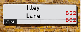
Illey Lane is a street located near the city of Birmingham and in the otherSettlement of Illey. The street has a length of approximately 2,411 metres.
The street is located within the Bromsgrove District and Dudley District (B) Council's jurisdiction. They provide various services, like refuse collection, and manage council tax collection. It's situated in the West Midlands region of the UK.
The road has been assigned the Unique Street Reference Numbers of 4700579, 4700580, 11401154 and 11408026 in the National Street Gazetteer.
The street has the postcodes of B62 0HJ, B32 4AR, B62 0HF and B62 0HE.
It is located within the county of Worcestershire, situated in the West Midlands region of the UK. It's 104.14 miles North West from central London., 6.22 miles South West from Birmingham, 18.43 miles North East from Worcester and 21.89 miles West from Coventry.
ILLEY LANE is within the Post Town of HALESOWEN
Map of Illey Lane
| Street Crime (updated 03/12/2024) | ||
|---|---|---|
| Location Note | Central Point of Street - Not Actual Location | |
| MSOA Info | For MSOAs E02006697, E02002035 (Statistical Neighbourhood) | |
| Click Hint | Click on a Circle for a detailed breakdown below map. | |
| Crime Levels |
Green = Very Low Yellow = Low Orange = High Red = Very High |
|
| Postcodes | ||
| Icon | Postcodes for Illey Lane | |
| Walking Distances | ||
| Distance Info | Green Circle = 10 Minutes Walk (800 metres) | |
Street Crime Data accessed from data.police.uk on 06/10/2024.
Moving to Illey Lane?
I can help you uncover potential pitfalls and provide key questions to ask about your new property. With decades of experience as a Local Land Charges Manager, I offer confidential insights to make your move informed and stress-free.
This service is free, but you may wish to make an optional donation to support it. Please include the property name and address in your request as well as anything you wish to focus on.
Contact Me
Do you know why this road is called Illey Lane?
What's it like to live here?
Share a Photo of Illey Lane
Ask the community a question.
Do you have any questions, memories to share, have any photos or know any facts? We'd love to know more.
Submit Your Comment
Budget Friendly Hotels near Illey Lane
| Budget Hotel Name | Distance (miles) |
|---|---|
|
1: Name:Travelodge Birmingham Frankley M5 Southbound Address: Moto Service Area, Illey Ln, M5 Motorway, Frankley, Birmingham, B32 4AR Telephone: 0871 984 6067 Visit Hotel Page |
0.40 |
|
2: Name:Travelodge Birmingham Halesowen Address: Whitehall Rd, Birmingham, B63 3HY Telephone: 0871 984 6488 Visit Hotel Page |
1.73 |
|
3: Name:Premier Inn Birmingham South Rubery Address: Great Park Telephone: Visit Hotel Page |
2.57 |
|
4: Name:Premier Inn Birmingham South Longbridge Station Address: 1 High Street Telephone: Visit Hotel Page |
3.02 |
|
5: Name:Premier Inn Hagley Address: Birmingham Road Telephone: Visit Hotel Page |
3.37 |
Hotel Options
Your support helps keep this site running!
If you enjoy using this website, consider making a donation to help me cover hosting costs.
EPC (Energy Performance Certificate) Information for Illey Lane
UPRN: 90141263
EPC Current: F
EPC Potential: C
Habitable Rooms: 4
Property Type: House
Tenure: Owner-occupied
Built Form: End-Terrace
Age Band: 1900-1929
Mains Gas: No
UPRN: 90141263
EPC Current: F
EPC Potential: C
Habitable Rooms: 4
Property Type: House
Tenure: Owner-occupied
Built Form: End-Terrace
Age Band: 1900-1929
Mains Gas: No
UPRN: 90141263
EPC Current: F
EPC Potential: C
Habitable Rooms: 4
Property Type: House
Tenure: Owner-occupied
Built Form: End-Terrace
Age Band: 1900-1929
Mains Gas: No
UPRN: 90141268
EPC Current: F
EPC Potential: A
Habitable Rooms: 6
Property Type: House
Tenure: Owner-occupied
Built Form: Semi-Detached
Age Band: 1900-1929
Mains Gas: No
UPRN: 90141268
EPC Current: F
EPC Potential: A
Habitable Rooms: 6
Property Type: House
Tenure: Owner-occupied
Built Form: Semi-Detached
Age Band: 1900-1929
Mains Gas: No
UPRN: 90141268
EPC Current: F
EPC Potential: A
Habitable Rooms: 6
Property Type: House
Tenure: Owner-occupied
Built Form: Semi-Detached
Age Band: 1900-1929
Mains Gas: No
UPRN: 90141265
EPC Current: G
EPC Potential: D
Habitable Rooms: 4
Property Type: House
Tenure: Owner-occupied
Built Form: Mid-Terrace
Age Band: before 1900
Mains Gas: No
UPRN: 90141265
EPC Current: G
EPC Potential: D
Habitable Rooms: 4
Property Type: House
Tenure: Owner-occupied
Built Form: Mid-Terrace
Age Band: before 1900
Mains Gas: No
UPRN: 90141265
EPC Current: G
EPC Potential: D
Habitable Rooms: 4
Property Type: House
Tenure: Owner-occupied
Built Form: Mid-Terrace
Age Band: before 1900
Mains Gas: No
UPRN: 90147975
EPC Current: D
EPC Potential: B
Habitable Rooms: 9
Property Type: House
Tenure: Owner-occupied
Built Form: Detached
Age Band: before 1900
Mains Gas: Yes
UPRN: 90147975
EPC Current: D
EPC Potential: B
Habitable Rooms: 9
Property Type: House
Tenure: Owner-occupied
Built Form: Detached
Age Band: before 1900
Mains Gas: Yes
UPRN: 90147975
EPC Current: D
EPC Potential: B
Habitable Rooms: 9
Property Type: House
Tenure: Owner-occupied
Built Form: Detached
Age Band: before 1900
Mains Gas: Yes
UPRN: 90151703
EPC Current: G
EPC Potential: D
Habitable Rooms: 7
Property Type: House
Tenure: Owner-occupied
Built Form: Detached
Age Band: before 1900
Mains Gas: No
UPRN: 90151703
EPC Current: G
EPC Potential: D
Habitable Rooms: 7
Property Type: House
Tenure: Owner-occupied
Built Form: Detached
Age Band: before 1900
Mains Gas: No
UPRN: 90151703
EPC Current: G
EPC Potential: D
Habitable Rooms: 7
Property Type: House
Tenure: Owner-occupied
Built Form: Detached
Age Band: before 1900
Mains Gas: No
UPRN: 90151185
EPC Current: F
EPC Potential: C
Habitable Rooms: 8
Property Type: House
Tenure: Owner-occupied
Built Form: Semi-Detached
Age Band: before 1900
Mains Gas: No
UPRN: 90151185
EPC Current: F
EPC Potential: C
Habitable Rooms: 8
Property Type: House
Tenure: Owner-occupied
Built Form: Semi-Detached
Age Band: before 1900
Mains Gas: No
UPRN: 90151185
EPC Current: F
EPC Potential: C
Habitable Rooms: 8
Property Type: House
Tenure: Owner-occupied
Built Form: Semi-Detached
Age Band: before 1900
Mains Gas: No
UPRN: 90151706
EPC Current: G
EPC Potential: A
Habitable Rooms: 7
Property Type: House
Tenure: Owner-occupied
Built Form: Detached
Age Band: before 1900
Mains Gas: No
UPRN: 90151706
EPC Current: G
EPC Potential: A
Habitable Rooms: 7
Property Type: House
Tenure: Owner-occupied
Built Form: Detached
Age Band: before 1900
Mains Gas: No
UPRN: 90151706
EPC Current: G
EPC Potential: A
Habitable Rooms: 7
Property Type: House
Tenure: Owner-occupied
Built Form: Detached
Age Band: before 1900
Mains Gas: No
UPRN: 90146382
EPC Current: C
EPC Potential: B
Habitable Rooms: N/A
Property Type: House
Tenure: Owner-occupied
Built Form: Detached
Age Band: U
Mains Gas: Unknown
UPRN: 90146382
EPC Current: C
EPC Potential: B
Habitable Rooms: N/A
Property Type: House
Tenure: Owner-occupied
Built Form: Detached
Age Band: U
Mains Gas: Unknown
UPRN: 90146382
EPC Current: C
EPC Potential: B
Habitable Rooms: N/A
Property Type: House
Tenure: Owner-occupied
Built Form: Detached
Age Band: U
Mains Gas: Unknown
UPRN: 100120588124
EPC Current: E
EPC Potential: A
Habitable Rooms: 5
Property Type: House
Tenure: Owner-occupied
Built Form: Detached
Age Band: 1900-1929
Mains Gas: No
UPRN: 100120588124
EPC Current: E
EPC Potential: A
Habitable Rooms: 5
Property Type: House
Tenure: Owner-occupied
Built Form: Detached
Age Band: 1900-1929
Mains Gas: No
UPRN: 100120588124
EPC Current: E
EPC Potential: A
Habitable Rooms: 5
Property Type: House
Tenure: Owner-occupied
Built Form: Detached
Age Band: 1900-1929
Mains Gas: No
UPRN: 90159180
EPC Current: D
EPC Potential: C
Habitable Rooms: 9
Property Type: House
Tenure: Owner-occupied
Built Form: Detached
Age Band: 1991-1995
Mains Gas: No
UPRN: 90159180
EPC Current: D
EPC Potential: C
Habitable Rooms: 9
Property Type: House
Tenure: Owner-occupied
Built Form: Detached
Age Band: 1991-1995
Mains Gas: No
UPRN: 90159180
EPC Current: D
EPC Potential: C
Habitable Rooms: 9
Property Type: House
Tenure: Owner-occupied
Built Form: Detached
Age Band: 1991-1995
Mains Gas: No
UPRN: 90151708
EPC Current: F
EPC Potential: C
Habitable Rooms: 7
Property Type: House
Tenure: Owner-occupied
Built Form: Detached
Age Band: before 1900
Mains Gas: No
UPRN: 90151708
EPC Current: F
EPC Potential: C
Habitable Rooms: 7
Property Type: House
Tenure: Owner-occupied
Built Form: Detached
Age Band: before 1900
Mains Gas: No
UPRN: 90151708
EPC Current: F
EPC Potential: C
Habitable Rooms: 7
Property Type: House
Tenure: Owner-occupied
Built Form: Detached
Age Band: before 1900
Mains Gas: No
UPRN: 90212307
EPC Current: C
EPC Potential: B
Habitable Rooms: 5
Property Type: House
Tenure: Owner-occupied
Built Form: Semi-Detached
Age Band: 2007 onwards
Mains Gas: No
UPRN: 90212307
EPC Current: C
EPC Potential: B
Habitable Rooms: 5
Property Type: House
Tenure: Owner-occupied
Built Form: Semi-Detached
Age Band: 2007 onwards
Mains Gas: No
UPRN: 90212307
EPC Current: C
EPC Potential: B
Habitable Rooms: 5
Property Type: House
Tenure: Owner-occupied
Built Form: Semi-Detached
Age Band: 2007 onwards
Mains Gas: No
UPRN: 90141269
EPC Current: D
EPC Potential: C
Habitable Rooms: 6
Property Type: House
Tenure: Owner-occupied
Built Form: Detached
Age Band: 1967-1975
Mains Gas: No
UPRN: 90141269
EPC Current: D
EPC Potential: C
Habitable Rooms: 6
Property Type: House
Tenure: Owner-occupied
Built Form: Detached
Age Band: 1967-1975
Mains Gas: No
UPRN: 90141269
EPC Current: D
EPC Potential: C
Habitable Rooms: 6
Property Type: House
Tenure: Owner-occupied
Built Form: Detached
Age Band: 1967-1975
Mains Gas: No
UPRN: 90146381
EPC Current: E
EPC Potential: B
Habitable Rooms: 6
Property Type: House
Tenure: Owner-occupied
Built Form: Detached
Age Band: 1900-1929
Mains Gas: No
UPRN: 90146381
EPC Current: E
EPC Potential: B
Habitable Rooms: 6
Property Type: House
Tenure: Owner-occupied
Built Form: Detached
Age Band: 1900-1929
Mains Gas: No
UPRN: 90146381
EPC Current: E
EPC Potential: B
Habitable Rooms: 6
Property Type: House
Tenure: Owner-occupied
Built Form: Detached
Age Band: 1900-1929
Mains Gas: No
UPRN: 100121266758
EPC Current: C
EPC Potential: B
Habitable Rooms: N/A
Property Type: House
Tenure: unknown
Built Form: Detached
Age Band: U
Mains Gas: Unknown
UPRN: 100121266758
EPC Current: C
EPC Potential: B
Habitable Rooms: N/A
Property Type: House
Tenure: unknown
Built Form: Detached
Age Band: U
Mains Gas: Unknown
UPRN: 100121266758
EPC Current: C
EPC Potential: B
Habitable Rooms: N/A
Property Type: House
Tenure: unknown
Built Form: Detached
Age Band: U
Mains Gas: Unknown
UPRN: 90211349
EPC Current: C
EPC Potential: C
Habitable Rooms: N/A
Property Type: House
Tenure: NO DATA!
Built Form: Semi-Detached
Age Band: U
Mains Gas: Unknown
UPRN: 90211349
EPC Current: C
EPC Potential: C
Habitable Rooms: N/A
Property Type: House
Tenure: NO DATA!
Built Form: Semi-Detached
Age Band: U
Mains Gas: Unknown
UPRN: 90211349
EPC Current: C
EPC Potential: C
Habitable Rooms: N/A
Property Type: House
Tenure: NO DATA!
Built Form: Semi-Detached
Age Band: U
Mains Gas: Unknown
House Sales
| Year | High | Low | Average | Sales |
|---|---|---|---|---|
| 2014 | £295,000 | £295,000 | £295,000 | 1 |
| 2017 | £181,500 | £519,950 | £475,363 | 4 |
| 2018 | £198,000 | £575,000 | £449,333 | 3 |
| 2020 | £300,000 | £90,000 | £230,000 | 3 |
Contains HM Land Registry data © Crown copyright and database right 2024. This data is licensed under the Open Government Licence v3.0.
Nearby Estate Agents
| Name | Address | Website |
|---|---|---|
| Hicks Hadley | 13 Hagley Road, Halesowen, B63 4PU | Visit Website |
| Taylors Estate Agents | 21, Hagley Road, Halesowen, B63 4PU | Visit Website |
| Bloore King & Kavanagh | 8 Hagley Road, Halesowen, B63 4RG | Visit Website |
| Connells | 10 Hagley Road, Halesowen, B63 4RG | Visit Website |
| Connells Lettings | 10 Hagley Road, Halesowen, B63 4RG | Visit Website |
Neighbourhood Policing |
| Police Force: West Mercia &West Midlands |
| Find a Local Neighbourhood Watch Scheme |
Location Details
| Illey Lane | |
|---|---|

| |
| Latitude | 52.431252 |
| Longitude | -2.025750 |
| OS Easting (X): | 398249 |
| OS Northing (Y): | 281516 |
| OS Grid Reference: | SO982815 |
Known Residential Addresses for Illey Lane
- SHENSTONE COTTAGE
- DINGLE COTTAGE
- ILLEY BROOK FARM LOT 1
- ILLEY BROOK FARM LOT 2
- ILLEYBROOK FARM
- POTTERS FARM
- THE WHITE HOUSE
- INNAGE FARM
- ILLEY BROOK FARM SWALLOW BARN
- YEW TREE COTTAGE 1
Roads that have a Junction with Illey Lane
| Street | Junction Type |
|---|---|
| Bromsgrove Road (B4551) | junction |
| Kitwell Lane | junction |
Sunset and Sunrise times
| Sunrise | 08:16 |
|---|---|
| Sunset | 16:06 |
Latest Weather Conditions
| Observed at Weather Station: | Coleshill 31 December 2024 at 17:00 (14.57 miles away) |
|---|---|
| Current Weather: | Overcast |
| Temperature and Humidity: | 10.8°C (74.6%) |
| Wind Direction and Speed: | SSW (18 mph) |
Population Statistics
| ONS Area Code | E00164075 & E00049590 |
|---|---|
| ONS Area Name | Ageing Rural Flat Tenants & Detached Rural Retirement |
| Average Age | 49.87 & 46.48 |
| Area Population | 1119.00 & 1328.00 |
| Male Population | 552.00 & 662.00 (50%) |
| Female Population | 567.00 & 666.00 (50%) |
| Benefit Claimants | 6 (0%) |
| LSOA Code: | E01032169 &E01009804 |
|---|---|
| LSOA Name: | Bromsgrove 002D &Dudley 036D |
| SOA Code: | 2a &8a |
| SOA Name: | |
| MSOA Code: | E02006697 &E02002035 |
| MSOA Name: | Bromsgrove 002 &Dudley 036 |
Nearest Supermarkets
| Iceland Halesowen |
|---|
| 24/25 Hagley Street, Halesowen, Birmingham, B63 3AU |
| 01215850321 |
| Distance: 1.58 Miles |
| Directions to Iceland Halesowen |
| Asda Halesowen |
|---|
| Queensway Mount, Halesowen, B63 4AB |
| 0121 504 4200 |
| Distance: 1.63 Miles |
| Directions to Asda Halesowen |
| Tesco Hasbury Express |
|---|
| 364 Hagley Rd, Hasbury, Halesowen, B63 4JS |
| 0345 026 9361 |
| Distance: 1.91 Miles |
| Directions to Tesco Hasbury Express |
| Tesco Birmingham Frankley Express |
|---|
| 414 Frankley Beeches Rd, Birmingham, B31 5NJ |
| 0345 675 7182 |
| Distance: 2.06 Miles |
| Directions to Tesco Birmingham Frankley Express |
Telephone Information
| Area Code |
|---|
| Area Code: 01384 - Dudley |
| Area Code: 0121 - Birmingham |
| Area Code: 01527 - Redditch |
Broadband Information
| Speed | Average Speed | Median Speed | Maximum Speed | Next-generation access (NGA) | Number of Connections |
|---|---|---|---|---|---|
| Greater than 2 Mbps | 4.5 | 4.7 | 6.5 | N | 13 |
Local Government
| Local Council Details |
|---|
| Within the area of Bromsgrove &Dudley |
| Visit the Council's Website |
| Visit the Council's Website |
| The Council House, Burcot Lane, Bromsgrove, Worcestershire, B60 1AA, Council House, Priory Road, Dudley, West Midlands &DY1 1HF |
| Send email |
| Telephone Number: 01527 873 232 &01384 812 345 |
| Local Member of Parliament |
|---|
| Within the Westminster Parliamentary Constituency of Bromsgrove &Halesowen and Rowley Regis |
| The Member of Parliament is Bradley Thomas &Alex Ballinger |
| Details for the MP Bradley Thomas &Alex Ballinger on parliament.uk |
| Details for the MP Bradley Thomas &Alex Ballinger on theyworkforyou.com |
| In the 2024 General Election Bradley Thomas &Alex Ballinger won with a majority of 3,016 the result was Con hold &Lab gain from Con. The total electorate was 76,468 |
| Wards, Parish Councils and County Councils |
|---|
| Ward: Belbroughton & Romsley &Halesowen South Ward |
| Parish: Frankley Parish Council |
| Ceremonial County: Worcestershire |
Nearest Schools
England Secondary Schools
King Edward VI Five Ways School
Address: King Edward VI Five Ways School, Scotland Lane, Bartley Green, Birmingham, West Midlands, B32 4BT
Distance: 1.12 miles
Contact: 01214753535
King Edward VI Five Ways School
Address: King Edward VI Five Ways School, Scotland Lane, Bartley Green, Birmingham, West Midlands, B32 4BT
Distance: 1.12 miles
Contact:
Bartley Green School
Address: Bartley Green School, Adams Hill, Birmingham, West Midlands, B32 3QJ
Distance: 1.22 miles
Contact: 01214769246
The Earls High School
Address: The Earls High School, Furnace Lane, Halesowen, West Midlands, B63 3SL
Distance: 1.83 miles
Contact: 01384816105
The Earls High School
Address: The Earls High School, Furnace Lane, Halesowen, West Midlands, B63 3SL
Distance: 1.83 miles
Contact:
Windsor High School and Sixth Form
Address: Windsor High School and Sixth Form, Richmond Street, Halesowen, West Midlands, B63 4BB
Distance: 1.98 miles
Contact: 01215501452
England Primary Schools
St Michael's Church of England Primary School
Address: St Michael's Church of England Primary School, Nantmel Grove, Bartley Green, Birmingham, West Midlands, B32 3JS
Distance: 1.08 miles
Contact: 01214644345
St Peter's Catholic Primary School
Address: St Peter's Catholic Primary School, Adams Hill, Bartley Green, Birmingham, West Midlands, B32 3QD
Distance: 1.14 miles
Contact: 01214646921
Kitwell Primary School
Address: Kitwell Primary School, Wychbury Road, Bartley Green, Birmingham, West Midlands, B32 4DL
Distance: 0.68 miles
Contact: 01214760694
Forestdale Primary School
Address: Forestdale Primary School, Wareham Road, Frankley, Birmingham, West Midlands, B45 0JS
Distance: 1.83 miles
Contact: 01214648659
Woodgate Primary School
Address: Woodgate Primary School, Lutley Grove, Bartley Green, Birmingham, West Midlands, B32 3PN
Distance: 1.01 miles
Contact: 01214642315
Manor Way Primary Academy
Address: Manor Way Primary Academy, Brier Mill Road, Halesowen, West Midlands, B63 3HA
Distance: 1.25 miles
Contact: 01212727310
Tenterfields Primary Academy
Address: Tenterfields Primary Academy, Tenterfields, HALESOWEN, West Midlands, B63 3LH
Distance: 1.58 miles
Contact: 01212895020
Tenterfields Primary School
Address: Tenterfields Primary School, Tenterfields, Halesowen, West Midlands, B63 3LH
Distance: 1.58 miles
Contact:
Our Lady and St Kenelm RC School
Address: Our Lady and St Kenelm RC School, Bundle Hill, Halesowen, West Midlands, B63 4AR
Distance: 1.80 miles
Contact: 01384816880
Halesowen CofE Primary School
Address: Halesowen CofE Primary School, High Street, Halesowen, West Midlands, B63 3BB
Distance: 1.73 miles
Contact: 01384818885
St Margaret's At Hasbury CofE Primary School
Address: St Margaret's At Hasbury CofE Primary School, Hagley Road, Hasbury, Halesowen, West Midlands, B63 4QD
Distance: 1.69 miles
Contact: 01384818660
Lutley Primary School
Address: Lutley Primary School, Brookwillow Road, Halesowen, West Midlands, B63 1BU
Distance: 2.16 miles
Contact: 01384818220
Lutley Primary School
Address: Lutley Primary School, Brookwillow Road, Halesowen, West Midlands, B63 1BU
Distance: 2.16 miles
Contact:
Nearest Hospitals
| Reaside Clinic |
|---|
| Address: Birmingham Great Park, Bristol Road South, Rednal, Birmingham, B45 9BE, |
| NHS Sector |
| Birmingham and Solihull Mental Health NHS Foundation Trust |
| Telephone: 0121 301 3000 |
| Visit Hospital Website |
| Distance: 3.65 (miles) |
| Directions from to Reaside Clinic |
| Hillis Lodge |
|---|
| Address: Hollymoor Way, Northfield, Birmingham, |
| NHS Sector |
| Birmingham and Solihull Mental Health NHS Foundation Trust |
| Telephone: 0121 301 4100 |
| Visit Hospital Website |
| Distance: 3.74 (miles) |
| Directions from to Hillis Lodge |
| West Midlands Hospital |
|---|
| Address: Colman Hill, Colman Hill, Halesowen, Halesowen, B63 2AH, |
| Independent Sector |
| Ramsay Healthcare UK Operations Limited |
| Telephone: 01384 632618 |
| Visit Hospital Website |
| Distance: 4.54 (miles) |
| Directions from to West Midlands Hospital |
Nearest Dentists
Dentists
DENTAL SURGERY
Address: 12 CURDALE ROAD, BIRMINGHAM, WEST MIDLANDS, B32 4HB
Distance: 0.86 miles
Contact: :
JIGGINS LANE (DENTAL SURGERY)
Address: 17 JIGGINS LANE, BIRMINGHAM, WEST MIDLANDS, B32 3LE
Distance: 1.33 miles
Contact: :
WILLIAMS DENTAL SURGERY
Address: 20 HAGLEY STREET, HALESOWEN, WEST MIDLANDS, B63 3AU
Distance: 1.58 miles
Contact: :
MORGAN DENTAL PRACTICE
Address: RUMBOW HOUSE, RUMBOW, HALESOWEN, WEST MIDLANDS, B63 3HU
Distance: 1.66 miles
Contact: :
OAKLEIGH DENTAL PRACTICE
Address: 103 SPIES LANE, HALESOWEN, WEST MIDLANDS, B62 9SS
Distance: 1.71 miles
Contact: :
DENTAL SURGERY
Address: 22 ARDEN ROAD, RUBERY, REDNAL, BIRMINGHAM, WEST MIDLANDS, B45 0JA
Distance: 1.99 miles
Contact: :
Nearest GP Surgeries
Doctors
BARTLEY GREEN MEDICAL PRACTICE
Address: 71 ROMSLEY ROAD, BARTLEY GREEN, BIRMINGHAM, WEST MIDLANDS, B32 3PR
Distance: 1.02 miles
Contact: tel: 0121 4774300
JIGGINS LANE MEDICAL CENTRE
Address: 17 JIGGINS LANE, BARTLEY GREEN, BIRMINGHAM, WEST MIDLANDS, B32 3LE
Distance: 1.33 miles
Contact: tel: 0121 4777272
STOURSIDE MEDICAL PRACTICE
Address: HALESOWEN HEALTH CENTRE, 14 BIRMINGHAM STREET, HALESOWEN, WEST MIDLANDS, B63 3HN
Distance: 1.58 miles
Contact: tel: 0121 5501010
WOODGATE VALLEY HEALTH CENTRE
Address: 61 STEVENS AVENUE, WOODGATE, BIRMINGHAM, WEST MIDLANDS, B32 3SD
Distance: 1.65 miles
Contact: tel: 0121 4260088
WOODGATE VALLEY PRACTICE - COVID LOCAL VACCINATION SERVICE 2
Address: 61 STEVENS AVENUE, BIRMINGHAM, B32 3SD
Distance: 1.65 miles
Contact: :
HALESOWEN MEDICAL PRACTICE
Address: 2 QUARRY LANE, HALESOWEN, WEST MIDLANDS, B63 4WD
Distance: 1.66 miles
Contact: tel: 0121 5504917
Nearest Dispensing Chemists
Pharmacies
KNIGHTS BARTLEY GREEN PHARMACY
Address: 1 CURDALE ROAD, BARTLEY GREEN, BIRMINGHAM, B32 4HD
Distance: 0.88 miles
Contact: tel: 01214 753425
KNIGHTS JIGGINS LANE PHARMACY
Address: 17 JIGGINS LANE, BARTLEY GREEN, BIRMINGHAM, B32 3LE
Distance: 1.33 miles
Contact: tel: 01214 751654
HALESOWEN PHARMACY
Address: 11 PECKINGHAM STREET, HALESOWEN, B63 3AW
Distance: 1.58 miles
Contact: tel: 01215 501374
MANOR PHARMACY
Address: 12 MANOR LANE, DUDLEY, HALESOWEN, WEST MIDLANDS, B62 8PY
Distance: 1.61 miles
Contact: tel: 01214 217487
BOOTS
Address: 61 STEVENS AVENUE, BIRMINGHAM, WEST MIDLANDS, B32 3SD
Distance: 1.65 miles
Contact: tel: 0121 4263773
HASBURY PHARMACY
Address: ST MARGARETS WELL SURGERY, 2 QUARRY LANE, HALESOWEN, B63 4WD
Distance: 1.66 miles
Contact: tel: 01215 859065
Nearest Opticians
Opticians
MOEC LTD
Address: 14 CURDALE ROAD, BIRMINGHAM, B32 4HB
Distance: 0.86 miles
Contact: :
QUALITY OPTICAL SERVICES - THE SPECTACLE WORKS
Address: 4 BIRMINGHAM STREET, HALESOWEN, WEST MIDLANDS, B63 3HN
Distance: 1.58 miles
Contact: :
EYE SOCIETY
Address: 4 PECKINGHAM STREET, HALESOWEN, WEST MIDLANDS, B63 3AW
Distance: 1.58 miles
Contact: :
CHAPMAN & MYERS OPTICIANS (HALESOWEN)
Address: 9 HAGLEY STREET, HALESOWEN, B63 3AS
Distance: 1.59 miles
Contact: :
BOOTS OPTICIANS (HALESOWEN)
Address: 2 HAGLEY STREET, HALESOWEN, DUDLEY, WEST MIDLANDS, B63 3AS
Distance: 1.59 miles
Contact: :
SCRIVENS OPTICIANS (HALESOWEN)
Address: UNIT 37 HAGLEY MALL, CORNBOW CENTRE, HALESOWEN, B63 4AL
Distance: 1.63 miles
Contact: :
Transport
Nearest Rail Stations
Northfield Station is 2.98 miles away.
Address: Northfield station, Quarry Lane, Northfield, West Midlands, B31 2PY
Northfield is situated on the Bristol to Brimingham Line.
Northfield Station is staffed on a part time basis.
Old Hill Station is 3.03 miles away.
Address: Old Hill station, Station Road, Old Hill, West Midlands, B64 6PL
Old Hill is situated on the Birmingham to Worcester via Kidderminster line.
Old Hill Station is staffed on a part time basis.