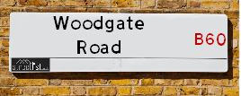
Woodgate Road is a street located in the otherSettlement of Lower Bentley and in the otherSettlement of Woodgate and near the otherSettlement of Woodgate. The street has a length of approximately 3,574 metres.
The street is located within the Bromsgrove District and Wychavon District Council's jurisdiction. They provide various services, like refuse collection, and manage council tax collection. It's situated in the West Midlands region of the UK.
The road has been assigned the Unique Street Reference Numbers of 4701209, 4702899, 45405617 and 4702573 in the National Street Gazetteer.
The street has the postcodes of B60 4HZ, B60 4HG, B60 4HB and B60 4HA.
It is located within the county of Worcestershire, situated in the West Midlands region of the UK. It's 99.04 miles North West from central London., 10.18 miles North East from Worcester, 14.33 miles South West from Birmingham and 23.9 miles West from Coventry.
Moving to Woodgate Road?
I can help you uncover potential pitfalls and provide key questions to ask about your new property. With decades of experience as a Local Land Charges Manager, I offer confidential insights to make your move informed and stress-free.
This service is free, but you may wish to make an optional donation to support it. Please include the property name and address in your request as well as anything you wish to focus on.
Contact Me
Do you know why this road is called Woodgate Road?
What's it like to live here?
Ask the community a question.
Do you have any questions, memories to share or know any facts? We'd love to know more.
Map of Woodgate Road
| Postcodes | ||
|---|---|---|
| Icon | Postcodes for Woodgate Road | |
| Walking Distances | ||
| Distance Info | Green Circle = 10 Minutes Walk (800 metres) | |
Street Crime Data accessed from data.police.uk on 06/10/2024.
Budget Friendly Hotels near Woodgate Road
| Budget Hotel Name | Distance (miles) |
|---|---|
|
1: Name:Travelodge Bromsgrove Address: 2 Finstall Rd, Bromsgrove, B60 2DZ Telephone: 0871 984 8484 Visit Hotel Page |
2.26 |
|
2: Name:Premier Inn Redditch West A448 Address: Birchfield Road Telephone: Visit Hotel Page |
2.78 |
|
3: Name:Holiday Inn Express Droitwich Address: Worcester Rd, Wychbold Telephone: Visit Hotel Page |
3.32 |
|
4: Name:Premier Inn Bromsgrove Central Address: Birmingham Road Telephone: Visit Hotel Page |
3.39 |
|
5: Name:Travelodge Droitwich Address: Rashwood Hill, A38, Droitwich, WR9 0BJ Telephone: 0871 984 6074 Visit Hotel Page |
3.66 |
Hotel Options
Your support helps keep this site running!
If you enjoy using this website, consider buying me a coffee to help cover hosting costs.
Nearby Estate Agents
| Name | Address | Website |
|---|---|---|
| Right Estate Agents | 1 St.Godwalds Road Aston Fields Bromsgrove B60 3BN | Visit Website |
| Karen Seager Sales & Lettings | Worcester Road, Wychbold, WR9 0DF | Visit Website |
| Hansons | 6 New Road, Bromsgrove, B60 2JD | |
| A P Morgan Estate Agents | 4 Worcester Road, Bromsgrove, B61 7AE | Visit Website |
| Leaders Lettings | 11 Worcester Road, Bromsgrove, B61 7DL | Visit Website |
Neighbourhood Policing |
| Police Force: West Mercia |
 View Neighbourhood Crime and Policing View Neighbourhood Crime and Policing |
| Find a Local Neighbourhood Watch Scheme |
Location Details
| Woodgate Road | |
|---|---|

| |
| Latitude | 52.290214 |
| Longitude | -2.040302 |
| OS Easting (X): | 397251 |
| OS Northing (Y): | 265830 |
| OS Grid Reference: | SO973658 |
Roads that have a Junction with Woodgate Road
| Street | Junction Type |
|---|---|
| Moorgate Road | junction |
| Holmes Lane | junction |
| Coalash Lane | junction |
| Lower Bentley Lane | junction |
| Fosters Green | junction |
| High Elms Lane | junction |
| Hill Lane | junction |
| Forest Lane | junction |
Sunset and Sunrise times
| Sunrise | 08:13 |
|---|---|
| Sunset | 15:59 |
Latest Weather Conditions
| Observed at Weather Station: | Pershore 21 December 2024 at 23:00 (9.83 miles away) |
|---|---|
| Current Weather: | Clear night |
| Temperature and Humidity: | 6.8°C (77.2%) |
| Wind Direction and Speed: | W (11 mph) |
Population Statistics
| ONS Area Code | E00164070 & E00164062 |
|---|---|
| ONS Area Name | Established Farming Communities & Rural White-Collar Workers |
| Average Age | & 45.72 |
| Male Population | & 1060.00 (51%) |
| Female Population | & 1034.00 (49%) |
| Benefit Claimants | & 13 (1%) |
| LSOA Code: | E01033060 &E01032166 |
|---|---|
| LSOA Name: | Bromsgrove 014E &Bromsgrove 014C |
| SOA Code: | 2a &2d |
| SOA Name: | |
| MSOA Code: | E02006709 |
| MSOA Name: | Bromsgrove 014 |
Nearest Supermarkets
| Morrisons Bromsgrove |
|---|
| Buntsford Park Road, Bromsgrove B60 3DX |
| 01527 576713 |
| Distance: 1.95 Miles |
| Directions to Morrisons Bromsgrove |
| Waitrose Bromsgrove - Opening 11 May 2017 |
|---|
| St John Street, BROMSGROVE, B61 7JH |
| 01527 876189 |
| Distance: 3.14 Miles |
| Directions to Waitrose Bromsgrove - Opening 11 May 2017 |
| Iceland Bromsgrove |
|---|
| 12 Mill Lane, Bromsgrove, Worcestershire, B61 8AG |
| 01527870173 |
| Distance: 3.28 Miles |
| Directions to Iceland Bromsgrove |
| Asda Bromsgrove |
|---|
| 21 Market Street, Bromsgrove, B61 8DA |
| 01527 839500 |
| Distance: 3.3 Miles |
| Directions to Asda Bromsgrove |
Telephone Information
| Area Code |
|---|
| Area Code: 01527 - Redditch |
Local Government
| Local Council Details |
|---|
| Within the area of Bromsgrove |
| Visit the Council's Website |
| The Council House, Burcot Lane, Bromsgrove, Worcestershire &B60 1AA |
| Send email |
| Telephone Number: 01527 873 232 |
| Local Member of Parliament |
|---|
| Within the Westminster Parliamentary Constituency of Bromsgrove |
| The Member of Parliament is Bradley Thomas |
| Details for the MP Bradley Thomas on parliament.uk |
| Details for the MP Bradley Thomas on theyworkforyou.com |
| In the 2024 General Election Bradley Thomas won with a majority of 3,016 the result was Con hold. The total electorate was 76,468 |
| Wards, Parish Councils and County Councils |
|---|
| Ward: Tardebigge &Avoncroft Ward |
| Ceremonial County: Worcestershire |
Nearest Schools
Nearest Hospitals
| Name | Address | Postcode | Distance | Map |
|---|
Nearest Dentists
Dentists
| Name | Address | Postcode | Distance | Map |
|---|
Nearest GP Surgeries
Doctors
THE SURGERY
Address: RYEFIELDS ROAD, STOKE PRIOR, BROMSGROVE, WORCESTERSHIRE, B60 4NA
Distance: 2.10 miles
Contact: :
NEW ROAD SURGERY BROMSGROVE
Address: 46 NEW ROAD, BROMSGROVE, WORCESTERSHIRE, B60 2JS
Distance: 2.87 miles
Contact: tel: 01527 575800
WYCHBOLD SURGERY
Address: DE WYCH ROAD, WYCHBOLD, DROITWICH SPA, WORCESTERSHIRE, WR9 7PS
Distance: 3.13 miles
Contact: :
BHI PARKSIDE - COVID LOCAL VACCINATION SERVICE 3
Address: STOURBRIDGE ROAD, BROMSGROVE, B61 0AZ
Distance: 3.38 miles
Contact: :
CHURCHFIELDS SURGERY
Address: B H I PARKSIDE, STOURBRIDGE ROAD, BROMSGROVE, WORCESTERSHIRE, B61 0AZ
Distance: 3.38 miles
Contact: tel: 01527 872163
ST. JOHNS SURGERY
Address: B H I PARKSIDE, STOURBRIDGE ROAD, BROMSGROVE, WORCESTERSHIRE, B61 0AZ
Distance: 3.38 miles
Contact: tel: 01527 872393
Nearest Dispensing Chemists
Pharmacies
| Name | Address | Postcode | Telephone | Map | Distance in Km |
|---|
Nearest Opticians
Opticians
EYEDEALS DIRECT
Address: 38 HIGH STREET, BROMSGROVE, WORCESTERSHIRE, B61 8HQ
Distance: 3.15 miles
Contact: :
EYE DEALS (BROMSGROVE)
Address: 38 HIGH STREET, BROMSGROVE, WORCESTERSHIRE, B61 8HQ
Distance: 3.15 miles
Contact: :
HAMPTONS OPTICIANS
Address: 11A CROWN CLOSE, BROMSGROVE, WORCESTERSHIRE, B61 8DJ
Distance: 3.18 miles
Contact: :
SAMREEN UPPAL LIMITED T/A PERFECT FOCUS -AFFORDABLE EYE HEALTH
Address: 27-29 HIGH STREET, BROMSGROVE, B61 8AJ
Distance: 3.18 miles
Contact: :
BOOTS OPTICIANS (BROMSGROVE)
Address: 64 HIGH STREET, BROMSGROVE, WORCESTERSHIRE, B61 8EX
Distance: 3.20 miles
Contact: :
SPEX4U (BROMSGROVE)
Address: 1 CHURCH STREET, BROMSGROVE, WORCESTERSHIRE, B61 8DD
Distance: 3.24 miles
Contact: :
Transport
Nearest Rail Stations
Bromsgrove Station is 2.27 miles away.
Address: Bromsgrove station, New Road, Bromsgrove, Worcestershire, B60 2LX
Bromsgrove is situated on the Bristol to Brimingham Line.
Bromsgrove Station is an unstaffed station.
Redditch Station is 4.17 miles away.
Address: Redditch station, Bromsgrove Road, Redditch, Worcestershire, B97 4RB
Redditch is situated on the Bristol to Brimingham Line.
Redditch Station is staffed on a part time basis.