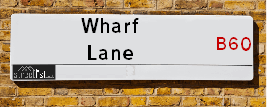
Wharf Lane in the village of Tardebigge
About Wharf Lane
Wharf Lane is a street located . The street has a length of approximately 579 metres.
The street is publicly maintained which means that the road is adopted and Worcestershire is responsible for the repair and upkeep of the highway.
Crime & Historic Map of Wharf Lane
This interactive map displays both historic mapping and street crime data. Click on a circle to view crime statistics, and use the button above to toggle the 1900s historic map.
This interactive map allows you to **zoom and pan** for a better view of the data.
- Use the + and - buttons on the map to zoom in and out.
- Scroll with your **middle mouse wheel** to zoom in and out.
- On a **mobile device**, use **pinch and zoom gestures** to navigate the map.
- Click on crime markers for more details.


| Street Crime (updated 07/02/2025) | ||
|---|---|---|
| Location Note | Central Point of Street - Not Actual Location | |
| MSOA Info | For MSOA E02006709 (Statistical Neighbourhood) | |
| Click Hint | Click on a Circle for a detailed breakdown below map. | |
| Crime Levels |
Green = Very Low Yellow = Low Orange = High Red = Very High |
|
| Postcodes | ||
| Icon | Postcodes for Wharf Lane | |
| Walking Distances | ||
| Distance Info | Green Circle = 10 Minutes Walk (800 metres) | |
Street Crime Data accessed from data.police.uk on 07/02/2025.
The street is located within the Bromsgrove District Council's jurisdiction. They provide various services, like refuse collection, and manage council tax collection. It's situated in the West Midlands region of the UK.
The road has been assigned the Unique Street Reference Number of 4701163 in the National Street Gazetteer.
It is located within the county of , situated in the West Midlands region of the UK. It's 99.2 miles North West from central London., 11.22 miles South from Birmingham, 13.19 miles North East from Worcester and 21.57 miles West from Coventry.
WHARF LANE is within the Post Town of
Moving to Wharf Lane?
I can help you uncover potential pitfalls and provide key questions to ask about your new property. With decades of experience as a Local Land Charges Manager, I offer confidential insights to make your move informed and stress-free.
This service is free, but you may wish to make an optional donation to support it. Please include the property name and address in your request as well as anything you wish to focus on.
Contact Me
Do you know why this road is called Wharf Lane?
What's it like to live here?
Share a Photo of Wharf Lane
Ask the community a question.
Do you have any questions, memories to share, have any photos or know any facts? We'd love to know more.
Submit Your Comment

Budget Friendly Hotels near Wharf Lane
| Budget Hotel Name | Distance (miles) |
|---|---|
|
1: Name:Premier Inn Redditch West A448 Address: Birchfield Road Telephone: Visit Hotel Page |
1.93 |
|
2: Name:Travelodge Bromsgrove Address: 2 Finstall Rd, Bromsgrove, B60 2DZ Telephone: 0871 984 8484 Visit Hotel Page |
1.97 |
|
3: Name:Premier Inn Bromsgrove Central Address: Birmingham Road Telephone: Visit Hotel Page |
2.10 |
|
4: Name:Holiday Inn Express Birmingham Redditch Address: 2 Hewell Road Telephone: Visit Hotel Page |
2.84 |
|
5: Name:Premier Inn Redditch North A441 Address: Bordesley Lane Telephone: Visit Hotel Page |
2.85 |
Hotel Options
Your support helps keep this site running!
If you enjoy using this website, consider making a donation to help me cover hosting costs.

Nearby Estate Agents
| Name | Address | Website |
|---|---|---|
| Right Estate Agents | 1 St.Godwalds Road Aston Fields Bromsgrove B60 3BN | Visit Website |
| Arden Estates | 67 Hewell Road, Barnt Green, B45 8NL | Visit Website |
| Robert Oulsnam & Company | 79 Hewell Road, Barnt Green, B45 8NL | |
| Robert Oulsnam & Company New Homes | 79 Hewell Road, Barnt Green, B45 8NL | |
| 1st Class Student Homes | 453 Birmingham Road, Redditch, B97 6RL |
Neighbourhood Policing |
| Police Force: West Mercia |
| Find a Local Neighbourhood Watch Scheme |
Location Details
| Wharf Lane | |
|---|---|

| |
| Latitude | 52.329179 |
| Longitude | -2.002456 |
| OS Easting (X): | 399832 |
| OS Northing (Y): | 270163 |
| OS Grid Reference: | SO998702 |
Roads that have a Junction with Wharf Lane
| Street | Junction Type |
|---|---|
| Brockhill Lane | junction |
Sunset and Sunrise times
| Sunrise | 07:17 |
|---|---|
| Sunset | 17:26 |
Latest Weather Conditions
| Observed at Weather Station: | Pershore 17 February 2025 at 15:00 (12.62 miles away) |
|---|---|
| Current Weather: | Sunny day |
| Temperature and Humidity: | 5.7°C (59.3%) |
| Wind Direction and Speed: | ESE (8 mph) |
Population Statistics
| ONS Area Code | E00172218 |
|---|---|
| ONS Area Name | Detached Rural Retirement |
| LSOA Code: | E01033060 |
|---|---|
| LSOA Name: | Bromsgrove 014E |
| SOA Code: | 2a |
| SOA Name: | |
| MSOA Code: | E02006709 |
| MSOA Name: | Bromsgrove 014 |
Nearest Supermarkets
| Tesco Barnt Green Express |
|---|
| 30 Hewell Rd, Barnt Green, Birmingham, B45 8NE |
| 0345 026 9233 |
| Distance: 2.24 Miles |
| Directions to Tesco Barnt Green Express |
| Tesco Redditch Brockhill Express |
|---|
| Willow Way, Redditch, Redditch, B97 6PH |
| 0345 610 2754 |
| Distance: 2.3 Miles |
| Directions to Tesco Redditch Brockhill Express |
| Iceland Bromsgrove Food Warehous |
|---|
| Unit 2, Bromsgrove Retail Park, Bromsgrove, B61 0DD |
| 01527871208 |
| Distance: 2.33 Miles |
| Directions to Iceland Bromsgrove Food Warehous |
| Iceland Bromsgrove |
|---|
| 12 Mill Lane, Bromsgrove, Worcestershire, B61 8AG |
| 01527870173 |
| Distance: 2.47 Miles |
| Directions to Iceland Bromsgrove |
Telephone Information
| Area Code |
|---|
| Area Code: 01527 - Redditch |
Local Government
| Local Council Details |
|---|
| Within the area of Bromsgrove |
| Visit the Council's Website |
| The Council House, Burcot Lane, Bromsgrove, Worcestershire &B60 1AA |
| Send email |
| Telephone Number: 01527 873 232 |
| Local Member of Parliament |
|---|
| Within the Westminster Parliamentary Constituency of Bromsgrove |
| The Member of Parliament is Bradley Thomas |
| Details for the MP Bradley Thomas on parliament.uk |
| Details for the MP Bradley Thomas on theyworkforyou.com |
| In the 2024 General Election Bradley Thomas won with a majority of 3,016 the result was Con hold. The total electorate was 76,468 |
| Wards, Parish Councils and County Councils |
|---|
| Ward: Tardebigge Ward |
| Parish: Tutnall and Cobley Parish Council |
| Ceremonial County: |
Nearest Schools
England Primary Schools
Lickey End First School
Address: Lickey End First School, School Lane, Lickey End, Bromsgrove, Worcestershire, B60 1JG
Distance: 2.35 miles
Contact: 01527872360
Our Lady of Mount Carmel Catholic First School
Address: Our Lady of Mount Carmel Catholic First School, Downsell Road, Webheath, Redditch, Worcestershire, B97 5RR
Distance: 2.52 miles
Contact: 01527546398
Holyoakes Field First School
Address: Holyoakes Field First School, Cookridge Close, Redditch, Worcestershire, B97 6HF
Distance: 2.29 miles
Contact: 0152762928
Tardebigge CofE First School
Address: Tardebigge CofE First School, Church Lane, Tardebigge, Bromsgrove, Worcestershire, B60 3AH
Distance: 0.69 miles
Contact: 01527872886
England Secondary Schools
Aston Fields Middle School
Address: Aston Fields Middle School, Drummond Road, Bromsgrove, Worcestershire, B60 2ET
Distance: 1.84 miles
Contact: 01527876026
Birchensale Middle School
Address: Birchensale Middle School, Bridley Moor Road, Redditch, Worcestershire, B97 6HT
Distance: 2.51 miles
Contact:
Nearest Hospitals
| Princess of Wales Community Hospital - Worcestershire Health and Care NHS Trust |
|---|
| Address: Princess of Wales Community Hospital, Stourbridge Road, Bromsgrove, B61 0BB, |
| NHS Sector |
| Worcestershire Health and Care NHS Trust |
| Telephone: 01527 488000 |
| Visit Hospital Website |
| Distance: 3.98 (miles) |
| Directions from to Princess of Wales Community Hospital - Worcestershire Health and Care NHS Trust |
| Cygnet Wast Hills |
|---|
| Address: Wasthill Lane, Kings Norton, Birmingham, B38 9ET, |
| NHS Sector |
| Cygnet Health Care Limited |
| Telephone: 0121 458 2263 |
| Visit Hospital Website |
| Distance: 7.3 (miles) |
| Directions from to Cygnet Wast Hills |
| Reaside Clinic |
|---|
| Address: Birmingham Great Park, Bristol Road South, Rednal, Birmingham, B45 9BE, |
| NHS Sector |
| Birmingham and Solihull Mental Health NHS Foundation Trust |
| Telephone: 0121 301 3000 |
| Visit Hospital Website |
| Distance: 7.9 (miles) |
| Directions from to Reaside Clinic |
Nearest Dentists
Dentists
TIME FOR TEETH HMP HEWELL
Address: HEWELL LANE, REDDITCH, WORCESTERSHIRE, B97 6QS
Distance: 0.62 miles
Contact: :
DAMANI DENTAL PRACTICE
Address: 5 TRINITY COURT, STOKE ROAD, BROMSGROVE, WORCESTERSHIRE, B60 3EQ
Distance: 2.02 miles
Contact: :
DENTAL SURGERY
Address: 68 NEW ROAD, BROMSGROVE, WORCESTERSHIRE, B60 2LA
Distance: 2.06 miles
Contact: :
DENTAL SURGERY
Address: 111 HEWELL ROAD, BARNT GREEN, BIRMINGHAM, WEST MIDLANDS, B45 8NW
Distance: 2.16 miles
Contact: :
TYNSALL AVENUE (DENTAL SURGERY)
Address: 11 TYNSALL AVENUE, REDDITCH, WORCESTERSHIRE, B97 5SF
Distance: 2.35 miles
Contact: :
DENTAL SURGERY
Address: 2 COLLEGE ROAD, BROMSGROVE, WORCESTERSHIRE, B60 2NE
Distance: 2.36 miles
Contact: :
Nearest GP Surgeries
Doctors
BARNT GREEN SURGERY
Address: 82 HEWELL ROAD, BARNT GREEN, BIRMINGHAM, WEST MIDLANDS, B45 8NF
Distance: 2.18 miles
Contact: tel: 0121 4451704
NEW ROAD SURGERY BROMSGROVE
Address: 46 NEW ROAD, BROMSGROVE, WORCESTERSHIRE, B60 2JS
Distance: 2.28 miles
Contact: tel: 01527 575800
DAVENAL HOUSE SURGERY PARTNERSHIP
Address: 28 BIRMINGHAM ROAD, BROMSGROVE, WORCESTERSHIRE, B61 0DD
Distance: 2.34 miles
Contact: tel: 01527 872008
DR SMART CJ
Address: ALVECHURCH MEDICAL CENTRE, 5 THE SQUARE, ALVECHURCH, BIRMINGHAM, WEST MIDLANDS, B48 7LA
Distance: 2.40 miles
Contact: tel: 01214581342
BHI PARKSIDE - COVID LOCAL VACCINATION SERVICE 3
Address: STOURBRIDGE ROAD, BROMSGROVE, B61 0AZ
Distance: 2.49 miles
Contact: :
CHURCHFIELDS SURGERY
Address: B H I PARKSIDE, STOURBRIDGE ROAD, BROMSGROVE, WORCESTERSHIRE, B61 0AZ
Distance: 2.49 miles
Contact: tel: 01527 872163
Nearest Dispensing Chemists
Pharmacies
BROMSGROVE PHARMACY
Address: 46 NEW ROAD, BROMSGROVE, B60 2JS
Distance: 2.28 miles
Contact: tel: 01527 876876
BARNT GREEN PHARMACY
Address: 32 HEWELL ROAD, BARNT GREEN, BIRMINGHAM, WEST MIDLANDS, B45 8NE
Distance: 2.28 miles
Contact: tel: 0121 4452116
KNIGHTS BROMSGROVE PHARMACY
Address: 36 BIRMINGHAM ROAD, BROMSGROVE, WORCESTERSHIRE, B61 0DD
Distance: 2.34 miles
Contact: tel: 01527 835984
ALVECHURCH PHARMACY
Address: 7-8 THE SQUARE, ALVECHURCH, BIRMINGHAM, B48 7LA
Distance: 2.40 miles
Contact: tel: 01214 452771
KNIGHTS CENTRAL PHARMACY
Address: 18 MARKET STREET, BROMSGROVE, WORCESTERSHIRE, B61 8DA
Distance: 2.46 miles
Contact: tel: 01527 833133
BOOTS
Address: 78 HIGH STREET, BROMSGROVE, WORCESTERSHIRE, B61 8HD
Distance: 2.48 miles
Contact: tel: 01527 872056
Nearest Opticians
Opticians
JIVA BANGAY - BARNT GREEN OPTICIANS
Address: 12 HEWELL ROAD, BARNT GREEN, BIRMINGHAM, B45 8NE
Distance: 2.28 miles
Contact: :
EYE OPTICIANS - BARNT GREEN
Address: 28 HEWELL ROAD, BARNT GREEN, BIRMINGHAM, WEST MIDLANDS, B45 8NE
Distance: 2.28 miles
Contact: :
J & D MASON OPTICIANS (ALVECHURCH)
Address: 23 THE SQUARE, ALVECHURCH, BIRMINGHAM, WEST MIDLANDS, B48 7LA
Distance: 2.40 miles
Contact: tel: 0121 447 8682, fax: 01214478682
CHAPMAN OPTICIANS LTD (BROMSGROVE)
Address: 103 HIGH STREET, BROMSGROVE, WORCESTERSHIRE, B61 8AE
Distance: 2.45 miles
Contact: :
SPECSAVERS (BROMSGROVE)
Address: 131 HIGH STREET, BROMSGROVE, WORCESTERSHIRE, B61 8AE
Distance: 2.45 miles
Contact: :
BOOTS OPTICIANS (BROMSGROVE)
Address: 64 HIGH STREET, BROMSGROVE, WORCESTERSHIRE, B61 8EX
Distance: 2.48 miles
Contact: :
Transport
Nearest Rail Stations
Alvechurch Station is 1.88 miles away.
Address: Alvechurch station, Station Road, Alvechurch, Worcestershire, B48 7SE
Alvechurch is situated on the Bristol to Brimingham Line.
Alvechurch Station is an unstaffed station.
Bromsgrove Station is 1.99 miles away.
Address: Bromsgrove station, New Road, Bromsgrove, Worcestershire, B60 2LX
Bromsgrove is situated on the Bristol to Brimingham Line.
Bromsgrove Station is an unstaffed station.