Seafield Lane is a street located in Branson's Cross and near Branson's Cross and in Heath Green and near Heath Green and near the village of Portway. The street has a length of approximately 2,946 metres.
The street is publicly maintained which means that the road is adopted and Worcestershire is responsible for the repair and upkeep of the highway.
The street is located within the Bromsgrove District Council's jurisdiction. They provide various services, like refuse collection, and manage council tax collection. It's situated in the West Midlands region of the UK.
The road has been assigned the Unique Street Reference Number of 4700944 in the National Street Gazetteer.
The street has the postcodes of B98 9DL, B98 9DD, B98 9DB, B98 9BX, B48 7HN, B48 7HJ and B48 7HL.
It is located within the county of Worcestershire, situated in the West Midlands region of the UK. It's 95.76 miles North West from central London., 9.5 miles South from Birmingham, 16.64 miles West from Coventry and 17.47 miles North East from Worcester.
SEAFIELD LANE is within the Post Town of BIRMINGHAM
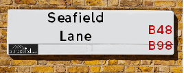
Map of Seafield Lane
| Street Crime (updated 14/01/2025) | ||
|---|---|---|
| Location Note | Central Point of Street - Not Actual Location | |
| MSOA Info | For MSOA E02006704 (Statistical Neighbourhood) | |
| Click Hint | Click on a Circle for a detailed breakdown below map. | |
| Crime Levels |
Green = Very Low Yellow = Low Orange = High Red = Very High |
|
| Postcodes | ||
| Icon | Postcodes for Seafield Lane | |
| Walking Distances | ||
| Distance Info | Green Circle = 10 Minutes Walk (800 metres) | |
Street Crime Data accessed from data.police.uk on 06/10/2024.
Moving to Seafield Lane?
I can help you uncover potential pitfalls and provide key questions to ask about your new property. With decades of experience as a Local Land Charges Manager, I offer confidential insights to make your move informed and stress-free.
This service is free, but you may wish to make an optional donation to support it. Please include the property name and address in your request as well as anything you wish to focus on.
Contact Me
Do you know why this road is called Seafield Lane?
What's it like to live here?
Share a Photo of Seafield Lane
Ask the community a question.
Do you have any questions, memories to share, have any photos or know any facts? We'd love to know more.
Submit Your Comment
Find Homes to Rent in Alvechurch

Budget Friendly Hotels near Seafield Lane
| Budget Hotel Name | Distance (miles) |
|---|---|
|
1: Name:Premier Inn Redditch North A441 Address: Bordesley Lane Telephone: Visit Hotel Page |
2.81 |
|
2: Name:Holiday Inn Express Birmingham Redditch Address: 2 Hewell Road Telephone: Visit Hotel Page |
3.36 |
|
3: Name:Travelodge Birmingham Maypole Address: Maypole Lane, Birmingham, B14 5JF Telephone: 0871 559 1896 Visit Hotel Page |
4.35 |
|
4: Name:Premier Inn Redditch West A448 Address: Birchfield Road Telephone: Visit Hotel Page |
4.63 |
|
5: Name:Premier Inn Solihull Hockley Heath M42 Address: Stratford Road Telephone: Visit Hotel Page |
4.68 |
Hotel Options
Your support helps keep this site running!
If you enjoy using this website, consider making a donation to help me cover hosting costs.
EPC (Energy Performance Certificate) Information for Seafield Lane
UPRN: 10094552667
EPC Current: C
EPC Potential: B
Habitable Rooms: N/A
Property Type: House
Tenure: Not defined - use in the case of a new dwelling fo
Built Form: Mid-Terrace
Age Band: U
Mains Gas: Unknown
UPRN: 100120586324
EPC Current: E
EPC Potential: C
Habitable Rooms: 8
Property Type: House
Tenure: Owner-occupied
Built Form: Detached
Age Band: before 1900
Mains Gas: No
UPRN: 100120586326
EPC Current: E
EPC Potential: D
Habitable Rooms: 5
Property Type: House
Tenure: Owner-occupied
Built Form: Detached
Age Band: 1996-2002
Mains Gas: No
UPRN: 100120586327
EPC Current: E
EPC Potential: D
Habitable Rooms: 13
Property Type: House
Tenure: Owner-occupied
Built Form: Detached
Age Band: 1900-1929
Mains Gas: No
UPRN: 100120586328
EPC Current: E
EPC Potential: C
Habitable Rooms: 7
Property Type: House
Tenure: Owner-occupied
Built Form: Detached
Age Band: before 1900
Mains Gas: No
UPRN: 10094552666
EPC Current: C
EPC Potential: B
Habitable Rooms: N/A
Property Type: House
Tenure: Not defined - use in the case of a new dwelling fo
Built Form: End-Terrace
Age Band: U
Mains Gas: Unknown
UPRN: 10094552618
EPC Current: D
EPC Potential: C
Habitable Rooms: 5
Property Type: House
Tenure: Rented (private)
Built Form: Detached
Age Band: 1983-1990
Mains Gas: No
UPRN: 10094552668
EPC Current: C
EPC Potential: B
Habitable Rooms: N/A
Property Type: House
Tenure: Not defined - use in the case of a new dwelling fo
Built Form: End-Terrace
Age Band: U
Mains Gas: Unknown
UPRN: 10094552140
EPC Current: D
EPC Potential: B
Habitable Rooms: 2
Property Type: House
Tenure: rental (private)
Built Form: Detached
Age Band: 1900-1929
Mains Gas: No
UPRN: 100120586335
EPC Current: D
EPC Potential: C
Habitable Rooms: 3
Property Type: House
Tenure: Owner-occupied
Built Form: Detached
Age Band: 1983-1990
Mains Gas: No
House Sales
| Year | High | Low | Average | Sales |
|---|---|---|---|---|
| 2015 | £1,300,000 | £1,300,000 | £1,300,000 | 1 |
| 2016 | £635,000 | £750,000 | £692,500 | 2 |
| 2018 | £1,967,213 | £770,000 | £1,368,607 | 2 |
| 2021 | £620,000 | £575,000 | £597,500 | 2 |
| 2023 | £693,000 | £693,000 | £693,000 | 1 |
Contains HM Land Registry data © Crown copyright and database right 2025. This data is licensed under the Open Government Licence v3.0.
Nearby Estate Agents
| Name | Address | Website |
|---|---|---|
| 1st Class Student Homes | 453 Birmingham Road, Redditch, B97 6RL | |
| Citizen Housing - Regency Fields | Regency Fields, Tidbury Green, Solihull,,B90 1UZ | |
| Melvyn Danes | 321 Alcester Road, Wythall, Birmingham, B47 5HJ | Visit Website |
| The Agents Property Consultants | 116a High Street, Henley-In-Arden,B95 5PS | |
| Kelly Homes | 7 Drakes Cross Parade, Alcester Road, Wythall, B47 5HD | Visit Website |
Neighbourhood Policing |
| Police Force: West Mercia |
 View Neighbourhood Crime and Policing View Neighbourhood Crime and Policing |
| Find a Local Neighbourhood Watch Scheme |
Location Details
| Seafield Lane | |
|---|---|

| |
| Latitude | 52.342058 |
| Longitude | -1.887484 |
| OS Easting (X): | 407664 |
| OS Northing (Y): | 271602 |
| OS Grid Reference: | SP077716 |
Known Residential Addresses for Seafield Lane
- BROADGATES
- MERECROFT
- LYNDHURST
- SEAFIELD COTTAGE
- 2
- HOLLYFIELD
- SEAFIELD FARM
Roads that have a Junction with Seafield Lane
| Street | Junction Type |
|---|---|
| Billelsley Lane | junction |
| Whitepits Lane | junction |
| Brockhill Lane | junction |
| Cherry Pit Lane | junction |
| Beoley Lane (B4101) | junction |
Sunset and Sunrise times
| Sunrise | 07:42 |
|---|---|
| Sunset | 17:00 |
Latest Weather Conditions
| Observed at Weather Station: | Coleshill 3 February 2025 at 22:00 (12.68 miles away) |
|---|---|
| Current Weather: | Clear night |
| Temperature and Humidity: | 4.6°C (88.0%) |
| Wind Direction and Speed: | S (8 mph) |
Population Statistics
| ONS Area Code | E00172214, E00163861 & E00163860 |
|---|---|
| ONS Area Name | Rural White-Collar Workers, Established Farming Communities & Ageing Rural Flat Tenants |
| Average Age | 49.57 |
| Area Population | 1524.00 |
| Male Population | 742.00 (49%) |
| Female Population | 782.00 (51%) |
| Benefit Claimants | 3 (0%) |
| LSOA Code: | E01032123 |
|---|---|
| LSOA Name: | Bromsgrove 009B |
| SOA Code: | 2b |
| SOA Name: | |
| MSOA Code: | E02006704 |
| MSOA Name: | Bromsgrove 009 |
Nearest Supermarkets
| Morrisons Redditch |
|---|
| Warwick Highway, Redditch B98 0SW |
| 01527 503484 |
| Distance: 2.91 Miles |
| Directions to Morrisons Redditch |
| Waitrose At Hopwood Park Services |
|---|
| M42 Motorway, Junction 2, Redditch Road, Alvechurch, Birmingham, B48 7AU |
| 0121 4474000 |
| Distance: 2.94 Miles |
| Directions to Waitrose At Hopwood Park Services |
| Sainsburys Redditch |
|---|
| Abbey Trading Centre, Alvechurch Highway, Redditch, England, B97 6RF |
| 152762274 |
| Distance: 2.95 Miles |
| Directions to Sainsburys Redditch |
| Iceland Redditch |
|---|
| Trafford Park Ind. Estate, Trescott Road, Redditch, B98 7AH |
| 01527585364 |
| Distance: 3.31 Miles |
| Directions to Iceland Redditch |
Telephone Information
| Area Code |
|---|
| Area Code: 01527 - Redditch |
| Area Code: 01564 - Lapworth |
Local Government
| Local Council Details |
|---|
| Within the area of Bromsgrove |
| Visit the Council's Website |
| The Council House, Burcot Lane, Bromsgrove, Worcestershire &B60 1AA |
| Send email |
| Telephone Number: 01527 873 232 |
| Local Member of Parliament |
|---|
| Within the Westminster Parliamentary Constituency of Bromsgrove |
| The Member of Parliament is Bradley Thomas |
| Details for the MP Bradley Thomas on parliament.uk |
| Details for the MP Bradley Thomas on theyworkforyou.com |
| In the 2024 General Election Bradley Thomas won with a majority of 3,016 the result was Con hold. The total electorate was 76,468 |
| Wards, Parish Councils and County Councils |
|---|
| Ward: Alvechurch South Ward |
| Parish: Beoley Parish Council |
| Ceremonial County: Worcestershire |
Nearest Schools
Nearest Hospitals
| Cygnet Wast Hills |
|---|
| Address: Wasthill Lane, Kings Norton, Birmingham, B38 9ET, |
| NHS Sector |
| Cygnet Health Care Limited |
| Telephone: 0121 458 2263 |
| Visit Hospital Website |
| Distance: 6.13 (miles) |
| Directions from to Cygnet Wast Hills |
| Alexandra Hospital |
|---|
| Address: Woodrow Drive, Redditch, B98 7UB, |
| NHS Sector |
| Worcestershire Acute Hospitals NHS Trust |
| Telephone: 01527 503 030 |
| Visit Hospital Website |
| Distance: 7.12 (miles) |
| Directions from to Alexandra Hospital |
| West Heath Hospital |
|---|
| Address: West Heath Hospital, Rednal Road, Birmingham, B38 8HR, |
| NHS Sector |
| Birmingham Community Healthcare NHS Foundation Trust |
| Telephone: 0121 466 6000 |
| Distance: 7.69 (miles) |
| Directions from to West Heath Hospital |
Nearest Dentists
Dentists
DENTAL CENTRE OF EXCELLENCE
Address: NO 5 TANHOUSE LANE, REDDITCH, WORCESTERSHIRE, B98 9AA
Distance: 1.95 miles
Contact: :
OMNIA DENTAL SPA
Address: 243 STATION ROAD, WYTHALL, BIRMINGHAM, B47 6ET
Distance: 2.60 miles
Contact: :
OMNIA DENTAL SPA
Address: 243 STATION ROAD, WYTHALL, BIRMINGHAM, B47 6ET
Distance: 2.60 miles
Contact: :
DENTAL SURGERY
Address: 1 THE SQUARE, ALVECHURCH, BIRMINGHAM, WEST MIDLANDS, B48 7LA
Distance: 3.11 miles
Contact: :
DENTAL SURGERY
Address: 107 ARCHER ROAD, REDDITCH, WORCESTERSHIRE, B98 8DJ
Distance: 3.18 miles
Contact: :
RED HOUSE DENTAL CLINIC
Address: THE RED HOUSE, PROSPECT HILL, REDDITCH, WORCESTERSHIRE, B97 4BG
Distance: 3.23 miles
Contact: :
Nearest GP Surgeries
Doctors
MAPLE VIEW MEDICAL PRACTICE
Address: UNIT 5, TANHOUSE LANE, REDDITCH, B98 9AA
Distance: 1.95 miles
Contact: :
TANWORTH-IN-ARDEN MED CTR
Address: THE BIRCHES, BROAD LANE, TANWORTH-IN-ARDEN, SOLIHULL, WEST MIDLANDS, B94 5DP
Distance: 1.97 miles
Contact: tel: 01564 742274
HOLLYOAKS MEDICAL CENTRE
Address: 229 STATION ROAD, WYTHALL, BIRMINGHAM, WEST MIDLANDS, B47 6ET
Distance: 2.60 miles
Contact: tel: 01564 823182
WINYATES HEALTH CENTRE
Address: WINYATES CENTRE, WINYATES WAY, REDDITCH, WORCESTERSHIRE, B98 0NR
Distance: 2.69 miles
Contact: tel: 01527 513888
WINYATES HEALTH CENTRE - COVID LOCAL VACCINATION SERVICE 2
Address: WINYATES CENTRE, WINYATES WAY, REDDITCH, B98 0NR
Distance: 2.69 miles
Contact: :
DR SMART CJ
Address: ALVECHURCH MEDICAL CENTRE, 5 THE SQUARE, ALVECHURCH, BIRMINGHAM, WEST MIDLANDS, B48 7LA
Distance: 3.11 miles
Contact: tel: 01214581342
Nearest Dispensing Chemists
Pharmacies
ROWLANDS PHARMACY
Address: CHURCHILL NEIGHBOURHOOD CENTRE, TANHOUSE LANE, REDDITCH, WORCESTERSHIRE, B98 9AA
Distance: 1.95 miles
Contact: tel: 01527 65771
CHEMIST.NET
Address: 18 OXLEASOW ROAD, EAST MOONS MOAT, REDDITCH, WORCESTERSHIRE, B98 0RE
Distance: 2.30 miles
Contact: tel: 08081 561686
WYTHALL PHARMACY
Address: 221 STATION ROAD, WYTHALL, BIRMINGHAM, B47 6ET
Distance: 2.60 miles
Contact: tel: 01564 822198
KNIGHTS WINYATES PHARMACY
Address: WINYATES HEALTH CENTRE, WINYATES CENTRE, REDDITCH, WORCESTERSHIRE, B98 0NR
Distance: 2.69 miles
Contact: tel: 01527 529277
ALVECHURCH PHARMACY
Address: 7-8 THE SQUARE, ALVECHURCH, BIRMINGHAM, B48 7LA
Distance: 3.11 miles
Contact: tel: 01214 452771
STOCK AND LINDSAY LTD
Address: UNIT 3, MATCHBOROUGH CENTRE, MATCHBOROUGH WAY, REDDITCH, WORCESTERSHIRE, B98 0EP
Distance: 3.23 miles
Contact: tel: 01527 501817
Nearest Opticians
Opticians
MATTOO DAVINDER (BEOLEY)
Address: CHURCH HILL FARM, BEOLEY, REDDITCH, WORCESTERSHIRE, B98 9AR
Distance: 1.43 miles
Contact: :
FORENSIC EYECARE LIMITED
Address: 176 EARLSWOOD COMMON, EARLSWOOD, SOLIHULL, WARWICKSHIRE, B94 5SQ
Distance: 2.29 miles
Contact: :
WINYATES OPTICIANS
Address: UNIT 8, 17 WINYATES SHOPPING CENTRE, REDDITCH, WORCESTERSHIRE, B98 0NR
Distance: 2.69 miles
Contact: :
SPECSAVERS - REDDITCH ALVECHURCH
Address: SAINSBURYS SUPERMARKETS, ABBEY TRADING CENTRE, ALVECHURCH HIGHWAY, REDDITCH, B97 6RF
Distance: 2.96 miles
Contact: :
THE EYE COLLECTIVE (WYTHALL) LTD
Address: 2 DRAKES CROSS PARADE, HOLLYWOOD, BIRMINGHAM, B47 5HD
Distance: 2.99 miles
Contact: :
J & D MASON OPTICIANS (ALVECHURCH)
Address: 23 THE SQUARE, ALVECHURCH, BIRMINGHAM, WEST MIDLANDS, B48 7LA
Distance: 3.11 miles
Contact: tel: 0121 447 8682, fax: 01214478682
Transport
Nearest Rail Stations
Wood End Station is 1.82 miles away.
Address: Wood End station, Broad Lane, Tanworth-in-Arden, Warwickshire, B94 5DS
Wood End is situated on the North Warwickshire (Shakespeare Line) Line.
Wood End Station is an unstaffed station.
Earlswood (West Midlands) Station is 2.03 miles away.
Address: Earlswood (West Midlands) station, Station Drive, Earlswood, Warwickshire, B94 5JS
Earlswood (West Midlands) is situated on the North Warwickshire (Shakespeare Line) Line.
Earlswood (West Midlands) Station is an unstaffed station.