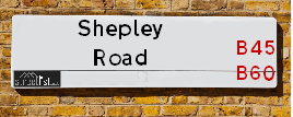
Shepley Road Birmingham is a street located in the city of Birmingham with a Postcode of B45 8SP
About Shepley Road
Shepley Road is a street located in the city of Birmingham. It uses the postcode B45 8SP. The street has a length of approximately 299 metres.
Crime & Historic Map of Shepley Road
This interactive map displays both historic mapping and street crime data. Click on a circle to view crime statistics, and use the button above to toggle the 1900s historic map.
This interactive map allows you to **zoom and pan** for a better view of the data.
- Use the + and - buttons on the map to zoom in and out.
- Scroll with your **middle mouse wheel** to zoom in and out.
- On a **mobile device**, use **pinch and zoom gestures** to navigate the map.
- Click on crime markers for more details.


| Postcodes | ||
|---|---|---|
| Icon | Postcodes for Shepley Road | |
| Walking Distances | ||
| Distance Info | Green Circle = 10 Minutes Walk (800 metres) | |
Street Crime Data accessed from data.police.uk on 07/02/2025.
The street is located within the Birmingham District (B) Council's jurisdiction. They provide various services, like refuse collection, and manage council tax collection. It's situated in the West Midlands region of the UK.
The road has been assigned the Unique Street Reference Number of 2700148 in the National Street Gazetteer.
It is located within the county of West Midlands, situated in the West Midlands region of the UK. It's 101.73 miles North West from central London., 7.51 miles South West from Birmingham, 16.46 miles North East from Worcester and 20.97 miles West from Coventry.
Moving to Shepley Road?
I can help you uncover potential pitfalls and provide key questions to ask about your new property. With decades of experience as a Local Land Charges Manager, I offer confidential insights to make your move informed and stress-free.
This service is free, but you may wish to make an optional donation to support it. Please include the property name and address in your request as well as anything you wish to focus on.
Contact Me
Do you know why this road is called Shepley Road?
What's it like to live here?
Share a Photo of Shepley Road
Ask the community a question.
Do you have any questions, memories to share, have any photos or know any facts? We'd love to know more.
Submit Your Comment

Budget Friendly Hotels near Shepley Road
| Budget Hotel Name | Distance (miles) |
|---|---|
|
1: Name:Premier Inn Birmingham South Rubery Address: Great Park Telephone: Visit Hotel Page |
0.39 |
|
2: Name:Premier Inn Birmingham South Longbridge Station Address: 1 High Street Telephone: Visit Hotel Page |
0.89 |
|
3: Name:Travelodge Bromsgrove Marlbrook Address: 462 Birmingham Rd, Marlbrook, Bromsgrove, B61 0HR Telephone: 0871 559 1809 Visit Hotel Page |
2.49 |
|
4: Name:Travelodge Birmingham Frankley M5 Southbound Address: Moto Service Area, Illey Ln, M5 Motorway, Frankley, Birmingham, B32 4AR Telephone: 0871 984 6067 Visit Hotel Page |
2.76 |
|
5: Name:Premier Inn Bromsgrove Central Address: Birmingham Road Telephone: Visit Hotel Page |
4.06 |
Hotel Options
Your support helps keep this site running!
If you enjoy using this website, consider making a donation to help me cover hosting costs.

Nearby Estate Agents
| Name | Address | Website |
|---|---|---|
| Pango Homes | Suite 2 09 Park House, Bristol Road South, Rubery, Birmingham,B45 9AH | |
| Dunedin Sales & Lettings | 2046 - 2048 Bristol Road South, Rubery, Rednal, Birmingham, B45 9JL | Visit Website |
| Genie Homes | 1668 Bristol Road South Rubery Rednal Birmingham B45 9TY | Visit Website |
| Robert Oulsnam & Company | 189 New Road, Rubery, Birmingham, B45 9JP | |
| Gordon Jones | 137 New Road, Rubery, Birmingham, B45 9JR | Visit Website |
We have found 1 postcode
Neighbourhood Policing |
| Police Force: West Midlands |
 View Neighbourhood Crime and Policing View Neighbourhood Crime and Policing |
| Find a Local Neighbourhood Watch Scheme |
Location Details
| Shepley Road | |
|---|---|

| |
| Latitude | 52.390707 |
| Longitude | -2.004277 |
| OS Easting (X): | 399708 |
| OS Northing (Y): | 277006 |
| OS Grid Reference: | SO997770 |
Roads that have a Junction with Shepley Road
| Street | Junction Type |
|---|---|
| Edgewood Road | junction |
| Ormscliffe Road | junction |
Sunset and Sunrise times
| Sunrise | 07:13 |
|---|---|
| Sunset | 17:30 |
Latest Weather Conditions
| Observed at Weather Station: | Coleshill 19 February 2025 at 20:00 (14.64 miles away) |
|---|---|
| Current Weather: | Mist |
| Temperature and Humidity: | 6.4°C (88.1%) |
| Wind Direction and Speed: | S (9 mph) |
Population Statistics
| ONS Area Code | E00046473 |
|---|---|
| ONS Area Name | Renting Hard-Pressed Workers |
| Average Age | 38.43 |
| Area Population | 1597.00 |
| Male Population | 759.00 (48%) |
| Female Population | 838.00 (52%) |
| Benefit Claimants | 40 (3%) |
| LSOA Code: | E01009171 |
|---|---|
| LSOA Name: | Birmingham 130D |
| SOA Code: | 4c |
| SOA Name: | |
| MSOA Code: | E02001956 |
| MSOA Name: | Birmingham 130 |
Nearest Supermarkets
| Morrisons Birmingham - Rubery |
|---|
| Rubery, Birmingham B45 9AH |
| 0121 460 1940 |
| Distance: 0.4 Miles |
| Directions to Morrisons Birmingham - Rubery |
| Sainsburys Longbridge |
|---|
| Longbridge Lane, Birmingham, England, B31 2TW |
| 0121 623 7030 |
| Distance: 0.95 Miles |
| Directions to Sainsburys Longbridge |
| Tesco Birmingham Frankley Express |
|---|
| 414 Frankley Beeches Rd, Birmingham, B31 5NJ |
| 0345 675 7182 |
| Distance: 1.24 Miles |
| Directions to Tesco Birmingham Frankley Express |
| Tesco West Heath Birmingham Express |
|---|
| 6 Redhill Rd, Birmingham, B31 3LD |
| 0345 675 6907 |
| Distance: 1.94 Miles |
| Directions to Tesco West Heath Birmingham Express |
Telephone Information
| Area Code |
|---|
| Area Code: 01527 - Redditch |
| Area Code: 0121 - Birmingham |
| Area Code: 01384 - Dudley |
Broadband Information
| Speed | Average Speed | Median Speed | Maximum Speed | Next-generation access (NGA) | Number of Connections |
|---|---|---|---|---|---|
| Greater than 2 Mbps | 28.3 | 20 | >=30 | Y | 44 |
Local Government
| Local Council Details |
|---|
| Within the area of Birmingham |
| Visit the Council's Website |
| Council House, Victoria Square, Birmingham &B1 1BB |
| Send email |
| Telephone Number: 0121 303 1111 |
| Local Member of Parliament |
|---|
| Within the Westminster Parliamentary Constituency of Birmingham &Northfield |
| The Member of Parliament is Laurence Turner |
| Details for the MP Laurence Turner on parliament.uk |
| Details for the MP Laurence Turner on theyworkforyou.com |
| In the 2024 General Election Laurence Turner won with a majority of 5,389 the result was Lab gain from Con. The total electorate was 74,048 |
| Wards, Parish Councils and County Councils |
|---|
| Ward: Rubery & Rednal Ward |
| Ceremonial County: West Midlands |
Nearest Schools
England Primary Schools
Cofton Primary School
Address: Cofton Primary School, Wootton Road, West Heath, Birmingham, West Midlands, B31 4ST
Distance: 1.49 miles
Contact: 01214753374
The Meadows Primary School
Address: The Meadows Primary School, Bristol Road South, Northfield, Bristol Road South, Northfield, Birmingham, West Midlands, B31 2SW
Distance: 1.33 miles
Contact: 01216753203
Rednal Hill Infant School
Address: Rednal Hill Infant School, Irwin Avenue, Rednal, Birmingham, West Midlands, B45 8QY
Distance: 0.28 miles
Contact: 01214532636
Rednal Hill Junior School
Address: Rednal Hill Junior School, Irwin Avenue, Rednal, Birmingham, West Midlands, B45 8QY
Distance: 0.28 miles
Contact: 01214532520
Albert Bradbeer Primary Academy
Address: Albert Bradbeer Primary Academy, Turves Green, Longbridge, Birmingham, West Midlands, B31 4RD
Distance: 1.33 miles
Contact: 01214642356
Lickey Hills Primary School and Nursery
Address: Lickey Hills Primary School and Nursery, Old Birmingham Road, Lickey, Birmingham, West Midlands, B45 8EU
Distance: 1.36 miles
Contact: 01214451992
Beaconside Primary and Nursery School
Address: Beaconside Primary and Nursery School, Hazel Road, Rubery, Birmingham, West Midlands, B45 9DX
Distance: 0.77 miles
Contact: 01214533801
St Andrew's CofE First School
Address: St Andrew's CofE First School, Hewell Road, Barnt Green, Birmingham, West Midlands, B45 8NG
Distance: 1.99 miles
Contact: 01214451410
St Columba's Catholic Primary School
Address: St Columba's Catholic Primary School, Lickey Road, Rednal, Birmingham, West Midlands, B45 8TD
Distance: 0.63 miles
Contact: 01216754841
Forestdale Primary School
Address: Forestdale Primary School, Wareham Road, Frankley, Birmingham, West Midlands, B45 0JS
Distance: 1.22 miles
Contact: 01214648659
Colmers Farm Primary School
Address: Colmers Farm Primary School, Leybrook Road, Birmingham, West Midlands, B45 9PB
Distance: 0.43 miles
Contact:
Holly Hill Methodist CofE Infant School
Address: Holly Hill Methodist CofE Infant School, New Street, Rubery, Rednal, Birmingham, West Midlands, B45 0EU
Distance: 1.11 miles
Contact: 01216758700
Reaside Academy
Address: Reaside Academy, Tresco Close, Frankley, Rubery, Birmingham, B45 0HY
Distance: 1.15 miles
Contact: 01216757235
Holywell Primary and Nursery School
Address: Holywell Primary and Nursery School, School Road, Rubery, Rednal, Birmingham, West Midlands, B45 9EY
Distance: 1.20 miles
Contact: 01214537829
St James Catholic Primary School
Address: St James Catholic Primary School, Leach Heath Lane, Rednal, Birmingham, West Midlands, B45 9BN
Distance: 0.34 miles
Contact: 01214649700
St James Catholic Primary School
Address: St James Catholic Primary School, Leach Heath Lane, Rednal, Birmingham, West Midlands, B45 9BN
Distance: 0.34 miles
Contact:
England Secondary Schools
Turves Green Boys' School
Address: Turves Green Boys' School, Turves Green, Northfield, Birmingham, West Midlands, B31 4BS
Distance: 1.46 miles
Contact:
Balaam Wood School
Address: Balaam Wood School, New Street, Frankley, Birmingham, West Midlands, B45 0EU
Distance: 1.11 miles
Contact:
Colmers School and Sixth Form College
Address: Colmers School and Sixth Form College, Bristol Road South, Rednal, Birmingham, West Midlands, B45 9NY
Distance: 0.39 miles
Contact: 01214531778
Waseley Hills High School
Address: Waseley Hills High School, School Road, Rubery, Birmingham, West Midlands, B45 9EL
Distance: 1.11 miles
Contact: 01214535211
Nearest Hospitals
| Name | Address | Postcode | Distance | Map |
|---|
Nearest Dentists
Dentists
| Name | Address | Postcode | Distance | Map |
|---|
Nearest GP Surgeries
Doctors
LEACH HEATH MEDICAL CENTRE
Address: 32 LEACH HEATH LANE, RUBERY, REDNAL, BIRMINGHAM, WEST MIDLANDS, B45 9BU
Distance: 0.38 miles
Contact: tel: 0121 4533516
NEW ROAD SURGERY
Address: 104-106 NEW ROAD, RUBERY, RUBERY, REDNAL, BIRMINGHAM, WEST MIDLANDS, B45 9HY
Distance: 0.76 miles
Contact: tel: 0121 4533584
CORNHILL SURGERY
Address: 65 NEW ROAD, RUBERY, REDNAL, BIRMINGHAM, WEST MIDLANDS, B45 9JT
Distance: 0.80 miles
Contact: tel: 0121 4533591
HOLLYMOOR MEDICAL CENTRE
Address: MANOR PARK GROVE, NORTHFIELD, BIRMINGHAM, WEST MIDLANDS, B31 5ER
Distance: 0.95 miles
Contact: tel: 0121 4769191
FRANKLEY HEALTH CENTRE
Address: 125 NEW STREET, RUBERY, REDNAL, BIRMINGHAM, WEST MIDLANDS, B45 0EU
Distance: 1.11 miles
Contact: tel: 0121 4538211
COFTON MEDICAL CENTRE
Address: 2 ROBINSFIELD DRIVE, BIRMINGHAM, WEST MIDLANDS, B31 4TU
Distance: 1.59 miles
Contact: tel: 0121 6935777
Nearest Dispensing Chemists
Pharmacies
| Name | Address | Postcode | Telephone | Map | Distance in Km |
|---|
Nearest Opticians
Opticians
SPEX4U
Address: 174 NEW ROAD, RUBERY, REDNAL, BIRMINGHAM, WEST MIDLANDS, B45 9JA
Distance: 0.58 miles
Contact: :
THE EYE COLLECTIVE - RUBERY
Address: 161 NEW ROAD, RUBERY, REDNAL, BIRMINGHAM, WEST MIDLANDS, B45 9JW
Distance: 0.65 miles
Contact: :
ROBINSON OPTICS LTD
Address: 135 NEW ROAD, RUBERY, REDNAL, BIRMINGHAM, WEST MIDLANDS, B45 9JR
Distance: 0.73 miles
Contact: :
M&S OPTICIANS - LONGBRIDGE
Address: 20 HIGH STREET, NORTHFIELD, BIRMINGHAM, B31 2UQ
Distance: 0.87 miles
Contact: :
SPECSAVERS OPTICIANS (LONGBRIDGE)
Address: LONGBRIDGE TOWN CENTRE, 11 HIGH STREET, NORTHFIELD, BIRMINGHAM, WEST MIDLANDS, B31 2UQ
Distance: 0.87 miles
Contact: :
THE EYE COLLECTIVE (WEST HEATH) LTD
Address: 3 ALVECHURCH ROAD, BIRMINGHAM, B31 3JW
Distance: 1.90 miles
Contact: :
Transport
Nearest Rail Stations
Longbridge Station is 1.05 miles away.
Address: Longbridge station, Longbridge Lane, Birmingham, West Midlands, B31 2TW
Longbridge is situated on the Bristol to Brimingham Line.
Longbridge Station is staffed on a part time basis.
Northfield Station is 2.02 miles away.
Address: Northfield station, Quarry Lane, Northfield, West Midlands, B31 2PY
Northfield is situated on the Bristol to Brimingham Line.
Northfield Station is staffed on a part time basis.