Redhill Road Birmingham is a street located in the city of Birmingham and near the city of Birmingham and in Red Hill
About Redhill Road
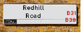
Redhill Road is a street located in the city of Birmingham and near the city of Birmingham and in Red Hill. The street has a length of approximately 3,569 metres.
The street is located within the Birmingham District (B) and Bromsgrove District Council's jurisdiction. They provide various services, like refuse collection, and manage council tax collection. It's situated in the West Midlands region of the UK.
The road has been assigned the Unique Street Reference Numbers of 2701047, 4700887, 2701171 and 2701046 in the National Street Gazetteer.
The street has the postcodes of B38 9EW, B38 9EN, B38 9EJ, B38 9EH, B38 9DS, B31 3PB, B31 3PA, B31 3NT, B31 3NS, B31 3NR, B31 3ND, B31 3LD, B31 3LA, B31 3JS, B31 3JR and B38 9EL.
It is located within the county of West Midlands, situated in the West Midlands region of the UK. It's 99.57 miles North West from central London., 6.4 miles South from Birmingham, 18.03 miles North East from Worcester and 18.32 miles West from Coventry.

Do you know why this road is called Redhill Road?
What's it like to live here?
Ask the community a question.
Do you have any questions, memories to share or know any facts? We'd love to know more.
Map of Redhill Road
| Postcodes | ||
|---|---|---|
| Icon | Postcodes for Redhill Road | |
| Walking Distances | ||
| Distance Info | Green Circle = 10 Minutes Walk (800 metres) | |
Street Crime Data accessed from data.police.uk on 06/10/2024.
Budget Friendly Hotels near Redhill Road
| Budget Hotel Name | Distance (miles) |
|---|---|
|
1: Name:Premier Inn Birmingham South Longbridge Station Address: 1 High Street Telephone: Visit Hotel Page |
1.86 |
|
2: Name:Travelodge Birmingham Maypole Address: Maypole Lane, Birmingham, B14 5JF Telephone: 0871 559 1896 Visit Hotel Page |
2.55 |
|
3: Name:Premier Inn Birmingham South Rubery Address: Great Park Telephone: Visit Hotel Page |
2.86 |
|
4: Name:Travelodge Birmingham Frankley M5 Southbound Address: Moto Service Area, Illey Ln, M5 Motorway, Frankley, Birmingham, B32 4AR Telephone: 0871 984 6067 Visit Hotel Page |
4.21 |
|
5: Name:Travelodge Bromsgrove Marlbrook Address: 462 Birmingham Rd, Marlbrook, Bromsgrove, B61 0HR Telephone: 0871 559 1809 Visit Hotel Page |
4.73 |
Your support helps keep this site running!
If you enjoy using this website, consider buying me a coffee to help cover hosting costs.
Nearby Estate Agents
| Name | Address | Website |
|---|---|---|
| Ashley Borne Sales and Lettings | 11A Alvechurch Road, West Heath, Birmingham, B31 3JW | Visit Website |
| Dixons | 72 The Green, Kings Norton, Birmingham, West Midlands, B38 8RU | |
| Evans Estate Agents | 1 The Green, Kings Norton, Birmingham, B38 8SD | Visit Website |
| Leaders Lettings | 1880 Pershore Road, Kings Norton, Birmingham, B30 3AS | Visit Website |
| Leaders Sales | 1880 Pershore Road, Kings Norton, Birmingham, B30 3AS | Visit Website |
We have found 16 postcodes
Neighbourhood Policing |
| Police Force: West Midlands &West Mercia |
| Find a Local Neighbourhood Watch Scheme |
Location Details
| Redhill Road | |
|---|---|

| |
| Latitude | 52.389916 |
| Longitude | -1.941388 |
| OS Easting (X): | 403988 |
| OS Northing (Y): | 276920 |
| OS Grid Reference: | SP040769 |
Roads that have a Junction with Redhill Road
| Street | Junction Type |
|---|---|
| Alvechurch Road | pseudo node |
| The Fordrough | junction |
| Alvechurch Road | junction |
| Alvechurch Road | junction |
| Redditch Road (A441) | roundabout |
| Grange Walk | junction |
| Tomlan Road | junction |
| Ivyhouse Road | junction |
| Sir Hilton's Road | junction |
| Lilley Lane | junction |
| Exe Croft | junction |
| Sylvia Avenue | junction |
| Redditch Road (A441) | roundabout |
| Wasthill Lane | junction |
| Bracken Way | junction |
| Goodrest Lane | junction |
| Bell Green Lane | junction |
| Icknield Street | junction |
Sunset and Sunrise times
| Sunrise | 07:38 |
|---|---|
| Sunset | 16:09 |
Latest Weather Conditions
| Observed at Weather Station: | Coleshill 21 November 2024 at 19:00 (12.32 miles away) |
|---|---|
| Current Weather: | Clear night |
| Temperature and Humidity: | 1.5°C (77.5%) |
| Wind Direction and Speed: | W (7 mph) |
Population Statistics
| ONS Area Code | E00046705, E00046709, E00046720, E00046678, E00046215, E00046213, E00046208, E00163841, E00163844, E00046195 & E00046217 |
|---|---|
| ONS Area Name | Hard-Pressed Ethnic Mix, Multi-Ethnic Professionals with Families, White Professionals, Ageing Industrious Workers, Communal Retirement & Renting Rural Retirement |
| Average Age | 39.42, 39.91, 41.38, 42.25, 44.88, 41.77 & 36.13 |
| Area Population | 1678.00, 1991.00, 1630.00, 1508.00, 2089.00, 1417.00 & 1518.00 |
| Male Population | 794.00, 949.00, 819.00, 727.00, 1058.00, 686.00 & 721.00 (49%) |
| Female Population | 884.00, 1042.00, 811.00, 781.00, 1031.00, 731.00 & 797.00 (51%) |
| Benefit Claimants | 62, 36, 8, 26, 15, 49 & 70 (2%) |
| LSOA Code: | E01009212, E01009216, E01009217, E01009112, E01032122, E01009115 &E01009113 |
|---|---|
| LSOA Name: | Birmingham 126C, Birmingham 131D, Birmingham 131E, Birmingham 127C, Bromsgrove 009A, Birmingham 128E &Birmingham 128C |
| SOA Code: | 4c, 5c, 8c, 5a &2a |
| SOA Name: | |
| MSOA Code: | E02001952, E02001957, E02001953, E02006704 &E02001954 |
| MSOA Name: | Birmingham 126, Birmingham 131, Birmingham 127, Bromsgrove 009 &Birmingham 128 |
Nearest Supermarkets
| Tesco West Heath Birmingham Express |
|---|
| 6 Redhill Rd, Birmingham, B31 3LD |
| 0345 675 6907 |
| Distance: 1.08 Miles |
| Directions to Tesco West Heath Birmingham Express |
| Sainsburys Longbridge |
|---|
| Longbridge Lane, Birmingham, England, B31 2TW |
| 0121 623 7030 |
| Distance: 1.82 Miles |
| Directions to Sainsburys Longbridge |
| Waitrose At Hopwood Park Services |
|---|
| M42 Motorway, Junction 2, Redditch Road, Alvechurch, Birmingham, B48 7AU |
| 0121 4474000 |
| Distance: 1.85 Miles |
| Directions to Waitrose At Hopwood Park Services |
| Sainsburys Northfield |
|---|
| Frankley Beeches Road, Birmingham, England, B31 5AA |
| 0121 476 9133 |
| Distance: 2.1 Miles |
| Directions to Sainsburys Northfield |
Telephone Information
| Area Code |
|---|
| Area Code: 01527 - Redditch |
| Area Code: 0121 - Birmingham |
| Area Code: 01564 - Lapworth |
Local Government
| Local Council Details |
|---|
| Within the area of Birmingham &Bromsgrove |
| Visit the Council's Website |
| Visit the Council's Website |
| Council House, Victoria Square, Birmingham, B1 1BB, The Council House, Burcot Lane, Bromsgrove, Worcestershire &B60 1AA |
| Send email |
| Telephone Number: 0121 303 1111 &01527 873 232 |
| Local Member of Parliament |
|---|
| Within the Westminster Parliamentary Constituency of Birmingham, Northfield &Bromsgrove |
| The Member of Parliament is Laurence Turner &Bradley Thomas |
| Details for the MP Laurence Turner &Bradley Thomas on parliament.uk |
| Details for the MP Laurence Turner &Bradley Thomas on theyworkforyou.com |
| In the 2024 General Election Laurence Turner &Bradley Thomas won with a majority of 5,389 the result was Lab gain from Con &Con hold. The total electorate was 74,048 |
| Wards, Parish Councils and County Councils |
|---|
| Ward: Longbridge & West Heath, King's Norton North, Barnt Green & Hopwood &King's Norton South Ward |
| Ceremonial County: West Midlands |
Nearest Schools
England Primary Schools
Kings Norton Junior and Infant School
Address: Kings Norton Junior and Infant School, Pershore Road South, Kings Norton, Birmingham, West Midlands, B30 3EU
Distance: 1.48 miles
Contact:
Turves Green Primary School
Address: Turves Green Primary School, Northfield, Birmingham, West Midlands, B31 4BP
Distance: 1.36 miles
Contact:
Cofton Primary School
Address: Cofton Primary School, Wootton Road, West Heath, Birmingham, West Midlands, B31 4ST
Distance: 1.17 miles
Contact: 01214753374
St Paul's Catholic Primary School
Address: St Paul's Catholic Primary School, Sisefield Road, Kings Norton, Birmingham, West Midlands, B38 9JB
Distance: 0.99 miles
Contact: 01214641546
Hawkesley Church Primary Academy
Address: Hawkesley Church Primary Academy, 376 Shannon Road, Kings Norton, Birmingham, West Midlands, B38 9TR
Distance: 0.32 miles
Contact: 01214596467
Fairway Primary Academy
Address: Fairway Primary Academy, Muirfield Gardens, Kings Norton, Birmingham, West Midlands, B38 8XQ
Distance: 0.99 miles
Contact: 01214643200
Wychall Primary School
Address: Wychall Primary School, Middle Field Road, Northfield, Birmingham, West Midlands, B31 3EH
Distance: 1.25 miles
Contact: 01214644255
West Heath Primary School
Address: West Heath Primary School, Rednal Road, West Heath Primary, Birmingham, West Midlands, B38 8HU
Distance: 0.89 miles
Contact: 01214584257
Turves Green Primary School
Address: Turves Green Primary School, Northfield, Birmingham, West Midlands, B31 4BP
Distance: 1.36 miles
Contact: 01214643686
St John Fisher Catholic Primary School
Address: St John Fisher Catholic Primary School, Alvechurch Road, West Heath, Birmingham, West Midlands, B31 3PN
Distance: 0.85 miles
Contact:
Albert Bradbeer Primary Academy
Address: Albert Bradbeer Primary Academy, Turves Green, Longbridge, Birmingham, West Midlands, B31 4RD
Distance: 1.39 miles
Contact: 01214642356
England Secondary Schools
St Thomas Aquinas Catholic School
Address: St Thomas Aquinas Catholic School, Wychall Lane, Kings Norton, Birmingham, West Midlands, B38 8AP
Distance: 1.35 miles
Contact:
Turves Green Girls' School
Address: Turves Green Girls' School, Turves Green, Northfield, Birmingham, West Midlands, B31 4BP
Distance: 1.36 miles
Contact:
Turves Green Boys' School
Address: Turves Green Boys' School, Turves Green, Northfield, Birmingham, West Midlands, B31 4BS
Distance: 1.39 miles
Contact:
Ark Kings Academy
Address: Ark Kings Academy, Shannon Road, Kings Norton, Birmingham, West Midlands, B38 9DE
Distance: 0.70 miles
Contact: 01214594451
St Thomas Aquinas Catholic School
Address: St Thomas Aquinas Catholic School, Wychall Lane, Kings Norton, Birmingham, West Midlands, B38 8AP
Distance: 1.35 miles
Contact: 01214644643
Nearest Hospitals
| Name | Address | Postcode | Distance | Map |
|---|
Nearest Dentists
Dentists
| Name | Address | Postcode | Distance | Map |
|---|
Nearest GP Surgeries
Doctors
HAWKESLEY MEDICAL PRACTICE
Address: 375 SHANNON ROAD, KINGS NORTON, BIRMINGHAM, WEST MIDLANDS, B38 9TJ
Distance: 0.42 miles
Contact: tel: 0121 4864200
GRANGE HILL SURGERY
Address: 41 GRANGE HILL ROAD, KINGS NORTON, BIRMINGHAM, WEST MIDLANDS, B38 8RF
Distance: 0.72 miles
Contact: :
WEST HEATH PRIMARY C CTR
Address: WEST HEATH PRIMARY C.CTR, 481 REDNAL ROAD, KINGS NORTON, BIRMINGHAM, WEST MIDLANDS, B38 8AX
Distance: 0.81 miles
Contact: tel: 0121 4658188
COFTON MEDICAL CENTRE
Address: 2 ROBINSFIELD DRIVE, BIRMINGHAM, WEST MIDLANDS, B31 4TU
Distance: 1.09 miles
Contact: tel: 0121 6935777
KINGS NORTON SURGERY
Address: 66 REDDITCH ROAD, KINGS NORTON, BIRMINGHAM, WEST MIDLANDS, B38 8QS
Distance: 1.11 miles
Contact: tel: 0121 4582550
WEST HEATH SURGERY - COVID LOCAL VACCINATION SERVICE 2
Address: 196 WEST HEATH ROAD, NORTHFIELD, BIRMINGHAM, B31 3HB
Distance: 1.20 miles
Contact: :
Nearest Dispensing Chemists
Pharmacies
| Name | Address | Postcode | Telephone | Map | Distance in Km |
|---|
Nearest Opticians
Opticians
Transport
Nearest Rail Stations
Northfield Station is 1.63 miles away.
Address: Northfield station, Quarry Lane, Northfield, West Midlands, B31 2PY
Northfield is situated on the Bristol to Brimingham Line.
Northfield Station is staffed on a part time basis.
Kings Norton Station is 1.66 miles away.
Address: Kings Norton station, Pershore Road South, Kings Norton, West Midlands, B30 3EG
Kings Norton is situated on the Bristol to Brimingham Line.
Kings Norton Station is staffed on a part time basis.