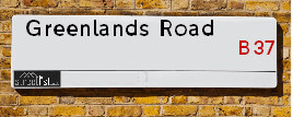
Greenlands Road is a street located in the city of Birmingham. The street has a length of approximately 925 metres.
The street is publicly maintained which means that the road is adopted and Solihull is responsible for the repair and upkeep of the highway.
The street is located within the Solihull District (B) Council's jurisdiction. They provide various services, like refuse collection, and manage council tax collection. It's situated in the West Midlands region of the UK.
The road has been assigned the Unique Street Reference Number of 35002621 in the National Street Gazetteer.
The street has the postcodes of B37 7XB, B37 7QU, B37 7QB, B37 7PH, B37 7ND, B37 7NB, B37 7NA, B37 7LY, B37 7LX, B37 7LU and B37 7LT.
It is located within the county of West Midlands, situated in the West Midlands region of the UK. It's 96.74 miles North West from central London., 7.03 miles East from Birmingham, 10.61 miles North West from Coventry and 27.75 miles South West from Leicester.
GREENLANDS ROAD is within the Post Town of BIRMINGHAM
Map of Greenlands Road
| Street Crime (updated 14/01/2025) | ||
|---|---|---|
| Location Note | Central Point of Street - Not Actual Location | |
| MSOA Info | For MSOAs E02002088, E02002086, E02002089 (Statistical Neighbourhood) | |
| Click Hint | Click on a Circle for a detailed breakdown below map. | |
| Crime Levels |
Green = Very Low Yellow = Low Orange = High Red = Very High |
|
| Postcodes | ||
| Icon | Postcodes for Greenlands Road | |
| Walking Distances | ||
| Distance Info | Green Circle = 10 Minutes Walk (800 metres) | |
Street Crime Data accessed from data.police.uk on 06/10/2024.
Moving to Greenlands Road?
I can help you uncover potential pitfalls and provide key questions to ask about your new property. With decades of experience as a Local Land Charges Manager, I offer confidential insights to make your move informed and stress-free.
This service is free, but you may wish to make an optional donation to support it. Please include the property name and address in your request as well as anything you wish to focus on.
Contact Me
Do you know why this road is called Greenlands Road?
What's it like to live here?
Share a Photo of Greenlands Road
Ask the community a question.
Do you have any questions, memories to share, have any photos or know any facts? We'd love to know more.
Submit Your Comment
Find Homes to Rent in Chelmsley Wood

Find Homes to Rent in Birmingham
Budget Friendly Hotels near Greenlands Road
| Budget Hotel Name | Distance (miles) |
|---|---|
|
1: Name:Premier Inn Birmingham NEC/Airport Address: Bickenhill Parkway Telephone: Visit Hotel Page |
1.11 |
|
2: Name:Holiday Inn Express Birmingham NEC Address: Bickenhill Parkway Telephone: Visit Hotel Page |
1.14 |
|
3: Name:ibis budget Birmingham International Airport � NEC Address: Ambassador Road Telephone: Visit Hotel Page |
1.53 |
|
4: Name:Travelodge Birmingham Airport Address: Terminal Rd, Birmingham, B26 3QW Telephone: 0871 984 6483 Visit Hotel Page |
2.02 |
|
5: Name:Travelodge Birmingham Castle Bromwich Address: Chester Rd, Birmingham, B36 0AG Telephone: 0871 559 1813 Visit Hotel Page |
2.56 |
Hotel Options
Your support helps keep this site running!
If you enjoy using this website, consider making a donation to help me cover hosting costs.
EPC (Energy Performance Certificate) Information for Greenlands Road
UPRN: 100070959697
EPC Current: E
EPC Potential: C
Habitable Rooms: 4
Property Type: House
Tenure: Owner-occupied
Built Form: End-Terrace
Age Band: 1967-1975
Mains Gas: Yes
UPRN: 100070959698
EPC Current: D
EPC Potential: B
Habitable Rooms: 4
Property Type: House
Tenure: Owner-occupied
Built Form: Mid-Terrace
Age Band: 1967-1975
Mains Gas: Yes
UPRN: 100070959700
EPC Current: C
EPC Potential: C
Habitable Rooms: 2
Property Type: Flat
Tenure: Owner-occupied
Built Form: End-Terrace
Age Band: 1950-1966
Mains Gas: Yes
UPRN: 100070959702
EPC Current: C
EPC Potential: C
Habitable Rooms: 2
Property Type: Flat
Tenure: rental (social)
Built Form: End-Terrace
Age Band: 1967-1975
Mains Gas: Yes
UPRN: 100070959704
EPC Current: C
EPC Potential: B
Habitable Rooms: 3
Property Type: House
Tenure: Owner-occupied
Built Form: Mid-Terrace
Age Band: 1967-1975
Mains Gas: Yes
UPRN: 100070959705
EPC Current: C
EPC Potential: C
Habitable Rooms: 3
Property Type: Flat
Tenure: rental (social)
Built Form: NO DATA!
Age Band: 1967-1975
Mains Gas: Yes
UPRN: 100070959707
EPC Current: C
EPC Potential: C
Habitable Rooms: 3
Property Type: Flat
Tenure: rental (private)
Built Form: End-Terrace
Age Band: 1967-1975
Mains Gas: Yes
UPRN: 100070959709
EPC Current: C
EPC Potential: C
Habitable Rooms: 3
Property Type: Flat
Tenure: rental (social)
Built Form: NO DATA!
Age Band: 1967-1975
Mains Gas: Yes
UPRN: 100070959711
EPC Current: C
EPC Potential: C
Habitable Rooms: 3
Property Type: Flat
Tenure: rental (social)
Built Form: End-Terrace
Age Band: 1967-1975
Mains Gas: Yes
UPRN: 100070959713
EPC Current: C
EPC Potential: B
Habitable Rooms: 5
Property Type: House
Tenure: Rented (private)
Built Form: Mid-Terrace
Age Band: 1967-1975
Mains Gas: Yes
UPRN: 100070959714
EPC Current: D
EPC Potential: B
Habitable Rooms: 4
Property Type: House
Tenure: Owner-occupied
Built Form: Mid-Terrace
Age Band: 1967-1975
Mains Gas: Yes
UPRN: 100070959716
EPC Current: C
EPC Potential: B
Habitable Rooms: 4
Property Type: House
Tenure: Rented (social)
Built Form: Mid-Terrace
Age Band: 1967-1975
Mains Gas: Yes
UPRN: 100070959717
EPC Current: C
EPC Potential: B
Habitable Rooms: 5
Property Type: House
Tenure: Rented (social)
Built Form: Mid-Terrace
Age Band: 1967-1975
Mains Gas: Yes
UPRN: 100070959720
EPC Current: D
EPC Potential: B
Habitable Rooms: 5
Property Type: House
Tenure: Owner-occupied
Built Form: Mid-Terrace
Age Band: 1967-1975
Mains Gas: Yes
UPRN: 100070959722
EPC Current: C
EPC Potential: B
Habitable Rooms: 5
Property Type: House
Tenure: Rented (social)
Built Form: End-Terrace
Age Band: 1967-1975
Mains Gas: Yes
UPRN: 100070959724
EPC Current: C
EPC Potential: C
Habitable Rooms: 2
Property Type: Flat
Tenure: rental (social)
Built Form: End-Terrace
Age Band: 1967-1975
Mains Gas: Yes
UPRN: 100070959725
EPC Current: D
EPC Potential: C
Habitable Rooms: 3
Property Type: Flat
Tenure: Owner-occupied
Built Form: End-Terrace
Age Band: 1950-1966
Mains Gas: Yes
UPRN: 100070959726
EPC Current: E
EPC Potential: C
Habitable Rooms: 2
Property Type: Flat
Tenure: Owner-occupied
Built Form: End-Terrace
Age Band: 1950-1966
Mains Gas: Yes
UPRN: 100070959728
EPC Current: C
EPC Potential: C
Habitable Rooms: 3
Property Type: Flat
Tenure: Not defined - use in the case of a new dwelling fo
Built Form: End-Terrace
Age Band: 1967-1975
Mains Gas: Yes
UPRN: 100070959732
EPC Current: D
EPC Potential: B
Habitable Rooms: 5
Property Type: House
Tenure: Owner-occupied
Built Form: Mid-Terrace
Age Band: 1967-1975
Mains Gas: Yes
UPRN: 100070959733
EPC Current: C
EPC Potential: B
Habitable Rooms: 6
Property Type: House
Tenure: Rented (social)
Built Form: End-Terrace
Age Band: 1976-1982
Mains Gas: Yes
UPRN: 100070959734
EPC Current: D
EPC Potential: B
Habitable Rooms: 5
Property Type: House
Tenure: Owner-occupied
Built Form: End-Terrace
Age Band: 1967-1975
Mains Gas: Yes
UPRN: 100070959735
EPC Current: C
EPC Potential: B
Habitable Rooms: 4
Property Type: Maisonette
Tenure: rental (social)
Built Form: NO DATA!
Age Band: 1967-1975
Mains Gas: Yes
UPRN: 100070959736
EPC Current: D
EPC Potential: B
Habitable Rooms: 5
Property Type: House
Tenure: Owner-occupied
Built Form: Mid-Terrace
Age Band: 1950-1966
Mains Gas: Yes
UPRN: 100070959737
EPC Current: C
EPC Potential: C
Habitable Rooms: 3
Property Type: Maisonette
Tenure: Owner-occupied
Built Form: Mid-Terrace
Age Band: 1967-1975
Mains Gas: Yes
UPRN: 100070959738
EPC Current: D
EPC Potential: B
Habitable Rooms: 5
Property Type: House
Tenure: Owner-occupied
Built Form: Mid-Terrace
Age Band: 1950-1966
Mains Gas: Yes
UPRN: 100070959739
EPC Current: C
EPC Potential: C
Habitable Rooms: 4
Property Type: Flat
Tenure: Rented (private)
Built Form: Mid-Terrace
Age Band: 1967-1975
Mains Gas: Yes
UPRN: 100070959741
EPC Current: D
EPC Potential: D
Habitable Rooms: 4
Property Type: Maisonette
Tenure: rental (private)
Built Form: Mid-Terrace
Age Band: 1930-1949
Mains Gas: Yes
UPRN: 100070959742
EPC Current: C
EPC Potential: B
Habitable Rooms: 5
Property Type: House
Tenure: Owner-occupied
Built Form: Mid-Terrace
Age Band: 1967-1975
Mains Gas: Yes
UPRN: 100070959743
EPC Current: D
EPC Potential: C
Habitable Rooms: 5
Property Type: Flat
Tenure: Owner-occupied
Built Form: End-Terrace
Age Band: 1967-1975
Mains Gas: Yes
UPRN: 100070959744
EPC Current: C
EPC Potential: B
Habitable Rooms: 5
Property Type: House
Tenure: Rented (private)
Built Form: Mid-Terrace
Age Band: 1967-1975
Mains Gas: Yes
UPRN: 100070959748
EPC Current: C
EPC Potential: B
Habitable Rooms: 5
Property Type: House
Tenure: Rented (private)
Built Form: Mid-Terrace
Age Band: 1967-1975
Mains Gas: Yes
UPRN: 100070959750
EPC Current: D
EPC Potential: B
Habitable Rooms: 5
Property Type: House
Tenure: Owner-occupied
Built Form: Mid-Terrace
Age Band: 1967-1975
Mains Gas: Yes
UPRN: 100070959751
EPC Current: C
EPC Potential: B
Habitable Rooms: 5
Property Type: House
Tenure: Owner-occupied
Built Form: Mid-Terrace
Age Band: 1950-1966
Mains Gas: Yes
UPRN: 100070959753
EPC Current: D
EPC Potential: B
Habitable Rooms: 3
Property Type: House
Tenure: Owner-occupied
Built Form: Mid-Terrace
Age Band: 1950-1966
Mains Gas: Yes
UPRN: 100070959754
EPC Current: D
EPC Potential: B
Habitable Rooms: 5
Property Type: House
Tenure: Owner-occupied
Built Form: End-Terrace
Age Band: 1967-1975
Mains Gas: Yes
UPRN: 100070959756
EPC Current: D
EPC Potential: B
Habitable Rooms: 5
Property Type: House
Tenure: rental (private)
Built Form: Mid-Terrace
Age Band: 1967-1975
Mains Gas: Yes
UPRN: 100070959757
EPC Current: C
EPC Potential: C
Habitable Rooms: 4
Property Type: Maisonette
Tenure: Rented (private)
Built Form: End-Terrace
Age Band: 1967-1975
Mains Gas: Yes
UPRN: 100070959758
EPC Current: D
EPC Potential: B
Habitable Rooms: 5
Property Type: House
Tenure: Owner-occupied
Built Form: Mid-Terrace
Age Band: 1950-1966
Mains Gas: Yes
UPRN: 100070959759
EPC Current: C
EPC Potential: B
Habitable Rooms: 4
Property Type: Flat
Tenure: rental (social)
Built Form: NO DATA!
Age Band: U
Mains Gas: Yes
UPRN: 100070959760
EPC Current: C
EPC Potential: B
Habitable Rooms: 5
Property Type: House
Tenure: Owner-occupied
Built Form: Mid-Terrace
Age Band: 1967-1975
Mains Gas: Yes
UPRN: 100070959761
EPC Current: C
EPC Potential: C
Habitable Rooms: 4
Property Type: Maisonette
Tenure: Rented (social)
Built Form: Mid-Terrace
Age Band: 1950-1966
Mains Gas: Yes
UPRN: 100070959762
EPC Current: C
EPC Potential: C
Habitable Rooms: 3
Property Type: Flat
Tenure: Rented (social)
Built Form: Semi-Detached
Age Band: 1967-1975
Mains Gas: Yes
UPRN: 100070959763
EPC Current: C
EPC Potential: C
Habitable Rooms: 4
Property Type: Maisonette
Tenure: Rented (social)
Built Form: Mid-Terrace
Age Band: 1950-1966
Mains Gas: Yes
UPRN: 100070959765
EPC Current: C
EPC Potential: C
Habitable Rooms: 4
Property Type: Flat
Tenure: rental (social)
Built Form: NO DATA!
Age Band: 1976-1982
Mains Gas: Yes
UPRN: 100070959766
EPC Current: C
EPC Potential: B
Habitable Rooms: 3
Property Type: Flat
Tenure: rental (social)
Built Form: End-Terrace
Age Band: 1967-1975
Mains Gas: Yes
UPRN: 100070959767
EPC Current: C
EPC Potential: B
Habitable Rooms: 4
Property Type: Maisonette
Tenure: rental (social)
Built Form: NO DATA!
Age Band: 1967-1975
Mains Gas: Yes
UPRN: 100070959769
EPC Current: D
EPC Potential: B
Habitable Rooms: 6
Property Type: House
Tenure: Owner-occupied
Built Form: End-Terrace
Age Band: 1967-1975
Mains Gas: Yes
UPRN: 10008212859
EPC Current: C
EPC Potential: C
Habitable Rooms: 3
Property Type: Flat
Tenure: Owner-occupied
Built Form: Detached
Age Band: 2007-2011
Mains Gas: Yes
UPRN: 100070959770
EPC Current: C
EPC Potential: B
Habitable Rooms: 3
Property Type: House
Tenure: Owner-occupied
Built Form: Mid-Terrace
Age Band: 1967-1975
Mains Gas: Yes
UPRN: 10008212860
EPC Current: C
EPC Potential: C
Habitable Rooms: 3
Property Type: Flat
Tenure: Owner-occupied
Built Form: Detached
Age Band: 2007 onwards
Mains Gas: Yes
UPRN: 10008212862
EPC Current: B
EPC Potential: B
Habitable Rooms: 3
Property Type: Flat
Tenure: Owner-occupied
Built Form: Mid-Terrace
Age Band: 2003-2006
Mains Gas: Yes
UPRN: 10008212863
EPC Current: C
EPC Potential: C
Habitable Rooms: 3
Property Type: Flat
Tenure: Owner-occupied
Built Form: Semi-Detached
Age Band: 2007-2011
Mains Gas: Yes
UPRN: 10008212864
EPC Current: C
EPC Potential: C
Habitable Rooms: 3
Property Type: Flat
Tenure: Owner-occupied
Built Form: Detached
Age Band: 2003-2006
Mains Gas: Yes
UPRN: 10008212865
EPC Current: C
EPC Potential: C
Habitable Rooms: 3
Property Type: Flat
Tenure: Owner-occupied
Built Form: Detached
Age Band: 2007 onwards
Mains Gas: Yes
UPRN: 100070959776
EPC Current: E
EPC Potential: B
Habitable Rooms: 3
Property Type: House
Tenure: rental (private)
Built Form: Mid-Terrace
Age Band: 1967-1975
Mains Gas: Yes
UPRN: 10008212866
EPC Current: C
EPC Potential: C
Habitable Rooms: 3
Property Type: Flat
Tenure: rental (private)
Built Form: Semi-Detached
Age Band: 2007 onwards
Mains Gas: Yes
UPRN: 10008212867
EPC Current: C
EPC Potential: C
Habitable Rooms: 3
Property Type: Flat
Tenure: Owner-occupied
Built Form: Semi-Detached
Age Band: 1996-2002
Mains Gas: Yes
UPRN: 10008212868
EPC Current: C
EPC Potential: C
Habitable Rooms: 3
Property Type: Flat
Tenure: Rented (social)
Built Form: Detached
Age Band: 1991-1995
Mains Gas: Yes
UPRN: 100070959778
EPC Current: D
EPC Potential: B
Habitable Rooms: 5
Property Type: House
Tenure: Owner-occupied
Built Form: Semi-Detached
Age Band: 1950-1966
Mains Gas: Yes
UPRN: 100070959779
EPC Current: D
EPC Potential: B
Habitable Rooms: 5
Property Type: House
Tenure: Owner-occupied
Built Form: Semi-Detached
Age Band: 1950-1966
Mains Gas: Yes
UPRN: 100070959781
EPC Current: D
EPC Potential: B
Habitable Rooms: 4
Property Type: House
Tenure: unknown
Built Form: Semi-Detached
Age Band: 1967-1975
Mains Gas: Yes
UPRN: 100070959783
EPC Current: D
EPC Potential: C
Habitable Rooms: 5
Property Type: House
Tenure: Owner-occupied
Built Form: Semi-Detached
Age Band: 1967-1975
Mains Gas: Yes
UPRN: 100070959784
EPC Current: D
EPC Potential: B
Habitable Rooms: 5
Property Type: House
Tenure: Rented (social)
Built Form: Mid-Terrace
Age Band: 1967-1975
Mains Gas: Yes
UPRN: 100070959785
EPC Current: D
EPC Potential: B
Habitable Rooms: 5
Property Type: House
Tenure: Owner-occupied
Built Form: Semi-Detached
Age Band: 1967-1975
Mains Gas: Yes
UPRN: 100070959790
EPC Current: E
EPC Potential: B
Habitable Rooms: 2
Property Type: House
Tenure: rental (private)
Built Form: Mid-Terrace
Age Band: 1967-1975
Mains Gas: Yes
UPRN: 100070959792
EPC Current: C
EPC Potential: C
Habitable Rooms: 2
Property Type: Flat
Tenure: rental (social)
Built Form: End-Terrace
Age Band: 1967-1975
Mains Gas: Yes
UPRN: 100070959793
EPC Current: D
EPC Potential: B
Habitable Rooms: 5
Property Type: House
Tenure: Owner-occupied
Built Form: End-Terrace
Age Band: 1967-1975
Mains Gas: Yes
UPRN: 100070959794
EPC Current: C
EPC Potential: B
Habitable Rooms: 5
Property Type: House
Tenure: Rented (social)
Built Form: End-Terrace
Age Band: 1967-1975
Mains Gas: Yes
UPRN: 100070959795
EPC Current: D
EPC Potential: C
Habitable Rooms: 3
Property Type: Flat
Tenure: rental (social)
Built Form: NO DATA!
Age Band: 1976-1982
Mains Gas: Yes
UPRN: 100070959796
EPC Current: D
EPC Potential: B
Habitable Rooms: 5
Property Type: House
Tenure: Owner-occupied
Built Form: End-Terrace
Age Band: 1967-1975
Mains Gas: Yes
UPRN: 100070959797
EPC Current: C
EPC Potential: C
Habitable Rooms: 5
Property Type: Maisonette
Tenure: Rented (private)
Built Form: Mid-Terrace
Age Band: 1967-1975
Mains Gas: Yes
UPRN: 100070959799
EPC Current: C
EPC Potential: C
Habitable Rooms: 5
Property Type: Maisonette
Tenure: Owner-occupied
Built Form: Mid-Terrace
Age Band: 1967-1975
Mains Gas: Yes
UPRN: 100070959801
EPC Current: C
EPC Potential: C
Habitable Rooms: 5
Property Type: Maisonette
Tenure: rental (social)
Built Form: Semi-Detached
Age Band: 1967-1975
Mains Gas: Yes
UPRN: 100070959804
EPC Current: D
EPC Potential: C
Habitable Rooms: 2
Property Type: Flat
Tenure: rental (social)
Built Form: Detached
Age Band: 1967-1975
Mains Gas: Yes
UPRN: 100070959805
EPC Current: D
EPC Potential: C
Habitable Rooms: 3
Property Type: Flat
Tenure: rental (social)
Built Form: NO DATA!
Age Band: 1976-1982
Mains Gas: Yes
UPRN: 100070959807
EPC Current: C
EPC Potential: C
Habitable Rooms: 3
Property Type: Flat
Tenure: rental (social)
Built Form: Semi-Detached
Age Band: 1967-1975
Mains Gas: Yes
UPRN: 100070959808
EPC Current: D
EPC Potential: C
Habitable Rooms: 3
Property Type: Maisonette
Tenure: rental (social)
Built Form: End-Terrace
Age Band: 1967-1975
Mains Gas: Yes
UPRN: 100070959809
EPC Current: C
EPC Potential: C
Habitable Rooms: 2
Property Type: Flat
Tenure: rental (social)
Built Form: NO DATA!
Age Band: 1976-1982
Mains Gas: Yes
UPRN: 100070959811
EPC Current: C
EPC Potential: B
Habitable Rooms: 2
Property Type: Flat
Tenure: rental (social)
Built Form: NO DATA!
Age Band: 1967-1975
Mains Gas: Yes
UPRN: 100070959812
EPC Current: C
EPC Potential: B
Habitable Rooms: 5
Property Type: House
Tenure: Owner-occupied
Built Form: Mid-Terrace
Age Band: 1967-1975
Mains Gas: Yes
UPRN: 100070959813
EPC Current: C
EPC Potential: B
Habitable Rooms: 4
Property Type: House
Tenure: Owner-occupied
Built Form: Mid-Terrace
Age Band: 1967-1975
Mains Gas: Yes
UPRN: 100070959814
EPC Current: C
EPC Potential: B
Habitable Rooms: 5
Property Type: House
Tenure: Owner-occupied
Built Form: Mid-Terrace
Age Band: 1967-1975
Mains Gas: Yes
UPRN: 100070959815
EPC Current: C
EPC Potential: B
Habitable Rooms: 5
Property Type: House
Tenure: Owner-occupied
Built Form: Mid-Terrace
Age Band: 1950-1966
Mains Gas: Yes
UPRN: 100070959816
EPC Current: C
EPC Potential: C
Habitable Rooms: 2
Property Type: Flat
Tenure: rental (social)
Built Form: NO DATA!
Age Band: 1967-1975
Mains Gas: Yes
UPRN: 100070959817
EPC Current: D
EPC Potential: D
Habitable Rooms: 3
Property Type: Flat
Tenure: rental (private)
Built Form: Semi-Detached
Age Band: 1967-1975
Mains Gas: Yes
UPRN: 100070959818
EPC Current: C
EPC Potential: C
Habitable Rooms: 2
Property Type: Flat
Tenure: Rented (social)
Built Form: End-Terrace
Age Band: 1967-1975
Mains Gas: Yes
UPRN: 100070959819
EPC Current: C
EPC Potential: C
Habitable Rooms: 3
Property Type: Flat
Tenure: Owner-occupied
Built Form: End-Terrace
Age Band: 1967-1975
Mains Gas: Yes
House Sales
| Year | High | Low | Average | Sales |
|---|---|---|---|---|
| 2014 | £99,000 | £66,000 | £96,750 | 4 |
| 2015 | £92,000 | £92,000 | £92,000 | 1 |
| 2016 | £118,500 | £70,000 | £104,500 | 3 |
| 2017 | £112,000 | £62,500 | £80,375 | 4 |
| 2018 | £87,000 | £92,000 | £89,000 | 4 |
| 2019 | £142,000 | £82,000 | £115,571 | 7 |
| 2021 | £143,000 | £72,000 | £107,500 | 2 |
| 2022 | £140,000 | £125,000 | £131,100 | 5 |
| 2023 | £168,000 | £175,000 | £171,500 | 2 |
Contains HM Land Registry data © Crown copyright and database right 2025. This data is licensed under the Open Government Licence v3.0.
Nearby Estate Agents
| Name | Address | Website |
|---|---|---|
| White Castle Lettings | 21 Shirland Road, Marston Green,B37 7GE | Visit Website |
| Citizen Housing Group LTD | 4040 Lakeside, Solihull Parkway, Birmingham, B37 7YN | |
| Black & White | 66, Station Road, Marston Green, Solihull, B37 7BA | Visit Website |
| Platform Housing Group | 1700 Solihull Parkway Birmingham Business Park Birmingham B37 7YD | Visit Website |
| Platform Housing Group | Solihull Parkway Birmingham Business Park Solihull B37 7YD | Visit Website |
We have found 11 postcodes
Neighbourhood Policing |
| Police Force: West Midlands |
 View Neighbourhood Crime and Policing View Neighbourhood Crime and Policing |
| Find a Local Neighbourhood Watch Scheme |
Location Details
| Greenlands Road | |
|---|---|

| |
| Latitude | 52.474706 |
| Longitude | -1.734929 |
| OS Easting (X): | 418002 |
| OS Northing (Y): | 286382 |
| OS Grid Reference: | SP180864 |
Known Residential Addresses for Greenlands Road
- 195
- 139
- 151
- 116
- 102
- 112
- 114
- 87
- 65
- 8
- 48
- 46
- 22
- 124
- 183
- 187
- 99
- 81
- 53
- 37
- 31
- 18
- 4
- 2
- 76
- 86
- 74
- 66
Roads that have a Junction with Greenlands Road
| Street | Junction Type |
|---|---|
| Moorend Avenue | roundabout |
| Moorend Avenue | roundabout |
| Coralin Close | junction |
| Stella Croft | junction |
| Alder Drive | junction |
| Arbor Way | junction |
| Arbor Way | junction |
| Alder Drive | junction |
| Piccadilly Close | junction |
| Birch Croft | junction |
| Piccadilly Close | junction |
| Rowan Way | junction |
| Nevada Way | junction |
| Helmswood Drive | junction |
Sunset and Sunrise times
| Sunrise | 07:47 |
|---|---|
| Sunset | 16:53 |
Latest Weather Conditions
| Observed at Weather Station: | Coleshill 31 January 2025 at 12:00 (1.97 miles away) |
|---|---|
| Current Weather: | Heavy rain |
| Temperature and Humidity: | 6.8°C (93.2%) |
| Wind Direction and Speed: | NW (8 mph) |
Population Statistics
| ONS Area Code | E00051191, E00051211, E00051140, E00051208, E00051195, E00051143, E00051145 & E00051141 |
|---|---|
| ONS Area Name | Multi-Ethnic Hardship & Hard-Pressed Ethnic Mix |
| Average Age | 36.97, 35.96, 35.68, 39.32 & 37.82 |
| Area Population | 1395.00, 1465.00, 1785.00, 1482.00 & 1554.00 |
| Male Population | 664.00, 734.00, 864.00, 726.00 & 747.00 (49%) |
| Female Population | 731.00, 921.00, 756.00 & 807.00 (52%) |
| Benefit Claimants | 73, 98, 90, 71 & 44 (5%) |
| LSOA Code: | E01010131, E01010111, E01010130, E01010125 &E01010112 |
|---|---|
| LSOA Name: | Solihull 008F, Solihull 008A, Solihull 008E, Solihull 006A &Solihull 009C |
| SOA Code: | 4c |
| SOA Name: | |
| MSOA Code: | E02002088, E02002086 &E02002089 |
| MSOA Name: | Solihull 008, Solihull 006 &Solihull 009 |
Nearest Supermarkets
| Iceland Chelmsley Wood |
|---|
| 79 Cedar Walk, Chelmsley Wood Centre, Birmingham, B37 5TU |
| 01217888105 |
| Distance: 0.37 Miles |
| Directions to Iceland Chelmsley Wood |
| Asda Chelmsley Wood |
|---|
| 341 Bosworth Drive, Solihull, B37 5EX |
| 0121 788 5700 |
| Distance: 0.4 Miles |
| Directions to Asda Chelmsley Wood |
| Morrisons Coleshill |
|---|
| Park Road, Coleshill B46 1AS |
| 01675 462256 |
| Distance: 1.98 Miles |
| Directions to Morrisons Coleshill |
| Morrisons Birmingham - Castle Bromwich |
|---|
| 264 Chester Road, Castle Bromwich, Birmingham B34 7HR |
| 0121 776 7878 |
| Distance: 2.1 Miles |
| Directions to Morrisons Birmingham - Castle Bromwich |
Telephone Information
| Area Code |
|---|
| Area Code: 01675 - Coleshill |
| Area Code: 01676 - Meriden |
| Area Code: 0121 - Birmingham |
Broadband Information
| Speed | Average Speed | Median Speed | Maximum Speed | Next-generation access (NGA) | Number of Connections |
|---|---|---|---|---|---|
| Greater than 2 Mbps | 22.4 | 25 | >=30 | Y | 6 |
Local Government
| Local Council Details |
|---|
| Within the area of Solihull |
| Visit the Council's Website |
| PO Box 18, Council House, Solihull, West Midlands &B91 3QS |
| Send email |
| Telephone Number: 0121 704 6000 |
| Local Member of Parliament |
|---|
| Within the Westminster Parliamentary Constituency of Meriden |
| The Member of Parliament is Saqib Bhatti |
| Details for the MP Saqib Bhatti on parliament.uk |
| Details for the MP Saqib Bhatti on theyworkforyou.com |
| In the 2024 General Election Saqib Bhatti won with a majority of 4,584 the result was Con hold. The total electorate was 73,659 |
| Wards, Parish Councils and County Councils |
|---|
| Ward: Chelmsley Wood &Bickenhill Ward |
| Parish: Chelmsley Wood Parish Council |
| Ceremonial County: West Midlands |
Nearest Schools
England Primary Schools
St Edward's Catholic Primary School
Address: St Edward's Catholic Primary School, Packington Lane, Coleshill, Birmingham, Warwickshire, B46 3JE
Distance: 1.55 miles
Contact:
Bishop Wilson Church of England Primary School
Address: Bishop Wilson Church of England Primary School, 10 Craig Croft, Chelmund's Cross, Chelmsley Wood, Birmingham, West Midlands, B37 7TR
Distance: 0.39 miles
Contact: 01217704063
Windy Arbor Primary School
Address: Windy Arbor Primary School, Woodlands Way, Chelmsley Wood, Birmingham, West Midlands, B37 6RN
Distance: 0.54 miles
Contact:
St Anthony's Catholic Primary School
Address: St Anthony's Catholic Primary School, Fordbridge Road, Kingshurst, Birmingham, West Midlands, B37 6LW
Distance: 1.25 miles
Contact:
St John the Baptist Catholic Primary School
Address: St John the Baptist Catholic Primary School, Arran Way, Chelmsley Wood, Birmingham, West Midlands, B36 0QE
Distance: 1.80 miles
Contact:
St Anne's Catholic Primary School
Address: St Anne's Catholic Primary School, Bosworth Drive, Chelmsley Wood, Birmingham, West Midlands, B37 5DP
Distance: 0.56 miles
Contact:
Fordbridge Community Primary School
Address: Fordbridge Community Primary School, Crabtree Drive, Chelmsley Wood, Birmingham, West Midlands, B37 5BU
Distance: 0.89 miles
Contact:
Kingshurst Primary School
Address: Kingshurst Primary School, School Close, Kingshurst, Birmingham, West Midlands, B37 6BN
Distance: 1.59 miles
Contact: 01217886510
The Shirestone Academy
Address: The Shirestone Academy, Shirestone Road, Tile Cross, Birmingham, West Midlands, B33 0DH
Distance: 1.38 miles
Contact: 01216754686
Coleshill Heath School
Address: Coleshill Heath School, Lime Grove, Chelmsley Wood, Birmingham, West Midlands, B37 7PY
Distance: 0.12 miles
Contact: 01217798070
Smith's Wood Primary Academy
Address: Smith's Wood Primary Academy, Burton's Way, Smith's Wood, Birmingham, West Midlands, B36 0SZ
Distance: 2.10 miles
Contact: 01217798050
Marston Green Infant Academy
Address: Marston Green Infant Academy, Elm Farm Avenue, Marston Green, Birmingham, West Midlands, B37 7AA
Distance: 0.92 miles
Contact: 01217795667
Marston Green Junior School
Address: Marston Green Junior School, Station Road, Marston Green, Birmingham, West Midlands, B37 7BA
Distance: 0.81 miles
Contact: 01217792227
Our Lady's Catholic Primary School
Address: Our Lady's Catholic Primary School, East Meadway, Tile Cross, Birmingham, West Midlands, B33 0AU
Distance: 1.46 miles
Contact:
Gossey Lane Academy
Address: Gossey Lane Academy, Gossey Lane, Kitts Green, Birmingham, West Midlands, B33 0DS
Distance: 1.79 miles
Contact: 01214642909
Gossey Lane Junior Infant and Nursery School
Address: Gossey Lane Junior Infant and Nursery School, Gossey Lane, Kitts Green, Birmingham, West Midlands, B33 0DS
Distance: 1.79 miles
Contact:
England Secondary Schools
The Coleshill School
Address: The Coleshill School, Coventry Road, Coleshill, Birmingham, Warwickshire, B46 3EX
Distance: 1.41 miles
Contact: 01675462435
Smith's Wood Sports College
Address: Smith's Wood Sports College, Windward Way, Smith's Wood, Birmingham, West Midlands, B36 0UE
Distance: 1.72 miles
Contact:
CTC Kingshurst Academy
Address: CTC Kingshurst Academy, Cooks Lane, Kingshurst, Solihull, West Midlands, B37 6NU
Distance: 1.01 miles
Contact:
John Henry Newman Catholic College
Address: John Henry Newman Catholic College, Chelmsley Road, Chelmsley Wood, Birmingham, West Midlands, B37 5GA
Distance: 0.91 miles
Contact: 01217705331
Grace Academy Solihull
Address: Grace Academy Solihull, Chapelhouse Road, Chelmsey Wood, Birmingham, West Midlands, B37 5JS
Distance: 0.86 miles
Contact: 01213294600
WMG Academy for Young Engineers (Solihull)
Address: WMG Academy for Young Engineers (Solihull), Chelmsley Road, Chelmsley Wood, Birmingham, B37 5FD
Distance: 0.62 miles
Contact: 01212893556
Smith's Wood Academy
Address: Smith's Wood Academy, Windward Way, Smith's Wood, Birmingham, West Midlands, B36 0UE
Distance: 1.72 miles
Contact: 01217884100
Tile Cross Academy
Address: Tile Cross Academy, Gressel Lane, Tile Cross, Birmingham, West Midlands, B33 9UF
Distance: 1.59 miles
Contact: 01215666400
The International School
Address: The International School, Gressel Lane, Tile Cross, Birmingham, West Midlands, B33 9UF
Distance: 1.59 miles
Contact:
Nearest Hospitals
| Brooklands Hospital |
|---|
| Address: Coleshill Road, Marston Green, Birmingham, B37 7HL, |
| NHS Sector |
| Coventry and Warwickshire Partnership NHS Trust |
| Telephone: 0121 329 4900 |
| Visit Hospital Website |
| Distance: 0.73 (miles) |
| Directions from to Brooklands Hospital |
| Spire Parkway Hospital |
|---|
| Address: 1 Damson Parkway, Solihull, B91 2PP, |
| Independent Sector |
| Spire Healthcare |
| Telephone: 0121 704 1451 |
| Visit Hospital Website |
| Distance: 6.17 (miles) |
| Directions from to Spire Parkway Hospital |
| Hertford House |
|---|
| Address: 29 Old Warwick Road, Olton, Solihull, B92 7JQ, |
| NHS Sector |
| Birmingham and Solihull Mental Health NHS Foundation Trust |
| Telephone: 0121 678 4860 |
| Visit Hospital Website |
| Distance: 6.39 (miles) |
| Directions from to Hertford House |
Nearest Dentists
Dentists
HEDINGHAM GROVE DENTAL SURGERY
Address: 5 HEDINGHAM GROVE, CHELMSLEY WOOD, BIRMINGHAM, WEST MIDLANDS, B37 7TP
Distance: 0.39 miles
Contact: :
DENTAL SURGERY
Address: CRABTREE DRIVE, BIRMINGHAM, WEST MIDLANDS, B37 5BU
Distance: 0.89 miles
Contact: :
WILKINSON DENTAL CARE
Address: 21 STATION ROAD, MARSTON GREEN, BIRMINGHAM, WEST MIDLANDS, B37 7AB
Distance: 0.91 miles
Contact: :
21-21A BELL LANE (DENTAL SURGERY)
Address: 21-21A BELL LANE, KITTS GREEN, BIRMINGHAM, WEST MIDLANDS, B33 0HS
Distance: 1.13 miles
Contact: :
LANSDOWN DENTAL PRACTICE
Address: 711 CHESTER ROAD, KINGSHURST, BIRMINGHAM, WEST MIDLANDS, B36 0LN
Distance: 1.24 miles
Contact: :
KINGSHURST DENTAL SURGERY
Address: 16 THE PARADE, KINGSHURST, BIRMINGHAM, WEST MIDLANDS, B37 6BA
Distance: 1.49 miles
Contact: :
Nearest GP Surgeries
Doctors
CROFT MEDICAL CENTRE
Address: 1 POMEROY WAY, CHELMSLEY WOOD, BIRMINGHAM, WEST MIDLANDS, B37 7WB
Distance: 0.34 miles
Contact: tel: 0121 2707180
CHELMSLEY LANE SURGERY
Address: 20 CHELMSLEY LANE, MARSTON GREEN, BIRMINGHAM, WEST MIDLANDS, B37 7BG
Distance: 0.87 miles
Contact: :
BOSWORTH MEDICAL GROUP
Address: CHELMSLEY WOOD PCC, CRABTREE DRIVE, CHELMSLEY WOOD, BIRMINGHAM, WEST MIDLANDS, B37 5BU
Distance: 0.89 miles
Contact: tel: 0121 7704484
NSC BOSWORTH HUB
Address: BOSWORTH MEDICAL CENTRE, 16 CRABTREE DRIVE, BIRMINGHAM, WEST MIDLANDS, B37 5BU
Distance: 0.89 miles
Contact: tel: 0121 3290031
CHELMSLEY WOOD - COVID LOCAL VACCINATION SERVICE 2
Address: CHELMSLEY WOOD PRIMARY CARE CENTRE, CRABTREE DRIVE, CHELMSLEY WOOD, BIRMINGHAM, B37 5BU
Distance: 0.89 miles
Contact: :
DR MACHIN P
Address: TILE CROSS SURGERY, 144 TILE CROSS ROAD, BIRMINGHAM, WEST MIDLANDS, B33 0LU
Distance: 1.09 miles
Contact: tel: 01217433409
Nearest Dispensing Chemists
Pharmacies
BOOTS
Address: 29-31 GREENWOOD WAY, BIRMINGHAM, WEST MIDLANDS, B37 5TL
Distance: 0.37 miles
Contact: tel: 0121 7706011
CROFT PHARMACY
Address: HEDINGHAM GROVE, CHELMSLEY WOOD, BIRMINGHAM, B37 7TP
Distance: 0.39 miles
Contact: tel: 01217 705077
ASDA PHARMACY
Address: BOSWORTH DRIVE, BIRMINGHAM, WEST MIDLANDS, B37 5EX
Distance: 0.41 miles
Contact: tel: 0121 7885710
KNIGHTS MARSTON GREEN PHARMACY
Address: 60 STATION ROAD, MARSTON GREEN, BIRMINGHAM, B37 7BA
Distance: 0.81 miles
Contact: tel: 01217 792226
BOOTS
Address: CHELMSLEY WOOD PCC, 16 CRABTREE DRIVE, CHELMSLEY WOOD, BIRMINGHAM, WEST MIDLANDS, B37 5BU
Distance: 0.89 miles
Contact: tel: 0121 7705602
BROWNS PHARMACY
Address: 3 BELL LANE, KITTS GREEN, BIRMINGHAM, B33 0HS
Distance: 1.13 miles
Contact: tel: 01217 792540
Nearest Opticians
Opticians
BOOTS OPTICIANS (CHELMSLEY WOOD)
Address: 11 COPPICE WAY, CHELMSLEY WOOD, BIRMINGHAM, WEST MIDLANDS, B37 5TX
Distance: 0.35 miles
Contact: :
SPECSAVERS (CHELMSLEY WOOD, BIRMINGHAM)
Address: 2-4 GREENWOOD SQUARE, BIRMINGHAM, WEST MIDLANDS, B37 5TR
Distance: 0.41 miles
Contact: :
MAGINNIS OPTICIANS - MARSTON GREEN
Address: 32A HOLLY LANE, MARSTON GREEN, BIRMINGHAM, WEST MIDLANDS, B37 7AE
Distance: 0.98 miles
Contact: :
COVENTRY 2 DOMICILIARY SPECSAVERS LIMITED
Address: 165 MERIDEN DRIVE, BIRMINGHAM, B37 6BT
Distance: 1.37 miles
Contact: :
I M HADFIELD OPTOMETRISTS - KINGSHURST
Address: 20 THE PARADE, KINGSHURST, BIRMINGHAM, WEST MIDLANDS, B37 6BA
Distance: 1.49 miles
Contact: :
DIRECT VISION OPTICIANS
Address: 297-299 CHURCH ROAD, SHELDON, BIRMINGHAM, WEST MIDLANDS, B26 3YH
Distance: 1.92 miles
Contact: :
Transport
Nearest Rail Stations
Marston Green Station is 1.01 miles away.
Address: Marston Green station, Holly Lane, Marston Green, West Midlands, B37 7AB
Marston Green is situated on the Rugby�Birmingham�Stafford line|West Coast Main Line.
Marston Green Station is staffed on a full time basis.
Birmingham International Station is 1.69 miles away.
Address: Birmingham International station, Stationlink Road, National Exhibition Centre, Birmingham, B40 1PA
Birmingham International is situated on the Rugby�Birmingham�Stafford line|West Coast Main Line and is managed by Avanti West Coast.
Birmingham International Station is staffed on a full time basis.