Conway Road is a street located in the city of Birmingham. The street has a length of approximately 1,171 metres.
The street is publicly maintained which means that the road is adopted and Solihull is responsible for the repair and upkeep of the highway.
The street is located within the Solihull District (B) Council's jurisdiction. They provide various services, like refuse collection, and manage council tax collection. It's situated in the West Midlands region of the UK.
The road has been assigned the Unique Street Reference Number of 35002528 in the National Street Gazetteer.
The street has the postcodes of B37 5LH, B37 5LG, B37 5LE, B37 5LD, B37 5LB and B37 5LA.
It is located within the county of West Midlands, situated in the West Midlands region of the UK. It's 97.39 miles North West from central London., 6.72 miles East from Birmingham, 11.16 miles North West from Coventry and 27.78 miles South West from Leicester.
CONWAY ROAD is within the Post Town of BIRMINGHAM
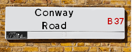
Map of Conway Road
| Street Crime (updated 14/01/2025) | ||
|---|---|---|
| Location Note | Central Point of Street - Not Actual Location | |
| MSOA Info | For MSOAs E02002087, E02002086 (Statistical Neighbourhood) | |
| Click Hint | Click on a Circle for a detailed breakdown below map. | |
| Crime Levels |
Green = Very Low Yellow = Low Orange = High Red = Very High |
|
| Postcodes | ||
| Icon | Postcodes for Conway Road | |
| Walking Distances | ||
| Distance Info | Green Circle = 10 Minutes Walk (800 metres) | |
Street Crime Data accessed from data.police.uk on 06/10/2024.
Moving to Conway Road?
I can help you uncover potential pitfalls and provide key questions to ask about your new property. With decades of experience as a Local Land Charges Manager, I offer confidential insights to make your move informed and stress-free.
This service is free, but you may wish to make an optional donation to support it. Please include the property name and address in your request as well as anything you wish to focus on.
Contact Me
Do you know why this road is called Conway Road?
What's it like to live here?
Share a Photo of Conway Road
Ask the community a question.
Do you have any questions, memories to share, have any photos or know any facts? We'd love to know more.
Submit Your Comment
Find Homes to Rent in Birmingham

Budget Friendly Hotels near Conway Road
| Budget Hotel Name | Distance (miles) |
|---|---|
|
1: Name:Holiday Inn Express Birmingham NEC Address: Bickenhill Parkway Telephone: Visit Hotel Page |
1.81 |
|
2: Name:Premier Inn Birmingham NEC/Airport Address: Bickenhill Parkway Telephone: Visit Hotel Page |
1.82 |
|
3: Name:Travelodge Birmingham Castle Bromwich Address: Chester Rd, Birmingham, B36 0AG Telephone: 0871 559 1813 Visit Hotel Page |
1.89 |
|
4: Name:ibis budget Birmingham International Airport � NEC Address: Ambassador Road Telephone: Visit Hotel Page |
2.20 |
|
5: Name:Travelodge Birmingham Airport Address: Terminal Rd, Birmingham, B26 3QW Telephone: 0871 984 6483 Visit Hotel Page |
2.58 |
Hotel Options
Your support helps keep this site running!
If you enjoy using this website, consider making a donation to help me cover hosting costs.
EPC (Energy Performance Certificate) Information for Conway Road
UPRN: 100070955666
EPC Current: D
EPC Potential: B
Habitable Rooms: 2
Property Type: Bungalow
Tenure: rental (social)
Built Form: End-Terrace
Age Band: 1976-1982
Mains Gas: Yes
UPRN: 100070955667
EPC Current: C
EPC Potential: C
Habitable Rooms: 2
Property Type: Bungalow
Tenure: rental (social)
Built Form: End-Terrace
Age Band: 1967-1975
Mains Gas: Yes
UPRN: 100070955668
EPC Current: C
EPC Potential: B
Habitable Rooms: 2
Property Type: Bungalow
Tenure: rental (social)
Built Form: Mid-Terrace
Age Band: 1967-1975
Mains Gas: Yes
UPRN: 100070955669
EPC Current: C
EPC Potential: C
Habitable Rooms: 2
Property Type: Bungalow
Tenure: rental (social)
Built Form: End-Terrace
Age Band: 1967-1975
Mains Gas: Yes
UPRN: 100070955670
EPC Current: D
EPC Potential: D
Habitable Rooms: 2
Property Type: Maisonette
Tenure: rental (social)
Built Form: Mid-Terrace
Age Band: 1967-1975
Mains Gas: Yes
UPRN: 100070955671
EPC Current: D
EPC Potential: B
Habitable Rooms: 2
Property Type: House
Tenure: rental (social)
Built Form: End-Terrace
Age Band: 1967-1975
Mains Gas: Yes
UPRN: 100070955673
EPC Current: C
EPC Potential: C
Habitable Rooms: 2
Property Type: Flat
Tenure: rental (social)
Built Form: End-Terrace
Age Band: 1967-1975
Mains Gas: Yes
UPRN: 100070955674
EPC Current: C
EPC Potential: B
Habitable Rooms: 2
Property Type: Flat
Tenure: rental (social)
Built Form: NO DATA!
Age Band: 1967-1975
Mains Gas: Yes
UPRN: 100070955676
EPC Current: D
EPC Potential: D
Habitable Rooms: 2
Property Type: Maisonette
Tenure: rental (private)
Built Form: Mid-Terrace
Age Band: 1967-1975
Mains Gas: Yes
UPRN: 100070955677
EPC Current: F
EPC Potential: C
Habitable Rooms: 1
Property Type: Maisonette
Tenure: Owner-occupied
Built Form: Semi-Detached
Age Band: 1967-1975
Mains Gas: Yes
UPRN: 100070955678
EPC Current: D
EPC Potential: B
Habitable Rooms: 5
Property Type: House
Tenure: rental (private)
Built Form: End-Terrace
Age Band: 1967-1975
Mains Gas: Yes
UPRN: 100070955679
EPC Current: C
EPC Potential: B
Habitable Rooms: 4
Property Type: House
Tenure: rental (social)
Built Form: Mid-Terrace
Age Band: 1967-1975
Mains Gas: Yes
UPRN: 100070955680
EPC Current: C
EPC Potential: B
Habitable Rooms: 5
Property Type: House
Tenure: rental (social)
Built Form: Mid-Terrace
Age Band: 1967-1975
Mains Gas: Yes
UPRN: 100070955681
EPC Current: D
EPC Potential: B
Habitable Rooms: 5
Property Type: House
Tenure: Owner-occupied
Built Form: End-Terrace
Age Band: 1996-2002
Mains Gas: Yes
UPRN: 100070955684
EPC Current: C
EPC Potential: B
Habitable Rooms: 6
Property Type: House
Tenure: Rented (private)
Built Form: Mid-Terrace
Age Band: 1967-1975
Mains Gas: Yes
UPRN: 100070955689
EPC Current: D
EPC Potential: B
Habitable Rooms: 4
Property Type: House
Tenure: Owner-occupied
Built Form: Mid-Terrace
Age Band: 1967-1975
Mains Gas: Yes
UPRN: 100070955690
EPC Current: C
EPC Potential: B
Habitable Rooms: 5
Property Type: House
Tenure: Owner-occupied
Built Form: Mid-Terrace
Age Band: 1967-1975
Mains Gas: Yes
UPRN: 100070955691
EPC Current: C
EPC Potential: B
Habitable Rooms: 5
Property Type: House
Tenure: Owner-occupied
Built Form: Mid-Terrace
Age Band: 1950-1966
Mains Gas: Yes
UPRN: 100070955692
EPC Current: C
EPC Potential: B
Habitable Rooms: 4
Property Type: House
Tenure: Owner-occupied
Built Form: Mid-Terrace
Age Band: 1967-1975
Mains Gas: Yes
UPRN: 100070955693
EPC Current: D
EPC Potential: C
Habitable Rooms: 5
Property Type: House
Tenure: rental (social)
Built Form: Mid-Terrace
Age Band: 1976-1982
Mains Gas: Yes
UPRN: 100070955694
EPC Current: D
EPC Potential: C
Habitable Rooms: 5
Property Type: House
Tenure: Owner-occupied
Built Form: Mid-Terrace
Age Band: 1967-1975
Mains Gas: Yes
UPRN: 100070955698
EPC Current: D
EPC Potential: B
Habitable Rooms: 4
Property Type: House
Tenure: Owner-occupied
Built Form: Mid-Terrace
Age Band: 1967-1975
Mains Gas: Yes
UPRN: 100070955699
EPC Current: C
EPC Potential: B
Habitable Rooms: 6
Property Type: House
Tenure: rental (private)
Built Form: End-Terrace
Age Band: 1976-1982
Mains Gas: Yes
UPRN: 100070955700
EPC Current: C
EPC Potential: B
Habitable Rooms: 4
Property Type: House
Tenure: Owner-occupied
Built Form: Mid-Terrace
Age Band: 1976-1982
Mains Gas: Yes
UPRN: 100070955701
EPC Current: C
EPC Potential: B
Habitable Rooms: 5
Property Type: House
Tenure: Rented (private)
Built Form: Mid-Terrace
Age Band: 1996-2002
Mains Gas: Yes
UPRN: 100070955702
EPC Current: D
EPC Potential: B
Habitable Rooms: 4
Property Type: House
Tenure: Owner-occupied
Built Form: Mid-Terrace
Age Band: 1967-1975
Mains Gas: Yes
UPRN: 100070955703
EPC Current: C
EPC Potential: B
Habitable Rooms: 5
Property Type: House
Tenure: Rented (social)
Built Form: Mid-Terrace
Age Band: 1967-1975
Mains Gas: Yes
UPRN: 100070955704
EPC Current: C
EPC Potential: C
Habitable Rooms: 5
Property Type: House
Tenure: Owner-occupied
Built Form: Semi-Detached
Age Band: 1976-1982
Mains Gas: Yes
UPRN: 100070955705
EPC Current: C
EPC Potential: C
Habitable Rooms: 2
Property Type: Flat
Tenure: rental (social)
Built Form: NO DATA!
Age Band: 1967-1975
Mains Gas: Yes
UPRN: 100070955706
EPC Current: D
EPC Potential: C
Habitable Rooms: 2
Property Type: House
Tenure: rental (social)
Built Form: End-Terrace
Age Band: 1967-1975
Mains Gas: Yes
UPRN: 100070955707
EPC Current: D
EPC Potential: C
Habitable Rooms: 5
Property Type: House
Tenure: Owner-occupied
Built Form: Semi-Detached
Age Band: 1976-1982
Mains Gas: Yes
UPRN: 100070955708
EPC Current: C
EPC Potential: B
Habitable Rooms: 5
Property Type: House
Tenure: Rented (private)
Built Form: Mid-Terrace
Age Band: 1967-1975
Mains Gas: Yes
UPRN: 100070955709
EPC Current: A
EPC Potential: A
Habitable Rooms: 6
Property Type: House
Tenure: Rented (private)
Built Form: Mid-Terrace
Age Band: 1967-1975
Mains Gas: Yes
UPRN: 100070955710
EPC Current: C
EPC Potential: B
Habitable Rooms: 5
Property Type: House
Tenure: Rented (social)
Built Form: End-Terrace
Age Band: 1967-1975
Mains Gas: Yes
UPRN: 100070955712
EPC Current: D
EPC Potential: B
Habitable Rooms: 5
Property Type: House
Tenure: Owner-occupied
Built Form: Semi-Detached
Age Band: 1950-1966
Mains Gas: Yes
UPRN: 100070955713
EPC Current: C
EPC Potential: C
Habitable Rooms: 4
Property Type: House
Tenure: rental (social)
Built Form: End-Terrace
Age Band: 1967-1975
Mains Gas: Yes
UPRN: 100070955715
EPC Current: C
EPC Potential: B
Habitable Rooms: 5
Property Type: House
Tenure: Owner-occupied
Built Form: Mid-Terrace
Age Band: 1967-1975
Mains Gas: Yes
UPRN: 100070955716
EPC Current: D
EPC Potential: B
Habitable Rooms: 5
Property Type: House
Tenure: rental (private)
Built Form: Mid-Terrace
Age Band: 1967-1975
Mains Gas: Yes
UPRN: 100070955717
EPC Current: D
EPC Potential: B
Habitable Rooms: 5
Property Type: House
Tenure: Owner-occupied
Built Form: Mid-Terrace
Age Band: 1967-1975
Mains Gas: Yes
UPRN: 100070955719
EPC Current: C
EPC Potential: B
Habitable Rooms: 5
Property Type: House
Tenure: Owner-occupied
Built Form: End-Terrace
Age Band: 1967-1975
Mains Gas: Yes
UPRN: 100070955720
EPC Current: C
EPC Potential: C
Habitable Rooms: 2
Property Type: Bungalow
Tenure: rental (social)
Built Form: End-Terrace
Age Band: 1967-1975
Mains Gas: Yes
UPRN: 100070955721
EPC Current: C
EPC Potential: B
Habitable Rooms: 2
Property Type: Bungalow
Tenure: rental (social)
Built Form: Mid-Terrace
Age Band: 1976-1982
Mains Gas: Yes
UPRN: 100070955723
EPC Current: C
EPC Potential: B
Habitable Rooms: 2
Property Type: Bungalow
Tenure: rental (private)
Built Form: Mid-Terrace
Age Band: 1967-1975
Mains Gas: Yes
UPRN: 100070955724
EPC Current: C
EPC Potential: B
Habitable Rooms: 2
Property Type: Bungalow
Tenure: rental (social)
Built Form: Mid-Terrace
Age Band: 1967-1975
Mains Gas: Yes
UPRN: 100070955725
EPC Current: D
EPC Potential: B
Habitable Rooms: 2
Property Type: Bungalow
Tenure: rental (social)
Built Form: End-Terrace
Age Band: 1967-1975
Mains Gas: Yes
UPRN: 100070955729
EPC Current: D
EPC Potential: C
Habitable Rooms: 5
Property Type: House
Tenure: Owner-occupied
Built Form: Mid-Terrace
Age Band: 1967-1975
Mains Gas: Yes
UPRN: 100070955730
EPC Current: C
EPC Potential: B
Habitable Rooms: 5
Property Type: House
Tenure: Owner-occupied
Built Form: Mid-Terrace
Age Band: 1950-1966
Mains Gas: Yes
UPRN: 100070955731
EPC Current: D
EPC Potential: B
Habitable Rooms: 4
Property Type: House
Tenure: Owner-occupied
Built Form: Mid-Terrace
Age Band: 1967-1975
Mains Gas: Yes
UPRN: 100070955732
EPC Current: E
EPC Potential: B
Habitable Rooms: 5
Property Type: House
Tenure: Owner-occupied
Built Form: End-Terrace
Age Band: 1967-1975
Mains Gas: Yes
UPRN: 100070955735
EPC Current: C
EPC Potential: B
Habitable Rooms: 2
Property Type: House
Tenure: rental (social)
Built Form: Mid-Terrace
Age Band: 1967-1975
Mains Gas: Yes
UPRN: 100070955740
EPC Current: C
EPC Potential: B
Habitable Rooms: 5
Property Type: House
Tenure: Owner-occupied
Built Form: Mid-Terrace
Age Band: 1976-1982
Mains Gas: Yes
UPRN: 100070955741
EPC Current: C
EPC Potential: C
Habitable Rooms: 2
Property Type: Maisonette
Tenure: rental (social)
Built Form: Mid-Terrace
Age Band: 1967-1975
Mains Gas: Yes
UPRN: 100070955742
EPC Current: C
EPC Potential: B
Habitable Rooms: 5
Property Type: House
Tenure: rental (social)
Built Form: Mid-Terrace
Age Band: 1976-1982
Mains Gas: Yes
UPRN: 100070955743
EPC Current: D
EPC Potential: C
Habitable Rooms: 2
Property Type: House
Tenure: rental (social)
Built Form: Mid-Terrace
Age Band: 1967-1975
Mains Gas: Yes
UPRN: 100070955744
EPC Current: C
EPC Potential: B
Habitable Rooms: 4
Property Type: House
Tenure: Owner-occupied
Built Form: Mid-Terrace
Age Band: 1967-1975
Mains Gas: Yes
UPRN: 100070955746
EPC Current: C
EPC Potential: B
Habitable Rooms: 5
Property Type: House
Tenure: Owner-occupied
Built Form: Mid-Terrace
Age Band: 1967-1975
Mains Gas: Yes
UPRN: 100070955747
EPC Current: C
EPC Potential: B
Habitable Rooms: 5
Property Type: House
Tenure: Owner-occupied
Built Form: End-Terrace
Age Band: 1950-1966
Mains Gas: Yes
UPRN: 100070955748
EPC Current: D
EPC Potential: B
Habitable Rooms: 5
Property Type: House
Tenure: Owner-occupied
Built Form: Mid-Terrace
Age Band: 1976-1982
Mains Gas: Yes
UPRN: 100070955750
EPC Current: C
EPC Potential: B
Habitable Rooms: 5
Property Type: House
Tenure: rental (social)
Built Form: Mid-Terrace
Age Band: 1976-1982
Mains Gas: Yes
UPRN: 100070955753
EPC Current: C
EPC Potential: C
Habitable Rooms: 4
Property Type: House
Tenure: Owner-occupied
Built Form: Mid-Terrace
Age Band: 1967-1975
Mains Gas: Yes
UPRN: 100070955755
EPC Current: D
EPC Potential: B
Habitable Rooms: 5
Property Type: House
Tenure: Owner-occupied
Built Form: Mid-Terrace
Age Band: 1976-1982
Mains Gas: Yes
UPRN: 100070955756
EPC Current: D
EPC Potential: B
Habitable Rooms: 4
Property Type: House
Tenure: Owner-occupied
Built Form: Mid-Terrace
Age Band: 1950-1966
Mains Gas: Yes
UPRN: 100070955758
EPC Current: D
EPC Potential: C
Habitable Rooms: 4
Property Type: House
Tenure: rental (social)
Built Form: Mid-Terrace
Age Band: 1967-1975
Mains Gas: Yes
UPRN: 100070955761
EPC Current: D
EPC Potential: C
Habitable Rooms: 2
Property Type: Flat
Tenure: rental (social)
Built Form: Mid-Terrace
Age Band: 1967-1975
Mains Gas: Yes
UPRN: 100070955765
EPC Current: C
EPC Potential: B
Habitable Rooms: 4
Property Type: House
Tenure: rental (social)
Built Form: End-Terrace
Age Band: 1967-1975
Mains Gas: Yes
UPRN: 100070955766
EPC Current: C
EPC Potential: B
Habitable Rooms: 5
Property Type: House
Tenure: Owner-occupied
Built Form: Mid-Terrace
Age Band: 1967-1975
Mains Gas: Yes
UPRN: 100070955770
EPC Current: C
EPC Potential: C
Habitable Rooms: 2
Property Type: Maisonette
Tenure: rental (social)
Built Form: Mid-Terrace
Age Band: 1967-1975
Mains Gas: Yes
UPRN: 100070955771
EPC Current: C
EPC Potential: B
Habitable Rooms: 5
Property Type: House
Tenure: Owner-occupied
Built Form: Mid-Terrace
Age Band: 1967-1975
Mains Gas: Yes
UPRN: 100070955772
EPC Current: D
EPC Potential: D
Habitable Rooms: 2
Property Type: Flat
Tenure: rental (social)
Built Form: End-Terrace
Age Band: 1967-1975
Mains Gas: Yes
UPRN: 100070955773
EPC Current: C
EPC Potential: B
Habitable Rooms: 5
Property Type: House
Tenure: Owner-occupied
Built Form: Mid-Terrace
Age Band: 1967-1975
Mains Gas: Yes
UPRN: 100070955777
EPC Current: C
EPC Potential: C
Habitable Rooms: 4
Property Type: House
Tenure: Owner-occupied
Built Form: Mid-Terrace
Age Band: 1967-1975
Mains Gas: Yes
UPRN: 100070955778
EPC Current: C
EPC Potential: B
Habitable Rooms: 6
Property Type: House
Tenure: Owner-occupied
Built Form: Mid-Terrace
Age Band: 1950-1966
Mains Gas: Yes
UPRN: 100070955782
EPC Current: C
EPC Potential: B
Habitable Rooms: 6
Property Type: House
Tenure: Owner-occupied
Built Form: Mid-Terrace
Age Band: 1967-1975
Mains Gas: Yes
UPRN: 100070955786
EPC Current: C
EPC Potential: B
Habitable Rooms: 5
Property Type: House
Tenure: Rented (private)
Built Form: Mid-Terrace
Age Band: 1991-1995
Mains Gas: Yes
UPRN: 100070955787
EPC Current: D
EPC Potential: B
Habitable Rooms: 5
Property Type: House
Tenure: Owner-occupied
Built Form: End-Terrace
Age Band: 1967-1975
Mains Gas: Yes
UPRN: 100070955788
EPC Current: C
EPC Potential: B
Habitable Rooms: 5
Property Type: House
Tenure: Rented (social)
Built Form: Mid-Terrace
Age Band: 1967-1975
Mains Gas: Yes
UPRN: 100070955789
EPC Current: D
EPC Potential: D
Habitable Rooms: 6
Property Type: House
Tenure: Owner-occupied
Built Form: Mid-Terrace
Age Band: 1967-1975
Mains Gas: Yes
UPRN: 100070955790
EPC Current: C
EPC Potential: B
Habitable Rooms: 5
Property Type: House
Tenure: Owner-occupied
Built Form: End-Terrace
Age Band: U
Mains Gas: Yes
UPRN: 100070955791
EPC Current: F
EPC Potential: B
Habitable Rooms: 5
Property Type: House
Tenure: Owner-occupied
Built Form: Mid-Terrace
Age Band: 1967-1975
Mains Gas: Yes
UPRN: 100070955792
EPC Current: D
EPC Potential: B
Habitable Rooms: 5
Property Type: House
Tenure: Owner-occupied
Built Form: End-Terrace
Age Band: 1967-1975
Mains Gas: Yes
UPRN: 100070955794
EPC Current: C
EPC Potential: B
Habitable Rooms: 5
Property Type: House
Tenure: Owner-occupied
Built Form: Mid-Terrace
Age Band: 1967-1975
Mains Gas: Yes
UPRN: 100070955795
EPC Current: C
EPC Potential: B
Habitable Rooms: 5
Property Type: House
Tenure: Owner-occupied
Built Form: Mid-Terrace
Age Band: 1967-1975
Mains Gas: Yes
UPRN: 100070955801
EPC Current: C
EPC Potential: B
Habitable Rooms: 5
Property Type: House
Tenure: Owner-occupied
Built Form: Mid-Terrace
Age Band: 1967-1975
Mains Gas: Yes
UPRN: 100070955803
EPC Current: E
EPC Potential: B
Habitable Rooms: 6
Property Type: House
Tenure: rental (private)
Built Form: End-Terrace
Age Band: 1967-1975
Mains Gas: Yes
UPRN: 100070955804
EPC Current: C
EPC Potential: B
Habitable Rooms: 5
Property Type: House
Tenure: Rented (social)
Built Form: Mid-Terrace
Age Band: 1967-1975
Mains Gas: Yes
UPRN: 100070955805
EPC Current: D
EPC Potential: C
Habitable Rooms: 6
Property Type: House
Tenure: Owner-occupied
Built Form: End-Terrace
Age Band: 1967-1975
Mains Gas: Yes
UPRN: 100070955806
EPC Current: C
EPC Potential: B
Habitable Rooms: 5
Property Type: House
Tenure: rental (social)
Built Form: End-Terrace
Age Band: 1967-1975
Mains Gas: Yes
UPRN: 100070955811
EPC Current: C
EPC Potential: B
Habitable Rooms: 5
Property Type: House
Tenure: Owner-occupied
Built Form: Mid-Terrace
Age Band: 1967-1975
Mains Gas: Yes
UPRN: 100070955812
EPC Current: C
EPC Potential: B
Habitable Rooms: 4
Property Type: House
Tenure: Owner-occupied
Built Form: Mid-Terrace
Age Band: 1950-1966
Mains Gas: Yes
UPRN: 100070955813
EPC Current: C
EPC Potential: B
Habitable Rooms: 5
Property Type: House
Tenure: Rented (private)
Built Form: Mid-Terrace
Age Band: 1967-1975
Mains Gas: Yes
UPRN: 100070955816
EPC Current: C
EPC Potential: B
Habitable Rooms: 5
Property Type: House
Tenure: rental (social)
Built Form: End-Terrace
Age Band: 1967-1975
Mains Gas: Yes
UPRN: 100070955817
EPC Current: E
EPC Potential: B
Habitable Rooms: 4
Property Type: House
Tenure: Rented (social)
Built Form: Mid-Terrace
Age Band: 1967-1975
Mains Gas: No
UPRN: 100070955820
EPC Current: E
EPC Potential: B
Habitable Rooms: 5
Property Type: House
Tenure: Owner-occupied
Built Form: Mid-Terrace
Age Band: 1967-1975
Mains Gas: Yes
UPRN: 100070955822
EPC Current: D
EPC Potential: B
Habitable Rooms: 5
Property Type: House
Tenure: Owner-occupied
Built Form: Mid-Terrace
Age Band: 1950-1966
Mains Gas: Yes
UPRN: 100070955823
EPC Current: E
EPC Potential: C
Habitable Rooms: 5
Property Type: House
Tenure: Owner-occupied
Built Form: Mid-Terrace
Age Band: 1967-1975
Mains Gas: Yes
UPRN: 100070955824
EPC Current: C
EPC Potential: B
Habitable Rooms: 5
Property Type: House
Tenure: Owner-occupied
Built Form: End-Terrace
Age Band: 1976-1982
Mains Gas: Yes
UPRN: 100070955825
EPC Current: D
EPC Potential: B
Habitable Rooms: 4
Property Type: House
Tenure: Owner-occupied
Built Form: Mid-Terrace
Age Band: 1967-1975
Mains Gas: Yes
UPRN: 100070955826
EPC Current: C
EPC Potential: B
Habitable Rooms: 5
Property Type: House
Tenure: rental (social)
Built Form: End-Terrace
Age Band: 1967-1975
Mains Gas: Yes
UPRN: 100070955828
EPC Current: C
EPC Potential: B
Habitable Rooms: 5
Property Type: House
Tenure: Rented (social)
Built Form: Mid-Terrace
Age Band: 1950-1966
Mains Gas: Yes
UPRN: 100070955829
EPC Current: D
EPC Potential: B
Habitable Rooms: 2
Property Type: Bungalow
Tenure: Rented (social)
Built Form: Semi-Detached
Age Band: 1967-1975
Mains Gas: Yes
UPRN: 100070955830
EPC Current: C
EPC Potential: B
Habitable Rooms: 4
Property Type: House
Tenure: Rented (social)
Built Form: Mid-Terrace
Age Band: 1967-1975
Mains Gas: Yes
UPRN: 100070955831
EPC Current: C
EPC Potential: C
Habitable Rooms: 2
Property Type: Bungalow
Tenure: rental (social)
Built Form: End-Terrace
Age Band: 2003-2006
Mains Gas: Yes
UPRN: 100070955835
EPC Current: D
EPC Potential: B
Habitable Rooms: 2
Property Type: Bungalow
Tenure: rental (social)
Built Form: Semi-Detached
Age Band: 1967-1975
Mains Gas: Yes
UPRN: 100070955836
EPC Current: C
EPC Potential: B
Habitable Rooms: 5
Property Type: House
Tenure: Owner-occupied
Built Form: Mid-Terrace
Age Band: 1967-1975
Mains Gas: Yes
UPRN: 100070955838
EPC Current: D
EPC Potential: B
Habitable Rooms: 5
Property Type: House
Tenure: Owner-occupied
Built Form: Mid-Terrace
Age Band: 1950-1966
Mains Gas: Yes
UPRN: 100070955840
EPC Current: C
EPC Potential: B
Habitable Rooms: 5
Property Type: House
Tenure: Owner-occupied
Built Form: Mid-Terrace
Age Band: 2003-2006
Mains Gas: Yes
UPRN: 100070955842
EPC Current: D
EPC Potential: C
Habitable Rooms: 4
Property Type: House
Tenure: Owner-occupied
Built Form: Mid-Terrace
Age Band: 1967-1975
Mains Gas: Yes
UPRN: 100070955845
EPC Current: C
EPC Potential: B
Habitable Rooms: 5
Property Type: House
Tenure: Rented (private)
Built Form: Mid-Terrace
Age Band: 1967-1975
Mains Gas: Yes
UPRN: 100070955846
EPC Current: D
EPC Potential: B
Habitable Rooms: 5
Property Type: House
Tenure: Owner-occupied
Built Form: Mid-Terrace
Age Band: 1967-1975
Mains Gas: Yes
UPRN: 100070955847
EPC Current: C
EPC Potential: B
Habitable Rooms: 4
Property Type: House
Tenure: Rented (social)
Built Form: Mid-Terrace
Age Band: 1967-1975
Mains Gas: Yes
UPRN: 100070955849
EPC Current: C
EPC Potential: B
Habitable Rooms: 3
Property Type: House
Tenure: rental (social)
Built Form: Mid-Terrace
Age Band: 1967-1975
Mains Gas: Yes
UPRN: 100070955852
EPC Current: C
EPC Potential: B
Habitable Rooms: 6
Property Type: House
Tenure: Owner-occupied
Built Form: End-Terrace
Age Band: 1967-1975
Mains Gas: Yes
UPRN: 100070955853
EPC Current: C
EPC Potential: B
Habitable Rooms: 5
Property Type: House
Tenure: Owner-occupied
Built Form: Mid-Terrace
Age Band: 1967-1975
Mains Gas: Yes
UPRN: 100070955854
EPC Current: C
EPC Potential: C
Habitable Rooms: 5
Property Type: House
Tenure: Owner-occupied
Built Form: Mid-Terrace
Age Band: 1967-1975
Mains Gas: Yes
UPRN: 100070955856
EPC Current: C
EPC Potential: B
Habitable Rooms: 5
Property Type: House
Tenure: Owner-occupied
Built Form: Mid-Terrace
Age Band: 1967-1975
Mains Gas: Yes
UPRN: 100070955857
EPC Current: D
EPC Potential: C
Habitable Rooms: 6
Property Type: House
Tenure: Owner-occupied
Built Form: Mid-Terrace
Age Band: 1967-1975
Mains Gas: Yes
UPRN: 100070955858
EPC Current: D
EPC Potential: D
Habitable Rooms: 5
Property Type: House
Tenure: Owner-occupied
Built Form: Mid-Terrace
Age Band: 1967-1975
Mains Gas: Yes
UPRN: 100070955859
EPC Current: D
EPC Potential: B
Habitable Rooms: 6
Property Type: House
Tenure: rental (private)
Built Form: Mid-Terrace
Age Band: 1950-1966
Mains Gas: Yes
UPRN: 100070955860
EPC Current: B
EPC Potential: A
Habitable Rooms: 5
Property Type: House
Tenure: Owner-occupied
Built Form: Mid-Terrace
Age Band: 1967-1975
Mains Gas: Yes
UPRN: 100070955861
EPC Current: F
EPC Potential: C
Habitable Rooms: 5
Property Type: House
Tenure: Owner-occupied
Built Form: Mid-Terrace
Age Band: 1950-1966
Mains Gas: Yes
UPRN: 100070955862
EPC Current: C
EPC Potential: C
Habitable Rooms: 5
Property Type: House
Tenure: Owner-occupied
Built Form: End-Terrace
Age Band: 1967-1975
Mains Gas: Yes
UPRN: 100070955865
EPC Current: C
EPC Potential: C
Habitable Rooms: 3
Property Type: Flat
Tenure: Rented (social)
Built Form: End-Terrace
Age Band: 1976-1982
Mains Gas: Yes
UPRN: 100070955866
EPC Current: C
EPC Potential: C
Habitable Rooms: 3
Property Type: Flat
Tenure: Rented (social)
Built Form: Mid-Terrace
Age Band: 1976-1982
Mains Gas: Yes
UPRN: 100070955867
EPC Current: C
EPC Potential: C
Habitable Rooms: 3
Property Type: Flat
Tenure: Rented (social)
Built Form: Mid-Terrace
Age Band: 1976-1982
Mains Gas: Yes
UPRN: 100070955868
EPC Current: C
EPC Potential: C
Habitable Rooms: 2
Property Type: Flat
Tenure: rental (social)
Built Form: Semi-Detached
Age Band: 1967-1975
Mains Gas: Yes
UPRN: 100070955869
EPC Current: C
EPC Potential: C
Habitable Rooms: 2
Property Type: Flat
Tenure: rental (social)
Built Form: Mid-Terrace
Age Band: 1967-1975
Mains Gas: Yes
UPRN: 100070955871
EPC Current: C
EPC Potential: C
Habitable Rooms: 2
Property Type: Maisonette
Tenure: rental (social)
Built Form: Mid-Terrace
Age Band: 1967-1975
Mains Gas: Yes
UPRN: 100070955872
EPC Current: D
EPC Potential: C
Habitable Rooms: 2
Property Type: Maisonette
Tenure: Owner-occupied
Built Form: Mid-Terrace
Age Band: 1967-1975
Mains Gas: Yes
UPRN: 100070955873
EPC Current: D
EPC Potential: B
Habitable Rooms: 2
Property Type: House
Tenure: rental (social)
Built Form: Mid-Terrace
Age Band: 1967-1975
Mains Gas: Yes
UPRN: 100070955874
EPC Current: E
EPC Potential: D
Habitable Rooms: 2
Property Type: Maisonette
Tenure: rental (private)
Built Form: Mid-Terrace
Age Band: 1967-1975
Mains Gas: Yes
UPRN: 100070955875
EPC Current: D
EPC Potential: C
Habitable Rooms: 2
Property Type: Maisonette
Tenure: rental (social)
Built Form: End-Terrace
Age Band: 1967-1975
Mains Gas: Yes
UPRN: 100070955876
EPC Current: C
EPC Potential: B
Habitable Rooms: 2
Property Type: Bungalow
Tenure: rental (social)
Built Form: End-Terrace
Age Band: 1967-1975
Mains Gas: Yes
UPRN: 100070955877
EPC Current: C
EPC Potential: B
Habitable Rooms: 3
Property Type: Bungalow
Tenure: Rented (social)
Built Form: Mid-Terrace
Age Band: 1976-1982
Mains Gas: Yes
UPRN: 100070955878
EPC Current: C
EPC Potential: B
Habitable Rooms: 3
Property Type: Bungalow
Tenure: Rented (social)
Built Form: Mid-Terrace
Age Band: 1976-1982
Mains Gas: Yes
UPRN: 100070955879
EPC Current: C
EPC Potential: B
Habitable Rooms: 3
Property Type: Bungalow
Tenure: Rented (social)
Built Form: Mid-Terrace
Age Band: 1976-1982
Mains Gas: Yes
UPRN: 100070955880
EPC Current: D
EPC Potential: B
Habitable Rooms: 2
Property Type: Bungalow
Tenure: Rented (social)
Built Form: End-Terrace
Age Band: 1967-1975
Mains Gas: Yes
UPRN: 100070955884
EPC Current: C
EPC Potential: B
Habitable Rooms: 5
Property Type: House
Tenure: Owner-occupied
Built Form: End-Terrace
Age Band: 1967-1975
Mains Gas: Yes
UPRN: 100070955889
EPC Current: D
EPC Potential: C
Habitable Rooms: 5
Property Type: House
Tenure: Owner-occupied
Built Form: End-Terrace
Age Band: U
Mains Gas: Yes
House Sales
| Year | High | Low | Average | Sales |
|---|---|---|---|---|
| 2014 | £122,000 | £105,000 | £111,667 | 3 |
| 2016 | £108,500 | £110,000 | £112,000 | 3 |
| 2017 | £125,000 | £129,000 | £127,571 | 7 |
| 2019 | £156,000 | £130,500 | £148,833 | 3 |
| 2020 | £135,000 | £160,000 | £143,900 | 5 |
| 2021 | £149,000 | £88,000 | £130,333 | 6 |
| 2022 | £215,000 | £95,000 | £160,667 | 9 |
| 2023 | £100,000 | £103,000 | £134,600 | 5 |
| 2024 | £185,000 | £185,000 | £185,000 | 1 |
Contains HM Land Registry data © Crown copyright and database right 2025. This data is licensed under the Open Government Licence v3.0.
Nearby Estate Agents
| Name | Address | Website |
|---|---|---|
| Leyland Lettings Ltd | Unit 2 Saxon Way Solihull B37 5AY | Visit Website |
| White Castle Lettings | 21 Shirland Road, Marston Green,B37 7GE | Visit Website |
| Ferndown Estates | 32 Station Road, Marston Green, Birmingham, B37 7AU | Visit Website |
| Black & White | 66, Station Road, Marston Green, Solihull, B37 7BA | Visit Website |
| Green & Company | 264 Chester Road, Castle Bromwich, Birmingham, B36 0LB | Visit Website |
Neighbourhood Policing |
| Police Force: West Midlands |
 View Neighbourhood Crime and Policing View Neighbourhood Crime and Policing |
| Find a Local Neighbourhood Watch Scheme |
Location Details
| Conway Road | |
|---|---|

| |
| Latitude | 52.483903 |
| Longitude | -1.742116 |
| OS Easting (X): | 417510 |
| OS Northing (Y): | 287403 |
| OS Grid Reference: | SP175874 |
Known Residential Addresses for Conway Road
- 24
- 291
- 295
- 96
- 32
- 40
- 76
- 70
- 54
- 68
- 52
- 56
- 102
- 110
- 86
- 60
- 50
- 164
- 254
- 230
- 152
- 228
- 244
- 174
- 248
- 190
- 134
- 219
- 209
- 185
- 267
- 337
- 270
- 262
- 347
- 266
Roads that have a Junction with Conway Road
| Street | Junction Type |
|---|---|
| Chelmsley Road | junction |
| Stapleton Drive | junction |
Sunset and Sunrise times
| Sunrise | 07:44 |
|---|---|
| Sunset | 16:57 |
Latest Weather Conditions
| Observed at Weather Station: | Coleshill 2 February 2025 at 00:00 (2.25 miles away) |
|---|---|
| Current Weather: | Overcast |
| Temperature and Humidity: | 4.8°C (83.1%) |
| Wind Direction and Speed: | S (10 mph) |
Population Statistics
| ONS Area Code | E00051283 & E00051282 |
|---|---|
| ONS Area Name | Hard-Pressed Ethnic Mix |
| Average Age | 37.26 & 34.92 |
| Area Population | 1520.00 & 1363.00 |
| Male Population | 710.00 & 729.00 (50%) |
| Female Population | 810.00 & 634.00 (50%) |
| Benefit Claimants | 66 & 108 (6%) |
| LSOA Code: | E01010140 &E01010141 |
|---|---|
| LSOA Name: | Solihull 007A &Solihull 006D |
| SOA Code: | 4c |
| SOA Name: | |
| MSOA Code: | E02002087 &E02002086 |
| MSOA Name: | Solihull 007 &Solihull 006 |
Nearest Supermarkets
| Asda Chelmsley Wood |
|---|
| 341 Bosworth Drive, Solihull, B37 5EX |
| 0121 788 5700 |
| Distance: 0.33 Miles |
| Directions to Asda Chelmsley Wood |
| Iceland Chelmsley Wood |
|---|
| 79 Cedar Walk, Chelmsley Wood Centre, Birmingham, B37 5TU |
| 01217888105 |
| Distance: 0.33 Miles |
| Directions to Iceland Chelmsley Wood |
| Morrisons Birmingham - Castle Bromwich |
|---|
| 264 Chester Road, Castle Bromwich, Birmingham B34 7HR |
| 0121 776 7878 |
| Distance: 1.42 Miles |
| Directions to Morrisons Birmingham - Castle Bromwich |
| Morrisons Coleshill |
|---|
| Park Road, Coleshill B46 1AS |
| 01675 462256 |
| Distance: 1.7 Miles |
| Directions to Morrisons Coleshill |
Telephone Information
| Area Code |
|---|
| Area Code: 01675 - Coleshill |
| Area Code: 01676 - Meriden |
| Area Code: 0121 - Birmingham |
Broadband Information
| Speed | Average Speed | Median Speed | Maximum Speed | Next-generation access (NGA) | Number of Connections |
|---|---|---|---|---|---|
| Greater than 2 Mbps | 28.4 | 22.7 | >=30 | Y | 12 |
Local Government
| Local Council Details |
|---|
| Within the area of Solihull |
| Visit the Council's Website |
| PO Box 18, Council House, Solihull, West Midlands &B91 3QS |
| Send email |
| Telephone Number: 0121 704 6000 |
| Local Member of Parliament |
|---|
| Within the Westminster Parliamentary Constituency of Meriden |
| The Member of Parliament is Saqib Bhatti |
| Details for the MP Saqib Bhatti on parliament.uk |
| Details for the MP Saqib Bhatti on theyworkforyou.com |
| In the 2024 General Election Saqib Bhatti won with a majority of 4,584 the result was Con hold. The total electorate was 73,659 |
| Wards, Parish Councils and County Councils |
|---|
| Ward: Kingshurst and Fordbridge Ward |
| Parish: Fordbridge Parish Council |
| Ceremonial County: West Midlands |
Nearest Schools
England Primary Schools
Bishop Wilson Church of England Primary School
Address: Bishop Wilson Church of England Primary School, 10 Craig Croft, Chelmund's Cross, Chelmsley Wood, Birmingham, West Midlands, B37 7TR
Distance: 0.72 miles
Contact: 01217704063
Windy Arbor Primary School
Address: Windy Arbor Primary School, Woodlands Way, Chelmsley Wood, Birmingham, West Midlands, B37 6RN
Distance: 0.69 miles
Contact:
St Anthony's Catholic Primary School
Address: St Anthony's Catholic Primary School, Fordbridge Road, Kingshurst, Birmingham, West Midlands, B37 6LW
Distance: 0.55 miles
Contact:
Yorkswood Primary School
Address: Yorkswood Primary School, Kingshurst Way, Kingshurst, Birmingham, West Midlands, B37 6DF
Distance: 0.84 miles
Contact: 01217798770
St John the Baptist Catholic Primary School
Address: St John the Baptist Catholic Primary School, Arran Way, Chelmsley Wood, Birmingham, West Midlands, B36 0QE
Distance: 1.13 miles
Contact:
St Anne's Catholic Primary School
Address: St Anne's Catholic Primary School, Bosworth Drive, Chelmsley Wood, Birmingham, West Midlands, B37 5DP
Distance: 0.33 miles
Contact:
Fordbridge Community Primary School
Address: Fordbridge Community Primary School, Crabtree Drive, Chelmsley Wood, Birmingham, West Midlands, B37 5BU
Distance: 0.54 miles
Contact:
Kingshurst Primary School
Address: Kingshurst Primary School, School Close, Kingshurst, Birmingham, West Midlands, B37 6BN
Distance: 0.88 miles
Contact: 01217886510
The Shirestone Academy
Address: The Shirestone Academy, Shirestone Road, Tile Cross, Birmingham, West Midlands, B33 0DH
Distance: 1.11 miles
Contact: 01216754686
Coleshill Heath School
Address: Coleshill Heath School, Lime Grove, Chelmsley Wood, Birmingham, West Midlands, B37 7PY
Distance: 0.62 miles
Contact: 01217798070
Smith's Wood Primary Academy
Address: Smith's Wood Primary Academy, Burton's Way, Smith's Wood, Birmingham, West Midlands, B36 0SZ
Distance: 1.41 miles
Contact: 01217798050
Marston Green Infant Academy
Address: Marston Green Infant Academy, Elm Farm Avenue, Marston Green, Birmingham, West Midlands, B37 7AA
Distance: 1.28 miles
Contact: 01217795667
Marston Green Junior School
Address: Marston Green Junior School, Station Road, Marston Green, Birmingham, West Midlands, B37 7BA
Distance: 1.20 miles
Contact: 01217792227
Our Lady's Catholic Primary School
Address: Our Lady's Catholic Primary School, East Meadway, Tile Cross, Birmingham, West Midlands, B33 0AU
Distance: 1.11 miles
Contact:
Gossey Lane Academy
Address: Gossey Lane Academy, Gossey Lane, Kitts Green, Birmingham, West Midlands, B33 0DS
Distance: 1.50 miles
Contact: 01214642909
Gossey Lane Junior Infant and Nursery School
Address: Gossey Lane Junior Infant and Nursery School, Gossey Lane, Kitts Green, Birmingham, West Midlands, B33 0DS
Distance: 1.50 miles
Contact:
England Secondary Schools
Smith's Wood Sports College
Address: Smith's Wood Sports College, Windward Way, Smith's Wood, Birmingham, West Midlands, B36 0UE
Distance: 1.03 miles
Contact:
CTC Kingshurst Academy
Address: CTC Kingshurst Academy, Cooks Lane, Kingshurst, Solihull, West Midlands, B37 6NU
Distance: 0.31 miles
Contact:
John Henry Newman Catholic College
Address: John Henry Newman Catholic College, Chelmsley Road, Chelmsley Wood, Birmingham, West Midlands, B37 5GA
Distance: 0.38 miles
Contact: 01217705331
Grace Academy Solihull
Address: Grace Academy Solihull, Chapelhouse Road, Chelmsey Wood, Birmingham, West Midlands, B37 5JS
Distance: 0.82 miles
Contact: 01213294600
WMG Academy for Young Engineers (Solihull)
Address: WMG Academy for Young Engineers (Solihull), Chelmsley Road, Chelmsley Wood, Birmingham, B37 5FD
Distance: 0.10 miles
Contact: 01212893556
Smith's Wood Academy
Address: Smith's Wood Academy, Windward Way, Smith's Wood, Birmingham, West Midlands, B36 0UE
Distance: 1.03 miles
Contact: 01217884100
Tile Cross Academy
Address: Tile Cross Academy, Gressel Lane, Tile Cross, Birmingham, West Midlands, B33 9UF
Distance: 1.17 miles
Contact: 01215666400
The International School
Address: The International School, Gressel Lane, Tile Cross, Birmingham, West Midlands, B33 9UF
Distance: 1.17 miles
Contact:
Nearest Hospitals
| Brooklands Hospital |
|---|
| Address: Coleshill Road, Marston Green, Birmingham, B37 7HL, |
| NHS Sector |
| Coventry and Warwickshire Partnership NHS Trust |
| Telephone: 0121 329 4900 |
| Visit Hospital Website |
| Distance: 1.42 (miles) |
| Directions from to Brooklands Hospital |
| Heartlands Hospital |
|---|
| Address: Bordesley Green East, Bordesley Green, Birmingham, B9 5SS, |
| Independent Sector |
| University Hospitals Birmingham NHS Foundation Trust |
| Telephone: 0121 424 2000 |
| Visit Hospital Website |
| Distance: 5.96 (miles) |
| Directions from to Heartlands Hospital |
| Tamarind Centre |
|---|
| Address: 165 Yardley Green Road, Bordesley Green, Birmingham, |
| NHS Sector |
| Birmingham and Solihull Mental Health NHS Foundation Trust |
| Telephone: 0121 301 0500 |
| Visit Hospital Website |
| Distance: 6.62 (miles) |
| Directions from to Tamarind Centre |
Nearest Dentists
Dentists
DENTAL SURGERY
Address: CRABTREE DRIVE, BIRMINGHAM, WEST MIDLANDS, B37 5BU
Distance: 0.54 miles
Contact: :
LANSDOWN DENTAL PRACTICE
Address: 711 CHESTER ROAD, KINGSHURST, BIRMINGHAM, WEST MIDLANDS, B36 0LN
Distance: 0.58 miles
Contact: :
HEDINGHAM GROVE DENTAL SURGERY
Address: 5 HEDINGHAM GROVE, CHELMSLEY WOOD, BIRMINGHAM, WEST MIDLANDS, B37 7TP
Distance: 0.75 miles
Contact: :
KINGSHURST DENTAL SURGERY
Address: 16 THE PARADE, KINGSHURST, BIRMINGHAM, WEST MIDLANDS, B37 6BA
Distance: 0.78 miles
Contact: :
21-21A BELL LANE (DENTAL SURGERY)
Address: 21-21A BELL LANE, KITTS GREEN, BIRMINGHAM, WEST MIDLANDS, B33 0HS
Distance: 1.11 miles
Contact: :
WILKINSON DENTAL CARE
Address: 21 STATION ROAD, MARSTON GREEN, BIRMINGHAM, WEST MIDLANDS, B37 7AB
Distance: 1.23 miles
Contact: :
Nearest GP Surgeries
Doctors
BOSWORTH MEDICAL GROUP
Address: CHELMSLEY WOOD PCC, CRABTREE DRIVE, CHELMSLEY WOOD, BIRMINGHAM, WEST MIDLANDS, B37 5BU
Distance: 0.54 miles
Contact: tel: 0121 7704484
NSC BOSWORTH HUB
Address: BOSWORTH MEDICAL CENTRE, 16 CRABTREE DRIVE, BIRMINGHAM, WEST MIDLANDS, B37 5BU
Distance: 0.54 miles
Contact: tel: 0121 3290031
CHELMSLEY WOOD - COVID LOCAL VACCINATION SERVICE 2
Address: CHELMSLEY WOOD PRIMARY CARE CENTRE, CRABTREE DRIVE, CHELMSLEY WOOD, BIRMINGHAM, B37 5BU
Distance: 0.54 miles
Contact: :
CROFT MEDICAL CENTRE
Address: 1 POMEROY WAY, CHELMSLEY WOOD, BIRMINGHAM, WEST MIDLANDS, B37 7WB
Distance: 0.71 miles
Contact: tel: 0121 2707180
KINGSHURST MEDICAL PRACTICE
Address: 40 GILSON WAY, KINGSHURST, BIRMINGHAM, WEST MIDLANDS, B37 6BE
Distance: 0.74 miles
Contact: tel: 01217 175350
DR MACHIN P
Address: TILE CROSS SURGERY, 144 TILE CROSS ROAD, BIRMINGHAM, WEST MIDLANDS, B33 0LU
Distance: 0.99 miles
Contact: tel: 01217433409
Nearest Dispensing Chemists
Pharmacies
ASDA PHARMACY
Address: BOSWORTH DRIVE, BIRMINGHAM, WEST MIDLANDS, B37 5EX
Distance: 0.34 miles
Contact: tel: 0121 7885710
BOOTS
Address: 29-31 GREENWOOD WAY, BIRMINGHAM, WEST MIDLANDS, B37 5TL
Distance: 0.34 miles
Contact: tel: 0121 7706011
BOOTS
Address: CHELMSLEY WOOD PCC, 16 CRABTREE DRIVE, CHELMSLEY WOOD, BIRMINGHAM, WEST MIDLANDS, B37 5BU
Distance: 0.54 miles
Contact: tel: 0121 7705602
CROFT PHARMACY
Address: HEDINGHAM GROVE, CHELMSLEY WOOD, BIRMINGHAM, B37 7TP
Distance: 0.75 miles
Contact: tel: 01217 705077
BROWNS PHARMACY
Address: 12-14 THE PARADE, KINGSHURST, BIRMINGHAM, B37 6BA
Distance: 0.78 miles
Contact: tel: 0121 7703196
BROWNS PHARMACY
Address: 3 BELL LANE, KITTS GREEN, BIRMINGHAM, B33 0HS
Distance: 1.11 miles
Contact: tel: 01217 792540
Nearest Opticians
Opticians
SPECSAVERS (CHELMSLEY WOOD, BIRMINGHAM)
Address: 2-4 GREENWOOD SQUARE, BIRMINGHAM, WEST MIDLANDS, B37 5TR
Distance: 0.30 miles
Contact: :
BOOTS OPTICIANS (CHELMSLEY WOOD)
Address: 11 COPPICE WAY, CHELMSLEY WOOD, BIRMINGHAM, WEST MIDLANDS, B37 5TX
Distance: 0.36 miles
Contact: :
COVENTRY 2 DOMICILIARY SPECSAVERS LIMITED
Address: 165 MERIDEN DRIVE, BIRMINGHAM, B37 6BT
Distance: 0.68 miles
Contact: :
I M HADFIELD OPTOMETRISTS - KINGSHURST
Address: 20 THE PARADE, KINGSHURST, BIRMINGHAM, WEST MIDLANDS, B37 6BA
Distance: 0.78 miles
Contact: :
MAGINNIS OPTICIANS - MARSTON GREEN
Address: 32A HOLLY LANE, MARSTON GREEN, BIRMINGHAM, WEST MIDLANDS, B37 7AE
Distance: 1.24 miles
Contact: :
COOK OPTICIANS
Address: 6 HURST LANE, CASTLE BROMWICH, BIRMINGHAM, WEST MIDLANDS, B34 7HR
Distance: 1.42 miles
Contact: :
Transport
Nearest Rail Stations
Marston Green Station is 1.29 miles away.
Address: Marston Green station, Holly Lane, Marston Green, West Midlands, B37 7AB
Marston Green is situated on the Rugby�Birmingham�Stafford line|West Coast Main Line.
Marston Green Station is staffed on a full time basis.
Lea Hall Station is 1.86 miles away.
Address: Lea Hall station, Lea Hall Road, Lea Hall, West Midlands, B33 8JU
Lea Hall is situated on the Rugby�Birmingham�Stafford line|West Coast Main Line.
Lea Hall Station is staffed on a part time basis.