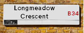
Longmeadow Crescent is a street located in the city of Birmingham. The street has a length of approximately 1,085 metres.
The street is publicly maintained which means that the road is adopted and Birmingham is responsible for the repair and upkeep of the highway.
The street is located within the Birmingham District (B) Council's jurisdiction. They provide various services, like refuse collection, and manage council tax collection. It's situated in the West Midlands region of the UK.
The road has been assigned the Unique Street Reference Number of 2705672 in the National Street Gazetteer.
The street has the postcodes of B34 7NQ, B34 7NL, B34 7NJ, B34 7NH, B34 7NG, B34 7NE, B34 7LB and B34 7LA.
It is located within the county of West Midlands, situated in the West Midlands region of the UK. It's 98.59 miles North West from central London., 6.06 miles East from Birmingham, 12.29 miles North West from Coventry and 28.17 miles West from Leicester.
LONGMEADOW CRESCENT is within the Post Town of BIRMINGHAM
Map of Longmeadow Crescent
| Street Crime (updated 03/12/2024) | ||
|---|---|---|
| Location Note | Central Point of Street - Not Actual Location | |
| MSOA Info | For MSOA E02001872 (Statistical Neighbourhood) | |
| Click Hint | Click on a Circle for a detailed breakdown below map. | |
| Crime Levels |
Green = Very Low Yellow = Low Orange = High Red = Very High |
|
| Postcodes | ||
| Icon | Postcodes for Longmeadow Crescent | |
| Walking Distances | ||
| Distance Info | Green Circle = 10 Minutes Walk (800 metres) | |
Street Crime Data accessed from data.police.uk on 06/10/2024.
Moving to Longmeadow Crescent?
I can help you uncover potential pitfalls and provide key questions to ask about your new property. With decades of experience as a Local Land Charges Manager, I offer confidential insights to make your move informed and stress-free.
This service is free, but you may wish to make an optional donation to support it. Please include the property name and address in your request as well as anything you wish to focus on.
Contact Me
Do you know why this road is called Longmeadow Crescent?
What's it like to live here?
Share a Photo of Longmeadow Crescent
Ask the community a question.
Do you have any questions, memories to share, have any photos or know any facts? We'd love to know more.
Submit Your Comment
Budget Friendly Hotels near Longmeadow Crescent
| Budget Hotel Name | Distance (miles) |
|---|---|
|
1: Name:Travelodge Birmingham Castle Bromwich Address: Chester Rd, Birmingham, B36 0AG Telephone: 0871 559 1813 Visit Hotel Page |
0.72 |
|
2: Name:Holiday Inn Express Birmingham - Castle Bromwich Address: 1200 Chester Rd, Castle Bromwich Telephone: Visit Hotel Page |
1.80 |
|
3: Name:Travelodge Birmingham Fort Dunlop Address: Fort Dunlop, Fort Pkwy, Birmingham, B24 9FD Telephone: 0871 984 6312 Visit Hotel Page |
2.29 |
|
4: Name:Premier Inn Birmingham NEC/Airport Address: Bickenhill Parkway Telephone: Visit Hotel Page |
3.00 |
|
5: Name:Holiday Inn Express Birmingham NEC Address: Bickenhill Parkway Telephone: Visit Hotel Page |
3.01 |
Hotel Options
Your support helps keep this site running!
If you enjoy using this website, consider making a donation to help me cover hosting costs.
Flats and Apartments in Longmeadow Crescent
APARTMENT 1
APARTMENT 3
APARTMENT 4
APARTMENT 6
APARTMENT 7
APARTMENT 8
APARTMENT 10
EPC (Energy Performance Certificate) Information for Longmeadow Crescent
UPRN: 10023292251
EPC Current: C
EPC Potential: B
Habitable Rooms: 6
Property Type: House
Tenure: Owner-occupied
Built Form: Detached
Age Band: 1996-2002
Mains Gas: Yes
UPRN: 100070437649
EPC Current: C
EPC Potential: C
Habitable Rooms: 2
Property Type: Flat
Tenure: rental (social)
Built Form: Semi-Detached
Age Band: 1950-1966
Mains Gas: Yes
UPRN: 100070437650
EPC Current: D
EPC Potential: D
Habitable Rooms: 2
Property Type: Flat
Tenure: Rented (social)
Built Form: Semi-Detached
Age Band: 1950-1966
Mains Gas: Yes
UPRN: 100070437651
EPC Current: C
EPC Potential: B
Habitable Rooms: 3
Property Type: House
Tenure: rental (social)
Built Form: End-Terrace
Age Band: 1950-1966
Mains Gas: Yes
UPRN: 10023292252
EPC Current: C
EPC Potential: B
Habitable Rooms: 6
Property Type: House
Tenure: Owner-occupied
Built Form: Detached
Age Band: 2003-2006
Mains Gas: Yes
UPRN: 100070437652
EPC Current: E
EPC Potential: D
Habitable Rooms: 3
Property Type: House
Tenure: Owner-occupied
Built Form: Mid-Terrace
Age Band: 1950-1966
Mains Gas: Yes
UPRN: 10023292255
EPC Current: C
EPC Potential: B
Habitable Rooms: 5
Property Type: House
Tenure: Owner-occupied
Built Form: Detached
Age Band: 1996-2002
Mains Gas: Yes
UPRN: 10024264198
EPC Current: C
EPC Potential: C
Habitable Rooms: 6
Property Type: House
Tenure: Owner-occupied
Built Form: Detached
Age Band: 2003-2006
Mains Gas: Yes
UPRN: 100070437655
EPC Current: C
EPC Potential: B
Habitable Rooms: 4
Property Type: House
Tenure: Owner-occupied
Built Form: Mid-Terrace
Age Band: 1930-1949
Mains Gas: Yes
UPRN: 100070437656
EPC Current: E
EPC Potential: B
Habitable Rooms: 3
Property Type: House
Tenure: Owner-occupied
Built Form: End-Terrace
Age Band: 1950-1966
Mains Gas: Yes
UPRN: 10023292250
EPC Current: C
EPC Potential: C
Habitable Rooms: 6
Property Type: House
Tenure: Owner-occupied
Built Form: Detached
Age Band: 2003-2006
Mains Gas: Yes
UPRN: 100070437657
EPC Current: D
EPC Potential: B
Habitable Rooms: 3
Property Type: House
Tenure: Owner-occupied
Built Form: End-Terrace
Age Band: 1950-1966
Mains Gas: Yes
UPRN: 100070437658
EPC Current: D
EPC Potential: B
Habitable Rooms: 5
Property Type: House
Tenure: Owner-occupied
Built Form: Mid-Terrace
Age Band: 1930-1949
Mains Gas: Yes
UPRN: 100070437659
EPC Current: D
EPC Potential: B
Habitable Rooms: 5
Property Type: House
Tenure: Owner-occupied
Built Form: Mid-Terrace
Age Band: 1950-1966
Mains Gas: Yes
UPRN: 100070437660
EPC Current: C
EPC Potential: B
Habitable Rooms: 3
Property Type: House
Tenure: rental (private)
Built Form: Mid-Terrace
Age Band: 1950-1966
Mains Gas: Yes
UPRN: 100070437662
EPC Current: C
EPC Potential: B
Habitable Rooms: 6
Property Type: House
Tenure: rental (social)
Built Form: End-Terrace
Age Band: 1950-1966
Mains Gas: Yes
UPRN: 100070437663
EPC Current: C
EPC Potential: B
Habitable Rooms: 6
Property Type: House
Tenure: Owner-occupied
Built Form: End-Terrace
Age Band: 1950-1966
Mains Gas: Yes
UPRN: 100070437666
EPC Current: C
EPC Potential: B
Habitable Rooms: 3
Property Type: House
Tenure: Owner-occupied
Built Form: Mid-Terrace
Age Band: 1950-1966
Mains Gas: Yes
UPRN: 100070437668
EPC Current: D
EPC Potential: B
Habitable Rooms: 3
Property Type: House
Tenure: Owner-occupied
Built Form: End-Terrace
Age Band: 1950-1966
Mains Gas: Yes
UPRN: 100070437670
EPC Current: C
EPC Potential: B
Habitable Rooms: 3
Property Type: House
Tenure: rental (social)
Built Form: Mid-Terrace
Age Band: 1950-1966
Mains Gas: Yes
UPRN: 100070437671
EPC Current: D
EPC Potential: B
Habitable Rooms: 5
Property Type: House
Tenure: Owner-occupied
Built Form: Mid-Terrace
Age Band: 1950-1966
Mains Gas: Yes
UPRN: 100070437672
EPC Current: D
EPC Potential: C
Habitable Rooms: 3
Property Type: House
Tenure: rental (social)
Built Form: Mid-Terrace
Age Band: 1950-1966
Mains Gas: Yes
UPRN: 100070437673
EPC Current: D
EPC Potential: B
Habitable Rooms: 4
Property Type: House
Tenure: rental (private)
Built Form: Mid-Terrace
Age Band: 1930-1949
Mains Gas: Yes
UPRN: 100070437674
EPC Current: D
EPC Potential: B
Habitable Rooms: 3
Property Type: House
Tenure: Owner-occupied
Built Form: End-Terrace
Age Band: 1950-1966
Mains Gas: Yes
UPRN: 100070437675
EPC Current: D
EPC Potential: C
Habitable Rooms: 2
Property Type: Flat
Tenure: rental (private)
Built Form: Semi-Detached
Age Band: 1950-1966
Mains Gas: Yes
UPRN: 100070437676
EPC Current: E
EPC Potential: C
Habitable Rooms: 3
Property Type: Flat
Tenure: Rented (private)
Built Form: End-Terrace
Age Band: 1967-1975
Mains Gas: Yes
UPRN: 100070437678
EPC Current: D
EPC Potential: D
Habitable Rooms: 2
Property Type: Flat
Tenure: rental (private)
Built Form: Semi-Detached
Age Band: 1950-1966
Mains Gas: Yes
UPRN: 100071390334
EPC Current: C
EPC Potential: B
Habitable Rooms: 7
Property Type: House
Tenure: Owner-occupied
Built Form: Semi-Detached
Age Band: 1950-1966
Mains Gas: Yes
UPRN: 100070437679
EPC Current: C
EPC Potential: B
Habitable Rooms: 4
Property Type: House
Tenure: Owner-occupied
Built Form: End-Terrace
Age Band: 1967-1975
Mains Gas: Yes
UPRN: 100070437682
EPC Current: C
EPC Potential: B
Habitable Rooms: 5
Property Type: House
Tenure: rental (social)
Built Form: Mid-Terrace
Age Band: 1950-1966
Mains Gas: Yes
UPRN: 100070437683
EPC Current: D
EPC Potential: B
Habitable Rooms: 4
Property Type: House
Tenure: Owner-occupied
Built Form: End-Terrace
Age Band: 1950-1966
Mains Gas: Yes
UPRN: 10024450386
EPC Current: C
EPC Potential: B
Habitable Rooms: 3
Property Type: Bungalow
Tenure: Rented (social)
Built Form: Semi-Detached
Age Band: 1996-2002
Mains Gas: Yes
UPRN: 10023292258
EPC Current: C
EPC Potential: B
Habitable Rooms: 3
Property Type: Bungalow
Tenure: Owner-occupied
Built Form: Semi-Detached
Age Band: 2003-2006
Mains Gas: Yes
UPRN: 10023292248
EPC Current: C
EPC Potential: A
Habitable Rooms: 3
Property Type: Bungalow
Tenure: Rented (social)
Built Form: Mid-Terrace
Age Band: 2003-2006
Mains Gas: Yes
UPRN: 10023292253
EPC Current: C
EPC Potential: B
Habitable Rooms: 3
Property Type: Bungalow
Tenure: Owner-occupied
Built Form: End-Terrace
Age Band: 2003-2006
Mains Gas: Yes
UPRN: 10024450388
EPC Current: C
EPC Potential: B
Habitable Rooms: 3
Property Type: Bungalow
Tenure: rental (social)
Built Form: Semi-Detached
Age Band: 2003-2006
Mains Gas: Yes
UPRN: 10023292257
EPC Current: C
EPC Potential: B
Habitable Rooms: 3
Property Type: Bungalow
Tenure: Rented (social)
Built Form: Semi-Detached
Age Band: 2003-2006
Mains Gas: Yes
UPRN: 100070437686
EPC Current: C
EPC Potential: B
Habitable Rooms: 5
Property Type: House
Tenure: Owner-occupied
Built Form: Mid-Terrace
Age Band: 1967-1975
Mains Gas: Yes
UPRN: 10024450389
EPC Current: C
EPC Potential: B
Habitable Rooms: 3
Property Type: Bungalow
Tenure: Owner-occupied
Built Form: Semi-Detached
Age Band: 2003-2006
Mains Gas: Yes
UPRN: 10024450390
EPC Current: C
EPC Potential: B
Habitable Rooms: 3
Property Type: Bungalow
Tenure: Rented (social)
Built Form: Semi-Detached
Age Band: 2003-2006
Mains Gas: Yes
UPRN: 100070437691
EPC Current: C
EPC Potential: B
Habitable Rooms: 6
Property Type: House
Tenure: Owner-occupied
Built Form: Semi-Detached
Age Band: 1950-1966
Mains Gas: Yes
UPRN: 100070437692
EPC Current: C
EPC Potential: B
Habitable Rooms: 5
Property Type: House
Tenure: Owner-occupied
Built Form: Semi-Detached
Age Band: 1950-1966
Mains Gas: Yes
UPRN: 100070437693
EPC Current: C
EPC Potential: C
Habitable Rooms: 2
Property Type: Bungalow
Tenure: rental (social)
Built Form: Semi-Detached
Age Band: 1930-1949
Mains Gas: Yes
UPRN: 100070437694
EPC Current: E
EPC Potential: B
Habitable Rooms: 3
Property Type: House
Tenure: Owner-occupied
Built Form: End-Terrace
Age Band: 1967-1975
Mains Gas: Yes
UPRN: 100070437696
EPC Current: E
EPC Potential: C
Habitable Rooms: 6
Property Type: House
Tenure: Owner-occupied
Built Form: End-Terrace
Age Band: 1950-1966
Mains Gas: Yes
UPRN: 100070437698
EPC Current: C
EPC Potential: B
Habitable Rooms: 3
Property Type: House
Tenure: Rented (social)
Built Form: Mid-Terrace
Age Band: 1967-1975
Mains Gas: Yes
UPRN: 100070437699
EPC Current: C
EPC Potential: B
Habitable Rooms: 5
Property Type: House
Tenure: Owner-occupied
Built Form: End-Terrace
Age Band: 1950-1966
Mains Gas: Yes
UPRN: 100070437701
EPC Current: C
EPC Potential: B
Habitable Rooms: 3
Property Type: House
Tenure: Rented (social)
Built Form: End-Terrace
Age Band: 1950-1966
Mains Gas: Yes
UPRN: 100070437702
EPC Current: D
EPC Potential: C
Habitable Rooms: 5
Property Type: House
Tenure: Owner-occupied
Built Form: Mid-Terrace
Age Band: 1950-1966
Mains Gas: Yes
UPRN: 100070437704
EPC Current: D
EPC Potential: B
Habitable Rooms: 4
Property Type: House
Tenure: Owner-occupied
Built Form: Mid-Terrace
Age Band: 1950-1966
Mains Gas: Yes
UPRN: 100070437705
EPC Current: D
EPC Potential: B
Habitable Rooms: 3
Property Type: House
Tenure: Owner-occupied
Built Form: Mid-Terrace
Age Band: 1950-1966
Mains Gas: Yes
UPRN: 100070437706
EPC Current: E
EPC Potential: B
Habitable Rooms: 3
Property Type: House
Tenure: Owner-occupied
Built Form: End-Terrace
Age Band: 1950-1966
Mains Gas: Yes
UPRN: 100070437707
EPC Current: C
EPC Potential: C
Habitable Rooms: 4
Property Type: House
Tenure: rental (social)
Built Form: Mid-Terrace
Age Band: 1950-1966
Mains Gas: Yes
UPRN: 100070437708
EPC Current: C
EPC Potential: B
Habitable Rooms: 3
Property Type: House
Tenure: rental (social)
Built Form: End-Terrace
Age Band: 1930-1949
Mains Gas: Yes
UPRN: 100070437709
EPC Current: C
EPC Potential: B
Habitable Rooms: 4
Property Type: House
Tenure: Owner-occupied
Built Form: Mid-Terrace
Age Band: 1930-1949
Mains Gas: Yes
UPRN: 100070437711
EPC Current: C
EPC Potential: C
Habitable Rooms: 3
Property Type: House
Tenure: Owner-occupied
Built Form: End-Terrace
Age Band: 1950-1966
Mains Gas: Yes
UPRN: 100070437712
EPC Current: D
EPC Potential: C
Habitable Rooms: 4
Property Type: House
Tenure: Owner-occupied
Built Form: Mid-Terrace
Age Band: 1950-1966
Mains Gas: Yes
UPRN: 100070437713
EPC Current: D
EPC Potential: B
Habitable Rooms: 4
Property Type: House
Tenure: Owner-occupied
Built Form: Semi-Detached
Age Band: 1950-1966
Mains Gas: Yes
UPRN: 100070437714
EPC Current: D
EPC Potential: B
Habitable Rooms: 4
Property Type: House
Tenure: Owner-occupied
Built Form: Mid-Terrace
Age Band: 1950-1966
Mains Gas: Yes
UPRN: 100070437715
EPC Current: C
EPC Potential: B
Habitable Rooms: 5
Property Type: House
Tenure: Owner-occupied
Built Form: Mid-Terrace
Age Band: 1930-1949
Mains Gas: Yes
UPRN: 100070437717
EPC Current: C
EPC Potential: B
Habitable Rooms: 3
Property Type: House
Tenure: Owner-occupied
Built Form: Mid-Terrace
Age Band: 1967-1975
Mains Gas: Yes
UPRN: 100070437719
EPC Current: D
EPC Potential: B
Habitable Rooms: 3
Property Type: House
Tenure: Owner-occupied
Built Form: End-Terrace
Age Band: 1930-1949
Mains Gas: Yes
UPRN: 10091115806
EPC Current: C
EPC Potential: A
Habitable Rooms: N/A
Property Type: Bungalow
Tenure: unknown
Built Form: Detached
Age Band: U
Mains Gas: Unknown
UPRN: 100070437720
EPC Current: C
EPC Potential: B
Habitable Rooms: 3
Property Type: House
Tenure: rental (social)
Built Form: End-Terrace
Age Band: 1950-1966
Mains Gas: Yes
UPRN: 100070437722
EPC Current: C
EPC Potential: B
Habitable Rooms: 3
Property Type: House
Tenure: Owner-occupied
Built Form: Mid-Terrace
Age Band: 1950-1966
Mains Gas: Yes
UPRN: 100070437723
EPC Current: C
EPC Potential: B
Habitable Rooms: 4
Property Type: House
Tenure: Owner-occupied
Built Form: Mid-Terrace
Age Band: 1950-1966
Mains Gas: Yes
UPRN: 100070437724
EPC Current: C
EPC Potential: B
Habitable Rooms: 4
Property Type: House
Tenure: Owner-occupied
Built Form: Mid-Terrace
Age Band: 1950-1966
Mains Gas: Yes
UPRN: 100070437725
EPC Current: C
EPC Potential: C
Habitable Rooms: 2
Property Type: Bungalow
Tenure: rental (social)
Built Form: End-Terrace
Age Band: 1930-1949
Mains Gas: Yes
UPRN: 100070437726
EPC Current: B
EPC Potential: B
Habitable Rooms: 4
Property Type: House
Tenure: rental (social)
Built Form: Mid-Terrace
Age Band: 1930-1949
Mains Gas: Yes
UPRN: 100070437728
EPC Current: F
EPC Potential: B
Habitable Rooms: 3
Property Type: House
Tenure: Owner-occupied
Built Form: End-Terrace
Age Band: 1950-1966
Mains Gas: No
UPRN: 100070437729
EPC Current: C
EPC Potential: C
Habitable Rooms: 5
Property Type: House
Tenure: Owner-occupied
Built Form: Mid-Terrace
Age Band: 1950-1966
Mains Gas: Yes
UPRN: 100070437731
EPC Current: D
EPC Potential: C
Habitable Rooms: 3
Property Type: House
Tenure: rental (private)
Built Form: Semi-Detached
Age Band: 1950-1966
Mains Gas: Yes
UPRN: 100070437734
EPC Current: D
EPC Potential: B
Habitable Rooms: 4
Property Type: House
Tenure: Owner-occupied
Built Form: Mid-Terrace
Age Band: 1930-1949
Mains Gas: Yes
UPRN: 100070437737
EPC Current: C
EPC Potential: B
Habitable Rooms: 3
Property Type: House
Tenure: Owner-occupied
Built Form: End-Terrace
Age Band: 1950-1966
Mains Gas: Yes
UPRN: 100070437738
EPC Current: C
EPC Potential: B
Habitable Rooms: 4
Property Type: House
Tenure: rental (private)
Built Form: Mid-Terrace
Age Band: 1950-1966
Mains Gas: Yes
UPRN: 100070437739
EPC Current: D
EPC Potential: B
Habitable Rooms: 3
Property Type: House
Tenure: rental (private)
Built Form: Mid-Terrace
Age Band: 1950-1966
Mains Gas: Yes
UPRN: 100070437740
EPC Current: D
EPC Potential: B
Habitable Rooms: 4
Property Type: House
Tenure: Rented (social)
Built Form: End-Terrace
Age Band: 1930-1949
Mains Gas: Yes
UPRN: 100070437742
EPC Current: D
EPC Potential: B
Habitable Rooms: 3
Property Type: House
Tenure: rental (private)
Built Form: End-Terrace
Age Band: 1950-1966
Mains Gas: Yes
UPRN: 100070437743
EPC Current: D
EPC Potential: B
Habitable Rooms: 5
Property Type: House
Tenure: Owner-occupied
Built Form: Mid-Terrace
Age Band: 1950-1966
Mains Gas: Yes
UPRN: 100070437747
EPC Current: D
EPC Potential: B
Habitable Rooms: 6
Property Type: House
Tenure: Owner-occupied
Built Form: End-Terrace
Age Band: 1950-1966
Mains Gas: Yes
UPRN: 100070437749
EPC Current: E
EPC Potential: B
Habitable Rooms: 4
Property Type: Bungalow
Tenure: Owner-occupied
Built Form: End-Terrace
Age Band: 1950-1966
Mains Gas: Yes
UPRN: 100070437751
EPC Current: C
EPC Potential: B
Habitable Rooms: 6
Property Type: House
Tenure: Owner-occupied
Built Form: Semi-Detached
Age Band: 1976-1982
Mains Gas: Yes
UPRN: 100070437754
EPC Current: C
EPC Potential: C
Habitable Rooms: 4
Property Type: House
Tenure: rental (social)
Built Form: Mid-Terrace
Age Band: 1930-1949
Mains Gas: Yes
UPRN: 100070437757
EPC Current: D
EPC Potential: C
Habitable Rooms: 3
Property Type: House
Tenure: Owner-occupied
Built Form: Mid-Terrace
Age Band: 1950-1966
Mains Gas: Yes
UPRN: 100070437758
EPC Current: C
EPC Potential: B
Habitable Rooms: 3
Property Type: House
Tenure: Owner-occupied
Built Form: End-Terrace
Age Band: 1950-1966
Mains Gas: Yes
UPRN: 100070437760
EPC Current: D
EPC Potential: B
Habitable Rooms: 4
Property Type: House
Tenure: Owner-occupied
Built Form: End-Terrace
Age Band: 1950-1966
Mains Gas: Yes
UPRN: 100070437761
EPC Current: C
EPC Potential: B
Habitable Rooms: 6
Property Type: House
Tenure: Owner-occupied
Built Form: End-Terrace
Age Band: 1950-1966
Mains Gas: Yes
UPRN: 100070437762
EPC Current: D
EPC Potential: B
Habitable Rooms: 4
Property Type: House
Tenure: Owner-occupied
Built Form: Mid-Terrace
Age Band: 1950-1966
Mains Gas: Yes
UPRN: 100070437763
EPC Current: D
EPC Potential: B
Habitable Rooms: 3
Property Type: House
Tenure: Owner-occupied
Built Form: Mid-Terrace
Age Band: 1950-1966
Mains Gas: Yes
UPRN: 100070437764
EPC Current: D
EPC Potential: C
Habitable Rooms: 4
Property Type: House
Tenure: Owner-occupied
Built Form: End-Terrace
Age Band: 1950-1966
Mains Gas: Yes
UPRN: 100070437766
EPC Current: D
EPC Potential: B
Habitable Rooms: 4
Property Type: House
Tenure: Owner-occupied
Built Form: Mid-Terrace
Age Band: 1950-1966
Mains Gas: Yes
UPRN: 100070437768
EPC Current: C
EPC Potential: B
Habitable Rooms: 4
Property Type: House
Tenure: rental (social)
Built Form: Mid-Terrace
Age Band: 1950-1966
Mains Gas: Yes
UPRN: 100070437769
EPC Current: D
EPC Potential: B
Habitable Rooms: 3
Property Type: House
Tenure: rental (social)
Built Form: Mid-Terrace
Age Band: 1950-1966
Mains Gas: Yes
UPRN: 100070437770
EPC Current: D
EPC Potential: C
Habitable Rooms: 4
Property Type: House
Tenure: rental (social)
Built Form: End-Terrace
Age Band: 1983-1990
Mains Gas: Yes
UPRN: 100070437771
EPC Current: C
EPC Potential: B
Habitable Rooms: 2
Property Type: Bungalow
Tenure: rental (social)
Built Form: End-Terrace
Age Band: 1950-1966
Mains Gas: Yes
UPRN: 100070437773
EPC Current: D
EPC Potential: B
Habitable Rooms: 1
Property Type: Bungalow
Tenure: Owner-occupied
Built Form: Mid-Terrace
Age Band: 1950-1966
Mains Gas: Yes
UPRN: 100070437774
EPC Current: D
EPC Potential: C
Habitable Rooms: 2
Property Type: Bungalow
Tenure: Rented (social)
Built Form: End-Terrace
Age Band: 1950-1966
Mains Gas: Yes
UPRN: 100070437775
EPC Current: C
EPC Potential: B
Habitable Rooms: 4
Property Type: House
Tenure: Rented (social)
Built Form: Semi-Detached
Age Band: 2003-2006
Mains Gas: Yes
UPRN: 100070437776
EPC Current: D
EPC Potential: C
Habitable Rooms: 2
Property Type: Bungalow
Tenure: rental (social)
Built Form: Detached
Age Band: 1930-1949
Mains Gas: Yes
UPRN: 100070437777
EPC Current: D
EPC Potential: C
Habitable Rooms: 4
Property Type: House
Tenure: rental (private)
Built Form: End-Terrace
Age Band: 1950-1966
Mains Gas: Yes
UPRN: 100070437778
EPC Current: D
EPC Potential: B
Habitable Rooms: 3
Property Type: House
Tenure: rental (social)
Built Form: Mid-Terrace
Age Band: 1930-1949
Mains Gas: Yes
UPRN: 100070437779
EPC Current: C
EPC Potential: B
Habitable Rooms: 4
Property Type: House
Tenure: Owner-occupied
Built Form: Mid-Terrace
Age Band: 1950-1966
Mains Gas: Yes
UPRN: 100070437780
EPC Current: D
EPC Potential: B
Habitable Rooms: 6
Property Type: House
Tenure: Owner-occupied
Built Form: Mid-Terrace
Age Band: 1950-1966
Mains Gas: Yes
UPRN: 100070437782
EPC Current: E
EPC Potential: B
Habitable Rooms: 3
Property Type: House
Tenure: Owner-occupied
Built Form: End-Terrace
Age Band: 1950-1966
Mains Gas: Yes
UPRN: 100070437783
EPC Current: D
EPC Potential: C
Habitable Rooms: 3
Property Type: House
Tenure: Owner-occupied
Built Form: End-Terrace
Age Band: 1950-1966
Mains Gas: Yes
UPRN: 100070437785
EPC Current: C
EPC Potential: B
Habitable Rooms: 3
Property Type: House
Tenure: rental (social)
Built Form: Mid-Terrace
Age Band: 1950-1966
Mains Gas: Yes
UPRN: 100070437787
EPC Current: D
EPC Potential: B
Habitable Rooms: 3
Property Type: House
Tenure: Owner-occupied
Built Form: End-Terrace
Age Band: 1930-1949
Mains Gas: Yes
UPRN: 100070437788
EPC Current: D
EPC Potential: C
Habitable Rooms: 4
Property Type: House
Tenure: Owner-occupied
Built Form: Mid-Terrace
Age Band: 1930-1949
Mains Gas: Yes
UPRN: 100070437789
EPC Current: D
EPC Potential: B
Habitable Rooms: 3
Property Type: House
Tenure: Owner-occupied
Built Form: Mid-Terrace
Age Band: 1950-1966
Mains Gas: Yes
UPRN: 100070437790
EPC Current: G
EPC Potential: B
Habitable Rooms: 4
Property Type: House
Tenure: Owner-occupied
Built Form: Mid-Terrace
Age Band: 1950-1966
Mains Gas: Yes
UPRN: 100070437791
EPC Current: C
EPC Potential: B
Habitable Rooms: 3
Property Type: House
Tenure: rental (social)
Built Form: Mid-Terrace
Age Band: 1950-1966
Mains Gas: Yes
UPRN: 100070437792
EPC Current: C
EPC Potential: B
Habitable Rooms: 4
Property Type: House
Tenure: Owner-occupied
Built Form: Mid-Terrace
Age Band: 1950-1966
Mains Gas: Yes
UPRN: 100070437793
EPC Current: D
EPC Potential: B
Habitable Rooms: 3
Property Type: House
Tenure: Owner-occupied
Built Form: Mid-Terrace
Age Band: 1967-1975
Mains Gas: Yes
UPRN: 100070437794
EPC Current: D
EPC Potential: B
Habitable Rooms: 4
Property Type: House
Tenure: Owner-occupied
Built Form: End-Terrace
Age Band: 1950-1966
Mains Gas: Yes
UPRN: 100070437795
EPC Current: C
EPC Potential: B
Habitable Rooms: 3
Property Type: House
Tenure: Owner-occupied
Built Form: Semi-Detached
Age Band: 1930-1949
Mains Gas: Yes
UPRN: 100070437797
EPC Current: C
EPC Potential: C
Habitable Rooms: 3
Property Type: House
Tenure: Owner-occupied
Built Form: Mid-Terrace
Age Band: 1930-1949
Mains Gas: Yes
UPRN: 100070437798
EPC Current: C
EPC Potential: B
Habitable Rooms: 3
Property Type: House
Tenure: rental (social)
Built Form: End-Terrace
Age Band: 1950-1966
Mains Gas: Yes
UPRN: 100070437802
EPC Current: C
EPC Potential: B
Habitable Rooms: 6
Property Type: House
Tenure: Owner-occupied
Built Form: Mid-Terrace
Age Band: 1950-1966
Mains Gas: Yes
UPRN: 100070437803
EPC Current: D
EPC Potential: B
Habitable Rooms: 3
Property Type: House
Tenure: Owner-occupied
Built Form: Mid-Terrace
Age Band: 1930-1949
Mains Gas: Yes
UPRN: 100070437804
EPC Current: D
EPC Potential: B
Habitable Rooms: 3
Property Type: House
Tenure: Owner-occupied
Built Form: End-Terrace
Age Band: 1950-1966
Mains Gas: Yes
UPRN: 100070437805
EPC Current: C
EPC Potential: B
Habitable Rooms: 3
Property Type: House
Tenure: Owner-occupied
Built Form: End-Terrace
Age Band: 1950-1966
Mains Gas: Yes
UPRN: 100070437806
EPC Current: C
EPC Potential: B
Habitable Rooms: 4
Property Type: House
Tenure: Owner-occupied
Built Form: Mid-Terrace
Age Band: 1950-1966
Mains Gas: Yes
UPRN: 100070437807
EPC Current: D
EPC Potential: D
Habitable Rooms: 4
Property Type: House
Tenure: Owner-occupied
Built Form: Mid-Terrace
Age Band: 1930-1949
Mains Gas: Yes
UPRN: 100070437808
EPC Current: D
EPC Potential: B
Habitable Rooms: 2
Property Type: Bungalow
Tenure: rental (social)
Built Form: End-Terrace
Age Band: 1950-1966
Mains Gas: Yes
UPRN: 100070437809
EPC Current: C
EPC Potential: C
Habitable Rooms: 1
Property Type: House
Tenure: rental (social)
Built Form: End-Terrace
Age Band: 1950-1966
Mains Gas: Yes
UPRN: 100070437810
EPC Current: C
EPC Potential: B
Habitable Rooms: 4
Property Type: House
Tenure: Rented (social)
Built Form: Mid-Terrace
Age Band: 1950-1966
Mains Gas: Yes
UPRN: 10033392706
EPC Current: C
EPC Potential: C
Habitable Rooms: 3
Property Type: Flat
Tenure: rental (social)
Built Form: End-Terrace
Age Band: 1996-2002
Mains Gas: Yes
UPRN: 10033392707
EPC Current: C
EPC Potential: C
Habitable Rooms: 3
Property Type: Maisonette
Tenure: rental (private)
Built Form: End-Terrace
Age Band: 1991-1995
Mains Gas: Yes
UPRN: 10033392708
EPC Current: C
EPC Potential: C
Habitable Rooms: 3
Property Type: Maisonette
Tenure: rental (social)
Built Form: Semi-Detached
Age Band: 1950-1966
Mains Gas: Yes
UPRN: 10033392709
EPC Current: C
EPC Potential: C
Habitable Rooms: 3
Property Type: Maisonette
Tenure: Owner-occupied
Built Form: Mid-Terrace
Age Band: 2003-2006
Mains Gas: Yes
UPRN: 10033392710
EPC Current: C
EPC Potential: C
Habitable Rooms: 3
Property Type: Maisonette
Tenure: rental (social)
Built Form: Mid-Terrace
Age Band: 1996-2002
Mains Gas: Yes
UPRN: 10033392711
EPC Current: C
EPC Potential: C
Habitable Rooms: 3
Property Type: Maisonette
Tenure: Owner-occupied
Built Form: Mid-Terrace
Age Band: 1976-1982
Mains Gas: Yes
UPRN: 10033392712
EPC Current: C
EPC Potential: C
Habitable Rooms: 3
Property Type: Flat
Tenure: Owner-occupied
Built Form: Mid-Terrace
Age Band: 1976-1982
Mains Gas: Yes
UPRN: 10033392713
EPC Current: C
EPC Potential: C
Habitable Rooms: 3
Property Type: Maisonette
Tenure: Owner-occupied
Built Form: Mid-Terrace
Age Band: 2003-2006
Mains Gas: Yes
UPRN: 10033392714
EPC Current: C
EPC Potential: B
Habitable Rooms: 2
Property Type: Maisonette
Tenure: Owner-occupied
Built Form: Mid-Terrace
Age Band: 2003-2006
Mains Gas: Yes
UPRN: 10033392715
EPC Current: C
EPC Potential: C
Habitable Rooms: 3
Property Type: Maisonette
Tenure: unknown
Built Form: End-Terrace
Age Band: 2003-2006
Mains Gas: Yes
UPRN: 10023292262
EPC Current: B
EPC Potential: B
Habitable Rooms: 3
Property Type: Flat
Tenure: rental (social)
Built Form: Enclosed End-Terrace
Age Band: 2003-2006
Mains Gas: Yes
UPRN: 10023292259
EPC Current: C
EPC Potential: C
Habitable Rooms: 3
Property Type: Flat
Tenure: Owner-occupied
Built Form: Detached
Age Band: 2003-2006
Mains Gas: No
UPRN: 10023292260
EPC Current: C
EPC Potential: C
Habitable Rooms: 2
Property Type: Flat
Tenure: Rented (social)
Built Form: End-Terrace
Age Band: 2003-2006
Mains Gas: No
UPRN: 10024334269
EPC Current: B
EPC Potential: B
Habitable Rooms: 2
Property Type: Flat
Tenure: rental (social)
Built Form: Mid-Terrace
Age Band: 2003-2006
Mains Gas: Yes
UPRN: 10023292266
EPC Current: C
EPC Potential: C
Habitable Rooms: 3
Property Type: Flat
Tenure: rental (social)
Built Form: End-Terrace
Age Band: 2003-2006
Mains Gas: No
UPRN: 10023292263
EPC Current: C
EPC Potential: C
Habitable Rooms: 3
Property Type: Flat
Tenure: rental (social)
Built Form: Enclosed End-Terrace
Age Band: 1991-1995
Mains Gas: Yes
UPRN: 10023292265
EPC Current: C
EPC Potential: C
Habitable Rooms: 3
Property Type: Flat
Tenure: rental (social)
Built Form: Enclosed End-Terrace
Age Band: 2003-2006
Mains Gas: No
House Sales
| Year | High | Low | Average | Sales |
|---|---|---|---|---|
| 2014 | £116,500 | £119,500 | £110,790 | 5 |
| 2015 | £125,000 | £228,000 | £120,100 | 5 |
| 2016 | £140,000 | £238,000 | £126,000 | 4 |
| 2017 | £135,000 | £155,000 | £137,917 | 6 |
| 2018 | £270,000 | £270,000 | £270,000 | 1 |
| 2019 | £165,000 | £158,000 | £156,700 | 5 |
| 2020 | £142,500 | £155,000 | £182,667 | 9 |
| 2021 | £163,000 | £195,000 | £190,100 | 5 |
| 2022 | £178,000 | £300,000 | £178,750 | 4 |
| 2023 | £170,000 | £310,000 | £179,833 | 6 |
Contains HM Land Registry data © Crown copyright and database right 2024. This data is licensed under the Open Government Licence v3.0.
Nearby Estate Agents
| Name | Address | Website |
|---|---|---|
| Burchell Edwards | 2-4 Hurst Lane, Castle Bromwich Birmingham, B34 7HR | Visit Website |
| Green & Company | 264 Chester Road, Castle Bromwich, Birmingham, B36 0LB | Visit Website |
| Dixons | 333 Chester Road, Castle Bromwich, Birmingham, W Midlands, B36 0JG | |
| Garner Canning Estate Agents | 301-303 Chester Road, Castle Bromwich, Birmingham, B36 0JG | Visit Website |
| Prime Estates | 254 Chester Road, Castle Bromwich, Birmingham, B36 0JE | Visit Website |
Neighbourhood Policing |
| Police Force: West Midlands |
 View Neighbourhood Crime and Policing View Neighbourhood Crime and Policing |
| Find a Local Neighbourhood Watch Scheme |
Location Details
| Longmeadow Crescent | |
|---|---|

| |
| Latitude | 52.497159 |
| Longitude | -1.760547 |
| OS Easting (X): | 416254 |
| OS Northing (Y): | 288873 |
| OS Grid Reference: | SP163889 |
Known Residential Addresses for Longmeadow Crescent
- 15
- 1
- 17
- 21
- 11
- 239
- 237
- 120
- 190
- 227
- 247
- 285
- 257
- 233
- 259
- 281
- 231
- 287
- 265
- 152
- 184
- 150
- 146
- 194
- 138
- 126
- 170
- 128
- 20
- 12
- 18
- 24
- 58
- 48
- 76
- 96
- 193
- 203
- 209
- 199
- 197
- 191
- 133
- 141
- 129
- 117
Roads that have a Junction with Longmeadow Crescent
| Street | Junction Type |
|---|---|
| Hurst Lane | junction |
| Berrowside Road | junction |
| Hall Hays Road | junction |
| Kitsland Road | junction |
| Rowington Road | junction |
| Berrowside Road | junction |
| Gilwell Road | junction |
| Budbrooke Grove | junction |
| York Crescent | junction |
| Lomond Close | junction |
| Freasley Road | junction |
Sunset and Sunrise times
| Sunrise | 08:15 |
|---|---|
| Sunset | 16:05 |
Latest Weather Conditions
| Observed at Weather Station: | Coleshill 31 December 2024 at 05:00 (3.24 miles away) |
|---|---|
| Current Weather: | Overcast |
| Temperature and Humidity: | 8.0°C (88.8%) |
| Wind Direction and Speed: | S (8 mph) |
Population Statistics
| ONS Area Code | E00047145, E00047204 & E00047194 |
|---|---|
| ONS Area Name | Private Renting Young Families, Multi-Ethnic Hardship & Hard-Pressed Ethnic Mix |
| Average Age | 34.69 |
| Area Population | 1943.00 |
| Male Population | 877.00 (45%) |
| Female Population | 1066.00 (55%) |
| Benefit Claimants | 75 (4%) |
| LSOA Code: | E01009308 |
|---|---|
| LSOA Name: | Birmingham 046C |
| SOA Code: | 4c |
| SOA Name: | |
| MSOA Code: | E02001872 |
| MSOA Name: | Birmingham 046 |
Nearest Supermarkets
| Morrisons Birmingham - Castle Bromwich |
|---|
| 264 Chester Road, Castle Bromwich, Birmingham B34 7HR |
| 0121 776 7878 |
| Distance: 0.22 Miles |
| Directions to Morrisons Birmingham - Castle Bromwich |
| Iceland Castle Bromwich |
|---|
| 18/26 Timberley Lane, Castle Bromwich, Birmingham, B34 7EH |
| 01217496886 |
| Distance: 0.53 Miles |
| Directions to Iceland Castle Bromwich |
| Tesco Castle Bromwich Green Ln Express |
|---|
| 136-140 Green Ln, Castle Bromwich, Birmingham, B36 0BX |
| 0345 026 9107 |
| Distance: 0.66 Miles |
| Directions to Tesco Castle Bromwich Green Ln Express |
| Asda Chelmsley Wood |
|---|
| 341 Bosworth Drive, Solihull, B37 5EX |
| 0121 788 5700 |
| Distance: 1.49 Miles |
| Directions to Asda Chelmsley Wood |
Telephone Information
| Area Code |
|---|
| Area Code: 01675 - Coleshill |
| Area Code: 0121 - Birmingham |
| Area Code: 01676 - Meriden |
Broadband Information
| Speed | Average Speed | Median Speed | Maximum Speed | Next-generation access (NGA) | Number of Connections |
|---|---|---|---|---|---|
| Greater than 2 Mbps | 5.7 | 4.5 | 8.5 | N | 5 |
Local Government
| Local Council Details |
|---|
| Within the area of Birmingham |
| Visit the Council's Website |
| Council House, Victoria Square, Birmingham &B1 1BB |
| Send email |
| Telephone Number: 0121 303 1111 |
| Local Member of Parliament |
|---|
| Within the Westminster Parliamentary Constituency of Birmingham &Hodge Hill |
| The Member of Parliament is Liam Byrne |
| Details for the MP Liam Byrne on parliament.uk |
| Details for the MP Liam Byrne on theyworkforyou.com |
| In the 2024 General Election Liam Byrne won with a majority of 1,566 the result was Lab hold. The total electorate was 77,737 |
| Wards, Parish Councils and County Councils |
|---|
| Ward: Shard End Ward |
| Parish: Unparished area |
| Ceremonial County: West Midlands |
Nearest Schools
England Primary Schools
St Anthony's Catholic Primary School
Address: St Anthony's Catholic Primary School, Fordbridge Road, Kingshurst, Birmingham, West Midlands, B37 6LW
Distance: 0.65 miles
Contact:
Yorkswood Primary School
Address: Yorkswood Primary School, Kingshurst Way, Kingshurst, Birmingham, West Midlands, B37 6DF
Distance: 0.37 miles
Contact: 01217798770
St John the Baptist Catholic Primary School
Address: St John the Baptist Catholic Primary School, Arran Way, Chelmsley Wood, Birmingham, West Midlands, B36 0QE
Distance: 0.78 miles
Contact:
Kingshurst Primary School
Address: Kingshurst Primary School, School Close, Kingshurst, Birmingham, West Midlands, B37 6BN
Distance: 0.46 miles
Contact: 01217886510
Timberley Academy
Address: Timberley Academy, Bradley Road, Shard End, Birmingham, West Midlands, B34 7RL
Distance: 0.48 miles
Contact: 01214642002
St Mary and St Margaret's Church of England Aided Primary School
Address: St Mary and St Margaret's Church of England Aided Primary School, Southfield Avenue, Castle Bromwich, Birmingham, West Midlands, B36 9AX
Distance: 1.16 miles
Contact: 01217472025
Smith's Wood Primary Academy
Address: Smith's Wood Primary Academy, Burton's Way, Smith's Wood, Birmingham, West Midlands, B36 0SZ
Distance: 0.68 miles
Contact: 01217798050
Hillstone Primary School
Address: Hillstone Primary School, Hillstone Road, Shard End, Birmingham, West Midlands, B34 7PY
Distance: 0.43 miles
Contact: 01216753573
Castle Bromwich Infant and Nursery School
Address: Castle Bromwich Infant and Nursery School, Green Lane, Castle Bromwich, Birmingham, West Midlands, B36 0BX
Distance: 0.66 miles
Contact:
Castle Bromwich Junior School
Address: Castle Bromwich Junior School, Castle Bromwich Junior School Hurst Lane North, Castle Bromwich, Birmingham, West Midlands, B36 0HD
Distance: 0.44 miles
Contact:
Guardian Angels Catholic Primary School
Address: Guardian Angels Catholic Primary School, Hurst Lane, Shard End, Birmingham, West Midlands, B34 7HN
Distance: 0.16 miles
Contact:
Our Lady's Catholic Primary School
Address: Our Lady's Catholic Primary School, East Meadway, Tile Cross, Birmingham, West Midlands, B33 0AU
Distance: 1.16 miles
Contact:
Gossey Lane Academy
Address: Gossey Lane Academy, Gossey Lane, Kitts Green, Birmingham, West Midlands, B33 0DS
Distance: 1.43 miles
Contact: 01214642909
Gossey Lane Junior Infant and Nursery School
Address: Gossey Lane Junior Infant and Nursery School, Gossey Lane, Kitts Green, Birmingham, West Midlands, B33 0DS
Distance: 1.43 miles
Contact:
Brownmead Primary Academy
Address: Brownmead Primary Academy, Pencroft Road, Shard End, Birmingham, West Midlands, B34 6SS
Distance: 0.82 miles
Contact: 01216753102
England Secondary Schools
Smith's Wood Sports College
Address: Smith's Wood Sports College, Windward Way, Smith's Wood, Birmingham, West Midlands, B36 0UE
Distance: 0.62 miles
Contact:
CTC Kingshurst Academy
Address: CTC Kingshurst Academy, Cooks Lane, Kingshurst, Solihull, West Midlands, B37 6NU
Distance: 0.89 miles
Contact:
Park Hall Academy
Address: Park Hall Academy, Water Orton Road, Castle Bromwich, Birmingham, West Midlands, B36 9HF
Distance: 1.01 miles
Contact: 01217480400
Smith's Wood Academy
Address: Smith's Wood Academy, Windward Way, Smith's Wood, Birmingham, West Midlands, B36 0UE
Distance: 0.62 miles
Contact: 01217884100
Tile Cross Academy
Address: Tile Cross Academy, Gressel Lane, Tile Cross, Birmingham, West Midlands, B33 9UF
Distance: 1.03 miles
Contact: 01215666400
The International School
Address: The International School, Gressel Lane, Tile Cross, Birmingham, West Midlands, B33 9UF
Distance: 1.03 miles
Contact:
Nearest Hospitals
| Brooklands Hospital |
|---|
| Address: Coleshill Road, Marston Green, Birmingham, B37 7HL, |
| NHS Sector |
| Coventry and Warwickshire Partnership NHS Trust |
| Telephone: 0121 329 4900 |
| Visit Hospital Website |
| Distance: 3.09 (miles) |
| Directions from to Brooklands Hospital |
| Heartlands Hospital |
|---|
| Address: Bordesley Green East, Bordesley Green, Birmingham, B9 5SS, |
| Independent Sector |
| University Hospitals Birmingham NHS Foundation Trust |
| Telephone: 0121 424 2000 |
| Visit Hospital Website |
| Distance: 5.06 (miles) |
| Directions from to Heartlands Hospital |
| Ardenleigh |
|---|
| Address: 385 Kingsbury Road, Erdington, Birmingham, B24 9SA, |
| NHS Sector |
| Birmingham and Solihull Mental Health NHS Foundation Trust |
| Telephone: 0121 301 4411 |
| Visit Hospital Website |
| Distance: 5.5 (miles) |
| Directions from to Ardenleigh |
Nearest Dentists
Dentists
DENTAL SURGERY
Address: 261 CHESTER ROAD, CASTLE BROMWICH, BIRMINGHAM, WEST MIDLANDS, B36 0ET
Distance: 0.42 miles
Contact: :
KINGSHURST DENTAL SURGERY
Address: 16 THE PARADE, KINGSHURST, BIRMINGHAM, WEST MIDLANDS, B37 6BA
Distance: 0.47 miles
Contact: :
SMITH'S WOOD MEDICAL CENTRE
Address: BURTONS WAY, BIRMINGHAM, B36 0SZ
Distance: 0.68 miles
Contact: :
266 BRADFORD ROAD (DENTAL PRACTICE)
Address: 266 BRADFORD ROAD, BIRMINGHAM, WEST MIDLANDS, B36 9AB
Distance: 0.76 miles
Contact: :
DENTAL SURGERY
Address: 11 GREEN LANE, CASTLE BROMWICH, BIRMINGHAM, WEST MIDLANDS, B36 0AY
Distance: 0.76 miles
Contact: :
LANSDOWN DENTAL PRACTICE
Address: 711 CHESTER ROAD, KINGSHURST, BIRMINGHAM, WEST MIDLANDS, B36 0LN
Distance: 0.89 miles
Contact: :
Nearest GP Surgeries
Doctors
THE CASTLE PRACTICE
Address: 2 HAWTHORNE ROAD, CASTLE BROMWICH, BIRMINGHAM, WEST MIDLANDS, B36 0HH
Distance: 0.31 miles
Contact: tel: 0121 7472422
CHESTER ROAD SURGERY
Address: 406C CHESTER ROAD, KINGSHURST, BIRMINGHAM, B36 0LF
Distance: 0.34 miles
Contact: :
KINGSHURST MEDICAL PRACTICE
Address: 40 GILSON WAY, KINGSHURST, BIRMINGHAM, WEST MIDLANDS, B37 6BE
Distance: 0.58 miles
Contact: tel: 01217 175350
GREEN LANE SURGERY
Address: SMITHS WOOD MEDICAL CTR, BURTONS WAY, SMITHS WOOD, BIRMINGHAM, WEST MIDLANDS, B36 0SZ
Distance: 0.68 miles
Contact: tel: 0121 7495115
ARRAN MEDICAL CENTRE
Address: BURTONS WAY, BIRMINGHAM, WEST MIDLANDS, B36 0SZ
Distance: 0.68 miles
Contact: tel: 0121 7704043
THE HARLEQUIN SURGERY
Address: 160 SHARD END CRESCENT, BIRMINGHAM, WEST MIDLANDS, B34 7BP
Distance: 0.74 miles
Contact: tel: 0121 7478291
Nearest Dispensing Chemists
Pharmacies
CASTLE PHARMACY
Address: 335 CHESTER ROAD, CASTLE BROMWICH, BIRMINGHAM, B36 0JG
Distance: 0.30 miles
Contact: tel: 01217 472386
BUCHAN CHEMIST
Address: 2 HAWTHORNE ROAD, CASTLE BROMWICH, BIRMINGHAM, WEST MIDLANDS, B36 0HH
Distance: 0.31 miles
Contact: tel: 0121 7472920
BROWNS PHARMACY
Address: 12-14 THE PARADE, KINGSHURST, BIRMINGHAM, B37 6BA
Distance: 0.47 miles
Contact: tel: 0121 7703196
BOOTS
Address: 352 BRADFORD ROAD, CASTLE BROMWICH, BIRMINGHAM, WEST MIDLANDS, B36 9AD
Distance: 0.63 miles
Contact: tel: 0121 7473062
SAYDON PHARMACY
Address: 156-158 GREEN LANE, CASTLE BROMWICH, BIRMINGHAM, WEST MIDLANDS, B36 0BU
Distance: 0.66 miles
Contact: tel: 0121 6811122
CHESTERS PHARMACY
Address: UNIT 1, 123 SHARD END CRESCENT, SHARD END, BIRMINGHAM, WEST MIDLANDS, B34 7AZ
Distance: 0.70 miles
Contact: tel: 0121 7481501
Nearest Opticians
Opticians
COOK OPTICIANS
Address: 6 HURST LANE, CASTLE BROMWICH, BIRMINGHAM, WEST MIDLANDS, B34 7HR
Distance: 0.22 miles
Contact: :
I M HADFIELD OPTOMETRISTS - KINGSHURST
Address: 20 THE PARADE, KINGSHURST, BIRMINGHAM, WEST MIDLANDS, B37 6BA
Distance: 0.47 miles
Contact: :
ELLIS OPTICIANS
Address: 350 BRADFORD ROAD, BIRMINGHAM, WEST MIDLANDS, B36 9AD
Distance: 0.63 miles
Contact: :
COVENTRY 2 DOMICILIARY SPECSAVERS LIMITED
Address: 165 MERIDEN DRIVE, BIRMINGHAM, B37 6BT
Distance: 0.72 miles
Contact: :
VISION REPUBLIC OPTICIANS
Address: 15 OWNALL ROAD, BIRMINGHAM, WEST MIDLANDS, B34 7AH
Distance: 0.74 miles
Contact: :
SCRIVENS OPTICIANS (LEA HALL)
Address: 300 KITTS GREEN ROAD, LEA HALL, BIRMINGHAM, WEST MIDLANDS, B33 9SB
Distance: 1.27 miles
Contact: :
Transport
Nearest Rail Stations
Lea Hall Station is 1.57 miles away.
Address: Lea Hall station, Lea Hall Road, Lea Hall, West Midlands, B33 8JU
Lea Hall is situated on the Rugby�Birmingham�Stafford line|West Coast Main Line.
Lea Hall Station is staffed on a part time basis.
Water Orton Station is 1.65 miles away.
Address: Water Orton station, Marsh Lane, Water Orton, Warwickshire, B46 1NE
Water Orton is situated on the Birmingham to Peterborough Line|Birmingham to Nottingham Line.
Water Orton Station is an unstaffed station.