Meadway is a street located in the city of Birmingham. The street has a length of approximately 5,671 metres.
The street is publicly maintained which means that the road is adopted and Birmingham is responsible for the repair and upkeep of the highway.
The street is located within the Birmingham District (B) Council's jurisdiction. They provide various services, like refuse collection, and manage council tax collection. It's situated in the West Midlands region of the UK.
The road has been assigned the Unique Street Reference Numbers of 2706209, 2759177, 2735884 and 2759178 in the National Street Gazetteer.
The street has the postcodes of B33 8NP, B33 8NN, B33 8NB, B33 8NA, B33 8LY, B33 8LX, B33 8HS, B33 8HG, B33 0XH, B33 0EB, B33 0EA, B33 0DZ, B33 0DY, B33 0DX and B33 0DR.
It is located within the county of West Midlands, situated in the West Midlands region of the UK. It's 98.51 miles North West from central London., 4.75 miles East from Birmingham, 12.75 miles West from Coventry and 26.83 miles North East from Worcester.
MEADWAY is within the Post Town of BIRMINGHAM
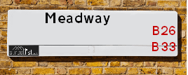
Map of Meadway
| Street Crime (updated 14/01/2025) | ||
|---|---|---|
| Location Note | Central Point of Street - Not Actual Location | |
| MSOA Info | For MSOAs E02001883, E02001895, E02001882, E02001888 (Statistical Neighbourhood) | |
| Click Hint | Click on a Circle for a detailed breakdown below map. | |
| Crime Levels |
Green = Very Low Yellow = Low Orange = High Red = Very High |
|
| Postcodes | ||
| Icon | Postcodes for Meadway | |
| Walking Distances | ||
| Distance Info | Green Circle = 10 Minutes Walk (800 metres) | |
Street Crime Data accessed from data.police.uk on 06/10/2024.
Moving to Meadway?
I can help you uncover potential pitfalls and provide key questions to ask about your new property. With decades of experience as a Local Land Charges Manager, I offer confidential insights to make your move informed and stress-free.
This service is free, but you may wish to make an optional donation to support it. Please include the property name and address in your request as well as anything you wish to focus on.
Contact Me
Do you know why this road is called Meadway?
What's it like to live here?
Share a Photo of Meadway
Ask the community a question.
Do you have any questions, memories to share, have any photos or know any facts? We'd love to know more.
Submit Your Comment
Find Homes to Rent in Birmingham

Budget Friendly Hotels near Meadway
| Budget Hotel Name | Distance (miles) |
|---|---|
|
1: Name:Travelodge Birmingham Yardley Address: 1741 Coventry Rd, Birmingham, B26 1DS Telephone: 0871 984 6065 Visit Hotel Page |
1.34 |
|
2: Name:Travelodge Birmingham Sheldon Address: 2225 Coventry Rd, Birmingham, B26 3EH Telephone: 0871 559 1806 Visit Hotel Page |
1.78 |
|
3: Name:Holiday Inn Express Birmingham�South A45 Address: 1270 Coventry Road, Yardley Telephone: Visit Hotel Page |
1.84 |
|
4: Name:Travelodge Birmingham Castle Bromwich Address: Chester Rd, Birmingham, B36 0AG Telephone: 0871 559 1813 Visit Hotel Page |
1.84 |
|
5: Name:Holiday Inn Express Birmingham - Castle Bromwich Address: 1200 Chester Rd, Castle Bromwich Telephone: Visit Hotel Page |
2.30 |
Hotel Options
Your support helps keep this site running!
If you enjoy using this website, consider making a donation to help me cover hosting costs.
Flats and Apartments in Meadway
FLAT 1
FLAT 2
FLAT 4
FLAT 5
FLAT 6
FLAT 7
FLAT 8
FLAT 1
FLAT 2
APARTMENT 1
APARTMENT 2
APARTMENT 3
APARTMENT 4
APARTMENT 5
APARTMENT 6
APARTMENT 7
APARTMENT 8
APARTMENT 9
FLAT 1
FLAT 2
FLAT 1
FLAT 2
EPC (Energy Performance Certificate) Information for Meadway
UPRN: 100070448657
EPC Current: D
EPC Potential: B
Habitable Rooms: 2
Property Type: Bungalow
Tenure: Rented (social)
Built Form: Detached
Age Band: 1991-1995
Mains Gas: Yes
UPRN: 100070448658
EPC Current: D
EPC Potential: D
Habitable Rooms: 4
Property Type: House
Tenure: rental (private)
Built Form: Semi-Detached
Age Band: 1900-1929
Mains Gas: Yes
UPRN: 100070448659
EPC Current: E
EPC Potential: B
Habitable Rooms: 5
Property Type: House
Tenure: Owner-occupied
Built Form: Semi-Detached
Age Band: 1950-1966
Mains Gas: Yes
UPRN: 100070448661
EPC Current: D
EPC Potential: B
Habitable Rooms: 5
Property Type: House
Tenure: rental (private)
Built Form: Semi-Detached
Age Band: 1950-1966
Mains Gas: Yes
UPRN: 100070448662
EPC Current: C
EPC Potential: B
Habitable Rooms: 7
Property Type: House
Tenure: Owner-occupied
Built Form: Semi-Detached
Age Band: 1950-1966
Mains Gas: Yes
UPRN: 100070448663
EPC Current: D
EPC Potential: B
Habitable Rooms: 4
Property Type: House
Tenure: rental (private)
Built Form: Semi-Detached
Age Band: 1950-1966
Mains Gas: Yes
UPRN: 100070448664
EPC Current: D
EPC Potential: B
Habitable Rooms: 5
Property Type: House
Tenure: rental (social)
Built Form: Semi-Detached
Age Band: 1930-1949
Mains Gas: Yes
UPRN: 100070448667
EPC Current: D
EPC Potential: B
Habitable Rooms: 5
Property Type: House
Tenure: Owner-occupied
Built Form: Semi-Detached
Age Band: 1950-1966
Mains Gas: Yes
UPRN: 100070448668
EPC Current: D
EPC Potential: B
Habitable Rooms: 5
Property Type: House
Tenure: Owner-occupied
Built Form: Semi-Detached
Age Band: 1950-1966
Mains Gas: Yes
UPRN: 100070448669
EPC Current: C
EPC Potential: C
Habitable Rooms: 5
Property Type: House
Tenure: Owner-occupied
Built Form: Semi-Detached
Age Band: 1930-1949
Mains Gas: Yes
UPRN: 100070448671
EPC Current: E
EPC Potential: C
Habitable Rooms: 6
Property Type: House
Tenure: Owner-occupied
Built Form: Semi-Detached
Age Band: 1930-1949
Mains Gas: Yes
UPRN: 100070448672
EPC Current: D
EPC Potential: B
Habitable Rooms: 4
Property Type: House
Tenure: Owner-occupied
Built Form: Semi-Detached
Age Band: 1930-1949
Mains Gas: Yes
UPRN: 100070448673
EPC Current: D
EPC Potential: B
Habitable Rooms: 5
Property Type: House
Tenure: Owner-occupied
Built Form: Semi-Detached
Age Band: 1930-1949
Mains Gas: Yes
UPRN: 100070448675
EPC Current: D
EPC Potential: B
Habitable Rooms: 4
Property Type: House
Tenure: rental (social)
Built Form: Semi-Detached
Age Band: 1930-1949
Mains Gas: Yes
UPRN: 100070448676
EPC Current: D
EPC Potential: B
Habitable Rooms: 5
Property Type: House
Tenure: rental (social)
Built Form: Semi-Detached
Age Band: 1930-1949
Mains Gas: Yes
UPRN: 100070448677
EPC Current: C
EPC Potential: B
Habitable Rooms: 4
Property Type: House
Tenure: Owner-occupied
Built Form: Semi-Detached
Age Band: 1950-1966
Mains Gas: Yes
UPRN: 100070448678
EPC Current: D
EPC Potential: B
Habitable Rooms: 4
Property Type: House
Tenure: Owner-occupied
Built Form: Semi-Detached
Age Band: 1950-1966
Mains Gas: Yes
UPRN: 100070448679
EPC Current: C
EPC Potential: B
Habitable Rooms: 5
Property Type: House
Tenure: Owner-occupied
Built Form: Semi-Detached
Age Band: 1930-1949
Mains Gas: Yes
UPRN: 100070448682
EPC Current: D
EPC Potential: B
Habitable Rooms: 5
Property Type: House
Tenure: Owner-occupied
Built Form: Semi-Detached
Age Band: 1950-1966
Mains Gas: Yes
UPRN: 100070448683
EPC Current: D
EPC Potential: C
Habitable Rooms: 6
Property Type: House
Tenure: Owner-occupied
Built Form: Semi-Detached
Age Band: 1950-1966
Mains Gas: Yes
UPRN: 100070448686
EPC Current: D
EPC Potential: C
Habitable Rooms: 5
Property Type: House
Tenure: Rented (social)
Built Form: Semi-Detached
Age Band: 1950-1966
Mains Gas: Yes
UPRN: 100070448687
EPC Current: D
EPC Potential: C
Habitable Rooms: 5
Property Type: House
Tenure: Owner-occupied
Built Form: Semi-Detached
Age Band: 1950-1966
Mains Gas: Yes
UPRN: 100070448688
EPC Current: D
EPC Potential: B
Habitable Rooms: 6
Property Type: House
Tenure: Owner-occupied
Built Form: Semi-Detached
Age Band: 1930-1949
Mains Gas: Yes
UPRN: 100070448690
EPC Current: D
EPC Potential: B
Habitable Rooms: 5
Property Type: House
Tenure: Owner-occupied
Built Form: Semi-Detached
Age Band: 1930-1949
Mains Gas: Yes
UPRN: 100070448695
EPC Current: E
EPC Potential: B
Habitable Rooms: 5
Property Type: House
Tenure: rental (social)
Built Form: Semi-Detached
Age Band: 1950-1966
Mains Gas: Yes
UPRN: 100070448698
EPC Current: D
EPC Potential: C
Habitable Rooms: 4
Property Type: House
Tenure: Owner-occupied
Built Form: End-Terrace
Age Band: 1950-1966
Mains Gas: Yes
UPRN: 100070448700
EPC Current: D
EPC Potential: B
Habitable Rooms: 5
Property Type: House
Tenure: Owner-occupied
Built Form: Mid-Terrace
Age Band: 1950-1966
Mains Gas: Yes
UPRN: 100070448701
EPC Current: C
EPC Potential: B
Habitable Rooms: 5
Property Type: House
Tenure: Rented (social)
Built Form: Semi-Detached
Age Band: 1950-1966
Mains Gas: Yes
UPRN: 100070448702
EPC Current: C
EPC Potential: B
Habitable Rooms: 5
Property Type: House
Tenure: rental (private)
Built Form: Mid-Terrace
Age Band: 1950-1966
Mains Gas: Yes
UPRN: 100070448704
EPC Current: C
EPC Potential: B
Habitable Rooms: 5
Property Type: House
Tenure: rental (private)
Built Form: End-Terrace
Age Band: 1950-1966
Mains Gas: Yes
UPRN: 100070448705
EPC Current: C
EPC Potential: C
Habitable Rooms: 6
Property Type: House
Tenure: Owner-occupied
Built Form: Mid-Terrace
Age Band: 1930-1949
Mains Gas: Yes
UPRN: 100070448707
EPC Current: E
EPC Potential: C
Habitable Rooms: 5
Property Type: House
Tenure: Owner-occupied
Built Form: Mid-Terrace
Age Band: 1930-1949
Mains Gas: Yes
UPRN: 100070448708
EPC Current: D
EPC Potential: B
Habitable Rooms: 7
Property Type: House
Tenure: Owner-occupied
Built Form: Mid-Terrace
Age Band: 1930-1949
Mains Gas: Yes
UPRN: 100070448709
EPC Current: C
EPC Potential: B
Habitable Rooms: 4
Property Type: House
Tenure: Rented (social)
Built Form: Mid-Terrace
Age Band: 1930-1949
Mains Gas: Yes
UPRN: 100070448710
EPC Current: C
EPC Potential: B
Habitable Rooms: 6
Property Type: House
Tenure: Rented (social)
Built Form: Mid-Terrace
Age Band: 1950-1966
Mains Gas: Yes
UPRN: 100070448711
EPC Current: C
EPC Potential: B
Habitable Rooms: 4
Property Type: House
Tenure: Rented (social)
Built Form: End-Terrace
Age Band: 1930-1949
Mains Gas: Yes
UPRN: 100070448712
EPC Current: D
EPC Potential: C
Habitable Rooms: 6
Property Type: House
Tenure: Owner-occupied
Built Form: End-Terrace
Age Band: 1950-1966
Mains Gas: Yes
UPRN: 100070448714
EPC Current: C
EPC Potential: B
Habitable Rooms: 5
Property Type: House
Tenure: Owner-occupied
Built Form: End-Terrace
Age Band: 1950-1966
Mains Gas: Yes
UPRN: 100070448715
EPC Current: D
EPC Potential: B
Habitable Rooms: 5
Property Type: House
Tenure: Owner-occupied
Built Form: Mid-Terrace
Age Band: 1950-1966
Mains Gas: Yes
UPRN: 100070448717
EPC Current: C
EPC Potential: B
Habitable Rooms: 8
Property Type: House
Tenure: rental (private)
Built Form: Mid-Terrace
Age Band: 1950-1966
Mains Gas: Yes
UPRN: 100070448719
EPC Current: C
EPC Potential: B
Habitable Rooms: 6
Property Type: House
Tenure: rental (social)
Built Form: End-Terrace
Age Band: 1930-1949
Mains Gas: Yes
UPRN: 100070448720
EPC Current: D
EPC Potential: B
Habitable Rooms: 6
Property Type: House
Tenure: Owner-occupied
Built Form: End-Terrace
Age Band: 1950-1966
Mains Gas: Yes
UPRN: 100070448721
EPC Current: D
EPC Potential: C
Habitable Rooms: 4
Property Type: House
Tenure: Owner-occupied
Built Form: End-Terrace
Age Band: 1930-1949
Mains Gas: Yes
UPRN: 100070448723
EPC Current: E
EPC Potential: C
Habitable Rooms: 5
Property Type: House
Tenure: Owner-occupied
Built Form: Semi-Detached
Age Band: 1950-1966
Mains Gas: Yes
UPRN: 100070448726
EPC Current: D
EPC Potential: C
Habitable Rooms: 5
Property Type: House
Tenure: Owner-occupied
Built Form: Mid-Terrace
Age Band: 1950-1966
Mains Gas: Yes
UPRN: 100070448727
EPC Current: D
EPC Potential: B
Habitable Rooms: 5
Property Type: House
Tenure: Owner-occupied
Built Form: End-Terrace
Age Band: 1950-1966
Mains Gas: Yes
UPRN: 100070448729
EPC Current: D
EPC Potential: B
Habitable Rooms: 4
Property Type: House
Tenure: Owner-occupied
Built Form: Semi-Detached
Age Band: 1950-1966
Mains Gas: Yes
UPRN: 100070448730
EPC Current: C
EPC Potential: B
Habitable Rooms: 4
Property Type: House
Tenure: Rented (social)
Built Form: Semi-Detached
Age Band: 1950-1966
Mains Gas: Yes
UPRN: 100070448731
EPC Current: D
EPC Potential: C
Habitable Rooms: 5
Property Type: House
Tenure: Owner-occupied
Built Form: Semi-Detached
Age Band: 1930-1949
Mains Gas: Yes
UPRN: 100070448732
EPC Current: D
EPC Potential: B
Habitable Rooms: 5
Property Type: House
Tenure: Owner-occupied
Built Form: Semi-Detached
Age Band: 1950-1966
Mains Gas: Yes
UPRN: 100070448735
EPC Current: D
EPC Potential: B
Habitable Rooms: 5
Property Type: House
Tenure: Owner-occupied
Built Form: Semi-Detached
Age Band: 1950-1966
Mains Gas: Yes
UPRN: 100070448736
EPC Current: D
EPC Potential: B
Habitable Rooms: 2
Property Type: Bungalow
Tenure: Rented (social)
Built Form: End-Terrace
Age Band: 1967-1975
Mains Gas: Yes
UPRN: 100070448737
EPC Current: D
EPC Potential: B
Habitable Rooms: 5
Property Type: House
Tenure: Owner-occupied
Built Form: Semi-Detached
Age Band: 1950-1966
Mains Gas: Yes
UPRN: 100070448738
EPC Current: D
EPC Potential: B
Habitable Rooms: 2
Property Type: Bungalow
Tenure: Rented (social)
Built Form: Mid-Terrace
Age Band: 1967-1975
Mains Gas: Yes
UPRN: 100070448739
EPC Current: C
EPC Potential: B
Habitable Rooms: 5
Property Type: House
Tenure: Owner-occupied
Built Form: Semi-Detached
Age Band: 1950-1966
Mains Gas: Yes
UPRN: 100070448740
EPC Current: D
EPC Potential: C
Habitable Rooms: 2
Property Type: Bungalow
Tenure: Rented (social)
Built Form: Mid-Terrace
Age Band: 1950-1966
Mains Gas: Yes
UPRN: 100070448741
EPC Current: D
EPC Potential: C
Habitable Rooms: 5
Property Type: House
Tenure: rental (social)
Built Form: Semi-Detached
Age Band: 1950-1966
Mains Gas: Yes
UPRN: 100070448742
EPC Current: D
EPC Potential: B
Habitable Rooms: 2
Property Type: Bungalow
Tenure: rental (social)
Built Form: End-Terrace
Age Band: 1967-1975
Mains Gas: Yes
UPRN: 100070448744
EPC Current: C
EPC Potential: C
Habitable Rooms: 6
Property Type: House
Tenure: Owner-occupied
Built Form: Semi-Detached
Age Band: 1930-1949
Mains Gas: Yes
UPRN: 100070448745
EPC Current: D
EPC Potential: B
Habitable Rooms: 7
Property Type: House
Tenure: Owner-occupied
Built Form: Semi-Detached
Age Band: 1930-1949
Mains Gas: Yes
UPRN: 100070448746
EPC Current: C
EPC Potential: B
Habitable Rooms: 6
Property Type: House
Tenure: Owner-occupied
Built Form: Semi-Detached
Age Band: 1950-1966
Mains Gas: Yes
UPRN: 100070448747
EPC Current: C
EPC Potential: C
Habitable Rooms: 4
Property Type: House
Tenure: rental (social)
Built Form: Semi-Detached
Age Band: 1930-1949
Mains Gas: Yes
UPRN: 100070448748
EPC Current: D
EPC Potential: B
Habitable Rooms: 4
Property Type: House
Tenure: Owner-occupied
Built Form: Semi-Detached
Age Band: 1950-1966
Mains Gas: Yes
UPRN: 100070448749
EPC Current: D
EPC Potential: B
Habitable Rooms: 5
Property Type: House
Tenure: Owner-occupied
Built Form: Semi-Detached
Age Band: 1950-1966
Mains Gas: Yes
UPRN: 100070448752
EPC Current: D
EPC Potential: B
Habitable Rooms: 5
Property Type: House
Tenure: rental (social)
Built Form: Semi-Detached
Age Band: 1950-1966
Mains Gas: Yes
UPRN: 100070448756
EPC Current: D
EPC Potential: B
Habitable Rooms: 5
Property Type: House
Tenure: Owner-occupied
Built Form: End-Terrace
Age Band: 1967-1975
Mains Gas: Yes
UPRN: 100070448757
EPC Current: D
EPC Potential: B
Habitable Rooms: 6
Property Type: House
Tenure: Rented (social)
Built Form: Mid-Terrace
Age Band: 1950-1966
Mains Gas: Yes
UPRN: 100070448760
EPC Current: D
EPC Potential: B
Habitable Rooms: 5
Property Type: House
Tenure: Owner-occupied
Built Form: End-Terrace
Age Band: 1983-1990
Mains Gas: Yes
UPRN: 100070448764
EPC Current: C
EPC Potential: B
Habitable Rooms: 7
Property Type: House
Tenure: Owner-occupied
Built Form: Semi-Detached
Age Band: 1950-1966
Mains Gas: Yes
UPRN: 100070448765
EPC Current: C
EPC Potential: B
Habitable Rooms: 6
Property Type: House
Tenure: Owner-occupied
Built Form: Semi-Detached
Age Band: 1950-1966
Mains Gas: Yes
UPRN: 100070448766
EPC Current: D
EPC Potential: D
Habitable Rooms: 8
Property Type: House
Tenure: Owner-occupied
Built Form: Semi-Detached
Age Band: 1930-1949
Mains Gas: Yes
UPRN: 100070448767
EPC Current: E
EPC Potential: B
Habitable Rooms: 8
Property Type: House
Tenure: Owner-occupied
Built Form: Semi-Detached
Age Band: 1950-1966
Mains Gas: Yes
UPRN: 100070448768
EPC Current: D
EPC Potential: B
Habitable Rooms: 6
Property Type: House
Tenure: Owner-occupied
Built Form: Semi-Detached
Age Band: 1950-1966
Mains Gas: Yes
UPRN: 100070448769
EPC Current: C
EPC Potential: C
Habitable Rooms: 3
Property Type: Maisonette
Tenure: rental (private)
Built Form: Semi-Detached
Age Band: 1950-1966
Mains Gas: Yes
UPRN: 10093330018
EPC Current: D
EPC Potential: C
Habitable Rooms: 3
Property Type: Maisonette
Tenure: rental (private)
Built Form: Semi-Detached
Age Band: 1950-1966
Mains Gas: Yes
UPRN: 100070448770
EPC Current: D
EPC Potential: C
Habitable Rooms: 5
Property Type: House
Tenure: Owner-occupied
Built Form: End-Terrace
Age Band: 1950-1966
Mains Gas: Yes
UPRN: 100070448773
EPC Current: E
EPC Potential: B
Habitable Rooms: 5
Property Type: House
Tenure: Owner-occupied
Built Form: End-Terrace
Age Band: 1930-1949
Mains Gas: Yes
UPRN: 100070448774
EPC Current: C
EPC Potential: B
Habitable Rooms: 5
Property Type: House
Tenure: Rented (private)
Built Form: End-Terrace
Age Band: 1950-1966
Mains Gas: Yes
UPRN: 100070448776
EPC Current: D
EPC Potential: B
Habitable Rooms: 5
Property Type: House
Tenure: Owner-occupied
Built Form: Mid-Terrace
Age Band: 1950-1966
Mains Gas: Yes
UPRN: 100070448778
EPC Current: D
EPC Potential: B
Habitable Rooms: 5
Property Type: House
Tenure: Owner-occupied
Built Form: Semi-Detached
Age Band: 1950-1966
Mains Gas: Yes
UPRN: 100070448779
EPC Current: D
EPC Potential: B
Habitable Rooms: 4
Property Type: House
Tenure: Owner-occupied
Built Form: Semi-Detached
Age Band: 1930-1949
Mains Gas: Yes
UPRN: 100070448780
EPC Current: C
EPC Potential: B
Habitable Rooms: 5
Property Type: House
Tenure: rental (private)
Built Form: End-Terrace
Age Band: 1950-1966
Mains Gas: Yes
UPRN: 100070448781
EPC Current: C
EPC Potential: B
Habitable Rooms: 6
Property Type: House
Tenure: Owner-occupied
Built Form: Mid-Terrace
Age Band: 1930-1949
Mains Gas: Yes
UPRN: 100070448782
EPC Current: C
EPC Potential: B
Habitable Rooms: 4
Property Type: House
Tenure: Owner-occupied
Built Form: Mid-Terrace
Age Band: 1950-1966
Mains Gas: Yes
UPRN: 100070448783
EPC Current: E
EPC Potential: B
Habitable Rooms: 5
Property Type: House
Tenure: Owner-occupied
Built Form: Semi-Detached
Age Band: 1950-1966
Mains Gas: Yes
UPRN: 10093747365
EPC Current: B
EPC Potential: A
Habitable Rooms: N/A
Property Type: House
Tenure: unknown
Built Form: Semi-Detached
Age Band: U
Mains Gas: Unknown
UPRN: 10093747366
EPC Current: B
EPC Potential: A
Habitable Rooms: N/A
Property Type: House
Tenure: unknown
Built Form: Detached
Age Band: U
Mains Gas: Unknown
UPRN: 100070448788
EPC Current: D
EPC Potential: B
Habitable Rooms: 2
Property Type: House
Tenure: Rented (private)
Built Form: Semi-Detached
Age Band: 1930-1949
Mains Gas: Yes
UPRN: 10093747367
EPC Current: B
EPC Potential: A
Habitable Rooms: N/A
Property Type: House
Tenure: unknown
Built Form: Semi-Detached
Age Band: U
Mains Gas: Unknown
UPRN: 10093747368
EPC Current: B
EPC Potential: A
Habitable Rooms: N/A
Property Type: House
Tenure: unknown
Built Form: Semi-Detached
Age Band: U
Mains Gas: Unknown
UPRN: 100070448790
EPC Current: D
EPC Potential: B
Habitable Rooms: 5
Property Type: House
Tenure: Owner-occupied
Built Form: Mid-Terrace
Age Band: 1930-1949
Mains Gas: Yes
UPRN: 10093747369
EPC Current: B
EPC Potential: A
Habitable Rooms: N/A
Property Type: House
Tenure: unknown
Built Form: Semi-Detached
Age Band: U
Mains Gas: Unknown
UPRN: 10093747370
EPC Current: B
EPC Potential: A
Habitable Rooms: N/A
Property Type: House
Tenure: unknown
Built Form: Semi-Detached
Age Band: U
Mains Gas: Unknown
UPRN: 10093747371
EPC Current: B
EPC Potential: A
Habitable Rooms: N/A
Property Type: House
Tenure: unknown
Built Form: Semi-Detached
Age Band: U
Mains Gas: Unknown
UPRN: 100070448793
EPC Current: C
EPC Potential: B
Habitable Rooms: 5
Property Type: House
Tenure: Owner-occupied
Built Form: Mid-Terrace
Age Band: 1930-1949
Mains Gas: Yes
UPRN: 10093747372
EPC Current: B
EPC Potential: A
Habitable Rooms: N/A
Property Type: House
Tenure: unknown
Built Form: Semi-Detached
Age Band: U
Mains Gas: Unknown
UPRN: 10093747373
EPC Current: B
EPC Potential: A
Habitable Rooms: N/A
Property Type: House
Tenure: unknown
Built Form: Semi-Detached
Age Band: U
Mains Gas: Unknown
UPRN: 100070448795
EPC Current: D
EPC Potential: B
Habitable Rooms: 4
Property Type: House
Tenure: rental (private)
Built Form: Semi-Detached
Age Band: 1930-1949
Mains Gas: Yes
UPRN: 10093747374
EPC Current: B
EPC Potential: A
Habitable Rooms: N/A
Property Type: House
Tenure: unknown
Built Form: Semi-Detached
Age Band: U
Mains Gas: Unknown
UPRN: 100070448796
EPC Current: E
EPC Potential: C
Habitable Rooms: 7
Property Type: House
Tenure: Owner-occupied
Built Form: Semi-Detached
Age Band: 1930-1949
Mains Gas: Yes
UPRN: 100070448798
EPC Current: C
EPC Potential: B
Habitable Rooms: 7
Property Type: House
Tenure: Owner-occupied
Built Form: Semi-Detached
Age Band: 1930-1949
Mains Gas: Yes
UPRN: 100070448800
EPC Current: E
EPC Potential: B
Habitable Rooms: 4
Property Type: House
Tenure: Owner-occupied
Built Form: End-Terrace
Age Band: 1950-1966
Mains Gas: No
UPRN: 100070448801
EPC Current: C
EPC Potential: B
Habitable Rooms: 5
Property Type: House
Tenure: rental (social)
Built Form: Mid-Terrace
Age Band: 1950-1966
Mains Gas: Yes
UPRN: 100070448804
EPC Current: D
EPC Potential: C
Habitable Rooms: 5
Property Type: House
Tenure: Owner-occupied
Built Form: Mid-Terrace
Age Band: 1950-1966
Mains Gas: Yes
UPRN: 100070448806
EPC Current: F
EPC Potential: B
Habitable Rooms: 4
Property Type: House
Tenure: Owner-occupied
Built Form: End-Terrace
Age Band: 1950-1966
Mains Gas: Yes
UPRN: 100070448807
EPC Current: D
EPC Potential: B
Habitable Rooms: 5
Property Type: House
Tenure: Owner-occupied
Built Form: Mid-Terrace
Age Band: 1950-1966
Mains Gas: Yes
UPRN: 100070448808
EPC Current: D
EPC Potential: C
Habitable Rooms: 6
Property Type: House
Tenure: Owner-occupied
Built Form: Semi-Detached
Age Band: 1950-1966
Mains Gas: Yes
UPRN: 100070448809
EPC Current: C
EPC Potential: B
Habitable Rooms: 5
Property Type: House
Tenure: rental (social)
Built Form: Mid-Terrace
Age Band: 1950-1966
Mains Gas: Yes
UPRN: 100070448812
EPC Current: C
EPC Potential: C
Habitable Rooms: 4
Property Type: House
Tenure: Owner-occupied
Built Form: End-Terrace
Age Band: 1950-1966
Mains Gas: Yes
UPRN: 100070448813
EPC Current: D
EPC Potential: B
Habitable Rooms: 5
Property Type: House
Tenure: Owner-occupied
Built Form: Semi-Detached
Age Band: 1950-1966
Mains Gas: Yes
UPRN: 100070448814
EPC Current: D
EPC Potential: B
Habitable Rooms: 5
Property Type: House
Tenure: Owner-occupied
Built Form: Mid-Terrace
Age Band: 1930-1949
Mains Gas: Yes
UPRN: 100070448816
EPC Current: C
EPC Potential: B
Habitable Rooms: 6
Property Type: House
Tenure: rental (private)
Built Form: Mid-Terrace
Age Band: 1950-1966
Mains Gas: Yes
UPRN: 100070448820
EPC Current: D
EPC Potential: B
Habitable Rooms: 4
Property Type: House
Tenure: Rented (private)
Built Form: Semi-Detached
Age Band: 1967-1975
Mains Gas: Yes
UPRN: 100070448821
EPC Current: D
EPC Potential: B
Habitable Rooms: 4
Property Type: House
Tenure: Owner-occupied
Built Form: Semi-Detached
Age Band: 1950-1966
Mains Gas: Yes
UPRN: 100070448824
EPC Current: C
EPC Potential: B
Habitable Rooms: 4
Property Type: House
Tenure: rental (social)
Built Form: End-Terrace
Age Band: 1930-1949
Mains Gas: Yes
UPRN: 100070448826
EPC Current: D
EPC Potential: C
Habitable Rooms: 5
Property Type: House
Tenure: Owner-occupied
Built Form: Mid-Terrace
Age Band: 1950-1966
Mains Gas: Yes
UPRN: 10023507430
EPC Current: C
EPC Potential: C
Habitable Rooms: 3
Property Type: Flat
Tenure: rental (private)
Built Form: Detached
Age Band: 2003-2006
Mains Gas: No
UPRN: 10023507431
EPC Current: C
EPC Potential: B
Habitable Rooms: 3
Property Type: Flat
Tenure: rental (private)
Built Form: End-Terrace
Age Band: 2003-2006
Mains Gas: No
UPRN: 10023507432
EPC Current: C
EPC Potential: B
Habitable Rooms: 3
Property Type: Flat
Tenure: rental (private)
Built Form: Mid-Terrace
Age Band: 2003-2006
Mains Gas: No
UPRN: 10023507433
EPC Current: C
EPC Potential: B
Habitable Rooms: 3
Property Type: Flat
Tenure: rental (private)
Built Form: End-Terrace
Age Band: 2003-2006
Mains Gas: No
UPRN: 10023507434
EPC Current: C
EPC Potential: B
Habitable Rooms: 3
Property Type: Flat
Tenure: rental (private)
Built Form: Mid-Terrace
Age Band: 2003-2006
Mains Gas: No
UPRN: 10091112685
EPC Current: D
EPC Potential: C
Habitable Rooms: 3
Property Type: Flat
Tenure: Rented (private)
Built Form: Detached
Age Band: 2003-2006
Mains Gas: No
UPRN: 10023507435
EPC Current: C
EPC Potential: B
Habitable Rooms: 3
Property Type: Flat
Tenure: rental (private)
Built Form: Detached
Age Band: 2003-2006
Mains Gas: No
UPRN: 10023507436
EPC Current: B
EPC Potential: B
Habitable Rooms: 3
Property Type: Flat
Tenure: rental (private)
Built Form: End-Terrace
Age Band: 2003-2006
Mains Gas: No
UPRN: 10023507437
EPC Current: C
EPC Potential: B
Habitable Rooms: 3
Property Type: Flat
Tenure: rental (private)
Built Form: End-Terrace
Age Band: 2003-2006
Mains Gas: No
UPRN: 100071456500
EPC Current: C
EPC Potential: C
Habitable Rooms: 2
Property Type: Flat
Tenure: rental (social)
Built Form: Semi-Detached
Age Band: 1983-1990
Mains Gas: Yes
UPRN: 100071288239
EPC Current: C
EPC Potential: C
Habitable Rooms: 2
Property Type: Flat
Tenure: rental (social)
Built Form: Semi-Detached
Age Band: 1930-1949
Mains Gas: Yes
UPRN: 100071288243
EPC Current: D
EPC Potential: C
Habitable Rooms: 2
Property Type: Flat
Tenure: Rented (social)
Built Form: Semi-Detached
Age Band: 1950-1966
Mains Gas: Yes
UPRN: 100071288245
EPC Current: D
EPC Potential: C
Habitable Rooms: 2
Property Type: Flat
Tenure: rental (social)
Built Form: Semi-Detached
Age Band: 1930-1949
Mains Gas: Yes
UPRN: 100071288247
EPC Current: C
EPC Potential: C
Habitable Rooms: 2
Property Type: Flat
Tenure: Rented (social)
Built Form: Semi-Detached
Age Band: 1950-1966
Mains Gas: Yes
UPRN: 100071456332
EPC Current: D
EPC Potential: B
Habitable Rooms: 4
Property Type: House
Tenure: Owner-occupied
Built Form: Semi-Detached
Age Band: 1950-1966
Mains Gas: Yes
UPRN: 100071288251
EPC Current: C
EPC Potential: C
Habitable Rooms: 2
Property Type: Flat
Tenure: rental (social)
Built Form: NO DATA!
Age Band: 1930-1949
Mains Gas: Yes
UPRN: 100071456501
EPC Current: C
EPC Potential: C
Habitable Rooms: 2
Property Type: Flat
Tenure: rental (social)
Built Form: Semi-Detached
Age Band: 1983-1990
Mains Gas: No
UPRN: 100071288244
EPC Current: C
EPC Potential: C
Habitable Rooms: 2
Property Type: Flat
Tenure: rental (social)
Built Form: Semi-Detached
Age Band: 1930-1949
Mains Gas: Yes
UPRN: 100071288248
EPC Current: D
EPC Potential: D
Habitable Rooms: 2
Property Type: Flat
Tenure: Rented (social)
Built Form: Semi-Detached
Age Band: 1950-1966
Mains Gas: Yes
UPRN: 100071288250
EPC Current: D
EPC Potential: C
Habitable Rooms: 2
Property Type: Flat
Tenure: rental (social)
Built Form: Semi-Detached
Age Band: 1950-1966
Mains Gas: Yes
UPRN: 100071288252
EPC Current: C
EPC Potential: C
Habitable Rooms: 2
Property Type: Flat
Tenure: rental (social)
Built Form: NO DATA!
Age Band: 1900-1929
Mains Gas: Yes
UPRN: 100071456502
EPC Current: C
EPC Potential: C
Habitable Rooms: 2
Property Type: Flat
Tenure: rental (social)
Built Form: Semi-Detached
Age Band: 1983-1990
Mains Gas: Yes
UPRN: 100071456503
EPC Current: C
EPC Potential: C
Habitable Rooms: 2
Property Type: Flat
Tenure: rental (social)
Built Form: Semi-Detached
Age Band: 1983-1990
Mains Gas: Yes
UPRN: 100071456504
EPC Current: C
EPC Potential: C
Habitable Rooms: 2
Property Type: Flat
Tenure: rental (social)
Built Form: Semi-Detached
Age Band: 1983-1990
Mains Gas: No
UPRN: 100071456505
EPC Current: C
EPC Potential: C
Habitable Rooms: 2
Property Type: Flat
Tenure: rental (social)
Built Form: Semi-Detached
Age Band: 1983-1990
Mains Gas: Yes
UPRN: 100071456506
EPC Current: C
EPC Potential: C
Habitable Rooms: 2
Property Type: Flat
Tenure: rental (social)
Built Form: Semi-Detached
Age Band: 1983-1990
Mains Gas: No
UPRN: 100071456507
EPC Current: C
EPC Potential: C
Habitable Rooms: 2
Property Type: Flat
Tenure: Owner-occupied
Built Form: Semi-Detached
Age Band: 1983-1990
Mains Gas: No
House Sales
| Year | High | Low | Average | Sales |
|---|---|---|---|---|
| 2014 | £109,000 | £125,000 | £117,333 | 3 |
| 2015 | £105,000 | £148,000 | £119,850 | 7 |
| 2016 | £124,500 | £160,000 | £142,167 | 3 |
| 2017 | £140,000 | £350,000 | £140,832 | 14 |
| 2018 | £117,000 | £81,920 | £155,742 | 12 |
| 2019 | £135,000 | £289,995 | £191,713 | 7 |
| 2020 | £175,000 | £118,000 | £147,900 | 5 |
| 2021 | £187,500 | £169,000 | £191,875 | 12 |
| 2022 | £180,000 | £225,000 | £202,500 | 2 |
| 2023 | £197,000 | £230,000 | £213,500 | 2 |
| 2024 | £215,000 | £231,000 | £223,000 | 2 |
Contains HM Land Registry data © Crown copyright and database right 2025. This data is licensed under the Open Government Licence v3.0.
Nearby Estate Agents
| Name | Address | Website |
|---|---|---|
| YOUR MOVE Murray Rogers | 165 Station Road, Stechford, Birmingham, B33 8BA | Visit Website |
| YOUR MOVE Murray Rogers Lettings | 165 Station Road, Stechford, Birmingham, B33 8BA | Visit Website |
| Reeds Rains | 124 Church Road, Yardley, Birmingham, B25 8UT | Visit Website |
| Reeds Rains Lettings | 124 Church Road, Yardley, Birmingham, B25 8UT | Visit Website |
| Partridge Homes | 167-169 Church Road, Yardley, Birmingham, B25 8UR | Visit Website |
We have found 15 postcodes
Neighbourhood Policing |
| Police Force: West Midlands |
 View Neighbourhood Crime and Policing View Neighbourhood Crime and Policing |
| Find a Local Neighbourhood Watch Scheme |
Location Details
| Meadway | |
|---|---|

| |
| Latitude | 52.477155 |
| Longitude | -1.788796 |
| OS Easting (X): | 414343 |
| OS Northing (Y): | 286642 |
| OS Grid Reference: | SP143866 |
Known Residential Addresses for Meadway
- 237
- 338
- 193
- 199
- LEAWAY SERVICE STATION
- 417
- 363
- 304
- 374
- 366
- 32
- 12
- 22
- 7
- 31
- 23
- 17
- 98
- 116
- 100
- 92
- 118
- 90
- 81
- 61
- 170
- 194
- 188
- 280
- 252
- 270
- 239
- 271
- 241
- 247
- 251
- 243
- 383
- 371
- 330
- 334
- 336
- 322
- 362
- 394
- 386
- 376
- 358
- 384
- 414
- 30
- 73
- 87
- 65
- 210
- 264
- 248
- 224
- 226
- 272
- 242
- 274
- 222
- 295
Roads that have a Junction with Meadway
| Street | Junction Type |
|---|---|
| Bordesley Green East | junction |
| Wheatcroft Road | junction |
| The Lea | junction |
| Holbeach Road | junction |
| Lea Hall Road | junction |
| The Lea | junction |
| Sheldon Heath Road | junction |
| Holbeach Road | roundabout |
| Holbeach Road | junction |
| Garretts Green Lane | junction |
| Lea Hall Road | roundabout |
| Garretts Green Lane | roundabout |
| Gossey Lane | junction |
| Mirfield Road | junction |
| Gossey Lane | junction |
| Gossey Lane | junction |
| Gossey Lane | junction |
| Kitts Green Road | junction |
| Gossey Lane | junction |
Sunset and Sunrise times
| Sunrise | 08:00 |
|---|---|
| Sunset | 16:37 |
Latest Weather Conditions
| Observed at Weather Station: | Coleshill 22 January 2025 at 06:00 (4.20 miles away) |
|---|---|
| Current Weather: | Mist |
| Temperature and Humidity: | 0.6°C (97.8%) |
| Wind Direction and Speed: | N (0 mph) |
Population Statistics
| ONS Area Code | E00047162, E00047164, E00047163, E00047245, E00048141, E00048137, E00175795 & E00048139 |
|---|---|
| ONS Area Name | Private Renting Young Families & Multi-Ethnic Hardship |
| Average Age | 36.07, 36.68, 38.60, 38.09 & 36.28 |
| Area Population | 1637.00, 1386.00, 1548.00, 1510.00 & 1616.00 |
| Male Population | 769.00, 689.00, 746.00, 708.00 & 783.00 (48%) |
| Female Population | 868.00, 697.00, 802.00 & 833.00 (52%) |
| Benefit Claimants | 77, 75, 65 & 68 (5%) |
| LSOA Code: | E01009299, E01009322, E01009508, E01009514 &E01009512 |
|---|---|
| LSOA Name: | Birmingham 057B, Birmingham 069D, Birmingham 056C, Birmingham 062B &Birmingham 062A |
| SOA Code: | 4c &7a |
| SOA Name: | |
| MSOA Code: | E02001883, E02001895, E02001882 &E02001888 |
| MSOA Name: | Birmingham 057, Birmingham 069, Birmingham 056 &Birmingham 062 |
Nearest Supermarkets
| Asda Sheldon |
|---|
| 105 Kelynmead Road, Sheldon, Birmingham, B33 8LF |
| 0121 600 4600 |
| Distance: 0.09 Miles |
| Directions to Asda Sheldon |
| Iceland Yardley |
|---|
| 128 Church Road, Yardley, Birmingham, B25 8UT |
| 01217840079 |
| Distance: 1.01 Miles |
| Directions to Iceland Yardley |
| Iceland Stechford Food Warehouse |
|---|
| Unit E, Stechford Retail Park, Birmingham, B33 9AN |
| 01217842668 |
| Distance: 1.03 Miles |
| Directions to Iceland Stechford Food Warehouse |
| Tesco Yardley Extra |
|---|
| Swan Shopping Centre, Coventry Rd, Birmingham, B26 1AD |
| 0345 671 9465 |
| Distance: 1.47 Miles |
| Directions to Tesco Yardley Extra |
Telephone Information
| Area Code |
|---|
| Area Code: 01675 - Coleshill |
| Area Code: 0121 - Birmingham |
| Area Code: 01676 - Meriden |
Broadband Information
| Speed | Average Speed | Median Speed | Maximum Speed | Next-generation access (NGA) | Number of Connections |
|---|---|---|---|---|---|
| Less than 2 Mbps | 18 | 8.6 | >=30 | Y | 18 |
Local Government
| Local Council Details |
|---|
| Within the area of Birmingham |
| Visit the Council's Website |
| Council House, Victoria Square, Birmingham &B1 1BB |
| Send email |
| Telephone Number: 0121 303 1111 |
| Local Member of Parliament |
|---|
| Within the Westminster Parliamentary Constituency of Birmingham, Hodge Hill, Birmingham &Yardley |
| The Member of Parliament is Liam Byrne |
| Details for the MP Liam Byrne on parliament.uk |
| Details for the MP Liam Byrne on theyworkforyou.com |
| In the 2024 General Election Liam Byrne won with a majority of 1,566 the result was Lab hold. The total electorate was 77,737 |
| Wards, Parish Councils and County Councils |
|---|
| Ward: Glebe Farm & Tile Cross &Garretts Green Ward |
| Parish: Unparished area |
| Ceremonial County: West Midlands |
Nearest Schools
England Primary Schools
Fordbridge Community Primary School
Address: Fordbridge Community Primary School, Crabtree Drive, Chelmsley Wood, Birmingham, West Midlands, B37 5BU
Distance: 1.50 miles
Contact:
The Shirestone Academy
Address: The Shirestone Academy, Shirestone Road, Tile Cross, Birmingham, West Midlands, B33 0DH
Distance: 0.92 miles
Contact: 01216754686
Oasis Academy Blakenhale Junior
Address: Oasis Academy Blakenhale Junior, Homestead Road, Garretts Green, Birmingham, West Midlands, B33 0XG
Distance: 0.36 miles
Contact: 01217833960
Oasis Academy Blakenhale Infants
Address: Oasis Academy Blakenhale Infants, Blakenhale Road, Garrett's Green, Birmingham, West Midlands, B33 0XD
Distance: 0.30 miles
Contact: 01217833960
Lea Forest Primary Academy
Address: Lea Forest Primary Academy, Hurstcroft Road, Kitts Green, Birmingham, B33 9RD
Distance: 0.43 miles
Contact: 01216753985
Audley Primary School
Address: Audley Primary School, Audley Road, Stechford, Birmingham, West Midlands, B33 9HY
Distance: 0.78 miles
Contact:
Lyndon Green Junior School
Address: Lyndon Green Junior School, Wensley Road, Sheldon, Birmingham, West Midlands, B26 1LU
Distance: 1.09 miles
Contact: 01216752983
The Oval Primary School
Address: The Oval Primary School, Whittington Oval, Yardley, Birmingham, West Midlands, B33 8JG
Distance: 0.35 miles
Contact:
Lyndon Green Infant School
Address: Lyndon Green Infant School, Wychwood Cresent, Sheldon, Birmingham, West Midlands, B26 1LZ
Distance: 1.19 miles
Contact: 01216753543
Colebourne Primary School
Address: Colebourne Primary School, Stechford Road, Hodge Hill, Birmingham, West Midlands, B34 6BJ
Distance: 1.37 miles
Contact: 01216758500
Yardley Primary School
Address: Yardley Primary School, Harvey Road, Yardley, Birmingham, West Midlands, B26 1TD
Distance: 1.28 miles
Contact: 01214643235
St Cuthbert's RC Junior and Infant (NC) School
Address: St Cuthbert's RC Junior and Infant (NC) School, Gumbleberrys Close, Off Cotterills Lane, Stechford, Birmingham, West Midlands, B8 2PS
Distance: 1.41 miles
Contact: 01216752205
Corpus Christi Catholic Primary School
Address: Corpus Christi Catholic Primary School, Lyttelton Road, Stechford, Birmingham, West Midlands, B33 8BL
Distance: 1.02 miles
Contact: 01216752784
Blakesley Hall Primary School
Address: Blakesley Hall Primary School, Yardley Green Road, Stechford, Birmingham, West Midlands, B33 8TH
Distance: 1.17 miles
Contact: 01217832148
Stechford Primary School
Address: Stechford Primary School, Albert Road, Stechford, Birmingham, B33 8SJ
Distance: 1.04 miles
Contact: 01214643245
St Bernadette's Catholic Primary School
Address: St Bernadette's Catholic Primary School, Hobmoor Road, Yardley, Birmingham, West Midlands, B25 8QL
Distance: 1.67 miles
Contact: 01217837232
Bordesley Green Primary School
Address: Bordesley Green Primary School, Marchmont Road, Birmingham, West Midlands, B9 5XX
Distance: 2.10 miles
Contact: 01217721601
Marston Green Junior School
Address: Marston Green Junior School, Station Road, Marston Green, Birmingham, West Midlands, B37 7BA
Distance: 1.79 miles
Contact: 01217792227
Elms Farm Community Primary School
Address: Elms Farm Community Primary School, Dorncliffe Avenue, Sheldon, Birmingham, West Midlands, B33 0PJ
Distance: 1.13 miles
Contact: 01214644634
Our Lady's Catholic Primary School
Address: Our Lady's Catholic Primary School, East Meadway, Tile Cross, Birmingham, West Midlands, B33 0AU
Distance: 0.91 miles
Contact:
Gossey Lane Academy
Address: Gossey Lane Academy, Gossey Lane, Kitts Green, Birmingham, West Midlands, B33 0DS
Distance: 0.51 miles
Contact: 01214642909
Gossey Lane Junior Infant and Nursery School
Address: Gossey Lane Junior Infant and Nursery School, Gossey Lane, Kitts Green, Birmingham, West Midlands, B33 0DS
Distance: 0.51 miles
Contact:
Stanville Primary School
Address: Stanville Primary School, Stanville Road, Birmingham, West Midlands, B26 3YN
Distance: 1.10 miles
Contact: 01214642322
Audley Primary School
Address: Audley Primary School, Audley Road, Stechford, Birmingham, West Midlands, B33 9HY
Distance: 0.78 miles
Contact: 01214643139
The Oval School
Address: The Oval School, Whittington Oval, Yardley, Birmingham, West Midlands, B33 8JG
Distance: 0.35 miles
Contact: 01214643248
Oasis Academy Hobmoor
Address: Oasis Academy Hobmoor, Wash Lane, Yardley, Birmingham, West Midlands, B25 8FD
Distance: 1.47 miles
Contact: 01216753269
Alston Primary School
Address: Alston Primary School, Alston Road, Bordesley Green East, Birmingham, West Midlands, B9 5UN
Distance: 1.76 miles
Contact: 01214641569
England Secondary Schools
CTC Kingshurst Academy
Address: CTC Kingshurst Academy, Cooks Lane, Kingshurst, Solihull, West Midlands, B37 6NU
Distance: 1.91 miles
Contact:
John Henry Newman Catholic College
Address: John Henry Newman Catholic College, Chelmsley Road, Chelmsley Wood, Birmingham, West Midlands, B37 5GA
Distance: 1.65 miles
Contact: 01217705331
Grace Academy Solihull
Address: Grace Academy Solihull, Chapelhouse Road, Chelmsey Wood, Birmingham, West Midlands, B37 5JS
Distance: 1.41 miles
Contact: 01213294600
King Edward VI Sheldon Heath Academy
Address: King Edward VI Sheldon Heath Academy, Sheldon Heath Road, Sheldon, Birmingham, West Midlands, B26 2RZ
Distance: 0.78 miles
Contact: 01216472471
Starbank School
Address: Starbank School, Starbank Road, Birmingham, West Midlands, B10 9LR
Distance: 1.91 miles
Contact:
Tile Cross Academy
Address: Tile Cross Academy, Gressel Lane, Tile Cross, Birmingham, West Midlands, B33 9UF
Distance: 0.90 miles
Contact: 01215666400
The International School
Address: The International School, Gressel Lane, Tile Cross, Birmingham, West Midlands, B33 9UF
Distance: 0.90 miles
Contact:
Cockshut Hill School
Address: Cockshut Hill School, Cockshut Hill, Yardley, Birmingham, West Midlands, B26 2HX
Distance: 0.62 miles
Contact: 01212895900
Cockshut Hill Technology College
Address: Cockshut Hill Technology College, Cockshut Hill, Yardley, Birmingham, West Midlands, B26 2HX
Distance: 0.62 miles
Contact:
Washwood Heath Academy
Address: Washwood Heath Academy, Burney Lane, Stechford, Birmingham, West Midlands, B8 2AS
Distance: 1.66 miles
Contact: 01216757272
Starbank School
Address: Starbank School, Hob Moor Road, Birmingham, B10 9BT
Distance: 1.92 miles
Contact: 01214642638
Saltley Academy
Address: Saltley Academy, Belchers Lane, Bordesley Green, Birmingham, West Midlands, B9 5RX
Distance: 1.88 miles
Contact: 01215666555
Waverley School
Address: Waverley School, Yardley Green Road, Bordesley Green, Birmingham, West Midlands, B9 5QA
Distance: 1.81 miles
Contact: 01215666600
Waverley Studio College
Address: Waverley Studio College, 470 Belchers Lane, Bordesley Green, Birmingham, West Midlands, B9 5SX
Distance: 1.94 miles
Contact: 01215666622
Nearest Hospitals
| Heartlands Hospital |
|---|
| Address: Bordesley Green East, Bordesley Green, Birmingham, B9 5SS, |
| Independent Sector |
| University Hospitals Birmingham NHS Foundation Trust |
| Telephone: 0121 424 2000 |
| Visit Hospital Website |
| Distance: 2.81 (miles) |
| Directions from to Heartlands Hospital |
| Brooklands Hospital |
|---|
| Address: Coleshill Road, Marston Green, Birmingham, B37 7HL, |
| NHS Sector |
| Coventry and Warwickshire Partnership NHS Trust |
| Telephone: 0121 329 4900 |
| Visit Hospital Website |
| Distance: 3.1 (miles) |
| Directions from to Brooklands Hospital |
| Tamarind Centre |
|---|
| Address: 165 Yardley Green Road, Bordesley Green, Birmingham, |
| NHS Sector |
| Birmingham and Solihull Mental Health NHS Foundation Trust |
| Telephone: 0121 301 0500 |
| Visit Hospital Website |
| Distance: 3.41 (miles) |
| Directions from to Tamarind Centre |
Nearest Dentists
Dentists
SHELDON DENTAL SURGERY
Address: 197 MEADWAY, BIRMINGHAM, WEST MIDLANDS, B33 8NB
Distance: 0.05 miles
Contact: :
DENTAL SURGERY
Address: 104 LEA VILLAGE, BIRMINGHAM, WEST MIDLANDS, B33 9SD
Distance: 0.50 miles
Contact: :
GLEBE FARM DENTAL CARE
Address: 21 GLEBE FARM ROAD, STECHFORD, BIRMINGHAM, WEST MIDLANDS, B33 9LY
Distance: 0.78 miles
Contact: :
DENTAL SURGERY
Address: 22 MANOR HOUSE LANE, BIRMINGHAM, WEST MIDLANDS, B26 1PG
Distance: 1.17 miles
Contact: :
21-21A BELL LANE (DENTAL SURGERY)
Address: 21-21A BELL LANE, KITTS GREEN, BIRMINGHAM, WEST MIDLANDS, B33 0HS
Distance: 1.18 miles
Contact: :
RICHMOND PRIMARY CARE CENTRE
Address: 299 BORDESLEY GREEN EAST, STECHFORD, BIRMINGHAM, WEST MIDLANDS, B33 8TA
Distance: 1.21 miles
Contact: :
Nearest GP Surgeries
Doctors
ARRAN MEDICAL CENTRE BRANCH SURGERY
Address: 194 SHELDON HEATH ROAD, SHELDON, BIRMINGHAM, WEST MIDLANDS, B26 2DR
Distance: 0.37 miles
Contact: :
SHELDON HEATH ROAD SURGERY
Address: 119 SHELDON HEATH ROAD, SHELDON, BIRMINGHAM, WEST MIDLANDS, B26 2DP
Distance: 0.38 miles
Contact: tel: 01217845465
MIRFIELD SURGERY
Address: 287 KITTS GREEN ROAD, BIRMINGHAM, BIRMINGHAM, WEST MIDLANDS, B33 9SA
Distance: 0.51 miles
Contact: tel: 0121 4110484
GARRETTS GREEN LANE SURGERY
Address: 172 GARRETTS GREEN LANE, SHELDON, BIRMINGHAM, WEST MIDLANDS, B26 2SB
Distance: 0.60 miles
Contact: tel: 0121 7433003
THE POOLWAY MEDICAL CENTRE
Address: CHURCH LANE HEALTH CENTRE, 80 CHURCH LANE, KITTS GREEN, BIRMINGHAM, WEST MIDLANDS, B33 9EN
Distance: 0.63 miles
Contact: tel: 0151 3308200
POOLWAY MEDICAL CENTRE
Address: 80 CHURCH LANE, KITTS GREEN, BIRMINGHAM, B33 9EN
Distance: 0.63 miles
Contact: :
Nearest Dispensing Chemists
Pharmacies
PAN PHARMACY
Address: 91-93 PARTRIDGE ROAD, BIRMINGHAM, WEST MIDLANDS, B26 2DD
Distance: 0.27 miles
Contact: tel: 01217 861807
SAINI PHARMACY
Address: 292 KITTS GREEN ROAD, LEA VILLAGE, BIRMINGHAM, B33 9SB
Distance: 0.55 miles
Contact: tel: 01217 842448
PAN PHARMACY
Address: 136 GARRETTS GREEN LANE, SHELDON, BIRMINGHAM, WEST MIDLANDS, B26 2JN
Distance: 0.67 miles
Contact: tel: 01217 432082
G GOULDING LTD
Address: 119 CHURCH LANE, KITTS GREEN, STECHFORD, BIRMINGHAM, WEST MIDLANDS, B33 9EJ
Distance: 0.72 miles
Contact: :
SAINI PHARMACY
Address: 38 EAST MEADWAY, TILE CROSS, BIRMINGHAM, B33 0AP
Distance: 0.81 miles
Contact: tel: 01217 832475
GLEBE PHARMACY
Address: 10 GLEBE FARM ROAD, STECHFORD, BIRMINGHAM, B33 9LZ
Distance: 0.81 miles
Contact: tel: 01217 862960
Nearest Opticians
Opticians
SCRIVENS OPTICIANS (LEA HALL)
Address: 300 KITTS GREEN ROAD, LEA HALL, BIRMINGHAM, WEST MIDLANDS, B33 9SB
Distance: 0.55 miles
Contact: :
ONSIGHT DOMICILIARY SERVICES LIMITED
Address: 190 FLAXLEY ROAD, BIRMINGHAM, B33 9HD
Distance: 0.80 miles
Contact: :
J ELLIS OPTICIANS
Address: 146 CHURCH ROAD, YARDLEY, BIRMINGHAM, WEST MIDLANDS, B25 8UT
Distance: 1.02 miles
Contact: :
SPARK OPTICS STECHFORD LTD
Address: 149 STATION ROAD, STECHFORD, BIRMINGHAM, B33 8BA
Distance: 1.03 miles
Contact: :
DIRECT VISION OPTICIANS
Address: 297-299 CHURCH ROAD, SHELDON, BIRMINGHAM, WEST MIDLANDS, B26 3YH
Distance: 1.08 miles
Contact: :
VISION REPUBLIC OPTICIANS
Address: 15 OWNALL ROAD, BIRMINGHAM, WEST MIDLANDS, B34 7AH
Distance: 1.28 miles
Contact: :
Transport
Nearest Rail Stations
Lea Hall Station is 0.27 miles away.
Address: Lea Hall station, Lea Hall Road, Lea Hall, West Midlands, B33 8JU
Lea Hall is situated on the Rugby�Birmingham�Stafford line|West Coast Main Line.
Lea Hall Station is staffed on a part time basis.
Stechford Station is 1.08 miles away.
Address: Stechford station, Victoria Road, Stechford, West Midlands, B33 8AJ
Stechford is situated on the Rugby�Birmingham�Stafford line|West Coast Main Line.
Stechford Station is staffed on a part time basis.