Stonehouse Lane is a street located in the city of Birmingham. The street has a length of approximately 1,507 metres.
The street is publicly maintained which means that the road is adopted and Birmingham is responsible for the repair and upkeep of the highway.
The street is located within the Birmingham District (B) Council's jurisdiction. They provide various services, like refuse collection, and manage council tax collection. It's situated in the West Midlands region of the UK.
The road has been assigned the Unique Street Reference Numbers of 2704343, 2759149 and 2759206 in the National Street Gazetteer.
The street has the postcodes of B32 3EA, B32 3DX, B32 3DU, B32 3AL, B32 3AH, B32 3AG, B32 3AD, B32 3AB and B32 3AE.
It is located within the county of West Midlands, situated in the West Midlands region of the UK. It's 103.17 miles North West from central London., 4.16 miles South West from Birmingham, 20.09 miles West from Coventry and 20.1 miles North East from Worcester.
STONEHOUSE LANE is within the Post Town of BIRMINGHAM
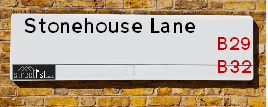
Map of Stonehouse Lane
| Street Crime (updated 14/01/2025) | ||
|---|---|---|
| Location Note | Central Point of Street - Not Actual Location | |
| MSOA Info | For MSOAs E02001920, E02001921 (Statistical Neighbourhood) | |
| Click Hint | Click on a Circle for a detailed breakdown below map. | |
| Crime Levels |
Green = Very Low Yellow = Low Orange = High Red = Very High |
|
| Postcodes | ||
| Icon | Postcodes for Stonehouse Lane | |
| Walking Distances | ||
| Distance Info | Green Circle = 10 Minutes Walk (800 metres) | |
Street Crime Data accessed from data.police.uk on 06/10/2024.
Moving to Stonehouse Lane?
I can help you uncover potential pitfalls and provide key questions to ask about your new property. With decades of experience as a Local Land Charges Manager, I offer confidential insights to make your move informed and stress-free.
This service is free, but you may wish to make an optional donation to support it. Please include the property name and address in your request as well as anything you wish to focus on.
Contact Me
Do you know why this road is called Stonehouse Lane?
What's it like to live here?
Share a Photo of Stonehouse Lane
Ask the community a question.
Do you have any questions, memories to share, have any photos or know any facts? We'd love to know more.
Submit Your Comment
Find Homes to Rent in Birmingham

Budget Friendly Hotels near Stonehouse Lane
| Budget Hotel Name | Distance (miles) |
|---|---|
|
1: Name:Travelodge Birmingham Frankley M5 Southbound Address: Moto Service Area, Illey Ln, M5 Motorway, Frankley, Birmingham, B32 4AR Telephone: 0871 984 6067 Visit Hotel Page |
1.78 |
|
2: Name:Premier Inn Birmingham Central Hagley Road Address: 176 - 184 Hagley Road Telephone: Visit Hotel Page |
2.53 |
|
3: Name:Travelodge Birmingham Halesowen Address: Whitehall Rd, Birmingham, B63 3HY Telephone: 0871 984 6488 Visit Hotel Page |
2.85 |
|
4: Name:Travelodge Birmingham Central Broadway Plaza Address: 220 Ladywood Middleway, Birmingham, B16 8LP Telephone: 0871 984 6325 Visit Hotel Page |
3.26 |
|
5: Name:Premier Inn Birmingham South Longbridge Station Address: 1 High Street Telephone: Visit Hotel Page |
3.34 |
Hotel Options
Your support helps keep this site running!
If you enjoy using this website, consider making a donation to help me cover hosting costs.
EPC (Energy Performance Certificate) Information for Stonehouse Lane
UPRN: 100070526128
EPC Current: C
EPC Potential: B
Habitable Rooms: 5
Property Type: House
Tenure: Owner-occupied
Built Form: Mid-Terrace
Age Band: 1967-1975
Mains Gas: Yes
UPRN: 10093616629
EPC Current: B
EPC Potential: A
Habitable Rooms: N/A
Property Type: House
Tenure: Owner-occupied
Built Form: Detached
Age Band: U
Mains Gas: Unknown
UPRN: 100070526130
EPC Current: C
EPC Potential: B
Habitable Rooms: 5
Property Type: House
Tenure: Owner-occupied
Built Form: End-Terrace
Age Band: 1967-1975
Mains Gas: Yes
UPRN: 10093616630
EPC Current: B
EPC Potential: A
Habitable Rooms: N/A
Property Type: House
Tenure: Owner-occupied
Built Form: Detached
Age Band: U
Mains Gas: Unknown
UPRN: 10093616631
EPC Current: B
EPC Potential: A
Habitable Rooms: N/A
Property Type: House
Tenure: Owner-occupied
Built Form: Detached
Age Band: U
Mains Gas: Unknown
UPRN: 100070526132
EPC Current: C
EPC Potential: B
Habitable Rooms: 5
Property Type: House
Tenure: Owner-occupied
Built Form: Mid-Terrace
Age Band: 1967-1975
Mains Gas: Yes
UPRN: 100070526136
EPC Current: D
EPC Potential: B
Habitable Rooms: 4
Property Type: House
Tenure: Owner-occupied
Built Form: Semi-Detached
Age Band: 1983-1990
Mains Gas: Yes
UPRN: 100070526137
EPC Current: F
EPC Potential: B
Habitable Rooms: 3
Property Type: House
Tenure: Owner-occupied
Built Form: Semi-Detached
Age Band: 1976-1982
Mains Gas: Yes
UPRN: 100070526138
EPC Current: E
EPC Potential: B
Habitable Rooms: 3
Property Type: House
Tenure: Owner-occupied
Built Form: Semi-Detached
Age Band: 1983-1990
Mains Gas: Yes
UPRN: 100070526139
EPC Current: C
EPC Potential: B
Habitable Rooms: 4
Property Type: House
Tenure: Owner-occupied
Built Form: Semi-Detached
Age Band: 1983-1990
Mains Gas: Yes
UPRN: 100070526140
EPC Current: D
EPC Potential: C
Habitable Rooms: 4
Property Type: House
Tenure: Owner-occupied
Built Form: Semi-Detached
Age Band: 1983-1990
Mains Gas: Yes
UPRN: 100070526141
EPC Current: C
EPC Potential: B
Habitable Rooms: 5
Property Type: House
Tenure: Owner-occupied
Built Form: Semi-Detached
Age Band: 1983-1990
Mains Gas: Yes
UPRN: 100070526142
EPC Current: D
EPC Potential: B
Habitable Rooms: 3
Property Type: House
Tenure: Rented (private)
Built Form: Semi-Detached
Age Band: 1991-1995
Mains Gas: Yes
UPRN: 100070526143
EPC Current: E
EPC Potential: C
Habitable Rooms: 3
Property Type: House
Tenure: rental (private)
Built Form: Semi-Detached
Age Band: 1983-1990
Mains Gas: Yes
UPRN: 100070526144
EPC Current: D
EPC Potential: B
Habitable Rooms: 3
Property Type: House
Tenure: Owner-occupied
Built Form: Semi-Detached
Age Band: 1991-1995
Mains Gas: Yes
UPRN: 100070526145
EPC Current: D
EPC Potential: B
Habitable Rooms: 3
Property Type: House
Tenure: Owner-occupied
Built Form: Semi-Detached
Age Band: 1983-1990
Mains Gas: Yes
UPRN: 100070526147
EPC Current: C
EPC Potential: B
Habitable Rooms: 5
Property Type: House
Tenure: Owner-occupied
Built Form: Semi-Detached
Age Band: 2003-2006
Mains Gas: Yes
UPRN: 100070526149
EPC Current: D
EPC Potential: B
Habitable Rooms: 4
Property Type: House
Tenure: rental (private)
Built Form: Semi-Detached
Age Band: 1983-1990
Mains Gas: Yes
UPRN: 100070526150
EPC Current: C
EPC Potential: B
Habitable Rooms: 4
Property Type: House
Tenure: Owner-occupied
Built Form: Semi-Detached
Age Band: 1983-1990
Mains Gas: Yes
UPRN: 100070526151
EPC Current: C
EPC Potential: C
Habitable Rooms: 5
Property Type: House
Tenure: Owner-occupied
Built Form: Semi-Detached
Age Band: 1983-1990
Mains Gas: Yes
UPRN: 100070526152
EPC Current: E
EPC Potential: B
Habitable Rooms: 4
Property Type: House
Tenure: rental (social)
Built Form: End-Terrace
Age Band: 1900-1929
Mains Gas: Yes
UPRN: 100070526154
EPC Current: D
EPC Potential: B
Habitable Rooms: 3
Property Type: House
Tenure: Rented (social)
Built Form: Mid-Terrace
Age Band: 1900-1929
Mains Gas: Yes
UPRN: 100070526157
EPC Current: D
EPC Potential: B
Habitable Rooms: 3
Property Type: House
Tenure: rental (social)
Built Form: End-Terrace
Age Band: before 1900
Mains Gas: Yes
UPRN: 100070526158
EPC Current: D
EPC Potential: B
Habitable Rooms: 4
Property Type: House
Tenure: Owner-occupied
Built Form: Mid-Terrace
Age Band: 1900-1929
Mains Gas: Yes
UPRN: 100070526159
EPC Current: D
EPC Potential: C
Habitable Rooms: 5
Property Type: House
Tenure: Owner-occupied
Built Form: Mid-Terrace
Age Band: 1900-1929
Mains Gas: Yes
UPRN: 100070526160
EPC Current: D
EPC Potential: B
Habitable Rooms: 4
Property Type: House
Tenure: rental (social)
Built Form: Mid-Terrace
Age Band: 1900-1929
Mains Gas: Yes
UPRN: 100070526161
EPC Current: D
EPC Potential: C
Habitable Rooms: 4
Property Type: House
Tenure: Owner-occupied
Built Form: End-Terrace
Age Band: before 1900
Mains Gas: Yes
UPRN: 100070526162
EPC Current: D
EPC Potential: D
Habitable Rooms: 4
Property Type: House
Tenure: Owner-occupied
Built Form: Mid-Terrace
Age Band: 1950-1966
Mains Gas: Yes
UPRN: 100070526164
EPC Current: D
EPC Potential: B
Habitable Rooms: 4
Property Type: House
Tenure: rental (private)
Built Form: Mid-Terrace
Age Band: 1900-1929
Mains Gas: Yes
UPRN: 100070526165
EPC Current: D
EPC Potential: B
Habitable Rooms: 3
Property Type: House
Tenure: Owner-occupied
Built Form: Mid-Terrace
Age Band: 1900-1929
Mains Gas: Yes
UPRN: 100070526166
EPC Current: D
EPC Potential: B
Habitable Rooms: 4
Property Type: House
Tenure: rental (private)
Built Form: Mid-Terrace
Age Band: 1900-1929
Mains Gas: Yes
UPRN: 100070526167
EPC Current: D
EPC Potential: B
Habitable Rooms: 4
Property Type: House
Tenure: Owner-occupied
Built Form: Mid-Terrace
Age Band: before 1900
Mains Gas: Yes
UPRN: 100070526168
EPC Current: D
EPC Potential: B
Habitable Rooms: 4
Property Type: House
Tenure: Rented (private)
Built Form: Mid-Terrace
Age Band: 1930-1949
Mains Gas: Yes
UPRN: 100070526169
EPC Current: D
EPC Potential: B
Habitable Rooms: 3
Property Type: House
Tenure: Rented (private)
Built Form: Mid-Terrace
Age Band: 1900-1929
Mains Gas: Yes
UPRN: 100070526170
EPC Current: D
EPC Potential: B
Habitable Rooms: 4
Property Type: House
Tenure: rental (private)
Built Form: Mid-Terrace
Age Band: 1900-1929
Mains Gas: Yes
UPRN: 100070526171
EPC Current: D
EPC Potential: B
Habitable Rooms: 4
Property Type: House
Tenure: rental (private)
Built Form: Mid-Terrace
Age Band: before 1900
Mains Gas: Yes
UPRN: 100070526172
EPC Current: D
EPC Potential: B
Habitable Rooms: 5
Property Type: House
Tenure: Rented (private)
Built Form: Mid-Terrace
Age Band: 1900-1929
Mains Gas: Yes
UPRN: 100070526173
EPC Current: D
EPC Potential: B
Habitable Rooms: 3
Property Type: House
Tenure: Not defined - use in the case of a new dwelling fo
Built Form: Mid-Terrace
Age Band: 1900-1929
Mains Gas: Yes
UPRN: 100070526175
EPC Current: D
EPC Potential: D
Habitable Rooms: 5
Property Type: House
Tenure: Owner-occupied
Built Form: Mid-Terrace
Age Band: 1900-1929
Mains Gas: Yes
UPRN: 100070526176
EPC Current: D
EPC Potential: B
Habitable Rooms: 4
Property Type: House
Tenure: Owner-occupied
Built Form: Mid-Terrace
Age Band: before 1900
Mains Gas: Yes
UPRN: 100070526177
EPC Current: E
EPC Potential: B
Habitable Rooms: 3
Property Type: House
Tenure: Owner-occupied
Built Form: End-Terrace
Age Band: before 1900
Mains Gas: Yes
UPRN: 100070526178
EPC Current: E
EPC Potential: D
Habitable Rooms: 5
Property Type: House
Tenure: Owner-occupied
Built Form: Semi-Detached
Age Band: 1930-1949
Mains Gas: Yes
UPRN: 100070526181
EPC Current: E
EPC Potential: C
Habitable Rooms: 5
Property Type: House
Tenure: Owner-occupied
Built Form: Semi-Detached
Age Band: 1930-1949
Mains Gas: Yes
UPRN: 100070526182
EPC Current: D
EPC Potential: B
Habitable Rooms: 5
Property Type: House
Tenure: Owner-occupied
Built Form: Semi-Detached
Age Band: 1930-1949
Mains Gas: Yes
UPRN: 100070526183
EPC Current: D
EPC Potential: B
Habitable Rooms: 5
Property Type: House
Tenure: Owner-occupied
Built Form: Semi-Detached
Age Band: 1930-1949
Mains Gas: Yes
UPRN: 100070526185
EPC Current: E
EPC Potential: D
Habitable Rooms: 4
Property Type: House
Tenure: Owner-occupied
Built Form: Semi-Detached
Age Band: 1930-1949
Mains Gas: Yes
UPRN: 100070526187
EPC Current: D
EPC Potential: B
Habitable Rooms: 5
Property Type: House
Tenure: Owner-occupied
Built Form: Semi-Detached
Age Band: 1930-1949
Mains Gas: Yes
UPRN: 100070526189
EPC Current: E
EPC Potential: B
Habitable Rooms: 4
Property Type: House
Tenure: Owner-occupied
Built Form: Semi-Detached
Age Band: 1930-1949
Mains Gas: Yes
UPRN: 100070526190
EPC Current: D
EPC Potential: B
Habitable Rooms: 4
Property Type: House
Tenure: Owner-occupied
Built Form: Semi-Detached
Age Band: 1930-1949
Mains Gas: Yes
UPRN: 100070526191
EPC Current: D
EPC Potential: B
Habitable Rooms: 5
Property Type: House
Tenure: Rented (private)
Built Form: Semi-Detached
Age Band: 1930-1949
Mains Gas: Yes
UPRN: 100070526193
EPC Current: D
EPC Potential: C
Habitable Rooms: 5
Property Type: Bungalow
Tenure: Owner-occupied
Built Form: Semi-Detached
Age Band: 1950-1966
Mains Gas: Yes
UPRN: 100070526196
EPC Current: D
EPC Potential: B
Habitable Rooms: 4
Property Type: Bungalow
Tenure: Owner-occupied
Built Form: Detached
Age Band: 1950-1966
Mains Gas: Yes
UPRN: 100070526197
EPC Current: G
EPC Potential: B
Habitable Rooms: 4
Property Type: Bungalow
Tenure: Owner-occupied
Built Form: Detached
Age Band: 1930-1949
Mains Gas: Yes
UPRN: 100070526198
EPC Current: E
EPC Potential: C
Habitable Rooms: 4
Property Type: Bungalow
Tenure: Owner-occupied
Built Form: Detached
Age Band: 1950-1966
Mains Gas: Yes
UPRN: 100070526199
EPC Current: C
EPC Potential: B
Habitable Rooms: 7
Property Type: House
Tenure: Owner-occupied
Built Form: Detached
Age Band: 1930-1949
Mains Gas: Yes
UPRN: 100070526200
EPC Current: C
EPC Potential: C
Habitable Rooms: 4
Property Type: House
Tenure: Owner-occupied
Built Form: End-Terrace
Age Band: 1950-1966
Mains Gas: Yes
UPRN: 100070526202
EPC Current: D
EPC Potential: B
Habitable Rooms: 3
Property Type: House
Tenure: rental (private)
Built Form: Mid-Terrace
Age Band: 1930-1949
Mains Gas: Yes
UPRN: 100070526204
EPC Current: D
EPC Potential: C
Habitable Rooms: 4
Property Type: House
Tenure: rental (private)
Built Form: End-Terrace
Age Band: 1950-1966
Mains Gas: Yes
UPRN: 100070526206
EPC Current: C
EPC Potential: C
Habitable Rooms: 3
Property Type: House
Tenure: rental (social)
Built Form: Mid-Terrace
Age Band: 1950-1966
Mains Gas: Yes
UPRN: 100070526209
EPC Current: E
EPC Potential: C
Habitable Rooms: 6
Property Type: House
Tenure: Owner-occupied
Built Form: Semi-Detached
Age Band: 1900-1929
Mains Gas: Yes
UPRN: 100070526210
EPC Current: D
EPC Potential: B
Habitable Rooms: 4
Property Type: House
Tenure: Owner-occupied
Built Form: Semi-Detached
Age Band: 1950-1966
Mains Gas: Yes
UPRN: 100070526211
EPC Current: D
EPC Potential: C
Habitable Rooms: 5
Property Type: House
Tenure: Owner-occupied
Built Form: Semi-Detached
Age Band: 1930-1949
Mains Gas: Yes
UPRN: 100070526212
EPC Current: D
EPC Potential: B
Habitable Rooms: 4
Property Type: House
Tenure: Owner-occupied
Built Form: Semi-Detached
Age Band: 1950-1966
Mains Gas: Yes
UPRN: 100070526213
EPC Current: D
EPC Potential: B
Habitable Rooms: 5
Property Type: House
Tenure: rental (social)
Built Form: Semi-Detached
Age Band: 1930-1949
Mains Gas: Yes
UPRN: 100070526214
EPC Current: D
EPC Potential: B
Habitable Rooms: 5
Property Type: House
Tenure: Owner-occupied
Built Form: Mid-Terrace
Age Band: 1950-1966
Mains Gas: Yes
UPRN: 100070526216
EPC Current: C
EPC Potential: C
Habitable Rooms: 4
Property Type: House
Tenure: rental (social)
Built Form: Mid-Terrace
Age Band: 1950-1966
Mains Gas: Yes
UPRN: 100070526217
EPC Current: E
EPC Potential: C
Habitable Rooms: 7
Property Type: House
Tenure: Owner-occupied
Built Form: Mid-Terrace
Age Band: 1950-1966
Mains Gas: Yes
UPRN: 100070526222
EPC Current: C
EPC Potential: C
Habitable Rooms: 3
Property Type: House
Tenure: Owner-occupied
Built Form: Mid-Terrace
Age Band: 1950-1966
Mains Gas: Yes
UPRN: 100070526224
EPC Current: D
EPC Potential: C
Habitable Rooms: 6
Property Type: House
Tenure: Owner-occupied
Built Form: Mid-Terrace
Age Band: 1950-1966
Mains Gas: Yes
UPRN: 100070526226
EPC Current: E
EPC Potential: D
Habitable Rooms: 2
Property Type: House
Tenure: rental (social)
Built Form: End-Terrace
Age Band: 1967-1975
Mains Gas: Yes
UPRN: 100070526227
EPC Current: D
EPC Potential: D
Habitable Rooms: 5
Property Type: House
Tenure: rental (social)
Built Form: End-Terrace
Age Band: 1930-1949
Mains Gas: Yes
UPRN: 100070526228
EPC Current: D
EPC Potential: B
Habitable Rooms: 3
Property Type: House
Tenure: rental (private)
Built Form: End-Terrace
Age Band: 1950-1966
Mains Gas: Yes
UPRN: 100070526229
EPC Current: D
EPC Potential: B
Habitable Rooms: 5
Property Type: House
Tenure: Owner-occupied
Built Form: Semi-Detached
Age Band: 1930-1949
Mains Gas: Yes
UPRN: 100070526232
EPC Current: D
EPC Potential: B
Habitable Rooms: 4
Property Type: House
Tenure: Owner-occupied
Built Form: Mid-Terrace
Age Band: 1950-1966
Mains Gas: Yes
UPRN: 100070526234
EPC Current: D
EPC Potential: B
Habitable Rooms: 4
Property Type: House
Tenure: Owner-occupied
Built Form: Mid-Terrace
Age Band: 1930-1949
Mains Gas: Yes
UPRN: 100070526235
EPC Current: D
EPC Potential: B
Habitable Rooms: 4
Property Type: House
Tenure: Owner-occupied
Built Form: Semi-Detached
Age Band: 1930-1949
Mains Gas: Yes
UPRN: 100070526236
EPC Current: C
EPC Potential: B
Habitable Rooms: 5
Property Type: House
Tenure: Owner-occupied
Built Form: Mid-Terrace
Age Band: 1950-1966
Mains Gas: Yes
UPRN: 100070526238
EPC Current: D
EPC Potential: B
Habitable Rooms: 4
Property Type: House
Tenure: Owner-occupied
Built Form: Semi-Detached
Age Band: 1950-1966
Mains Gas: Yes
UPRN: 100070526239
EPC Current: E
EPC Potential: E
Habitable Rooms: 4
Property Type: House
Tenure: Owner-occupied
Built Form: Semi-Detached
Age Band: 1900-1929
Mains Gas: Yes
UPRN: 100070526240
EPC Current: E
EPC Potential: C
Habitable Rooms: 6
Property Type: House
Tenure: Owner-occupied
Built Form: Semi-Detached
Age Band: 1930-1949
Mains Gas: Yes
UPRN: 100070526241
EPC Current: D
EPC Potential: D
Habitable Rooms: 6
Property Type: House
Tenure: rental (social)
Built Form: Mid-Terrace
Age Band: 1930-1949
Mains Gas: Yes
UPRN: 100070526243
EPC Current: C
EPC Potential: B
Habitable Rooms: 6
Property Type: House
Tenure: Owner-occupied
Built Form: End-Terrace
Age Band: 1930-1949
Mains Gas: Yes
UPRN: 100070526246
EPC Current: E
EPC Potential: B
Habitable Rooms: 5
Property Type: House
Tenure: Owner-occupied
Built Form: Semi-Detached
Age Band: 1930-1949
Mains Gas: Yes
House Sales
| Year | High | Low | Average | Sales |
|---|---|---|---|---|
| 2014 | £120,000 | £139,950 | £129,590 | 5 |
| 2015 | £125,000 | £125,000 | £125,000 | 1 |
| 2016 | £111,000 | £300,000 | £132,400 | 5 |
| 2017 | £125,000 | £365,000 | £200,969 | 13 |
| 2018 | £78,000 | £143,000 | £126,779 | 7 |
| 2019 | £144,000 | £185,000 | £164,500 | 2 |
| 2020 | £140,000 | £190,000 | £140,429 | 7 |
| 2021 | £135,000 | £232,000 | £186,500 | 4 |
| 2022 | £236,000 | £290,000 | £235,500 | 6 |
| 2023 | £238,000 | £237,302 | £237,651 | 2 |
| 2024 | £183,000 | £280,000 | £231,500 | 2 |
Contains HM Land Registry data © Crown copyright and database right 2025. This data is licensed under the Open Government Licence v3.0.
Nearby Estate Agents
| Name | Address | Website |
|---|---|---|
| Warwick Place | Links View & Duncan Smith House, Warwick Place,100 Ferncliffe Road, Harborne, Birmingham, B17 0QH | Visit Website |
| Douglas Smart Move | 364-366 High Street, Harborne, Birmingham,B17 9PY | Visit Website |
| Trueman Estates | 33 Lordswood Road, Harborne, Birmingham,B17 9RP | Visit Website |
| MECS Sales & Lettings | 2-4 Lonsdale Road, Harborne, Birmingham,B17 9RA | Visit Website |
| MECS Sales & Lettings | 318 High Street Harborne Birmingham B17 9PU | Visit Website |
Neighbourhood Policing |
| Police Force: West Midlands |
 View Neighbourhood Crime and Policing View Neighbourhood Crime and Policing |
| Find a Local Neighbourhood Watch Scheme |
Location Details
| Stonehouse Lane | |
|---|---|

| |
| Latitude | 52.443770 |
| Longitude | -1.980818 |
| OS Easting (X): | 401303 |
| OS Northing (Y): | 282908 |
| OS Grid Reference: | SP013829 |
Known Residential Addresses for Stonehouse Lane
- 314
- 312
- 310
- 25
- 21
- 23
- STONEHOUSE FARM
- 182
- THE STONEHOUSE
- 329
- 365
- 353
- 327
- 296
- 328
- 294
- 308
- 276
- 280
- 270
- 356
- 278
- 41
- 61
- 31
- 39
- 33
- 63
- 37
- 143
- 158
- 166
- 174
- 168
- 142
- 162
- 164
- 354
- 318
- 320
- 340
- 350
- 322
- 51
- 49
- 6
- 22
Roads that have a Junction with Stonehouse Lane
| Street | Junction Type |
|---|---|
| Simmons Leasow | junction |
| Sommerfield Road | junction |
| Mill Lane | junction |
| Sommerfield Road | junction |
| Clapgate Lane | junction |
| West Boulevard (B4121) | roundabout |
| Barnes Hill (B4121) | roundabout |
| California Way | pseudo node |
| Stonehouse Hill | junction |
| Harts Green Close | junction |
| Ullswater Close | junction |
| Blakemore Close | junction |
Sunset and Sunrise times
| Sunrise | 07:45 |
|---|---|
| Sunset | 16:58 |
Latest Weather Conditions
| Observed at Weather Station: | Coleshill 2 February 2025 at 03:00 (12.54 miles away) |
|---|---|
| Current Weather: | Overcast |
| Temperature and Humidity: | 4.0°C (82.9%) |
| Wind Direction and Speed: | S (11 mph) |
Population Statistics
| ONS Area Code | E00045288, E00045286, E00045279 & E00048095 |
|---|---|
| ONS Area Name | Private Renting Young Families, Multi-Ethnic Professionals with Families & Achieving Minorities |
| Average Age | 36.48, 38.93 & 36.02 |
| Area Population | 1726.00, 1577.00 & 1536.00 |
| Male Population | 789.00, 756.00 & 709.00 (47%) |
| Female Population | 937.00, 821.00 & 827.00 (53%) |
| Benefit Claimants | 91, 56 & 74 (5%) |
| LSOA Code: | E01008918, E01008919 &E01009500 |
|---|---|
| LSOA Name: | Birmingham 094A, Birmingham 095A &Birmingham 095E |
| SOA Code: | 4c, 3d &7a |
| SOA Name: | |
| MSOA Code: | E02001920 &E02001921 |
| MSOA Name: | Birmingham 094 &Birmingham 095 |
Nearest Supermarkets
| Asda Barnes Hill |
|---|
| 51 Barnes Hill, Birmingham, B29 5UP |
| 0121 296 0654 |
| Distance: 0.1 Miles |
| Directions to Asda Barnes Hill |
| Tesco Quinton Superstore |
|---|
| Ridgacre Rd, Quinton, Birmingham, B32 1EG |
| 0345 026 9520 |
| Distance: 1.29 Miles |
| Directions to Tesco Quinton Superstore |
| Waitrose Harborne |
|---|
| 210 High Street, Harborne, Birmingham, West Midlands, B17 9PP |
| 0121 428 4044 |
| Distance: 1.65 Miles |
| Directions to Waitrose Harborne |
| Sainsburys Selly Oak Boulevard |
|---|
| 19 Selly Oak Shopping Park, Aston Webb Boulevard, Birmingham, England, B29 6SJ |
| 0121 623 7040 |
| Distance: 1.76 Miles |
| Directions to Sainsburys Selly Oak Boulevard |
Telephone Information
| Area Code |
|---|
| Area Code: 0121 - Birmingham |
| Area Code: 01384 - Dudley |
Broadband Information
| Speed | Average Speed | Median Speed | Maximum Speed | Next-generation access (NGA) | Number of Connections |
|---|---|---|---|---|---|
| Greater than 2 Mbps | 13.7 | 13.7 | 20 | Y | 3 |
Local Government
| Local Council Details |
|---|
| Within the area of Birmingham |
| Visit the Council's Website |
| Council House, Victoria Square, Birmingham &B1 1BB |
| Send email |
| Telephone Number: 0121 303 1111 |
| Local Member of Parliament |
|---|
| Within the Westminster Parliamentary Constituency of Birmingham &Edgbaston |
| The Member of Parliament is Preet Kaur Gill &Laurence Turner |
| Details for the MP Preet Kaur Gill &Laurence Turner on parliament.uk |
| Details for the MP Preet Kaur Gill &Laurence Turner on theyworkforyou.com |
| In the 2024 General Election Preet Kaur Gill &Laurence Turner won with a majority of 8,368 the result was Lab hold &Lab gain from Con. The total electorate was 71,787 |
| Wards, Parish Councils and County Councils |
|---|
| Ward: Bartley Green &Weoley & Selly Oak Ward |
| Parish: Unparished area |
| Ceremonial County: West Midlands |
Nearest Schools
England Primary Schools
Water Mill Primary School
Address: Water Mill Primary School, Water Mill Close, Selly Oak, Birmingham, West Midlands, B29 6TS
Distance: 1.38 miles
Contact: 01214647769
Harborne Primary School
Address: Harborne Primary School, Station Road, Harborne, Birmingham, West Midlands, B17 9LU
Distance: 1.55 miles
Contact: 01214642705
St Mary's Catholic Primary School
Address: St Mary's Catholic Primary School, Vivian Road, Harborne, Birmingham, West Midlands, B17 0DN
Distance: 1.46 miles
Contact: 01214642141
St Peters CofE Primary School
Address: St Peters CofE Primary School, Old Church Road, Harborne, Birmingham, West Midlands, B17 0BE
Distance: 1.18 miles
Contact: 01214642128
Princethorpe Infant School
Address: Princethorpe Infant School, Princethorpe Road, Weoley Castle, Birmingham, West Midlands, B29 5QB
Distance: 0.74 miles
Contact:
Princethorpe Junior School
Address: Princethorpe Junior School, Princethorpe Road, Weoley Castle, Birmingham, West Midlands, B29 5QB
Distance: 0.74 miles
Contact:
Our Lady and St Rose of Lima Catholic Primary School
Address: Our Lady and St Rose of Lima Catholic Primary School, Gregory Avenue, Weoley Castle, Our Lady & St. Rose of Lima Catholic Primary Schoo, Birmingham, West Midlands, B29 5DY
Distance: 0.91 miles
Contact: 01214642283
Bellfield Junior School
Address: Bellfield Junior School, Vineyard Road, Northfield, Birmingham, West Midlands, B31 1PT
Distance: 1.91 miles
Contact: 01214642895
Bellfield Infant School (NC)
Address: Bellfield Infant School (NC), Vineyard Road, Birmingham, West Midlands, B31 1PT
Distance: 1.91 miles
Contact: 01214644855
Welsh House Farm Community School and Special Needs Resources Base
Address: Welsh House Farm Community School and Special Needs Resources Base, Welsh House Farm Road, Quinton, Birmingham, West Midlands, B32 2NG
Distance: 0.65 miles
Contact: 01214644355
Woodcock Hill Primary School
Address: Woodcock Hill Primary School, Farwood Road, Northfield, Birmingham, West Midlands, B31 1BS
Distance: 0.82 miles
Contact: 01216754130
World's End Infant and Nursery School
Address: World's End Infant and Nursery School, Worlds End Lane, Quinton, Birmingham, West Midlands, B32 2SA
Distance: 0.84 miles
Contact: 01214220453
World's End Junior School
Address: World's End Junior School, Worlds End Lane, Quinton, Birmingham, West Midlands, B32 2SA
Distance: 0.84 miles
Contact: 01214645913
Our Lady of Fatima Catholic Primary School
Address: Our Lady of Fatima Catholic Primary School, Winchfield Drive, Harborne, Birmingham, West Midlands, B17 8TR
Distance: 1.63 miles
Contact:
Lightwoods Primary School
Address: Lightwoods Primary School, Castle Road East, Oldbury, West Midlands, B68 9BG
Distance: 1.75 miles
Contact:
Northfield Manor Primary Academy
Address: Northfield Manor Primary Academy, Swarthmore Road, Selly Oak, Birmingham, West Midlands, B29 4JT
Distance: 1.29 miles
Contact: 01215940898
Princethorpe Infant School
Address: Princethorpe Infant School, Princethorpe Road, Weoley Castle, Birmingham, West Midlands, B29 5QB
Distance: 0.74 miles
Contact: 01214751083
Jervoise School
Address: Jervoise School, Jervoise Road, Weoley Castle, Birmingham, West Midlands, B29 5QU
Distance: 0.57 miles
Contact: 01214643233
Green Meadow Primary School
Address: Green Meadow Primary School, Green Meadow Road, Selly Oak, Birmingham, West Midlands, B29 4EE
Distance: 1.13 miles
Contact: 01214754505
Paganel Primary School
Address: Paganel Primary School, Swinford Road, Selly Oak, Birmingham, West Midlands, B29 5TG
Distance: 0.45 miles
Contact: 01214645040
The Orchards Primary Academy
Address: The Orchards Primary Academy, Rhayader Road, Northfield, Birmingham, West Midlands, B31 1TX
Distance: 1.74 miles
Contact: 01214644302
Nonsuch Primary School
Address: Nonsuch Primary School, Wood Leasow, Woodgate Valley, Birmingham, West Midlands, B32 3SE
Distance: 0.45 miles
Contact: 01214642064
Our Lady of Fatima Catholic Primary School
Address: Our Lady of Fatima Catholic Primary School, Winchfield Drive, Harborne, Birmingham, West Midlands, B17 8TR
Distance: 1.63 miles
Contact: 01214292900
Woodhouse Primary Academy
Address: Woodhouse Primary Academy, Woodhouse Road, Quinton, Birmingham, West Midlands, B32 2DL
Distance: 1.06 miles
Contact: 01214641769
St Michael's Church of England Primary School
Address: St Michael's Church of England Primary School, Nantmel Grove, Bartley Green, Birmingham, West Midlands, B32 3JS
Distance: 1.11 miles
Contact: 01214644345
St Hubert's Catholic Primary School
Address: St Hubert's Catholic Primary School, Wolverhampton Road, Oldbury, West Midlands, B68 0LP
Distance: 2.00 miles
Contact:
St Peter's Catholic Primary School
Address: St Peter's Catholic Primary School, Adams Hill, Bartley Green, Birmingham, West Midlands, B32 3QD
Distance: 0.95 miles
Contact: 01214646921
Warley Infant School
Address: Warley Infant School, Bleakhouse Road, Oldbury, West Midlands, B68 9DS
Distance: 2.28 miles
Contact:
Bleakhouse Primary School
Address: Bleakhouse Primary School, Bleakhouse Road, Oldbury, West Midlands, B68 9DS
Distance: 2.28 miles
Contact: 01214222841
Kitwell Primary School
Address: Kitwell Primary School, Wychbury Road, Bartley Green, Birmingham, West Midlands, B32 4DL
Distance: 1.49 miles
Contact: 01214760694
Woodgate Primary School
Address: Woodgate Primary School, Lutley Grove, Bartley Green, Birmingham, West Midlands, B32 3PN
Distance: 1.08 miles
Contact: 01214642315
Four Dwellings Primary Academy
Address: Four Dwellings Primary Academy, Quinton Road West, Quinton, Birmingham, West Midlands, B32 1PJ
Distance: 1.17 miles
Contact: 01215666666
Howley Grange Primary School
Address: Howley Grange Primary School, Howley Grange Road, Halesowen, West Midlands, B62 0HS
Distance: 1.63 miles
Contact: 01384685101
Lapal Primary School
Address: Lapal Primary School, Priory Road, Halesowen, West Midlands, B62 0BZ
Distance: 1.87 miles
Contact: 01384818200
Lapal Primary School
Address: Lapal Primary School, Priory Road, Halesowen, West Midlands, B62 0BZ
Distance: 1.87 miles
Contact:
Quinton Church Primary School
Address: Quinton Church Primary School, Hagley Road West, Quinton, Birmingham, West Midlands, B32 1AJ
Distance: 1.74 miles
Contact: 01216754422
Quinton Church Primary School
Address: Quinton Church Primary School, Hagley Road West, Quinton, Birmingham, West Midlands, B32 1AJ
Distance: 1.74 miles
Contact:
England Secondary Schools
Lordswood Girls' School and The Sixth Form Centre, Harborne A Specialist Media Arts College
Address: Lordswood Girls' School and The Sixth Form Centre, Harborne A Specialist Media Arts College, Knightlow Road, Harborne, Birmingham, West Midlands, B17 8QB
Distance: 1.88 miles
Contact:
Lordswood Boys' School
Address: Lordswood Boys' School, Hagley Road, Birmingham, West Midlands, B17 8BJ
Distance: 2.08 miles
Contact:
The University of Birmingham School
Address: The University of Birmingham School, Weoley Park Road, Selly Oak, Birmingham, B29 6QU
Distance: 1.46 miles
Contact: 01217965000
Shenley Academy
Address: Shenley Academy, Shenley Lane, Northfield, Birmingham, West Midlands, B29 4HE
Distance: 1.03 miles
Contact: 01214645191
King Edward VI Lordswood School for Girls
Address: King Edward VI Lordswood School for Girls, Knightlow Road, Harborne, Birmingham, West Midlands, B17 8QB
Distance: 1.88 miles
Contact: 01214292838
Hillcrest School and Sixth Form Centre
Address: Hillcrest School and Sixth Form Centre, Stonehouse Lane, Birmingham, West Midlands, B32 3AE
Distance: 0.15 miles
Contact: 01214643172
King Edward VI Five Ways School
Address: King Edward VI Five Ways School, Scotland Lane, Bartley Green, Birmingham, West Midlands, B32 4BT
Distance: 1.12 miles
Contact: 01214753535
King Edward VI Five Ways School
Address: King Edward VI Five Ways School, Scotland Lane, Bartley Green, Birmingham, West Midlands, B32 4BT
Distance: 1.12 miles
Contact:
Bartley Green School
Address: Bartley Green School, Adams Hill, Birmingham, West Midlands, B32 3QJ
Distance: 0.88 miles
Contact: 01214769246
Four Dwellings Academy
Address: Four Dwellings Academy, Dwellings Lane, Quinton, Birmingham, B32 1RJ
Distance: 1.24 miles
Contact: 01215666666
Nearest Hospitals
| Barberry |
|---|
| Address: 25 Vincent Drive, Birmingham, |
| NHS Sector |
| Birmingham and Solihull Mental Health NHS Foundation Trust |
| Telephone: 0121 301 2002 |
| Visit Hospital Website |
| Distance: 2.68 (miles) |
| Directions from to Barberry |
| Queen Elizabeth Hospital Birmingham |
|---|
| Address: Mindelsohn Way, Edgbaston, Birmingham, |
| NHS Sector |
| University Hospitals Birmingham NHS Foundation Trust |
| Telephone: 0121 371 2000 |
| Visit Hospital Website |
| Distance: 2.74 (miles) |
| Directions from to Queen Elizabeth Hospital Birmingham |
| Oleaster |
|---|
| Address: 6 Mindelsohn Crescent, Edgbaston, Birmingham, B15 2SY, |
| NHS Sector |
| Birmingham and Solihull Mental Health NHS Foundation Trust |
| Telephone: 0121 301 2200 |
| Visit Hospital Website |
| Distance: 2.75 (miles) |
| Directions from to Oleaster |
Nearest Dentists
Dentists
DENTAL SURGERY
Address: 267 BARNES HILL, BIRMINGHAM, WEST MIDLANDS, B29 5TX
Distance: 0.49 miles
Contact: :
JIGGINS LANE (DENTAL SURGERY)
Address: 17 JIGGINS LANE, BIRMINGHAM, WEST MIDLANDS, B32 3LE
Distance: 0.78 miles
Contact: :
ROOPRAI-ROOPRAI & ASSOCIATES
Address: 68 NORTHFIELD ROAD, HARBORNE, BIRMINGHAM, WEST MIDLANDS, B17 0SU
Distance: 0.95 miles
Contact: :
EURO DENTAL CARE
Address: 368 COURT OAK ROAD, HARBORNE, BIRMINGHAM, WEST MIDLANDS, B32 2DY
Distance: 1.15 miles
Contact: :
DENTAL SURGERY
Address: 12 CURDALE ROAD, BIRMINGHAM, WEST MIDLANDS, B32 4HB
Distance: 1.26 miles
Contact: :
DENTAL SURGERY
Address: 1 ST. PETERS ROAD, HARBORNE, BIRMINGHAM, WEST MIDLANDS, B17 0AT
Distance: 1.32 miles
Contact: :
Nearest GP Surgeries
Doctors
WOODGATE VALLEY HEALTH CENTRE
Address: 61 STEVENS AVENUE, WOODGATE, BIRMINGHAM, WEST MIDLANDS, B32 3SD
Distance: 0.45 miles
Contact: tel: 0121 4260088
WOODGATE VALLEY PRACTICE - COVID LOCAL VACCINATION SERVICE 2
Address: 61 STEVENS AVENUE, BIRMINGHAM, B32 3SD
Distance: 0.45 miles
Contact: :
MILLENNIUM MEDICAL CENTRE
Address: 121 WEOLEY CASTLE ROAD, WEOLEY CASTLE, BIRMINGHAM, WEST MIDLANDS, B29 5QD
Distance: 0.72 miles
Contact: tel: 0121 4275201
JIGGINS LANE MEDICAL CENTRE
Address: 17 JIGGINS LANE, BARTLEY GREEN, BIRMINGHAM, WEST MIDLANDS, B32 3LE
Distance: 0.78 miles
Contact: tel: 0121 4777272
QUINBORNE MEDICAL PRACTICE
Address: SELCROFT AVENUE, QUINTON, BIRMINGHAM, WEST MIDLANDS, B32 2BX
Distance: 0.84 miles
Contact: :
BARTLEY GREEN MEDICAL PRACTICE
Address: 71 ROMSLEY ROAD, BARTLEY GREEN, BIRMINGHAM, WEST MIDLANDS, B32 3PR
Distance: 1.07 miles
Contact: tel: 0121 4774300
Nearest Dispensing Chemists
Pharmacies
BOOTS
Address: 61 STEVENS AVENUE, BIRMINGHAM, WEST MIDLANDS, B32 3SD
Distance: 0.45 miles
Contact: tel: 0121 4263773
DEAN PHARMACY
Address: 175 WEOLEY CASTLE ROAD, SELLY OAK, BIRMINGHAM, B29 5QH
Distance: 0.57 miles
Contact: tel: 01214 271851
CASTLE CHEMIST
Address: 104 WEOLEY CASTLE ROAD, SELLY OAK, BIRMINGHAM, B29 5PT
Distance: 0.69 miles
Contact: tel: 01214 751822
KINGS PHARMACY
Address: 118-120 WEOLEY CASTLE ROAD, BIRMINGHAM, WEST MIDLANDS, B29 5PT
Distance: 0.69 miles
Contact: tel: 0121 4777756
KNIGHTS JIGGINS LANE PHARMACY
Address: 17 JIGGINS LANE, BARTLEY GREEN, BIRMINGHAM, B32 3LE
Distance: 0.78 miles
Contact: tel: 01214 751654
SELCROFT PHARMACY
Address: SELCROFT AVENUE, QUINTON, BIRMINGHAM, WEST MIDLANDS, B32 2BX
Distance: 0.84 miles
Contact: tel: 0121 4276060
Nearest Opticians
Opticians
4376 BARNSHILL
Address: ASDA STORES LTD, 51 BARNES HILL, BIRMINGHAM, WEST MIDLANDS, B29 5UP
Distance: 0.09 miles
Contact: :
SCRIVENS OPTICIANS (WEOLEY CASTLE)
Address: 167 WEOLEY CASTLE ROAD, WEOLEY CASTLE, BIRMINGHAM, WEST MIDLANDS, B29 5QH
Distance: 0.57 miles
Contact: :
ONE VISION ICARE LTD
Address: 130 CASTLE SQUARE, WEOLEY CASTLE, BIRMINGHAM, WEST MIDLANDS, B29 5QL
Distance: 0.59 miles
Contact: :
ALBRIGHT OPTOMETRISTS
Address: 90 WEOLEY CASTLE ROAD, WEOLEY CASTLE, BIRMINGHAM, WEST MIDLANDS, B29 5PT
Distance: 0.69 miles
Contact: :
KNIGHTS OPHTHALMIC OPTICIANS
Address: 191 WEOLEY AVENUE, SELLY OAK, BIRMINGHAM, WEST MIDLANDS, B29 6PU
Distance: 1.01 miles
Contact: :
QUINTON LANE CARE CENTRE
Address: 27 QUINTON LANE, BIRMINGHAM, WEST MIDLANDS, B32 2TR
Distance: 1.23 miles
Contact: :
Transport
Nearest Rail Stations
Selly Oak Station is 1.90 miles away.
Address: Selly Oak station, Bristol Road, Selly Oak, West Midlands, B29 6DW
Selly Oak is situated on the Bristol to Brimingham Line.
Selly Oak Station is staffed on a part time basis.
University (Birmingham) Station is 1.93 miles away.
Address: University station, University Road West, Edgbaston, West Midlands, B15 2FB
University (Birmingham) is situated on the Bristol to Brimingham Line.
University (Birmingham) Station is staffed on a part time basis.