Groveley Lane in Rednal in the city of BIRMINGHAM in the city of BIRMINGHAM
About Groveley Lane
Groveley Lane is a street located in the city of Birmingham. The street has a length of approximately 3,904 metres.
Crime & Historic Map of Groveley Lane
This interactive map displays both historic mapping and street crime data. Click on a circle to view crime statistics, and use the button above to toggle the 1900s historic map.
This interactive map allows you to **zoom and pan** for a better view of the data.
- Use the + and - buttons on the map to zoom in and out.
- Scroll with your **middle mouse wheel** to zoom in and out.
- On a **mobile device**, use **pinch and zoom gestures** to navigate the map.
- Click on crime markers for more details.


| Street Crime (updated 07/02/2025) | ||
|---|---|---|
| Location Note | Central Point of Street - Not Actual Location | |
| MSOA Info | For MSOAs E02001955, E02006701, E02001957 (Statistical Neighbourhood) | |
| Click Hint | Click on a Circle for a detailed breakdown below map. | |
| Crime Levels |
Green = Very Low Yellow = Low Orange = High Red = Very High |
|
| Postcodes | ||
| Icon | Postcodes for Groveley Lane | |
| Walking Distances | ||
| Distance Info | Green Circle = 10 Minutes Walk (800 metres) | |
Street Crime Data accessed from data.police.uk on 07/02/2025.
The street is located within the Birmingham District (B) and Bromsgrove District Council's jurisdiction. They provide various services, like refuse collection, and manage council tax collection. It's situated in the West Midlands region of the UK.
The road has been assigned the Unique Street Reference Numbers of 2751496, 2759150, 4700461, 2700840 and 2700939 in the National Street Gazetteer.
The street has the postcodes of B45 8UQ, B45 8UG, B45 8UF, B45 8UD, B45 8UB, B45 8UA, B31 4QQ, B31 4QH, B31 4QG, B31 4QF, B31 4QE, B31 4QD, B31 4QB, B31 4QA, B31 4PZ, B31 4PS, B31 2GR and B31 4PT.
It is located within the county of West Midlands, situated in the West Midlands region of the UK. It's 100.81 miles North West from central London., 7.2 miles South West from Birmingham, 16.83 miles North East from Worcester and 20.01 miles West from Coventry.
GROVELEY LANE is within the Post Town of BIRMINGHAM
Moving to Groveley Lane?
I can help you uncover potential pitfalls and provide key questions to ask about your new property. With decades of experience as a Local Land Charges Manager, I offer confidential insights to make your move informed and stress-free.
This service is free, but you may wish to make an optional donation to support it. Please include the property name and address in your request as well as anything you wish to focus on.
Contact Me
Do you know why this road is called Groveley Lane?
What's it like to live here?
Share a Photo of Groveley Lane
Ask the community a question.
Do you have any questions, memories to share, have any photos or know any facts? We'd love to know more.
Submit Your Comment
Find Homes to Rent in Birmingham

Find Homes to Rent in Birmingham
Budget Friendly Hotels near Groveley Lane
| Budget Hotel Name | Distance (miles) |
|---|---|
|
1: Name:Premier Inn Birmingham South Longbridge Station Address: 1 High Street Telephone: Visit Hotel Page |
0.58 |
|
2: Name:Premier Inn Birmingham South Rubery Address: Great Park Telephone: Visit Hotel Page |
1.29 |
|
3: Name:Travelodge Bromsgrove Marlbrook Address: 462 Birmingham Rd, Marlbrook, Bromsgrove, B61 0HR Telephone: 0871 559 1809 Visit Hotel Page |
3.13 |
|
4: Name:Travelodge Birmingham Frankley M5 Southbound Address: Moto Service Area, Illey Ln, M5 Motorway, Frankley, Birmingham, B32 4AR Telephone: 0871 984 6067 Visit Hotel Page |
3.31 |
|
5: Name:Travelodge Birmingham Maypole Address: Maypole Lane, Birmingham, B14 5JF Telephone: 0871 559 1896 Visit Hotel Page |
4.19 |
Hotel Options
Your support helps keep this site running!
If you enjoy using this website, consider making a donation to help me cover hosting costs.

EPC (Energy Performance Certificate) Information for Groveley Lane
UPRN: 100070389648
EPC Current: C
EPC Potential: B
Habitable Rooms: 5
Property Type: House
Tenure: Rented (private)
Built Form: Semi-Detached
Age Band: 1930-1949
Mains Gas: Yes
UPRN: 100070389648
EPC Current: C
EPC Potential: B
Habitable Rooms: 5
Property Type: House
Tenure: Rented (private)
Built Form: Semi-Detached
Age Band: 1930-1949
Mains Gas: Yes
UPRN: 100070389649
EPC Current: D
EPC Potential: B
Habitable Rooms: 4
Property Type: House
Tenure: Owner-occupied
Built Form: Semi-Detached
Age Band: 1930-1949
Mains Gas: Yes
UPRN: 100070389649
EPC Current: D
EPC Potential: B
Habitable Rooms: 4
Property Type: House
Tenure: Owner-occupied
Built Form: Semi-Detached
Age Band: 1930-1949
Mains Gas: Yes
UPRN: 100070389650
EPC Current: E
EPC Potential: B
Habitable Rooms: 4
Property Type: House
Tenure: Owner-occupied
Built Form: Semi-Detached
Age Band: 1930-1949
Mains Gas: Yes
UPRN: 100070389650
EPC Current: E
EPC Potential: B
Habitable Rooms: 4
Property Type: House
Tenure: Owner-occupied
Built Form: Semi-Detached
Age Band: 1930-1949
Mains Gas: Yes
UPRN: 100070389651
EPC Current: D
EPC Potential: C
Habitable Rooms: 3
Property Type: House
Tenure: Owner-occupied
Built Form: Semi-Detached
Age Band: 1930-1949
Mains Gas: Yes
UPRN: 100070389651
EPC Current: D
EPC Potential: C
Habitable Rooms: 3
Property Type: House
Tenure: Owner-occupied
Built Form: Semi-Detached
Age Band: 1930-1949
Mains Gas: Yes
UPRN: 100070389652
EPC Current: D
EPC Potential: C
Habitable Rooms: 5
Property Type: House
Tenure: Owner-occupied
Built Form: Semi-Detached
Age Band: 1930-1949
Mains Gas: Yes
UPRN: 100070389652
EPC Current: D
EPC Potential: C
Habitable Rooms: 5
Property Type: House
Tenure: Owner-occupied
Built Form: Semi-Detached
Age Band: 1930-1949
Mains Gas: Yes
UPRN: 100070389654
EPC Current: E
EPC Potential: C
Habitable Rooms: 5
Property Type: House
Tenure: Owner-occupied
Built Form: Semi-Detached
Age Band: 1930-1949
Mains Gas: Yes
UPRN: 100070389654
EPC Current: E
EPC Potential: C
Habitable Rooms: 5
Property Type: House
Tenure: Owner-occupied
Built Form: Semi-Detached
Age Band: 1930-1949
Mains Gas: Yes
UPRN: 100070389655
EPC Current: D
EPC Potential: C
Habitable Rooms: 5
Property Type: House
Tenure: unknown
Built Form: Semi-Detached
Age Band: 1930-1949
Mains Gas: Yes
UPRN: 100070389655
EPC Current: D
EPC Potential: C
Habitable Rooms: 5
Property Type: House
Tenure: unknown
Built Form: Semi-Detached
Age Band: 1930-1949
Mains Gas: Yes
UPRN: 100070389656
EPC Current: D
EPC Potential: B
Habitable Rooms: 5
Property Type: House
Tenure: Owner-occupied
Built Form: Semi-Detached
Age Band: 1900-1929
Mains Gas: Yes
UPRN: 100070389656
EPC Current: D
EPC Potential: B
Habitable Rooms: 5
Property Type: House
Tenure: Owner-occupied
Built Form: Semi-Detached
Age Band: 1900-1929
Mains Gas: Yes
UPRN: 200001483289
EPC Current: C
EPC Potential: B
Habitable Rooms: 9
Property Type: House
Tenure: Owner-occupied
Built Form: Detached
Age Band: 1996-2002
Mains Gas: Yes
UPRN: 200001483289
EPC Current: C
EPC Potential: B
Habitable Rooms: 9
Property Type: House
Tenure: Owner-occupied
Built Form: Detached
Age Band: 1996-2002
Mains Gas: Yes
UPRN: 100070389658
EPC Current: D
EPC Potential: C
Habitable Rooms: 7
Property Type: House
Tenure: Owner-occupied
Built Form: Detached
Age Band: 1996-2002
Mains Gas: Yes
UPRN: 100070389658
EPC Current: D
EPC Potential: C
Habitable Rooms: 7
Property Type: House
Tenure: Owner-occupied
Built Form: Detached
Age Band: 1996-2002
Mains Gas: Yes
UPRN: 100070389660
EPC Current: D
EPC Potential: B
Habitable Rooms: 3
Property Type: House
Tenure: Rented (private)
Built Form: Semi-Detached
Age Band: 1930-1949
Mains Gas: Yes
UPRN: 100070389660
EPC Current: D
EPC Potential: B
Habitable Rooms: 3
Property Type: House
Tenure: Rented (private)
Built Form: Semi-Detached
Age Band: 1930-1949
Mains Gas: Yes
UPRN: 100070389661
EPC Current: D
EPC Potential: B
Habitable Rooms: 5
Property Type: House
Tenure: Owner-occupied
Built Form: Semi-Detached
Age Band: 1930-1949
Mains Gas: Yes
UPRN: 100070389661
EPC Current: D
EPC Potential: B
Habitable Rooms: 5
Property Type: House
Tenure: Owner-occupied
Built Form: Semi-Detached
Age Band: 1930-1949
Mains Gas: Yes
UPRN: 100070389662
EPC Current: D
EPC Potential: B
Habitable Rooms: 4
Property Type: House
Tenure: Owner-occupied
Built Form: Detached
Age Band: 1930-1949
Mains Gas: Yes
UPRN: 100070389662
EPC Current: D
EPC Potential: B
Habitable Rooms: 4
Property Type: House
Tenure: Owner-occupied
Built Form: Detached
Age Band: 1930-1949
Mains Gas: Yes
UPRN: 100070389663
EPC Current: E
EPC Potential: B
Habitable Rooms: 5
Property Type: House
Tenure: Owner-occupied
Built Form: Semi-Detached
Age Band: 1930-1949
Mains Gas: Yes
UPRN: 100070389663
EPC Current: E
EPC Potential: B
Habitable Rooms: 5
Property Type: House
Tenure: Owner-occupied
Built Form: Semi-Detached
Age Band: 1930-1949
Mains Gas: Yes
UPRN: 100070389664
EPC Current: E
EPC Potential: B
Habitable Rooms: 3
Property Type: Bungalow
Tenure: Owner-occupied
Built Form: Detached
Age Band: 1930-1949
Mains Gas: Yes
UPRN: 100070389664
EPC Current: E
EPC Potential: B
Habitable Rooms: 3
Property Type: Bungalow
Tenure: Owner-occupied
Built Form: Detached
Age Band: 1930-1949
Mains Gas: Yes
UPRN: 100070389665
EPC Current: D
EPC Potential: B
Habitable Rooms: 3
Property Type: House
Tenure: Owner-occupied
Built Form: Semi-Detached
Age Band: 1930-1949
Mains Gas: Yes
UPRN: 100070389665
EPC Current: D
EPC Potential: B
Habitable Rooms: 3
Property Type: House
Tenure: Owner-occupied
Built Form: Semi-Detached
Age Band: 1930-1949
Mains Gas: Yes
UPRN: 100070389668
EPC Current: C
EPC Potential: B
Habitable Rooms: 4
Property Type: House
Tenure: Owner-occupied
Built Form: Semi-Detached
Age Band: 1930-1949
Mains Gas: Yes
UPRN: 100070389668
EPC Current: C
EPC Potential: B
Habitable Rooms: 4
Property Type: House
Tenure: Owner-occupied
Built Form: Semi-Detached
Age Band: 1930-1949
Mains Gas: Yes
UPRN: 100070389674
EPC Current: F
EPC Potential: E
Habitable Rooms: 4
Property Type: House
Tenure: Owner-occupied
Built Form: Semi-Detached
Age Band: 1930-1949
Mains Gas: Yes
UPRN: 100070389674
EPC Current: F
EPC Potential: E
Habitable Rooms: 4
Property Type: House
Tenure: Owner-occupied
Built Form: Semi-Detached
Age Band: 1930-1949
Mains Gas: Yes
UPRN: 100070389676
EPC Current: D
EPC Potential: B
Habitable Rooms: 3
Property Type: House
Tenure: Owner-occupied
Built Form: Semi-Detached
Age Band: 1950-1966
Mains Gas: Yes
UPRN: 100070389676
EPC Current: D
EPC Potential: B
Habitable Rooms: 3
Property Type: House
Tenure: Owner-occupied
Built Form: Semi-Detached
Age Band: 1950-1966
Mains Gas: Yes
UPRN: 100070389679
EPC Current: D
EPC Potential: C
Habitable Rooms: 4
Property Type: House
Tenure: Rented (private)
Built Form: Semi-Detached
Age Band: 1930-1949
Mains Gas: Yes
UPRN: 100070389679
EPC Current: D
EPC Potential: C
Habitable Rooms: 4
Property Type: House
Tenure: Rented (private)
Built Form: Semi-Detached
Age Band: 1930-1949
Mains Gas: Yes
UPRN: 100070389680
EPC Current: E
EPC Potential: D
Habitable Rooms: 5
Property Type: House
Tenure: Owner-occupied
Built Form: Semi-Detached
Age Band: 1930-1949
Mains Gas: Yes
UPRN: 100070389680
EPC Current: E
EPC Potential: D
Habitable Rooms: 5
Property Type: House
Tenure: Owner-occupied
Built Form: Semi-Detached
Age Band: 1930-1949
Mains Gas: Yes
UPRN: 100070389681
EPC Current: D
EPC Potential: B
Habitable Rooms: 5
Property Type: House
Tenure: Owner-occupied
Built Form: Semi-Detached
Age Band: 1930-1949
Mains Gas: Yes
UPRN: 100070389681
EPC Current: D
EPC Potential: B
Habitable Rooms: 5
Property Type: House
Tenure: Owner-occupied
Built Form: Semi-Detached
Age Band: 1930-1949
Mains Gas: Yes
UPRN: 100070389682
EPC Current: G
EPC Potential: F
Habitable Rooms: 4
Property Type: House
Tenure: Owner-occupied
Built Form: Semi-Detached
Age Band: 1930-1949
Mains Gas: Yes
UPRN: 100070389682
EPC Current: G
EPC Potential: F
Habitable Rooms: 4
Property Type: House
Tenure: Owner-occupied
Built Form: Semi-Detached
Age Band: 1930-1949
Mains Gas: Yes
UPRN: 100070389685
EPC Current: D
EPC Potential: B
Habitable Rooms: 5
Property Type: House
Tenure: Owner-occupied
Built Form: Semi-Detached
Age Band: 1930-1949
Mains Gas: Yes
UPRN: 100070389685
EPC Current: D
EPC Potential: B
Habitable Rooms: 5
Property Type: House
Tenure: Owner-occupied
Built Form: Semi-Detached
Age Band: 1930-1949
Mains Gas: Yes
UPRN: 100070389687
EPC Current: E
EPC Potential: B
Habitable Rooms: 4
Property Type: House
Tenure: Owner-occupied
Built Form: Semi-Detached
Age Band: 1930-1949
Mains Gas: Yes
UPRN: 100070389687
EPC Current: E
EPC Potential: B
Habitable Rooms: 4
Property Type: House
Tenure: Owner-occupied
Built Form: Semi-Detached
Age Band: 1930-1949
Mains Gas: Yes
UPRN: 100070389688
EPC Current: E
EPC Potential: C
Habitable Rooms: 9
Property Type: House
Tenure: Owner-occupied
Built Form: Semi-Detached
Age Band: 1930-1949
Mains Gas: Yes
UPRN: 100070389688
EPC Current: E
EPC Potential: C
Habitable Rooms: 9
Property Type: House
Tenure: Owner-occupied
Built Form: Semi-Detached
Age Band: 1930-1949
Mains Gas: Yes
UPRN: 100070389690
EPC Current: D
EPC Potential: B
Habitable Rooms: 4
Property Type: Bungalow
Tenure: Owner-occupied
Built Form: Detached
Age Band: 1991-1995
Mains Gas: Yes
UPRN: 100070389690
EPC Current: D
EPC Potential: B
Habitable Rooms: 4
Property Type: Bungalow
Tenure: Owner-occupied
Built Form: Detached
Age Band: 1991-1995
Mains Gas: Yes
UPRN: 100070389691
EPC Current: D
EPC Potential: C
Habitable Rooms: 4
Property Type: House
Tenure: Owner-occupied
Built Form: Semi-Detached
Age Band: 1930-1949
Mains Gas: Yes
UPRN: 100070389691
EPC Current: D
EPC Potential: C
Habitable Rooms: 4
Property Type: House
Tenure: Owner-occupied
Built Form: Semi-Detached
Age Band: 1930-1949
Mains Gas: Yes
UPRN: 100070389693
EPC Current: E
EPC Potential: B
Habitable Rooms: 4
Property Type: House
Tenure: rental (private)
Built Form: Semi-Detached
Age Band: 1900-1929
Mains Gas: Yes
UPRN: 100070389693
EPC Current: E
EPC Potential: B
Habitable Rooms: 4
Property Type: House
Tenure: rental (private)
Built Form: Semi-Detached
Age Band: 1900-1929
Mains Gas: Yes
UPRN: 100070389696
EPC Current: E
EPC Potential: B
Habitable Rooms: 3
Property Type: House
Tenure: unknown
Built Form: Semi-Detached
Age Band: 1930-1949
Mains Gas: Yes
UPRN: 100070389696
EPC Current: E
EPC Potential: B
Habitable Rooms: 3
Property Type: House
Tenure: unknown
Built Form: Semi-Detached
Age Band: 1930-1949
Mains Gas: Yes
UPRN: 100070389697
EPC Current: D
EPC Potential: B
Habitable Rooms: 4
Property Type: House
Tenure: Owner-occupied
Built Form: Semi-Detached
Age Band: 1900-1929
Mains Gas: Yes
UPRN: 100070389697
EPC Current: D
EPC Potential: B
Habitable Rooms: 4
Property Type: House
Tenure: Owner-occupied
Built Form: Semi-Detached
Age Band: 1900-1929
Mains Gas: Yes
UPRN: 100070389700
EPC Current: D
EPC Potential: B
Habitable Rooms: 4
Property Type: House
Tenure: rental (private)
Built Form: Mid-Terrace
Age Band: 1950-1966
Mains Gas: Yes
UPRN: 100070389700
EPC Current: D
EPC Potential: B
Habitable Rooms: 4
Property Type: House
Tenure: rental (private)
Built Form: Mid-Terrace
Age Band: 1950-1966
Mains Gas: Yes
UPRN: 100070389702
EPC Current: E
EPC Potential: B
Habitable Rooms: 5
Property Type: House
Tenure: Owner-occupied
Built Form: Mid-Terrace
Age Band: 1900-1929
Mains Gas: Yes
UPRN: 100070389702
EPC Current: E
EPC Potential: B
Habitable Rooms: 5
Property Type: House
Tenure: Owner-occupied
Built Form: Mid-Terrace
Age Band: 1900-1929
Mains Gas: Yes
UPRN: 100070389703
EPC Current: E
EPC Potential: B
Habitable Rooms: 4
Property Type: House
Tenure: Owner-occupied
Built Form: Semi-Detached
Age Band: 1930-1949
Mains Gas: Yes
UPRN: 100070389703
EPC Current: E
EPC Potential: B
Habitable Rooms: 4
Property Type: House
Tenure: Owner-occupied
Built Form: Semi-Detached
Age Band: 1930-1949
Mains Gas: Yes
UPRN: 100070389704
EPC Current: D
EPC Potential: B
Habitable Rooms: 4
Property Type: House
Tenure: Owner-occupied
Built Form: End-Terrace
Age Band: 1930-1949
Mains Gas: Yes
UPRN: 100070389704
EPC Current: D
EPC Potential: B
Habitable Rooms: 4
Property Type: House
Tenure: Owner-occupied
Built Form: End-Terrace
Age Band: 1930-1949
Mains Gas: Yes
UPRN: 100070389705
EPC Current: D
EPC Potential: B
Habitable Rooms: 4
Property Type: House
Tenure: Owner-occupied
Built Form: Semi-Detached
Age Band: 1900-1929
Mains Gas: Yes
UPRN: 100070389705
EPC Current: D
EPC Potential: B
Habitable Rooms: 4
Property Type: House
Tenure: Owner-occupied
Built Form: Semi-Detached
Age Band: 1900-1929
Mains Gas: Yes
UPRN: 100070389706
EPC Current: D
EPC Potential: B
Habitable Rooms: 4
Property Type: House
Tenure: Rented (private)
Built Form: End-Terrace
Age Band: 1950-1966
Mains Gas: Yes
UPRN: 100070389706
EPC Current: D
EPC Potential: B
Habitable Rooms: 4
Property Type: House
Tenure: Rented (private)
Built Form: End-Terrace
Age Band: 1950-1966
Mains Gas: Yes
UPRN: 100070389707
EPC Current: D
EPC Potential: B
Habitable Rooms: 3
Property Type: House
Tenure: rental (private)
Built Form: Semi-Detached
Age Band: 1930-1949
Mains Gas: Yes
UPRN: 100070389707
EPC Current: D
EPC Potential: B
Habitable Rooms: 3
Property Type: House
Tenure: rental (private)
Built Form: Semi-Detached
Age Band: 1930-1949
Mains Gas: Yes
UPRN: 100070389708
EPC Current: E
EPC Potential: B
Habitable Rooms: 5
Property Type: House
Tenure: Owner-occupied
Built Form: Mid-Terrace
Age Band: 1930-1949
Mains Gas: Yes
UPRN: 100070389708
EPC Current: E
EPC Potential: B
Habitable Rooms: 5
Property Type: House
Tenure: Owner-occupied
Built Form: Mid-Terrace
Age Band: 1930-1949
Mains Gas: Yes
UPRN: 100070389710
EPC Current: D
EPC Potential: C
Habitable Rooms: 5
Property Type: House
Tenure: Owner-occupied
Built Form: Mid-Terrace
Age Band: 1950-1966
Mains Gas: Yes
UPRN: 100070389710
EPC Current: D
EPC Potential: C
Habitable Rooms: 5
Property Type: House
Tenure: Owner-occupied
Built Form: Mid-Terrace
Age Band: 1950-1966
Mains Gas: Yes
UPRN: 100070389713
EPC Current: D
EPC Potential: B
Habitable Rooms: 5
Property Type: House
Tenure: Owner-occupied
Built Form: Semi-Detached
Age Band: 1930-1949
Mains Gas: Yes
UPRN: 100070389713
EPC Current: D
EPC Potential: B
Habitable Rooms: 5
Property Type: House
Tenure: Owner-occupied
Built Form: Semi-Detached
Age Band: 1930-1949
Mains Gas: Yes
UPRN: 100070389715
EPC Current: D
EPC Potential: B
Habitable Rooms: 4
Property Type: House
Tenure: Owner-occupied
Built Form: Semi-Detached
Age Band: 1930-1949
Mains Gas: Yes
UPRN: 100070389715
EPC Current: D
EPC Potential: B
Habitable Rooms: 4
Property Type: House
Tenure: Owner-occupied
Built Form: Semi-Detached
Age Band: 1930-1949
Mains Gas: Yes
UPRN: 100070389718
EPC Current: D
EPC Potential: C
Habitable Rooms: 5
Property Type: House
Tenure: Owner-occupied
Built Form: Mid-Terrace
Age Band: 1950-1966
Mains Gas: Yes
UPRN: 100070389718
EPC Current: D
EPC Potential: C
Habitable Rooms: 5
Property Type: House
Tenure: Owner-occupied
Built Form: Mid-Terrace
Age Band: 1950-1966
Mains Gas: Yes
UPRN: 100070389719
EPC Current: C
EPC Potential: B
Habitable Rooms: 3
Property Type: House
Tenure: Owner-occupied
Built Form: End-Terrace
Age Band: 1976-1982
Mains Gas: Yes
UPRN: 100070389719
EPC Current: C
EPC Potential: B
Habitable Rooms: 3
Property Type: House
Tenure: Owner-occupied
Built Form: End-Terrace
Age Band: 1976-1982
Mains Gas: Yes
UPRN: 100070389720
EPC Current: E
EPC Potential: B
Habitable Rooms: 5
Property Type: House
Tenure: Owner-occupied
Built Form: Semi-Detached
Age Band: 1930-1949
Mains Gas: Yes
UPRN: 100070389720
EPC Current: E
EPC Potential: B
Habitable Rooms: 5
Property Type: House
Tenure: Owner-occupied
Built Form: Semi-Detached
Age Band: 1930-1949
Mains Gas: Yes
UPRN: 100070389721
EPC Current: E
EPC Potential: B
Habitable Rooms: 4
Property Type: House
Tenure: Owner-occupied
Built Form: Semi-Detached
Age Band: 1900-1929
Mains Gas: Yes
UPRN: 100070389721
EPC Current: E
EPC Potential: B
Habitable Rooms: 4
Property Type: House
Tenure: Owner-occupied
Built Form: Semi-Detached
Age Band: 1900-1929
Mains Gas: Yes
UPRN: 100070389722
EPC Current: E
EPC Potential: B
Habitable Rooms: 5
Property Type: House
Tenure: Owner-occupied
Built Form: Semi-Detached
Age Band: 1930-1949
Mains Gas: Yes
UPRN: 100070389722
EPC Current: E
EPC Potential: B
Habitable Rooms: 5
Property Type: House
Tenure: Owner-occupied
Built Form: Semi-Detached
Age Band: 1930-1949
Mains Gas: Yes
UPRN: 100070389728
EPC Current: D
EPC Potential: B
Habitable Rooms: 4
Property Type: House
Tenure: Owner-occupied
Built Form: End-Terrace
Age Band: 1930-1949
Mains Gas: Yes
UPRN: 100070389728
EPC Current: D
EPC Potential: B
Habitable Rooms: 4
Property Type: House
Tenure: Owner-occupied
Built Form: End-Terrace
Age Band: 1930-1949
Mains Gas: Yes
UPRN: 100070389729
EPC Current: D
EPC Potential: B
Habitable Rooms: 3
Property Type: House
Tenure: unknown
Built Form: Semi-Detached
Age Band: 1930-1949
Mains Gas: Yes
UPRN: 100070389729
EPC Current: D
EPC Potential: B
Habitable Rooms: 3
Property Type: House
Tenure: unknown
Built Form: Semi-Detached
Age Band: 1930-1949
Mains Gas: Yes
UPRN: 100070389730
EPC Current: D
EPC Potential: B
Habitable Rooms: 3
Property Type: House
Tenure: Owner-occupied
Built Form: End-Terrace
Age Band: 1900-1929
Mains Gas: Yes
UPRN: 100070389730
EPC Current: D
EPC Potential: B
Habitable Rooms: 3
Property Type: House
Tenure: Owner-occupied
Built Form: End-Terrace
Age Band: 1900-1929
Mains Gas: Yes
UPRN: 100070389732
EPC Current: D
EPC Potential: D
Habitable Rooms: 4
Property Type: House
Tenure: rental (private)
Built Form: Mid-Terrace
Age Band: 1930-1949
Mains Gas: Yes
UPRN: 100070389732
EPC Current: D
EPC Potential: D
Habitable Rooms: 4
Property Type: House
Tenure: rental (private)
Built Form: Mid-Terrace
Age Band: 1930-1949
Mains Gas: Yes
UPRN: 100070389733
EPC Current: E
EPC Potential: D
Habitable Rooms: 5
Property Type: House
Tenure: rental (private)
Built Form: Semi-Detached
Age Band: 1930-1949
Mains Gas: Yes
UPRN: 100070389733
EPC Current: E
EPC Potential: D
Habitable Rooms: 5
Property Type: House
Tenure: rental (private)
Built Form: Semi-Detached
Age Band: 1930-1949
Mains Gas: Yes
UPRN: 100070389734
EPC Current: E
EPC Potential: B
Habitable Rooms: 5
Property Type: House
Tenure: Owner-occupied
Built Form: Mid-Terrace
Age Band: 1930-1949
Mains Gas: Yes
UPRN: 100070389734
EPC Current: E
EPC Potential: B
Habitable Rooms: 5
Property Type: House
Tenure: Owner-occupied
Built Form: Mid-Terrace
Age Band: 1930-1949
Mains Gas: Yes
UPRN: 100070389737
EPC Current: D
EPC Potential: B
Habitable Rooms: 4
Property Type: House
Tenure: Owner-occupied
Built Form: Semi-Detached
Age Band: 1930-1949
Mains Gas: Yes
UPRN: 100070389737
EPC Current: D
EPC Potential: B
Habitable Rooms: 4
Property Type: House
Tenure: Owner-occupied
Built Form: Semi-Detached
Age Band: 1930-1949
Mains Gas: Yes
UPRN: 100070389738
EPC Current: E
EPC Potential: D
Habitable Rooms: 4
Property Type: House
Tenure: Owner-occupied
Built Form: End-Terrace
Age Band: 1950-1966
Mains Gas: Yes
UPRN: 100070389738
EPC Current: E
EPC Potential: D
Habitable Rooms: 4
Property Type: House
Tenure: Owner-occupied
Built Form: End-Terrace
Age Band: 1950-1966
Mains Gas: Yes
UPRN: 100070389739
EPC Current: D
EPC Potential: B
Habitable Rooms: 5
Property Type: House
Tenure: Owner-occupied
Built Form: Semi-Detached
Age Band: 1930-1949
Mains Gas: Yes
UPRN: 100070389739
EPC Current: D
EPC Potential: B
Habitable Rooms: 5
Property Type: House
Tenure: Owner-occupied
Built Form: Semi-Detached
Age Band: 1930-1949
Mains Gas: Yes
UPRN: 100070389740
EPC Current: D
EPC Potential: B
Habitable Rooms: 5
Property Type: House
Tenure: Rented (private)
Built Form: Mid-Terrace
Age Band: 1950-1966
Mains Gas: Yes
UPRN: 100070389740
EPC Current: D
EPC Potential: B
Habitable Rooms: 5
Property Type: House
Tenure: Rented (private)
Built Form: Mid-Terrace
Age Band: 1950-1966
Mains Gas: Yes
UPRN: 100070389741
EPC Current: D
EPC Potential: B
Habitable Rooms: 4
Property Type: House
Tenure: Owner-occupied
Built Form: Semi-Detached
Age Band: 1950-1966
Mains Gas: Yes
UPRN: 100070389741
EPC Current: D
EPC Potential: B
Habitable Rooms: 4
Property Type: House
Tenure: Owner-occupied
Built Form: Semi-Detached
Age Band: 1950-1966
Mains Gas: Yes
UPRN: 100070389745
EPC Current: D
EPC Potential: B
Habitable Rooms: 5
Property Type: House
Tenure: Owner-occupied
Built Form: Semi-Detached
Age Band: 1930-1949
Mains Gas: Yes
UPRN: 100070389745
EPC Current: D
EPC Potential: B
Habitable Rooms: 5
Property Type: House
Tenure: Owner-occupied
Built Form: Semi-Detached
Age Band: 1930-1949
Mains Gas: Yes
UPRN: 100070389746
EPC Current: D
EPC Potential: B
Habitable Rooms: 4
Property Type: House
Tenure: rental (private)
Built Form: End-Terrace
Age Band: 1930-1949
Mains Gas: Yes
UPRN: 100070389746
EPC Current: D
EPC Potential: B
Habitable Rooms: 4
Property Type: House
Tenure: rental (private)
Built Form: End-Terrace
Age Band: 1930-1949
Mains Gas: Yes
UPRN: 100070389747
EPC Current: E
EPC Potential: B
Habitable Rooms: 5
Property Type: House
Tenure: Owner-occupied
Built Form: Semi-Detached
Age Band: 1930-1949
Mains Gas: Yes
UPRN: 100070389747
EPC Current: E
EPC Potential: B
Habitable Rooms: 5
Property Type: House
Tenure: Owner-occupied
Built Form: Semi-Detached
Age Band: 1930-1949
Mains Gas: Yes
UPRN: 100070389748
EPC Current: D
EPC Potential: B
Habitable Rooms: 5
Property Type: House
Tenure: Owner-occupied
Built Form: Mid-Terrace
Age Band: 1930-1949
Mains Gas: Yes
UPRN: 100070389748
EPC Current: D
EPC Potential: B
Habitable Rooms: 5
Property Type: House
Tenure: Owner-occupied
Built Form: Mid-Terrace
Age Band: 1930-1949
Mains Gas: Yes
UPRN: 100070389749
EPC Current: E
EPC Potential: B
Habitable Rooms: 6
Property Type: House
Tenure: Owner-occupied
Built Form: Semi-Detached
Age Band: 1930-1949
Mains Gas: Yes
UPRN: 100070389749
EPC Current: E
EPC Potential: B
Habitable Rooms: 6
Property Type: House
Tenure: Owner-occupied
Built Form: Semi-Detached
Age Band: 1930-1949
Mains Gas: Yes
UPRN: 100070389750
EPC Current: D
EPC Potential: C
Habitable Rooms: 5
Property Type: House
Tenure: rental (private)
Built Form: Mid-Terrace
Age Band: 1930-1949
Mains Gas: Yes
UPRN: 100070389750
EPC Current: D
EPC Potential: C
Habitable Rooms: 5
Property Type: House
Tenure: rental (private)
Built Form: Mid-Terrace
Age Band: 1930-1949
Mains Gas: Yes
UPRN: 100070389752
EPC Current: E
EPC Potential: D
Habitable Rooms: 4
Property Type: House
Tenure: unknown
Built Form: End-Terrace
Age Band: 1930-1949
Mains Gas: Yes
UPRN: 100070389752
EPC Current: E
EPC Potential: D
Habitable Rooms: 4
Property Type: House
Tenure: unknown
Built Form: End-Terrace
Age Band: 1930-1949
Mains Gas: Yes
UPRN: 100070389754
EPC Current: D
EPC Potential: B
Habitable Rooms: 4
Property Type: House
Tenure: rental (private)
Built Form: End-Terrace
Age Band: 1930-1949
Mains Gas: Yes
UPRN: 100070389754
EPC Current: D
EPC Potential: B
Habitable Rooms: 4
Property Type: House
Tenure: rental (private)
Built Form: End-Terrace
Age Band: 1930-1949
Mains Gas: Yes
UPRN: 100070389756
EPC Current: D
EPC Potential: B
Habitable Rooms: 5
Property Type: House
Tenure: rental (private)
Built Form: Mid-Terrace
Age Band: 1930-1949
Mains Gas: Yes
UPRN: 100070389756
EPC Current: D
EPC Potential: B
Habitable Rooms: 5
Property Type: House
Tenure: rental (private)
Built Form: Mid-Terrace
Age Band: 1930-1949
Mains Gas: Yes
UPRN: 100070389758
EPC Current: D
EPC Potential: B
Habitable Rooms: 5
Property Type: House
Tenure: Owner-occupied
Built Form: Mid-Terrace
Age Band: 1950-1966
Mains Gas: Yes
UPRN: 100070389758
EPC Current: D
EPC Potential: B
Habitable Rooms: 5
Property Type: House
Tenure: Owner-occupied
Built Form: Mid-Terrace
Age Band: 1950-1966
Mains Gas: Yes
UPRN: 100070389760
EPC Current: D
EPC Potential: B
Habitable Rooms: 4
Property Type: House
Tenure: Owner-occupied
Built Form: End-Terrace
Age Band: 1930-1949
Mains Gas: Yes
UPRN: 100070389760
EPC Current: D
EPC Potential: B
Habitable Rooms: 4
Property Type: House
Tenure: Owner-occupied
Built Form: End-Terrace
Age Band: 1930-1949
Mains Gas: Yes
UPRN: 100070389762
EPC Current: D
EPC Potential: B
Habitable Rooms: 5
Property Type: House
Tenure: Owner-occupied
Built Form: End-Terrace
Age Band: 1930-1949
Mains Gas: Yes
UPRN: 100070389762
EPC Current: D
EPC Potential: B
Habitable Rooms: 5
Property Type: House
Tenure: Owner-occupied
Built Form: End-Terrace
Age Band: 1930-1949
Mains Gas: Yes
UPRN: 100070389763
EPC Current: D
EPC Potential: B
Habitable Rooms: 5
Property Type: House
Tenure: Owner-occupied
Built Form: Semi-Detached
Age Band: 1950-1966
Mains Gas: Yes
UPRN: 100070389763
EPC Current: D
EPC Potential: B
Habitable Rooms: 5
Property Type: House
Tenure: Owner-occupied
Built Form: Semi-Detached
Age Band: 1950-1966
Mains Gas: Yes
UPRN: 100070389766
EPC Current: E
EPC Potential: B
Habitable Rooms: 4
Property Type: House
Tenure: Owner-occupied
Built Form: Mid-Terrace
Age Band: 1930-1949
Mains Gas: Yes
UPRN: 100070389766
EPC Current: E
EPC Potential: B
Habitable Rooms: 4
Property Type: House
Tenure: Owner-occupied
Built Form: Mid-Terrace
Age Band: 1930-1949
Mains Gas: Yes
UPRN: 100070389768
EPC Current: E
EPC Potential: B
Habitable Rooms: 5
Property Type: House
Tenure: Owner-occupied
Built Form: End-Terrace
Age Band: 1930-1949
Mains Gas: Yes
UPRN: 100070389768
EPC Current: E
EPC Potential: B
Habitable Rooms: 5
Property Type: House
Tenure: Owner-occupied
Built Form: End-Terrace
Age Band: 1930-1949
Mains Gas: Yes
UPRN: 100070389769
EPC Current: E
EPC Potential: C
Habitable Rooms: 4
Property Type: House
Tenure: Owner-occupied
Built Form: Semi-Detached
Age Band: 1930-1949
Mains Gas: Yes
UPRN: 100070389769
EPC Current: E
EPC Potential: C
Habitable Rooms: 4
Property Type: House
Tenure: Owner-occupied
Built Form: Semi-Detached
Age Band: 1930-1949
Mains Gas: Yes
UPRN: 100070389770
EPC Current: D
EPC Potential: B
Habitable Rooms: 4
Property Type: House
Tenure: Owner-occupied
Built Form: End-Terrace
Age Band: 1950-1966
Mains Gas: Yes
UPRN: 100070389770
EPC Current: D
EPC Potential: B
Habitable Rooms: 4
Property Type: House
Tenure: Owner-occupied
Built Form: End-Terrace
Age Band: 1950-1966
Mains Gas: Yes
UPRN: 100070389771
EPC Current: F
EPC Potential: D
Habitable Rooms: 5
Property Type: House
Tenure: Owner-occupied
Built Form: Semi-Detached
Age Band: 1930-1949
Mains Gas: Yes
UPRN: 100070389771
EPC Current: F
EPC Potential: D
Habitable Rooms: 5
Property Type: House
Tenure: Owner-occupied
Built Form: Semi-Detached
Age Band: 1930-1949
Mains Gas: Yes
UPRN: 100070389772
EPC Current: D
EPC Potential: B
Habitable Rooms: 5
Property Type: House
Tenure: rental (private)
Built Form: Mid-Terrace
Age Band: 1930-1949
Mains Gas: Yes
UPRN: 100070389772
EPC Current: D
EPC Potential: B
Habitable Rooms: 5
Property Type: House
Tenure: rental (private)
Built Form: Mid-Terrace
Age Band: 1930-1949
Mains Gas: Yes
UPRN: 100070389773
EPC Current: E
EPC Potential: B
Habitable Rooms: 4
Property Type: House
Tenure: Owner-occupied
Built Form: Semi-Detached
Age Band: 1930-1949
Mains Gas: Yes
UPRN: 100070389773
EPC Current: E
EPC Potential: B
Habitable Rooms: 4
Property Type: House
Tenure: Owner-occupied
Built Form: Semi-Detached
Age Band: 1930-1949
Mains Gas: Yes
UPRN: 100070389774
EPC Current: D
EPC Potential: B
Habitable Rooms: 5
Property Type: House
Tenure: Owner-occupied
Built Form: Mid-Terrace
Age Band: 1930-1949
Mains Gas: Yes
UPRN: 100070389774
EPC Current: D
EPC Potential: B
Habitable Rooms: 5
Property Type: House
Tenure: Owner-occupied
Built Form: Mid-Terrace
Age Band: 1930-1949
Mains Gas: Yes
UPRN: 100070389777
EPC Current: D
EPC Potential: B
Habitable Rooms: 4
Property Type: House
Tenure: Owner-occupied
Built Form: Semi-Detached
Age Band: 1930-1949
Mains Gas: Yes
UPRN: 100070389777
EPC Current: D
EPC Potential: B
Habitable Rooms: 4
Property Type: House
Tenure: Owner-occupied
Built Form: Semi-Detached
Age Band: 1930-1949
Mains Gas: Yes
UPRN: 100070389778
EPC Current: E
EPC Potential: B
Habitable Rooms: 4
Property Type: House
Tenure: Owner-occupied
Built Form: End-Terrace
Age Band: 1930-1949
Mains Gas: Yes
UPRN: 100070389778
EPC Current: E
EPC Potential: B
Habitable Rooms: 4
Property Type: House
Tenure: Owner-occupied
Built Form: End-Terrace
Age Band: 1930-1949
Mains Gas: Yes
UPRN: 100070389779
EPC Current: E
EPC Potential: B
Habitable Rooms: 5
Property Type: House
Tenure: Owner-occupied
Built Form: Semi-Detached
Age Band: 1930-1949
Mains Gas: Yes
UPRN: 100070389779
EPC Current: E
EPC Potential: B
Habitable Rooms: 5
Property Type: House
Tenure: Owner-occupied
Built Form: Semi-Detached
Age Band: 1930-1949
Mains Gas: Yes
UPRN: 100070389780
EPC Current: D
EPC Potential: B
Habitable Rooms: 5
Property Type: House
Tenure: Owner-occupied
Built Form: Mid-Terrace
Age Band: 1930-1949
Mains Gas: Yes
UPRN: 100070389780
EPC Current: D
EPC Potential: B
Habitable Rooms: 5
Property Type: House
Tenure: Owner-occupied
Built Form: Mid-Terrace
Age Band: 1930-1949
Mains Gas: Yes
UPRN: 100070389781
EPC Current: D
EPC Potential: B
Habitable Rooms: 4
Property Type: House
Tenure: Owner-occupied
Built Form: Semi-Detached
Age Band: 1930-1949
Mains Gas: Yes
UPRN: 100070389781
EPC Current: D
EPC Potential: B
Habitable Rooms: 4
Property Type: House
Tenure: Owner-occupied
Built Form: Semi-Detached
Age Band: 1930-1949
Mains Gas: Yes
UPRN: 100070389783
EPC Current: D
EPC Potential: B
Habitable Rooms: 5
Property Type: House
Tenure: Owner-occupied
Built Form: Semi-Detached
Age Band: 1950-1966
Mains Gas: Yes
UPRN: 100070389783
EPC Current: D
EPC Potential: B
Habitable Rooms: 5
Property Type: House
Tenure: Owner-occupied
Built Form: Semi-Detached
Age Band: 1950-1966
Mains Gas: Yes
UPRN: 100070389785
EPC Current: D
EPC Potential: B
Habitable Rooms: 5
Property Type: House
Tenure: Owner-occupied
Built Form: Semi-Detached
Age Band: 1930-1949
Mains Gas: Yes
UPRN: 100070389785
EPC Current: D
EPC Potential: B
Habitable Rooms: 5
Property Type: House
Tenure: Owner-occupied
Built Form: Semi-Detached
Age Band: 1930-1949
Mains Gas: Yes
UPRN: 100070389786
EPC Current: E
EPC Potential: B
Habitable Rooms: 5
Property Type: House
Tenure: Owner-occupied
Built Form: Semi-Detached
Age Band: 1930-1949
Mains Gas: Yes
UPRN: 100070389786
EPC Current: E
EPC Potential: B
Habitable Rooms: 5
Property Type: House
Tenure: Owner-occupied
Built Form: Semi-Detached
Age Band: 1930-1949
Mains Gas: Yes
UPRN: 100070389787
EPC Current: E
EPC Potential: C
Habitable Rooms: 4
Property Type: House
Tenure: Owner-occupied
Built Form: Semi-Detached
Age Band: 1950-1966
Mains Gas: Yes
UPRN: 100070389787
EPC Current: E
EPC Potential: C
Habitable Rooms: 4
Property Type: House
Tenure: Owner-occupied
Built Form: Semi-Detached
Age Band: 1950-1966
Mains Gas: Yes
UPRN: 100070389788
EPC Current: E
EPC Potential: B
Habitable Rooms: 5
Property Type: House
Tenure: Owner-occupied
Built Form: Mid-Terrace
Age Band: 1930-1949
Mains Gas: Yes
UPRN: 100070389788
EPC Current: E
EPC Potential: B
Habitable Rooms: 5
Property Type: House
Tenure: Owner-occupied
Built Form: Mid-Terrace
Age Band: 1930-1949
Mains Gas: Yes
UPRN: 100070389791
EPC Current: E
EPC Potential: C
Habitable Rooms: 5
Property Type: House
Tenure: Owner-occupied
Built Form: Semi-Detached
Age Band: 1950-1966
Mains Gas: Yes
UPRN: 100070389791
EPC Current: E
EPC Potential: C
Habitable Rooms: 5
Property Type: House
Tenure: Owner-occupied
Built Form: Semi-Detached
Age Band: 1950-1966
Mains Gas: Yes
UPRN: 100070389793
EPC Current: E
EPC Potential: C
Habitable Rooms: 7
Property Type: House
Tenure: Owner-occupied
Built Form: Semi-Detached
Age Band: 1930-1949
Mains Gas: Yes
UPRN: 100070389793
EPC Current: E
EPC Potential: C
Habitable Rooms: 7
Property Type: House
Tenure: Owner-occupied
Built Form: Semi-Detached
Age Band: 1930-1949
Mains Gas: Yes
UPRN: 100070389795
EPC Current: D
EPC Potential: B
Habitable Rooms: 5
Property Type: House
Tenure: Owner-occupied
Built Form: Semi-Detached
Age Band: 1930-1949
Mains Gas: Yes
UPRN: 100070389795
EPC Current: D
EPC Potential: B
Habitable Rooms: 5
Property Type: House
Tenure: Owner-occupied
Built Form: Semi-Detached
Age Band: 1930-1949
Mains Gas: Yes
UPRN: 100070389797
EPC Current: E
EPC Potential: D
Habitable Rooms: 4
Property Type: House
Tenure: rental (private)
Built Form: Semi-Detached
Age Band: 1930-1949
Mains Gas: Yes
UPRN: 100070389797
EPC Current: E
EPC Potential: D
Habitable Rooms: 4
Property Type: House
Tenure: rental (private)
Built Form: Semi-Detached
Age Band: 1930-1949
Mains Gas: Yes
UPRN: 100070389798
EPC Current: D
EPC Potential: B
Habitable Rooms: 5
Property Type: House
Tenure: rental (private)
Built Form: Mid-Terrace
Age Band: 1950-1966
Mains Gas: Yes
UPRN: 100070389798
EPC Current: D
EPC Potential: B
Habitable Rooms: 5
Property Type: House
Tenure: rental (private)
Built Form: Mid-Terrace
Age Band: 1950-1966
Mains Gas: Yes
UPRN: 100070389802
EPC Current: F
EPC Potential: B
Habitable Rooms: 5
Property Type: House
Tenure: Owner-occupied
Built Form: End-Terrace
Age Band: 1930-1949
Mains Gas: Yes
UPRN: 100070389802
EPC Current: F
EPC Potential: B
Habitable Rooms: 5
Property Type: House
Tenure: Owner-occupied
Built Form: End-Terrace
Age Band: 1930-1949
Mains Gas: Yes
UPRN: 100070389804
EPC Current: E
EPC Potential: C
Habitable Rooms: 4
Property Type: House
Tenure: Owner-occupied
Built Form: Mid-Terrace
Age Band: 1930-1949
Mains Gas: Yes
UPRN: 100070389804
EPC Current: E
EPC Potential: C
Habitable Rooms: 4
Property Type: House
Tenure: Owner-occupied
Built Form: Mid-Terrace
Age Band: 1930-1949
Mains Gas: Yes
UPRN: 100070389807
EPC Current: E
EPC Potential: D
Habitable Rooms: 5
Property Type: House
Tenure: Owner-occupied
Built Form: Semi-Detached
Age Band: 1930-1949
Mains Gas: Yes
UPRN: 100070389807
EPC Current: E
EPC Potential: D
Habitable Rooms: 5
Property Type: House
Tenure: Owner-occupied
Built Form: Semi-Detached
Age Band: 1930-1949
Mains Gas: Yes
UPRN: 100070389808
EPC Current: E
EPC Potential: D
Habitable Rooms: 4
Property Type: House
Tenure: Owner-occupied
Built Form: Semi-Detached
Age Band: 1930-1949
Mains Gas: Yes
UPRN: 100070389808
EPC Current: E
EPC Potential: D
Habitable Rooms: 4
Property Type: House
Tenure: Owner-occupied
Built Form: Semi-Detached
Age Band: 1930-1949
Mains Gas: Yes
UPRN: 100070389809
EPC Current: D
EPC Potential: D
Habitable Rooms: 4
Property Type: House
Tenure: Owner-occupied
Built Form: Semi-Detached
Age Band: 1900-1929
Mains Gas: Yes
UPRN: 100070389809
EPC Current: D
EPC Potential: D
Habitable Rooms: 4
Property Type: House
Tenure: Owner-occupied
Built Form: Semi-Detached
Age Band: 1900-1929
Mains Gas: Yes
UPRN: 100070389810
EPC Current: D
EPC Potential: B
Habitable Rooms: 4
Property Type: House
Tenure: rental (private)
Built Form: Semi-Detached
Age Band: 1930-1949
Mains Gas: Yes
UPRN: 100070389810
EPC Current: D
EPC Potential: B
Habitable Rooms: 4
Property Type: House
Tenure: rental (private)
Built Form: Semi-Detached
Age Band: 1930-1949
Mains Gas: Yes
UPRN: 100070389811
EPC Current: D
EPC Potential: B
Habitable Rooms: 5
Property Type: House
Tenure: Owner-occupied
Built Form: Semi-Detached
Age Band: 1930-1949
Mains Gas: Yes
UPRN: 100070389811
EPC Current: D
EPC Potential: B
Habitable Rooms: 5
Property Type: House
Tenure: Owner-occupied
Built Form: Semi-Detached
Age Band: 1930-1949
Mains Gas: Yes
UPRN: 100070389812
EPC Current: D
EPC Potential: B
Habitable Rooms: 3
Property Type: House
Tenure: Owner-occupied
Built Form: Semi-Detached
Age Band: 1930-1949
Mains Gas: Yes
UPRN: 100070389812
EPC Current: D
EPC Potential: B
Habitable Rooms: 3
Property Type: House
Tenure: Owner-occupied
Built Form: Semi-Detached
Age Band: 1930-1949
Mains Gas: Yes
UPRN: 100070389813
EPC Current: D
EPC Potential: B
Habitable Rooms: 5
Property Type: House
Tenure: Owner-occupied
Built Form: Semi-Detached
Age Band: 1930-1949
Mains Gas: Yes
UPRN: 100070389813
EPC Current: D
EPC Potential: B
Habitable Rooms: 5
Property Type: House
Tenure: Owner-occupied
Built Form: Semi-Detached
Age Band: 1930-1949
Mains Gas: Yes
UPRN: 100070389815
EPC Current: D
EPC Potential: B
Habitable Rooms: 5
Property Type: House
Tenure: Owner-occupied
Built Form: Semi-Detached
Age Band: 1930-1949
Mains Gas: Yes
UPRN: 100070389815
EPC Current: D
EPC Potential: B
Habitable Rooms: 5
Property Type: House
Tenure: Owner-occupied
Built Form: Semi-Detached
Age Band: 1930-1949
Mains Gas: Yes
UPRN: 100070389816
EPC Current: D
EPC Potential: B
Habitable Rooms: 5
Property Type: House
Tenure: Owner-occupied
Built Form: Mid-Terrace
Age Band: 1950-1966
Mains Gas: Yes
UPRN: 100070389816
EPC Current: D
EPC Potential: B
Habitable Rooms: 5
Property Type: House
Tenure: Owner-occupied
Built Form: Mid-Terrace
Age Band: 1950-1966
Mains Gas: Yes
UPRN: 100070389817
EPC Current: D
EPC Potential: B
Habitable Rooms: 4
Property Type: House
Tenure: Owner-occupied
Built Form: Semi-Detached
Age Band: 1930-1949
Mains Gas: Yes
UPRN: 100070389817
EPC Current: D
EPC Potential: B
Habitable Rooms: 4
Property Type: House
Tenure: Owner-occupied
Built Form: Semi-Detached
Age Band: 1930-1949
Mains Gas: Yes
UPRN: 100070389818
EPC Current: C
EPC Potential: B
Habitable Rooms: 5
Property Type: House
Tenure: Owner-occupied
Built Form: Mid-Terrace
Age Band: 1930-1949
Mains Gas: Yes
UPRN: 100070389818
EPC Current: C
EPC Potential: B
Habitable Rooms: 5
Property Type: House
Tenure: Owner-occupied
Built Form: Mid-Terrace
Age Band: 1930-1949
Mains Gas: Yes
UPRN: 100070389819
EPC Current: D
EPC Potential: B
Habitable Rooms: 3
Property Type: House
Tenure: Owner-occupied
Built Form: Semi-Detached
Age Band: 1930-1949
Mains Gas: Yes
UPRN: 100070389819
EPC Current: D
EPC Potential: B
Habitable Rooms: 3
Property Type: House
Tenure: Owner-occupied
Built Form: Semi-Detached
Age Band: 1930-1949
Mains Gas: Yes
UPRN: 100070389820
EPC Current: D
EPC Potential: B
Habitable Rooms: 4
Property Type: House
Tenure: Rented (private)
Built Form: End-Terrace
Age Band: 1930-1949
Mains Gas: Yes
UPRN: 100070389820
EPC Current: D
EPC Potential: B
Habitable Rooms: 4
Property Type: House
Tenure: Rented (private)
Built Form: End-Terrace
Age Band: 1930-1949
Mains Gas: Yes
UPRN: 100070389821
EPC Current: D
EPC Potential: D
Habitable Rooms: 3
Property Type: House
Tenure: Owner-occupied
Built Form: Semi-Detached
Age Band: 1930-1949
Mains Gas: Yes
UPRN: 100070389821
EPC Current: D
EPC Potential: D
Habitable Rooms: 3
Property Type: House
Tenure: Owner-occupied
Built Form: Semi-Detached
Age Band: 1930-1949
Mains Gas: Yes
UPRN: 100070389823
EPC Current: D
EPC Potential: B
Habitable Rooms: 5
Property Type: House
Tenure: Owner-occupied
Built Form: Semi-Detached
Age Band: 1930-1949
Mains Gas: Yes
UPRN: 100070389823
EPC Current: D
EPC Potential: B
Habitable Rooms: 5
Property Type: House
Tenure: Owner-occupied
Built Form: Semi-Detached
Age Band: 1930-1949
Mains Gas: Yes
UPRN: 100070389826
EPC Current: D
EPC Potential: B
Habitable Rooms: 5
Property Type: House
Tenure: Owner-occupied
Built Form: Mid-Terrace
Age Band: 1930-1949
Mains Gas: Yes
UPRN: 100070389826
EPC Current: D
EPC Potential: B
Habitable Rooms: 5
Property Type: House
Tenure: Owner-occupied
Built Form: Mid-Terrace
Age Band: 1930-1949
Mains Gas: Yes
UPRN: 100070389827
EPC Current: D
EPC Potential: D
Habitable Rooms: 5
Property Type: House
Tenure: Owner-occupied
Built Form: Semi-Detached
Age Band: 1930-1949
Mains Gas: Yes
UPRN: 100070389827
EPC Current: D
EPC Potential: D
Habitable Rooms: 5
Property Type: House
Tenure: Owner-occupied
Built Form: Semi-Detached
Age Band: 1930-1949
Mains Gas: Yes
UPRN: 100070389828
EPC Current: D
EPC Potential: B
Habitable Rooms: 4
Property Type: House
Tenure: rental (private)
Built Form: Semi-Detached
Age Band: 1900-1929
Mains Gas: Yes
UPRN: 100070389828
EPC Current: D
EPC Potential: B
Habitable Rooms: 4
Property Type: House
Tenure: rental (private)
Built Form: Semi-Detached
Age Band: 1900-1929
Mains Gas: Yes
UPRN: 100070389829
EPC Current: D
EPC Potential: B
Habitable Rooms: 5
Property Type: House
Tenure: Owner-occupied
Built Form: Semi-Detached
Age Band: 1930-1949
Mains Gas: Yes
UPRN: 100070389829
EPC Current: D
EPC Potential: B
Habitable Rooms: 5
Property Type: House
Tenure: Owner-occupied
Built Form: Semi-Detached
Age Band: 1930-1949
Mains Gas: Yes
UPRN: 100070389830
EPC Current: D
EPC Potential: B
Habitable Rooms: 4
Property Type: House
Tenure: Owner-occupied
Built Form: End-Terrace
Age Band: 1930-1949
Mains Gas: Yes
UPRN: 100070389830
EPC Current: D
EPC Potential: B
Habitable Rooms: 4
Property Type: House
Tenure: Owner-occupied
Built Form: End-Terrace
Age Band: 1930-1949
Mains Gas: Yes
UPRN: 100070389833
EPC Current: E
EPC Potential: C
Habitable Rooms: 5
Property Type: House
Tenure: Owner-occupied
Built Form: Semi-Detached
Age Band: 1930-1949
Mains Gas: Yes
UPRN: 100070389833
EPC Current: E
EPC Potential: C
Habitable Rooms: 5
Property Type: House
Tenure: Owner-occupied
Built Form: Semi-Detached
Age Band: 1930-1949
Mains Gas: Yes
UPRN: 100070389835
EPC Current: E
EPC Potential: B
Habitable Rooms: 5
Property Type: House
Tenure: Owner-occupied
Built Form: Semi-Detached
Age Band: 1900-1929
Mains Gas: Yes
UPRN: 100070389835
EPC Current: E
EPC Potential: B
Habitable Rooms: 5
Property Type: House
Tenure: Owner-occupied
Built Form: Semi-Detached
Age Band: 1900-1929
Mains Gas: Yes
UPRN: 100070389836
EPC Current: D
EPC Potential: B
Habitable Rooms: 5
Property Type: House
Tenure: Owner-occupied
Built Form: Semi-Detached
Age Band: 1930-1949
Mains Gas: Yes
UPRN: 100070389836
EPC Current: D
EPC Potential: B
Habitable Rooms: 5
Property Type: House
Tenure: Owner-occupied
Built Form: Semi-Detached
Age Band: 1930-1949
Mains Gas: Yes
UPRN: 100070389837
EPC Current: D
EPC Potential: B
Habitable Rooms: 4
Property Type: House
Tenure: Owner-occupied
Built Form: Semi-Detached
Age Band: 1930-1949
Mains Gas: Yes
UPRN: 100070389837
EPC Current: D
EPC Potential: B
Habitable Rooms: 4
Property Type: House
Tenure: Owner-occupied
Built Form: Semi-Detached
Age Band: 1930-1949
Mains Gas: Yes
UPRN: 100070389841
EPC Current: D
EPC Potential: B
Habitable Rooms: 5
Property Type: House
Tenure: Owner-occupied
Built Form: Semi-Detached
Age Band: 1930-1949
Mains Gas: Yes
UPRN: 100070389841
EPC Current: D
EPC Potential: B
Habitable Rooms: 5
Property Type: House
Tenure: Owner-occupied
Built Form: Semi-Detached
Age Band: 1930-1949
Mains Gas: Yes
UPRN: 100070389844
EPC Current: D
EPC Potential: B
Habitable Rooms: 4
Property Type: House
Tenure: Owner-occupied
Built Form: Semi-Detached
Age Band: 1930-1949
Mains Gas: Yes
UPRN: 100070389844
EPC Current: D
EPC Potential: B
Habitable Rooms: 4
Property Type: House
Tenure: Owner-occupied
Built Form: Semi-Detached
Age Band: 1930-1949
Mains Gas: Yes
UPRN: 100070389853
EPC Current: E
EPC Potential: B
Habitable Rooms: 4
Property Type: House
Tenure: Owner-occupied
Built Form: End-Terrace
Age Band: 1930-1949
Mains Gas: Yes
UPRN: 100070389853
EPC Current: E
EPC Potential: B
Habitable Rooms: 4
Property Type: House
Tenure: Owner-occupied
Built Form: End-Terrace
Age Band: 1930-1949
Mains Gas: Yes
UPRN: 100070389854
EPC Current: D
EPC Potential: B
Habitable Rooms: 3
Property Type: House
Tenure: Owner-occupied
Built Form: End-Terrace
Age Band: 1930-1949
Mains Gas: Yes
UPRN: 100070389854
EPC Current: D
EPC Potential: B
Habitable Rooms: 3
Property Type: House
Tenure: Owner-occupied
Built Form: End-Terrace
Age Band: 1930-1949
Mains Gas: Yes
UPRN: 100070389860
EPC Current: C
EPC Potential: B
Habitable Rooms: 5
Property Type: House
Tenure: Owner-occupied
Built Form: End-Terrace
Age Band: 1930-1949
Mains Gas: Yes
UPRN: 100070389860
EPC Current: C
EPC Potential: B
Habitable Rooms: 5
Property Type: House
Tenure: Owner-occupied
Built Form: End-Terrace
Age Band: 1930-1949
Mains Gas: Yes
UPRN: 100070389861
EPC Current: D
EPC Potential: B
Habitable Rooms: 3
Property Type: House
Tenure: Rented (private)
Built Form: End-Terrace
Age Band: 1930-1949
Mains Gas: Yes
UPRN: 100070389861
EPC Current: D
EPC Potential: B
Habitable Rooms: 3
Property Type: House
Tenure: Rented (private)
Built Form: End-Terrace
Age Band: 1930-1949
Mains Gas: Yes
UPRN: 100070389862
EPC Current: E
EPC Potential: B
Habitable Rooms: 5
Property Type: House
Tenure: Owner-occupied
Built Form: End-Terrace
Age Band: 1930-1949
Mains Gas: Yes
UPRN: 100070389862
EPC Current: E
EPC Potential: B
Habitable Rooms: 5
Property Type: House
Tenure: Owner-occupied
Built Form: End-Terrace
Age Band: 1930-1949
Mains Gas: Yes
UPRN: 100070389863
EPC Current: D
EPC Potential: B
Habitable Rooms: 4
Property Type: House
Tenure: Owner-occupied
Built Form: End-Terrace
Age Band: 1930-1949
Mains Gas: Yes
UPRN: 100070389863
EPC Current: D
EPC Potential: B
Habitable Rooms: 4
Property Type: House
Tenure: Owner-occupied
Built Form: End-Terrace
Age Band: 1930-1949
Mains Gas: Yes
UPRN: 100070389865
EPC Current: D
EPC Potential: B
Habitable Rooms: 5
Property Type: House
Tenure: Owner-occupied
Built Form: Mid-Terrace
Age Band: 1950-1966
Mains Gas: Yes
UPRN: 100070389865
EPC Current: D
EPC Potential: B
Habitable Rooms: 5
Property Type: House
Tenure: Owner-occupied
Built Form: Mid-Terrace
Age Band: 1950-1966
Mains Gas: Yes
UPRN: 100070389867
EPC Current: G
EPC Potential: B
Habitable Rooms: 5
Property Type: House
Tenure: Owner-occupied
Built Form: Semi-Detached
Age Band: 1930-1949
Mains Gas: No
UPRN: 100070389867
EPC Current: G
EPC Potential: B
Habitable Rooms: 5
Property Type: House
Tenure: Owner-occupied
Built Form: Semi-Detached
Age Band: 1930-1949
Mains Gas: No
UPRN: 100070389868
EPC Current: D
EPC Potential: D
Habitable Rooms: 3
Property Type: House
Tenure: rental (private)
Built Form: End-Terrace
Age Band: 1930-1949
Mains Gas: Yes
UPRN: 100070389868
EPC Current: D
EPC Potential: D
Habitable Rooms: 3
Property Type: House
Tenure: rental (private)
Built Form: End-Terrace
Age Band: 1930-1949
Mains Gas: Yes
UPRN: 100070389869
EPC Current: E
EPC Potential: B
Habitable Rooms: 3
Property Type: House
Tenure: Owner-occupied
Built Form: End-Terrace
Age Band: 1930-1949
Mains Gas: Yes
UPRN: 100070389869
EPC Current: E
EPC Potential: B
Habitable Rooms: 3
Property Type: House
Tenure: Owner-occupied
Built Form: End-Terrace
Age Band: 1930-1949
Mains Gas: Yes
UPRN: 100070389870
EPC Current: D
EPC Potential: B
Habitable Rooms: 4
Property Type: House
Tenure: rental (private)
Built Form: Semi-Detached
Age Band: 1930-1949
Mains Gas: Yes
UPRN: 100070389870
EPC Current: D
EPC Potential: B
Habitable Rooms: 4
Property Type: House
Tenure: rental (private)
Built Form: Semi-Detached
Age Band: 1930-1949
Mains Gas: Yes
UPRN: 100070389871
EPC Current: C
EPC Potential: B
Habitable Rooms: 7
Property Type: House
Tenure: Owner-occupied
Built Form: Semi-Detached
Age Band: 1930-1949
Mains Gas: Yes
UPRN: 100070389871
EPC Current: C
EPC Potential: B
Habitable Rooms: 7
Property Type: House
Tenure: Owner-occupied
Built Form: Semi-Detached
Age Band: 1930-1949
Mains Gas: Yes
UPRN: 100070389873
EPC Current: E
EPC Potential: C
Habitable Rooms: 4
Property Type: House
Tenure: Owner-occupied
Built Form: Semi-Detached
Age Band: 1930-1949
Mains Gas: Yes
UPRN: 100070389873
EPC Current: E
EPC Potential: C
Habitable Rooms: 4
Property Type: House
Tenure: Owner-occupied
Built Form: Semi-Detached
Age Band: 1930-1949
Mains Gas: Yes
UPRN: 100070389875
EPC Current: D
EPC Potential: C
Habitable Rooms: 8
Property Type: House
Tenure: rental (private)
Built Form: Semi-Detached
Age Band: 1950-1966
Mains Gas: Yes
UPRN: 100070389875
EPC Current: D
EPC Potential: C
Habitable Rooms: 8
Property Type: House
Tenure: rental (private)
Built Form: Semi-Detached
Age Band: 1950-1966
Mains Gas: Yes
UPRN: 100070389877
EPC Current: D
EPC Potential: B
Habitable Rooms: 5
Property Type: House
Tenure: rental (private)
Built Form: End-Terrace
Age Band: 1930-1949
Mains Gas: Yes
UPRN: 100070389877
EPC Current: D
EPC Potential: B
Habitable Rooms: 5
Property Type: House
Tenure: rental (private)
Built Form: End-Terrace
Age Band: 1930-1949
Mains Gas: Yes
UPRN: 100070389878
EPC Current: D
EPC Potential: B
Habitable Rooms: 4
Property Type: House
Tenure: rental (private)
Built Form: Semi-Detached
Age Band: 1950-1966
Mains Gas: Yes
UPRN: 100070389878
EPC Current: D
EPC Potential: B
Habitable Rooms: 4
Property Type: House
Tenure: rental (private)
Built Form: Semi-Detached
Age Band: 1950-1966
Mains Gas: Yes
UPRN: 100070389879
EPC Current: D
EPC Potential: B
Habitable Rooms: 5
Property Type: House
Tenure: Owner-occupied
Built Form: Mid-Terrace
Age Band: 1930-1949
Mains Gas: Yes
UPRN: 100070389879
EPC Current: D
EPC Potential: B
Habitable Rooms: 5
Property Type: House
Tenure: Owner-occupied
Built Form: Mid-Terrace
Age Band: 1930-1949
Mains Gas: Yes
UPRN: 100070389880
EPC Current: D
EPC Potential: B
Habitable Rooms: 5
Property Type: House
Tenure: Owner-occupied
Built Form: Mid-Terrace
Age Band: 1930-1949
Mains Gas: Yes
UPRN: 100070389880
EPC Current: D
EPC Potential: B
Habitable Rooms: 5
Property Type: House
Tenure: Owner-occupied
Built Form: Mid-Terrace
Age Band: 1930-1949
Mains Gas: Yes
UPRN: 100070389881
EPC Current: E
EPC Potential: B
Habitable Rooms: 5
Property Type: House
Tenure: Owner-occupied
Built Form: Mid-Terrace
Age Band: 1930-1949
Mains Gas: Yes
UPRN: 100070389881
EPC Current: E
EPC Potential: B
Habitable Rooms: 5
Property Type: House
Tenure: Owner-occupied
Built Form: Mid-Terrace
Age Band: 1930-1949
Mains Gas: Yes
UPRN: 100070389883
EPC Current: E
EPC Potential: B
Habitable Rooms: 5
Property Type: House
Tenure: Owner-occupied
Built Form: End-Terrace
Age Band: 1930-1949
Mains Gas: Yes
UPRN: 100070389883
EPC Current: E
EPC Potential: B
Habitable Rooms: 5
Property Type: House
Tenure: Owner-occupied
Built Form: End-Terrace
Age Band: 1930-1949
Mains Gas: Yes
UPRN: 100070389884
EPC Current: D
EPC Potential: B
Habitable Rooms: 4
Property Type: House
Tenure: Owner-occupied
Built Form: Semi-Detached
Age Band: 1900-1929
Mains Gas: Yes
UPRN: 100070389884
EPC Current: D
EPC Potential: B
Habitable Rooms: 4
Property Type: House
Tenure: Owner-occupied
Built Form: Semi-Detached
Age Band: 1900-1929
Mains Gas: Yes
UPRN: 100070389885
EPC Current: D
EPC Potential: B
Habitable Rooms: 6
Property Type: House
Tenure: Owner-occupied
Built Form: End-Terrace
Age Band: 1930-1949
Mains Gas: Yes
UPRN: 100070389885
EPC Current: D
EPC Potential: B
Habitable Rooms: 6
Property Type: House
Tenure: Owner-occupied
Built Form: End-Terrace
Age Band: 1930-1949
Mains Gas: Yes
UPRN: 100070389887
EPC Current: D
EPC Potential: D
Habitable Rooms: 5
Property Type: House
Tenure: rental (private)
Built Form: Mid-Terrace
Age Band: 1930-1949
Mains Gas: Yes
UPRN: 100070389887
EPC Current: D
EPC Potential: D
Habitable Rooms: 5
Property Type: House
Tenure: rental (private)
Built Form: Mid-Terrace
Age Band: 1930-1949
Mains Gas: Yes
UPRN: 100070389888
EPC Current: E
EPC Potential: B
Habitable Rooms: 4
Property Type: House
Tenure: Owner-occupied
Built Form: Mid-Terrace
Age Band: 1930-1949
Mains Gas: Yes
UPRN: 100070389888
EPC Current: E
EPC Potential: B
Habitable Rooms: 4
Property Type: House
Tenure: Owner-occupied
Built Form: Mid-Terrace
Age Band: 1930-1949
Mains Gas: Yes
UPRN: 100070389890
EPC Current: D
EPC Potential: B
Habitable Rooms: 4
Property Type: House
Tenure: Owner-occupied
Built Form: Mid-Terrace
Age Band: 1930-1949
Mains Gas: Yes
UPRN: 100070389890
EPC Current: D
EPC Potential: B
Habitable Rooms: 4
Property Type: House
Tenure: Owner-occupied
Built Form: Mid-Terrace
Age Band: 1930-1949
Mains Gas: Yes
UPRN: 100070389892
EPC Current: D
EPC Potential: B
Habitable Rooms: 4
Property Type: House
Tenure: Owner-occupied
Built Form: End-Terrace
Age Band: 1900-1929
Mains Gas: Yes
UPRN: 100070389892
EPC Current: D
EPC Potential: B
Habitable Rooms: 4
Property Type: House
Tenure: Owner-occupied
Built Form: End-Terrace
Age Band: 1900-1929
Mains Gas: Yes
UPRN: 100070389894
EPC Current: D
EPC Potential: B
Habitable Rooms: 5
Property Type: House
Tenure: Owner-occupied
Built Form: Semi-Detached
Age Band: 1950-1966
Mains Gas: Yes
UPRN: 100070389894
EPC Current: D
EPC Potential: B
Habitable Rooms: 5
Property Type: House
Tenure: Owner-occupied
Built Form: Semi-Detached
Age Band: 1950-1966
Mains Gas: Yes
UPRN: 100070389895
EPC Current: D
EPC Potential: B
Habitable Rooms: 2
Property Type: Bungalow
Tenure: Rented (social)
Built Form: Semi-Detached
Age Band: 1950-1966
Mains Gas: Yes
UPRN: 100070389895
EPC Current: D
EPC Potential: B
Habitable Rooms: 2
Property Type: Bungalow
Tenure: Rented (social)
Built Form: Semi-Detached
Age Band: 1950-1966
Mains Gas: Yes
UPRN: 100070389897
EPC Current: C
EPC Potential: A
Habitable Rooms: 2
Property Type: Bungalow
Tenure: Owner-occupied
Built Form: Semi-Detached
Age Band: 1983-1990
Mains Gas: Yes
UPRN: 100070389897
EPC Current: C
EPC Potential: A
Habitable Rooms: 2
Property Type: Bungalow
Tenure: Owner-occupied
Built Form: Semi-Detached
Age Band: 1983-1990
Mains Gas: Yes
UPRN: 100070389898
EPC Current: D
EPC Potential: B
Habitable Rooms: 4
Property Type: House
Tenure: Owner-occupied
Built Form: Semi-Detached
Age Band: 1950-1966
Mains Gas: Yes
UPRN: 100070389898
EPC Current: D
EPC Potential: B
Habitable Rooms: 4
Property Type: House
Tenure: Owner-occupied
Built Form: Semi-Detached
Age Band: 1950-1966
Mains Gas: Yes
UPRN: 100070389900
EPC Current: E
EPC Potential: B
Habitable Rooms: 5
Property Type: House
Tenure: Owner-occupied
Built Form: Semi-Detached
Age Band: 1950-1966
Mains Gas: Yes
UPRN: 100070389900
EPC Current: E
EPC Potential: B
Habitable Rooms: 5
Property Type: House
Tenure: Owner-occupied
Built Form: Semi-Detached
Age Band: 1950-1966
Mains Gas: Yes
UPRN: 100070389901
EPC Current: D
EPC Potential: C
Habitable Rooms: 2
Property Type: Bungalow
Tenure: Rented (social)
Built Form: Semi-Detached
Age Band: 1967-1975
Mains Gas: Yes
UPRN: 100070389901
EPC Current: D
EPC Potential: C
Habitable Rooms: 2
Property Type: Bungalow
Tenure: Rented (social)
Built Form: Semi-Detached
Age Band: 1967-1975
Mains Gas: Yes
UPRN: 100070389903
EPC Current: D
EPC Potential: B
Habitable Rooms: 2
Property Type: Bungalow
Tenure: rental (social)
Built Form: End-Terrace
Age Band: 1950-1966
Mains Gas: Yes
UPRN: 100070389903
EPC Current: D
EPC Potential: B
Habitable Rooms: 2
Property Type: Bungalow
Tenure: rental (social)
Built Form: End-Terrace
Age Band: 1950-1966
Mains Gas: Yes
UPRN: 100070389904
EPC Current: C
EPC Potential: B
Habitable Rooms: 5
Property Type: House
Tenure: Owner-occupied
Built Form: Semi-Detached
Age Band: 1950-1966
Mains Gas: Yes
UPRN: 100070389904
EPC Current: C
EPC Potential: B
Habitable Rooms: 5
Property Type: House
Tenure: Owner-occupied
Built Form: Semi-Detached
Age Band: 1950-1966
Mains Gas: Yes
UPRN: 100070389905
EPC Current: E
EPC Potential: D
Habitable Rooms: 2
Property Type: Bungalow
Tenure: rental (social)
Built Form: Semi-Detached
Age Band: 1967-1975
Mains Gas: Yes
UPRN: 100070389905
EPC Current: E
EPC Potential: D
Habitable Rooms: 2
Property Type: Bungalow
Tenure: rental (social)
Built Form: Semi-Detached
Age Band: 1967-1975
Mains Gas: Yes
UPRN: 100070389909
EPC Current: D
EPC Potential: B
Habitable Rooms: 2
Property Type: Bungalow
Tenure: rental (social)
Built Form: Semi-Detached
Age Band: 1950-1966
Mains Gas: Yes
UPRN: 100070389909
EPC Current: D
EPC Potential: B
Habitable Rooms: 2
Property Type: Bungalow
Tenure: rental (social)
Built Form: Semi-Detached
Age Band: 1950-1966
Mains Gas: Yes
UPRN: 100070389910
EPC Current: F
EPC Potential: C
Habitable Rooms: 5
Property Type: House
Tenure: Owner-occupied
Built Form: Semi-Detached
Age Band: 1950-1966
Mains Gas: Yes
UPRN: 100070389910
EPC Current: F
EPC Potential: C
Habitable Rooms: 5
Property Type: House
Tenure: Owner-occupied
Built Form: Semi-Detached
Age Band: 1950-1966
Mains Gas: Yes
UPRN: 100070389911
EPC Current: E
EPC Potential: C
Habitable Rooms: 5
Property Type: House
Tenure: Owner-occupied
Built Form: End-Terrace
Age Band: 1930-1949
Mains Gas: Yes
UPRN: 100070389911
EPC Current: E
EPC Potential: C
Habitable Rooms: 5
Property Type: House
Tenure: Owner-occupied
Built Form: End-Terrace
Age Band: 1930-1949
Mains Gas: Yes
UPRN: 100070389913
EPC Current: C
EPC Potential: B
Habitable Rooms: 5
Property Type: House
Tenure: rental (social)
Built Form: Mid-Terrace
Age Band: 1967-1975
Mains Gas: Yes
UPRN: 100070389913
EPC Current: C
EPC Potential: B
Habitable Rooms: 5
Property Type: House
Tenure: rental (social)
Built Form: Mid-Terrace
Age Band: 1967-1975
Mains Gas: Yes
UPRN: 100070389915
EPC Current: C
EPC Potential: B
Habitable Rooms: 5
Property Type: House
Tenure: Owner-occupied
Built Form: Mid-Terrace
Age Band: 1967-1975
Mains Gas: Yes
UPRN: 100070389915
EPC Current: C
EPC Potential: B
Habitable Rooms: 5
Property Type: House
Tenure: Owner-occupied
Built Form: Mid-Terrace
Age Band: 1967-1975
Mains Gas: Yes
UPRN: 100070389916
EPC Current: D
EPC Potential: B
Habitable Rooms: 5
Property Type: House
Tenure: Owner-occupied
Built Form: Mid-Terrace
Age Band: 1967-1975
Mains Gas: Yes
UPRN: 100070389916
EPC Current: D
EPC Potential: B
Habitable Rooms: 5
Property Type: House
Tenure: Owner-occupied
Built Form: Mid-Terrace
Age Band: 1967-1975
Mains Gas: Yes
UPRN: 100070389918
EPC Current: C
EPC Potential: B
Habitable Rooms: 3
Property Type: House
Tenure: rental (social)
Built Form: Semi-Detached
Age Band: 1983-1990
Mains Gas: Yes
UPRN: 100070389918
EPC Current: C
EPC Potential: B
Habitable Rooms: 3
Property Type: House
Tenure: rental (social)
Built Form: Semi-Detached
Age Band: 1983-1990
Mains Gas: Yes
UPRN: 100070389919
EPC Current: C
EPC Potential: C
Habitable Rooms: 3
Property Type: Flat
Tenure: rental (social)
Built Form: Semi-Detached
Age Band: 1967-1975
Mains Gas: Yes
UPRN: 100070389919
EPC Current: C
EPC Potential: C
Habitable Rooms: 3
Property Type: Flat
Tenure: rental (social)
Built Form: Semi-Detached
Age Band: 1967-1975
Mains Gas: Yes
UPRN: 100070389921
EPC Current: D
EPC Potential: D
Habitable Rooms: 3
Property Type: Flat
Tenure: Rented (social)
Built Form: Mid-Terrace
Age Band: 1950-1966
Mains Gas: Yes
UPRN: 100070389921
EPC Current: D
EPC Potential: D
Habitable Rooms: 3
Property Type: Flat
Tenure: Rented (social)
Built Form: Mid-Terrace
Age Band: 1950-1966
Mains Gas: Yes
UPRN: 100070389922
EPC Current: D
EPC Potential: C
Habitable Rooms: 3
Property Type: Flat
Tenure: Rented (social)
Built Form: End-Terrace
Age Band: 1950-1966
Mains Gas: Yes
UPRN: 100070389922
EPC Current: D
EPC Potential: C
Habitable Rooms: 3
Property Type: Flat
Tenure: Rented (social)
Built Form: End-Terrace
Age Band: 1950-1966
Mains Gas: Yes
UPRN: 100070389924
EPC Current: C
EPC Potential: C
Habitable Rooms: 7
Property Type: House
Tenure: Owner-occupied
Built Form: Mid-Terrace
Age Band: 1950-1966
Mains Gas: Yes
UPRN: 100070389924
EPC Current: C
EPC Potential: C
Habitable Rooms: 7
Property Type: House
Tenure: Owner-occupied
Built Form: Mid-Terrace
Age Band: 1950-1966
Mains Gas: Yes
UPRN: 100070389925
EPC Current: D
EPC Potential: C
Habitable Rooms: 7
Property Type: House
Tenure: Owner-occupied
Built Form: End-Terrace
Age Band: 1950-1966
Mains Gas: Yes
UPRN: 100070389925
EPC Current: D
EPC Potential: C
Habitable Rooms: 7
Property Type: House
Tenure: Owner-occupied
Built Form: End-Terrace
Age Band: 1950-1966
Mains Gas: Yes
UPRN: 100070389926
EPC Current: D
EPC Potential: B
Habitable Rooms: 2
Property Type: Bungalow
Tenure: Rented (social)
Built Form: Semi-Detached
Age Band: 1950-1966
Mains Gas: Yes
UPRN: 100070389926
EPC Current: D
EPC Potential: B
Habitable Rooms: 2
Property Type: Bungalow
Tenure: Rented (social)
Built Form: Semi-Detached
Age Band: 1950-1966
Mains Gas: Yes
UPRN: 100070389927
EPC Current: F
EPC Potential: E
Habitable Rooms: 2
Property Type: Bungalow
Tenure: rental (social)
Built Form: Semi-Detached
Age Band: 1950-1966
Mains Gas: Yes
UPRN: 100070389927
EPC Current: F
EPC Potential: E
Habitable Rooms: 2
Property Type: Bungalow
Tenure: rental (social)
Built Form: Semi-Detached
Age Band: 1950-1966
Mains Gas: Yes
UPRN: 100070389928
EPC Current: D
EPC Potential: C
Habitable Rooms: 2
Property Type: House
Tenure: rental (social)
Built Form: Semi-Detached
Age Band: 1950-1966
Mains Gas: Yes
UPRN: 100070389928
EPC Current: D
EPC Potential: C
Habitable Rooms: 2
Property Type: House
Tenure: rental (social)
Built Form: Semi-Detached
Age Band: 1950-1966
Mains Gas: Yes
UPRN: 10091114580
EPC Current: B
EPC Potential: A
Habitable Rooms: N/A
Property Type: House
Tenure: unknown
Built Form: Semi-Detached
Age Band: U
Mains Gas: Unknown
UPRN: 10091114580
EPC Current: B
EPC Potential: A
Habitable Rooms: N/A
Property Type: House
Tenure: unknown
Built Form: Semi-Detached
Age Band: U
Mains Gas: Unknown
UPRN: 10091114578
EPC Current: B
EPC Potential: A
Habitable Rooms: N/A
Property Type: House
Tenure: unknown
Built Form: Semi-Detached
Age Band: U
Mains Gas: Unknown
UPRN: 10091114578
EPC Current: B
EPC Potential: A
Habitable Rooms: N/A
Property Type: House
Tenure: unknown
Built Form: Semi-Detached
Age Band: U
Mains Gas: Unknown
UPRN: 10091114579
EPC Current: B
EPC Potential: A
Habitable Rooms: N/A
Property Type: House
Tenure: unknown
Built Form: Semi-Detached
Age Band: U
Mains Gas: Unknown
UPRN: 10091114579
EPC Current: B
EPC Potential: A
Habitable Rooms: N/A
Property Type: House
Tenure: unknown
Built Form: Semi-Detached
Age Band: U
Mains Gas: Unknown
UPRN: 10091114581
EPC Current: B
EPC Potential: A
Habitable Rooms: N/A
Property Type: House
Tenure: unknown
Built Form: Semi-Detached
Age Band: U
Mains Gas: Unknown
UPRN: 10091114581
EPC Current: B
EPC Potential: A
Habitable Rooms: N/A
Property Type: House
Tenure: unknown
Built Form: Semi-Detached
Age Band: U
Mains Gas: Unknown
UPRN: 10091114582
EPC Current: B
EPC Potential: A
Habitable Rooms: N/A
Property Type: House
Tenure: unknown
Built Form: Semi-Detached
Age Band: U
Mains Gas: Unknown
UPRN: 10091114582
EPC Current: B
EPC Potential: A
Habitable Rooms: N/A
Property Type: House
Tenure: unknown
Built Form: Semi-Detached
Age Band: U
Mains Gas: Unknown
UPRN: 10091114583
EPC Current: B
EPC Potential: A
Habitable Rooms: N/A
Property Type: House
Tenure: unknown
Built Form: Semi-Detached
Age Band: U
Mains Gas: Unknown
UPRN: 10091114583
EPC Current: B
EPC Potential: A
Habitable Rooms: N/A
Property Type: House
Tenure: unknown
Built Form: Semi-Detached
Age Band: U
Mains Gas: Unknown
UPRN: 10091114584
EPC Current: B
EPC Potential: A
Habitable Rooms: N/A
Property Type: House
Tenure: unknown
Built Form: Detached
Age Band: U
Mains Gas: Unknown
UPRN: 10091114584
EPC Current: B
EPC Potential: A
Habitable Rooms: N/A
Property Type: House
Tenure: unknown
Built Form: Detached
Age Band: U
Mains Gas: Unknown
UPRN: 10091114585
EPC Current: B
EPC Potential: A
Habitable Rooms: N/A
Property Type: House
Tenure: unknown
Built Form: Detached
Age Band: U
Mains Gas: Unknown
UPRN: 10091114585
EPC Current: B
EPC Potential: A
Habitable Rooms: N/A
Property Type: House
Tenure: unknown
Built Form: Detached
Age Band: U
Mains Gas: Unknown
UPRN: 10091114586
EPC Current: B
EPC Potential: A
Habitable Rooms: N/A
Property Type: House
Tenure: unknown
Built Form: Detached
Age Band: U
Mains Gas: Unknown
UPRN: 10091114586
EPC Current: B
EPC Potential: A
Habitable Rooms: N/A
Property Type: House
Tenure: unknown
Built Form: Detached
Age Band: U
Mains Gas: Unknown
UPRN: 10091114587
EPC Current: C
EPC Potential: B
Habitable Rooms: 8
Property Type: House
Tenure: Owner-occupied
Built Form: Detached
Age Band: 2012 onwards
Mains Gas: Yes
UPRN: 10091114587
EPC Current: C
EPC Potential: B
Habitable Rooms: 8
Property Type: House
Tenure: Owner-occupied
Built Form: Detached
Age Band: 2012 onwards
Mains Gas: Yes
UPRN: 10091114588
EPC Current: C
EPC Potential: B
Habitable Rooms: 6
Property Type: House
Tenure: Owner-occupied
Built Form: Detached
Age Band: 2007 onwards
Mains Gas: Yes
UPRN: 10091114588
EPC Current: C
EPC Potential: B
Habitable Rooms: 6
Property Type: House
Tenure: Owner-occupied
Built Form: Detached
Age Band: 2007 onwards
Mains Gas: Yes
UPRN: 10091114590
EPC Current: C
EPC Potential: C
Habitable Rooms: 6
Property Type: House
Tenure: Owner-occupied
Built Form: Detached
Age Band: 2003-2006
Mains Gas: Yes
UPRN: 10091114590
EPC Current: C
EPC Potential: C
Habitable Rooms: 6
Property Type: House
Tenure: Owner-occupied
Built Form: Detached
Age Band: 2003-2006
Mains Gas: Yes
UPRN: 100071279284
EPC Current: E
EPC Potential: B
Habitable Rooms: 4
Property Type: House
Tenure: rental (private)
Built Form: Detached
Age Band: 1900-1929
Mains Gas: Yes
UPRN: 100071279284
EPC Current: E
EPC Potential: B
Habitable Rooms: 4
Property Type: House
Tenure: rental (private)
Built Form: Detached
Age Band: 1900-1929
Mains Gas: Yes
UPRN: 100071279285
EPC Current: D
EPC Potential: B
Habitable Rooms: 4
Property Type: House
Tenure: Owner-occupied
Built Form: Semi-Detached
Age Band: 1900-1929
Mains Gas: Yes
UPRN: 100071279285
EPC Current: D
EPC Potential: B
Habitable Rooms: 4
Property Type: House
Tenure: Owner-occupied
Built Form: Semi-Detached
Age Band: 1900-1929
Mains Gas: Yes
UPRN: 100071279286
EPC Current: E
EPC Potential: D
Habitable Rooms: 6
Property Type: House
Tenure: Owner-occupied
Built Form: Semi-Detached
Age Band: before 1900
Mains Gas: Yes
UPRN: 100071279286
EPC Current: E
EPC Potential: D
Habitable Rooms: 6
Property Type: House
Tenure: Owner-occupied
Built Form: Semi-Detached
Age Band: before 1900
Mains Gas: Yes
House Sales
| Year | High | Low | Average | Sales |
|---|---|---|---|---|
| 2014 | £125,000 | £279,950 | £123,583 | 6 |
| 2015 | £250,000 | £145,000 | £176,366 | 19 |
| 2016 | £130,000 | £500,000 | £135,269 | 13 |
| 2017 | £156,500 | £174,950 | £145,310 | 15 |
| 2018 | £120,000 | £577,500 | £271,611 | 9 |
| 2019 | £340,000 | £293,500 | £182,779 | 32 |
| 2020 | £165,000 | £385,000 | £231,366 | 17 |
| 2021 | £182,000 | £382,500 | £262,177 | 31 |
| 2022 | £170,000 | £375,000 | £186,900 | 13 |
| 2023 | £141,000 | £335,000 | £326,737 | 23 |
| 2024 | £260,000 | £425,000 | £278,750 | 4 |
Contains HM Land Registry data © Crown copyright and database right 2025. This data is licensed under the Open Government Licence v3.0.
Nearby Estate Agents
| Name | Address | Website |
|---|---|---|
| Genie Homes | 1668 Bristol Road South Rubery Rednal Birmingham B45 9TY | Visit Website |
| A P Morgan Estate Agents | 1 Devon Way, Northfield, Birmingham, B31 2TS | Visit Website |
| Ashley Borne Sales and Lettings | 11A Alvechurch Road, West Heath, Birmingham, B31 3JW | Visit Website |
| Pango Homes | Suite 2 09 Park House, Bristol Road South, Rubery, Birmingham,B45 9AH | |
| Dunedin Sales & Lettings | 2046 - 2048 Bristol Road South, Rubery, Rednal, Birmingham, B45 9JL | Visit Website |
We have found 18 postcodes
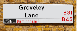
Neighbourhood Policing |
| Police Force: West Midlands &West Mercia |
| Find a Local Neighbourhood Watch Scheme |
Location Details
| Groveley Lane | |
|---|---|

| |
| Latitude | 52.387235 |
| Longitude | -1.981294 |
| OS Easting (X): | 401272 |
| OS Northing (Y): | 276620 |
| OS Grid Reference: | SP013766 |
Known Residential Addresses for Groveley Lane
- 381
- 373
- 369
- 363
- 375
- 339
- 341
- 337
- 343
- 349
- CLIFTON COTTAGE
- 345
- 347
- NEW COTTAGE
- 515A
- 510
- 518
- 500
- 516
- 492
- 466
- 470
- 472
- 468
- 476
- 372
- 450
- STIRLING HOUSE, 387 APARTMENT 6
- STIRLING HOUSE, 387 APARTMENT 3
- STIRLING HOUSE, 387 APARTMENT 9
- STIRLING HOUSE, 387 APARTMENT 2
- STIRLING HOUSE, 387 APARTMENT 8
- STIRLING HOUSE, 387 APARTMENT 5
- STIRLING HOUSE, 387 APARTMENT 7
- STIRLING HOUSE, 387 APARTMENT 4
- STIRLING HOUSE, 387 APARTMENT 1
- STIRLING HOUSE, 387
- 331
- 517
- 377
- 365
- 379
- 367
- 329
- 333
- 325
- 264
- 137
- 179
- 113
- 131
- 155
- 163
- 149
- 145
- 141
- 181
- 161
- 203
- 235
- 191
- 205
- 229
- 185
- 197
- 239
- 189
- 209
- 201
- 212
- 178
- 180
- 204
- 230
- 130
- 136
- 72
- 64
- 96
- 13
- 31
- 15
- 11
- 49
- 29
- 7
- 53
- 30
- 107
- 81
- 83
- 59
- 89
- 55
- 105
- 97
- 515
- 517A
- 528
- 482
- 496
- 494
- 498
- 478
- 456
- 416
- 366
- 362
- 368
- 374
- 380
- 370
- 376
- 378
- 364
- 460
- 436
- 448
- 281
- 289
- 247
- 255
- 251
- 249
- 291
- 253
- 159
- 231
- 237
- 233
- 228
- 248
- 252
- 222
- 200
- 194
- 260
- 198
- 196
- 236
- 188
- 172
- 142
- 126
- 128
- 146
- 154
- 140
- 148
- 102
- 98
- 76
- 86
- 78
- 88
- 74
- 73
- 71
- 484
- 408
Roads that have a Junction with Groveley Lane
| Street | Junction Type |
|---|---|
| East Works Drive | junction |
| Parsonage Drive | junction |
| Parsonage Drive | junction |
| Chestnut Drive | junction |
| Ashmead Drive | junction |
| Private Way | junction |
| Ten Ashes Lane | junction |
| Lowhill Lane | pseudo node |
| Hawker Close | junction |
| Edenhurst Road | junction |
| Coombes Lane | junction |
| Coombes Lane | junction |
| Nuthurst Road | junction |
| Wootton Road | junction |
| Carbridge Close | junction |
| Wootton Road | junction |
| Longbridge Lane (B4096) | junction |
Sunset and Sunrise times
| Sunrise | 07:13 |
|---|---|
| Sunset | 17:30 |
Latest Weather Conditions
| Observed at Weather Station: | Coleshill 19 February 2025 at 12:00 (13.88 miles away) |
|---|---|
| Current Weather: | Overcast |
| Temperature and Humidity: | 3.9°C (80.4%) |
| Wind Direction and Speed: | SE (7 mph) |
Population Statistics
| ONS Area Code | E00046488, E00046432, E00163947, E00046480, E00046476, E00046431, E00046463, E00046465 & E00163948 |
|---|---|
| ONS Area Name | Self-Sufficient Retirement, Multi-Ethnic Hardship, White Suburban Communities, Deprived Blue-Collar Terraces, Industrious Transitions & Older Workers and Retirement |
| Average Age | 38.19, 43.36, 41.07 & 41.42 |
| Area Population | 1452.00, 1531.00, 1489.00 & 1483.00 |
| Male Population | 673.00, 771.00, 761.00 & 725.00 (49%) |
| Female Population | 779.00, 760.00, 728.00 & 758.00 (51%) |
| Benefit Claimants | 65, 9, 30 & 16 (2%) |
| LSOA Code: | E01009163, E01032142, E01009168 &E01009170 |
|---|---|
| LSOA Name: | Birmingham 129B, Bromsgrove 006A, Birmingham 131B &Birmingham 131C |
| SOA Code: | 4c, 8b &5b |
| SOA Name: | |
| MSOA Code: | E02001955, E02006701 &E02001957 |
| MSOA Name: | Birmingham 129, Bromsgrove 006 &Birmingham 131 |
Nearest Supermarkets
| Sainsburys Longbridge |
|---|
| Longbridge Lane, Birmingham, England, B31 2TW |
| 0121 623 7030 |
| Distance: 0.61 Miles |
| Directions to Sainsburys Longbridge |
| Tesco West Heath Birmingham Express |
|---|
| 6 Redhill Rd, Birmingham, B31 3LD |
| 0345 675 6907 |
| Distance: 1.24 Miles |
| Directions to Tesco West Heath Birmingham Express |
| Morrisons Birmingham - Rubery |
|---|
| Rubery, Birmingham B45 9AH |
| 0121 460 1940 |
| Distance: 1.28 Miles |
| Directions to Morrisons Birmingham - Rubery |
| Tesco Birmingham Frankley Express |
|---|
| 414 Frankley Beeches Rd, Birmingham, B31 5NJ |
| 0345 675 7182 |
| Distance: 1.55 Miles |
| Directions to Tesco Birmingham Frankley Express |
Telephone Information
| Dialling Code | Telephone Exchange | Telephone Cabinet | Fibre to the Cabinet or Fibre to the Premises |
|---|---|---|---|
| 0121 | HILLSIDE; HEREFORD & WORCESTER - CMHILL | P7 | FTTC |
Broadband Information
| Speed | Average Speed | Median Speed | Maximum Speed | Next-generation access (NGA) | Number of Connections |
|---|---|---|---|---|---|
| Less than 2 Mbps | 11.2 | 4.2 | >=30 | Y | 25 |
Local Government
| Local Council Details |
|---|
| Within the area of Birmingham &Bromsgrove |
| Visit the Council's Website |
| Visit the Council's Website |
| Council House, Victoria Square, Birmingham, B1 1BB, The Council House, Burcot Lane, Bromsgrove, Worcestershire &B60 1AA |
| Send email |
| Telephone Number: 0121 303 1111 &01527 873 232 |
| Local Member of Parliament |
|---|
| Within the Westminster Parliamentary Constituency of Birmingham, Northfield &Bromsgrove |
| The Member of Parliament is Laurence Turner &Bradley Thomas |
| Details for the MP Laurence Turner &Bradley Thomas on parliament.uk |
| Details for the MP Laurence Turner &Bradley Thomas on theyworkforyou.com |
| In the 2024 General Election Laurence Turner &Bradley Thomas won with a majority of 5,389 the result was Lab gain from Con &Con hold. The total electorate was 74,048 |
| Wards, Parish Councils and County Councils |
|---|
| Ward: Rubery & Rednal, Longbridge & West Heath &Cofton Ward |
| Parish: Cofton Hackett Parish Council |
| Ceremonial County: West Midlands |
Nearest Schools
England Secondary Schools
Turves Green Girls' School
Address: Turves Green Girls' School, Turves Green, Northfield, Birmingham, West Midlands, B31 4BP
Distance: 1.04 miles
Contact:
Turves Green Boys' School
Address: Turves Green Boys' School, Turves Green, Northfield, Birmingham, West Midlands, B31 4BS
Distance: 0.84 miles
Contact:
Colmers School and Sixth Form College
Address: Colmers School and Sixth Form College, Bristol Road South, Rednal, Birmingham, West Midlands, B45 9NY
Distance: 1.12 miles
Contact: 01214531778
England Primary Schools
Turves Green Primary School
Address: Turves Green Primary School, Northfield, Birmingham, West Midlands, B31 4BP
Distance: 1.04 miles
Contact:
Cofton Primary School
Address: Cofton Primary School, Wootton Road, West Heath, Birmingham, West Midlands, B31 4ST
Distance: 0.55 miles
Contact: 01214753374
The Meadows Primary School
Address: The Meadows Primary School, Bristol Road South, Northfield, Bristol Road South, Northfield, Birmingham, West Midlands, B31 2SW
Distance: 1.13 miles
Contact: 01216753203
Rednal Hill Infant School
Address: Rednal Hill Infant School, Irwin Avenue, Rednal, Birmingham, West Midlands, B45 8QY
Distance: 0.81 miles
Contact: 01214532636
Rednal Hill Junior School
Address: Rednal Hill Junior School, Irwin Avenue, Rednal, Birmingham, West Midlands, B45 8QY
Distance: 0.81 miles
Contact: 01214532520
Wychall Primary School
Address: Wychall Primary School, Middle Field Road, Northfield, Birmingham, West Midlands, B31 3EH
Distance: 1.90 miles
Contact: 01214644255
West Heath Primary School
Address: West Heath Primary School, Rednal Road, West Heath Primary, Birmingham, West Midlands, B38 8HU
Distance: 1.41 miles
Contact: 01214584257
Turves Green Primary School
Address: Turves Green Primary School, Northfield, Birmingham, West Midlands, B31 4BP
Distance: 1.04 miles
Contact: 01214643686
St John Fisher Catholic Primary School
Address: St John Fisher Catholic Primary School, Alvechurch Road, West Heath, Birmingham, West Midlands, B31 3PN
Distance: 1.00 miles
Contact:
Albert Bradbeer Primary Academy
Address: Albert Bradbeer Primary Academy, Turves Green, Longbridge, Birmingham, West Midlands, B31 4RD
Distance: 0.60 miles
Contact: 01214642356
Lickey Hills Primary School and Nursery
Address: Lickey Hills Primary School and Nursery, Old Birmingham Road, Lickey, Birmingham, West Midlands, B45 8EU
Distance: 1.79 miles
Contact: 01214451992
St Columba's Catholic Primary School
Address: St Columba's Catholic Primary School, Lickey Road, Rednal, Birmingham, West Midlands, B45 8TD
Distance: 0.66 miles
Contact: 01216754841
Colmers Farm Primary School
Address: Colmers Farm Primary School, Leybrook Road, Birmingham, West Midlands, B45 9PB
Distance: 1.16 miles
Contact:
St James Catholic Primary School
Address: St James Catholic Primary School, Leach Heath Lane, Rednal, Birmingham, West Midlands, B45 9BN
Distance: 1.34 miles
Contact: 01214649700
St James Catholic Primary School
Address: St James Catholic Primary School, Leach Heath Lane, Rednal, Birmingham, West Midlands, B45 9BN
Distance: 1.34 miles
Contact:
Nearest Hospitals
| Hillis Lodge |
|---|
| Address: Hollymoor Way, Northfield, Birmingham, |
| NHS Sector |
| Birmingham and Solihull Mental Health NHS Foundation Trust |
| Telephone: 0121 301 4100 |
| Visit Hospital Website |
| Distance: 2.03 (miles) |
| Directions from to Hillis Lodge |
| West Heath Hospital |
|---|
| Address: West Heath Hospital, Rednal Road, Birmingham, B38 8HR, |
| NHS Sector |
| Birmingham Community Healthcare NHS Foundation Trust |
| Telephone: 0121 466 6000 |
| Distance: 2.23 (miles) |
| Directions from to West Heath Hospital |
| Reaside Clinic |
|---|
| Address: Birmingham Great Park, Bristol Road South, Rednal, Birmingham, B45 9BE, |
| NHS Sector |
| Birmingham and Solihull Mental Health NHS Foundation Trust |
| Telephone: 0121 301 3000 |
| Visit Hospital Website |
| Distance: 2.33 (miles) |
| Directions from to Reaside Clinic |
Nearest Dentists
Dentists
DENTAL SURGERY
Address: 225 LONGBRIDGE LANE, BIRMINGHAM, WEST MIDLANDS, B31 4RE
Distance: 0.57 miles
Contact: :
17 EDGEWOOD ROAD
Address: REDNAL, BIRMINGHAM, WEST MIDLANDS, B45 8SB
Distance: 0.80 miles
Contact: :
DENTAL SURGERY
Address: 31 REDHILL ROAD, NORTHFIELD, BIRMINGHAM, WEST MIDLANDS, B31 3JS
Distance: 1.18 miles
Contact: :
HOLLYMOOR TOWER DENTAL SURGERY
Address: MANOR PARK GROVE, NORTHFIELD, BIRMINGHAM, WEST MIDLANDS, B31 5ER
Distance: 1.37 miles
Contact: :
DENTAL DEPT.
Address: REASIDE CLINIC, BRISTOL ROAD SOUTH, REDNAL, BIRMINGHAM, WEST MIDLANDS, B45 9BE
Distance: 1.45 miles
Contact: :
DENTAL SURGERY
Address: 14 EACHWAY, RUBERY, REDNAL, BIRMINGHAM, WEST MIDLANDS, B45 9DQ
Distance: 1.58 miles
Contact: :
Nearest GP Surgeries
Doctors
COFTON MEDICAL CENTRE
Address: 2 ROBINSFIELD DRIVE, BIRMINGHAM, WEST MIDLANDS, B31 4TU
Distance: 0.72 miles
Contact: tel: 0121 6935777
WEST HEATH SURGERY - COVID LOCAL VACCINATION SERVICE 2
Address: 196 WEST HEATH ROAD, NORTHFIELD, BIRMINGHAM, B31 3HB
Distance: 1.29 miles
Contact: :
WEST HEATH SURGERY
Address: 196 WEST HEATH ROAD, NORTHFIELD, BIRMINGHAM, WEST MIDLANDS, B31 3HB
Distance: 1.29 miles
Contact: tel: 0121 4761135
HOLLYMOOR MEDICAL CENTRE
Address: MANOR PARK GROVE, NORTHFIELD, BIRMINGHAM, WEST MIDLANDS, B31 5ER
Distance: 1.37 miles
Contact: tel: 0121 4769191
LEACH HEATH MEDICAL CENTRE
Address: 32 LEACH HEATH LANE, RUBERY, REDNAL, BIRMINGHAM, WEST MIDLANDS, B45 9BU
Distance: 1.38 miles
Contact: tel: 0121 4533516
WEST HEATH PRIMARY C CTR
Address: WEST HEATH PRIMARY C.CTR, 481 REDNAL ROAD, KINGS NORTON, BIRMINGHAM, WEST MIDLANDS, B38 8AX
Distance: 1.42 miles
Contact: tel: 0121 4658188
Nearest Dispensing Chemists
Pharmacies
KNIGHTS LONGBRIDGE PHARMACY
Address: 4 SUNBURY ROAD, LONGBRIDGE, BIRMINGHAM, WEST MIDLANDS, B31 4LJ
Distance: 0.55 miles
Contact: tel: 01214 752655
MORRISONS PHARMACY
Address: BIRMINGHAM GREAT PARK, BRISTOL ROAD SOUTH, RUBERY, BIRMINGHAM, WEST MIDLANDS, B45 9NY
Distance: 1.12 miles
Contact: tel: 01214 532614
KNIGHTS WEST HEATH PHARMACY
Address: 5 ALVECHURCH ROAD, WEST HEATH, BIRMINGHAM, WEST MIDLANDS, B31 3JW
Distance: 1.14 miles
Contact: tel: 01214 770123
BOOTS
Address: 11 ALVECHURCH ROAD, WEST HEATH, BIRMINGHAM, WEST MIDLANDS, B31 3JP
Distance: 1.17 miles
Contact: tel: 0121 4752790
HINGLEY CHEMIST
Address: MANOR PARK GROVE, NORTHFIELD, BIRMINGHAM, WEST MIDLANDS, B31 5ER
Distance: 1.37 miles
Contact: tel: 0121 4530055
RUBERY LATE NIGHT PHARMACY
Address: JOHNS, 196 NEW ROAD, REDNAL, RUBERY, BIRMINGHAM, WEST MIDLANDS, B45 9JA
Distance: 1.58 miles
Contact: :
Nearest Opticians
Opticians
M&S OPTICIANS - LONGBRIDGE
Address: 20 HIGH STREET, NORTHFIELD, BIRMINGHAM, B31 2UQ
Distance: 0.56 miles
Contact: :
SPECSAVERS OPTICIANS (LONGBRIDGE)
Address: LONGBRIDGE TOWN CENTRE, 11 HIGH STREET, NORTHFIELD, BIRMINGHAM, WEST MIDLANDS, B31 2UQ
Distance: 0.56 miles
Contact: :
THE EYE COLLECTIVE (WEST HEATH) LTD
Address: 3 ALVECHURCH ROAD, BIRMINGHAM, B31 3JW
Distance: 1.14 miles
Contact: :
SPEX4U
Address: 174 NEW ROAD, RUBERY, REDNAL, BIRMINGHAM, WEST MIDLANDS, B45 9JA
Distance: 1.58 miles
Contact: :
THE EYE COLLECTIVE - RUBERY
Address: 161 NEW ROAD, RUBERY, REDNAL, BIRMINGHAM, WEST MIDLANDS, B45 9JW
Distance: 1.64 miles
Contact: :
ROBINSON OPTICS LTD
Address: 135 NEW ROAD, RUBERY, REDNAL, BIRMINGHAM, WEST MIDLANDS, B45 9JR
Distance: 1.73 miles
Contact: :
Transport
Nearest Rail Stations
Longbridge Station is 0.64 miles away.
Address: Longbridge station, Longbridge Lane, Birmingham, West Midlands, B31 2TW
Longbridge is situated on the Bristol to Brimingham Line.
Longbridge Station is staffed on a part time basis.
Northfield Station is 1.59 miles away.
Address: Northfield station, Quarry Lane, Northfield, West Midlands, B31 2PY
Northfield is situated on the Bristol to Brimingham Line.
Northfield Station is staffed on a part time basis.