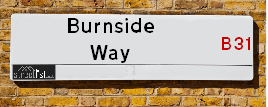
Burnside Way is a street located in the city of Birmingham. The street has a length of approximately 253 metres.
The street is located within the Birmingham District (B) Council's jurisdiction. They provide various services, like refuse collection, and manage council tax collection. It's situated in the West Midlands region of the UK.
The road has been assigned the Unique Street Reference Number of 2700710 in the National Street Gazetteer.
The street has the postcodes of B31 4JZ and B31 4JY.
It is located within the county of West Midlands, situated in the West Midlands region of the UK. It's 100.94 miles North West from central London., 6.73 miles South West from Birmingham, 17.29 miles North East from Worcester and 19.82 miles West from Coventry.
BURNSIDE WAY is within the Post Town of BIRMINGHAM
Map of Burnside Way
| Street Crime (updated 14/01/2025) | ||
|---|---|---|
| Location Note | Central Point of Street - Not Actual Location | |
| MSOA Info | For MSOA E02001957 (Statistical Neighbourhood) | |
| Click Hint | Click on a Circle for a detailed breakdown below map. | |
| Crime Levels |
Green = Very Low Yellow = Low Orange = High Red = Very High |
|
| Postcodes | ||
| Icon | Postcodes for Burnside Way | |
| Walking Distances | ||
| Distance Info | Green Circle = 10 Minutes Walk (800 metres) | |
Street Crime Data accessed from data.police.uk on 06/10/2024.
Moving to Burnside Way?
I can help you uncover potential pitfalls and provide key questions to ask about your new property. With decades of experience as a Local Land Charges Manager, I offer confidential insights to make your move informed and stress-free.
This service is free, but you may wish to make an optional donation to support it. Please include the property name and address in your request as well as anything you wish to focus on.
Contact Me
Do you know why this road is called Burnside Way?
What's it like to live here?
Share a Photo of Burnside Way
Ask the community a question.
Do you have any questions, memories to share, have any photos or know any facts? We'd love to know more.
Submit Your Comment
Find Homes to Rent in Birmingham

Budget Friendly Hotels near Burnside Way
| Budget Hotel Name | Distance (miles) |
|---|---|
|
1: Name:Premier Inn Birmingham South Longbridge Station Address: 1 High Street Telephone: Visit Hotel Page |
0.33 |
|
2: Name:Premier Inn Birmingham South Rubery Address: Great Park Telephone: Visit Hotel Page |
1.32 |
|
3: Name:Travelodge Birmingham Frankley M5 Southbound Address: Moto Service Area, Illey Ln, M5 Motorway, Frankley, Birmingham, B32 4AR Telephone: 0871 984 6067 Visit Hotel Page |
3.00 |
|
4: Name:Travelodge Bromsgrove Marlbrook Address: 462 Birmingham Rd, Marlbrook, Bromsgrove, B61 0HR Telephone: 0871 559 1809 Visit Hotel Page |
3.50 |
|
5: Name:Travelodge Birmingham Maypole Address: Maypole Lane, Birmingham, B14 5JF Telephone: 0871 559 1896 Visit Hotel Page |
3.92 |
Hotel Options
Your support helps keep this site running!
If you enjoy using this website, consider making a donation to help me cover hosting costs.
EPC (Energy Performance Certificate) Information for Burnside Way
UPRN: 100070313255
EPC Current: E
EPC Potential: C
Habitable Rooms: 3
Property Type: Flat
Tenure: Owner-occupied
Built Form: Semi-Detached
Age Band: 1950-1966
Mains Gas: Yes
UPRN: 100070313258
EPC Current: E
EPC Potential: D
Habitable Rooms: 4
Property Type: Maisonette
Tenure: Owner-occupied
Built Form: Semi-Detached
Age Band: 1950-1966
Mains Gas: Yes
UPRN: 100070313257
EPC Current: C
EPC Potential: C
Habitable Rooms: 3
Property Type: Maisonette
Tenure: Owner-occupied
Built Form: Semi-Detached
Age Band: 1967-1975
Mains Gas: Yes
UPRN: 100070313259
EPC Current: D
EPC Potential: B
Habitable Rooms: 6
Property Type: House
Tenure: Owner-occupied
Built Form: Semi-Detached
Age Band: 1967-1975
Mains Gas: Yes
UPRN: 100070313261
EPC Current: D
EPC Potential: C
Habitable Rooms: 3
Property Type: Maisonette
Tenure: Owner-occupied
Built Form: Semi-Detached
Age Band: 1950-1966
Mains Gas: Yes
UPRN: 100070313264
EPC Current: C
EPC Potential: C
Habitable Rooms: 3
Property Type: Flat
Tenure: Owner-occupied
Built Form: Semi-Detached
Age Band: 1950-1966
Mains Gas: Yes
UPRN: 100070313263
EPC Current: C
EPC Potential: C
Habitable Rooms: 3
Property Type: Flat
Tenure: Owner-occupied
Built Form: Semi-Detached
Age Band: 1976-1982
Mains Gas: Yes
UPRN: 100070313266
EPC Current: D
EPC Potential: C
Habitable Rooms: 2
Property Type: Maisonette
Tenure: Owner-occupied
Built Form: Semi-Detached
Age Band: 1950-1966
Mains Gas: Yes
UPRN: 100070313268
EPC Current: D
EPC Potential: C
Habitable Rooms: 5
Property Type: House
Tenure: Owner-occupied
Built Form: Semi-Detached
Age Band: 1950-1966
Mains Gas: Yes
UPRN: 100070313272
EPC Current: C
EPC Potential: C
Habitable Rooms: 3
Property Type: Maisonette
Tenure: rental (private)
Built Form: Semi-Detached
Age Band: 1967-1975
Mains Gas: Yes
UPRN: 100070313275
EPC Current: C
EPC Potential: C
Habitable Rooms: 3
Property Type: Maisonette
Tenure: Owner-occupied
Built Form: Semi-Detached
Age Band: 1950-1966
Mains Gas: Yes
UPRN: 100070313276
EPC Current: D
EPC Potential: B
Habitable Rooms: 5
Property Type: House
Tenure: Owner-occupied
Built Form: Semi-Detached
Age Band: 1950-1966
Mains Gas: Yes
UPRN: 100070313278
EPC Current: C
EPC Potential: C
Habitable Rooms: 4
Property Type: Maisonette
Tenure: Owner-occupied
Built Form: Semi-Detached
Age Band: 1950-1966
Mains Gas: Yes
UPRN: 100070313277
EPC Current: C
EPC Potential: C
Habitable Rooms: 3
Property Type: Flat
Tenure: Rented (private)
Built Form: Semi-Detached
Age Band: 1950-1966
Mains Gas: Yes
UPRN: 100070313280
EPC Current: C
EPC Potential: C
Habitable Rooms: 3
Property Type: Flat
Tenure: Owner-occupied
Built Form: End-Terrace
Age Band: 1967-1975
Mains Gas: Yes
UPRN: 100070313279
EPC Current: C
EPC Potential: C
Habitable Rooms: 3
Property Type: Maisonette
Tenure: Owner-occupied
Built Form: Semi-Detached
Age Band: 1950-1966
Mains Gas: Yes
UPRN: 100070313281
EPC Current: E
EPC Potential: C
Habitable Rooms: 3
Property Type: Flat
Tenure: Owner-occupied
Built Form: Semi-Detached
Age Band: 1950-1966
Mains Gas: Yes
UPRN: 100070313282
EPC Current: D
EPC Potential: B
Habitable Rooms: 3
Property Type: Bungalow
Tenure: Owner-occupied
Built Form: Detached
Age Band: 1983-1990
Mains Gas: Yes
UPRN: 100070313283
EPC Current: C
EPC Potential: C
Habitable Rooms: 3
Property Type: Flat
Tenure: Owner-occupied
Built Form: Semi-Detached
Age Band: 1950-1966
Mains Gas: Yes
UPRN: 100070313285
EPC Current: C
EPC Potential: C
Habitable Rooms: 3
Property Type: Flat
Tenure: Owner-occupied
Built Form: Semi-Detached
Age Band: 1950-1966
Mains Gas: Yes
UPRN: 100070313286
EPC Current: D
EPC Potential: C
Habitable Rooms: 3
Property Type: Flat
Tenure: rental (private)
Built Form: Semi-Detached
Age Band: 1967-1975
Mains Gas: No
UPRN: 100070313287
EPC Current: D
EPC Potential: C
Habitable Rooms: 4
Property Type: Maisonette
Tenure: Owner-occupied
Built Form: Semi-Detached
Age Band: 1967-1975
Mains Gas: Yes
UPRN: 100070313289
EPC Current: C
EPC Potential: C
Habitable Rooms: 3
Property Type: Maisonette
Tenure: Owner-occupied
Built Form: Semi-Detached
Age Band: 1967-1975
Mains Gas: No
UPRN: 100070313290
EPC Current: C
EPC Potential: C
Habitable Rooms: 3
Property Type: Flat
Tenure: rental (private)
Built Form: Semi-Detached
Age Band: 1950-1966
Mains Gas: Yes
UPRN: 100070313292
EPC Current: C
EPC Potential: C
Habitable Rooms: 3
Property Type: Flat
Tenure: Owner-occupied
Built Form: Enclosed End-Terrace
Age Band: 1950-1966
Mains Gas: Yes
UPRN: 100070313294
EPC Current: D
EPC Potential: C
Habitable Rooms: 3
Property Type: Maisonette
Tenure: rental (private)
Built Form: Semi-Detached
Age Band: 1967-1975
Mains Gas: No
UPRN: 100070313295
EPC Current: D
EPC Potential: C
Habitable Rooms: 3
Property Type: Flat
Tenure: Owner-occupied
Built Form: Semi-Detached
Age Band: 1950-1966
Mains Gas: Yes
UPRN: 100070313296
EPC Current: C
EPC Potential: C
Habitable Rooms: 3
Property Type: Flat
Tenure: Rented (private)
Built Form: Semi-Detached
Age Band: 1950-1966
Mains Gas: Yes
UPRN: 100070313298
EPC Current: E
EPC Potential: C
Habitable Rooms: 3
Property Type: Flat
Tenure: Owner-occupied
Built Form: Semi-Detached
Age Band: 1950-1966
Mains Gas: Yes
UPRN: 100070313300
EPC Current: C
EPC Potential: C
Habitable Rooms: 3
Property Type: Flat
Tenure: Owner-occupied
Built Form: Semi-Detached
Age Band: 1950-1966
Mains Gas: Yes
UPRN: 100070313301
EPC Current: D
EPC Potential: D
Habitable Rooms: 3
Property Type: Maisonette
Tenure: Owner-occupied
Built Form: Detached
Age Band: 1950-1966
Mains Gas: Yes
UPRN: 100070313302
EPC Current: C
EPC Potential: C
Habitable Rooms: 3
Property Type: Maisonette
Tenure: rental (private)
Built Form: Semi-Detached
Age Band: 1950-1966
Mains Gas: Yes
UPRN: 100070313303
EPC Current: C
EPC Potential: C
Habitable Rooms: 3
Property Type: Flat
Tenure: Owner-occupied
Built Form: Semi-Detached
Age Band: 1967-1975
Mains Gas: Yes
UPRN: 100070313305
EPC Current: C
EPC Potential: C
Habitable Rooms: 3
Property Type: Maisonette
Tenure: Owner-occupied
Built Form: Semi-Detached
Age Band: 1950-1966
Mains Gas: Yes
UPRN: 100070313306
EPC Current: D
EPC Potential: C
Habitable Rooms: 3
Property Type: Maisonette
Tenure: rental (private)
Built Form: Semi-Detached
Age Band: 1950-1966
Mains Gas: Yes
UPRN: 100070313307
EPC Current: C
EPC Potential: C
Habitable Rooms: 3
Property Type: Flat
Tenure: rental (private)
Built Form: Semi-Detached
Age Band: 1950-1966
Mains Gas: Yes
UPRN: 100070313310
EPC Current: E
EPC Potential: E
Habitable Rooms: 3
Property Type: Flat
Tenure: Rented (private)
Built Form: Semi-Detached
Age Band: 1967-1975
Mains Gas: No
UPRN: 100070313311
EPC Current: C
EPC Potential: C
Habitable Rooms: 3
Property Type: Flat
Tenure: rental (private)
Built Form: Semi-Detached
Age Band: 1976-1982
Mains Gas: Yes
UPRN: 100070313312
EPC Current: C
EPC Potential: C
Habitable Rooms: 3
Property Type: Flat
Tenure: rental (private)
Built Form: Semi-Detached
Age Band: 1950-1966
Mains Gas: Yes
UPRN: 100070313314
EPC Current: C
EPC Potential: C
Habitable Rooms: 3
Property Type: Flat
Tenure: Owner-occupied
Built Form: Semi-Detached
Age Band: 1967-1975
Mains Gas: Yes
UPRN: 100070313315
EPC Current: D
EPC Potential: C
Habitable Rooms: 3
Property Type: Flat
Tenure: Owner-occupied
Built Form: Semi-Detached
Age Band: 1967-1975
Mains Gas: Yes
UPRN: 100070313316
EPC Current: D
EPC Potential: C
Habitable Rooms: 3
Property Type: Maisonette
Tenure: rental (private)
Built Form: Semi-Detached
Age Band: 1950-1966
Mains Gas: Yes
UPRN: 100070313318
EPC Current: D
EPC Potential: D
Habitable Rooms: 3
Property Type: Maisonette
Tenure: rental (private)
Built Form: End-Terrace
Age Band: 1967-1975
Mains Gas: Yes
UPRN: 100070313319
EPC Current: C
EPC Potential: C
Habitable Rooms: 5
Property Type: Maisonette
Tenure: Rented (private)
Built Form: Semi-Detached
Age Band: 1930-1949
Mains Gas: Yes
UPRN: 100070313320
EPC Current: D
EPC Potential: C
Habitable Rooms: 3
Property Type: Flat
Tenure: Owner-occupied
Built Form: Semi-Detached
Age Band: 1967-1975
Mains Gas: Yes
UPRN: 100070313321
EPC Current: C
EPC Potential: C
Habitable Rooms: 3
Property Type: Maisonette
Tenure: Owner-occupied
Built Form: Semi-Detached
Age Band: 1967-1975
Mains Gas: Yes
UPRN: 100070313322
EPC Current: C
EPC Potential: B
Habitable Rooms: 4
Property Type: Flat
Tenure: rental (private)
Built Form: Semi-Detached
Age Band: 1950-1966
Mains Gas: Yes
UPRN: 100070313323
EPC Current: C
EPC Potential: C
Habitable Rooms: 3
Property Type: Flat
Tenure: Owner-occupied
Built Form: Semi-Detached
Age Band: 1950-1966
Mains Gas: Yes
UPRN: 100070313324
EPC Current: C
EPC Potential: C
Habitable Rooms: 3
Property Type: Maisonette
Tenure: Owner-occupied
Built Form: Semi-Detached
Age Band: 1976-1982
Mains Gas: Yes
UPRN: 100070313326
EPC Current: C
EPC Potential: C
Habitable Rooms: 3
Property Type: Maisonette
Tenure: Owner-occupied
Built Form: Semi-Detached
Age Band: 1950-1966
Mains Gas: Yes
UPRN: 100070313327
EPC Current: C
EPC Potential: C
Habitable Rooms: 3
Property Type: Maisonette
Tenure: Owner-occupied
Built Form: Semi-Detached
Age Band: 1950-1966
Mains Gas: Yes
UPRN: 100070313331
EPC Current: C
EPC Potential: B
Habitable Rooms: 4
Property Type: House
Tenure: Owner-occupied
Built Form: Semi-Detached
Age Band: 1991-1995
Mains Gas: Yes
UPRN: 100070313332
EPC Current: C
EPC Potential: C
Habitable Rooms: 3
Property Type: Maisonette
Tenure: Owner-occupied
Built Form: Semi-Detached
Age Band: 1950-1966
Mains Gas: Yes
UPRN: 100070313333
EPC Current: D
EPC Potential: B
Habitable Rooms: 4
Property Type: House
Tenure: Owner-occupied
Built Form: Semi-Detached
Age Band: 1996-2002
Mains Gas: Yes
UPRN: 100070313334
EPC Current: C
EPC Potential: C
Habitable Rooms: 3
Property Type: Maisonette
Tenure: Owner-occupied
Built Form: Semi-Detached
Age Band: 1967-1975
Mains Gas: Yes
UPRN: 100070313335
EPC Current: D
EPC Potential: C
Habitable Rooms: 4
Property Type: Maisonette
Tenure: Owner-occupied
Built Form: Semi-Detached
Age Band: 1950-1966
Mains Gas: Yes
UPRN: 100070313336
EPC Current: C
EPC Potential: C
Habitable Rooms: 3
Property Type: Flat
Tenure: rental (private)
Built Form: Semi-Detached
Age Band: 1967-1975
Mains Gas: Yes
UPRN: 100070313337
EPC Current: D
EPC Potential: B
Habitable Rooms: 3
Property Type: House
Tenure: Owner-occupied
Built Form: Semi-Detached
Age Band: 1996-2002
Mains Gas: Yes
UPRN: 100070313339
EPC Current: C
EPC Potential: B
Habitable Rooms: 4
Property Type: House
Tenure: rental (private)
Built Form: Semi-Detached
Age Band: 1983-1990
Mains Gas: Yes
UPRN: 100070313342
EPC Current: C
EPC Potential: C
Habitable Rooms: 4
Property Type: House
Tenure: Owner-occupied
Built Form: Semi-Detached
Age Band: 1996-2002
Mains Gas: Yes
House Sales
| Year | High | Low | Average | Sales |
|---|---|---|---|---|
| 2014 | £92,000 | £41,250 | £65,188 | 4 |
| 2015 | £75,000 | £75,000 | £75,000 | 1 |
| 2016 | £98,000 | £98,500 | £89,400 | 5 |
| 2017 | £105,275 | £249,999 | £151,319 | 4 |
| 2018 | £107,000 | £90,000 | £91,000 | 3 |
| 2019 | £105,000 | £90,000 | £102,250 | 4 |
| 2020 | £125,000 | £120,000 | £116,100 | 5 |
| 2021 | £130,000 | £104,000 | £116,833 | 3 |
| 2022 | £120,000 | £131,000 | £128,250 | 4 |
| 2023 | £255,000 | £85,500 | £149,625 | 4 |
| 2024 | £120,000 | £120,000 | £120,000 | 1 |
Contains HM Land Registry data © Crown copyright and database right 2025. This data is licensed under the Open Government Licence v3.0.
Nearby Estate Agents
| Name | Address | Website |
|---|---|---|
| A P Morgan Estate Agents | 1 Devon Way, Northfield, Birmingham, B31 2TS | Visit Website |
| Genie Homes | 1668 Bristol Road South Rubery Rednal Birmingham B45 9TY | Visit Website |
| Ashley Borne Sales and Lettings | 11A Alvechurch Road, West Heath, Birmingham, B31 3JW | Visit Website |
| Bloor Homes | Frankley Beeches Road, Northfield, Birmingham, B31 5NH | Visit Website |
| Pango Homes | Suite 2 09 Park House, Bristol Road South, Rubery, Birmingham,B45 9AH |
Neighbourhood Policing |
| Police Force: West Midlands |
 View Neighbourhood Crime and Policing View Neighbourhood Crime and Policing |
| Find a Local Neighbourhood Watch Scheme |
Location Details
| Burnside Way | |
|---|---|

| |
| Latitude | 52.393751 |
| Longitude | -1.977378 |
| OS Easting (X): | 401539 |
| OS Northing (Y): | 277345 |
| OS Grid Reference: | SP015773 |
Known Residential Addresses for Burnside Way
- 26
- 16
- 58
- 36
- 20A
- 60
- 20
- 2A
- 62
- 4A
- 18A
- 70
- 30
- 56
- 80
- 25
- 65
- 59
- 29
- 33
- 49
- 63
- 39
- 67
- 64
- 78
- 6
- 86
- 47
- 5
- 55
- 68
- 71
Roads that have a Junction with Burnside Way
| Street | Junction Type |
|---|---|
| Longbridge Lane | junction |
Sunset and Sunrise times
| Sunrise | 07:49 |
|---|---|
| Sunset | 16:52 |
Latest Weather Conditions
| Observed at Weather Station: | Coleshill 30 January 2025 at 16:00 (13.53 miles away) |
|---|---|
| Current Weather: | Cloudy |
| Temperature and Humidity: | 6.9°C (63.2%) |
| Wind Direction and Speed: | W (11 mph) |
Population Statistics
| ONS Area Code | E00046457 |
|---|---|
| ONS Area Name | Multi-Ethnic Hardship |
| Average Age | 36.18 |
| Area Population | 1319.00 |
| Male Population | 637.00 (48%) |
| Female Population | 682.00 (52%) |
| Benefit Claimants | 25 (2%) |
| LSOA Code: | E01009166 |
|---|---|
| LSOA Name: | Birmingham 131A |
| SOA Code: | 3d |
| SOA Name: | |
| MSOA Code: | E02001957 |
| MSOA Name: | Birmingham 131 |
Nearest Supermarkets
| Sainsburys Longbridge |
|---|
| Longbridge Lane, Birmingham, England, B31 2TW |
| 0121 623 7030 |
| Distance: 0.3 Miles |
| Directions to Sainsburys Longbridge |
| Tesco West Heath Birmingham Express |
|---|
| 6 Redhill Rd, Birmingham, B31 3LD |
| 0345 675 6907 |
| Distance: 0.82 Miles |
| Directions to Tesco West Heath Birmingham Express |
| Tesco Birmingham Frankley Express |
|---|
| 414 Frankley Beeches Rd, Birmingham, B31 5NJ |
| 0345 675 7182 |
| Distance: 1.24 Miles |
| Directions to Tesco Birmingham Frankley Express |
| Morrisons Birmingham - Rubery |
|---|
| Rubery, Birmingham B45 9AH |
| 0121 460 1940 |
| Distance: 1.3 Miles |
| Directions to Morrisons Birmingham - Rubery |
Telephone Information
| Area Code |
|---|
| Area Code: 01527 - Redditch |
| Area Code: 0121 - Birmingham |
| Area Code: 01384 - Dudley |
Broadband Information
| Speed | Average Speed | Median Speed | Maximum Speed | Next-generation access (NGA) | Number of Connections |
|---|---|---|---|---|---|
| Less than 2 Mbps | 21.2 | 20 | >=30 | Y | 20 |
Local Government
| Local Council Details |
|---|
| Within the area of Birmingham |
| Visit the Council's Website |
| Council House, Victoria Square, Birmingham &B1 1BB |
| Send email |
| Telephone Number: 0121 303 1111 |
| Local Member of Parliament |
|---|
| Within the Westminster Parliamentary Constituency of Birmingham &Northfield |
| The Member of Parliament is Laurence Turner |
| Details for the MP Laurence Turner on parliament.uk |
| Details for the MP Laurence Turner on theyworkforyou.com |
| In the 2024 General Election Laurence Turner won with a majority of 5,389 the result was Lab gain from Con. The total electorate was 74,048 |
| Wards, Parish Councils and County Councils |
|---|
| Ward: Longbridge & West Heath Ward |
| Parish: Unparished area |
| Ceremonial County: West Midlands |
Nearest Schools
England Secondary Schools
St Thomas Aquinas Catholic School
Address: St Thomas Aquinas Catholic School, Wychall Lane, Kings Norton, Birmingham, West Midlands, B38 8AP
Distance: 1.67 miles
Contact:
Turves Green Girls' School
Address: Turves Green Girls' School, Turves Green, Northfield, Birmingham, West Midlands, B31 4BP
Distance: 0.57 miles
Contact:
Turves Green Boys' School
Address: Turves Green Boys' School, Turves Green, Northfield, Birmingham, West Midlands, B31 4BS
Distance: 0.37 miles
Contact:
St Thomas Aquinas Catholic School
Address: St Thomas Aquinas Catholic School, Wychall Lane, Kings Norton, Birmingham, West Midlands, B38 8AP
Distance: 1.67 miles
Contact: 01214644643
Colmers School and Sixth Form College
Address: Colmers School and Sixth Form College, Bristol Road South, Rednal, Birmingham, West Midlands, B45 9NY
Distance: 1.11 miles
Contact: 01214531778
Waseley Hills High School
Address: Waseley Hills High School, School Road, Rubery, Birmingham, West Midlands, B45 9EL
Distance: 2.26 miles
Contact: 01214535211
England Primary Schools
Turves Green Primary School
Address: Turves Green Primary School, Northfield, Birmingham, West Midlands, B31 4BP
Distance: 0.57 miles
Contact:
Cofton Primary School
Address: Cofton Primary School, Wootton Road, West Heath, Birmingham, West Midlands, B31 4ST
Distance: 0.43 miles
Contact: 01214753374
St Laurence Church Infant School
Address: St Laurence Church Infant School, Bunbury Road, Northfield, Birmingham, West Midlands, B31 2DJ
Distance: 1.50 miles
Contact: 01214642888
St Laurence Church Junior School
Address: St Laurence Church Junior School, Bunbury Road, Northfield, Birmingham, West Midlands, B31 2DJ
Distance: 1.50 miles
Contact: 01214646499
The Meadows Primary School
Address: The Meadows Primary School, Bristol Road South, Northfield, Bristol Road South, Northfield, Birmingham, West Midlands, B31 2SW
Distance: 0.69 miles
Contact: 01216753203
Rednal Hill Infant School
Address: Rednal Hill Infant School, Irwin Avenue, Rednal, Birmingham, West Midlands, B45 8QY
Distance: 0.89 miles
Contact: 01214532636
Rednal Hill Junior School
Address: Rednal Hill Junior School, Irwin Avenue, Rednal, Birmingham, West Midlands, B45 8QY
Distance: 0.89 miles
Contact: 01214532520
Fairway Primary Academy
Address: Fairway Primary Academy, Muirfield Gardens, Kings Norton, Birmingham, West Midlands, B38 8XQ
Distance: 1.54 miles
Contact: 01214643200
Wychall Primary School
Address: Wychall Primary School, Middle Field Road, Northfield, Birmingham, West Midlands, B31 3EH
Distance: 1.48 miles
Contact: 01214644255
West Heath Primary School
Address: West Heath Primary School, Rednal Road, West Heath Primary, Birmingham, West Midlands, B38 8HU
Distance: 1.03 miles
Contact: 01214584257
Turves Green Primary School
Address: Turves Green Primary School, Northfield, Birmingham, West Midlands, B31 4BP
Distance: 0.57 miles
Contact: 01214643686
St John Fisher Catholic Primary School
Address: St John Fisher Catholic Primary School, Alvechurch Road, West Heath, Birmingham, West Midlands, B31 3PN
Distance: 0.72 miles
Contact:
Albert Bradbeer Primary Academy
Address: Albert Bradbeer Primary Academy, Turves Green, Longbridge, Birmingham, West Midlands, B31 4RD
Distance: 0.17 miles
Contact: 01214642356
St Brigid's Catholic Primary School
Address: St Brigid's Catholic Primary School, Frankley Beeches Road, Northfield, Birmingham, West Midlands, B31 5AB
Distance: 1.22 miles
Contact: 01214642364
St Columba's Catholic Primary School
Address: St Columba's Catholic Primary School, Lickey Road, Rednal, Birmingham, West Midlands, B45 8TD
Distance: 0.58 miles
Contact: 01216754841
Colmers Farm Primary School
Address: Colmers Farm Primary School, Leybrook Road, Birmingham, West Midlands, B45 9PB
Distance: 1.13 miles
Contact:
St James Catholic Primary School
Address: St James Catholic Primary School, Leach Heath Lane, Rednal, Birmingham, West Midlands, B45 9BN
Distance: 1.46 miles
Contact: 01214649700
St James Catholic Primary School
Address: St James Catholic Primary School, Leach Heath Lane, Rednal, Birmingham, West Midlands, B45 9BN
Distance: 1.46 miles
Contact:
Nearest Hospitals
| Hillis Lodge |
|---|
| Address: Hollymoor Way, Northfield, Birmingham, |
| NHS Sector |
| Birmingham and Solihull Mental Health NHS Foundation Trust |
| Telephone: 0121 301 4100 |
| Visit Hospital Website |
| Distance: 1.58 (miles) |
| Directions from to Hillis Lodge |
| West Heath Hospital |
|---|
| Address: West Heath Hospital, Rednal Road, Birmingham, B38 8HR, |
| NHS Sector |
| Birmingham Community Healthcare NHS Foundation Trust |
| Telephone: 0121 466 6000 |
| Distance: 1.68 (miles) |
| Directions from to West Heath Hospital |
| Reaside Clinic |
|---|
| Address: Birmingham Great Park, Bristol Road South, Rednal, Birmingham, B45 9BE, |
| NHS Sector |
| Birmingham and Solihull Mental Health NHS Foundation Trust |
| Telephone: 0121 301 3000 |
| Visit Hospital Website |
| Distance: 2.22 (miles) |
| Directions from to Reaside Clinic |
Nearest Dentists
Dentists
DENTAL SURGERY
Address: 225 LONGBRIDGE LANE, BIRMINGHAM, WEST MIDLANDS, B31 4RE
Distance: 0.17 miles
Contact: :
DENTAL SURGERY
Address: 31 REDHILL ROAD, NORTHFIELD, BIRMINGHAM, WEST MIDLANDS, B31 3JS
Distance: 0.80 miles
Contact: :
17 EDGEWOOD ROAD
Address: REDNAL, BIRMINGHAM, WEST MIDLANDS, B45 8SB
Distance: 1.01 miles
Contact: :
HOLLYMOOR TOWER DENTAL SURGERY
Address: MANOR PARK GROVE, NORTHFIELD, BIRMINGHAM, WEST MIDLANDS, B31 5ER
Distance: 1.15 miles
Contact: :
DENTAL SURGERY
Address: 990 BRISTOL ROAD SOUTH, NORTHFIELD, BIRMINGHAM, WEST MIDLANDS, B31 2PE
Distance: 1.18 miles
Contact: :
HILLTOP DENTAL SPA
Address: 1007 BRISTOL ROAD SOUTH, NORTHFIELD, BIRMINGHAM, B31 2QT
Distance: 1.18 miles
Contact: :
Nearest GP Surgeries
Doctors
COFTON MEDICAL CENTRE
Address: 2 ROBINSFIELD DRIVE, BIRMINGHAM, WEST MIDLANDS, B31 4TU
Distance: 0.45 miles
Contact: tel: 0121 6935777
WEST HEATH SURGERY - COVID LOCAL VACCINATION SERVICE 2
Address: 196 WEST HEATH ROAD, NORTHFIELD, BIRMINGHAM, B31 3HB
Distance: 0.85 miles
Contact: :
WEST HEATH SURGERY
Address: 196 WEST HEATH ROAD, NORTHFIELD, BIRMINGHAM, WEST MIDLANDS, B31 3HB
Distance: 0.85 miles
Contact: tel: 0121 4761135
WEST HEATH PRIMARY C CTR
Address: WEST HEATH PRIMARY C.CTR, 481 REDNAL ROAD, KINGS NORTON, BIRMINGHAM, WEST MIDLANDS, B38 8AX
Distance: 1.06 miles
Contact: tel: 0121 4658188
HOLLYMOOR MEDICAL CENTRE
Address: MANOR PARK GROVE, NORTHFIELD, BIRMINGHAM, WEST MIDLANDS, B31 5ER
Distance: 1.15 miles
Contact: tel: 0121 4769191
WOODLAND ROAD SURGERY
Address: 57 WOODLAND ROAD, NORTHFIELD, BIRMINGHAM, WEST MIDLANDS, B31 2HZ
Distance: 1.31 miles
Contact: tel: 0121 4751065
Nearest Dispensing Chemists
Pharmacies
KNIGHTS LONGBRIDGE PHARMACY
Address: 4 SUNBURY ROAD, LONGBRIDGE, BIRMINGHAM, WEST MIDLANDS, B31 4LJ
Distance: 0.13 miles
Contact: tel: 01214 752655
KNIGHTS WEST HEATH PHARMACY
Address: 5 ALVECHURCH ROAD, WEST HEATH, BIRMINGHAM, WEST MIDLANDS, B31 3JW
Distance: 0.75 miles
Contact: tel: 01214 770123
BOOTS
Address: 11 ALVECHURCH ROAD, WEST HEATH, BIRMINGHAM, WEST MIDLANDS, B31 3JP
Distance: 0.78 miles
Contact: tel: 0121 4752790
MORRISONS PHARMACY
Address: BIRMINGHAM GREAT PARK, BRISTOL ROAD SOUTH, RUBERY, BIRMINGHAM, WEST MIDLANDS, B45 9NY
Distance: 1.11 miles
Contact: tel: 01214 532614
HINGLEY CHEMIST
Address: MANOR PARK GROVE, NORTHFIELD, BIRMINGHAM, WEST MIDLANDS, B31 5ER
Distance: 1.15 miles
Contact: tel: 0121 4530055
BOOTS
Address: 1 MIDDLEMORE ROAD, NORTHFIELD, BIRMINGHAM, WEST MIDLANDS, B31 3UD
Distance: 1.20 miles
Contact: tel: 0121 6043000
Nearest Opticians
Opticians
M&S OPTICIANS - LONGBRIDGE
Address: 20 HIGH STREET, NORTHFIELD, BIRMINGHAM, B31 2UQ
Distance: 0.33 miles
Contact: :
SPECSAVERS OPTICIANS (LONGBRIDGE)
Address: LONGBRIDGE TOWN CENTRE, 11 HIGH STREET, NORTHFIELD, BIRMINGHAM, WEST MIDLANDS, B31 2UQ
Distance: 0.33 miles
Contact: :
THE EYE COLLECTIVE (WEST HEATH) LTD
Address: 3 ALVECHURCH ROAD, BIRMINGHAM, B31 3JW
Distance: 0.75 miles
Contact: :
MATTOO DAVINDER (HELIERS ROAD)
Address: NORTHFIELD HEALTH CENTRE, 15 ST. HELIERS ROAD, BIRMINGHAM, WEST MIDLANDS, B31 1QT
Distance: 1.32 miles
Contact: :
SPECS DIRECT (BRISTOL ROAD)
Address: 871 BRISTOL ROAD SOUTH, NORTHFIELD, BIRMINGHAM, B31 2PA
Distance: 1.38 miles
Contact: :
THE EYE COLLECTIVE
Address: 892 BRISTOL ROAD SOUTH, NORTHFIELD, BIRMINGHAM, WEST MIDLANDS, B31 2NS
Distance: 1.40 miles
Contact: :
Transport
Nearest Rail Stations
Longbridge Station is 0.25 miles away.
Address: Longbridge station, Longbridge Lane, Birmingham, West Midlands, B31 2TW
Longbridge is situated on the Bristol to Brimingham Line.
Longbridge Station is staffed on a part time basis.
Northfield Station is 1.11 miles away.
Address: Northfield station, Quarry Lane, Northfield, West Midlands, B31 2PY
Northfield is situated on the Bristol to Brimingham Line.
Northfield Station is staffed on a part time basis.