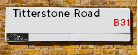
Titterstone Road in the city of BIRMINGHAM
About Titterstone Road
Titterstone Road is a street located in the city of Birmingham. It uses the postcode B31 3SX. The street has a length of approximately 227 metres.
The street is publicly maintained which means that the road is adopted and Birmingham is responsible for the repair and upkeep of the highway.
The street is located within the Birmingham District (B) Council's jurisdiction. They provide various services, like refuse collection, and manage council tax collection. It's situated in the West Midlands region of the UK.
The road has been assigned the Unique Street Reference Number of 2701142 in the National Street Gazetteer.
It is located within the county of West Midlands, situated in the West Midlands region of the UK. It's 100.86 miles North West from central London., 6.31 miles South West from Birmingham, 17.73 miles North East from Worcester and 19.47 miles West from Coventry.
TITTERSTONE ROAD is within the Post Town of BIRMINGHAM

Do you know why this road is called Titterstone Road?
What's it like to live here?
Ask the community a question.
Do you have any questions, memories to share or know any facts? We'd love to know more.
Map of Titterstone Road
| Street Crime (updated 02/11/2024) | ||
|---|---|---|
| Location Note | Central Point of Street - Not Actual Location | |
| MSOA Info | For MSOA E02001952 (Statistical Neighbourhood) | |
| Click Hint | Click on a Circle for a detailed breakdown below map. | |
| Crime Levels |
Green = Very Low Yellow = Low Orange = High Red = Very High |
|
| Postcodes | ||
| Icon | Postcodes for Titterstone Road | |
| Walking Distances | ||
| Distance Info | Green Circle = 10 Minutes Walk (800 metres) | |
Street Crime Data accessed from data.police.uk on 06/10/2024.
Budget Friendly Hotels near Titterstone Road
| Budget Hotel Name | Distance (miles) |
|---|---|
|
1: Name:Premier Inn Birmingham South Longbridge Station Address: 1 High Street Telephone: Visit Hotel Page |
0.66 |
|
2: Name:Premier Inn Birmingham South Rubery Address: Great Park Telephone: Visit Hotel Page |
1.66 |
|
3: Name:Travelodge Birmingham Frankley M5 Southbound Address: Moto Service Area, Illey Ln, M5 Motorway, Frankley, Birmingham, B32 4AR Telephone: 0871 984 6067 Visit Hotel Page |
2.97 |
|
4: Name:Travelodge Birmingham Maypole Address: Maypole Lane, Birmingham, B14 5JF Telephone: 0871 559 1896 Visit Hotel Page |
3.54 |
|
5: Name:Travelodge Bromsgrove Marlbrook Address: 462 Birmingham Rd, Marlbrook, Bromsgrove, B61 0HR Telephone: 0871 559 1809 Visit Hotel Page |
3.95 |
Your support helps keep this site running!
If you enjoy using this website, consider buying me a coffee to help cover hosting costs.
House Sales
| Year | High | Low | Average | Sales |
|---|---|---|---|---|
| 2014 | £97,000 | £97,000 | £97,000 | 1 |
| 2017 | £123,000 | £123,000 | £123,000 | 1 |
| 2019 | £120,000 | £241,000 | £180,500 | 2 |
| 2020 | £148,000 | £148,000 | £148,000 | 1 |
| 2021 | £160,000 | £186,000 | £173,000 | 2 |
Contains HM Land Registry data © Crown copyright and database right 2024. This data is licensed under the Open Government Licence v3.0.
Nearby Estate Agents
| Name | Address | Website |
|---|---|---|
| Ashley Borne Sales and Lettings | 11A Alvechurch Road, West Heath, Birmingham, B31 3JW | Visit Website |
| A P Morgan Estate Agents | 1 Devon Way, Northfield, Birmingham, B31 2TS | Visit Website |
| Genie Homes | 1668 Bristol Road South Rubery Rednal Birmingham B45 9TY | Visit Website |
| Dixons | 830 Bristol Road South, Northfield, Birmingham, West Midlands, B31 2NS | |
| Evans Estate Agents | 886a Bristol Road South Northfield Birmingham B31 2NS | Visit Website |
We have found 1 postcode
Neighbourhood Policing |
| Police Force: West Midlands |
 View Neighbourhood Crime and Policing View Neighbourhood Crime and Policing |
| Find a Local Neighbourhood Watch Scheme |
Location Details
| Titterstone Road | |
|---|---|

| |
| Latitude | 52.398082 |
| Longitude | -1.969440 |
| OS Easting (X): | 402079 |
| OS Northing (Y): | 277827 |
| OS Grid Reference: | SP021778 |
Roads that have a Junction with Titterstone Road
| Street | Junction Type |
|---|---|
| Clunbury Road | junction |
| Fairfax Road | junction |
Sunset and Sunrise times
| Sunrise | 07:38 |
|---|---|
| Sunset | 16:09 |
Latest Weather Conditions
| Observed at Weather Station: | Coleshill 21 November 2024 at 19:00 (13.10 miles away) |
|---|---|
| Current Weather: | Clear night |
| Temperature and Humidity: | 1.5°C (77.5%) |
| Wind Direction and Speed: | W (7 mph) |
Population Statistics
| ONS Area Code | E00046714 |
|---|---|
| ONS Area Name | Multi-Ethnic Hardship |
| Average Age | 39.42 |
| Area Population | 1678.00 |
| Male Population | 794.00 (47%) |
| Female Population | 884.00 (53%) |
| Benefit Claimants | 62 (4%) |
| LSOA Code: | E01009212 |
|---|---|
| LSOA Name: | Birmingham 126C |
| SOA Code: | 4c |
| SOA Name: | |
| MSOA Code: | E02001952 |
| MSOA Name: | Birmingham 126 |
Nearest Supermarkets
| Tesco West Heath Birmingham Express |
|---|
| 6 Redhill Rd, Birmingham, B31 3LD |
| 0345 675 6907 |
| Distance: 0.39 Miles |
| Directions to Tesco West Heath Birmingham Express |
| Sainsburys Longbridge |
|---|
| Longbridge Lane, Birmingham, England, B31 2TW |
| 0121 623 7030 |
| Distance: 0.61 Miles |
| Directions to Sainsburys Longbridge |
| Sainsburys Northfield |
|---|
| Frankley Beeches Road, Birmingham, England, B31 5AA |
| 0121 476 9133 |
| Distance: 1.03 Miles |
| Directions to Sainsburys Northfield |
| Tesco Birmingham Frankley Express |
|---|
| 414 Frankley Beeches Rd, Birmingham, B31 5NJ |
| 0345 675 7182 |
| Distance: 1.29 Miles |
| Directions to Tesco Birmingham Frankley Express |
Telephone Information
| Area Code |
|---|
| Area Code: 01527 - Redditch |
| Area Code: 0121 - Birmingham |
| Area Code: 01384 - Dudley |
Broadband Information
| Speed | Average Speed | Median Speed | Maximum Speed | Next-generation access (NGA) | Number of Connections |
|---|---|---|---|---|---|
| Less than 2 Mbps | 15.5 | 6.3 | >=30 | Y | 17 |
Local Government
| Local Council Details |
|---|
| Within the area of Birmingham |
| Visit the Council's Website |
| Council House, Victoria Square, Birmingham &B1 1BB |
| Send email |
| Telephone Number: 0121 303 1111 |
| Local Member of Parliament |
|---|
| Within the Westminster Parliamentary Constituency of Birmingham &Northfield |
| The Member of Parliament is Laurence Turner |
| Details for the MP Laurence Turner on parliament.uk |
| Details for the MP Laurence Turner on theyworkforyou.com |
| In the 2024 General Election Laurence Turner won with a majority of 5,389 the result was Lab gain from Con. The total electorate was 74,048 |
| Wards, Parish Councils and County Councils |
|---|
| Ward: Longbridge & West Heath Ward |
| Parish: Unparished area |
| Ceremonial County: West Midlands |
Nearest Schools
England Secondary Schools
St Thomas Aquinas Catholic School
Address: St Thomas Aquinas Catholic School, Wychall Lane, Kings Norton, Birmingham, West Midlands, B38 8AP
Distance: 1.22 miles
Contact:
Turves Green Girls' School
Address: Turves Green Girls' School, Turves Green, Northfield, Birmingham, West Midlands, B31 4BP
Distance: 0.15 miles
Contact:
Turves Green Boys' School
Address: Turves Green Boys' School, Turves Green, Northfield, Birmingham, West Midlands, B31 4BS
Distance: 0.09 miles
Contact:
Ark Kings Academy
Address: Ark Kings Academy, Shannon Road, Kings Norton, Birmingham, West Midlands, B38 9DE
Distance: 1.60 miles
Contact: 01214594451
St Thomas Aquinas Catholic School
Address: St Thomas Aquinas Catholic School, Wychall Lane, Kings Norton, Birmingham, West Midlands, B38 8AP
Distance: 1.22 miles
Contact: 01214644643
Colmers School and Sixth Form College
Address: Colmers School and Sixth Form College, Bristol Road South, Rednal, Birmingham, West Midlands, B45 9NY
Distance: 1.43 miles
Contact: 01214531778
England Primary Schools
Turves Green Primary School
Address: Turves Green Primary School, Northfield, Birmingham, West Midlands, B31 4BP
Distance: 0.15 miles
Contact:
Cofton Primary School
Address: Cofton Primary School, Wootton Road, West Heath, Birmingham, West Midlands, B31 4ST
Distance: 0.55 miles
Contact: 01214753374
Bellfield Junior School
Address: Bellfield Junior School, Vineyard Road, Northfield, Birmingham, West Midlands, B31 1PT
Distance: 1.29 miles
Contact: 01214642895
Bellfield Infant School (NC)
Address: Bellfield Infant School (NC), Vineyard Road, Birmingham, West Midlands, B31 1PT
Distance: 1.29 miles
Contact: 01214644855
St Laurence Church Infant School
Address: St Laurence Church Infant School, Bunbury Road, Northfield, Birmingham, West Midlands, B31 2DJ
Distance: 1.11 miles
Contact: 01214642888
St Laurence Church Junior School
Address: St Laurence Church Junior School, Bunbury Road, Northfield, Birmingham, West Midlands, B31 2DJ
Distance: 1.11 miles
Contact: 01214646499
The Meadows Primary School
Address: The Meadows Primary School, Bristol Road South, Northfield, Bristol Road South, Northfield, Birmingham, West Midlands, B31 2SW
Distance: 0.61 miles
Contact: 01216753203
Hawkesley Church Primary Academy
Address: Hawkesley Church Primary Academy, 376 Shannon Road, Kings Norton, Birmingham, West Midlands, B38 9TR
Distance: 1.32 miles
Contact: 01214596467
Fairway Primary Academy
Address: Fairway Primary Academy, Muirfield Gardens, Kings Norton, Birmingham, West Midlands, B38 8XQ
Distance: 1.11 miles
Contact: 01214643200
Wychall Primary School
Address: Wychall Primary School, Middle Field Road, Northfield, Birmingham, West Midlands, B31 3EH
Distance: 1.03 miles
Contact: 01214644255
West Heath Primary School
Address: West Heath Primary School, Rednal Road, West Heath Primary, Birmingham, West Midlands, B38 8HU
Distance: 0.62 miles
Contact: 01214584257
Turves Green Primary School
Address: Turves Green Primary School, Northfield, Birmingham, West Midlands, B31 4BP
Distance: 0.15 miles
Contact: 01214643686
St John Fisher Catholic Primary School
Address: St John Fisher Catholic Primary School, Alvechurch Road, West Heath, Birmingham, West Midlands, B31 3PN
Distance: 0.48 miles
Contact:
Albert Bradbeer Primary Academy
Address: Albert Bradbeer Primary Academy, Turves Green, Longbridge, Birmingham, West Midlands, B31 4RD
Distance: 0.30 miles
Contact: 01214642356
St Brigid's Catholic Primary School
Address: St Brigid's Catholic Primary School, Frankley Beeches Road, Northfield, Birmingham, West Midlands, B31 5AB
Distance: 0.97 miles
Contact: 01214642364
St Columba's Catholic Primary School
Address: St Columba's Catholic Primary School, Lickey Road, Rednal, Birmingham, West Midlands, B45 8TD
Distance: 0.94 miles
Contact: 01216754841
Colmers Farm Primary School
Address: Colmers Farm Primary School, Leybrook Road, Birmingham, West Midlands, B45 9PB
Distance: 1.45 miles
Contact:
Nearest Hospitals
| West Heath Hospital |
|---|
| Address: West Heath Hospital, Rednal Road, Birmingham, B38 8HR, |
| NHS Sector |
| Birmingham Community Healthcare NHS Foundation Trust |
| Telephone: 0121 466 6000 |
| Distance: 1.06 (miles) |
| Directions from to West Heath Hospital |
| Hillis Lodge |
|---|
| Address: Hollymoor Way, Northfield, Birmingham, |
| NHS Sector |
| Birmingham and Solihull Mental Health NHS Foundation Trust |
| Telephone: 0121 301 4100 |
| Visit Hospital Website |
| Distance: 1.76 (miles) |
| Directions from to Hillis Lodge |
| Cygnet Wast Hills |
|---|
| Address: Wasthill Lane, Kings Norton, Birmingham, B38 9ET, |
| NHS Sector |
| Cygnet Health Care Limited |
| Telephone: 0121 458 2263 |
| Visit Hospital Website |
| Distance: 2.24 (miles) |
| Directions from to Cygnet Wast Hills |
Nearest Dentists
Dentists
DENTAL SURGERY
Address: 225 LONGBRIDGE LANE, BIRMINGHAM, WEST MIDLANDS, B31 4RE
Distance: 0.34 miles
Contact: :
DENTAL SURGERY
Address: 31 REDHILL ROAD, NORTHFIELD, BIRMINGHAM, WEST MIDLANDS, B31 3JS
Distance: 0.41 miles
Contact: :
DENTAL SURGERY
Address: 990 BRISTOL ROAD SOUTH, NORTHFIELD, BIRMINGHAM, WEST MIDLANDS, B31 2PE
Distance: 0.87 miles
Contact: :
HILLTOP DENTAL SPA
Address: 1007 BRISTOL ROAD SOUTH, NORTHFIELD, BIRMINGHAM, B31 2QT
Distance: 0.89 miles
Contact: :
NORTHFIELD HEALTH CENTRE
Address: 15 ST HELIERS ROAD, BIRMINGHAM, WEST MIDLANDS, B31 1QT
Distance: 1.05 miles
Contact: :
HOLLYMOOR TOWER DENTAL SURGERY
Address: MANOR PARK GROVE, NORTHFIELD, BIRMINGHAM, WEST MIDLANDS, B31 5ER
Distance: 1.30 miles
Contact: :
Nearest GP Surgeries
Doctors
COFTON MEDICAL CENTRE
Address: 2 ROBINSFIELD DRIVE, BIRMINGHAM, WEST MIDLANDS, B31 4TU
Distance: 0.39 miles
Contact: tel: 0121 6935777
WEST HEATH SURGERY - COVID LOCAL VACCINATION SERVICE 2
Address: 196 WEST HEATH ROAD, NORTHFIELD, BIRMINGHAM, B31 3HB
Distance: 0.40 miles
Contact: :
WEST HEATH SURGERY
Address: 196 WEST HEATH ROAD, NORTHFIELD, BIRMINGHAM, WEST MIDLANDS, B31 3HB
Distance: 0.40 miles
Contact: tel: 0121 4761135
WEST HEATH PRIMARY C CTR
Address: WEST HEATH PRIMARY C.CTR, 481 REDNAL ROAD, KINGS NORTON, BIRMINGHAM, WEST MIDLANDS, B38 8AX
Distance: 0.67 miles
Contact: tel: 0121 4658188
WOODLAND ROAD SURGERY
Address: 57 WOODLAND ROAD, NORTHFIELD, BIRMINGHAM, WEST MIDLANDS, B31 2HZ
Distance: 0.89 miles
Contact: tel: 0121 4751065
ST HELIERS MEDICAL PRACTICE
Address: 15 ST. HELIERS ROAD, BIRMINGHAM, B31 1QT
Distance: 1.05 miles
Contact: tel: 0121 4781850
Nearest Dispensing Chemists
Pharmacies
KNIGHTS WEST HEATH PHARMACY
Address: 5 ALVECHURCH ROAD, WEST HEATH, BIRMINGHAM, WEST MIDLANDS, B31 3JW
Distance: 0.36 miles
Contact: tel: 01214 770123
BOOTS
Address: 11 ALVECHURCH ROAD, WEST HEATH, BIRMINGHAM, WEST MIDLANDS, B31 3JP
Distance: 0.37 miles
Contact: tel: 0121 4752790
KNIGHTS LONGBRIDGE PHARMACY
Address: 4 SUNBURY ROAD, LONGBRIDGE, BIRMINGHAM, WEST MIDLANDS, B31 4LJ
Distance: 0.47 miles
Contact: tel: 01214 752655
BOOTS
Address: 1 MIDDLEMORE ROAD, NORTHFIELD, BIRMINGHAM, WEST MIDLANDS, B31 3UD
Distance: 0.78 miles
Contact: tel: 0121 6043000
KNIGHTS ROYSTON HALL PHARMACY
Address: 15 ST HELIERS ROAD, NORTHFIELD, BIRMINGHAM, WEST MIDLANDS, B31 1QT
Distance: 1.05 miles
Contact: tel: 01214 754427
CLOCK PHARMACY
Address: 827 BRISTOL ROAD SOUTH, NORTHFIELD, BIRMINGHAM, WEST MIDLANDS, B31 2PA
Distance: 1.07 miles
Contact: tel: 0121 4774646
Nearest Opticians
Opticians
Transport
Nearest Rail Stations
Longbridge Station is 0.51 miles away.
Address: Longbridge station, Longbridge Lane, Birmingham, West Midlands, B31 2TW
Longbridge is situated on the Bristol to Brimingham Line.
Longbridge Station is staffed on a part time basis.
Northfield Station is 0.72 miles away.
Address: Northfield station, Quarry Lane, Northfield, West Midlands, B31 2PY
Northfield is situated on the Bristol to Brimingham Line.
Northfield Station is staffed on a part time basis.