Warwards Lane is a street located in the city of Birmingham. The street has a length of approximately 878 metres.
The street is located within the Birmingham District (B) Council's jurisdiction. They provide various services, like refuse collection, and manage council tax collection. It's situated in the West Midlands region of the UK.
The road has been assigned the Unique Street Reference Number of 2703694 and 2703534 in the National Street Gazetteer.
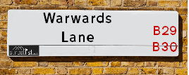
The street has the postcodes of B29 7RE, B29 7RD, B29 7RB, B29 7RA, B29 7QX, B29 7QU and B29 7QR.
It is located within the county of West Midlands, situated in the West Midlands region of the UK. It's 100.93 miles North West from central London., 3.14 miles South from Birmingham, 17.6 miles West from Coventry and 20.99 miles North East from Worcester.
Map of Warwards Lane
| Postcodes | ||
|---|---|---|
| Icon | Postcodes for Warwards Lane | |
| Walking Distances | ||
| Distance Info | Green Circle = 10 Minutes Walk (800 metres) | |
Street Crime Data accessed from data.police.uk on 06/10/2024.
Moving to Warwards Lane?
I can help you uncover potential pitfalls and provide key questions to ask about your new property. With decades of experience as a Local Land Charges Manager, I offer confidential insights to make your move informed and stress-free.
This service is free, but you may wish to make an optional donation to support it. Please include the property name and address in your request as well as anything you wish to focus on.
Contact Me
Do you know why this road is called Warwards Lane?
What's it like to live here?
Share a Photo of Warwards Lane
Ask the community a question.
Do you have any questions, memories to share, have any photos or know any facts? We'd love to know more.
Submit Your Comment
Budget Friendly Hotels near Warwards Lane
| Budget Hotel Name | Distance (miles) |
|---|---|
|
1: Name:Premier Inn Birmingham Central Hagley Road Address: 176 - 184 Hagley Road Telephone: Visit Hotel Page |
2.54 |
|
2: Name:Travelodge Birmingham Maypole Address: Maypole Lane, Birmingham, B14 5JF Telephone: 0871 559 1896 Visit Hotel Page |
2.64 |
|
3: Name:Travelodge Birmingham Central Broadway Plaza Address: 220 Ladywood Middleway, Birmingham, B16 8LP Telephone: 0871 984 6325 Visit Hotel Page |
2.64 |
|
4: Name:ibis budget Birmingham Centre Address: Great Colmore Street Telephone: Visit Hotel Page |
2.65 |
|
5: Name:Premier Inn Birmingham City Centre Broad Street Address: Essington Street Telephone: Visit Hotel Page |
2.77 |
Hotel Options
Your support helps keep this site running!
If you enjoy using this website, consider making a donation to help me cover hosting costs.
Nearby Estate Agents
| Name | Address | Website |
|---|---|---|
| Amber Court Lettings | 19 Raddlebarn Road, Selly Oak, Birmingham, B29 6HJ | Visit Website |
| MasonKnight Properties | 201B Tiverton Road, Selly Oak, Birmingham, B29 6DB | Visit Website |
| Charles Church Central | Macniece Close, Birmingham, West Midlands, B29 6WS | Visit Website |
| Purple Frog Property Limited | 189 Dawlish Road, Bournbrook, Birmingham, B29 7AW | Visit Website |
| Robert Oulsnam & Company | 1394 & 1396 Pershore Road, Stirchley, Birmingham, B30 2PH |
Neighbourhood Policing |
| Police Force: West Midlands |
 View Neighbourhood Crime and Policing View Neighbourhood Crime and Policing |
| Find a Local Neighbourhood Watch Scheme |
Location Details
| Warwards Lane | |
|---|---|

| |
| Latitude | 52.435820 |
| Longitude | -1.923079 |
| OS Easting (X): | 405228 |
| OS Northing (Y): | 282027 |
| OS Grid Reference: | SP052820 |
Roads that have a Junction with Warwards Lane
| Street | Junction Type |
|---|---|
| Ribblesdale Road | junction |
| Pershore Road (A441) | junction |
| St Stephens Road | junction |
| Darris Road | junction |
| Milner Road | junction |
| Woodside Road | junction |
| Raddlebarn Road | junction |
Sunset and Sunrise times
| Sunrise | 08:15 |
|---|---|
| Sunset | 16:05 |
Latest Weather Conditions
| Observed at Weather Station: | Coleshill 31 December 2024 at 09:00 (10.32 miles away) |
|---|---|
| Current Weather: | Overcast |
| Temperature and Humidity: | 8.5°C (85.3%) |
| Wind Direction and Speed: | SSW (16 mph) |
Population Statistics
| ONS Area Code | E00047063, E00047080, E00047093 & E00047091 |
|---|---|
| ONS Area Name | Student Digs, Achieving Minorities & Inner City Ethnic Mix |
| Average Age | 25.03, 34.97 & 36.20 |
| Area Population | 2212.00, 1516.00 & 1648.00 |
| Male Population | 1069.00, 777.00 & 891.00 (51%) |
| Female Population | 1143.00, 739.00 & 757.00 (49%) |
| Benefit Claimants | 8, 35 & 33 (1%) |
| LSOA Code: | E01009286, E01009293 &E01009282 |
|---|---|
| LSOA Name: | Birmingham 096C, Birmingham 100D &Birmingham 100B |
| SOA Code: | 1a, 7b &7a |
| SOA Name: | |
| MSOA Code: | E02001922 &E02001926 |
| MSOA Name: | Birmingham 096 &Birmingham 100 |
Nearest Supermarkets
| Sainsburys Selly Oak Bristol Road Local |
|---|
| 535 Bristol Road, Selly Oak, England, B29 6BD |
| 1214712485 |
| Distance: 0.79 Miles |
| Directions to Sainsburys Selly Oak Bristol Road Local |
| Iceland Selly Oak Food Warehouse |
|---|
| BATTERY RETAIL PARK, BIRMINGHAM, , B29 6SJ |
| 01214727636 |
| Distance: 0.81 Miles |
| Directions to Iceland Selly Oak Food Warehouse |
| Tesco Birmingham Bristol Rd Express |
|---|
| 581 Bristol Rd, Kingston Park, Birmingham, B29 6BE |
| 0345 671 9572 |
| Distance: 0.81 Miles |
| Directions to Tesco Birmingham Bristol Rd Express |
| Tesco Selly Oak Bristol Rd Esso Express |
|---|
| 479 Bristol Rd, Bournbrook, B29 6BA |
| 0345 675 7156 |
| Distance: 0.82 Miles |
| Directions to Tesco Selly Oak Bristol Rd Esso Express |
Telephone Information
| Dialling Code | Telephone Exchange | Telephone Cabinet | Fibre to the Cabinet or Fibre to the Premises |
|---|---|---|---|
| 0121 | SELLY OAK - CMSEL | P11 | FTTC |
Local Government
| Local Council Details |
|---|
| Within the area of Birmingham |
| Visit the Council's Website |
| Council House, Victoria Square, Birmingham &B1 1BB |
| Send email |
| Telephone Number: 0121 303 1111 |
| Local Member of Parliament |
|---|
| Within the Westminster Parliamentary Constituency of Birmingham &Selly Oak |
| The Member of Parliament is Alistair Carns |
| Details for the MP Alistair Carns on parliament.uk |
| Details for the MP Alistair Carns on theyworkforyou.com |
| In the 2024 General Election Alistair Carns won with a majority of 11,537 the result was Lab hold. The total electorate was 75,678 |
| Wards, Parish Councils and County Councils |
|---|
| Ward: Bournbrook & Selly Park Ward |
| Ceremonial County: West Midlands |
Nearest Schools
England Secondary Schools
King Edward VI Camp Hill School for Boys
Address: King Edward VI Camp Hill School for Boys, Vicarage Road, Kings Heath, Birmingham, West Midlands, B14 7QJ
Distance: 0.94 miles
Contact:
King Edward VI Camp Hill School for Girls
Address: King Edward VI Camp Hill School for Girls, Vicarage Road, Kings Heath, Birmingham, West Midlands, B14 7QJ
Distance: 0.94 miles
Contact:
Selly Park Girls' School
Address: Selly Park Girls' School, 5 Selly Park Road, Selly Park, Birmingham, West Midlands, B29 7PH
Distance: 0.21 miles
Contact: 01214721238
Dame Elizabeth Cadbury Technology College
Address: Dame Elizabeth Cadbury Technology College, Woodbrooke Road, Bournville, Birmingham, West Midlands, B30 1UL
Distance: 1.00 miles
Contact:
King Edward VI Camp Hill School for Boys
Address: King Edward VI Camp Hill School for Boys, Vicarage Road, Kings Heath, Birmingham, West Midlands, B14 7QJ
Distance: 0.94 miles
Contact: 01214443188
King Edward VI Camp Hill School for Girls
Address: King Edward VI Camp Hill School for Girls, Vicarage Road, Kings Heath, Birmingham, West Midlands, B14 7QJ
Distance: 0.94 miles
Contact: 01214442150
Dame Elizabeth Cadbury School
Address: Dame Elizabeth Cadbury School, Woodbrooke Road, Bournville, Birmingham, West Midlands, B30 1UL
Distance: 1.00 miles
Contact: 01214644040
The University of Birmingham School
Address: The University of Birmingham School, Weoley Park Road, Selly Oak, Birmingham, B29 6QU
Distance: 1.07 miles
Contact: 01217965000
England Primary Schools
Colmore Infant and Nursery School
Address: Colmore Infant and Nursery School, Colmore Road, Kings Heath, Birmingham, West Midlands, B14 6AJ
Distance: 1.15 miles
Contact: 01214642820
Colmore Junior School
Address: Colmore Junior School, Colmore Road, Kings Heath, Birmingham, West Midlands, B14 6AJ
Distance: 1.15 miles
Contact: 01214642843
St Edward's Catholic Primary School
Address: St Edward's Catholic Primary School, Greenland Road, Selly Park, Birmingham, West Midlands, B29 7PN
Distance: 0.30 miles
Contact: 01214641730
Stirchley Primary School
Address: Stirchley Primary School, Pershore Road, Birmingham, West Midlands, B30 2JL
Distance: 0.70 miles
Contact:
Raddlebarn Primary School
Address: Raddlebarn Primary School, Gristhorpe Road, Selly Oak, Birmingham, West Midlands, B29 7TD
Distance: 0.18 miles
Contact: 01214720062
Bournville Infant School
Address: Bournville Infant School, Linden Road, Birmingham, West Midlands, B30 1JY
Distance: 0.72 miles
Contact:
Bournville Village Primary
Address: Bournville Village Primary, Linden Road, Bournville, Birmingham, West Midlands, B30 1JY
Distance: 0.72 miles
Contact: 01216759098
St Mary's Church of England Primary School
Address: St Mary's Church of England Primary School, Lodge Hill Road, Selly Oak, Birmingham, West Midlands, B29 6NU
Distance: 0.90 miles
Contact: 01216751729
Moor Green Primary Academy
Address: Moor Green Primary Academy, Moor Green Lane, Moseley, Birmingham, B13 8QP
Distance: 0.60 miles
Contact: 01214645662
Stirchley Primary School
Address: Stirchley Primary School, Pershore Road, Stirchley, Birmingham, West Midlands, B30 2JL
Distance: 0.70 miles
Contact: 01214582989
Tiverton Academy
Address: Tiverton Academy, Tiverton Road, Selly Oak, Birmingham, West Midlands, B29 6BW
Distance: 0.70 miles
Contact: 01214643125
England Higher Schools
Fircroft College of Adult Education
Address: Fircroft College of Adult Education, 1018 Bristol Road, Selly Oak, Birmingham, West Midlands, B29 6LH
Distance: 0.95 miles
Contact: 01214720116
Nearest Hospitals
| Name | Address | Postcode | Distance | Map |
|---|
Nearest Dentists
Dentists
| Name | Address | Postcode | Distance | Map |
|---|
Nearest GP Surgeries
Doctors
RIVER BROOK MEDICAL CENTRE
Address: 3 RIVER BROOK DRIVE, STIRCHLEY, BIRMINGHAM, WEST MIDLANDS, B30 2SH
Distance: 0.44 miles
Contact: tel: 0121 4512525
RIVER BROOK MEDICAL CENTRE - COVID LOCAL VACCINATION SERVICE 2
Address: 3 RIVER BROOK DRIVE, STIRCHLEY, BIRMINGHAM, B30 2SH
Distance: 0.44 miles
Contact: :
UNIVERSITY SOUTHGATE PRACTICE
Address: 3 RIVER BROOK DRIVE, STIRCHLEY, BIRMINGHAM, B30 2SH
Distance: 0.44 miles
Contact: tel: 0121 4155237
BOURNVILLE SURGERY
Address: 41B SYCAMORE ROAD, BOURNVILLE, BIRMINGHAM, WEST MIDLANDS, B30 2AA
Distance: 0.53 miles
Contact: tel: 0121 4727231
BOURNVILLE SURGERY
Address: 41B SYCAMORE ROAD, BOURNVILLE, BIRMINGHAM, B30 2AA
Distance: 0.53 miles
Contact: :
MOOR GREEN LANE MEDICAL CENTRE
Address: 339 MOOR GREEN LANE, BIRMINGHAM, WEST MIDLANDS, B13 8QS
Distance: 0.55 miles
Contact: tel: 0121 4110393
Nearest Dispensing Chemists
Pharmacies
| Name | Address | Postcode | Telephone | Map | Distance in Km |
|---|
Nearest Opticians
Opticians
MAGINNIS OPTICIANS - STIRCHLEY
Address: 1379 PERSHORE ROAD, STIRCHLEY, BIRMINGHAM, WEST MIDLANDS, B30 2JR
Distance: 0.57 miles
Contact: :
SPECSAVERS (SELLY OAK)
Address: SAINSBURYS, 19 SELLY OAK SHOPPING PARK, CHAPEL LANE, BIRMINGHAM, B29 6SJ
Distance: 0.79 miles
Contact: :
THE EYE COLLECTIVE - SELLY OAK
Address: 14 SELLY OAK SHOPPING PARK, ASTON WEBB BOULEVARD, SELLY OAK, BIRMINGHAM, B29 6SQ
Distance: 0.90 miles
Contact: :
BRITTAIN OPTICIANS
Address: 97 HIGH STREET, HARBORNE, BIRMINGHAM, WEST MIDLANDS, B29 4AY
Distance: 1.18 miles
Contact: :
SW OPTICS
Address: UNIVERSITY OF BIRMINGHAM, EDGBASTON, BIRMINGHAM, WEST MIDLANDS, B15 2TT
Distance: 1.22 miles
Contact: :
SCRIVENS OPTICIANS (KINGS HEATH)
Address: 124 HIGH STREET, KINGS HEATH, BIRMINGHAM, WEST MIDLANDS, B14 7LG
Distance: 1.27 miles
Contact: :
Transport
Nearest Rail Stations
Bournville Station is 0.63 miles away.
Address: Bournville station, Bournville Lane, Bournville, West Midlands, B30 1LG
Bournville is situated on the Bristol to Brimingham Line.
Bournville Station is staffed on a part time basis.
Selly Oak Station is 0.69 miles away.
Address: Selly Oak station, Bristol Road, Selly Oak, West Midlands, B29 6DW
Selly Oak is situated on the Bristol to Brimingham Line.
Selly Oak Station is staffed on a part time basis.