Wagon Lane is a street located in the city of Birmingham and in the town of Solihull. The street has a length of approximately 872 metres.
The street is publicly maintained which means that the road is adopted and Birmingham is responsible for the repair and upkeep of the highway.
The street is located within the Solihull District (B) and Birmingham District (B) Council's jurisdiction. They provide various services, like refuse collection, and manage council tax collection. It's situated in the West Midlands region of the UK.
The road has been assigned the Unique Street Reference Number of 35000644 and 2707052 in the National Street Gazetteer.
The street has the postcodes of B92 7PW, B92 7PN, B92 7PD, B92 7PB, B92 7PA and B26 3DU.
It is located within the county of West Midlands, situated in the West Midlands region of the UK. It's 97.64 miles North West from central London., 4.84 miles East from Birmingham, 12.45 miles West from Coventry and 25.61 miles North East from Worcester.
WAGON LANE is within the Post Town of BIRMINGHAM
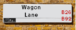
Map of Wagon Lane
| Street Crime (updated 14/01/2025) | ||
|---|---|---|
| Location Note | Central Point of Street - Not Actual Location | |
| MSOA Info | For MSOAs E02001907, E02002090 (Statistical Neighbourhood) | |
| Click Hint | Click on a Circle for a detailed breakdown below map. | |
| Crime Levels |
Green = Very Low Yellow = Low Orange = High Red = Very High |
|
| Postcodes | ||
| Icon | Postcodes for Wagon Lane | |
| Walking Distances | ||
| Distance Info | Green Circle = 10 Minutes Walk (800 metres) | |
Street Crime Data accessed from data.police.uk on 06/10/2024.
Moving to Wagon Lane?
I can help you uncover potential pitfalls and provide key questions to ask about your new property. With decades of experience as a Local Land Charges Manager, I offer confidential insights to make your move informed and stress-free.
This service is free, but you may wish to make an optional donation to support it. Please include the property name and address in your request as well as anything you wish to focus on.
Contact Me
Do you know why this road is called Wagon Lane?
What's it like to live here?
Share a Photo of Wagon Lane
Ask the community a question.
Do you have any questions, memories to share, have any photos or know any facts? We'd love to know more.
Submit Your Comment
Find Homes to Rent in Solihull

Budget Friendly Hotels near Wagon Lane
| Budget Hotel Name | Distance (miles) |
|---|---|
|
1: Name:Travelodge Birmingham Sheldon Address: 2225 Coventry Rd, Birmingham, B26 3EH Telephone: 0871 559 1806 Visit Hotel Page |
0.50 |
|
2: Name:Travelodge Birmingham Yardley Address: 1741 Coventry Rd, Birmingham, B26 1DS Telephone: 0871 984 6065 Visit Hotel Page |
0.57 |
|
3: Name:Holiday Inn Express Birmingham�South A45 Address: 1270 Coventry Road, Yardley Telephone: Visit Hotel Page |
1.45 |
|
4: Name:Travelodge Birmingham Airport Address: Terminal Rd, Birmingham, B26 3QW Telephone: 0871 984 6483 Visit Hotel Page |
1.91 |
|
5: Name:ibis budget Birmingham International Airport � NEC Address: Ambassador Road Telephone: Visit Hotel Page |
2.64 |
Hotel Options
Your support helps keep this site running!
If you enjoy using this website, consider making a donation to help me cover hosting costs.
Flats and Apartments in Wagon Lane
APARTMENT
APARTMENT
APARTMENT
APARTMENT
APARTMENT
APARTMENT
APARTMENT
APARTMENT
APARTMENT
APARTMENT
APARTMENT
APARTMENT
APARTMENT 2
APARTMENT 2
APARTMENT 2
APARTMENT 20
APARTMENT 30
APARTMENT 202
APARTMENT 203
APARTMENT 204
APARTMENT 205
APARTMENT 206
APARTMENT 207
APARTMENT 208
APARTMENT 209
APARTMENT 302
APARTMENT 303
APARTMENT 304
APARTMENT 305
APARTMENT 306
APARTMENT 307
APARTMENT 10
APARTMENT 20
APARTMENT 101
APARTMENT 102
APARTMENT 104
APARTMENT 105
APARTMENT 201
APARTMENT 202
APARTMENT 204
APARTMENT 205
FLAT 1
FLAT 2
FLAT 3
FLAT 4
FLAT 5
APARTMENT 101
APARTMENT 102
APARTMENT 103
EPC (Energy Performance Certificate) Information for Wagon Lane
UPRN: 10094976409
EPC Current: D
EPC Potential: D
Habitable Rooms: N/A
Property Type: Flat
Tenure: Not defined - use in the case of a new dwelling fo
Built Form: Detached
Age Band: 2021
Mains Gas: Unknown
UPRN: 10094976448
EPC Current: D
EPC Potential: D
Habitable Rooms: N/A
Property Type: Flat
Tenure: Not defined - use in the case of a new dwelling fo
Built Form: Detached
Age Band: 2021
Mains Gas: Unknown
UPRN: 10094976463
EPC Current: D
EPC Potential: D
Habitable Rooms: N/A
Property Type: Flat
Tenure: Not defined - use in the case of a new dwelling fo
Built Form: Detached
Age Band: 2021
Mains Gas: Unknown
UPRN: 10094976410
EPC Current: C
EPC Potential: C
Habitable Rooms: N/A
Property Type: Flat
Tenure: Not defined - use in the case of a new dwelling fo
Built Form: Detached
Age Band: 2021
Mains Gas: Unknown
UPRN: 10094976449
EPC Current: C
EPC Potential: C
Habitable Rooms: N/A
Property Type: Flat
Tenure: Not defined - use in the case of a new dwelling fo
Built Form: Detached
Age Band: 2021
Mains Gas: Unknown
UPRN: 10094976464
EPC Current: C
EPC Potential: C
Habitable Rooms: N/A
Property Type: Flat
Tenure: Not defined - use in the case of a new dwelling fo
Built Form: Detached
Age Band: 2021
Mains Gas: Unknown
UPRN: 10094976411
EPC Current: C
EPC Potential: C
Habitable Rooms: N/A
Property Type: Flat
Tenure: Not defined - use in the case of a new dwelling fo
Built Form: Detached
Age Band: 2021
Mains Gas: Unknown
UPRN: 10094976450
EPC Current: C
EPC Potential: C
Habitable Rooms: N/A
Property Type: Flat
Tenure: Not defined - use in the case of a new dwelling fo
Built Form: Detached
Age Band: 2021
Mains Gas: Unknown
UPRN: 10094976465
EPC Current: D
EPC Potential: D
Habitable Rooms: N/A
Property Type: Flat
Tenure: Not defined - use in the case of a new dwelling fo
Built Form: Detached
Age Band: 2021
Mains Gas: Unknown
UPRN: 10094976412
EPC Current: D
EPC Potential: D
Habitable Rooms: N/A
Property Type: Flat
Tenure: Not defined - use in the case of a new dwelling fo
Built Form: Detached
Age Band: 2021
Mains Gas: Unknown
UPRN: 10094976451
EPC Current: C
EPC Potential: C
Habitable Rooms: N/A
Property Type: Flat
Tenure: Not defined - use in the case of a new dwelling fo
Built Form: Detached
Age Band: 2021
Mains Gas: Unknown
UPRN: 10094976413
EPC Current: D
EPC Potential: D
Habitable Rooms: N/A
Property Type: Flat
Tenure: Not defined - use in the case of a new dwelling fo
Built Form: Detached
Age Band: 2021
Mains Gas: Unknown
UPRN: 10094976452
EPC Current: D
EPC Potential: D
Habitable Rooms: N/A
Property Type: Flat
Tenure: Not defined - use in the case of a new dwelling fo
Built Form: Detached
Age Band: 2021
Mains Gas: Unknown
UPRN: 10094976414
EPC Current: C
EPC Potential: C
Habitable Rooms: N/A
Property Type: Flat
Tenure: Not defined - use in the case of a new dwelling fo
Built Form: Detached
Age Band: 2021
Mains Gas: Unknown
UPRN: 10094976415
EPC Current: C
EPC Potential: C
Habitable Rooms: N/A
Property Type: Flat
Tenure: Not defined - use in the case of a new dwelling fo
Built Form: Detached
Age Band: 2021
Mains Gas: Unknown
UPRN: 10094976416
EPC Current: D
EPC Potential: D
Habitable Rooms: N/A
Property Type: Flat
Tenure: Not defined - use in the case of a new dwelling fo
Built Form: Detached
Age Band: 2021
Mains Gas: Unknown
UPRN: 10094976417
EPC Current: D
EPC Potential: D
Habitable Rooms: N/A
Property Type: Flat
Tenure: Not defined - use in the case of a new dwelling fo
Built Form: Detached
Age Band: 2021
Mains Gas: Unknown
UPRN: 10094976418
EPC Current: C
EPC Potential: C
Habitable Rooms: N/A
Property Type: Flat
Tenure: Not defined - use in the case of a new dwelling fo
Built Form: Detached
Age Band: 2021
Mains Gas: Unknown
UPRN: 10094976419
EPC Current: C
EPC Potential: C
Habitable Rooms: N/A
Property Type: Flat
Tenure: Not defined - use in the case of a new dwelling fo
Built Form: Detached
Age Band: 2021
Mains Gas: Unknown
UPRN: 10094976420
EPC Current: D
EPC Potential: D
Habitable Rooms: N/A
Property Type: Flat
Tenure: Not defined - use in the case of a new dwelling fo
Built Form: Detached
Age Band: 2021
Mains Gas: Unknown
UPRN: 10094976421
EPC Current: D
EPC Potential: D
Habitable Rooms: N/A
Property Type: Flat
Tenure: Not defined - use in the case of a new dwelling fo
Built Form: Detached
Age Band: 2021
Mains Gas: Unknown
UPRN: 10094976458
EPC Current: D
EPC Potential: D
Habitable Rooms: N/A
Property Type: Flat
Tenure: Not defined - use in the case of a new dwelling fo
Built Form: Detached
Age Band: 2021
Mains Gas: Unknown
UPRN: 10094976422
EPC Current: D
EPC Potential: D
Habitable Rooms: N/A
Property Type: Flat
Tenure: Not defined - use in the case of a new dwelling fo
Built Form: Detached
Age Band: 2021
Mains Gas: Unknown
UPRN: 10094976459
EPC Current: D
EPC Potential: D
Habitable Rooms: N/A
Property Type: Flat
Tenure: Not defined - use in the case of a new dwelling fo
Built Form: Detached
Age Band: 2021
Mains Gas: Unknown
UPRN: 10094976423
EPC Current: D
EPC Potential: D
Habitable Rooms: N/A
Property Type: Flat
Tenure: Not defined - use in the case of a new dwelling fo
Built Form: Detached
Age Band: 2021
Mains Gas: Unknown
UPRN: 10094976460
EPC Current: D
EPC Potential: D
Habitable Rooms: N/A
Property Type: Flat
Tenure: Not defined - use in the case of a new dwelling fo
Built Form: Detached
Age Band: 2021
Mains Gas: Unknown
UPRN: 10094976424
EPC Current: D
EPC Potential: D
Habitable Rooms: N/A
Property Type: Flat
Tenure: Not defined - use in the case of a new dwelling fo
Built Form: Detached
Age Band: 2021
Mains Gas: Unknown
UPRN: 10094976461
EPC Current: D
EPC Potential: D
Habitable Rooms: N/A
Property Type: Flat
Tenure: Not defined - use in the case of a new dwelling fo
Built Form: Detached
Age Band: 2021
Mains Gas: Unknown
UPRN: 10094976425
EPC Current: D
EPC Potential: D
Habitable Rooms: N/A
Property Type: Flat
Tenure: Not defined - use in the case of a new dwelling fo
Built Form: Detached
Age Band: 2021
Mains Gas: Unknown
UPRN: 10094976462
EPC Current: D
EPC Potential: D
Habitable Rooms: N/A
Property Type: Flat
Tenure: Not defined - use in the case of a new dwelling fo
Built Form: Detached
Age Band: 2021
Mains Gas: Unknown
UPRN: 10094976426
EPC Current: D
EPC Potential: D
Habitable Rooms: N/A
Property Type: Flat
Tenure: Not defined - use in the case of a new dwelling fo
Built Form: Detached
Age Band: 2021
Mains Gas: Unknown
UPRN: 10094976427
EPC Current: D
EPC Potential: D
Habitable Rooms: N/A
Property Type: Flat
Tenure: Not defined - use in the case of a new dwelling fo
Built Form: Detached
Age Band: 2021
Mains Gas: Unknown
UPRN: 10094976428
EPC Current: D
EPC Potential: D
Habitable Rooms: N/A
Property Type: Flat
Tenure: Not defined - use in the case of a new dwelling fo
Built Form: Detached
Age Band: 2021
Mains Gas: Unknown
UPRN: 10094976429
EPC Current: D
EPC Potential: D
Habitable Rooms: N/A
Property Type: Flat
Tenure: Not defined - use in the case of a new dwelling fo
Built Form: Detached
Age Band: 2021
Mains Gas: Unknown
UPRN: 10094976430
EPC Current: C
EPC Potential: C
Habitable Rooms: N/A
Property Type: Flat
Tenure: Not defined - use in the case of a new dwelling fo
Built Form: Detached
Age Band: 2021
Mains Gas: Unknown
UPRN: 10094976431
EPC Current: C
EPC Potential: C
Habitable Rooms: N/A
Property Type: Flat
Tenure: Not defined - use in the case of a new dwelling fo
Built Form: Detached
Age Band: 2021
Mains Gas: Unknown
UPRN: 10094976432
EPC Current: D
EPC Potential: D
Habitable Rooms: N/A
Property Type: Flat
Tenure: Not defined - use in the case of a new dwelling fo
Built Form: Detached
Age Band: 2021
Mains Gas: Unknown
UPRN: 10094976433
EPC Current: D
EPC Potential: D
Habitable Rooms: N/A
Property Type: Flat
Tenure: Not defined - use in the case of a new dwelling fo
Built Form: Detached
Age Band: 2021
Mains Gas: Unknown
UPRN: 10094976434
EPC Current: D
EPC Potential: D
Habitable Rooms: N/A
Property Type: Flat
Tenure: Not defined - use in the case of a new dwelling fo
Built Form: Detached
Age Band: 2021
Mains Gas: Unknown
UPRN: 10094976435
EPC Current: D
EPC Potential: D
Habitable Rooms: N/A
Property Type: Flat
Tenure: Not defined - use in the case of a new dwelling fo
Built Form: Detached
Age Band: 2021
Mains Gas: Unknown
UPRN: 10094976436
EPC Current: D
EPC Potential: D
Habitable Rooms: N/A
Property Type: Flat
Tenure: Not defined - use in the case of a new dwelling fo
Built Form: Detached
Age Band: 2021
Mains Gas: Unknown
UPRN: 10094976437
EPC Current: D
EPC Potential: D
Habitable Rooms: N/A
Property Type: Flat
Tenure: Not defined - use in the case of a new dwelling fo
Built Form: Detached
Age Band: 2021
Mains Gas: Unknown
UPRN: 10094976438
EPC Current: D
EPC Potential: D
Habitable Rooms: N/A
Property Type: Flat
Tenure: Not defined - use in the case of a new dwelling fo
Built Form: Detached
Age Band: 2021
Mains Gas: Unknown
UPRN: 10094976439
EPC Current: D
EPC Potential: D
Habitable Rooms: N/A
Property Type: Flat
Tenure: Not defined - use in the case of a new dwelling fo
Built Form: Detached
Age Band: 2021
Mains Gas: Unknown
UPRN: 10094976395
EPC Current: D
EPC Potential: D
Habitable Rooms: N/A
Property Type: Flat
Tenure: Not defined - use in the case of a new dwelling fo
Built Form: Detached
Age Band: 2021
Mains Gas: Unknown
UPRN: 10094976440
EPC Current: D
EPC Potential: D
Habitable Rooms: N/A
Property Type: Flat
Tenure: Not defined - use in the case of a new dwelling fo
Built Form: Detached
Age Band: 2021
Mains Gas: Unknown
UPRN: 10094976396
EPC Current: D
EPC Potential: D
Habitable Rooms: N/A
Property Type: Flat
Tenure: Not defined - use in the case of a new dwelling fo
Built Form: Detached
Age Band: 2021
Mains Gas: Unknown
UPRN: 10094976441
EPC Current: D
EPC Potential: D
Habitable Rooms: N/A
Property Type: Flat
Tenure: Not defined - use in the case of a new dwelling fo
Built Form: Detached
Age Band: 2021
Mains Gas: Unknown
UPRN: 10094976397
EPC Current: D
EPC Potential: D
Habitable Rooms: N/A
Property Type: Flat
Tenure: Not defined - use in the case of a new dwelling fo
Built Form: Detached
Age Band: 2021
Mains Gas: Unknown
UPRN: 10094976442
EPC Current: D
EPC Potential: D
Habitable Rooms: N/A
Property Type: Flat
Tenure: Not defined - use in the case of a new dwelling fo
Built Form: Detached
Age Band: 2021
Mains Gas: Unknown
UPRN: 10094976398
EPC Current: D
EPC Potential: D
Habitable Rooms: N/A
Property Type: Flat
Tenure: Not defined - use in the case of a new dwelling fo
Built Form: Detached
Age Band: 2021
Mains Gas: Unknown
UPRN: 10094976443
EPC Current: D
EPC Potential: D
Habitable Rooms: N/A
Property Type: Flat
Tenure: Not defined - use in the case of a new dwelling fo
Built Form: Detached
Age Band: 2021
Mains Gas: Unknown
UPRN: 10094976399
EPC Current: D
EPC Potential: D
Habitable Rooms: N/A
Property Type: Flat
Tenure: Not defined - use in the case of a new dwelling fo
Built Form: Detached
Age Band: 2021
Mains Gas: Unknown
UPRN: 10094976444
EPC Current: D
EPC Potential: D
Habitable Rooms: N/A
Property Type: Flat
Tenure: Not defined - use in the case of a new dwelling fo
Built Form: Detached
Age Band: 2021
Mains Gas: Unknown
UPRN: 10094976400
EPC Current: D
EPC Potential: D
Habitable Rooms: N/A
Property Type: Flat
Tenure: Not defined - use in the case of a new dwelling fo
Built Form: Detached
Age Band: 2021
Mains Gas: Unknown
UPRN: 10094976445
EPC Current: D
EPC Potential: D
Habitable Rooms: N/A
Property Type: Flat
Tenure: Not defined - use in the case of a new dwelling fo
Built Form: Detached
Age Band: 2021
Mains Gas: Unknown
UPRN: 10094976401
EPC Current: D
EPC Potential: D
Habitable Rooms: N/A
Property Type: Flat
Tenure: Not defined - use in the case of a new dwelling fo
Built Form: Detached
Age Band: 2021
Mains Gas: Unknown
UPRN: 10094976446
EPC Current: D
EPC Potential: D
Habitable Rooms: N/A
Property Type: Flat
Tenure: Not defined - use in the case of a new dwelling fo
Built Form: Detached
Age Band: 2021
Mains Gas: Unknown
UPRN: 10094976402
EPC Current: D
EPC Potential: D
Habitable Rooms: N/A
Property Type: Flat
Tenure: Not defined - use in the case of a new dwelling fo
Built Form: Detached
Age Band: 2021
Mains Gas: Unknown
UPRN: 10094976447
EPC Current: D
EPC Potential: D
Habitable Rooms: N/A
Property Type: Flat
Tenure: Not defined - use in the case of a new dwelling fo
Built Form: Detached
Age Band: 2021
Mains Gas: Unknown
UPRN: 10094976403
EPC Current: D
EPC Potential: D
Habitable Rooms: N/A
Property Type: Flat
Tenure: Not defined - use in the case of a new dwelling fo
Built Form: Detached
Age Band: 2021
Mains Gas: Unknown
UPRN: 10094976404
EPC Current: D
EPC Potential: D
Habitable Rooms: N/A
Property Type: Flat
Tenure: Not defined - use in the case of a new dwelling fo
Built Form: Detached
Age Band: 2021
Mains Gas: Unknown
UPRN: 10094976405
EPC Current: D
EPC Potential: D
Habitable Rooms: N/A
Property Type: Flat
Tenure: Not defined - use in the case of a new dwelling fo
Built Form: Detached
Age Band: 2021
Mains Gas: Unknown
UPRN: 10094976406
EPC Current: D
EPC Potential: D
Habitable Rooms: N/A
Property Type: Flat
Tenure: Not defined - use in the case of a new dwelling fo
Built Form: Detached
Age Band: 2021
Mains Gas: Unknown
UPRN: 100071446330
EPC Current: C
EPC Potential: C
Habitable Rooms: 3
Property Type: Flat
Tenure: Rented (private)
Built Form: Detached
Age Band: 1983-1990
Mains Gas: Yes
UPRN: 100071305452
EPC Current: C
EPC Potential: C
Habitable Rooms: 3
Property Type: Flat
Tenure: Rented (private)
Built Form: Detached
Age Band: 1983-1990
Mains Gas: Yes
UPRN: 100071305453
EPC Current: C
EPC Potential: C
Habitable Rooms: 3
Property Type: Flat
Tenure: rental (private)
Built Form: Detached
Age Band: 1983-1990
Mains Gas: Yes
UPRN: 100071305454
EPC Current: B
EPC Potential: B
Habitable Rooms: 3
Property Type: Flat
Tenure: rental (private)
Built Form: Semi-Detached
Age Band: 1983-1990
Mains Gas: Yes
UPRN: 100071305455
EPC Current: C
EPC Potential: C
Habitable Rooms: 3
Property Type: Flat
Tenure: rental (private)
Built Form: Detached
Age Band: 1983-1990
Mains Gas: Yes
House Sales
| Year | High | Low | Average | Sales |
|---|---|---|---|---|
| 2014 | £180,000 | £99,000 | £139,500 | 2 |
| 2015 | £154,500 | £149,500 | £200,875 | 8 |
| 2016 | £245,000 | £156,000 | £184,000 | 4 |
| 2017 | £265,000 | £200,000 | £259,136 | 11 |
| 2018 | £249,500 | £210,000 | £231,429 | 7 |
| 2019 | £292,500 | £226,000 | £259,700 | 5 |
| 2020 | £230,000 | £120,000 | £203,591 | 11 |
| 2021 | £275,000 | £196,500 | £262,300 | 5 |
| 2022 | £307,000 | £250,000 | £288,059 | 12 |
| 2023 | £231,000 | £237,500 | £234,250 | 2 |
Contains HM Land Registry data © Crown copyright and database right 2025. This data is licensed under the Open Government Licence v3.0.
Nearby Estate Agents
| Name | Address | Website |
|---|---|---|
| Sydney Mitchell Estate Agents | 2233 Coventry Road, Sheldon, Solihull, B26 3NL | Visit Website |
| Burchell Edwards | 2208 Coventry Road, Sheldon, Birmingham, B26 3JH | Visit Website |
| Melvyn Danes | 2214 Coventry Road, Sheldon, Birmingham, B26 3JH | Visit Website |
| Cityends Limited | 1620 Coventry Road, Yardley, Birmingham,B26 1AL | Visit Website |
| Encasa | 57 Warwick Road, Olton Hollow, Solihull, B92 7HS | Visit Website |
Neighbourhood Policing |
| Police Force: West Midlands |
 View Neighbourhood Crime and Policing View Neighbourhood Crime and Policing |
| Find a Local Neighbourhood Watch Scheme |
Location Details
| Wagon Lane | |
|---|---|

| |
| Latitude | 52.455396 |
| Longitude | -1.793328 |
| OS Easting (X): | 414042 |
| OS Northing (Y): | 284221 |
| OS Grid Reference: | SP140842 |
Known Residential Addresses for Wagon Lane
- 27
- THE LAURELS, 9 FLAT 1
- THE LAURELS, 9 FLAT 2
- THE LAURELS, 9 FLAT 3
- THE LAURELS, 9 FLAT 4
- 121 APARTMENT 6
- 121 APARTMENT 4
- SHELDON COURT, 1A
- THE LAURELS, 9 FLAT 5
- MYLEN HOUSE, 11
- 155
- 152
- 156
- 161
- 177
- 158
- 189
- 120
- 104
- 119
- 121 THE FARMHOUSE
- 108
- 79
- 93
- 69
- 71
- 91
- 100
- 61
- 98
- 75
- 59
- 65
- 90
- 58
- 83
- 76
- 97
- 55
- 42
- 45
- 48
- 47
- 33
- 25
- 121 APARTMENT 1
- 118
- 87
- 26
- 46
- 52
Roads that have a Junction with Wagon Lane
| Street | Junction Type |
|---|---|
| Barn Lane | junction |
| Coniston Avenue | junction |
| Amberley Road | junction |
| Wells Green Road | junction |
| Birchley Rise | junction |
| Marcot Road | junction |
| New Coventry Road (A45) | junction |
Sunset and Sunrise times
| Sunrise | 08:00 |
|---|---|
| Sunset | 16:37 |
Latest Weather Conditions
| Observed at Weather Station: | Coleshill 22 January 2025 at 06:00 (4.71 miles away) |
|---|---|
| Current Weather: | Mist |
| Temperature and Humidity: | 0.6°C (97.8%) |
| Wind Direction and Speed: | N (0 mph) |
Population Statistics
| ONS Area Code | E00047226, E00051378, E00051368 & E00051366 |
|---|---|
| ONS Area Name | Private Renting Young Families & Multi-Ethnic Suburbia |
| Average Age | 40.79, 39.44 & 43.52 |
| Area Population | 1647.00, 1465.00 & 1513.00 |
| Male Population | 778.00, 716.00 & 741.00 (48%) |
| Female Population | 869.00, 749.00 & 772.00 (52%) |
| Benefit Claimants | 30, 10 & 11 (1%) |
| LSOA Code: | E01009316, E01010163 &E01010162 |
|---|---|
| LSOA Name: | Birmingham 081B, Solihull 010D &Solihull 010C |
| SOA Code: | 3d, 8c &8b |
| SOA Name: | |
| MSOA Code: | E02001907 &E02002090 |
| MSOA Name: | Birmingham 081 &Solihull 010 |
Nearest Supermarkets
| Tesco Sheldon Superstore |
|---|
| Coventry Rd, Sheldon, Birmingham, B26 3DY |
| 0345 677 9845 |
| Distance: 0.19 Miles |
| Directions to Tesco Sheldon Superstore |
| Iceland Sheldon |
|---|
| 2154 Coventry Road, Sheldon, Birmingham, B26 3JB |
| 01217423939 |
| Distance: 0.42 Miles |
| Directions to Iceland Sheldon |
| Morrisons Sheldon |
|---|
| 2259-2297 Coventry Road, Sheldon B26 3PD |
| 0121 742 6584 |
| Distance: 0.7 Miles |
| Directions to Morrisons Sheldon |
| Tesco Hobs Moat Express |
|---|
| 47-49 Hobs Moat Rd, Sheldon, Solihull, B92 8JJ |
| 0345 026 9030 |
| Distance: 0.95 Miles |
| Directions to Tesco Hobs Moat Express |
Telephone Information
| Area Code |
|---|
| Area Code: 0121 - Birmingham |
| Area Code: 01675 - Coleshill |
| Area Code: 01676 - Meriden |
| Area Code: 01564 - Lapworth |
Broadband Information
| Speed | Average Speed | Median Speed | Maximum Speed | Next-generation access (NGA) | Number of Connections |
|---|---|---|---|---|---|
| Less than 2 Mbps | 18.9 | 16.4 | >=30 | Y | 29 |
Local Government
| Local Council Details |
|---|
| Within the area of Birmingham &Solihull |
| Visit the Council's Website |
| Visit the Council's Website |
| Council House, Victoria Square, Birmingham, B1 1BB, PO Box 18, Council House, Solihull, West Midlands &B91 3QS |
| Send email |
| Telephone Number: 0121 303 1111 &0121 704 6000 |
| Local Member of Parliament |
|---|
| Within the Westminster Parliamentary Constituency of Birmingham, Yardley &Solihull |
| The Member of Parliament is Jess Phillips &Neil Shastri-Hurst |
| Details for the MP Jess Phillips &Neil Shastri-Hurst on parliament.uk |
| Details for the MP Jess Phillips &Neil Shastri-Hurst on theyworkforyou.com |
| In the 2024 General Election Jess Phillips &Neil Shastri-Hurst won with a majority of 693 the result was Lab hold &Con hold. The total electorate was 73,203 |
| Wards, Parish Councils and County Councils |
|---|
| Ward: Sheldon &Lyndon Ward |
| Parish: Unparished area |
| Ceremonial County: West Midlands |
Nearest Schools
England Secondary Schools
King Edward VI Sheldon Heath Academy
Address: King Edward VI Sheldon Heath Academy, Sheldon Heath Road, Sheldon, Birmingham, West Midlands, B26 2RZ
Distance: 1.03 miles
Contact: 01216472471
Archbishop Ilsley Catholic School
Address: Archbishop Ilsley Catholic School, Victoria Road, Acocks Green, Birmingham, West Midlands, B27 7XY
Distance: 1.40 miles
Contact:
Cockshut Hill School
Address: Cockshut Hill School, Cockshut Hill, Yardley, Birmingham, West Midlands, B26 2HX
Distance: 0.90 miles
Contact: 01212895900
Cockshut Hill Technology College
Address: Cockshut Hill Technology College, Cockshut Hill, Yardley, Birmingham, West Midlands, B26 2HX
Distance: 0.90 miles
Contact:
Ark Victoria Academy
Address: Ark Victoria Academy, Talbot Way, Small Heath, Birmingham, West Midlands, B10 0HJ
Distance: 2.25 miles
Contact: 01213934459
Lyndon School
Address: Lyndon School, Daylesford Road, Solihull, West Midlands, B92 8EJ
Distance: 0.52 miles
Contact: 01217433402
England Primary Schools
Oasis Academy Blakenhale Junior
Address: Oasis Academy Blakenhale Junior, Homestead Road, Garretts Green, Birmingham, West Midlands, B33 0XG
Distance: 1.32 miles
Contact: 01217833960
Oasis Academy Blakenhale Infants
Address: Oasis Academy Blakenhale Infants, Blakenhale Road, Garrett's Green, Birmingham, West Midlands, B33 0XD
Distance: 1.34 miles
Contact: 01217833960
Lyndon Green Junior School
Address: Lyndon Green Junior School, Wensley Road, Sheldon, Birmingham, West Midlands, B26 1LU
Distance: 0.43 miles
Contact: 01216752983
Lyndon Green Infant School
Address: Lyndon Green Infant School, Wychwood Cresent, Sheldon, Birmingham, West Midlands, B26 1LZ
Distance: 0.33 miles
Contact: 01216753543
Gilbertstone Primary School
Address: Gilbertstone Primary School, Clay Lane, Birmingham, West Midlands, B26 1EH
Distance: 0.66 miles
Contact: 01214644664
Yardley Primary School
Address: Yardley Primary School, Harvey Road, Yardley, Birmingham, West Midlands, B26 1TD
Distance: 0.98 miles
Contact: 01214643235
Cottesbrooke Junior School
Address: Cottesbrooke Junior School, Cedars Avenue, Birmingham, West Midlands, B27 6JL
Distance: 1.15 miles
Contact:
Holy Souls Catholic Primary School
Address: Holy Souls Catholic Primary School, Mallard Close, Acocks Green, Birmingham, West Midlands, B27 6BN
Distance: 1.24 miles
Contact:
St Bernadette's Catholic Primary School
Address: St Bernadette's Catholic Primary School, Hobmoor Road, Yardley, Birmingham, West Midlands, B25 8QL
Distance: 1.69 miles
Contact: 01217837232
St Benedict's Primary School
Address: St Benedict's Primary School, St Benedict's Road, Birmingham, West Midlands, B10 9DP
Distance: 2.32 miles
Contact: 01214646420
Redhill Primary School
Address: Redhill Primary School, Redhill Road, Hay Mills, Birmingham, West Midlands, B25 8HQ
Distance: 1.73 miles
Contact: 01214646322
Holy Family Catholic Primary School
Address: Holy Family Catholic Primary School, Coventry Road, Small Heath, Birmingham, West Midlands, B10 0HT
Distance: 2.33 miles
Contact: 01216752670
Elms Farm Community Primary School
Address: Elms Farm Community Primary School, Dorncliffe Avenue, Sheldon, Birmingham, West Midlands, B33 0PJ
Distance: 1.03 miles
Contact: 01214644634
Stanville Primary School
Address: Stanville Primary School, Stanville Road, Birmingham, West Midlands, B26 3YN
Distance: 0.77 miles
Contact: 01214642322
St Thomas More Catholic Primary School
Address: St Thomas More Catholic Primary School, Horse Shoes Lane, Sheldon, Birmingham, West Midlands, B26 3HU
Distance: 0.41 miles
Contact:
Cottesbrooke Infant and Nursery School
Address: Cottesbrooke Infant and Nursery School, Yardley Road, Acocks Green, Birmingham, West Midlands, B27 6LG
Distance: 1.06 miles
Contact: 01217062742
Oasis Academy Hobmoor
Address: Oasis Academy Hobmoor, Wash Lane, Yardley, Birmingham, West Midlands, B25 8FD
Distance: 1.38 miles
Contact: 01216753269
Mapledene Primary School
Address: Mapledene Primary School, Mapledene Road, Mapledene Road, Birmingham, Uk, Birmingham, West Midlands, B26 3XE
Distance: 1.09 miles
Contact: 01214642881
Ulverley School
Address: Ulverley School, Rodney Road, Solihull, West Midlands, B92 8RZ
Distance: 1.38 miles
Contact:
St Andrew's Catholic Primary School
Address: St Andrew's Catholic Primary School, Windrush Close, Solihull, West Midlands, B92 8QL
Distance: 0.86 miles
Contact:
Valley Primary
Address: Valley Primary, Old Lode Lane, Solihull, West Midlands, B92 8LW
Distance: 0.87 miles
Contact: 01217434691
Olton Primary School
Address: Olton Primary School, Lyndon Road, Olton, Solihull, West Midlands, B92 7QF
Distance: 0.70 miles
Contact: 01217062644
St Margaret's Church of England Voluntary Aided Primary School
Address: St Margaret's Church of England Voluntary Aided Primary School, Richmond Road, Olton, Solihull, West Midlands, B92 7RR
Distance: 0.94 miles
Contact:
Kineton Green Primary School
Address: Kineton Green Primary School, Kineton Green Road, Olton, Solihull, West Midlands, B92 7EB
Distance: 1.59 miles
Contact: 01217063873
Our Lady of Compassion Catholic Primary School
Address: Our Lady of Compassion Catholic Primary School, Kineton Green Road, Solihull, West Midlands, B92 7EG
Distance: 1.86 miles
Contact:
Cedars Academy
Address: Cedars Academy, Cedars Avenue, Birmingham, West Midlands, B27 6JL
Distance: 1.15 miles
Contact: 01214643178
The Oaklands Primary School
Address: The Oaklands Primary School, Dolphin Lane, Acocks Green, Birmingham, West Midlands, B27 7BT
Distance: 1.53 miles
Contact: 01217062168
Nearest Hospitals
| Hertford House |
|---|
| Address: 29 Old Warwick Road, Olton, Solihull, B92 7JQ, |
| NHS Sector |
| Birmingham and Solihull Mental Health NHS Foundation Trust |
| Telephone: 0121 678 4860 |
| Visit Hospital Website |
| Distance: 2.14 (miles) |
| Directions from to Hertford House |
| Heartlands Hospital |
|---|
| Address: Bordesley Green East, Bordesley Green, Birmingham, B9 5SS, |
| Independent Sector |
| University Hospitals Birmingham NHS Foundation Trust |
| Telephone: 0121 424 2000 |
| Visit Hospital Website |
| Distance: 3.71 (miles) |
| Directions from to Heartlands Hospital |
| Brooklands Hospital |
|---|
| Address: Coleshill Road, Marston Green, Birmingham, B37 7HL, |
| NHS Sector |
| Coventry and Warwickshire Partnership NHS Trust |
| Telephone: 0121 329 4900 |
| Visit Hospital Website |
| Distance: 3.77 (miles) |
| Directions from to Brooklands Hospital |
Nearest Dentists
Dentists
DENTAL SURGERY
Address: 151 NEW COVENTRY ROAD, BIRMINGHAM, WEST MIDLANDS, B26 3DX
Distance: 0.09 miles
Contact: :
DENTAL SURGERY
Address: 26 SHEAF LANE, BIRMINGHAM, WEST MIDLANDS, B26 3HD
Distance: 0.49 miles
Contact: :
DENTAL SURGERY
Address: 22 MANOR HOUSE LANE, BIRMINGHAM, WEST MIDLANDS, B26 1PG
Distance: 0.60 miles
Contact: :
COVENTRY ROAD (DENTAL SURGERY)
Address: 2236A COVENTRY ROAD, SHELDON, BIRMINGHAM, WEST MIDLANDS, B26 3JH
Distance: 0.60 miles
Contact: :
BHANDAL DENTAL PRACTICE
Address: 1746 COVENTRY ROAD, YARDLEY, BIRMINGHAM, WEST MIDLANDS, B26 1BG
Distance: 0.71 miles
Contact: :
YEW TREE DENTAL SURGERY
Address: 529 HOB MOOR ROAD, YARDLEY, BIRMINGHAM, WEST MIDLANDS, B25 8TH
Distance: 1.12 miles
Contact: :
Nearest GP Surgeries
Doctors
MANOR HOUSE LANE SURGERY
Address: 1 MANOR HOUSE LANE, YARDLEY, BIRMINGHAM, WEST MIDLANDS, B26 1PE
Distance: 0.57 miles
Contact: tel: 0121 7432273
CHURCH ROAD SURGERY
Address: 90 CHURCH ROAD, SHELDON, BIRMINGHAM, WEST MIDLANDS, B26 3TP
Distance: 0.58 miles
Contact: tel: 0121 7411101
CRANES PARK ROAD SURGERY
Address: 25 CRANES PARK ROAD, SHELDON, BIRMINGHAM, WEST MIDLANDS, B26 3SE
Distance: 0.59 miles
Contact: tel: 0121 7432018
RICHMOND MEDICAL CENTRE
Address: 179 RICHMOND ROAD, SOLIHULL, WEST MIDLANDS, B92 7SA
Distance: 0.59 miles
Contact: tel: 0121 7432159
RICHMOND MEDICAL CENTRE - COVID LOCAL VACCINATION SERVICE 2
Address: 179 RICHMOND ROAD, SOLIHULL, B92 7SA
Distance: 0.59 miles
Contact: :
THE SHELDON MEDICAL CENTRE
Address: 169 CHURCH ROAD, SHELDON, BIRMINGHAM, WEST MIDLANDS, B26 3TT
Distance: 0.75 miles
Contact: tel: 0121 7435511
Nearest Dispensing Chemists
Pharmacies
PAN PHARMACY
Address: 2154A-2156 COVENTRY ROAD, SHELDON, BIRMINGHAM, B26 3JB
Distance: 0.42 miles
Contact: tel: 01217 438808
BOOTS
Address: 255 LYNDON ROAD, SOLIHULL, WEST MIDLANDS, B92 7QP
Distance: 0.44 miles
Contact: tel: 0121 7428325
MANOR PHARMACY
Address: 1756-1758 COVENTRY ROAD, YARDLEY, BIRMINGHAM, B26 1PB
Distance: 0.50 miles
Contact: tel: 01217 425679
PAN PHARMACY
Address: 160-160A COMMON LANE, SHELDON, BIRMINGHAM, B26 3DN
Distance: 0.52 miles
Contact: tel: 01217 432385
PAN PHARMACY
Address: 2222 COVENTRY ROAD, SHELDON, BIRMINGHAM, B26 3JH
Distance: 0.60 miles
Contact: tel: 01217 433676
PAN PHARMACY
Address: 136 GARRETTS GREEN LANE, SHELDON, BIRMINGHAM, WEST MIDLANDS, B26 2JN
Distance: 0.85 miles
Contact: tel: 01217 432082
Nearest Opticians
Opticians
SCRIVENS OPTICIANS (SHELDON)
Address: 2162 COVENTRY ROAD, SHELDON, BIRMINGHAM, WEST MIDLANDS, B26 3JB
Distance: 0.42 miles
Contact: :
BOOTS OPTICIANS (SHELDON)
Address: 2236 COVENTRY ROAD, SHELDON, BIRMINGHAM, WEST MIDLANDS, B26 3JH
Distance: 0.60 miles
Contact: :
EYE SPECIALISTS OPTICIANS (SOLIHULL)
Address: 83 HOBS MOAT ROAD, SOLIHULL, WEST MIDLANDS, B92 8JL
Distance: 0.87 miles
Contact: :
DIRECT VISION OPTICIANS
Address: 297-299 CHURCH ROAD, SHELDON, BIRMINGHAM, WEST MIDLANDS, B26 3YH
Distance: 0.90 miles
Contact: :
KRYSTAL VISION
Address: 1566 SWAN SHOPPING CENTRE, COVENTRY ROAD, YARDLEY, BIRMINGHAM, WEST MIDLANDS, B26 1AD
Distance: 0.97 miles
Contact: :
YARDLEY
Address: SWAN SHOPPING CENTRE, COVENTRY ROAD, YARDLEY, BIRMINGHAM, WEST MIDLANDS, B26 1AD
Distance: 0.97 miles
Contact: :
Transport
Nearest Rail Stations
Acocks Green Station is 1.16 miles away.
Address: Acocks Green station, Yardley Road, Acocks Green, West Midlands, B27 6EB
Acocks Green is situated on the Chiltern Main Line.
Acocks Green Station is staffed on a part time basis.
Olton Station is 1.25 miles away.
Address: Olton station, Warwick Road, Solihull, West Midlands, B92 7AR
Olton is situated on the Chiltern Main Line.
Olton Station is staffed on a part time basis.