Old Damson Lane is a street located near the town of Solihull. The street has a length of approximately 646 metres.
The street is located within the Solihull District (B) Council's jurisdiction. They provide various services, like refuse collection, and manage council tax collection. It's situated in the West Midlands region of the UK.
The road has been assigned the Unique Street Reference Number of 35005645 and 35088887 in the National Street Gazetteer.
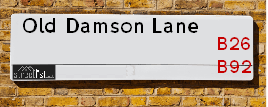
The street has the postcodes of B92 9ED and B92 9EE.
It is located within the county of West Midlands, situated in the West Midlands region of the UK. It's 95.73 miles North West from central London., 6.85 miles East from Birmingham, 10.47 miles West from Coventry and 26.4 miles North East from Worcester.
Map of Old Damson Lane
| Postcodes | ||
|---|---|---|
| Icon | Postcodes for Old Damson Lane | |
| Walking Distances | ||
| Distance Info | Green Circle = 10 Minutes Walk (800 metres) | |
Street Crime Data accessed from data.police.uk on 06/10/2024.
Moving to Old Damson Lane?
I can help you uncover potential pitfalls and provide key questions to ask about your new property. With decades of experience as a Local Land Charges Manager, I offer confidential insights to make your move informed and stress-free.
This service is free, but you may wish to make an optional donation to support it. Please include the property name and address in your request as well as anything you wish to focus on.
Contact Me
Do you know why this road is called Old Damson Lane?
What's it like to live here?
Share a Photo of Old Damson Lane
Ask the community a question.
Do you have any questions, memories to share, have any photos or know any facts? We'd love to know more.
Submit Your Comment

Budget Friendly Hotels near Old Damson Lane
| Budget Hotel Name | Distance (miles) |
|---|---|
|
1: Name:Travelodge Birmingham Airport Address: Terminal Rd, Birmingham, B26 3QW Telephone: 0871 984 6483 Visit Hotel Page |
0.24 |
|
2: Name:ibis budget Birmingham International Airport � NEC Address: Ambassador Road Telephone: Visit Hotel Page |
1.03 |
|
3: Name:Travelodge Birmingham Sheldon Address: 2225 Coventry Rd, Birmingham, B26 3EH Telephone: 0871 559 1806 Visit Hotel Page |
1.51 |
|
4: Name:Premier Inn Birmingham NEC/Airport Address: Bickenhill Parkway Telephone: Visit Hotel Page |
1.65 |
|
5: Name:Holiday Inn Express Birmingham NEC Address: Bickenhill Parkway Telephone: Visit Hotel Page |
2.03 |
Hotel Options
Your support helps keep this site running!
If you enjoy using this website, consider making a donation to help me cover hosting costs.
Nearby Estate Agents
| Name | Address | Website |
|---|---|---|
| Burchell Edwards | 2208 Coventry Road, Sheldon, Birmingham, B26 3JH | Visit Website |
| Melvyn Danes | 2214 Coventry Road, Sheldon, Birmingham, B26 3JH | Visit Website |
| Sydney Mitchell Estate Agents | 2233 Coventry Road, Sheldon, Solihull, B26 3NL | Visit Website |
| Black & White | 66, Station Road, Marston Green, Solihull, B37 7BA | Visit Website |
| Ferndown Estates | 32 Station Road, Marston Green, Birmingham, B37 7AU | Visit Website |
Neighbourhood Policing |
| Police Force: West Midlands |
 View Neighbourhood Crime and Policing View Neighbourhood Crime and Policing |
| Find a Local Neighbourhood Watch Scheme |
Location Details
| Old Damson Lane | |
|---|---|

| |
| Latitude | 52.443471 |
| Longitude | -1.749904 |
| OS Easting (X): | 416997 |
| OS Northing (Y): | 282904 |
| OS Grid Reference: | SP170829 |
Roads that have a Junction with Old Damson Lane
| Street | Junction Type |
|---|---|
| Coventry Road (A45) | junction |
| Gables Close | junction |
| Damson Parkway (B4105) | junction |
Sunset and Sunrise times
| Sunrise | 08:00 |
|---|---|
| Sunset | 16:37 |
Latest Weather Conditions
| Observed at Weather Station: | Coleshill 22 January 2025 at 06:00 (3.60 miles away) |
|---|---|
| Current Weather: | Mist |
| Temperature and Humidity: | 0.6°C (97.8%) |
| Wind Direction and Speed: | N (0 mph) |
Population Statistics
| ONS Area Code | E00051111 |
|---|---|
| ONS Area Name | Ageing in Suburbia |
| Average Age | 42.67 |
| Area Population | 1498.00 |
| Male Population | 730.00 (49%) |
| Female Population | 768.00 (51%) |
| Benefit Claimants | 13 (1%) |
| LSOA Code: | E01010115 |
|---|---|
| LSOA Name: | Solihull 015A |
| SOA Code: | 3a |
| SOA Name: | |
| MSOA Code: | E02002095 |
| MSOA Name: | Solihull 015 |
Nearest Supermarkets
| Morrisons Sheldon |
|---|
| 2259-2297 Coventry Road, Sheldon B26 3PD |
| 0121 742 6584 |
| Distance: 1.31 Miles |
| Directions to Morrisons Sheldon |
| Tesco Hobs Moat Express |
|---|
| 47-49 Hobs Moat Rd, Sheldon, Solihull, B92 8JJ |
| 0345 026 9030 |
| Distance: 1.48 Miles |
| Directions to Tesco Hobs Moat Express |
| Iceland Sheldon |
|---|
| 2154 Coventry Road, Sheldon, Birmingham, B26 3JB |
| 01217423939 |
| Distance: 1.59 Miles |
| Directions to Iceland Sheldon |
| Tesco Sheldon Superstore |
|---|
| Coventry Rd, Sheldon, Birmingham, B26 3DY |
| 0345 677 9845 |
| Distance: 1.83 Miles |
| Directions to Tesco Sheldon Superstore |
Telephone Information
| Area Code |
|---|
| Area Code: 01675 - Coleshill |
| Area Code: 01676 - Meriden |
| Area Code: 0121 - Birmingham |
| Area Code: 01564 - Lapworth |
Broadband Information
| Speed | Average Speed | Median Speed | Maximum Speed | Next-generation access (NGA) | Number of Connections |
|---|---|---|---|---|---|
| Greater than 2 Mbps | 4 | 4 | 5.3 | N | 4 |
Local Government
| Local Council Details |
|---|
| Within the area of Solihull |
| Visit the Council's Website |
| PO Box 18, Council House, Solihull, West Midlands &B91 3QS |
| Send email |
| Telephone Number: 0121 704 6000 |
| Local Member of Parliament |
|---|
| Within the Westminster Parliamentary Constituency of Solihull |
| The Member of Parliament is Saqib Bhatti |
| Details for the MP Saqib Bhatti on parliament.uk |
| Details for the MP Saqib Bhatti on theyworkforyou.com |
| In the 2024 General Election Saqib Bhatti won with a majority of 4,584 the result was Con hold. The total electorate was 73,659 |
| Wards, Parish Councils and County Councils |
|---|
| Ward: Elmdon Ward |
| Ceremonial County: West Midlands |
Nearest Schools
England Primary Schools
St Thomas More Catholic Primary School
Address: St Thomas More Catholic Primary School, Horse Shoes Lane, Sheldon, Birmingham, West Midlands, B26 3HU
Distance: 1.64 miles
Contact:
Coppice Junior School
Address: Coppice Junior School, Coppice Road, Solihull, West Midlands, B92 9JY
Distance: 1.09 miles
Contact:
Damson Wood Nursery and Infant School
Address: Damson Wood Nursery and Infant School, Stockwell Rise, Solihull, West Midlands, B92 9LX
Distance: 1.12 miles
Contact: 01217058652
Damson Wood Nursery and Infant School
Address: Damson Wood Nursery and Infant School, Stockwell Rise, Solihull, West Midlands, B92 9LX
Distance: 1.12 miles
Contact:
Yew Tree Primary School
Address: Yew Tree Primary School, Wherretts Well Lane, Solihull, West Midlands, B91 2SD
Distance: 1.56 miles
Contact:
Mapledene Primary School
Address: Mapledene Primary School, Mapledene Road, Mapledene Road, Birmingham, Uk, Birmingham, West Midlands, B26 3XE
Distance: 1.36 miles
Contact: 01214642881
Valley Primary
Address: Valley Primary, Old Lode Lane, Solihull, West Midlands, B92 8LW
Distance: 1.18 miles
Contact: 01217434691
England Secondary Schools
Lode Heath School
Address: Lode Heath School, Lode Lane, Solihull, West Midlands, B91 2HW
Distance: 1.69 miles
Contact: 01217041421
Lyndon School
Address: Lyndon School, Daylesford Road, Solihull, West Midlands, B92 8EJ
Distance: 1.70 miles
Contact: 01217433402
Nearest Hospitals
| Name | Address | Postcode | Distance | Map |
|---|
Nearest Dentists
Dentists
| Name | Address | Postcode | Distance | Map |
|---|
Nearest GP Surgeries
Doctors
COVENTRY ROAD PRACTICE
Address: 2314 COVENTRY ROAD, SHELDON, BIRMINGHAM, WEST MIDLANDS, B26 3JS
Distance: 1.24 miles
Contact: tel: 0121 7432154
CRANES PARK ROAD SURGERY
Address: 25 CRANES PARK ROAD, SHELDON, BIRMINGHAM, WEST MIDLANDS, B26 3SE
Distance: 1.53 miles
Contact: tel: 0121 7432018
MEADOWSIDE FAMILY HEALTH CENTRE
Address: 30 WINCHCOMBE ROAD, SOLIHULL, B92 8PJ
Distance: 1.55 miles
Contact: :
HOBS MOAT MEDICAL CENTRE
Address: ULLERIES ROAD, SOLIHULL, WEST MIDLANDS, B92 8ED
Distance: 1.64 miles
Contact: tel: 0121 7425211
THE SHELDON MEDICAL CENTRE
Address: 169 CHURCH ROAD, SHELDON, BIRMINGHAM, WEST MIDLANDS, B26 3TT
Distance: 1.66 miles
Contact: tel: 0121 7435511
YEW TREE MEDICAL CENTRE
Address: 100 YEW TREE LANE, SOLIHULL, WEST MIDLANDS, B91 2RA
Distance: 1.68 miles
Contact: :
Nearest Dispensing Chemists
Pharmacies
| Name | Address | Postcode | Telephone | Map | Distance in Km |
|---|
Nearest Opticians
Opticians
BOOTS OPTICIANS (SHELDON)
Address: 2236 COVENTRY ROAD, SHELDON, BIRMINGHAM, WEST MIDLANDS, B26 3JH
Distance: 1.41 miles
Contact: :
EYE SPECIALISTS OPTICIANS (SOLIHULL)
Address: 83 HOBS MOAT ROAD, SOLIHULL, WEST MIDLANDS, B92 8JL
Distance: 1.48 miles
Contact: :
SCRIVENS OPTICIANS (SHELDON)
Address: 2162 COVENTRY ROAD, SHELDON, BIRMINGHAM, WEST MIDLANDS, B26 3JB
Distance: 1.59 miles
Contact: :
MAGINNIS OPTICIANS - MARSTON GREEN
Address: 32A HOLLY LANE, MARSTON GREEN, BIRMINGHAM, WEST MIDLANDS, B37 7AE
Distance: 1.70 miles
Contact: :
DIRECT VISION OPTICIANS
Address: 297-299 CHURCH ROAD, SHELDON, BIRMINGHAM, WEST MIDLANDS, B26 3YH
Distance: 1.78 miles
Contact: :
MIDLAND EYE
Address: 50 LODE LANE, SOLIHULL, B91 2AW
Distance: 1.96 miles
Contact: :
Transport
Nearest Rail Stations
Birmingham International Station is 1.13 miles away.
Address: Birmingham International station, Stationlink Road, National Exhibition Centre, Birmingham, B40 1PA
Birmingham International is situated on the Rugby�Birmingham�Stafford line|West Coast Main Line and is managed by Avanti West Coast.
Birmingham International Station is staffed on a full time basis.
Marston Green Station is 1.66 miles away.
Address: Marston Green station, Holly Lane, Marston Green, West Midlands, B37 7AB
Marston Green is situated on the Rugby�Birmingham�Stafford line|West Coast Main Line.
Marston Green Station is staffed on a full time basis.